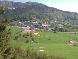
It is a mountain recreational village (850 m) situated in the western part of the Nízke Tatry (Low Tatras), spread out on a large saddle on the main road from the city of Banská Bystrica to Ružomberok. It lies in the protected zone of NAPANT (National Park Low Tatras), near national park Veľká Fatra (High Fatra) and is an important centre for summer and winter recreation.
Small villages were arising in the region already in the 17th century and at the beginning of the 18th century the village Donovaly was founded on the territory belonging to the mining administration of Banská Bystrica. It became an administrative centre of mining village (the first written reference about the village is from the year 1710) and its dwellers worked in the forests and at the railways of Horehronie. During the Second World War, it was a centre of partisans and refugees. From there out, they were going eastwards, on the crest of Low Tatras.
You can find here a church built in the classical style originating from 1825 with original inner arrangement, and many rustic houses with glassed verandas. The verandas were equalised to the level of the terrain with the cellars.
The village successively became very attractive for tourists seeking for winter and summer sports. We can find here 11 km of downhill ski tracks, 25 km of jogging tracks, chair lifts and a lot of facilities for hiking and recreation.