Basic Geography of the Hawaiian Islands
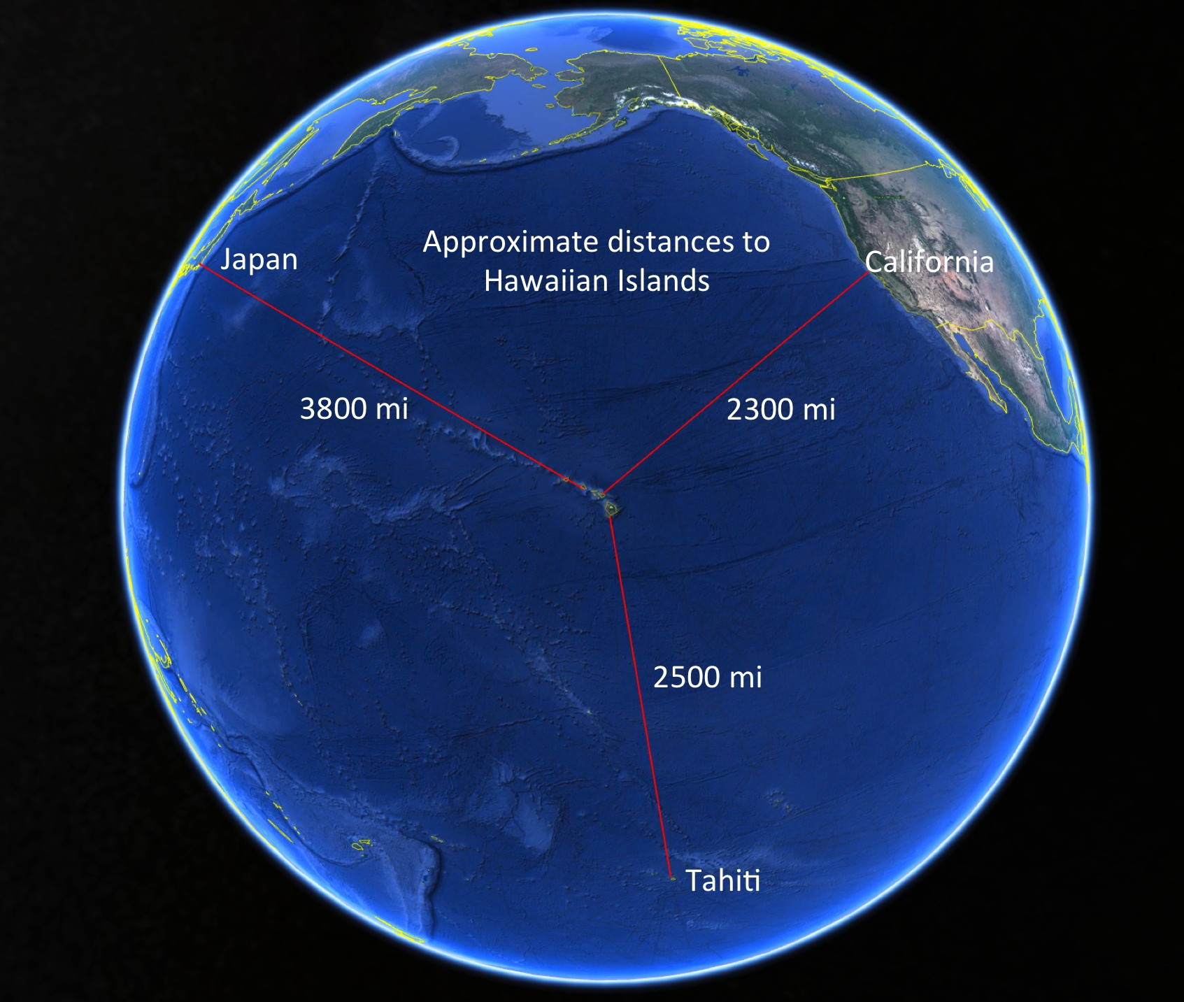
The Hawaiian Islands are a long way from anywhere. In fact, they are considered the most remote archipelago on Earth. Polynesians traveling north from the region current French Polynesia (most likely the Marquesas Islands area) did not discover the Hawaiian Islands until somewhere around 300-600 AD. The Hawaiian Islands are approximately 2300 miles from the California coast, 2500 miles north of Tahiti and almost 4000 miles from Tokyo.
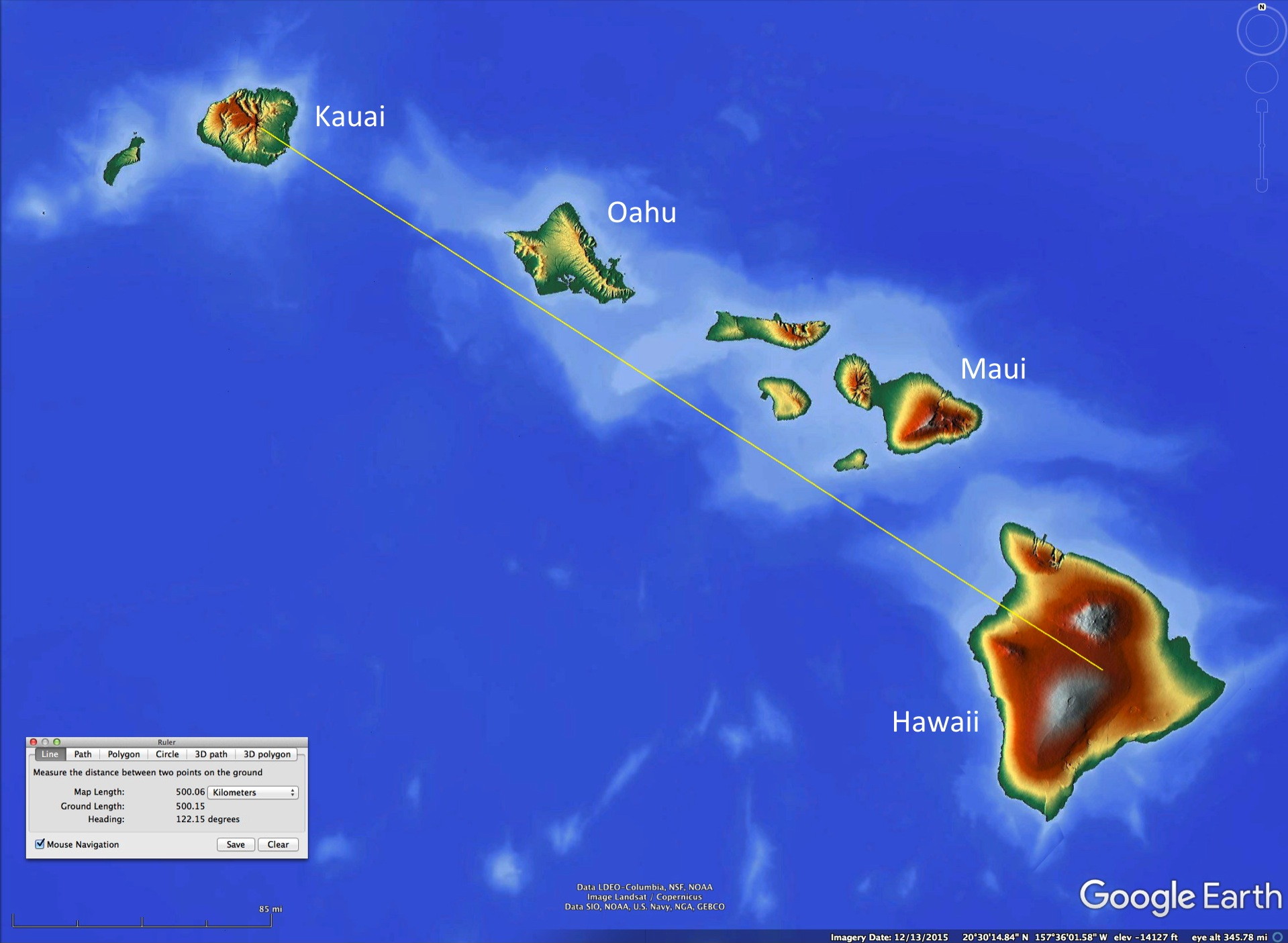
The Hawaiian Islands comprising the state of Hawaii, are composed of a number of large islands and many smaller islands and islets. The four main islands where most tourists spend time are, from Southeast to Northwest, Hawaii, Maui, Oahu and Kauai. Note that the island of Hawaii, the largest Hawaiian island, is commonly called “the Big Island” to distinguish it from the state of Hawaii. As with most US locations, some of the best online maps can be generated from the National Map Page; for Hawaii I’ve merged shaded relief and topographic maps here.
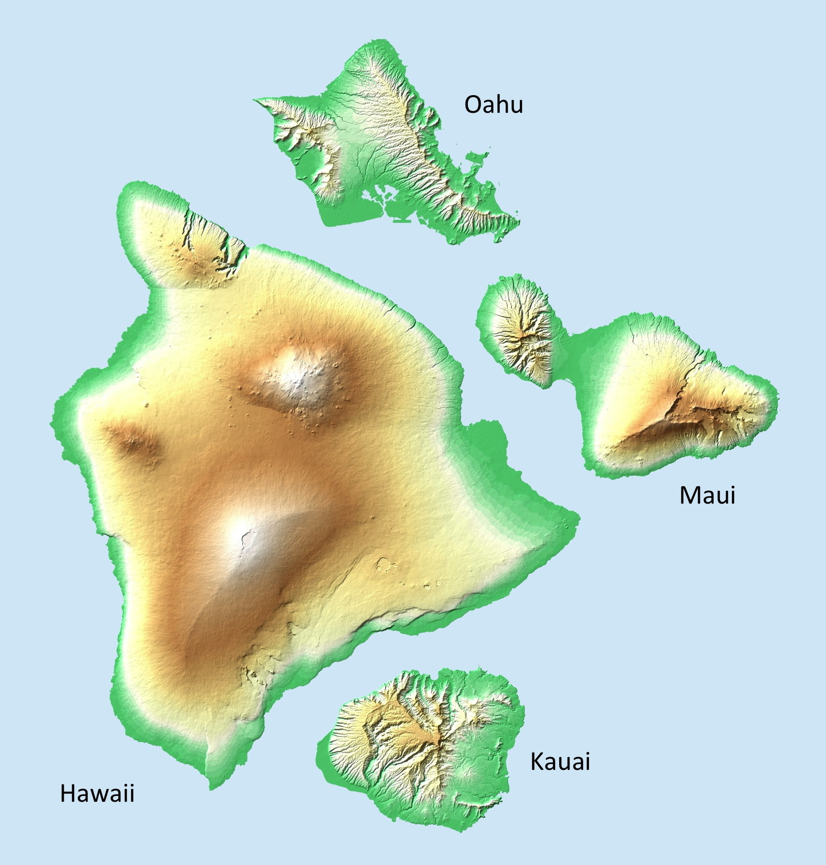
A comparison of the four largest Hawaiian Islands is useful. By rearranging these islands (figure below) we can get a better idea of their relative sizes, elevations and degree of erosion (related to age of the island and any recent volcanic activity).
The main islands are all in the tropics – they range from 19˚ to 22˚N, farther south than any other part of the US in North America.

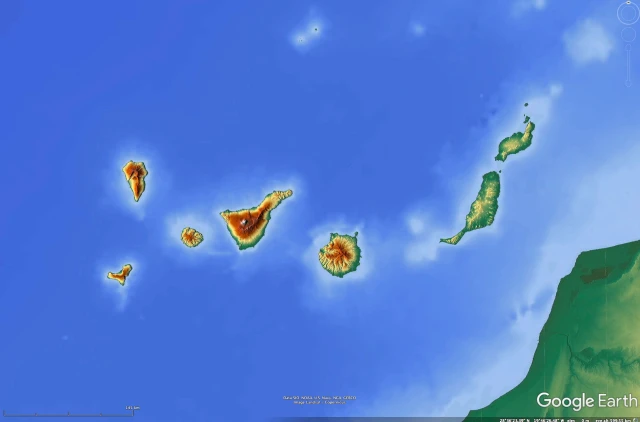
How the Hawaiian Islands compare with other oceanic archipelagos
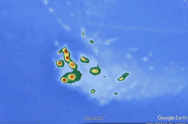
We include a few maps to show the size of the main Hawaiian Islands with other oceanic archipelagos of similar volcanic origin around the world that travelers might be familiar with. Each has special features but here we want the reader to compare their sizes – all maps in the slideshow below are made from Google Earth to nearly the same scale for easy comparison. The Channel Islands off the southern California coast are not volcanic, but are included for scale (mostly for some Americans who might be familiar with them).


Although the Hawaiian Islands are closer to the Equator than any other part of the US, they are not necessarily warmer as a result. While their wintertime temperatures are reliably warmer (near sea level) than any other US location, the summer temperatures are actually somewhat cooler than most southeastern (e.g. Florida) or the southwestern desert US locations. This is because the waters around Hawaii never get as warm as those in the Gulf of Mexico or off the southeastern US in summer. However, the Hawaiian water is warmer in winter than the waters around the Gulf of Mexico or most of Florida.
The first impression of many visitors to the Hawaiian Islands is one of mild shock. They’ve seen the photos of lush canyons, palms and high waterfalls. Now, upon landing at the airport at Kailua-Kona on the west coast of the Big Island they look out the plane window and see barren lava flows. What’s wrong?

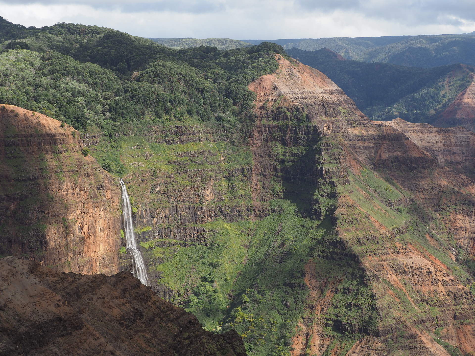
The Hawaiian Islands lie in an oceanic region that doesn’t get very much rainfall. Estimates are about 20-30 inches per year – away from the islands. The fact that there are very wet areas and many high waterfalls on most of the Hawaiian Islands is due to how the moist trade winds interact with the terrain of the islands. This produces very high rainfall on some parts of the islands. But on other parts of the same islands the rainfall is suppressed, and many areas are quite arid.

Now, if you want tourists to see lots of sun and warm weather you would put your resorts in sunny , dry locations quite naturally. Indeed, most of the major resorts complexes are on the drier lee-side of the islands. The airports on Oahu (Honolulu) and on Hawaii (Kona) are in dry areas, while airports on Maui and Kauai and somewhat in-between in terms of rain. Thus, tourists arriving on the Kona coast of Hawaii, or on Maui and driving to their west-side resorts, will see dry landscapes most of the year. Indeed, the Kailua-Kona airport is built across a recent lava flow and looks like the moon to many travelers (the moon actually doesn’t quite look that way, but that’s a detail).
So, returning to the lack of lushness many visitors see at first – it is on the windward side of the islands. And, that side is much cloudier, and the waves and surf are larger/rougher and often unsuitable for casual swimming. Here is where the high waterfalls are – but you have to travel quite a distance from the resorts to see these parts of the islands.
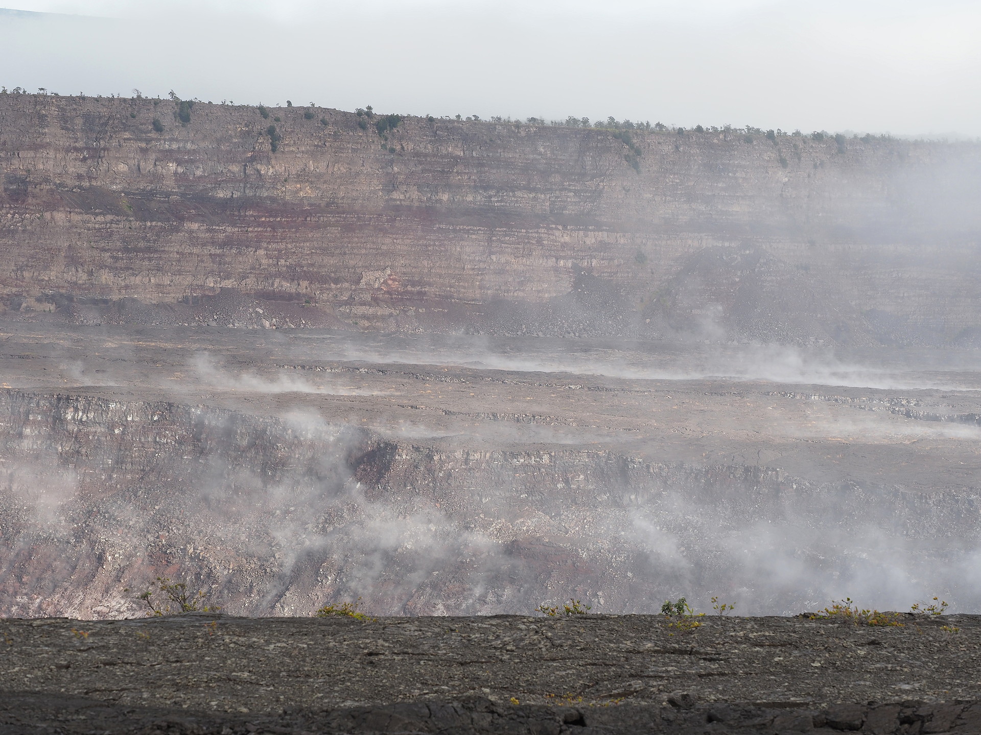
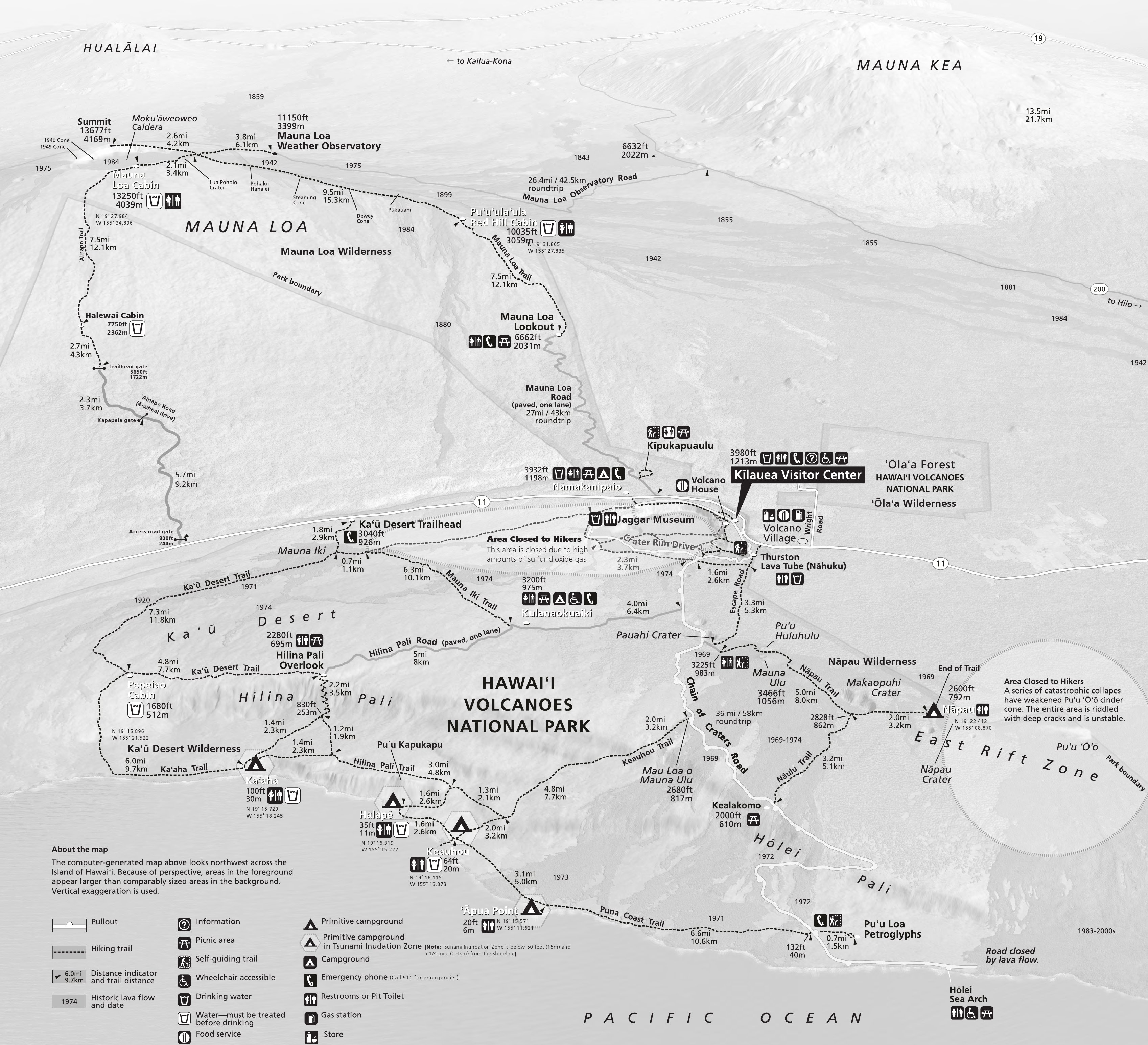
The Hawaiian Islands are all volcanic in origin and are viewed as a result of a “hotspot” in the upper mantle – visualized as a sort of heat source in the upper mantle of the Earth over which the North Pacific tectonic plate has been moving for millions of years. This simple conceptual model doesn’t answer many questions (like why are there discrete islands rather than one continuous ridge), but it is understandably hard to make direct measurements in the interior of the Earth. The best information source about the Hawaiian volcanoes and their monitoring is from the United States Geological Service Hawaiian Volcano Observatory website. The entire site has interesting information, at varying levels of detail but sufficient for nearly all natural history travelers. More information is on our page related to the geology of the Hawaiian Islands.
Below we describe the basic geographical aspects of each of the main islands. This includes simplified aspects of their relief, geology and climate. More extensive discussions of geology and climate are discussed under their respective pages and flora and fauna are likewise covered on their pages.
Finding “Nature” in Hawaii
Finding natural areas in the Hawaiian Islands is not as simple as one might expect. Yes, there are the national parks on the Big Island and on Maui. But other islands don’t have national parks and many of the state parks are associated with beaches. Waterfall-dominated parks do have trails, but nature is not the focus of such parks.
All Hawaiian Islands have forest reserves managed by the state of Hawaii. These reserves may include introduced trees and are not managed to be strictly natural landscapes – though some are quite natural. Hunting is allowed on weekends and hunters may be the most frequent visitors to such reserves. It is suggested you wear bright orange clothing to be visible to hunters – exactly what a birder might not want to do! The relatively recent Hawaiian State Natural Area Reserve system is attempting to strictly protect natural landscapes for biodiversity protection but these are often closed to public entry.
Below we quickly summarize our perception of highlights for seeing “nature” on the islands we have visited.
The Big Island (Hawaii)
During our Dec 2019 visit to Hawaii we spent 7 nights on the Big Island – all in the small community of Volcano – at the eastern entrance to Hawaii Volcanoes National Park. This small town/village area is at about 3500 ft elevation so it is cool compared with coastal locations. In addition, the trade wind flow ascends this side of the Big Island and it is very frequently cloudy with light rain. Annual precipitation is near 140 inches per year, resulting in verdant landscapes.

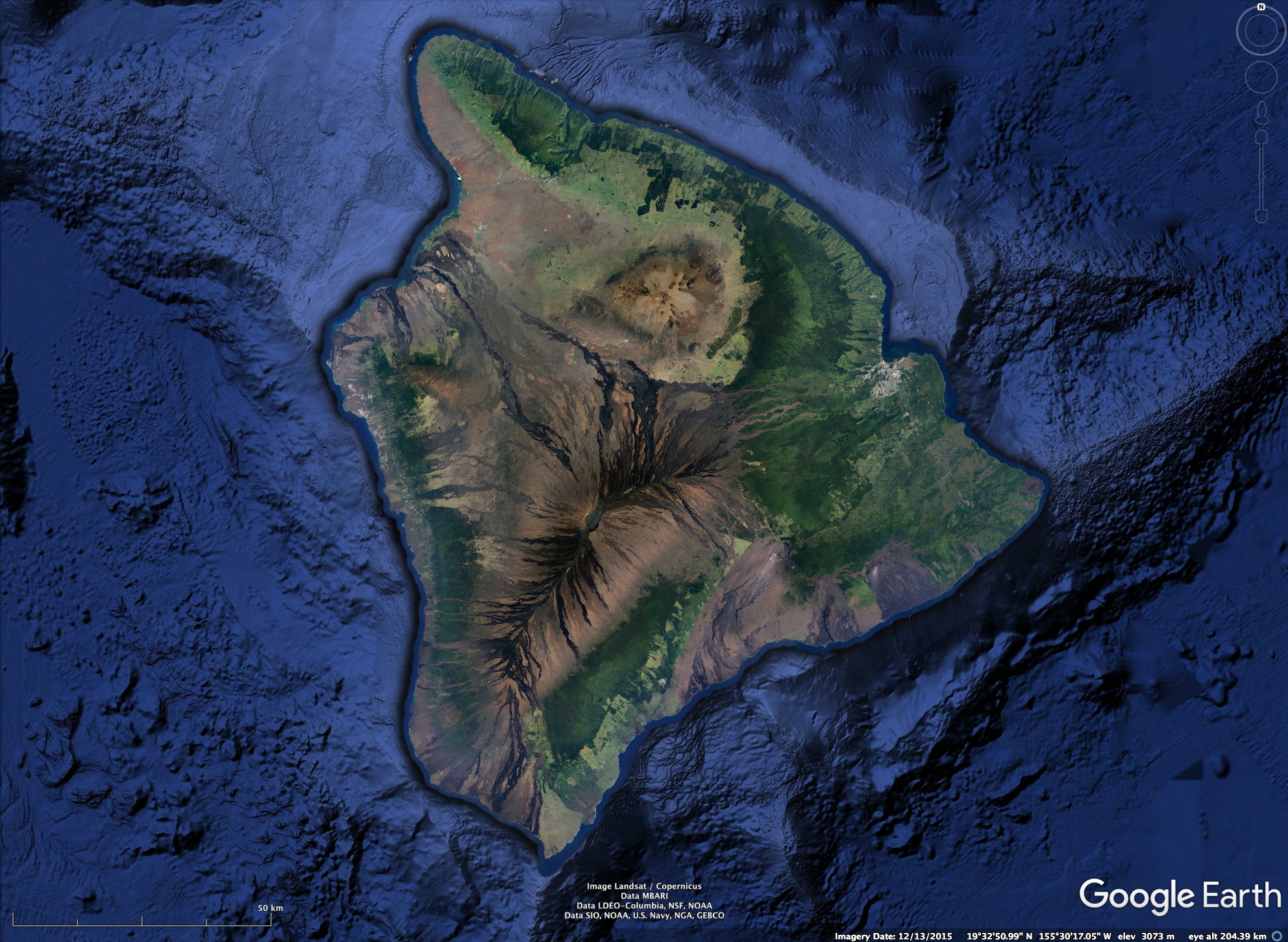


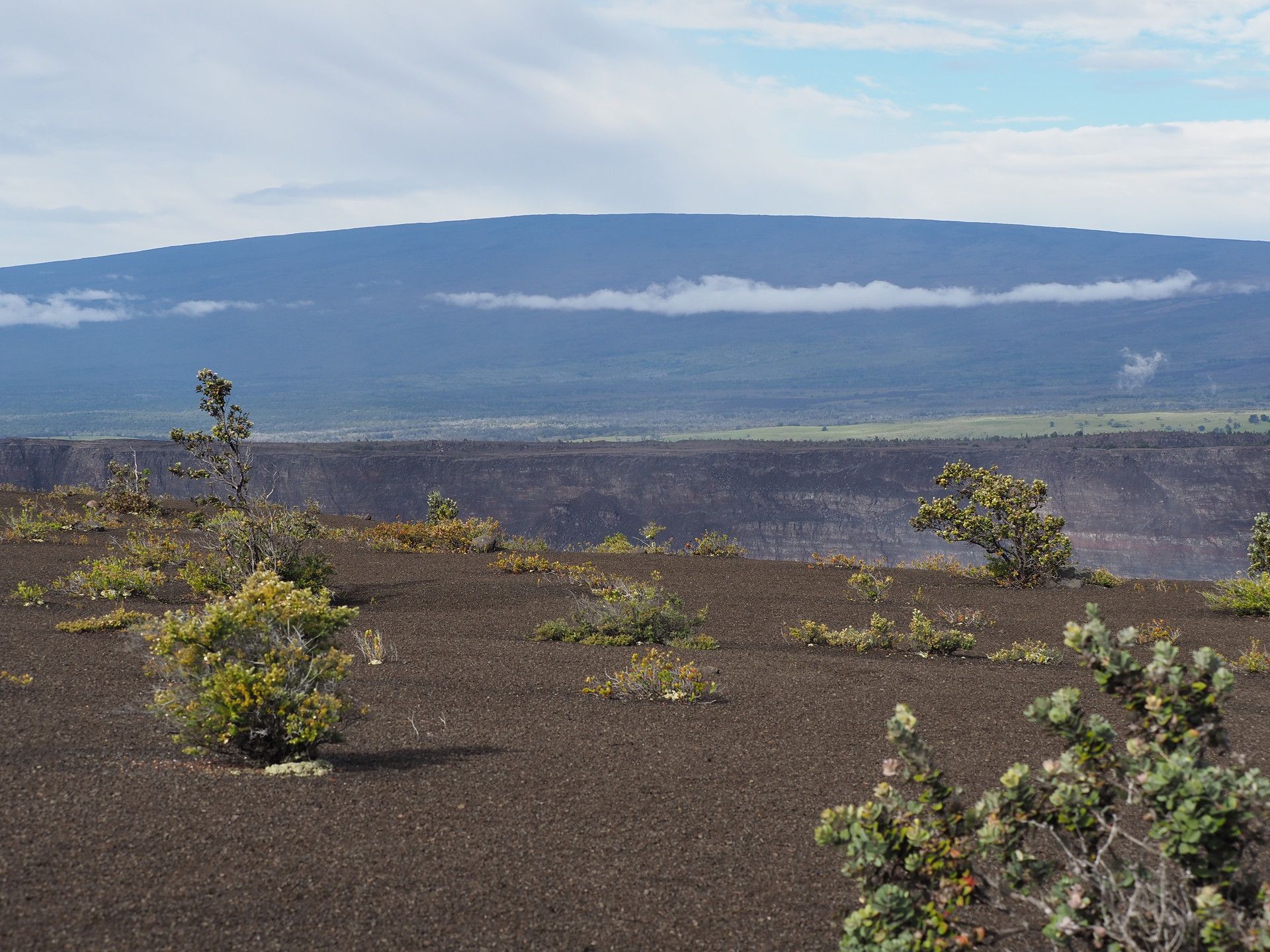
Hawaii Volcanoes National Park is our favorite area in the Hawaiian Islands to experience natural environments. The combination of extensive trails through volcanic landscapes and sharp transitions between moist and dry forests, along with coastal and high mountain environments, allows for one to experience relatively natural and relatively uncrowded environments. Because the Park’s attractions are quite distant (at least 80-90 miles) from the main touristic resorts on the Kona coast (west side) of the Big Island, fewer tourists visit the park, and many of those that do visit are “day trippers” or as part of tours. These individuals are thus not present early in the morning or late in the day. The lack of current volcanic activity (ending in late 2018) may have reduced present visitation numbers, though this is not clear.


Maui
After the Big Island, Haleakala National Park on Maui is our next favorite area for observation of natural environments. While there are fewer trails at Haleakala National Park and they are more strenuous, they pass through relatively natural high altitude landscapes.
The drawback of the Haleakala area is that it is far from tourist accommodations – requiring an hour or more drive from coastal resorts. This makes getting an early start on trails difficult, and possibly forcing night driving on your return from the park.
The trails in Haleakala NP that descend into the “crater” are long and best suited to overnight hikes. There are huts with bunks for hikers, as well as camping areas for backpackers, but these require reservations with the park service.
There are other areas on Maui that are worthwhile for naturalists to visit. We did not drive the highway to Hana, on the southeast side of Maui, but this is where the moist forests are found. However, accessing natural-state moist forest is not easy, as no roads or trails are open to the best natural moist forests. Likewise, in the Iao Valley State Park, few visitor’s explore the more remote parts of the West Maui Mountains because of the muddy/poor trail conditions. Also, there are many non-native plants in the more touristic areas.
A more natural dry forest environment exists in the Ahihi-Kinau Natural Area Reserve, located on the southwest tip of Maui and containing the most recent lava flow on the island. While you can walk on a trail over the lava flow to see stone constructs made by the original Hawaiians, you cannot access the best examples of dry forest remnants.
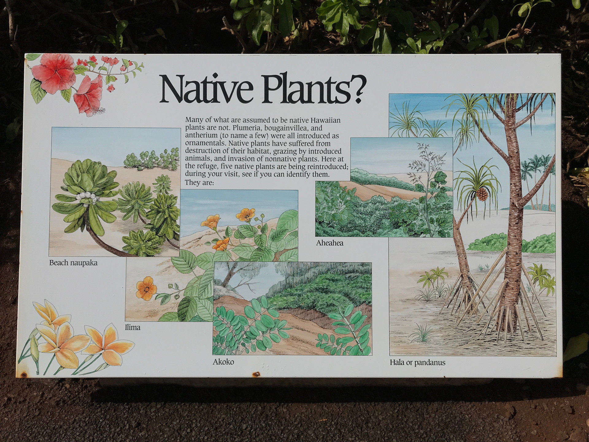
Finally, for seeing birds, the Kealia NWR is probably the best place to see wading birds. It is a slowly recovering wetland that is being managed for wildlife (mostly birds). Unfortunately, there are plenty of feral hogs and the ponds are clearly artificial. Despite these aspects of the refuge the boardwalk along the beach and lagoon with its many educational plaques is excellent. And for those wanting to see the Hawaiian Stilts and a few other endemic Hawaiian water birds, the location is good for stroll. Just not worth coming all the way to Hawaii for.

Haleakala is a long drive from the resort areas on Maui – it is about 40 miles to reach the main visitor center that is at 7000 ft elevation. It is another 3000 ft altitude gain to the upper visitor center and entrance trail into the main “crater” of Haleakala. The road is very winding, with many curves – especially before reaching the national park.


We did not extensively explore Maui, especially the moist areas on the eastern part of the island – the road to Hana. However, finding natural moist forests on Maui (or on any of the islands) is not simple. All Hawaiian Islands have forest reserves managed by the state of Hawaii. These reserves may include introduced trees and are not managed to be strictly natural landscapes – though some are quite natural. Hunting is allowed on weekends and hunters may be the most frequent visitors to such reserves. The relatively recent Hawaiian State Natural Area Reserve system is attempting to protect natural landscapes but these are often closed to public entry.


Kauai
We only spent 3 days on Kauai, so we could not sample all interesting natural areas. We chose not to hike Alakai Swamp trail at 4000 ft elevation, known as the best birding location on the island and with unique wet bog plants, due to the drizzly and rainy weather and also the condition of the trail (muddy).


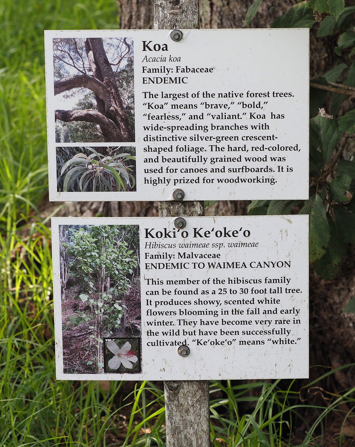
The road ascending along the western side of Waimea Canyon, on the western side of Kauai, to the state park lookouts over the Napali coast is mostly a series of scenic viewpoints and doesn’t offer much information related to the the natural history of Kauai. An exception to this is the inconspicuous (and very limited side-of-the-road parking) self-guided nature trail about half way up the mountain that focuses on a rare and endangered species of plant related to the Silverswords.


We visited the Kilauea Point National Wildlife Refuge, while mostly known for its historic lighthouse, is known among birders for being the best spot in all of the (main) islands for seeing seabirds. These include Laysan Albatross, White-tailed Tropicbirds, several species of Boobies and Frigatebirds. The Nene is also conveniently seen here.
A second spot for primarily bird-watching is a restored series of ponds in western Kauai near the Air Force missile range. The ponds (former gravel pit) have native coastal vegetation with identifying plaques and explanations of the importance of these wetlands. Some of the endemic birds like the Hawaiian Stilt, hawaiian Coot and some non-endemic but native birds like the Black-Crowned Night Heron are present. Nene also hang out in this area.


Oahu
We did not visit Oahu – other than a short stop to transfer planes on our flight from Hilo on the Big Island to Lihue (Kauai). However, since more tourists visit Oahu than any other island, we briefly describe some of its aspects here. The reader can compare it with the other islands – and perhaps decide whether it should be a natural history destination.
We chose not to visit Oahu because of the additional time required, the congestion of Honolulu and elsewhere on the island, the lack of relatively pristine environments, the lack of higher mountains that allow for ascending about the trade wind clouds, the lack of recent volcanism etc. You can see our perspectives…
