

Assabet River NWR Final CCP - U.S. Fish and Wildlife Service
Assabet River NWR Final CCP - U.S. Fish and Wildlife Service
Assabet River NWR Final CCP - U.S. Fish and Wildlife Service

Create successful ePaper yourself
Turn your PDF publications into a flip-book with our unique Google optimized e-Paper software.
U.S. <strong>Fish</strong> & <strong>Wildlife</strong> <strong>Service</strong><br />
<strong>Assabet</strong> <strong>River</strong> National<br />
<strong>Wildlife</strong> Refuge<br />
<strong>Final</strong> Comprehensive<br />
Conservation Plan<br />
January 2005
This goose, designed by J.N. “Ding”<br />
Darling, has become the symbol of<br />
the National <strong>Wildlife</strong> Refuge<br />
System<br />
The U.S. <strong>Fish</strong> <strong>and</strong> <strong>Wildlife</strong> <strong>Service</strong> is the principle federal agency for conserving,<br />
protecting, <strong>and</strong> enhancing fish <strong>and</strong> wildlife in their habitats for the continuing benefit of<br />
the American people. The <strong>Service</strong> manages the 96-million acre National <strong>Wildlife</strong> Refuge<br />
System comprised of 544 national wildlife refuges <strong>and</strong> thous<strong>and</strong>s of waterfowl production<br />
areas. It also operates 65 national fish hatcheries <strong>and</strong> 78 ecological services field stations.<br />
The agency enforces federal wildlife laws, manages migratory bird populations, restores<br />
significant fisheries, conserves <strong>and</strong> restores wildlife habitat such as wetl<strong>and</strong>s, administers<br />
the Endangered Species Act, <strong>and</strong> helps foreign governments with their conservation<br />
efforts. It also oversees the Federal Aid program which distributes hundreds of millions<br />
of dollars in excise taxes on fishing <strong>and</strong> hunting equipment to state wildlife agencies.<br />
Comprehensive Conservation Plans provide long term guidance for management<br />
decisions; set forth goals, objectives, <strong>and</strong> strategies needed to accomplish refuge purposes;<br />
<strong>and</strong>, identify the <strong>Service</strong>’s best estimate of future needs. These plans detail program<br />
planning levels that are sometimes substantially above current budget allocations <strong>and</strong>, as<br />
such, are primarily for <strong>Service</strong> strategic planning <strong>and</strong> program prioritization purposes.<br />
The plans do not constitute a commitment for staffing increases, operational <strong>and</strong><br />
maintenance increases, or funding for future l<strong>and</strong> acquisition.<br />
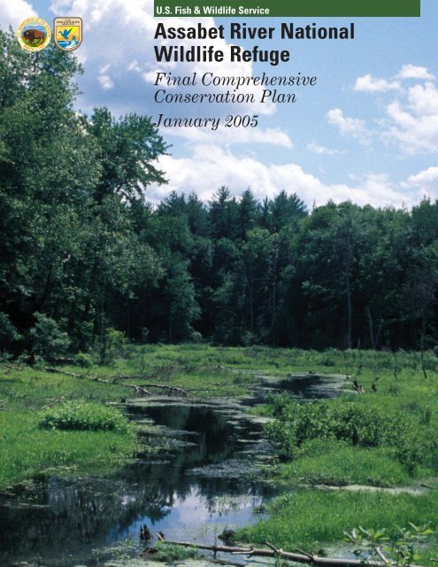
Cover Photo: <strong>Assabet</strong> <strong>River</strong> <strong>NWR</strong> © Marijke Holtrop
Table of Contents<br />
Chapter 1: Introduction <strong>and</strong> Background................................................................................- 1 -<br />
Refuge Overview......................................................................................................................- 1 -<br />
Purpose <strong>and</strong> Need for a <strong>CCP</strong>.................................................................................................- 1 -<br />
U.S. <strong>Fish</strong> <strong>and</strong> <strong>Wildlife</strong> <strong>Service</strong> Mission ................................................................................- 3 -<br />
Refuge System Mission ..........................................................................................................- 4 -<br />
Laws...........................................................................................................................................- 4 -<br />
National <strong>and</strong> Regional Conservation Plans <strong>and</strong> Initiatives Guiding this <strong>CCP</strong>...............- 5 -<br />
Gulf of Maine - Ecosystem Priorities................................................................................- 5 -<br />
North American Waterfowl Management Plan ..............................................................- 5 -<br />
Partners in Flight Bird Conservation Plans....................................................................- 7 -<br />
Regional Wetl<strong>and</strong>s Concept Plan- Emergency Wetl<strong>and</strong>s Resources Act...................- 9 -<br />
Our Irreplaceable Heritage - Protecting Biodiversity in Massachusetts, 1998 .........- 9 -<br />
Existing Partnerships.............................................................................................................- 9 -<br />
Chapter 2: The Comprehensive Conservation Planning Process.......................................- 11 -<br />
Wilderness Assessment ........................................................................................................- 12 -<br />
Issues, Concerns, <strong>and</strong> Opportunities ..................................................................................- 13 -<br />
Issues <strong>and</strong> Concerns Considered Outside the Scope of This Plan .................................- 14 -<br />
Chapter 3: Refuge <strong>and</strong> Resource Descriptions .....................................................................- 17 -<br />
Geographic/Ecosystem Setting ...........................................................................................- 17 -<br />
Socio-economic Setting .........................................................................................................- 17 -<br />
Refuge Resources..................................................................................................................- 18 -<br />
Climate ................................................................................................................................- 18 -<br />
Topography ........................................................................................................................- 18 -<br />
Geology................................................................................................................................- 19 -<br />
Soils......................................................................................................................................- 19 -<br />
Hydrology ...........................................................................................................................- 20 -<br />
Air Quality ..........................................................................................................................- 21 -<br />
Water Quality.....................................................................................................................- 22 -<br />
Other Contaminant Issues ...............................................................................................- 26 -<br />
Physical Safety Hazards...................................................................................................- 27 -<br />
Biological Resources .............................................................................................................- 28 -<br />
Vegetation <strong>and</strong> Habitat Types.........................................................................................- 28 -<br />
Vernal pools ............................................................................................................................- 31 -<br />
Invasive or Overabundant Species..................................................................................- 31 -<br />
<strong>Wildlife</strong> Resources.................................................................................................................- 32 -<br />
Migratory Birds.................................................................................................................- 32 -<br />
Mammals.............................................................................................................................- 33 -<br />
Reptiles <strong>and</strong> Amphibians..................................................................................................- 35 -<br />
<strong>Fish</strong>eries .............................................................................................................................- 35 -<br />
Invertebrates......................................................................................................................- 37 -<br />
Threatened <strong>and</strong> Endangered Species.............................................................................- 37 -<br />
Special Designations .........................................................................................................- 37 -<br />
Cultural Resources................................................................................................................- 38 -<br />
Prehistoric Period..............................................................................................................- 38 -<br />
Historic Period...................................................................................................................- 39 -<br />
Socio-economic Resources....................................................................................................- 44 -
Population <strong>and</strong> Demographic Conditions.......................................................................- 44 -<br />
Adjacent Communities <strong>and</strong> L<strong>and</strong> Uses..........................................................................- 44 -<br />
Chapter 4: Management Direction..........................................................................................- 45 -<br />
Refuge Complex Vision.........................................................................................................- 45 -<br />
Refuge Complex Goals..........................................................................................................- 45 -<br />
General Refuge Management ..............................................................................................- 59 -<br />
Refuge Access <strong>and</strong> Fees ...................................................................................................- 59 -<br />
Accessibility........................................................................................................................- 60 -<br />
Fire Management ..............................................................................................................- 60 -<br />
L<strong>and</strong> Protection .................................................................................................................- 61 -<br />
Resource Protection <strong>and</strong> Visitor Safety.........................................................................- 62 -<br />
Special Use Permits <strong>and</strong> Memor<strong>and</strong>um of Underst<strong>and</strong>ing <strong>and</strong> Agreement ............- 62 -<br />
Research .............................................................................................................................- 63 -<br />
Chapter 5: Refuge Administration..........................................................................................- 65 -<br />
Refuge Staffing ......................................................................................................................- 65 -<br />
Refuge Funding .....................................................................................................................- 65 -<br />
Refuge Buildings <strong>and</strong> Facilities...........................................................................................- 66 -<br />
Step-Down Management Plans ...........................................................................................- 66 -<br />
Maintaining Existing Facilities ...........................................................................................- 67 -<br />
Compatibility Determinations .............................................................................................- 68 -<br />
Monitoring <strong>and</strong> Evaluation ..................................................................................................- 69 -<br />
Adaptive Management..........................................................................................................- 70 -<br />
Additional NEPA Analysis...................................................................................................- 71 -<br />
Plan Amendment <strong>and</strong> Revision............................................................................................- 71 -<br />
Literature Cited.........................................................................................................................- 73 -<br />
Glossary.......................................................................................................................................- 79 -<br />
List of Preparers........................................................................................................................- 89 -<br />
Appendices..................................................................................................................................- 91 -<br />
Appendix A: Relevant Laws.....................................................................................................- 93 -<br />
Appendix B: U.S. Forest <strong>Service</strong> Content Analysis Team Summary Report ................- 101 -<br />
Appendix C: Responses to Substantive Comments............................................................- 157 -<br />
Appendix D: Species Lists......................................................................................................- 171 -<br />
Appendix E: RONS <strong>and</strong> MMS...............................................................................................- 201 -<br />
Appendix F: Existing <strong>and</strong> Proposed Staffing Charts for <strong>Assabet</strong> <strong>River</strong>, Great Meadows,<br />
<strong>and</strong> Oxbow <strong>NWR</strong>s....................................................................................................................- 205 -<br />
Appendix G: <strong>Final</strong> Compatibility Determinations ..............................................................- 209 -<br />
List of Tables<br />
Table 1-1: NAWMP Species Occurring at <strong>Assabet</strong> <strong>River</strong> <strong>NWR</strong> .....................................- 7 -<br />
Table 1-2: Bird Species of Concern Occurring on <strong>Assabet</strong> <strong>NWR</strong>....................................- 8 -<br />
Table 3-1: Revenue Sharing Payments to Towns within <strong>Assabet</strong> <strong>River</strong> <strong>NWR</strong> ...........- 18 -<br />
Table 3-2: Cover Types <strong>and</strong> Acreage at <strong>Assabet</strong> <strong>River</strong> <strong>NWR</strong> .......................................- 30 -<br />
Table 3-3: Rare Plant Species at <strong>Assabet</strong> <strong>River</strong> <strong>NWR</strong> ...................................................- 31 -<br />
Table 3-4: Invasive Species at <strong>Assabet</strong> <strong>River</strong> <strong>NWR</strong>........................................................- 32 -<br />
Table 3-5: State-listed Bird Species at <strong>Assabet</strong> <strong>River</strong> <strong>NWR</strong> .........................................- 33 -<br />
Table 3-6: State-listed Amphibians <strong>and</strong> Reptiles at <strong>Assabet</strong> <strong>River</strong> <strong>NWR</strong> ...................- 35 -<br />
Table 4-1: 2004 Massachusetts Hunting Seasons.............................................................- 56 -<br />
Table D-1: <strong>Fish</strong> of <strong>Assabet</strong> <strong>River</strong> <strong>NWR</strong> ...........................................................................- 171 -
Table D-2: Birds of <strong>Assabet</strong> <strong>River</strong> <strong>NWR</strong> .........................................................................- 171 -<br />
Table D-3: Mammals of <strong>Assabet</strong> <strong>River</strong> <strong>NWR</strong>..................................................................- 174 -<br />
Table D-4: Amphibians of <strong>Assabet</strong> <strong>River</strong> <strong>NWR</strong> ..............................................................- 175 -<br />
Table D-5: Reptiles of <strong>Assabet</strong> <strong>River</strong> <strong>NWR</strong> ....................................................................- 175 -<br />
Table D-6: Moths of <strong>Assabet</strong> <strong>River</strong> <strong>NWR</strong>........................................................................- 175 -<br />
Table D-7: Butterflies⁄Dragonflies at <strong>Assabet</strong> <strong>River</strong> <strong>NWR</strong> ..........................................- 177 -<br />
Table D-8: Vascular Plants of <strong>Assabet</strong> <strong>River</strong> <strong>NWR</strong> .......................................................- 178 -<br />
Table E-1: Projects Currently in the RONS Database <strong>and</strong> Proposed Projects to be<br />
included for <strong>Assabet</strong> <strong>River</strong> <strong>NWR</strong> ..................................................................- 201 -<br />
Table E-2: Projects Currently Backlogged in the Maintenance Management System<br />
(MMS) for <strong>Assabet</strong> <strong>River</strong> <strong>NWR</strong>.....................................................................- 203 -<br />
Table E-3: Projects Currently Backlogged in the MMS for the Eastern Massachusetts<br />
Refuge Complex ...............................................................................................- 203 -<br />
List of Maps<br />
Map 1-1: Eastern Massachusetts National <strong>Wildlife</strong> Refuge Complex.................................- 2 -<br />
Map 1-2: Gulf of Maine Ecosystem ...........................................................................................- 6 -<br />
Map 4-1: Public Uses to be Phased in at <strong>Assabet</strong> <strong>River</strong> <strong>NWR</strong> ...........................................- 51 -
Puffer Pond at <strong>Assabet</strong> <strong>NWR</strong>: Staff photo<br />
Chapter 1: Introduction <strong>and</strong> Background<br />
Chapter 1: Introduction <strong>and</strong> Background<br />
This <strong>Final</strong> Comprehensive Conservation Plan (<strong>CCP</strong>) has been prepared for<br />
the <strong>Assabet</strong> <strong>River</strong> National <strong>Wildlife</strong> Refuge (<strong>NWR</strong>), which is one of eight<br />
refuges of the Eastern Massachusetts <strong>NWR</strong> Complex (Complex) (see Map<br />
1-1). Concurrently, we are releasing the <strong>Final</strong> <strong>CCP</strong>s for Great Meadows<br />
(Concord <strong>and</strong> Sudbury divisions), <strong>and</strong> Oxbow <strong>NWR</strong>s.<br />
We will prepare a separate <strong>CCP</strong> <strong>and</strong> Environmental Impact Statement<br />
(<strong>CCP</strong>/EIS) for Monomoy <strong>and</strong> Nomans L<strong>and</strong> Isl<strong>and</strong> <strong>NWR</strong>s beginning later<br />
in 2004. We propose to begin the <strong>CCP</strong> process for Massasoit in 2005 <strong>and</strong><br />
Mashpee <strong>and</strong> Nantucket <strong>NWR</strong>s in 2006.<br />
This <strong>CCP</strong> is the culmination of a planning process that formally began in<br />
January 1999. Numerous meetings with the public, the State, <strong>and</strong><br />
conservation partners were held to identify <strong>and</strong> evaluate management<br />
alternatives. A draft <strong>CCP</strong> <strong>and</strong> Environmental Assessment (<strong>CCP</strong>/EA) was<br />
distributed in July 2003 for public review <strong>and</strong> comment. This <strong>CCP</strong> presents<br />
the management goals, objectives, <strong>and</strong> strategies that we believe will best<br />
achieve our vision for the refuge, contribute to the National <strong>Wildlife</strong> Refuge<br />
System (Refuge System) Mission, achieve refuge purposes <strong>and</strong> legal<br />
m<strong>and</strong>ates, support regional conservation priorities, <strong>and</strong> serve the American<br />
public.<br />
Refuge Overview<br />
Formerly known as the Sudbury Training Annex, <strong>Assabet</strong><br />
<strong>River</strong> <strong>NWR</strong> is the most recent addition to the Complex,<br />
created in the fall of 2000, when Fort Devens Army base<br />
transferred 2,230 acres to the U.S. <strong>Fish</strong> <strong>and</strong> <strong>Wildlife</strong> <strong>Service</strong><br />
(<strong>Service</strong>). This transfer was made in accordance with the<br />
Defense Base Closure <strong>and</strong> Realignment Act of 1990, with<br />
the purpose of having “particular value in carrying out the<br />
national migratory bird management program.” All acres<br />
within the approved Refuge boundary are acquired. The<br />
large wetl<strong>and</strong> complex <strong>and</strong> the contiguous forested areas<br />
are important feeding <strong>and</strong> breeding areas for migratory<br />
birds. Under Army administration, the area was not open to<br />
general public use. Because of this, public access remains a<br />
high priority for local community members.<br />
Purpose <strong>and</strong> Need for a <strong>CCP</strong><br />
The purpose of a <strong>CCP</strong> is to provide managers <strong>and</strong> other interested partners<br />
guidance <strong>and</strong> direction for each refuge over the next 15 years, thus<br />
achieving refuge purposes <strong>and</strong> contributing to the mission of the Refuge<br />
System. The plan identifies what role the refuge plays, consistent with<br />
Comprehensive Conservation Plan - 1 -
- 2 -<br />
Chapter 1: Introduction <strong>and</strong> Background<br />
Map 1-1: Eastern Massachusetts National <strong>Wildlife</strong> Refuge Complex<br />
<strong>Assabet</strong> <strong>River</strong> <strong>NWR</strong>
Eastern Bluebird: Photo by<br />
Bruce Flaig<br />
Chapter 1: Introduction <strong>and</strong> Background<br />
sound principles of fish <strong>and</strong> wildlife conservation, in the protection,<br />
enhancement <strong>and</strong> restoration of trust resources.<br />
This plan is also needed to:<br />
provide a clear statement of desired future conditions for habitat,<br />
wildlife, visitors <strong>and</strong> facilities;<br />
provide refuge neighbors, visitors, <strong>and</strong> partners with a clear<br />
underst<strong>and</strong>ing of the reasons for management actions;<br />
ensure management reflects the policies <strong>and</strong> goals of the Refuge<br />
System <strong>and</strong> legal m<strong>and</strong>ates;<br />
ensure the compatibility of current <strong>and</strong> future uses;<br />
review current boundaries of the refuges, <strong>and</strong> evaluate the need to<br />
revise boundaries to better achieve refuge purposes;<br />
provide long-term continuity <strong>and</strong> direction for refuge <strong>and</strong> Complex<br />
management; <strong>and</strong>,<br />
provide a basis for staffing <strong>and</strong> operations, maintenance, <strong>and</strong> the<br />
development of budget requests.<br />
Currently, there is no management plan in place for <strong>Assabet</strong> <strong>River</strong> <strong>NWR</strong><br />
that establishes priorities or provides consistent direction for managing<br />
fish, wildlife, habitats, <strong>and</strong> public uses on the refuge. This plan will help to<br />
resolve issues related to control of nuisance <strong>and</strong> invasive species, public<br />
uses in conflict with wildlife needs, lack of opportunities for wildlife<br />
dependent recreation, <strong>and</strong> the needs of our federal trust wildlife<br />
species.<br />
The National <strong>Wildlife</strong> Refuge System Improvement Act of 1997<br />
(Refuge Improvement Act; Public Law 105-57) requires that all <strong>NWR</strong>s<br />
have a <strong>CCP</strong> in place by 2012 to help fulfill the new mission of the<br />
Refuge System. The Refuge Improvement Act states that wildlife<br />
conservation is the priority of the Refuge System’s l<strong>and</strong>s, <strong>and</strong> that the<br />
biological integrity, diversity, <strong>and</strong> environmental health of refuge l<strong>and</strong>s<br />
shall be maintained. Additionally, the Refuge Improvement Act identifies<br />
six wildlife-dependent recreational uses that will receive priority<br />
consideration over other recreational uses of the refuge: wildlife<br />
observation <strong>and</strong> photography, hunting, fishing, environmental education,<br />
<strong>and</strong> interpretation.<br />
U.S. <strong>Fish</strong> <strong>and</strong> <strong>Wildlife</strong> <strong>Service</strong> Mission<br />
The Refuge System is managed by the <strong>Service</strong>, under the Department of<br />
the Interior. The mission of the <strong>Service</strong> is:<br />
“...working with others to conserve, protect, <strong>and</strong> enhance fish, wildlife, <strong>and</strong><br />
plants <strong>and</strong> their habitats for the continuing benefit of the American<br />
people.”<br />
Comprehensive Conservation Plan - 3 -
“To administer a national<br />
network of l<strong>and</strong>s <strong>and</strong> waters<br />
for the conservation,<br />
management, <strong>and</strong> where<br />
appropriate, restoration of<br />
the fish, wildlife, <strong>and</strong> plant<br />
resources <strong>and</strong> their habitats<br />
within the United States for<br />
the benefit of present <strong>and</strong><br />
future generations of<br />
Americans.” (Refuge<br />
Improvement Act; Public<br />
Law 105-57)–Mission of the<br />
Refuge System.<br />
Winter at <strong>Assabet</strong> <strong>River</strong> <strong>NWR</strong>: Staff<br />
- 4 -<br />
Chapter 1: Introduction <strong>and</strong> Background<br />
The <strong>Service</strong> manages <strong>NWR</strong>s, waterfowl protection areas, <strong>and</strong> National<br />
<strong>Fish</strong> Hatcheries. By law, Congress entrusts the following federal trust<br />
resources to the <strong>Service</strong> for conservation <strong>and</strong> protection: migratory birds<br />
<strong>and</strong> fish, endangered species, interjurisdictional fish, <strong>and</strong> certain marine<br />
mammals. The <strong>Service</strong> also enforces federal wildlife laws <strong>and</strong> international<br />
treaties on importing <strong>and</strong> exporting wildlife, assists with state fish <strong>and</strong><br />
wildlife programs, <strong>and</strong> helps other countries develop wildlife conservation<br />
programs.<br />
Refuge System Mission<br />
The Refuge System is the world’s largest collection of l<strong>and</strong>s <strong>and</strong> waters set<br />
aside specifically for the conservation of wildlife <strong>and</strong> ecosystem protection.<br />
The Refuge System consists of 544 national wildlife refuges that provide<br />
important habitat for native plants <strong>and</strong> many species of mammals,<br />
Laws<br />
birds, fish, <strong>and</strong> threatened <strong>and</strong> endangered species, encompassing<br />
over 95 million acres. Refuges offer a wide variety of recreational<br />
opportunities, <strong>and</strong> many have visitor centers, wildlife trails, <strong>and</strong><br />
environmental education programs. Nationwide, over 34 million<br />
visitors annually hunt, fish, observe <strong>and</strong> photograph wildlife, or<br />
participate in interpretive activities on national wildlife refuges.<br />
In 1997, the Refuge Improvement Act established a unifying mission<br />
for the refuge system, a new process for determining compatible<br />
public uses, <strong>and</strong> the requirement to prepare a <strong>CCP</strong> for each refuge.<br />
The new law states that the refuge system must focus on wildlife<br />
conservation. It further states that the National mission, coupled with<br />
the purpose(s) for which each refuge was established, will provide the<br />
principal management direction for each refuge.<br />
While the Refuge System Mission <strong>and</strong> each refuge’s purpose provide the<br />
foundation for management, national wildlife refuges are also governed by<br />
other federal laws, executive orders, treaties, interstate compacts, <strong>and</strong><br />
regulations pertaining to the conservation <strong>and</strong> protection of natural <strong>and</strong><br />
cultural resources (see Appendix A for a more complete list of<br />
guiding laws).<br />
A primary law affecting refuge management is the National <strong>Wildlife</strong><br />
Refuge System Administration Act of 1966 (Administration Act)<br />
which authorizes the Secretary of the Interior to permit any use of<br />
a refuge “...whenever it is determined that such uses are compatible<br />
with the major purposes for which such areas were established.”<br />
The Administration Act was amended by the Refuge Improvement<br />
Act. It is also the key legislation on managing public uses, <strong>and</strong><br />
protecting the Refuge System from incompatible or harmful human<br />
<strong>Assabet</strong> <strong>River</strong> <strong>NWR</strong>
Wood Duck: Photo by Bruce<br />
Flaig<br />
Chapter 1: Introduction <strong>and</strong> Background<br />
activities to ensure that Americans can enjoy Refuge System l<strong>and</strong>s <strong>and</strong><br />
waters.<br />
Additionally, it is <strong>Service</strong> policy to address how each refuge, with an<br />
approved <strong>CCP</strong>, can help achieve the goals of the national Wilderness<br />
Preservation System. Thus, concurrent with the <strong>CCP</strong> process, we have<br />
incorporated a summary of a wilderness assessment into this document<br />
(see Wilderness Assessment section in Chapter 2).<br />
The Refuge Recreation Act of 1962 requires that any recreational use of<br />
refuge l<strong>and</strong>s be compatible with the primary purposes for which a refuge<br />
was established <strong>and</strong> not inconsistent with other previously authorized<br />
operations.<br />
The National Historic Preservation Act of 1966 provides for the<br />
management of historic <strong>and</strong> archaeological resources that occur on any<br />
refuge. Other legislation, such as the Endangered Species Act, the North<br />
American Wetl<strong>and</strong>s Conservation Act, the Wilderness Act of 1964 <strong>and</strong><br />
particularly the National Environmental Policy Act (NEPA) all provide<br />
guidance for the conservation of fish <strong>and</strong> wildlife <strong>and</strong> their habitats.<br />
National <strong>and</strong> Regional Conservation Plans <strong>and</strong> Initiatives Guiding this<br />
<strong>CCP</strong><br />
Gulf of Maine - Ecosystem Priorities<br />
The <strong>Service</strong> has 52 ecosystem teams across the country. The <strong>Assabet</strong> <strong>River</strong><br />
<strong>NWR</strong> is located in the Gulf of Maine ecosystem (see Map 1-2). The<br />
ecosystem priorities that are applicable to the refuge are:<br />
Protect, enhance, <strong>and</strong> restore populations of migratory bird species of<br />
special concern <strong>and</strong> their habitats.<br />
Manage service l<strong>and</strong>s to protect, enhance <strong>and</strong> restore habitats to<br />
maintain biodiversity.<br />
North American Waterfowl Management Plan<br />
The North American Waterfowl Management Plan (NAWMP) documents<br />
the strategy between the United States, Canada <strong>and</strong> Mexico to restore<br />
waterfowl populations through habitat protection, restoration, <strong>and</strong><br />
enhancement. Implementation of the plan is at the regional level. Ten<br />
regional habitat “joint ventures” are partnerships involving federal, state,<br />
provincial, tribal nations, local businesses, conservation organizations, <strong>and</strong><br />
individual citizens. Units of the Complex are contained within the Atlantic<br />
Coast Joint Venture.<br />
The Atlantic Coast Joint Venture Program identifies seven focus areas in<br />
Massachusetts. One of these focus areas includes the inl<strong>and</strong> rivers of the<br />
Blackstone, Nashua, <strong>and</strong> the Sudbury-<strong>Assabet</strong>-Concord <strong>River</strong>s. The<br />
Comprehensive Conservation Plan - 5 -
- 6 -<br />
Chapter 1: Introduction <strong>and</strong> Background<br />
Map 1-2: Gulf of Maine Ecosystem<br />
<strong>Assabet</strong> <strong>River</strong> <strong>NWR</strong>
Chapter 1: Introduction <strong>and</strong> Background<br />
<strong>Assabet</strong> <strong>River</strong> <strong>NWR</strong> is part of this focus area, with nationally significant<br />
wetl<strong>and</strong>s that support migrating waterfowl. The Program is developing a<br />
focus area report that identifies important waterfowl resources, threats,<br />
<strong>and</strong> conservation recommendations.<br />
A draft updated NAWMP document is at:<br />
http://birdhabitat.fws.gov/NAWMP/2003nawmpdraft.htm. In the<br />
Implementation Framework section of this document species priorities are<br />
listed for each region. Table 1-1 includes species identified in the NAWMP<br />
that occur at <strong>Assabet</strong> <strong>River</strong> <strong>NWR</strong>.<br />
Table 1-1: NAWMP Species Occurring at <strong>Assabet</strong> <strong>River</strong> <strong>NWR</strong><br />
Species Continental Breeding Breeding Nonbreeding Nonbreeding<br />
Priority Importance Need Importance Need<br />
Mallard High Mod. Low Moderate Mod. High High<br />
Wood Duck Moderate Mod. Low Mod. Low Mod. Low Mod. Low<br />
Great Blue Heron with fish: Photo<br />
by Bruce Flaig<br />
Partners in Flight Bird Conservation Plans<br />
Partners in Flight (PIF) was initiated in 1990 as a voluntary, international<br />
coalition of agencies, organizations, institutions, industries, <strong>and</strong> other<br />
citizens dedicated to l<strong>and</strong>bird conservation. The foundation for PIF’s<br />
long-term strategy for bird conservation is a series of scientifically based<br />
bird conservation plans. The goal of each PIF bird conservation plan is to<br />
ensure long-term maintenance of healthy populations of native l<strong>and</strong>birds.<br />
These plans use information on bird population trends, species’<br />
distributions, <strong>and</strong> the vulnerability of the species <strong>and</strong> their habitats to<br />
threats, to rank the conservation priority of birds occurring within a<br />
particular physiographic area.<br />
The PIF approach differs from many existing federal <strong>and</strong> state-level listing<br />
processes in that it (1) is voluntary <strong>and</strong> non-regulatory, <strong>and</strong> (2) focuses<br />
proactively on relatively common species in areas where conservation<br />
actions can be most effective, rather than ocal emphasis on rare <strong>and</strong><br />
peripheral populations. A L<strong>and</strong>bird Conservation Plan for the southern<br />
New Engl<strong>and</strong> physiographic area was completed in 2000, which includes all<br />
of eastern Massachusetts. This plan identifies 72 priority breeding bird<br />
species, 8 priority winter species, <strong>and</strong> 7 major habitat types as priorities for<br />
conservation in this area. Of the priority species for this physiographic<br />
area, at least 29 of the priority breeding species have been<br />
recorded as occurring on the refuge <strong>and</strong> 1 of the 8 wintering<br />
species have been recorded as wintering on the refuge. In the<br />
plan, focal species are selected for each habitat type <strong>and</strong> used in<br />
developing population <strong>and</strong> habitat objectives.<br />
Implementation strategies <strong>and</strong> management guidelines for<br />
achieving these objectives are also included for each habitat type.<br />
Priority habitats for southern New Engl<strong>and</strong> include maritime<br />
marshes, beaches/dunes, mature forest, early successional<br />
Comprehensive Conservation Plan - 7 -
- 8 -<br />
Chapter 1: Introduction <strong>and</strong> Background<br />
scrub/pine barrens, freshwater wetl<strong>and</strong>s, <strong>and</strong> grassl<strong>and</strong>s. The list of<br />
priority species, objectives, <strong>and</strong> conservation actions recommended in the<br />
southern New Engl<strong>and</strong> Bird Conservation Plan will help direct l<strong>and</strong>bird<br />
management on the refuge.<br />
The North Atlantic Regional Shorebird Plan (NARSP) identifies 38<br />
priority shorebird species based upon a national scoring system that<br />
assesses population trends, relative abundance, threats <strong>and</strong> distribution<br />
patterns. The <strong>Service</strong> has recorded 3 of these species as occurring on the<br />
refuge. The NARSP builds upon the information in the U.S. Shorebird<br />
Conservation Plan (USSCP). The USSCP is a partnership involving<br />
organizations throughout the United States committed to the conservation<br />
of shorebirds. At a regional scale, the goal of the USSCP is to ensure that<br />
adequate quantity <strong>and</strong> quality of habitat is identified <strong>and</strong> maintained to<br />
support the different shorebirds that breed in, winter in, <strong>and</strong> migrate<br />
through each region. In August 2004, the USSCP was revised based upon<br />
the latest population <strong>and</strong> habitat information available. The revised list<br />
included 7 highly imperiled shorebird taxa <strong>and</strong> 23 taxa of high concern.<br />
The refuge supports 1 species of shorebird of high concern.<br />
Additionally, the <strong>Service</strong> has attempted to assess <strong>and</strong> integrate all the<br />
information above <strong>and</strong> compile a list of Birds of Conservation Concern for<br />
Bird Conservation Region 30, which contains the refuge. There are a total<br />
of 32 species listed, 7 of these have been recorded as occurring on the<br />
refuge.<br />
Table 1-2: Bird Species of Concern Occurring on <strong>Assabet</strong> <strong>NWR</strong><br />
PIF BCR 30 NARSP USSCP<br />
Species Priority Wintering Conservation Priority High Concern<br />
Breeding<br />
Concerns Shorebird<br />
Blue-winged Warbler � �<br />
Wood Thrush � �<br />
Prairie Warbler � �<br />
Baltimore Oriole � �<br />
Scarlet Tanager �<br />
American Woodcock � � �<br />
Golden-winged<br />
Warbler<br />
� �<br />
Rose-breasted<br />
Grosbeak<br />
�<br />
Chimney Swift �<br />
Eastern Wood-pewee �<br />
Black-<strong>and</strong>-white<br />
Warbler<br />
�<br />
Hairy Woodpecker �<br />
Eastern Towhee �<br />
Purple Finch �<br />
Canada Warbler � �<br />
Blackburnian<br />
Warbler<br />
�<br />
<strong>Assabet</strong> <strong>River</strong> <strong>NWR</strong>
Chapter 1: Introduction <strong>and</strong> Background<br />
PIF BCR 30 NARSP USSCP<br />
Species Priority Wintering Conservation Priority High Concern<br />
Breeding<br />
Concerns Shorebird<br />
Bobolink �<br />
Whip-poor-will � �<br />
Northern Parula �<br />
Yellow-breasted Chat �<br />
Red-shouldered<br />
Hawk<br />
�<br />
Northern Harrier �<br />
Vesper Sparrow �<br />
Sharp-shinned Hawk �<br />
Barred Owl �<br />
Cooper’s Hawk �<br />
Osprey �<br />
Savannah Sparrow � �<br />
Great Blue Heron �<br />
Common Snipe �<br />
Killdeer �<br />
Volunteer cleanup at <strong>Assabet</strong> <strong>NWR</strong>: Staff Photo<br />
Regional Wetl<strong>and</strong>s Concept Plan- Emergency Wetl<strong>and</strong>s Resources Act<br />
In 1986, Congress enacted the Emergency Wetl<strong>and</strong>s Resources Act to<br />
promote the conservation of our nation’s wetl<strong>and</strong>s. This act requires<br />
identification of the location <strong>and</strong> types of wetl<strong>and</strong>s, <strong>and</strong> which l<strong>and</strong>s should<br />
be targeted for state <strong>and</strong> federal l<strong>and</strong> acquisition efforts. In 1990, the<br />
Northeast Regional Office of the <strong>Service</strong> completed a Regional Wetl<strong>and</strong>s<br />
Concept Plan to identify wetl<strong>and</strong>s in the region. The Regional Plan<br />
identifies a total of 850 wetl<strong>and</strong> sites <strong>and</strong> complexes in the region. 1,800<br />
acres of wetl<strong>and</strong>s associated with the Sudbury, <strong>Assabet</strong> <strong>and</strong> Concord<br />
<strong>River</strong>s were identified as being regionally valuable for wildlife, fisheries,<br />
<strong>and</strong> recreation.<br />
Our Irreplaceable Heritage - Protecting Biodiversity in Massachusetts,<br />
1998<br />
This report recommends that the state develop a<br />
biodiversity protection strategy that outlines how all native<br />
biodiversity will be conserved. It also identifies <strong>and</strong><br />
describes eight types of natural communities that may<br />
require immediate conservation attention because of their<br />
potential vulnerability <strong>and</strong> large number of rare species<br />
they contain. Seven of the eight communities listed in the<br />
report occur within the Complex boundary.<br />
Existing Partnerships<br />
Throughout this <strong>CCP</strong>, we use the term “partners”. In<br />
addition to our volunteers, we receive significant help from<br />
Comprehensive Conservation Plan - 9 -
- 10 -<br />
Chapter 1: Introduction <strong>and</strong> Background<br />
the following partners:<br />
• Ecological <strong>Service</strong>s, New Engl<strong>and</strong> Field Office (<strong>Service</strong>)<br />
• Friends of the <strong>Assabet</strong> <strong>River</strong> <strong>NWR</strong><br />
• Massachusetts Department of Conservation <strong>and</strong> Recreation, Division of<br />
State Parks <strong>and</strong> Recreation<br />
• Massachusetts Department of <strong>Fish</strong> <strong>and</strong> Game (DFG), Division of<br />
<strong>Fish</strong>eries <strong>and</strong> <strong>Wildlife</strong> (Mass<strong>Wildlife</strong>)<br />
• New Engl<strong>and</strong> Wildflower Society<br />
• Organization for the <strong>Assabet</strong> <strong>River</strong> (OAR)<br />
• Stow Conservation Trust<br />
• SuAsCo Watershed Community Council<br />
• Sudbury Foundation<br />
• Sudbury Valley Trustees (SVT)<br />
The Friends of the <strong>Assabet</strong> <strong>River</strong> <strong>NWR</strong> provide considerable time <strong>and</strong><br />
effort toward accomplishment of refuge <strong>and</strong> <strong>Service</strong> goals. They<br />
participate in environmental education <strong>and</strong> outreach, l<strong>and</strong> protection,<br />
biological surveys, habitat management, <strong>and</strong> fund raising projects. During<br />
fiscal year 2003, the Friends of <strong>Assabet</strong> <strong>River</strong> <strong>NWR</strong> contributed a total of<br />
3,206 volunteer hours to the refuge. Without their assistance, much of the<br />
work necessary to open the refuge would not be done yet.<br />
<strong>Assabet</strong> <strong>River</strong> <strong>NWR</strong>
Chapter 2: The Comprehensive Conservation Planning Process<br />
Chapter 2: The Comprehensive Conservation Planning<br />
Process<br />
Given the m<strong>and</strong>ate in the Refuge Improvement Act to develop a <strong>CCP</strong> for<br />
each national wildlife refuge, the Complex began the planning process in<br />
1998. We started by forming a core planning team of refuge staff <strong>and</strong><br />
regional office planners. We placed a Notice of Intent (NOI) to prepare an<br />
EIS in the January 1999 Federal Register to officially kick-off our planning<br />
effort for all eight of the Complex refuges.<br />
First, we collected information on our biological <strong>and</strong> habitat resources.<br />
While in the process of collecting information, we initiated the public<br />
scoping <strong>and</strong> involvement part of the process. We held meetings with each<br />
town’s board of selectmen <strong>and</strong> state <strong>and</strong> federal agencies. Many of these<br />
partners provided information on natural resources <strong>and</strong> public uses on<br />
refuges in the Complex. In February of 1999 we held open houses in each<br />
town to provide an opportunity for public comment on different issues<br />
including current <strong>and</strong> future management<br />
strategies, l<strong>and</strong> protection <strong>and</strong> public uses.<br />
We<br />
were pleased with the participation at many of<br />
our meetings, which ranged from 30 people to<br />
over 100.<br />
We recognized that attending our open houses<br />
will be difficult for many <strong>and</strong> designed an issues<br />
workbook to encourage additional comment. Over<br />
8,000 people representing a variety of interests<br />
received workbooks. Workbooks were also<br />
available at open houses <strong>and</strong> at the refuge<br />
headquarters. We received over 660 responses.<br />
Using the information collected from our partners<br />
<strong>and</strong> through public comment we identified<br />
significant issues to be addressed in the plan. In<br />
August of 1999, we distributed a planning update<br />
to everyone on our mailing list describing the key<br />
issues identified for each refuge. Once key issues were determined <strong>and</strong><br />
refined, we developed alternative strategies to resolve each one. We<br />
derived the strategies from public comment, follow-up contacts with<br />
partners <strong>and</strong> refuge staff. After a reasonable range of alternatives was<br />
identified, we evaluated the environmental consequences of each<br />
alternative.<br />
In February of 2001 we recognized that producing a <strong>CCP</strong>/EIS for the<br />
entire Complex would be far too cumbersome to be efficient. At that time,<br />
we published an NOI to prepare a <strong>CCP</strong>/EA for five of the refuges in the<br />
Complex, <strong>Assabet</strong> <strong>River</strong>, Great Meadows, Oxbow, Mashpee <strong>and</strong> Massasoit<br />
Comprehensive Conservation Plan - 11 -
Blue Iris: Photo by Marijke Holtrop<br />
- 12 -<br />
Chapter 2: The Comprehensive Conservation Planning Process<br />
<strong>NWR</strong>s. Additional issues <strong>and</strong> a need for more information prompted us to<br />
later split Mashpee <strong>and</strong> Massasoit <strong>NWR</strong>s from the draft as well.<br />
The <strong>Service</strong> solicited comments on the draft <strong>CCP</strong>/EA for Great Meadows,<br />
<strong>Assabet</strong> <strong>River</strong>, <strong>and</strong> Oxbow <strong>NWR</strong>s from July 20 to September 3, 2003. We<br />
contracted with the U.S. Forest <strong>Service</strong>’s Content Analysis Team (CAT) to<br />
compile the nearly 2,000 comments that we received. The CAT developed a<br />
summary report of comments (Appendix B) as well as a database of<br />
individual comments. We utilized the original comments received, CAT<br />
report <strong>and</strong> comment database to develop a list of comments that required<br />
responses. Editorial suggestions <strong>and</strong> notes of concurrence with or<br />
opposition to certain proposals were noted <strong>and</strong> included in the decision<br />
making process, but do not receive formal responses. We have included our<br />
responses to requests for additional information or clarification, provisions<br />
of additional information, <strong>and</strong> specific concerns as Appendix C. We have<br />
made changes to the <strong>CCP</strong> where appropriate.<br />
The final product of the process is three st<strong>and</strong>-alone <strong>CCP</strong>s, one<br />
for each refuge. Implementation of the <strong>CCP</strong>s can occur once the<br />
Finding of (No) Significant Impact (FONSI) is signed.<br />
Each year, we will evaluate our accomplishments under the <strong>CCP</strong>s.<br />
Monitoring or new information may indicate the need to change<br />
our strategies. The collection of additional data at <strong>Assabet</strong> <strong>River</strong><br />
<strong>NWR</strong> will likely require modification <strong>and</strong> specification of the<br />
wildlife <strong>and</strong> habitat management strategies. We will modify the<br />
<strong>CCP</strong> documents <strong>and</strong> associated management activities as needed, following<br />
the procedures outlined in <strong>Service</strong> policy <strong>and</strong> NEPA requirements.<br />
The<br />
<strong>CCP</strong>s will be fully revised every 15 years or sooner if necessary.<br />
Wilderness Assessment<br />
The<br />
planning team conducted a Wilderness Assessment, as required by<br />
Refuge Planning Policy, to determine if any l<strong>and</strong>s <strong>and</strong> waters in fee title<br />
ownership were suitable to be proposed for designation as a Wilderness<br />
Area. During the inventory stage, we determined that the <strong>Assabet</strong> <strong>River</strong><br />
<strong>NWR</strong> does not fulfill the eligibility requirements for a Wilderness Study<br />
Area as defined by the Wilderness Act. The refuge <strong>and</strong> its surrounding<br />
area have been altered in some way by man, with the imprint of man’s work<br />
generally noticeable. The refuge does not have 5,000 contiguous acres, <strong>and</strong><br />
is not of sufficient size as to make practicable its preservation <strong>and</strong> use in an<br />
unimpaired condition. Furthermore, permanent roads are contained within<br />
the refuge. Therefore, suitability of the refuge for Wilderness Designation<br />
is not analyzed further in this document.<br />
<strong>Assabet</strong> <strong>River</strong> <strong>NWR</strong>
Chapter 2: The Comprehensive Conservation Planning Process<br />
Issues, Concerns, <strong>and</strong> Opportunities<br />
Issues, concerns, <strong>and</strong> opportunities were brought to the attention of the<br />
refuge planning team through early planning discussions with local<br />
governments, state, <strong>and</strong> federal representatives, <strong>and</strong> through the public<br />
scoping process. We received comments from the public both verbally at<br />
open houses <strong>and</strong> in writing, through Issues Workbooks <strong>and</strong> individual<br />
letters. In addition issues were identified by the <strong>Service</strong> <strong>and</strong> from<br />
comments received on the Draft <strong>CCP</strong>/EA. Many issues that are very<br />
important to the public often fall outside the scope of the decision to be<br />
made within this planning process. In some instances, the <strong>Service</strong> cannot<br />
resolve issues some people have communicated to us. We have considered<br />
all issues throughout our planning process, <strong>and</strong> have developed plans that<br />
attempt to address the important issues where possible.<br />
Habitat <strong>and</strong> <strong>Wildlife</strong> Management<br />
Many people were interested in our management programs. The refuge has<br />
begun additional surveys <strong>and</strong> inventories to collect baseline information.<br />
Our efforts at the refuge will help us develop a Habitat Management Plan<br />
(HMP) which will provide a detailed description of our goals <strong>and</strong> objectives<br />
for habitat management on the refuge.<br />
Individuals <strong>and</strong> groups expressed a great deal of interest in how we<br />
manage migratory birds <strong>and</strong> upl<strong>and</strong> habitats on the refuge. The public is<br />
concerned about what will happen with fencing that currently surrounds<br />
the refuge <strong>and</strong> how it impacts wildlife movement. The fencing was not<br />
removed when the property was transferred to the <strong>Service</strong>.<br />
Control of Invasive, Injurious, <strong>and</strong> Overabundant Plant <strong>and</strong> Animal<br />
Species<br />
Invasive species, including Japanese knotweed (Polygonum cuspidatum),<br />
black locust (Robinia pseudo-acacia), <strong>and</strong> spotted knapweed (Centaurea<br />
maculosa) <strong>and</strong> are a concern at the refuge. These species limit the<br />
productivity of wildlife habitat. Management to control invasive species was<br />
mentioned as a watershed-wide priority to some conservation associations.<br />
We continue our efforts to control known invasives on the refuge.<br />
Hunting<br />
Requests were made at public meetings <strong>and</strong> through written comments<br />
both to allow <strong>and</strong> not to allow deer hunting on the refuge. We received a<br />
petition requesting consideration of bow hunting at <strong>Assabet</strong> <strong>River</strong> <strong>NWR</strong>.<br />
There were suggestions to provide lawful hunting opportunities on the<br />
refuge to control deer populations <strong>and</strong> deter poaching. Cooperation with<br />
Comprehensive Conservation Plan - 13 -
- 14 -<br />
Trailmarker: Photo by Karla<br />
Thompson<br />
Chapter 2: The Comprehensive Conservation Planning Process<br />
local towns <strong>and</strong> hunting groups was a suggestion. Others opposed hunting<br />
of any kind on the refuge.<br />
Management of Public Use <strong>and</strong> Access<br />
The Complex Headquarters <strong>and</strong> visitor contact station is located in<br />
Sudbury, MA. The need for environmental educational programs in<br />
local schools as well as additional interpretive opportunities where the<br />
public can learn about the refuge was also raised.<br />
We do not have a consistent process for collecting <strong>and</strong> documenting<br />
visitation at the refuge. The refuge will be opened in phases<br />
beginning in the fall of 2004. Trespass has been occurring at the<br />
refuge.<br />
Resource Protection <strong>and</strong> Visitor Safety<br />
Many people voiced concern for additional protection for cultural <strong>and</strong><br />
historical resources. Other concerns included the need to control<br />
poaching, trespassing <strong>and</strong> other refuge regulations violations. We<br />
need to address use of existing structures, if possible, <strong>and</strong> determine<br />
where a number of buildings need to be removed. To date, 18<br />
buildings have been removed from the refuge. There is still a large amount<br />
of material to be removed from the refuge, including razor wire, <strong>and</strong> holes<br />
to be filled.<br />
Infrastructure <strong>and</strong> Operations <strong>and</strong> Maintenance<br />
We heard from some people that the Complex doesn’t have the resources<br />
<strong>and</strong> staff needed to support programs <strong>and</strong> maintenance of the refuge. A<br />
new biological position was added to the Complex in 2004 <strong>and</strong> additional<br />
positions have been identified to be filled as funding allows.<br />
Issues <strong>and</strong> Concerns Considered Outside the Scope of This Plan<br />
Some external threats to the refuges such as water quality <strong>and</strong><br />
contamination were identified by the public.<br />
Poor water quality in the Concord, Sudbury <strong>and</strong> <strong>Assabet</strong> <strong>River</strong>s prompted<br />
concern among citizens. The Concord <strong>and</strong> Sudbury <strong>River</strong>s both are<br />
reported to have high levels of contamination, <strong>and</strong> the <strong>Assabet</strong> <strong>River</strong><br />
suffers from excessive nutrient loading. In these watersheds, the <strong>Service</strong> is<br />
currently involved in watershed-wide efforts <strong>and</strong> partnerships to review<br />
<strong>and</strong> reduce impacts to the communities <strong>and</strong> to refuge resources. <strong>Service</strong><br />
contaminants specialists represent wildlife interests in contaminants<br />
cleanup efforts that directly affect refuge l<strong>and</strong>s, such as l<strong>and</strong>s transferred<br />
to the <strong>Service</strong> or rivers that flow into the refuges, <strong>and</strong> refuge staff<br />
<strong>Assabet</strong> <strong>River</strong> <strong>NWR</strong>
Chapter 2: The Comprehensive Conservation Planning Process<br />
participates in advisory committees that comment on permits <strong>and</strong> plans<br />
that affect water quality.<br />
Some Towns wish to develop water supply wells on refuge property.<br />
Some towns requested access for the purpose of drilling water supply wells.<br />
Wells have been shown to draw down the surrounding water table. A 1994<br />
study by the Massachusetts Office of Water Resources identified that<br />
“wells can have a significant impact on nearby (surface) water bodies <strong>and</strong><br />
may affect specific biological resources.” Concerns were<br />
raised by the public during <strong>CCP</strong> scoping that disturbance<br />
to wildlife, <strong>and</strong> other impacts due to the wells, or access to<br />
the wells, could occur.<br />
Chemical control of mosquitoes on National <strong>Wildlife</strong><br />
Refuges nationwide is being evaluated by the <strong>Service</strong>.<br />
The <strong>Service</strong> has developed a draft national mosquito<br />
policy for refuge managers to apply when determining<br />
how <strong>and</strong> when mosquito populations may be managed on<br />
l<strong>and</strong>s administered within the Refuge System. The draft<br />
Hazards at <strong>Assabet</strong> <strong>NWR</strong>: Staff photo<br />
science-based policy indicates that mosquito populations<br />
will essentially be allowed to function unimpeded as part<br />
of the wetl<strong>and</strong> ecosystem. Mosquito populations may be reduced in certain<br />
circumstances. We work with state <strong>and</strong> local public health departments<br />
<strong>and</strong> mosquito abatement agencies to monitor <strong>and</strong> if necessary contain<br />
mosquito-borne diseases. Mosquito spraying to control larval mosquitoes<br />
on <strong>Assabet</strong> <strong>River</strong> <strong>NWR</strong> has not occurred. The decision to restrict mosquito<br />
control on the refuge is consistent with the current draft policy. Any<br />
future <strong>Service</strong> policy will be applied to <strong>Assabet</strong> <strong>River</strong> <strong>NWR</strong>.<br />
Comprehensive Conservation Plan - 15 -
- 16 -<br />
Chapter 2: The Comprehensive Conservation Planning Process<br />
(This page intentionally left blank)<br />
<strong>Assabet</strong> <strong>River</strong> <strong>NWR</strong>
<strong>Assabet</strong> <strong>River</strong> <strong>NWR</strong>: Staff photo<br />
Chapter 3: Refuge <strong>and</strong> Resource Descriptions<br />
Chapter 3: Refuge <strong>and</strong> Resource Descriptions<br />
Geographic/Ecosystem Setting<br />
<strong>Assabet</strong> <strong>River</strong> <strong>NWR</strong>, formerly referred to as the U.S. Army’s Fort Devens<br />
Sudbury Training Annex, is a 2,230-acre parcel of l<strong>and</strong> located<br />
approximately 20 miles west of Boston, <strong>and</strong> 4 miles west of the Complex<br />
headquarters. It is located in portions of the towns of Hudson, Maynard,<br />
Stow <strong>and</strong> Sudbury <strong>and</strong> covers approximately 3.5 square miles. The <strong>Assabet</strong><br />
<strong>River</strong> <strong>NWR</strong> consists of two separate pieces of l<strong>and</strong>. The larger northern<br />
section is just north of Hudson Road. The southern section is located to the<br />
south of Hudson Road.<br />
The l<strong>and</strong>, centered in a developed area, has been protected by the Army for<br />
the last 58 years. That protection has allowed the maturation<br />
of extensive, structurally diverse wetl<strong>and</strong> habitats, whose<br />
ecological integrity is enhanced by its surrounding upl<strong>and</strong><br />
forests <strong>and</strong> grassl<strong>and</strong>s. The refuge provides significant<br />
habitat for migrating <strong>and</strong> resident wildlife. Along with<br />
providing habitat to numerous species considered threatened<br />
or endangered by the state of Massachusetts, the refuge also<br />
includes several rare wetl<strong>and</strong> types <strong>and</strong> a number of vernal<br />
pools, which are considered to be habitats of special concern.<br />
More specifically, approximately 70 percent of the refuge l<strong>and</strong><br />
is forested with white pine (Pinus strobus) <strong>and</strong> mixed<br />
hardwoods dominating. Approximately 22 percent is<br />
considered wetl<strong>and</strong> habitat, including a remnant Atlantic white cedar<br />
swamp, 6 dwarf-shrub bogs, 2 minerotrophic peatl<strong>and</strong> bogs, a collection of<br />
vernal pools <strong>and</strong> historical cranberry bogs, <strong>and</strong> grass <strong>and</strong> shrubl<strong>and</strong><br />
habitats in the remaining areas.<br />
Socio-economic Setting<br />
The Refuge Revenue Sharing Act of June 15, 1935, as amended, provides<br />
annual payments to taxing authorities, based on acreage <strong>and</strong> value of<br />
refuge l<strong>and</strong>s located within their jurisdiction. Money for these payments<br />
comes from the sale of oil <strong>and</strong> gas leases, timber sales, grazing fees, the<br />
sale of other Refuge System resources, <strong>and</strong> from Congressional<br />
appropriations. The Congressional appropriations are intended to make up<br />
the difference between the net receipts from the Refuge Revenue Sharing<br />
Fund <strong>and</strong> the total amount due to local taxing authorities. The actual<br />
Refuge Revenue Sharing Payment does vary from year to year, because<br />
Congress may or may not appropriate sufficient funds to make full<br />
payment.<br />
Comprehensive Conservation Plan - 17 -
- 18 -<br />
Forested Wetl<strong>and</strong>: Photo By<br />
Emily Holick<br />
Chapter 3: Refuge <strong>and</strong> Resource Descriptions<br />
The Refuge Revenue Sharing Payments are based on one of three different<br />
formulas, whichever results in the highest payment to the local taxing<br />
authority. In Massachusetts, the payments are based on three-quarters of<br />
one percent of the appraised market value. The purchase price of a<br />
property is considered its market value until the property is reappraised.<br />
The <strong>Service</strong> reappraises the value of refuge l<strong>and</strong>s every five years, <strong>and</strong> the<br />
appraisals are based on the l<strong>and</strong>’s “highest <strong>and</strong> best use”. On wetl<strong>and</strong>s <strong>and</strong><br />
formerly farml<strong>and</strong>-assessed properties, the full entitlement Refuge<br />
Revenue Sharing Payments sometimes exceed the real estate tax. In other<br />
cases, Refuge Revenue Sharing payments may be less than the local real<br />
estate tax.<br />
Table 3-1: Revenue Sharing Payments to Towns within <strong>Assabet</strong> <strong>River</strong> <strong>NWR</strong><br />
Year Hudson Maynard Stow Sudbury*<br />
2003 $775 $13,823 $19,112 $35,474<br />
2002 $806 $14,382 $19,885 $36,909<br />
2001 $863 $15,395 $21,286 $39,510<br />
2000 $846 $15,083 $20,854 $33,393<br />
*Refuge revenue sharing payments for Sudbury include payments for l<strong>and</strong>s in Great<br />
Meadows <strong>NWR</strong>.<br />
The fact that refuges put little dem<strong>and</strong> on the infrastructure of a<br />
municipality, must be considered in assessing the financial impact on the<br />
municipality. For example, there is no extra dem<strong>and</strong> placed on the school<br />
system or utilities; <strong>and</strong> little dem<strong>and</strong> on roads, police <strong>and</strong> fire protection,<br />
etc. However, visitation to the refuge often benefits local businesses. The<br />
refuge controls uses only on the properties it owns.<br />
Refuge Resources<br />
Climate<br />
<strong>Assabet</strong> <strong>River</strong> <strong>NWR</strong> experiences moderately cold, moist winters <strong>and</strong> warm,<br />
damp summers with an annual mean precipitation of 44 inches per year.<br />
Precipitation is fairly well distributed throughout the year. The driest<br />
months are July <strong>and</strong> October, with mean precipitation of 3.3 inches, <strong>and</strong> the<br />
wettest months are March <strong>and</strong> November with mean precipitation of 4.7<br />
inches. Winter precipitation is usually in the form of snow <strong>and</strong> ice storms.<br />
Due to its proximity to the Atlantic Ocean, the refuge experiences the<br />
influence of tropical storms <strong>and</strong> hurricanes <strong>and</strong> their associated gusty<br />
winds <strong>and</strong> torrential rains. July is the warmest month, with an average<br />
temperature of 72 degrees Fahrenheit (U.S. Army 1995).<br />
Topography<br />
The refuge is located near the western boundary of the seaboard lowl<strong>and</strong>s<br />
of the New Engl<strong>and</strong>-maritime province, <strong>and</strong> is dominated by broad flat<br />
plains with elevations of 190-200 feet above mean sea level (msl). Overall,<br />
<strong>Assabet</strong> <strong>River</strong> <strong>NWR</strong>
Diverse habitats fill <strong>Assabet</strong><br />
<strong>NWR</strong> such as this area near<br />
Taylor Brook: Photo by<br />
Marijke Holtrop<br />
Chapter 3: Refuge <strong>and</strong> Resource Descriptions<br />
elevations on the refuge range from approximately 170 to 321 feet above<br />
msl (U.S. Army 1995). Hills are located across the refuge, but predominate<br />
across the northern boundary <strong>and</strong> the central area of the northern portion<br />
of the property. In general terms, the topographic features on the refuge<br />
may be described as being approximately: 81 percent lowl<strong>and</strong>s, 16 percent<br />
hills <strong>and</strong> 3 percent open water (U.S. Army 1980).<br />
Geology<br />
The Wisconsin stage glaciation has shaped the l<strong>and</strong>form of the refuge, <strong>and</strong><br />
the northeast in general. Eight surface depositional types are found on the<br />
refuge, <strong>and</strong> six of these are from glacial action: kames, kame terraces, kame<br />
fields, outwash plains, ground moraines <strong>and</strong> drumlins. The remaining two<br />
sediment deposits are alluvium swamps. Glacial tills are compact, unsorted<br />
mixtures of clay, silt, s<strong>and</strong>, gravel <strong>and</strong> boulders. The hilly portions of the<br />
refuge tend to be till, with the flatter areas being glacial outwash. The tills<br />
may reach thicknesses of up to 40 feet in moraine areas, <strong>and</strong> up to 80 feet in<br />
drumlins. Alluvium is generally fine gravel, <strong>and</strong> the swamps are<br />
predominately s<strong>and</strong>, silt <strong>and</strong> organic matter. Kames are irregularly shaped<br />
mounds of poorly sorted s<strong>and</strong>s <strong>and</strong> gravels. Kame fields are simply<br />
described as areas of closely spaced kames. Kame terraces were formed by<br />
glacial meltwater depositing suspended matter between ice sheets. Vose<br />
Hill <strong>and</strong> the hill immediately south of Tuttle Hill are mapped as drumlins,<br />
glacially formed accumulations of till indicating by their orientation the<br />
direction of ice flow (USGS 1956). A million-year old river valley underlies<br />
Lake Boon, White Pond <strong>and</strong> the southern portion of the refuge (U.S. Army<br />
1995).<br />
The deeper lying bedrock is igneous <strong>and</strong> metamorphic rock of the<br />
Precambrian <strong>and</strong> Paleozoic ages. Depth to bedrock across the refuge is<br />
generally in the range of 40 to 100 feet below the ground surface. Primary<br />
formations found on the refuge include the Precambrian Marlboro schist;<br />
the Devonian age Salem <strong>and</strong> Dedham granodiorites; the carboniferous<br />
Nashoba gneiss; <strong>and</strong>, the Gospel Hill gneiss. Bedrock outcrops occur in<br />
several irregularly distributed areas across the refuge (U.S. Army 1995).<br />
Soils<br />
Soils across the refuge are comprised of a diverse range of types reflecting<br />
varied glacial <strong>and</strong> alluvial depositional processes. The U.S. Department of<br />
Agriculture, Natural Resources Conservation <strong>Service</strong> soil maps indicate<br />
the more common soils include those of the Carver, Windsor, Merrimac,<br />
Paxton, Deerfield, Montauk, <strong>and</strong> Charlton-Hollis series in the upl<strong>and</strong>s; <strong>and</strong>,<br />
the Swansea <strong>and</strong> Freetown series in wetl<strong>and</strong>s (USDA 1995).<br />
The Carver soil series consists of nearly level to steep, deep (5+ feet),<br />
excessively drained soils on glacial outwash plain, terraces, <strong>and</strong> deltas.<br />
They are very friable or loose loamy coarse s<strong>and</strong>s, with very rapid<br />
Comprehensive Conservation Plan - 19 -
- 20 -<br />
Chapter 3: Refuge <strong>and</strong> Resource Descriptions<br />
permeability. They tend to be droughty, with severe concern for seedling<br />
survival <strong>and</strong> slight concern for erosion in well managed forest cover.<br />
Windsor soils are found in nearly level to very steep conditions; are up to<br />
5+ feet deep; excessively drained soils on glacial outwash plains, terraces,<br />
deltas <strong>and</strong> escarpments. They formed in s<strong>and</strong>y glacial outwash, <strong>and</strong> have a<br />
very friable or loose loamy s<strong>and</strong> or loamy fin s<strong>and</strong> surface soil. They have<br />
rapid permeability <strong>and</strong> tend to be droughty, but concern for seedling<br />
mortality is listed as being slight.<br />
Merrimac soils occur in level to steep slopes; are up to 5+ feet deep; <strong>and</strong>,<br />
are excessively drained soils found on glacial outwash plains, terraces, <strong>and</strong><br />
kames. They formed in water-sorted, s<strong>and</strong>y glacial material, <strong>and</strong> are<br />
friable, fine s<strong>and</strong>y loams <strong>and</strong> s<strong>and</strong>y loams in the surface. They are<br />
moderately rapid in permeability, with few limitations for most uses, <strong>and</strong><br />
moderate risk for seedling mortality.<br />
Paxton soils are deep (5+ feet), well drained soils found on glacial drumlins.<br />
They formed in compact glacial till. These soils are friable fine s<strong>and</strong>y loams,<br />
with a very stony surface. They have slow or very slow permeability <strong>and</strong><br />
moderate risk for seedling mortality.<br />
The Deerfield series are deep, well drained, loamy fine s<strong>and</strong> soils. They are<br />
found on glacial outwash plains, terraces, <strong>and</strong> deltas. These soils may have<br />
a seasonal high water table at 18 to 36 inches <strong>and</strong> moderate seedling<br />
mortality risk.<br />
Montauk soils are well drained <strong>and</strong> found on drumlins. They formed in<br />
compact glacial tills, <strong>and</strong> are friable, fine s<strong>and</strong>y loams, with moderately<br />
rapid permeability. Montauk soils are stony to extremely stony, with a<br />
slight seedling mortality risk.<br />
The Charton-Hollis-rock outcrop complex soils are well drained, with (on<br />
average) approximately 10% bedrock outcrops.<br />
The Swansea <strong>and</strong> Freetown series are very poorly drained wetl<strong>and</strong> soils.<br />
They formed in depressions <strong>and</strong> flat areas of glacial outwash plains <strong>and</strong><br />
terraces, <strong>and</strong> may be 50 inches to many feet of black, highly decomposed<br />
organic material over s<strong>and</strong>y mineral materials. They have a water table<br />
that is at or near the surface most of the year (USDA 1995).<br />
Hydrology<br />
Most of the northern section <strong>and</strong> westernmost parts of the southern section<br />
of <strong>Assabet</strong> <strong>River</strong> <strong>NWR</strong> fall within the <strong>Assabet</strong> <strong>River</strong> drainage basin. The<br />
majority of the northern portion of the refuge drains northward through<br />
Taylor Brook <strong>and</strong> its tributaries, including Honey Brook. Two small,<br />
intermittent streams also flow from the northern/northwest portion of the<br />
<strong>Assabet</strong> <strong>River</strong> <strong>NWR</strong>
Chapter 3: Refuge <strong>and</strong> Resource Descriptions<br />
refuge into the <strong>Assabet</strong> <strong>River</strong>. The central <strong>and</strong> eastern areas of the<br />
southern portion of the refuge are within the Sudbury <strong>River</strong> drainage<br />
basin. Marlboro Brook drains from the southeastern portion of this section<br />
of the refuge into Hop Brook, a tributary of the Sudbury <strong>River</strong>, just above<br />
Stearns Millpond. The western portions of this section of<br />
the refuge drain toward White Pond, which has no surface<br />
outlet, but is thought to drain underground to Lake Boon<br />
<strong>and</strong> thence to the <strong>Assabet</strong> <strong>River</strong> (U.S. Army 1995).<br />
The water table under much of the refuge is shallow, as<br />
indicated by the extensive swamps, bogs, <strong>and</strong> water-holes<br />
found on the property. Groundwater discharge is thought to<br />
be supplying much of the flow occurring through the<br />
outwash plains underlying the lowl<strong>and</strong>s of the site (U.S.<br />
Army 1995). The poorly drained lowl<strong>and</strong>s soils have<br />
Taylor Brook: Photo by Marijke Holtrop<br />
supported the establishment of extensive <strong>and</strong> diverse<br />
wetl<strong>and</strong> habitats, which include forested <strong>and</strong> shrubdominated<br />
wetl<strong>and</strong>s, bogs, emergent wetl<strong>and</strong>s, open-water bodies in the<br />
form of several lakes <strong>and</strong> ponds, an ab<strong>and</strong>oned cranberry bog, <strong>and</strong><br />
scattered seasonally-flooded vernal pools (USFWS 1995).<br />
Air Quality<br />
The Massachusetts annual air quality report for 1999 (MADEP, 2000), <strong>and</strong><br />
the U.S. Environmental Protection Agency’s (USEPA) air quality planning<br />
<strong>and</strong> st<strong>and</strong>ards web page (EPA, 2001), contain the most recent data<br />
available for air quality in this area. The nearest data appear to be limited<br />
to those from monitoring sites in the City of Worcester <strong>and</strong> the Town of<br />
Stow. The Stow monitoring site has been located on the <strong>Assabet</strong> <strong>River</strong><br />
<strong>NWR</strong> since 1999, <strong>and</strong> prior to that time was located nearby on the Great<br />
Meadows <strong>NWR</strong> in Sudbury.<br />
The pollutants for which state-wide data are available are ozone (O 3 ),<br />
carbon monoxide (CO), nitrogen dioxide (NO 2 ), lead (Pb), sulfur dioxide<br />
(SO 2 ) <strong>and</strong> particulate matter (both 2.5 microns (PM2.5) <strong>and</strong> 10 microns<br />
(PM10)).<br />
The National Ambient Air Quality St<strong>and</strong>ards (NAAQS) determined by<br />
USEPA set the concentration limits that determine the attainment status<br />
for each criteria pollutant. Massachusetts does not attain the public health<br />
st<strong>and</strong>ard for two pollutants – ozone (O 3 ) for the entire state <strong>and</strong> CO in a few<br />
cities (MADEP 2000), including parts of Worcester <strong>and</strong> Middlesex counties<br />
within which the refuge is located (USEPA 2001).<br />
There are two ozone st<strong>and</strong>ards based on two different averaging times, 1hour<br />
<strong>and</strong> 8-hour. In 1999, there were 85 exceedances of the 8-hour st<strong>and</strong>ard<br />
occurring on 22 days, <strong>and</strong> 5 exceedances of the 1- hour st<strong>and</strong>ard occurring<br />
on 4 days on a state-wide basis. The 12-year trends for ozone readings in<br />
Comprehensive Conservation Plan - 21 -
- 22 -<br />
Chapter 3: Refuge <strong>and</strong> Resource Descriptions<br />
the state have been generally decreasing toward better quality since 1988.<br />
Massachusetts has made significant progress in attaining the CO st<strong>and</strong>ard<br />
by implementing air pollution control programs. The last violation of the<br />
CO NAAQS occurred in Boston in 1986. The Boston metropolitan area was<br />
redesignated to attainment of the CO federal air quality st<strong>and</strong>ard by the<br />
USEPA in 1996. Lowell, Springfield, Waltham, <strong>and</strong> Worcester remain in<br />
non-attainment of the CO st<strong>and</strong>ard. MADEP is currently preparing a<br />
request to the USEPA to redesignate these areas to attainment for CO<br />
because monitoring data has been below the st<strong>and</strong>ard for many years. The<br />
redesignation request, which includes technical support <strong>and</strong> a maintenance<br />
plan, will be subject to public review <strong>and</strong> comment prior to being submitted<br />
to the USEPA.<br />
In recent years there has been concern regarding the aerial deposition of<br />
mercury from atmospheric sources outside the northeast region (see for<br />
example Sweet <strong>and</strong> Prestbo 1999). Researchers have speculated that this<br />
may be the source of mercury levels found in some species <strong>and</strong> age-classes<br />
of fish in New Engl<strong>and</strong> above the 1 part per million st<strong>and</strong>ard established by<br />
the U.S. Food <strong>and</strong> Drug Administration (USFDA) (see discussion in the<br />
water quality section below).<br />
The annual average concentration of lead in the air decreased substantially<br />
since 1985 from more than 300 ug/m 3 to less than 0.05 ug/m 3 (the annual<br />
average NAAQS for lead is 1.5 ug/m 3 ). Massachusetts is well below the<br />
st<strong>and</strong>ard. This result is attributed to the use of unleaded gasoline in motor<br />
vehicles, which are the primary source of airborne lead emissions (MADEP<br />
2000). While air quality concentrations of lead have dramatically decreased,<br />
there may still be concern regarding residual lead levels in soils along<br />
heavily traveled roadways deposited prior to the change to unleaded<br />
gasoline usage.<br />
Water Quality<br />
The waters of the <strong>Assabet</strong> <strong>River</strong> have been designated as Class B, warm<br />
water fisheries by the Commonwealth of Massachusetts. Class B waters<br />
are defined as being suitable for “protection <strong>and</strong> propagation of fish, other<br />
aquatic life, for wildlife, <strong>and</strong> for primary <strong>and</strong> secondary contact recreation”<br />
(MADEP 1998). All sections of the <strong>Assabet</strong> <strong>River</strong> are included in the<br />
MADEP 303(d) list of waters as failing to meet the Class B st<strong>and</strong>ards,<br />
primarily due to elevated levels of phosphorus <strong>and</strong> nitrogen, <strong>and</strong> low<br />
dissolved oxygen concentrations (OAR 2000). The source of nutrient input<br />
is thought to be associated with discharges from seven municipal<br />
wastewater treatment facilities, storm water runoff from lawns <strong>and</strong><br />
agricultural l<strong>and</strong>s <strong>and</strong> releases from nutrients previously settled in the<br />
sediments of the river bottom (OAR 2000). Environmental consulting firms<br />
working for the Army have conducted four studies of contaminants in<br />
surface water, sediment <strong>and</strong> fish of Puffer Pond since the mid-1980s.<br />
<strong>Assabet</strong> <strong>River</strong> <strong>NWR</strong>
Chapter 3: Refuge <strong>and</strong> Resource Descriptions<br />
Summaries of these studies (taken from U.S. Army 1995) are presented<br />
below:<br />
Dames & Moore – 1984<br />
In 1984 Dames & Moore (D&M) collected background samples of surface<br />
water <strong>and</strong> sediment (D&M 1986). One of the samples was collected<br />
upstream of Puffer Pond, <strong>and</strong> one of them was collected downstream.<br />
Phenols were detected in upstream surface water, <strong>and</strong> polycyclic aromatic<br />
hydrocarbons (PAHs) were detected in downstream sediment. D&M<br />
reported that the observed PAH compounds may have resulted from<br />
widespread distribution of coal ash at the installation. D&M conducted an<br />
exp<strong>and</strong>ed second round of surface water <strong>and</strong> sediment<br />
sampling, to better define the pattern of contaminant<br />
distribution. On the basis of the second-round sampling<br />
results, D&M concluded that “no significant<br />
contamination sources exist in the Puffer Pond area”<br />
(D&M 1986, p. 2-32).<br />
U.S. Army Environmental Hygiene Agency – 1991<br />
The potential presence of contaminants in <strong>and</strong> around<br />
Puffer Pond led the Fort Devens preventive medicine<br />
Reflections: Photo by Emily Holick<br />
service to request a study of the pond by the U.S. Army<br />
Environmental Hygiene Agency (AEHA), “to determine<br />
if there is contamination that will compromise the health<br />
of people fishing in Puffer Pond” (AEHA 1991). AEHA conducted its study<br />
of Puffer Pond in April of 1991. They collected surface water <strong>and</strong> sediment<br />
samples at four locations in the pond, <strong>and</strong> fish at one location. Sixteen fish<br />
were collected, only one of which was from the predator trophic level (a<br />
large pickerel). The fish were filleted, <strong>and</strong> the samples were analyzed for<br />
metals, pesticides, <strong>and</strong> polychlorinated biphenyls (PCBs). The surface<br />
water <strong>and</strong> sediment samples were also analyzed. In the surface water<br />
samples, cadmium, lead, silver, <strong>and</strong> zinc exceeded USEPA water quality<br />
criteria for the protection of aquatic life. In sediment, the concentrations of<br />
all metals were “extremely low compared to sediments from other Army<br />
installations around the country <strong>and</strong> background soil concentrations in the<br />
eastern united states” (AEHA 1991, p. 5). The mercury concentration (1.2<br />
ug/g) in the pickerel sample exceeded the USFDA action level (1.0 ug/g).<br />
All other analytes in all fish samples were within safe levels for human<br />
consumption. AEHA (1991, p. 6) concluded that: (a) “no contamination was<br />
detected from past practices”; (b) exceedence of the USFDA action level by<br />
mercury in one fish sample may not be representative of the fish population<br />
in Puffer Pond; <strong>and</strong>, (c) that more fish should be sampled before releasing a<br />
health advisory. AEHA recommended that the additional fish sampling be<br />
conducted as part of investigations then being planned by the U.S. Army<br />
Toxic <strong>and</strong> Hazardous Materials Administration (USATHAMA). As a result<br />
Comprehensive Conservation Plan - 23 -
- 24 -<br />
Chapter 3: Refuge <strong>and</strong> Resource Descriptions<br />
of the AEHA findings, Fort Devens issued a catch-<strong>and</strong>-release advisory for<br />
Puffer Pond.<br />
OHM Corporation - 1992<br />
OHM Corporation (OHM) prepared a work plan (August 1992) for a Puffer<br />
Pond fish study to be conducted under contract to USATHAMA. The work<br />
plan incorporated a discussion of the methods <strong>and</strong> results of an ecological<br />
survey of Puffer Pond fish conducted by OHM in the spring of 1992. Using<br />
hook <strong>and</strong> line, on April 24 OHM caught <strong>and</strong> released 23 largemouth bass,<br />
<strong>and</strong> on May 1 OHM caught <strong>and</strong> released three pickerel, three largemouth<br />
bass, two black crappie, <strong>and</strong> two yellow perch. OHM visually inspected the<br />
fish, looked for swimming eccentricities, <strong>and</strong> observed nesting patterns<br />
along the shoreline. They found no deformities, behavioral problems, or<br />
other indications of stress or disease. OHM concluded that Puffer Pond<br />
contained a diverse <strong>and</strong> balanced fish population with no overt signs of<br />
stress.<br />
OHM’s work plan exp<strong>and</strong>ed the goals of the Puffer Pond fish studies to<br />
address ecological risks as well as human health risks. The plan was to<br />
make comparisons to background ponds, using fish data from the <strong>Service</strong>,<br />
the MADEP, <strong>and</strong> the published literature. OHM presented criteria for<br />
selecting background data from the identified sources.<br />
The field program was conducted in October 1992. OHM collected fish<br />
using a shrimp trawl instead of seines, because of flood conditions <strong>and</strong><br />
because of cold water <strong>and</strong> air temperatures. The flood conditions prevented<br />
OHM from collecting largemouth bass or any other top predator species.<br />
Black crappies were collected, <strong>and</strong> they were used to represent the<br />
predator trophic level. <strong>Fish</strong> background data provided to OHM were<br />
rejected as insufficient or inappropriate, on the basis of the selection<br />
criteria established in the work plan. OHM concluded from its quantitative<br />
human health <strong>and</strong> ecological risk assessments that the observed conditions<br />
do not pose a risk to human receptors (OHM April 1994, p. 5-9) <strong>and</strong> that the<br />
concentrations of analytes observed in the fish tissue “do not appear to be<br />
affecting the ecological health of Puffer Pond” (OHM 1992, p. 6-5).<br />
Ecology <strong>and</strong> Environment - 1993<br />
E&E conducted a bioaccumulation study at Puffer Pond to evaluate the<br />
extent of fish contamination <strong>and</strong> to fill data gaps in previous investigations.<br />
Sampling of surface water, sediment, <strong>and</strong> fish was conducted in Puffer<br />
Pond <strong>and</strong> in a background pond in November, 1993. Ministers Pond,<br />
located northeast of the junction of Routes 117 <strong>and</strong> 62 near the center of<br />
Stow, was selected as the background pond to use for comparing Puffer<br />
Pond sampling results. It generally met the following criteria:<br />
no or minimal potential site-related impacts;<br />
<strong>Assabet</strong> <strong>River</strong> <strong>NWR</strong>
Chapter 3: Refuge <strong>and</strong> Resource Descriptions<br />
a central Massachusetts location; <strong>and</strong><br />
morphology, pH, alkalinity, trophic status, <strong>and</strong> watershed<br />
characteristics similar to Puffer Pond.<br />
Surface water <strong>and</strong> sediment sample pairs were collected at six locations in<br />
each pond. <strong>Fish</strong> samples were collected at four locations in each pond, using<br />
gill nets, angling, <strong>and</strong> electroshocking. Chain pickerel were sampled as<br />
predators, yellow perch as foragers, <strong>and</strong> bullheads as bottom feeders.<br />
During actual sampling, four bullheads were the only bottom feeders<br />
collected in Ministers Pond. In the predator <strong>and</strong> bottom feeding levels,<br />
fillet concentrations were used to calculate human health risks, <strong>and</strong> whole<br />
fish concentrations were used to determine ecological risks. In the forager<br />
level, only whole fish samples were analyzed.<br />
In water samples from Puffer Pond, arsenic, cadmium, <strong>and</strong> lead were<br />
detected at concentrations above the screening values. Concentrations of<br />
those metals were below the screening values in all of the background pond<br />
surface water samples. However, the maximum lead concentration in the<br />
Puffer Pond samples was only slightly higher than the maximum<br />
concentration detected in the background pond.<br />
In sediment samples, arsenic concentrations exceeded the screening value<br />
in all Puffer Pond samples, whereas only one of the background samples<br />
exceeded the arsenic screening value. Concentrations of cadmium, lead,<br />
silver, <strong>and</strong> the pesticides DDD <strong>and</strong> DDE exceeded the<br />
respective screening values at approximately the same<br />
frequencies in samples from both ponds.<br />
Mercury was not detected in surface water or sediment<br />
from either pond at concentrations above the laboratory<br />
method detection limits (0.2 ug/l <strong>and</strong> 0.1 ug/g, respectively).<br />
Although mercury was not detected in surface water or<br />
sediment, it was detected in 14 of 24 fish from Puffer Pond<br />
<strong>and</strong> in 17 of 19 fish from Ministers Pond. Mercury exceeded<br />
the USFDA action level (1.0 mg/kg) in only one fish (a<br />
Beaver activity: Photo by Marijke Holtrop<br />
yellow perch from Puffer Pond), at a concentration of 1.12<br />
mg/kg. Concentrations of mercury, arsenic, chromium, <strong>and</strong> lead in Puffer<br />
Pond fish samples “were not statistically different from local background<br />
conditions” (E&E 1994).<br />
E&E concluded that potential human health risks associated with eating<br />
fish from Puffer Pond are negligible <strong>and</strong> that potential ecological <strong>and</strong><br />
human health risks are no greater than those posed by Ministers Pond or<br />
other similar ponds in the area. Despite low environmental concentrations,<br />
mercury is bioavailable to aquatic organisms. The fish are a primary food<br />
source for piscivorous wildlife <strong>and</strong> “may result in allowing the contaminants<br />
to magnify in the food chain as they are generally consumed whole” (E&E<br />
1994).<br />
Comprehensive Conservation Plan - 25 -
- 26 -<br />
Chapter 3: Refuge <strong>and</strong> Resource Descriptions<br />
Other Contaminant Issues<br />
The USEPA designated the Fort Devens Sudbury Training Annex as a<br />
national priorities list (NPL) superfund site in 1990 based on environmental<br />
studies that had been conducted by the Army. Under USEPA <strong>and</strong> MADEP<br />
oversight, the Army completed investigations <strong>and</strong>, where necessary, cleanup<br />
actions at 73 locations that were identified through record searches,<br />
interviews with past <strong>and</strong> current employees <strong>and</strong> field sampling results as<br />
being potentially contaminated. Facility-wide investigations of<br />
groundwater hydrology <strong>and</strong> quality, background soil contaminant<br />
concentrations <strong>and</strong> surface water <strong>and</strong> sediment quality were conducted. In<br />
addition, a site-wide investigation of potential arsenic contamination in soil,<br />
water, sediment, plants <strong>and</strong> soil invertebrates was completed (USEPA<br />
2000).<br />
The 73 specific sites investigated included individual, ab<strong>and</strong>oned empty<br />
drums, disturbed ground <strong>and</strong> vegetation, underground fuel storage tanks,<br />
demolition grounds, solvent <strong>and</strong> waste dumps, test clothing burial areas,<br />
refuse dumps, old gravel pits, chemical disposal sites, etc. The U.S. Army’s<br />
master environmental plan, revised <strong>and</strong> reissued in December 1995<br />
provided a status report of Army actions on these sites (U.S. Army 1995).<br />
The USEPA issued a final close out report for the 73 sites at the Fort<br />
Devens Sudbury Training Annex in September 2000 (USEPA 2000). Of the<br />
73 sites investigated on the Fort Devens Training Annex, USEPA <strong>and</strong><br />
MADEP determined:<br />
18 were classified no contamination found;<br />
11 were classified no contamination found following an enhanced area<br />
reconnaissance;<br />
9 were classified as posing no risk to humans or wildlife following<br />
preliminary risk assessments;<br />
5 were classified as having no contamination found following a full risk<br />
assessment;<br />
12 were classified as posing no risk to humans or wildlife following a full<br />
risk assessment;<br />
16 sites were subjected to removal actions, with confirmatory sampling<br />
indicating there was no residual risk to humans or wildlife;<br />
1 site was considered to be free of risk to humans <strong>and</strong> wildlife, but an<br />
additional set of testing results were to be evaluated for confirmation;<br />
<strong>and</strong>,<br />
1 site (A7) was classified as no further action following construction of a<br />
full, lined <strong>and</strong> capped l<strong>and</strong>fill at the site. Long-term monitoring by the<br />
Army for groundwater quality, l<strong>and</strong>fill cap integrity <strong>and</strong> site fencing<br />
condition is required at site A7.<br />
The USEPA final close out report is available at the refuge headquarters in<br />
Sudbury. Formal de-listing of the property from the national priority list<br />
has occurred.<br />
<strong>Assabet</strong> <strong>River</strong> <strong>NWR</strong>
Chapter 3: Refuge <strong>and</strong> Resource Descriptions<br />
The <strong>Service</strong> accepted the transfer of the Sudbury Training Annex subject<br />
to our complying with certain long-term institutional controls. These<br />
institutional controls were established by the Army <strong>and</strong> USEPA in<br />
consultation with MADEP <strong>and</strong> the <strong>Service</strong>. They restrict the <strong>Service</strong> from<br />
conducting any actions that will impair the integrity of the l<strong>and</strong>fill cap,<br />
liner, topography, etc. at site A7, <strong>and</strong> from allowing the construction of<br />
residences within 50 feet of the center line of the former World War II era<br />
railroad beds <strong>and</strong> the former internal Army fence line/firebreak along what<br />
the Army called the Patrol Road.<br />
According to the bioaccumulation study at Puffer Pond, mercury, zinc <strong>and</strong><br />
DDT degradation products are present in fish tissue from Puffer Pond;<br />
however, the levels were generally below available regional <strong>and</strong> national<br />
background fish tissue levels. This report concluded that the site-related<br />
human health <strong>and</strong> ecological risks associated with the use of Puffer Pond<br />
are not likely to be greater than those associated with the use of any other<br />
local pond. Puffer Pond is listed in the Massachusetts Department of Public<br />
Health freshwater fish consumption advisory list for mercury hazard. The<br />
advisory states that “the general public should not consume any fish from<br />
this water body.”<br />
Physical Safety Hazards<br />
Open wells, like this one, are being secured: Photo<br />
by Marijke Holtrop<br />
<strong>Assabet</strong> <strong>River</strong> <strong>NWR</strong> has been closed to the public due to a number of<br />
unmitigated safety hazards. These include:<br />
at least 33 open, h<strong>and</strong>-dug farm wells that pre-date the Army,<br />
some concertina wire,<br />
some smooth communication wire in the woods.<br />
Most of the concertina wire, the large utility pole<br />
physical fitness obstacle course <strong>and</strong> fencing have all<br />
been removed by or with help from the Friends of the<br />
<strong>Assabet</strong> <strong>River</strong> <strong>NWR</strong>. We do not need to remove the<br />
bunkers as they are covered with vegetation <strong>and</strong> have<br />
blended into the habitat.<br />
Comprehensive Conservation Plan - 27 -
- 28 -<br />
Chapter 3: Refuge <strong>and</strong> Resource Descriptions<br />
Biological Resources<br />
Vegetation <strong>and</strong> Habitat Types<br />
<strong>Service</strong> biologists completed a survey <strong>and</strong> evaluation of the habitat of<br />
portions of what then was still the Fort Devens Sudbury Training Annex in<br />
1992 (USFWS 1995). Short duration site visits, wetl<strong>and</strong> mapping produced<br />
by the <strong>Service</strong>’s national wetl<strong>and</strong> inventory team, forest cover mapping<br />
completed by the Fort Devens Natural Resource<br />
Management Office (NRMO), aerial photographs <strong>and</strong><br />
other existing data were used in the evaluation. The<br />
focus of this evaluation was the eastern portion of the<br />
property north of Hudson Road.<br />
The report notes that aerial photos, extensive stone<br />
walls, successional second-growth forests, old cranberry<br />
bogs <strong>and</strong> discussions with knowledgeable people all<br />
document the fairly extensive farming history of the<br />
l<strong>and</strong> prior to the Army’s acquisition in the early 1940’s.<br />
The presence of diverse wetl<strong>and</strong> <strong>and</strong> upl<strong>and</strong> habitat of<br />
high value to wildlife species was noted. Others have<br />
suggested that the diversity of habitat found on the<br />
refuge is due to the presence of highly varied<br />
topography, soils, drainage patterns, <strong>and</strong> the Army’s<br />
ownership <strong>and</strong> management of the property over a 50<br />
year time span.<br />
Although only portions of what is now the refuge were<br />
evaluated, the report found 476 acres of wetl<strong>and</strong> habitat.<br />
North of Hudson Road, approximately 291 acres (67%)<br />
were forested or mixed forested/shrub cover; 29 acres<br />
(7%) were shrub dominated; 41 acres (9%) were<br />
shrub/emergent herbaceous cover; 62 acres (14%) were<br />
open water ponds; <strong>and</strong> 14 acres (3%) were former<br />
cranberry bogs. The report indicated the portion of the<br />
Grasses: Photo by Emily Ann Hollick<br />
property south of Hudson Road contained<br />
approximately 39 acres of wetl<strong>and</strong>s (~9% of the area).<br />
Approximately 87% of these wetl<strong>and</strong>s were forested <strong>and</strong> the remainder was<br />
shrub-dominated wetl<strong>and</strong> habitat.<br />
The forested wetl<strong>and</strong>s are dominated by red maple (Acer rubrum) with<br />
black ash (Fraxinus niger), swamp white oak (Quercus bicolor), <strong>and</strong> some<br />
eastern hemlock (Tsuga canadensis) <strong>and</strong> white pine present. Understory<br />
shrubs included sweet pepperbush (Clethra alnifolia), swamp azalea<br />
(Rhododendron viscosum), european buckthorn (Rhamnus frangula),<br />
winterberry (Ilex verticillata), <strong>and</strong> maleberry (Lyonia ligustrina). At least<br />
one remnant Atlantic white cedar (Chamaecyparis thyoides) wetl<strong>and</strong> was<br />
<strong>Assabet</strong> <strong>River</strong> <strong>NWR</strong>
Chapter 3: Refuge <strong>and</strong> Resource Descriptions<br />
also noted. Shrub-dominated wetl<strong>and</strong>s were characterized as including<br />
speckled alder (Alnus serrulata), silky dogwood (Cornus ammomum),<br />
gray stemmed dogwood (Cornus racemosa), elderberry (Sambucus<br />
canadensis) <strong>and</strong> black chokeberry (Aronia melanocarpa), buttonbush<br />
(Cephalanthus occidentalis), meadowsweet (Spiraea latifolia), steeplebush<br />
(Spiraea tomentosa), <strong>and</strong> others. Emergent wetl<strong>and</strong> type vegetation<br />
included broadleaf cattail (Typha latifolia L.), sedges (Abildgaardia), bluejoint<br />
grass (Hemarthria), boneset (Tamaulipa), joe-pye-weed<br />
(Eupatorium), purple loosestrife, pickerel weed (Pontederia cordata L.),<br />
arrowhead (Sagittaria L.), smartweed (Polygonum), spike rush<br />
(Eleocharis R. Br.), waterlily (Nymphaea), <strong>and</strong> many submergent plants.<br />
Though historically much of the area was logged for agriculture, a majority<br />
of the upl<strong>and</strong> areas within the refuge have succeeded back to forest. Mixed<br />
white pine <strong>and</strong> oak hardwoods dominate. Common hard woods included<br />
red maple, white oak (Quercus alba), red oak (Quercus rubra), quaking<br />
aspen (Populus tremuloides). Other frequently encountered species<br />
included birches, beeches, American elm (Ulmus americana), black cherry<br />
(Prunus serotina var. serotina), <strong>and</strong> shagbark hickory (Carya ovata var.<br />
ovata). The understory was commonly mixes of sassafras (Sassafras<br />
albidum), blueberries <strong>and</strong> dogwoods. The cleared fields that were once<br />
utilized as agricultural l<strong>and</strong> are now in successional transition into forests.<br />
These meadows, shrub thickets <strong>and</strong> immature forests have the potential to<br />
provide food <strong>and</strong> cover to many species of migratory birds <strong>and</strong> other<br />
wildlife. Approximately 70% of the portions of the Army property surveyed<br />
were in forest at the time (USFWS 1995).<br />
The former ammunition bunkers that were once employed as storage<br />
facilities have become well revegetated. The bunkers, measuring<br />
approximately 75 feet long <strong>and</strong> 40 feet wide, are<br />
surrounded by dry, s<strong>and</strong>y, disturbed soils, which<br />
had good growth of cherry, white pine, oak,<br />
aspen, sweetfern, sedges, mosses <strong>and</strong> other p<br />
species.<br />
lant<br />
Approximately 3% of the Army l<strong>and</strong>s included in<br />
the survey were primarily in native <strong>and</strong><br />
introduced grasses, including approximately 30<br />
acres at the Army Taylor Drop Zone.<br />
The <strong>Service</strong>’s evaluation summarized the<br />
National Wetl<strong>and</strong> Inventory (NWI) mapping<br />
based on 1975-77 aerial photography, <strong>and</strong> an<br />
Sunset with geese: Photo by Paul Olsen<br />
earlier forest cover type mapping done for the<br />
NRMO by Leupold Forestry <strong>Service</strong> using 1980<br />
aerial photography. B.H. Keith Associates of Conway, NH prepared a<br />
wetl<strong>and</strong> cover type map for all of the Sudbury Training Annex for the<br />
NRMO in April, 1983 using 1980 aerial photography. However, the wetl<strong>and</strong><br />
Comprehensive Conservation Plan - 29 -
- 30 -<br />
Chapter 3: Refuge <strong>and</strong> Resource Descriptions<br />
classification scheme used by B.H. Keith does not conform to the NWI<br />
classifications, <strong>and</strong> it was not used for the <strong>Service</strong>’s evaluation. See Table 3-<br />
2 for the 1,647 acres the <strong>Service</strong> evaluated. In 1991, Aneptek Corporation<br />
completed an inventory of wildlife species <strong>and</strong> their habitats on portions of<br />
the Army’s Sudbury Training Annex, which were in use by the Army’s<br />
Natick Research, Development <strong>and</strong> Engineering Center, Natick, MA<br />
(Aneptek 1991). The Aneptek evaluation included the areas around the<br />
Army family housing on Bruen Road <strong>and</strong> the Taylor Drop Zone on the<br />
northern portion of what is now the refuge. The family housing area abuts<br />
the portion of the refuge located south of Hudson Road. Detailed<br />
inventories of the plant <strong>and</strong> animal communities found in these two areas<br />
are provided in the Aneptek report. Where species observations made at<br />
the Taylor Drop Zone have not been superceded by more recent or more<br />
encompassing evaluations, Aneptek’s records are included in the <strong>Service</strong>’s<br />
developing species lists for the <strong>Assabet</strong> <strong>River</strong> <strong>NWR</strong> (Appendix D).<br />
Table 3-2: Cover Types <strong>and</strong> Acreage at <strong>Assabet</strong> <strong>River</strong> <strong>NWR</strong><br />
Cover Type Acreage Percent<br />
White Pine 191 12<br />
White Pine – Hardwoods 123 7<br />
White Pine – Oak 561 34<br />
Oak Hardwoods 73 4<br />
Mixed Oak 159 10<br />
Cherry Hardwoods 11
Chapter 3: Refuge <strong>and</strong> Resource Descriptions<br />
A total of 8 rare plant species were documented on the property, including<br />
a state-listed endangered species (se), a state threatened species (st), two<br />
species listed by the state as being of special concern (sc), <strong>and</strong> three state<br />
watch list (wl) species <strong>and</strong> are shown in Table 3-3. Special concern species,<br />
a lady’s tresses (Spiranthes vernalis) listed in the Aneptek report as<br />
occurring on the property, was not found by Hunt. Hunt found the more<br />
common lady tresses (S. cernua) within the same location as the Aneptek<br />
record, <strong>and</strong> believed the earlier identification may have been incorrect.<br />
Included in the species found by Hunt were an additional 34 species (26<br />
native <strong>and</strong> 6 introduced), which he characterized as being uncommon in<br />
eastern Massachusetts.<br />
Table 3-3: Rare Plant Species at <strong>Assabet</strong> <strong>River</strong> <strong>NWR</strong><br />
Common name Scientific name Status 1<br />
Midl<strong>and</strong> Sedge Carex mesochorea SE<br />
Few Fruited Sedge Carex oligosperma ST<br />
New Engl<strong>and</strong> Blazing Star Liatris borealis SC<br />
Philadelphia Panic Grass Panicum philadelphicum SC<br />
var. philidelphicum<br />
Small Beggar-Ticks Bidens discoidea WL<br />
Lacegrass Eragrostis capillaries WL<br />
Northern Starwort Stellaria clycantha WL<br />
1 SE – state-listed endangered, ST – state-listed threatened, SC – statelisted<br />
species of special concern, WL – state watch list<br />
Vernal pools<br />
Vernal pools are a priority habitat type within the state of Massachusetts.<br />
Several vernal pools have been identified on the <strong>Assabet</strong> <strong>River</strong> <strong>NWR</strong><br />
(Dineen 2001). Additional surveys to locate vernal pools were initiated in<br />
the spring of 2001. Vernal pools are temporary freshwater depressions<br />
which hold spring rains <strong>and</strong> snowmelt waters, <strong>and</strong> then typically dry<br />
out during late summer. Vernal pools are critical breeding habitat for<br />
amphibian <strong>and</strong> invertebrate species due to the lack of predatory fish.<br />
The vernal pools of <strong>Assabet</strong> <strong>River</strong> <strong>NWR</strong> are confirmed breeding<br />
habitat for the blue-spotted salam<strong>and</strong>er (Ambystoma laterale), which is<br />
a state species of special concern, <strong>and</strong> spotted turtles (Clemmys<br />
Vernal Pool: Photo by Rob Vincent<br />
guttata), have also been observed on the refuge (Meyer <strong>and</strong><br />
Montemerlo, 1995).<br />
Invasive or Overabundant Species<br />
Hunt found that the number of exotic plant species was lower than<br />
expected, in part due to the undisturbed nature of the former Sudbury<br />
Training Annex. However, Hunt identified 19 species on the property that<br />
are included in a listing of “nonnative, invasive <strong>and</strong> potentially invasive<br />
plants in New Engl<strong>and</strong>” prepared by Dr. Leslie J. Mehrhoff of the<br />
University of Connecticut (UCONN 2000). No surveys have been<br />
Comprehensive Conservation Plan - 31 -
Canada Geese: Photo by Paul Buckley<br />
- 32 -<br />
Chapter 3: Refuge <strong>and</strong> Resource Descriptions<br />
completed to determine the extent of occurrence for any of these species on<br />
the refuge (see Table 3-4).<br />
Table 3-4: Invasive Species at <strong>Assabet</strong> <strong>River</strong> <strong>NWR</strong><br />
Scientific name Common name<br />
Acer platanoides Norway Maple<br />
Cyanchum nigrum (L.) Pers. Black Swallowwort<br />
Berberis thunbergii DC Japanese Barberry<br />
Catalpa speciosa (Warder ex Catawba Tree<br />
Barney) Warder ex Engelm<br />
Myosotis scorpioides L. True Forget-Me-Not<br />
Lonicera X bella Zabel Bella Honeysuckle<br />
Lonicera japonica Thunb. Japanese Honeysuckle<br />
Lonicera moorwii Gray Morrow Honeysuckle<br />
Celastrus orbiculata Thunb. Asiatic Bittersweet<br />
Phragmites australis (Cav.) Trin.<br />
Ex Steud. (= P. communis)<br />
Spotted Knapweed<br />
Iris pseudacorus L. Yellow Iris<br />
Robinia pseudo-acacia L. var.<br />
pseudo-acacia<br />
Black Locust<br />
Polygunum cuspidatum Siebold & Japanese Knotweed<br />
Zucar<br />
Rumex acetosella L. Sheep Sorrel<br />
Lysimachia nummalaria L. Moneywort<br />
Rhamnus frangula L. European Buckthorn<br />
Rosa multiflora Thunb. Multiflora Rose<br />
Ailanthus altissima (Mill.) Swingle Tree-of-Heaven<br />
<strong>Wildlife</strong> Resources<br />
Migratory Birds<br />
Comprehensive surveys for wintering, breeding, <strong>and</strong> migrating birds have<br />
not yet been completed on the refuge. However, refuge staff initiated<br />
breeding American woodcock (Scolopax minor), breeding l<strong>and</strong>-bird, <strong>and</strong><br />
breeding marsh bird surveys in 2000. The latter two surveys<br />
are following protocols of <strong>Service</strong> region-wide studies. The<br />
American woodcock surveys also follow st<strong>and</strong>ardized<br />
protocols, but it is not currently a part of a region-wide study.<br />
The <strong>Service</strong> Region 5 L<strong>and</strong>bird Breeding Survey conducted<br />
on <strong>Assabet</strong> <strong>River</strong> <strong>NWR</strong> is similar to the national breeding<br />
bird survey in which singing males are seen or heard at<br />
designated points along a route that traverses the refuge<br />
during the breeding season (May-July). This survey was<br />
initiated in the spring of 2000 <strong>and</strong> resulted in an initial species<br />
list of breeding l<strong>and</strong> birds. The l<strong>and</strong>bird survey is designed to<br />
continue for at least 5 years, at which time the data will be<br />
<strong>Assabet</strong> <strong>River</strong> <strong>NWR</strong>
Chapter 3: Refuge <strong>and</strong> Resource Descriptions<br />
analyzed to determine the frequency at which the subsequent surveys need<br />
to be conducted to accurately monitor refuge populations.<br />
The <strong>Service</strong> Region 5 Marshbird Callback Survey was conducted at the<br />
<strong>Assabet</strong> <strong>River</strong> <strong>NWR</strong> for the first time in 2000. This survey follows a<br />
national protocol which will assist with the monitoring of marshbirds<br />
throughout the nation. The Marshbird Callback Survey specifically targets<br />
the secretive birds of wetl<strong>and</strong>s that are generally missed during l<strong>and</strong>bird<br />
surveys.<br />
In addition, several other series of migratory bird inventories have been<br />
conducted on the refuge. Aneptek surveyed the areas at <strong>and</strong> around the<br />
Army’s Capehart family housing area <strong>and</strong> the Taylor Drop Zone two to<br />
three times per week in June <strong>and</strong> July, 1991. They identified a total of 54<br />
species using the mix of habitat at the drop zone. Ron Lockwood, a<br />
volunteer master birder, has conducted extensive observations on the<br />
refuge since 1999. The refuge supports four state-listed species (Table 3-5).<br />
Additionally, an occasional federally-threatened bald eagle is sighted flying<br />
over the refuge. Additional observations are continuing. For a complete list<br />
of migratory birds see Appendix D.<br />
Table 3-5: State-listed Bird Species at <strong>Assabet</strong> <strong>River</strong> <strong>NWR</strong><br />
Scientific name Common name Status 1 Reference<br />
Accipiter striatus Sharp-shinned Hawk SC Lockwood, 1999<br />
Accipiter cooperii Cooper’s Hawk SC Lockwood, 1999<br />
Dendroica striata Blackpoll Warbler SC Lockwood, 1999<br />
Parula americana Northern Parula ST Lockwood, 1999 & 20000<br />
1 SE – state-listed endangered, ST – state-listed threatened, SC – state-listed species of<br />
special concern, WL – state watch list<br />
Mammals<br />
Comprehensive surveys for mammal species have not yet been conducted<br />
on the refuge. However, two surveys have been completed on portions of<br />
the refuge. Aneptek (1991) inventoried the Taylor Drop Zone <strong>and</strong> nearby<br />
habitat, identifying mammals by sight, vocalization, track <strong>and</strong> scat through<br />
the months of June <strong>and</strong> July, 1991. A number of pitfall traps <strong>and</strong> two<br />
overnight 15-set Sherman trap transects across a variety of habitats at the<br />
Drop Zone were also run. A total of 14 mammalian species were recorded<br />
from this portion of what is now the refuge. Thomas (1992) surveyed small<br />
mammal species at seven locations on the Sudbury Training Annex from<br />
April 14 to December 10, 1992. Meyer <strong>and</strong> Montemerlo, 1995, recorded<br />
mammals from the portion of the former Sudbury Training Annex south of<br />
Hudson Road in June <strong>and</strong> July, 1995. Additional observations have been<br />
recorded by refuge personnel over the years. Twenty five mammalian<br />
species have been recorded on the refuge to date (Appendix D).<br />
Comprehensive Conservation Plan - 33 -
- 34 -<br />
Beaver activity at <strong>Assabet</strong> <strong>River</strong> <strong>NWR</strong>: Photo<br />
by Marijke Holtrop<br />
Chapter 3: Refuge <strong>and</strong> Resource Descriptions<br />
Species concentrated within the early successional open-l<strong>and</strong> areas include<br />
northern short-tailed shrews (Blarina brevicauda), meadow voles<br />
(Microtus pennsylvanicus), <strong>and</strong> meadow jumping mice (Zapus hudsonius).<br />
Forested l<strong>and</strong>s are likely to support such species as eastern gray squirrels<br />
(Sciurus carolinensis), red squirrels (Tamiasciurus hudsonicus), whitefooted<br />
mice (Peromyscus leucopus), southern red-backed<br />
voles (Clethrionomys gapperi), porcupine (Erethizon<br />
dorsatum) <strong>and</strong> fisher (Martes pennanti). Other species<br />
that occupy a variety of habitat types include whitetailed<br />
deer (Odocoileus virginianus), coyote (Canis latrans),<br />
red fox (Vulpes vulpes), raccoon (Procyon lotor), eastern<br />
cottontail (Sylvilagus floridanus), woodchuck (Marmota<br />
monax), eastern chipmunk (Tamias striatus), striped<br />
skunk (Mephitis mephitis), several species of moles <strong>and</strong><br />
bats. Other species present include flying squirrels<br />
(Glaucomys volens), bobcat (Lynx rufus), beaver (Castor<br />
canadensis), moose (Alces alces) <strong>and</strong> mink (Mustela<br />
vison).<br />
In December, 2002, The Friends of the <strong>Assabet</strong> <strong>River</strong> <strong>NWR</strong> received a<br />
grant from Sudbury Foundation for training 17 team members with<br />
researcher Sue Morse of Keeping Track VT. The <strong>Assabet</strong> Keeping Track<br />
(AKT) received training in identifying track <strong>and</strong> sign of nine focal species<br />
<strong>and</strong> in establishing <strong>and</strong> running a baseline wildlife monitoring program on<br />
the <strong>Assabet</strong> <strong>River</strong> <strong>NWR</strong>.<br />
The focal species of the AKT program are black bear (Ursus americanus),<br />
bobcat (Lynx rufus), fisher, mink, red <strong>and</strong> grey fox (Urocyon<br />
cinereoargenteus), moose, river otter (Lutra canadensis) <strong>and</strong> porcupine.<br />
Keeping Track VT's protocol was followed by starting with a thorough<br />
reconnaissance of the refuge resulting in four established transects for the<br />
collection of data. Data collection is follows specific guidelines <strong>and</strong> includes<br />
photographing tracks <strong>and</strong> signs when they are found. Each transect is<br />
approximately 60' wide <strong>and</strong> 2 miles long. The AKT team walks each<br />
transect four times a year corresponding to the various seasons of the year,<br />
with the first transect taking place in the spring of 2004.<br />
AKT provides data to the <strong>Service</strong> <strong>and</strong> Keeping Track VT where data from<br />
all Keeping Track teams is collected <strong>and</strong> analyzed. AKT has documented<br />
the presence of bobcat, fisher, mink, otter <strong>and</strong> red fox on the refuge with<br />
sightings of bear <strong>and</strong> moose in the area. AKT maintains a website<br />
(www.pbase.com/akt) with photos of monitoring activities.<br />
<strong>Assabet</strong> <strong>River</strong> <strong>NWR</strong>
Painted Turtle: Photo by David Flint<br />
Reptiles <strong>and</strong> Amphibians<br />
Chapter 3: Refuge <strong>and</strong> Resource Descriptions<br />
Comprehensive surveys of amphibians <strong>and</strong> reptiles have not yet been<br />
completed at the refuge. However, the refuge staff initiated an annual callcount<br />
survey for anuran species (frogs <strong>and</strong> toads) in 2000. The survey is<br />
part of a st<strong>and</strong>ardized study being conducted on several refuges in the<br />
<strong>Service</strong>’s northeast region. The survey is planned to continue to detect<br />
population changes. Aneptek (1991) inventoried amphibians <strong>and</strong><br />
reptiles within the habitats surrounding the former Taylor Drop<br />
Zone during June <strong>and</strong> July of that year. Three reptilian <strong>and</strong> seven<br />
amphibian species were recorded during their surveys. In addition,<br />
Meyer <strong>and</strong> Montemerlo (1995) surveyed the portion of the refuge<br />
south of Hudson Road for amphibian <strong>and</strong> reptilian species in June<br />
<strong>and</strong> July of that year.<br />
A complete listing of species recorded to date is included in<br />
Appendix D. One state-listed amphibian, the blue spotted<br />
salam<strong>and</strong>er (Ambystoma laterale), <strong>and</strong> three state-listed reptilian<br />
species, one of which is state threatened, have been reported from<br />
the refuge to date. Table 3-6 identifies these state-listed species.<br />
Table 3-6: State-listed Amphibians <strong>and</strong> Reptiles at <strong>Assabet</strong> <strong>River</strong> <strong>NWR</strong><br />
Scientific Name Common Name Status 1<br />
Ambystoma laterale Blue Spotted Salam<strong>and</strong>er SC<br />
Clemmys guttata Spotted Turtle SC<br />
Terrapene carolina Eastern Box Turtle SC<br />
Emys bl<strong>and</strong>ingii Bl<strong>and</strong>ing’s Turtle ST<br />
1 SE – state-listed endangered, ST – state-listed threatened, SC – statelisted<br />
species of special concern, WL – state watch list<br />
<strong>Fish</strong>eries<br />
The aquatic resources at <strong>Assabet</strong> <strong>River</strong> <strong>NWR</strong> include the <strong>Assabet</strong> <strong>River</strong>,<br />
Taylor Brook, Puffer Pond, Willis Pond, Cutting Pond <strong>and</strong> several other<br />
smaller ponds. Approximately one mile of the <strong>Assabet</strong> <strong>River</strong> parallels the<br />
northwestern boundary of the refuge, although there is a strip of privately<br />
owned l<strong>and</strong> between the refuge boundary <strong>and</strong> the river’s edge. Elizabeth<br />
Brook is the largest tributary of the <strong>Assabet</strong> <strong>River</strong> (Stow 1997), <strong>and</strong> flows<br />
into the <strong>Assabet</strong> on the opposite bank from the refuge.<br />
The <strong>Assabet</strong> is characterized by a warmwater fishery in the section below<br />
<strong>and</strong> above the stretch along the refuge. According to a Massachusetts<br />
Division of <strong>Fish</strong>eries <strong>and</strong> <strong>Wildlife</strong> survey done in July 1997, water<br />
temperatures of the <strong>Assabet</strong> <strong>River</strong> in the towns of Maynard, Stow <strong>and</strong><br />
Acton ranged from 25 ° to 27.2 ° C. Bottom type consisted of gravel, rubble<br />
<strong>and</strong> boulder with some silt <strong>and</strong> s<strong>and</strong> in the pools. Gamefish species captured<br />
during the State of Massachusetts 1997 survey included largemouth bass<br />
Comprehensive Conservation Plan - 35 -
- 36 -<br />
Chapter 3: Refuge <strong>and</strong> Resource Descriptions<br />
(Micropterus salmonoides) <strong>and</strong> chain pickerel (Esox niger). Other fish<br />
documented included yellow perch (Perca flavecens), pumpkinseed<br />
(Lepomis gibbosus), bluegill (Lepomis macrochirus), redbreast sunfish<br />
(Lepomis auritus), black crappie (Pomoxis nigromaculatus), white sucker<br />
(Catostomus commersoni), golden shiner (Notemigonus crysoleucas),<br />
fallfish (Semotilus corporalis), creek chubsucker (Erimyzon oblongus),<br />
yellow <strong>and</strong> brown bullhead (Ictalurus nebulosus) <strong>and</strong> American eel<br />
(Anquilla rostrata). See Appendix D for a complete listing of fish species.<br />
<strong>Fish</strong>ing in the <strong>Assabet</strong> <strong>River</strong> is regulated by the State of Massachusetts<br />
fish <strong>and</strong> wildlife laws.<br />
The Massachusetts Department of Public Health <strong>Fish</strong> Consumption<br />
Advisory for this river is the statewide advisory “for pregnant women not<br />
to consume fish caught in freshwater due to elevated levels of mercury in<br />
fish flesh” (MDFW 1999).<br />
Puffer Pond is a natural pond, most likely of glacial origin. It is<br />
approximately 30 acres (OHM 1994), <strong>and</strong> lies wholly within the refuge<br />
boundary. The northern end of the pond is bounded by a scrub/shrub<br />
emergent wetl<strong>and</strong>, with the remainder undeveloped <strong>and</strong> forested. It is a<br />
warmwater pond with a maximum depth of approximately 2.5 to 3 meters<br />
(OHM 1994). Taylor Brook is the outlet of Puffer Pond <strong>and</strong> flows into the<br />
<strong>Assabet</strong> <strong>River</strong>. Aquatic vegetation consists of yellow water lily (Nuphor<br />
varigatum), coontail (Ceratophyllum spp.), anacharis (Elodea spp.) <strong>and</strong><br />
cattails (Typha latifolia). The pond bottom consists of s<strong>and</strong>y/silt muck<br />
containing coarse organic particulate matter along the shoreline, grading to<br />
a more silty muck towards the central, deeper portions of the pond (OHM<br />
1994).<br />
<strong>Fish</strong> species found in Puffer Pond include chain pickerel, yellow perch,<br />
brown bullhead, largemouth bass, golden shiner, black crappie, <strong>and</strong> bluegill<br />
(OHM 1994). A listing of fish species found in the <strong>Assabet</strong> <strong>River</strong> <strong>and</strong> on the<br />
refuge is provided in Appendix D. All the fish caught during the 1994<br />
bioaccumulation study generally appeared in good health <strong>and</strong> were<br />
relatively abundant due to the high quality habitat found in the pond.<br />
Relatively large numbers of forage fish were found in Puffer Pond (OHM<br />
1994).<br />
A portion of the northern shoreline of Willis Pond is on the refuge<br />
boundary. Willis Pond is approximately 68 acres (Ackerman 1989). It is<br />
shallow, averaging around five feet deep. <strong>Fish</strong> species found in Willis Pond<br />
include sunfish (Enneacanthus obesus), largemouth bass, rock bass<br />
(Amblophites rupestris), yellow perch <strong>and</strong> chain pickerel (Cutting 2000).<br />
There is a report of smallmouth bass (Micropterus dolomieu) being caught<br />
from Willis Pond (Ackerman 1989).<br />
Cutting Pond is privately owned; however, its western edge borders the<br />
<strong>Assabet</strong> <strong>River</strong> <strong>NWR</strong>. It is less than twenty acres, <strong>and</strong> averages<br />
<strong>Assabet</strong> <strong>River</strong> <strong>NWR</strong>
Monarch Butterfly: Photo by<br />
Veronique Schejtman<br />
Chapter 3: Refuge <strong>and</strong> Resource Descriptions<br />
approximately three feet deep, although there are some springs in the pond<br />
(Cutting 2000). Cutting Pond is man-made, <strong>and</strong> has had no public access.<br />
Approval was given to purchase l<strong>and</strong> around the pond at the April 2004<br />
Sudbury Town meeting, <strong>and</strong> public access will be provided in the future.<br />
Yellow perch, largemouth bass, chain pickerel, <strong>and</strong> sunfish inhabit the pond<br />
according to the current owner, Mr. John Cutting.<br />
Invertebrates<br />
Comprehensive surveys for invertebrate species across the entire refuge<br />
have not yet been conducted. Aneptek (1991) surveyed the Taylor Drop<br />
Zone <strong>and</strong> its surrounding habitat in June <strong>and</strong> July of that year for<br />
invertebrate species. One hundred <strong>and</strong> ten taxa of annelids, mollusks,<br />
crustaceans, arthropods, <strong>and</strong> insects were found. Identification was made<br />
to the family <strong>and</strong>, in some cases, to the genus level.<br />
Mello <strong>and</strong> Peters (1992) completed a survey of the lepidoptera in<br />
portions of what is now the northern portion of <strong>Assabet</strong> <strong>River</strong> <strong>NWR</strong>.<br />
Efforts were concentrated in the areas bordering Willis Pond <strong>and</strong><br />
along Puffer Road, <strong>and</strong> included both deciduous upl<strong>and</strong> habitat <strong>and</strong><br />
the edges of a small wet meadow draining into Taylor Brook. Eighty<br />
five species of moths were recorded. No state-listed species were<br />
documented. The fact that night-light traps were not used <strong>and</strong> cool<br />
weather encountered during the survey period may have reduced the<br />
number of species observed (Mello <strong>and</strong> Peters 1992). Additional<br />
surveys were recommended, particularly within the Atlantic white<br />
cedar swamp area.<br />
Threatened <strong>and</strong> Endangered Species<br />
With the exception of occasional (most likely wintering) bald eagles,<br />
no federally listed threatened or endangered species are currently<br />
known from the <strong>Assabet</strong> <strong>River</strong> <strong>NWR</strong>. A small number of New<br />
Engl<strong>and</strong> blazing stars (a federal c<strong>and</strong>idate species in 1992) were<br />
recorded in 1992, but were not found by the New Engl<strong>and</strong> Wildflower<br />
Society during a 1999 re-survey for the Massachusetts Natural Heritage<br />
<strong>and</strong> Endangered Species Program (NHESP).<br />
Although surveys of the refuge are far from complete, 8 state-listed plant<br />
species, 4 state-listed birds, <strong>and</strong> 4 state-listed amphibian <strong>and</strong> reptilian<br />
species have been recorded to date (see Tables 3-3, 3-5 <strong>and</strong> 3-6).<br />
Special Designations<br />
<strong>Assabet</strong> <strong>River</strong> <strong>NWR</strong> is included in the Sudbury-<strong>Assabet</strong>-Concord (SuAsCo)<br />
inl<strong>and</strong> river priority for protection focus area under the NAWMP. The<br />
refuge area is also included within the Emergency Wetl<strong>and</strong>s Resources Act<br />
of 1986 <strong>and</strong> is included in the USEPA’s priority wetl<strong>and</strong>s of New Engl<strong>and</strong><br />
Comprehensive Conservation Plan - 37 -
- 38 -<br />
Chapter 3: Refuge <strong>and</strong> Resource Descriptions<br />
listing (1987). The refuge is identified as being high biodiversity focus areas<br />
in the SuAsCo watershed biodiversity protection <strong>and</strong> stewardship plan<br />
(Clark 2000).<br />
<strong>Assabet</strong> <strong>River</strong> <strong>NWR</strong> has been designated as a Massachusetts Important<br />
Bird Area (IBA) for its rare <strong>and</strong> unique habitat communities, including<br />
Atlantic white cedar swamp, a kettlehole pond, several dwarf shrub bogs,<br />
open canopy minerotrophic peatl<strong>and</strong>s, <strong>and</strong> other s<strong>and</strong> communities. IBAs<br />
provide essential habitat for at least one or more species of breeding,<br />
wintering or migrating birds. The primary goals of the program are listed<br />
below.<br />
“To identify, nominate <strong>and</strong> designate key sites that contribute to the<br />
preservation of significant bird populations or communities.<br />
To provide information that will help l<strong>and</strong> managers evaluate areas for<br />
habitat management or l<strong>and</strong> acquisition.<br />
To activate public <strong>and</strong> private participation in bird conservation efforts.<br />
To provide education <strong>and</strong> community outreach opportunities.”<br />
(http://www.massaudubon.org/birds-&-beyond/iba/iba-intro.html)<br />
Cultural Resources<br />
Prehistoric Period<br />
The refuge is located within the southern Merrimack <strong>River</strong> Basin. The<br />
earliest settlement/l<strong>and</strong> use patterns in this basin during the Paleoindian<br />
period were most likely a widely spaced network of site locations within a<br />
very large territory. By 7,500 to 6,000 years ago (Middle Archaic)<br />
populations were beginning to restrict settlement activities that appear to<br />
correspond with the boundaries of the larger drainages within the<br />
Merrimack Basin (Gallagher et. al. 1986). Perhaps due to an increase in<br />
population, or changes in natural resource distribution, a maximum<br />
concentration of settlement patterns within defined territories occurred<br />
between about 4,500 <strong>and</strong> 3,000 years ago (Late Archaic). A general period<br />
of environmental stress that affected the entire region occurred after 3,000<br />
years ago (Terminal Archaic <strong>and</strong> Early Woodl<strong>and</strong>), had a profound affect<br />
on l<strong>and</strong> use activities during that time. A noticeable restructuring of earlier<br />
settlement patterns during the period of 3,000 to 2,000 B.P. (Before<br />
present), is due to this event. Interior, upl<strong>and</strong> environments appear to be<br />
less populated, perhaps because people may have been utilizing coastal<br />
resources more intensely (Gallagher et. al. 1986).<br />
Toward the end of the prehistoric period, it appears that interior river<br />
drainages <strong>and</strong> some upl<strong>and</strong> settings were a vital part of settlement patterns<br />
by 1,600 to 1,000 years ago (Woodl<strong>and</strong> Period). A return to well defined<br />
river basin territories <strong>and</strong> the final episode of the prehistoric period seems<br />
to have taken place, although settlement patterns within interior section of<br />
the Merrimack Basin remain unclear (Gallagher et. al. 1986). The move<br />
<strong>Assabet</strong> <strong>River</strong> <strong>NWR</strong>
Chapter 3: Refuge <strong>and</strong> Resource Descriptions<br />
back into the interior sections may be the result of introduction of<br />
agriculture <strong>and</strong> the suitability of the inl<strong>and</strong> soil to sustain the new<br />
subsistence mode.<br />
Within the <strong>Assabet</strong> <strong>River</strong> <strong>NWR</strong>, there are a variety of environmental zones<br />
that represent areas of both high <strong>and</strong> low natural resource potential. Puffer<br />
Pond <strong>and</strong> the complex of streams <strong>and</strong> wetl<strong>and</strong>s associated with it is the<br />
most clear general zone of high natural resource potential (Hudson 1889;<br />
Ritchie 1980; Hoffman 1983). This pond, along with Willis Pond, is one of<br />
the few natural lakes or ponds in the western portion of the town of<br />
Sudbury (Gallagher et. al. 1986). It is directly connected to the <strong>Assabet</strong><br />
<strong>River</strong> by Taylor brook. Large areas of marsh <strong>and</strong> wooded wetl<strong>and</strong>s,<br />
extending the entire length of Taylor Brook form the outlet at the north<br />
end of Puffer Pond to the confluence with the <strong>Assabet</strong> <strong>River</strong>, would have<br />
been excellent habitat for a variety of waterfowl, fur-bearing mammals, <strong>and</strong><br />
other species exploited by Native Americans.<br />
The central portion of the refuge contains several large areas of wooded<br />
wetl<strong>and</strong>s covering several hundred acres. These wetl<strong>and</strong>s will have<br />
provided seasonally concentrated natural resources suitable to winter<br />
camps for humans. One prehistoric site has been located in the central<br />
wetl<strong>and</strong> portion of the refuge, <strong>and</strong> with further testing, several more will<br />
likely be found.<br />
The elevated, rocky hills within the refuge will have provided another type<br />
of environment for humans to utilize. This area will have sustained<br />
deciduous forest which will have provided habitat for deer, bear, raccoon<br />
<strong>and</strong> bobcat, as well as acorns, chestnuts <strong>and</strong> hickory nuts. Five prehistoric<br />
sites have been identified through limited archaeological testing (Gallagher<br />
et. al. 1986). Most likely more sites located in this environment<br />
representing all the major time periods within Native American history will<br />
be identified. <strong>Assabet</strong> <strong>River</strong> <strong>NWR</strong> offers a wide variety of environmental<br />
zones ideal for Native American settlement throughout history. This area<br />
was a cultural focus of the Merrimack <strong>River</strong> Basin. The limited<br />
archaeological studies completed, have revealed prehistoric archaeological<br />
sites in all of the various refuge environments (Gallagher et. al. 1986). The<br />
refuge should be considered highly sensitive for such cultural resources.<br />
The refuge has the potential to contribute information that is significant in<br />
underst<strong>and</strong>ing Native American settlement patterns <strong>and</strong> environmental<br />
uses for this region of Massachusetts.<br />
Historic Period<br />
Europeans began to settle the refuge area around 1650. In the beginning,<br />
there were conflicts with the existing Native American groups. These<br />
groups had been decimated by diseases <strong>and</strong> were beginning to become<br />
concentrated in Christian Indian settlements. All English settlements<br />
were affected by King Philip’s War in 1675, but after the War, with Native<br />
Comprehensive Conservation Plan - 39 -
- 40 -<br />
Wild Mushroom: Photo by Marijke<br />
Holtrop<br />
Chapter 3: Refuge <strong>and</strong> Resource Descriptions<br />
American nations losing political strength, the English were able to develop<br />
<strong>and</strong> settle the refuge area (Gallagher et. al. 1986).<br />
The people that settled in the refuge area primarily were involved with<br />
farming activities. The community was mostly self sufficient <strong>and</strong> provided<br />
goods, such as grain, to Boston, which served as a core town for this region.<br />
By 1750, the settlement pattern of the refuge area was influenced by<br />
increasing development. The towns that lie within the refuge supplied<br />
Boston with timber <strong>and</strong> agricultural products. After the Revolutionary<br />
War, trade networks exp<strong>and</strong>ed on an international scale, local centers<br />
began to acquire more economic strength (Gallagher et. al. 1986).<br />
During the 19th century, mills developed which provided economic<br />
opportunities for immigrants. One of the largest mills in the area was<br />
American Woolen Company. This company became the largest wool<br />
manufacturer in the region until the end of World War I. Agriculture was<br />
also still thriving in this region (Gallagher et. al. 1986).<br />
Within the boundaries of the refuge, many farms <strong>and</strong> residences were built<br />
since the early 19th century. Some, such as the Rice/Vose Tavern <strong>and</strong><br />
Puffer House, were 17th <strong>and</strong> 18th century in origin. The number of<br />
structures remained stable throughout the 19th century, with a settlement<br />
pattern oriented toward the few roadways that traversed the refuge. These<br />
roadways linked the homes to local <strong>and</strong> regional cores, <strong>and</strong> served as the<br />
sole transportation network in the peripheral economic zone of the<br />
region. L<strong>and</strong> use within the refuge was almost exclusively<br />
agricultural <strong>and</strong> pastoral, with some tracts of woodl<strong>and</strong>. By the early<br />
20th century, many of the older farms were acquired <strong>and</strong> new houses<br />
were constructed by Finnish immigrants until 1942, when the military<br />
acquired the property (Gallagher et. al. 1986).<br />
With the help of Paul Boothroyd of the Maynard Historical<br />
Commission, the <strong>Service</strong> has been able to acquire information about<br />
some of the structures once located on the refuge. One of the most<br />
historically significant structures is the Rice/Vose Tavern which was<br />
constructed in the early 17th century. During the Revolutionary War,<br />
Captain Joshua Perry of Portsmouth, New Hampshire <strong>and</strong> his wagon<br />
train of ammunition <strong>and</strong> supplies, stayed at the tavern on the way to<br />
New York State. The tavern also served as the community meeting<br />
hall. It was in full operation until 1815. The Army dismantled the<br />
tavern at an unknown date, but the foundation remains (Boothroyd,<br />
personal communication).<br />
Several of the houses that were located on the refuge in the earlier part of<br />
the 20th century that were demolished by the Army, were associated with<br />
farming activities. The Hill Farm consisted of two homes that were<br />
demolished by the Army. More research is needed to establish when the<br />
homes were built; however, the homestead encompassed about 109 acres.<br />
<strong>Assabet</strong> <strong>River</strong> <strong>NWR</strong>
Chapter 3: Refuge <strong>and</strong> Resource Descriptions<br />
The Lent Farm, located along Honey Brook was associated with a saw mill<br />
<strong>and</strong> a summer camp. This property contained about 92 acres. The Sarvela<br />
Farm, also known as the Haynes Place, earlier belonged to a Puffer <strong>and</strong><br />
was known as an old farm. This farm, located both in Stow <strong>and</strong> Maynard,<br />
contained about 43 acres (Boothroyd personal communication).<br />
The two major roads going through the refuge, Puffer Road <strong>and</strong> New<br />
Lancaster Road, date back to early colonial times <strong>and</strong> predate the Great<br />
Road. Also, there are two cranberry bogs, one belonging to the Luarila <strong>and</strong><br />
the other the Huikari farms. The bogs are associated with 19th century<br />
agriculture <strong>and</strong> l<strong>and</strong>scape use (Boothroyd personal communication).<br />
The Paananen Farm, originally owned by the Hendrickson Family,<br />
contains the foundation remains of the barn, silo <strong>and</strong> two wells. The Olila<br />
farm was close to Puffer Road. Early Colonial history suggests that there<br />
may be small pox graves south of the Rice Tavern on this property. The<br />
Matson Farm was on the corner of Davis Lane. The Matson’s are said to<br />
have worked at Maynard Mills. The Nelson Farm was a dairy farm with a<br />
mill house, greenhouse, <strong>and</strong> was a very old farm; in the 1850’s it was a girls’<br />
private boarding school run by Miss Hannah Blanchard Wood, youngest<br />
daughter of Dr. Jonathan Wood. At that time, the farm was owned by her<br />
sister married to Henry Brooks (Boothroyd, personal communication).<br />
<strong>Assabet</strong> <strong>River</strong> <strong>NWR</strong> provides a good opportunity to analyze early<br />
American farmsteads. Because the military allowed the l<strong>and</strong> to regenerate<br />
after they acquired the property, soils have remained intact in areas that<br />
were not disturbed by military training. There are both prehistoric <strong>and</strong><br />
historic resources that have the potential to add to our underst<strong>and</strong>ing of<br />
human history in this area. Further research is necessary to underst<strong>and</strong> a<br />
comprehensive history of the refuge. The refuge has the potential to yield<br />
significant information about l<strong>and</strong> use history <strong>and</strong> cultural l<strong>and</strong>scapes for<br />
this part of Massachusetts because of the proximity to Boston <strong>and</strong> lack of<br />
modern development.<br />
Before the military acquired the refuge area, lots were also beginning to be<br />
developed as vacation homes next to Puffer Pond. Many of these lots were<br />
not yet developed at the time of the purchase. While occupied by the<br />
military, the l<strong>and</strong> was used in several ways which included the construction<br />
of weapons storage areas, an elaborate railroad construction to transport<br />
ammunition between the weapons bunkers <strong>and</strong> Boston, weapons training<br />
areas, chemical testing areas, <strong>and</strong> other military activities. At times,<br />
portions of the Sudbury Annex (the refuge property) were leased out to<br />
private companies to develop items that will be useful to the military. The<br />
military also allowed the l<strong>and</strong> to regenerate itself from pasture <strong>and</strong> farm<br />
l<strong>and</strong> (Gallagher et. al. 1986). Most of the old farmstead houses were<br />
demolished by the military <strong>and</strong> the most of the fields were allowed to revert<br />
through natural succession to forest.<br />
Comprehensive Conservation Plan - 41 -
Chapter 3: Refuge <strong>and</strong> Resource Descriptions<br />
The Army’s historic uses of the l<strong>and</strong> area formerly known as the Sudbury<br />
Training Annex have been researched by the U.S. Army Environmental<br />
Center, <strong>and</strong> its contractors (U.S. Army 1995). The information was<br />
collected through various record searches, interviews, <strong>and</strong> map reviews. A<br />
summary of that information is presented in this section; a fuller<br />
description of the Army’s l<strong>and</strong>-use history is provided in the U.S. Army’s<br />
1995 Draft Master Environmental Plan, Fort Devens Sudbury Training<br />
Annex, Middlesex County, Massachusetts (prepared by ABB<br />
Environmental <strong>Service</strong>, Inc., Portl<strong>and</strong>, ME for the U.S. Army<br />
Environmental Center, Aberdeen, MD. December, 1995.)<br />
Prior to the formal formation of the Annex as a military facility in 1942, the<br />
l<strong>and</strong> was privately owned <strong>and</strong> primarily used as farml<strong>and</strong>. According to a<br />
Goldberg Zoino <strong>and</strong> Associates (GZA) report some of the l<strong>and</strong> “was owned<br />
by industrial companies (such as the Diamond Match Company or Maynard<br />
Woolen Mills).” The Annex itself consisted of l<strong>and</strong> falling within the<br />
boundaries of the towns of Sudbury, Maynard, Marlboro, Hudson <strong>and</strong> Stow<br />
(GZA 1991).<br />
The Annex became government property in 1942, when a formal petition<br />
was filed by the United States to acquire the l<strong>and</strong> by eminent domain<br />
(District Court of United States for District of Massachusetts, Misc. Civil<br />
no. 6507, March 25, 1942). The location was selected for strategic reasons --<br />
it was well out of range of naval guns - <strong>and</strong> for its close proximity to four<br />
active railroad lines. On August 16, 1942, the area was<br />
designated Boston Backup Storage Facility under the<br />
Comm<strong>and</strong>ing General of Boston Port of Embarkation.<br />
Transfer of the then 3,100-acre property occurred on<br />
November 10, 1942 (U.S. Army 1995).<br />
The Annex was originally used to store surplus ammunition<br />
for the war effort. It was named the Maynard Ammunition<br />
Backup Storage Point (MABSP). Initially, the Annex served<br />
as part of the Boston Port of Embarkation system, <strong>and</strong> was<br />
specifically tied to Castle Isl<strong>and</strong> Port, the loading point for<br />
One of the U.S. Army’s buildings at the refuge:<br />
ammunition being transported overseas. When ships were<br />
Photo by Marijke Holtrop<br />
not available for loading, or a surplus of ammunition had<br />
been received, ordnance will be stored at the MABSP. Provision for the<br />
safe storage of ordnance was ensured by the construction of 50 earthcovered<br />
concrete bunkers located around the central section of the Annex.<br />
Railroad spurs were developed to provide access between bunkers <strong>and</strong> the<br />
existing main railroad lines (U.S. Army 1995).<br />
- 42 -<br />
In 1946, the facility became part of Watertown Arsenal <strong>and</strong> was referred to<br />
as Watertown Arsenal (Maynard). The facility was apparently used as a<br />
storage depot until 1950, when it was transferred to the first Army <strong>and</strong><br />
became a subinstallation of Fort Devens from 1950 to 1952 for storage <strong>and</strong><br />
training. In 1952, the facility was again transferred from Fort Devens<br />
<strong>Assabet</strong> <strong>River</strong> <strong>NWR</strong>
Volunteers removing the former obstacle course:<br />
Photo by Marijke Holtrop<br />
Chapter 3: Refuge <strong>and</strong> Resource Descriptions<br />
management to the Chief of Ordnance, renamed the Maynard Ordnance<br />
Test Station (MOTS) <strong>and</strong> maintained that name through at least 1957. The<br />
principal use of the Annex from 1952 to 1957 was for ordnance research <strong>and</strong><br />
development activities (U.S. Army 1995).<br />
In 1958, control of the Annex was transferred to the Quartermaster<br />
Research <strong>and</strong> Engineering Center at Natick; <strong>and</strong> while troop training<br />
activities continued, the Annex was now also available for field testing of<br />
experiments developed by the laboratories at Natick. Other agencies <strong>and</strong> or<br />
operators also were granted permission to use the Annex for a variety of<br />
activities, primarily related to materials testing <strong>and</strong> personnel training. The<br />
Capehart Family Housing Area was established by Natick Laboratories in<br />
1962 for its employees. The designation for the Quartermaster Research<br />
<strong>and</strong> Engineering Center was changed to Natick Laboratories in 1962 <strong>and</strong> to<br />
United States Army Natick Research <strong>and</strong> Development Comm<strong>and</strong><br />
(NARADCOM) in 1976, but the same group maintained overall control of<br />
the Annex until 1982 (U.S. Army 1995).<br />
Custody of the entire Annex was transferred back to Fort Devens in 1982.<br />
(Fort Devens is located some 15 miles to the northwest of the Annex). Until<br />
the end of 1994, the mission of Fort Devens was to comm<strong>and</strong> <strong>and</strong> train its<br />
assigned duty units <strong>and</strong> to support the U.S. Army Security Agency<br />
Training Center <strong>and</strong> School, U.S. Army Reserves, Massachusetts National<br />
Guard, Reserve Officer Training Programs, <strong>and</strong> Air Defense sites in New<br />
Engl<strong>and</strong>. The Annex was used primarily for personnel training activities<br />
for active duty Army units, for the Army Reserve, as well as for the Army<br />
<strong>and</strong> Air National Guard troops.<br />
The Base Closure <strong>and</strong> Realignment Act of 1990 (Public Law 101-510), <strong>and</strong><br />
the subsequent decisions by the BRAC-1991 Commission <strong>and</strong> Congress<br />
required the closure <strong>and</strong> realignment of Fort Devens. The Army<br />
realignment action created the Devens Reserve Forces Training Area for<br />
use by Army Reserve <strong>and</strong> National Guard forces.<br />
The Sudbury Training Annex remained under the<br />
management of the Devens Reserve Forces<br />
Training Area while environmental investigations<br />
<strong>and</strong> remediation were being completed. On<br />
September 28, 2000, management of approximately<br />
2,230 acres of the property transferred to the<br />
<strong>Service</strong> for the formation of the <strong>Assabet</strong> <strong>River</strong><br />
<strong>NWR</strong>. At the time of the transfer of management to<br />
the <strong>Service</strong>, the Sudbury Training Annex, exclusive<br />
of the Capehart Family Housing area under the<br />
control of the Natick Research <strong>and</strong> Development<br />
Center, was approximately 2,305 acres in size. The<br />
Army at the Devens Reserve Forces Training<br />
Comprehensive Conservation Plan - 43 -
- 44 -<br />
Chapter 3: Refuge <strong>and</strong> Resource Descriptions<br />
Center retained administrative responsibility for approximately 75.67<br />
acres, of which 71.5+/- acres are planned to be transferred to the Federal<br />
Emergency Management Agency <strong>and</strong> 4.15+/- acres to the U.S. Air Force.<br />
Socio-economic Resources<br />
The group of towns in which the refuge is located is known as the Metro<br />
West section of greater metropolitan Boston.<br />
Population <strong>and</strong> Demographic Conditions<br />
Population trends vary considerably among the neighboring cities <strong>and</strong><br />
towns of Maynard, Sudbury, Hudson <strong>and</strong> Stow (U.S. Census Bureau 2001).<br />
Overall population levels in the four towns increased from 47,244 to 51,289<br />
(an 8.6% percent increase) between 1990 <strong>and</strong> 2000. The majority of this<br />
increase occurred in Sudbury. The population of Sudbury increased from<br />
14,358 to 16,841 (a 17.3% increase). Maynard’s population increased from<br />
10,325 to 10,433 (1%), Stow’s increased from 5,328 to 5,902 (10.8%), <strong>and</strong><br />
Hudson’s increased from 17,233 to 18,113 (5.1%) (U.S. Census 2001).<br />
The Boston-Worcester-Lawrence metropolitan area population increased<br />
by 363,697 people or 6.7% to a total of 5,819,100 in 2000. The greater<br />
Worcester metropolitan area grew by 33,005 people (nearly a 7% increase)<br />
to a population of 511,389 in the year 2000 (U.S. Census 2001). A more<br />
detailed set of the most recent available U.S. Census (1990) demographic<br />
descriptors for Hudson, Maynard <strong>and</strong> Sudbury is provided at the U.S.<br />
Census bureau’s web site for the Census 2000 data:<br />
http://factfinder.census.gov (comparable data for Stow was not available).<br />
Adjacent Communities <strong>and</strong> L<strong>and</strong> Uses<br />
Stow, Maynard, Hudson <strong>and</strong> Sudbury have zoned the refuge what is the<br />
equivalent of open-space/conservation. With the exception of the<br />
Massachusetts Fire Fighter Training Academy <strong>and</strong> a nursery, l<strong>and</strong> use<br />
surrounding the refuge is nearly entirely low-density residential.<br />
<strong>Assabet</strong> <strong>River</strong> <strong>NWR</strong>
Chapter 4: Management Direction<br />
Chapter 4: Management Direction<br />
The <strong>Service</strong> manages fish <strong>and</strong> wildlife habitats considering the needs of all<br />
resources in decision-making. A requirement of the Refuge Improvement<br />
Act is to maintain the ecological health, diversity, <strong>and</strong> integrity of refuges.<br />
The refuge is a vital link in the overall function of the ecosystem. To offset<br />
the historic <strong>and</strong> continuing loss of riparian <strong>and</strong> forested floodplain habitats<br />
within the ecosystem, the refuge helps to provide a biological "safety net"<br />
for migratory non-game birds <strong>and</strong> waterfowl, threatened <strong>and</strong> endangered<br />
species, <strong>and</strong> other species of concern.<br />
The vision <strong>and</strong> goals of the refuge translate the stated refuge purpose into<br />
management direction. To the extent practicable, each goal is supported by<br />
objectives with strategies needed to accomplish them. Objectives are<br />
intended to be accomplished within 15 years, although actual<br />
implementation may vary as a result of available funding <strong>and</strong> staff.<br />
Refuge Complex Vision<br />
The Complex will contribute to the mission of the Refuge System <strong>and</strong><br />
support ecosystem–wide priority wildlife <strong>and</strong> natural communities.<br />
Management will maximize the diversity <strong>and</strong> abundance of fish <strong>and</strong> wildlife<br />
with emphasis on threatened <strong>and</strong> endangered species, migratory birds, <strong>and</strong><br />
aquatic resources. The Complex will have a well-funded <strong>and</strong> communitysupported<br />
acquisition program which contributes to wildlife conservation.<br />
The refuges will be well known nationally <strong>and</strong> appreciated in their<br />
communities. They will be seen as active partners in their communities,<br />
school systems, <strong>and</strong> environmental organizations which will result in high<br />
levels of support for the refuges. The refuges will be a showcase for sound<br />
wildlife management techniques <strong>and</strong> will offer top-quality, compatible,<br />
wildlife dependent recreational activities. Refuges open to the public will<br />
provide staffed visitor contact facilities that are clean, attractive, <strong>and</strong><br />
accessible, with effective environmental education <strong>and</strong> interpretation.<br />
Refuge Complex Goals<br />
The following goals were developed for the Complex to support the mission<br />
of the Refuge System <strong>and</strong> the Gulf of Maine Ecosystem Priorities. These<br />
goals provide a general management direction for the refuges. Not all of<br />
the goals are applicable to all eight of the Complex refuges. Each of the<br />
goals is followed by the management strategies that will help refuge staff to<br />
meet the appropriate goals.<br />
Goal 1: Recover threatened <strong>and</strong> endangered species of the Complex.<br />
There are no known federally listed threatened or endangered species at<br />
<strong>Assabet</strong> <strong>River</strong> <strong>NWR</strong>. A number of the strategies <strong>and</strong> objectives that are<br />
Comprehensive Conservation Plan - 45 -
Mallard with ducklings: Photo by Joseph Rhatigan<br />
- 46 -<br />
Chapter 4: Management Direction<br />
listed under Goal 2 will benefit state listed species. If ongoing monitoring<br />
<strong>and</strong> surveys determine the presence of federally listed species, we will take<br />
any <strong>and</strong> all appropriate actions.<br />
Goal 2: Protect <strong>and</strong> enhance habitats that support self-sustaining<br />
populations of federal trust species <strong>and</strong> wildlife diversity.<br />
Objective 1: Collect <strong>and</strong> evaluate relevant baseline habitat <strong>and</strong> wildlife<br />
data to ensure future decisions are based on sound science.<br />
We are currently managing l<strong>and</strong>s for wetl<strong>and</strong> species, forest dwellers <strong>and</strong><br />
those species requiring grassl<strong>and</strong>, wetl<strong>and</strong> <strong>and</strong> old field habitat. However,<br />
due to the relatively small l<strong>and</strong> base we have, it is important for us to<br />
consider how we can best contribute to the overall picture of trust species<br />
of the Atlantic flyway. The Northeast Region of the Refuge System is<br />
currently working on a region-wide strategic plan to<br />
establish management goals for refuges which address<br />
l<strong>and</strong>scape concerns <strong>and</strong> needs. We are currently gathering<br />
data to better underst<strong>and</strong> the role of these refuges for these<br />
species <strong>and</strong> will begin additional surveying, monitoring <strong>and</strong><br />
researching of our l<strong>and</strong>s. This information is essential for<br />
determining our management focus. Using this information<br />
<strong>and</strong> guidance from the regional strategic plan, we will draft<br />
an HMP for the refuge which will outline the direction <strong>and</strong><br />
details of refuge management. The HMP will include<br />
information required under the <strong>Service</strong>’s Biological<br />
Integrity, Diversity, <strong>and</strong> Environmental Health Policy,<br />
including discussion of historic conditions <strong>and</strong> restoration of<br />
those conditions if possible (see http://policy.fws.gov/<br />
601fw3.html to view this policy).<br />
In addition to current management activities, increased staff <strong>and</strong> funding<br />
resources associated with our management will enable us to take a number<br />
of actions that will lead to the completion of two key step-down plans under<br />
this <strong>CCP</strong>: the HMP <strong>and</strong> a Habitat <strong>and</strong> <strong>Wildlife</strong> Inventory <strong>and</strong> Monitoring<br />
Plan (HWIMP).<br />
Strategy 1: Continue to participate in several region-wide <strong>and</strong> <strong>Service</strong>-wide<br />
surveys <strong>and</strong> studies, including information on frogs, shorebirds, marsh<br />
birds, <strong>and</strong> American woodcock. Breeding bird surveys <strong>and</strong> participation in<br />
the national frog deformity project will continue as staff <strong>and</strong> funding allow.<br />
Strategy 2: Update <strong>and</strong> exp<strong>and</strong> current wildlife inventories to close data<br />
gaps related, in part, to seasonality of use, habitat-type preferences, <strong>and</strong>,<br />
where practicable, estimates of population numbers. We will survey <strong>and</strong><br />
inventory both the <strong>Service</strong>’s trust resources (migratory birds <strong>and</strong> federally<br />
listed threatened <strong>and</strong> endangered species) <strong>and</strong> resident wildlife, including<br />
state listed threatened <strong>and</strong> endangered species. We expect to accomplish<br />
<strong>Assabet</strong> <strong>River</strong> <strong>NWR</strong>
Frog: Photo by Hanxing Yu<br />
Chapter 4: Management Direction<br />
these concurrently; however, if necessary, surveys <strong>and</strong> inventories related<br />
to the <strong>Service</strong>’s trust resources may receive priority.<br />
Strategy 3: Monitor water quality. We will rely on partners such as OAR<br />
<strong>and</strong> SVT to conduct this monitoring. We will<br />
participate in the SuAsCo Watershed Community<br />
Council <strong>and</strong> other venues <strong>and</strong> participate in the<br />
regulatory process to ensure that permits <strong>and</strong><br />
projects are approved that will improve water<br />
quality.<br />
Strategy 4: Within 3 years, conduct a thorough<br />
survey on plants of the refuge. We will obtain<br />
aerial photography to develop a cover type map<br />
<strong>and</strong> ground truth the information in the field. The<br />
cover type map will show locations <strong>and</strong> acres for<br />
each habitat type. In addition, we will record<br />
locations of federally endangered <strong>and</strong> threatened<br />
species, other priority species, <strong>and</strong> invasive species<br />
using a global positioning system, <strong>and</strong> identified on the cover type map. We<br />
will update the map every ten years.<br />
Strategy 5: Within 5 years, conduct a comprehensive survey of<br />
invertebrates in the spring <strong>and</strong> summer, noting federal <strong>and</strong> state<br />
endangered <strong>and</strong> threatened species. We will use “sticky” sticks (paint<br />
stirrers dipped in Tanglefoot Insect Trap Coating <strong>and</strong> placed horizontally<br />
on <strong>and</strong> vertically in the substrate) to sample ground-based invertebrates<br />
throughout the refuge. We will utilize collecting nets to sample winged<br />
invertebrates.<br />
Strategy 6: Within 5 years, survey amphibians <strong>and</strong> reptiles using a<br />
combination of pitfall traps, fyke nets, <strong>and</strong> audio cues. We will survey<br />
aquatic turtles using fyke nets during the summer <strong>and</strong> fall. We will sample<br />
terrestrial turtles, snakes, <strong>and</strong> amphibians using pitfall traps.<br />
Strategy 7: Within 5 years we will census migrating raptors, <strong>and</strong><br />
neotropical migrants for two seasons. We will conduct raptor surveys<br />
throughout the fall, using methods developed by the Hawk Migration<br />
Association of North America. We will work with local birders <strong>and</strong><br />
organizations to determine the best method for censussing neotropical<br />
migrants.<br />
Strategy 8: Within 10 years, sample freshwater fish throughout the river<br />
<strong>and</strong> ponds on the refuge using passive <strong>and</strong> active capture gear <strong>and</strong><br />
electrofishing. Passive gear includes, but is not limited to, gill nets, trammel<br />
nets, <strong>and</strong> fyke nets. Active gear includes, but is not limited to, seines, nets,<br />
<strong>and</strong> hooks. Depending on the diversity <strong>and</strong> abundance of fish that are found<br />
in the ponds, we may initiate mark/recapture studies.<br />
Comprehensive Conservation Plan - 47 -
Chapter 4: Management Direction<br />
Strategy 9: Within 10 years, survey small mammals using small live box<br />
traps, snap traps, <strong>and</strong> pitfall traps. We will arrange traps in a grid<br />
throughout the refuge <strong>and</strong> trapping will be done during the spring,<br />
summer, or fall. If any threatened or endangered species are found, we<br />
may initiate mark/recapture studies to develop a population estimate.<br />
Objective 2: Manage aquatic <strong>and</strong> upl<strong>and</strong> habitat to maintain habitat<br />
<strong>and</strong> species diversity.<br />
We will determine resources of concern, including focus species or speciesgroups<br />
<strong>and</strong> their habitat needs. Focus species <strong>and</strong> habitats are most likely<br />
to be selected based on a combination of factors such as: endangerment<br />
(federal <strong>and</strong> state-listed species); priority, national <strong>and</strong> regional <strong>Service</strong><br />
plans (such as the NAWMP, the PIF, etc); <strong>Service</strong> policies/regulations such<br />
as those related to HMPs <strong>and</strong> maintenance of ecological integrity; the<br />
purpose for which the refuge was established (its value for the conservation<br />
of migratory bird species); current/historical species <strong>and</strong> habitat presence;<br />
<strong>and</strong> recommendations from Mass<strong>Wildlife</strong> or other partners.<br />
Strategy 1: Continue with the status quo of our old field, grassl<strong>and</strong>,<br />
upl<strong>and</strong> <strong>and</strong> wetl<strong>and</strong> habitat management, until our management<br />
plans are completed. Some areas that are currently being mowed<br />
may eventually be allowed to revert to forest or may be managed as<br />
early successional habitat. Until final decisions are made about<br />
each parcel, based on the HMP, current management techniques<br />
will be allowed to continue.<br />
Strategy 2: Within 3 years, develop a long-range HMP. We will<br />
include information for all habitats <strong>and</strong> species on the refuge, with a<br />
focus on resources of regional <strong>and</strong> national concern (based on<br />
regional <strong>and</strong> <strong>Service</strong> plans). We will provide quantitative <strong>and</strong><br />
measurable objectives <strong>and</strong> strategies for habitat management to<br />
enhance resources of concern.<br />
Strategy 3: Within 5 years, complete a HWIMP. We will include an<br />
on-going monitoring component designed to measure progress<br />
toward those objectives outlined in the HMP, <strong>and</strong> to allow mid-<br />
Wetl<strong>and</strong> habitat: Photo by John Grabill course corrections or alterations as they may be needed. We will<br />
develop any additional step-down plans that may be required,<br />
depending on specific habitat management techniques or practices that<br />
may be recommended in the plans including chemical, mechanical or fire.<br />
We will develop protocol in this plan to be statistically sound <strong>and</strong> peer<br />
reviewed.<br />
- 48 -<br />
Strategy 4: Continue to seek opportunities to develop cooperative<br />
management agreements with neighboring conservation organizations <strong>and</strong><br />
individuals. We will work with our conservation partners <strong>and</strong>, where our<br />
<strong>Assabet</strong> <strong>River</strong> <strong>NWR</strong>
Japanese Knotweed: Photo by Marijke Holtrop<br />
Chapter 4: Management Direction<br />
mission, goals, <strong>and</strong> objectives are compatible, will work together to<br />
implement habitat management <strong>and</strong> biodiversity strategies.<br />
Objective 3: Limit the spread of invasive <strong>and</strong> overabundant species <strong>and</strong><br />
minimize habitat degradation.<br />
Strategy 1: Document presence, acreage, <strong>and</strong> location of invasive <strong>and</strong><br />
overabundant species in conjunction with vegetation surveys <strong>and</strong><br />
development of a cover type map. We will take baseline measurements of<br />
key condition indices such as density, height, <strong>and</strong> percent cover.<br />
Strategy 2: Develop an Integrated Pest Management Plan (IPMP), which<br />
will provide a full range of potential <strong>and</strong> alternative mechanical, biological<br />
<strong>and</strong> chemical control strategies. We will include a monitoring program as a<br />
part of the plan, which will consist of plot sampling, estimates of cover, <strong>and</strong><br />
responses of wildlife <strong>and</strong> other plants. We will use the<br />
IPMP in concert with habitat monitoring to assess<br />
progress <strong>and</strong> the effectiveness of different techniques,<br />
<strong>and</strong> identify additional problem species. We will<br />
research alternative methods of controlling certain<br />
species as appropriate, based on monitoring results.<br />
Control strategies will be species specific <strong>and</strong> may<br />
employ biological vectors, mechanical methods (h<strong>and</strong><br />
pulling), fire, or herbicides. We will use the least<br />
intrusive, but most effective control practice. As<br />
previously discussed, use of herbicides would require<br />
action specific step down plans, <strong>and</strong> in some situations<br />
proposed control methodologies may also require<br />
wetl<strong>and</strong> permitting review <strong>and</strong> approval.<br />
Strategy 3: We will also participate in appropriate, experimental invasive<br />
species control research programs. These programs must be reviewed <strong>and</strong><br />
approved by <strong>Service</strong> regional or national biological staff <strong>and</strong> the<br />
Department of the Interior’s wildlife research arm, the Biological<br />
Resources Division, now located within the U.S. Geologic Survey, before<br />
any research is initiated.<br />
Strategy 4: Control invasive <strong>and</strong> overabundant animal species using the<br />
most effective means available. There are currently identified problems<br />
related to overabundant or invasive animal species on the refuge. Beaver<br />
have occasionally caused localized flooding of refuge trails <strong>and</strong> maintenance<br />
roads <strong>and</strong> are raising water levels, which is affecting a well on the refuge.<br />
Control of such situations includes manually clearing culverts, installing<br />
grates on culverts <strong>and</strong> water-control structures, <strong>and</strong> installing beaver<br />
deceivers in dams or on culverts. Devices range from a simple PVC pipe<br />
inserted into dams to reduce water levels, to fencing constructed in a<br />
semicircle around a culvert with drain pipes inserted through the fence. If<br />
more serious threats to habitat, refuge facilities, adjacent property or<br />
Comprehensive Conservation Plan - 49 -
- 50 -<br />
One of the buildings that has been<br />
removed from <strong>Assabet</strong> <strong>NWR</strong>: Staff<br />
photo<br />
Chapter 4: Management Direction<br />
endangerment of health arise, we will work, in coordination with the<br />
Mass<strong>Wildlife</strong>, to either trap <strong>and</strong> relocate individual animals from problem<br />
sites, permit licensed sports trappers or hunters to reduce population<br />
numbers, remove individual beavers through trapping or shooting by<br />
refuge staff, or to permit a licensed animal damage control firm to reduce<br />
population numbers by trapping. If needed, we will issue a special use<br />
permit <strong>and</strong> complete a compatibility determination outlining specific<br />
requirements <strong>and</strong> conditions for beaver removal.<br />
We will monitor mute swans on the refuge. In an effort to keep this<br />
aggressive, non-native species from becoming a resident on the refuge,<br />
territorial or nesting swans on the refuge will be lethally removed after<br />
obtaining appropriate permits from our migratory bird office.<br />
Goal 3: Build a public that underst<strong>and</strong>s, appreciates, <strong>and</strong> supports<br />
refuge goals for wildlife.<br />
Objective 1: Mitigate existing physical safety hazards, complete<br />
necessary public use plans <strong>and</strong> regulations, <strong>and</strong> open<br />
portions of the refuge in phases.<br />
Strategy 1: Correct the currently known safety hazards. Prior to opening<br />
specific portions of the refuge, we will remove concertina wire, razor wire,<br />
unneeded barbed wire <strong>and</strong> old Army communications wire; secure the<br />
buildings either by boarding windows <strong>and</strong> doors or by demolishing <strong>and</strong><br />
removing buildings (if architectural/ engineering condition <strong>and</strong> historical<br />
significance assessments indicate that to be appropriate); install refuge<br />
signs to deter entrance into or around sites, where needed; <strong>and</strong> secure the<br />
large diameter, open h<strong>and</strong>-dug wells by filling in accordance with MADEP<br />
requirements. Most or all of these wells pre-date the Army’s acquisition of<br />
the property in 1942. If any of the wells are determined to be of historical<br />
significance, we will coordinate with the State Historic Preservation Office<br />
to determine the appropriate closure method (filling, capping with concrete<br />
or wood closures, etc).<br />
Strategy 2: Within 3 years, develop a Visitor <strong>Service</strong>s Plan.<br />
This document will include specific goals <strong>and</strong> strategies for the<br />
public use program. It will be available for public review <strong>and</strong><br />
comment.<br />
Strategy 3: Open portions of the refuge in phases. The sequencing<br />
of the portions to be opened may vary depending on availability of<br />
funding, completion of building condition <strong>and</strong> historical<br />
assessments, <strong>and</strong> continuation of support from the Friends of the<br />
<strong>Assabet</strong> <strong>River</strong> <strong>NWR</strong> <strong>and</strong> volunteers who have been assisting with<br />
this work. All opened trails are existing roads <strong>and</strong> will not require<br />
clearing of additional l<strong>and</strong>. Our current conceptual plan (Map 4-1) is<br />
<strong>Assabet</strong> <strong>River</strong> <strong>NWR</strong>
Map 4-1: Public Uses to be Phased in at <strong>Assabet</strong> <strong>River</strong> <strong>NWR</strong><br />
Chapter 4: Management Direction<br />
Comprehensive Conservation Plan - 51 -
Trail: Photo by Stanley Klein<br />
- 52 -<br />
Chapter 4: Management Direction<br />
to clear the safety hazards <strong>and</strong> open portions of the refuge in the following<br />
sequence:<br />
(1) The portion of the refuge running along Patrol Road from the former<br />
Main Gate on Hudson Road, past the Air Force Weather Radar Facility<br />
<strong>and</strong> ending at the former North Gate on White Pond Road. White Pond<br />
Road will be opened for foot traffic from the former North Gate to its<br />
southerly juncture with Patrol Road. At least rudimentary parking areas<br />
will be provided at the North <strong>and</strong> Main Gate entry<br />
points. Access on the refuge will initially be limited to<br />
foot traffic use of the Patrol Road through this area.<br />
General use of areas of the refuge off Patrol Road will<br />
be limited to educational <strong>and</strong> interpretive programs,<br />
wildlife observation <strong>and</strong> photography opportunities <strong>and</strong><br />
hunting season use.<br />
(2) The portion of the refuge running along Old<br />
Marlboro Road (also known as Craven Lane) running<br />
from the former Main Gate to the former East Gate at<br />
the Federal Emergency Management Agency Regional<br />
Center, <strong>and</strong> continuing along Patrol Road to the former<br />
North Gate. At least a rudimentary parking area will be<br />
provided at the East Gate entry point. Limited access to the easterly side of<br />
Puffer Pond could be provided in this phase. General use of areas of the<br />
refuge off these former roads will be limited to fishing at Puffer Pond,<br />
educational <strong>and</strong> interpretive programs <strong>and</strong> hunting season use.<br />
(3) A walking trail within the portion of the refuge located south of Hudson<br />
Road. A rudimentary parking area will be provided inside the refuge along<br />
the access road from Hudson Road. General use of areas of the refuge off<br />
the trail will be limited to educational <strong>and</strong> interpretive programs <strong>and</strong><br />
hunting season use.<br />
(4) A trail along the former railroad bed road network through the old<br />
bunker complex beginning at Old Marlboro Road <strong>and</strong> running northerly<br />
along the westerly side of Puffer Pond to old Puffer Road, <strong>and</strong> then<br />
easterly to Patrol Road. General use of areas of the refuge off the trail will<br />
be limited to educational <strong>and</strong> interpretive programs <strong>and</strong> hunting season<br />
use.<br />
(5) Two additional foot trails through the former bunker complex will be<br />
opened for public use. These will begin near the former Main Gate, with the<br />
first running along the southerly <strong>and</strong> westerly edge of the complex to<br />
Puffer Road. The second will run northerly through the mid portion of the<br />
complex to Puffer Road. Puffer Road will be opened for foot traffic from<br />
White Pond Road <strong>and</strong> easterly to its junction with Patrol Road. General use<br />
of areas of the refuge off the trails will be limited to educational <strong>and</strong><br />
interpretive programs <strong>and</strong> hunting season use.<br />
<strong>Assabet</strong> <strong>River</strong> <strong>NWR</strong>
Environmental Education: Staff photo<br />
Chapter 4: Management Direction<br />
Strategy 4: Provide minimally intrusive parking areas as funding <strong>and</strong> staff<br />
allow.<br />
Objective 2: Provide opportunities for wildlife observation <strong>and</strong><br />
photography where such opportunities can be safely<br />
provided while achieving refuge purposes.<br />
Strategy 1: Provide a total of approximately 15 miles of trails for public use<br />
as defined in the phased opening above.<br />
Strategy 2: Construct a wildlife observation platform <strong>and</strong> a photography<br />
blind. The current, proposed locations of these facilities are depicted on<br />
Map 4-1.<br />
Objective 3: Provide <strong>and</strong> enhance opportunities for environmental<br />
education, interpretation, <strong>and</strong> outreach where appropriate<br />
<strong>and</strong> compatible with refuge purposes.<br />
Strategy 1: Initiate a very active program in local <strong>and</strong> regional<br />
environmental education <strong>and</strong> interpretive programs.<br />
Strategy 2: Exp<strong>and</strong> the Complex’s Urban Education<br />
Program to include the refuge <strong>and</strong> an additional<br />
elementary-middle-high school system within the area.<br />
Strategy 3: Endeavor to work with other school systems to<br />
provide instructional materials <strong>and</strong> presentations related to<br />
refuge resources <strong>and</strong> management programs that are<br />
occurring on the refuge.<br />
Strategy 4: Provide teacher workshops when requested, if<br />
staffing allows.<br />
Strategy 5: Construct three informational kiosks at entrances to refuge foot<br />
trails <strong>and</strong> a self guided interpretive trail with signage <strong>and</strong> explanatory<br />
pamphlets.<br />
Objective 4: Provide opportunities for hunting <strong>and</strong> fishing where<br />
appropriate <strong>and</strong> compatible with refuge purposes.<br />
Parts of the <strong>Assabet</strong> <strong>River</strong> <strong>NWR</strong> will be open for shotgun, primitive<br />
weapons, <strong>and</strong> archery hunting. Species that will be open for hunting on<br />
various portions of the refuge <strong>and</strong> the specific areas are identified below<br />
<strong>and</strong> are depicted on Map 4-1.<br />
Comprehensive Conservation Plan - 53 -
- 54 -<br />
Chapter 4: Management Direction<br />
Before hunting is allowed on the refuge, the Code of Federal Regulations<br />
must be amended to authorize the hunting of upl<strong>and</strong> game (ruffed grouse,<br />
rabbit <strong>and</strong> squirrel), migratory birds (American woodcock) <strong>and</strong> big game<br />
(white tailed deer <strong>and</strong> turkey) hunting on <strong>Assabet</strong> <strong>River</strong> <strong>NWR</strong>. There will<br />
be a public comment period announced in the Federal Register. We<br />
anticipate an early 2005 Federal Register notice. Refuge staff will prepare<br />
a Hunt Plan before hunting is allowed. No additional<br />
NEPA compliance is necessary.<br />
Providing hunting <strong>and</strong> fishing opportunities addresses<br />
the m<strong>and</strong>ates of Executive Order 12996 <strong>and</strong> the Refuge<br />
Improvement Act by providing the public with an<br />
opportunity to engage in wildlife-dependent recreation.<br />
Hunting <strong>and</strong> fishing are recognized by the <strong>Service</strong> as<br />
traditional forms of wildlife dependent outdoor<br />
recreation. We anticipate a low to moderate degree of<br />
hunting <strong>and</strong> fishing pressure to occur as a result of<br />
opening the refuge for these activities. The plan to<br />
Water <strong>and</strong> pond lilies: Photo by Marijke Holtrop<br />
permit hunting <strong>and</strong> fishing on the refuge will not<br />
significantly affect the wildlife populations in Massachusetts, as the refuges<br />
represent only a very small portion of the overall habitat available in<br />
Eastern Massachusetts.<br />
The refuge weighs a number of factors in opening an area to hunting or<br />
fishing, including visitor safety considerations. The Refuge Manager may,<br />
upon annual review of the hunting program, impose further restrictions on<br />
hunting <strong>and</strong> fishing activity, recommend that the refuge be closed to<br />
hunting or fishing, or further liberalize hunting or fishing regulations<br />
within the limits of State law. Restrictions will occur if hunting or fishing<br />
becomes inconsistent with other higher priority refuge programs or<br />
endangers refuge resources or public safety.<br />
Annual permits will be required for hunting on the refuge. The permits will<br />
facilitate managing numbers of hunters <strong>and</strong> harvest. Fees charged for<br />
these permits will offset costs associated with managing hunting programs.<br />
For additional information on the fee program, see the section on fees<br />
beginning on page 59.<br />
Enforcement of federal <strong>and</strong> state hunting <strong>and</strong> fishing regulations will be<br />
accomplished through patrols by refuge law enforcement officers.<br />
Enforcement patrols may also be conducted by Massachusetts<br />
Environmental Police Officers. The frequency of patrols will be<br />
determined by hunter use, the level of compliance observed during patrols,<br />
<strong>and</strong> information obtained from participants, visitors <strong>and</strong> other sources.<br />
<strong>Assabet</strong> <strong>River</strong> <strong>NWR</strong>
Chapter 4: Management Direction<br />
Refuge brochures <strong>and</strong> hunter orientation prior to the hunting seasons will<br />
emphasize refuge specific regulations, safety considerations <strong>and</strong> the<br />
protection of wildlife species found on the refuge.<br />
In addition to state hunting regulations, the refuge may impose additional<br />
regulations. Examples of refuge regulations that would apply to hunting on<br />
the refuge include:<br />
• hunters will be required to obtain permits from the refuge to hunt on<br />
the refuge;<br />
• hunters may enter the refuge two hours before legal sunrise <strong>and</strong> must<br />
leave within 1.5 hours after legal sunset, <strong>and</strong> hunting can occur no<br />
earlier than one-half hour before sunrise <strong>and</strong> one-half hour after sunset;<br />
• no night hunting will be allowed on the refuge;<br />
• pre-hunt scouting of the refuge is allowed by permit, during specific<br />
time periods;<br />
• carrying guns is not permissible during pre-hunt scouts;<br />
• permanent blinds are not permitted on the refuge;<br />
• all hunting materials, tree st<strong>and</strong>s, <strong>and</strong> flagging must be removed at the<br />
end of each hunting day;<br />
• no one shall insert a nail, screw, spike, wire, or other ceramic, metal, or<br />
other tree-damaging object into a tree, or may hunt from a tree into<br />
which such an object has been inserted ;<br />
• the unauthorized distribution of bait <strong>and</strong> the hunting over bait is<br />
prohibited on wildlife refuge areas;<br />
• all firearms must be unloaded outside of legal state hunting hours;<br />
• the use of all terrain vehicles (ATV’s) <strong>and</strong> snowmobiles on refuge l<strong>and</strong> is<br />
prohibited;<br />
• training of dogs on the refuge is not permitted;<br />
• open fires are not permitted;<br />
• the use or possession of alcoholic beverages while hunting is prohibited.<br />
Check stations will not be established on the refuge at this time but<br />
reporting requirements may be instituted. Refuge staff will provide<br />
information about reporting forms when permits are issued.<br />
The refuge will work with partners to provide increased hunter education<br />
through training, brochures, <strong>and</strong> news releases.<br />
As a part of the hunt plan we will determine exactly when hunting will be<br />
allowed. The maximum amount of time that the refuge will be open for<br />
hunting is the full state seasons for each type of hunting. It is possible that<br />
we will open for a shorter duration, limited hours, or limited days of the<br />
week. In Massachusetts there is no hunting on Sundays. To illustrate the<br />
maximum potential hunting period, Table 4-1 displays the 2004<br />
Massachusetts hunting seasons for each of the types of hunting proposed<br />
for <strong>Assabet</strong> <strong>River</strong> <strong>NWR</strong>.<br />
Comprehensive Conservation Plan - 55 -
- 56 -<br />
Chapter 4: Management Direction<br />
Table 4-1: 2004 Massachusetts Hunting Seasons<br />
Season Start Date 1 End Date 1 Start Date 2 End Date 2<br />
Deer (Archery) 10/11/2004 11/20/2004<br />
Deer (Primitive<br />
Firearms) 12/13/2004 12/31/2004<br />
Deer (Shotgun) 11/29/2004 12/11/2004<br />
Wild Turkey 4/26/2004 5/22/2004<br />
Woodcock 10/14/2004 10/30/2004 11/1/2004 11/13/2004<br />
Ruffed Grouse 10/16/2004 11/27/2004<br />
Cottontail Rabbit 10/16/2004 2/28/2005<br />
Gray Squirrel 10/16/2004 1/1/2005<br />
Strategy 1: Provide opportunities for archery, shotgun <strong>and</strong> primitive<br />
firearm big <strong>and</strong> upl<strong>and</strong> game hunting on the refuge in accordance with<br />
Massachusetts State regulations <strong>and</strong> requirements. Among other<br />
restrictions, these regulations prohibit the discharge of any firearm or<br />
arrow upon or across any state or hard-surfaced highway or within 150 feet<br />
of any such highway, <strong>and</strong> hunting within 500 feet of any dwelling or<br />
building in use, except as authorized by the owner of occupant thereof.<br />
A limited special season will be provided for physically h<strong>and</strong>icapped<br />
hunters. Selected roads on the refuge will be open for vehicle traffic during<br />
this season. We believe the physical configuration of trails <strong>and</strong> roads on the<br />
refuge will allow us to provide h<strong>and</strong>icapped accessible hunting<br />
opportunities from several of these access routes.<br />
Shotgun hunting of upl<strong>and</strong> game (ruffed grouse, rabbit, <strong>and</strong> squirrel) <strong>and</strong><br />
big game (white-tailed deer <strong>and</strong> turkey (spring season only per current<br />
state season restrictions)) will be allowed on the “North Section” of <strong>Assabet</strong><br />
<strong>River</strong> <strong>NWR</strong>. All state regulations <strong>and</strong> restrictions will apply <strong>and</strong> be<br />
enforced, including the safety related restrictions discussed above. In<br />
addition, the use of non-toxic shot (non-lead) will be required for all upl<strong>and</strong><br />
game seasons (see Map 4-1).<br />
On the “South Section” of <strong>Assabet</strong> <strong>River</strong> <strong>NWR</strong>, hunting will be allowed by<br />
archery only for deer <strong>and</strong> turkey.<br />
Strategy 2: Provide opportunities for migratory bird hunting on the<br />
refuge. American woodcock hunting will be provided according to federal<br />
regulations, north of Hudson Road only. Waterfowl hunting on the refuge<br />
(or portions of the refuge) may be opened in the future, if the wildlife <strong>and</strong><br />
habitat inventories <strong>and</strong> plans previously discussed indicate such action will<br />
not have detrimental effect on waterfowl habitat or use of such habitat by<br />
migrating or overwintering populations. We are particularly concerned<br />
since most of the waterfowl may be concentrated in areas that will be<br />
difficult for hunters to access without impacting vegetation, including some<br />
rare state-listed plant species. We will continue to gather information to<br />
<strong>Assabet</strong> <strong>River</strong> <strong>NWR</strong>
USFWS photo<br />
Chapter 4: Management Direction<br />
assess waterfowl use on the refuge, specifically habitats being used <strong>and</strong><br />
seasonality of that use.<br />
Strategy 3: Provide fishing opportunities at Puffer Pond. <strong>Fish</strong>ing will be<br />
restricted to “catch-<strong>and</strong>-release” <strong>and</strong> “no live-bait” use. After additional<br />
fisheries surveys are completed <strong>and</strong> we assess sustainable harvest, we may<br />
consider eliminating the “catch-<strong>and</strong>-release” restriction. However, until<br />
that data is collected, only “catch-<strong>and</strong>-release” fishing will be allowed. We<br />
will provide limited shoreline fishing from up to four areas along the pond<br />
perimeter <strong>and</strong> fishing from canoes will be allowed. Ice fishing will not be<br />
permitted. The current, proposed locations of these facilities are depicted<br />
on Map 4-1. These shoreline fishing areas may need to receive stabilization<br />
or be provided with erosion control measures prior to being opened, <strong>and</strong><br />
they may be closed as needed to prevent or repair bank erosion if such<br />
should develop. At least one of these locations will be made h<strong>and</strong>icapped<br />
accessible.<br />
Objective 5: Improve the visibility of the refuge in the community <strong>and</strong><br />
increase awareness of the Refuge System in general <strong>and</strong> the<br />
management activities <strong>and</strong> purpose of the refuge.<br />
As the <strong>Assabet</strong> <strong>River</strong> <strong>NWR</strong> continues to contribute to the quality of life in<br />
east-central Massachusetts, strong support in the community <strong>and</strong> the<br />
region will also continue to contribute to its success. Helping h<strong>and</strong>s are<br />
needed for program development, data gathering, <strong>and</strong> other opportunities<br />
discussed in these alternatives. Only with this type of assistance can the<br />
refuge fully achieve its goals <strong>and</strong> objectives, support the missions of the<br />
Refuge System <strong>and</strong> the <strong>Service</strong>, <strong>and</strong> help meet the needs of the community.<br />
Volunteers participate in a wide variety of activities. These include wildlife<br />
<strong>and</strong> wildl<strong>and</strong>s photography, assisting with or conducting educational <strong>and</strong><br />
interpretive programs, providing information to visitors, conducting<br />
observations <strong>and</strong> surveys of wildlife species, botanical surveys, litter pickup,<br />
trail clearing <strong>and</strong> maintenance, sign rehabilitation, <strong>and</strong> other<br />
maintenance projects.<br />
The volunteer program at the Complex has been growing steadily. In<br />
1990, volunteers provided more than 3,435 hours of assistance to the<br />
Refuge Complex. In 2000, volunteers provided 20,675 hours of<br />
service. The total for 2001 was 25,432. Six thous<strong>and</strong> of those hours<br />
were at <strong>Assabet</strong> <strong>River</strong>, 5,870 at Oxbow <strong>and</strong> 2,641 at Great Meadows.<br />
Much of this volunteer work was done by core volunteers <strong>and</strong> active<br />
Friends Group members. Through 2004, we have received incredible<br />
support from volunteers. We are deeply indebted to all of our<br />
volunteers for their dedication <strong>and</strong> services rendered for the<br />
betterment of our nation’s natural resources.<br />
Comprehensive Conservation Plan - 57 -
- 58 -<br />
Wood Frog Eggs: Photo by Marijke Holtrop<br />
Chapter 4: Management Direction<br />
Strategy 1: Organize <strong>and</strong> host one or more annual events (such as National<br />
<strong>Fish</strong>ing Day, National <strong>Wildlife</strong> Refuge Week or Earth Day) designed to<br />
promote wildlife-dependent recreation <strong>and</strong> natural resource education.<br />
Strategy 2: Initiate programs to provide local communities <strong>and</strong> l<strong>and</strong>owners<br />
educational <strong>and</strong> informational material <strong>and</strong> strategies related to natural<br />
resource protection <strong>and</strong> restoration. On-going refuge resource<br />
management practices <strong>and</strong> habitat restoration areas will be incorporated in<br />
all of these programs to serve as illustrations or demonstrations of resource<br />
management concepts <strong>and</strong> techniques.<br />
Strategy 3: Develop a refuge-specific informational brochure.<br />
Strategy 4: Work with partners <strong>and</strong> local communities to place<br />
informational kiosks related to the refuge <strong>and</strong> resource management at<br />
three off-refuge locations.<br />
Goal 4: Adequately protect cultural resources that occur in the<br />
complex.<br />
Strategy 1: Continue evaluations or surveys of cultural resources<br />
(archeological <strong>and</strong> historical) on a refuge project-specific basis. Soil<br />
disturbance requires resource evaluation <strong>and</strong> clearance. Federal cultural<br />
resource protection laws <strong>and</strong> regulations would be enforced.<br />
Strategy 2: Within 10 years, initiate <strong>and</strong> complete<br />
cultural <strong>and</strong> historical resource surveys <strong>and</strong><br />
inventories on a refuge-wide basis. The<br />
archeological survey portion of this work will be<br />
designed to develop predictive models that could<br />
be applied refuge-wide in evaluating the potential<br />
of future projects to impact cultural resources.<br />
Strategy 3: Comply with Section 106 of the<br />
National Historic Preservation Act before<br />
conducting any ground disturbing activities.<br />
Compliance may require any or all of the following:<br />
State Historic Preservation Records survey,<br />
literature survey, or field survey. The <strong>Service</strong> has a legal responsibility<br />
to<br />
consider the effects its actions have on archeological <strong>and</strong> historic resources.<br />
Goal<br />
5: Maintain a well-trained, diverse staff working productively<br />
toward a shared refuge vision.<br />
We<br />
will continue to utilize <strong>Service</strong> policy, training opportunities, <strong>and</strong> other<br />
appropriate means to meet the staffing goals.<br />
<strong>Assabet</strong> <strong>River</strong> <strong>NWR</strong>
General Refuge Management<br />
Chapter 4: Management Direction<br />
The following management direction applies to various refuge goals <strong>and</strong><br />
across program areas. Some of this direction is required by <strong>Service</strong> policy<br />
or legal m<strong>and</strong>ates. Refuge management is organized by topic area.<br />
Refuge Access <strong>and</strong> Fees<br />
The Complex will charge an entrance fee at the Oxbow <strong>and</strong> <strong>Assabet</strong> <strong>River</strong><br />
<strong>NWR</strong>s, <strong>and</strong> at the Concord impoundments of Great Meadows <strong>NWR</strong>, <strong>and</strong> a<br />
user fee for hunting on the Complex. Our fee program will be established<br />
under the Recreation Fee Demonstration Program (Fee Demo Program),<br />
a program which Congress initiated in 1997 to encourage Department of<br />
Interior agencies that provide recreational opportunities to recover costs<br />
for their public use facilities, improve visitor facilities, promote activities for<br />
visitors <strong>and</strong> address the maintenance backlog of visitor service projects<br />
(USFWS 1997a). Congress re-authorized the Fee Demo Program in 2004<br />
for 10 years. The Fee Demo Program requires at least 70% of revenue<br />
remain at the collection site. Currently, 80% of the funds raised from user<br />
fees on a particular refuge in this region stay at the refuge. The other 20%<br />
is sent to the region to be distributed to other refuges. No more than 15%<br />
of the fees collected can be used for fee collecting or fee collection systems.<br />
The Complex has received money from these regional funds in previous<br />
years for public use facilities. If the program does become permanent, the<br />
percent of revenue remaining on site could change, however it will never be<br />
less than 70% <strong>and</strong> could be as much as 100%. Visitors with a current duck<br />
stamp, Golden Eagle Pass, Golden Age Pass or Golden Access Pass do not<br />
have to pay entrance fees.<br />
The following entrance fee program will be initiated at the Complex.<br />
• A one day entrance fee will be charged per car or per group if arriving<br />
via foot or bicycle. Our proposed fee will be $4 per day.<br />
• An annual pass for three refuges in the Complex (<strong>Assabet</strong> <strong>River</strong>, Great<br />
Meadows <strong>and</strong> Oxbow) will be available for $12.<br />
• Daily entrance fees will be collected by refuge staff stationed on site or<br />
at self-service fee collection stations.<br />
• Self-service fee collection stations will likely consist of a secure box with<br />
envelopes to register <strong>and</strong> pay the daily or annual fee.<br />
• We will attempt to make purchase of the annual pass available by fax<br />
<strong>and</strong> on-line. The pass will also be available at the Refuge<br />
Headquarters.<br />
The following Hunting Permit Fee Program will be implemented in<br />
conjunction with the hunting program described earlier in this chapter.<br />
• We will charge an annual fee of $20 for a hunting permit. This permit<br />
will be valid for all unrestricted hunting seasons open on the Northern<br />
refuges (<strong>Assabet</strong> <strong>River</strong>, Great Meadows, <strong>and</strong> Oxbow <strong>NWR</strong>s). Hunters<br />
Comprehensive Conservation Plan - 59 -
- 60 -<br />
Chapter 4: Management Direction<br />
with a valid hunt permit will not have to pay an entrance fee while<br />
scouting or hunting.<br />
• There may be a need to limit hunting during certain seasons to ensure a<br />
safe, high-quality hunt. Details of these restrictions <strong>and</strong> any application<br />
requirements will be outlined in the Hunting Management Plan. Based<br />
upon these restrictions, purchase of a permit does not guarantee the<br />
ability to hunt all seasons on all refuges. No additional fee would be<br />
required for hunting applications for restricted seasons.<br />
• At the time of purchase of the annual hunting permit, the individual<br />
may choose to purchase an annual entrance pass for an additional $5.<br />
The combined permit/pass must be purchased jointly.<br />
• Individuals that do not purchase the combination permit/pass will be<br />
subject to entrance fees on the refuge during times when they are not<br />
hunting or scouting.<br />
We realize that the new fee program will require an adjustment period.<br />
Our plan for instituting the fee includes: an educational period, a warning<br />
period, <strong>and</strong> finally a transition to full enforcement.<br />
We may adjust fees over the 15 year period addressed in this plan to reflect<br />
changes in administrative costs or management goals.<br />
Accessibility<br />
Each refuge will operate its programs or activities so that when viewed in<br />
its entirety, it is accessible <strong>and</strong> usable by disabled persons. The<br />
Rehabilitation Act of 1973, as amended, requires that programs <strong>and</strong><br />
facilities be, to the highest degree feasible, readily accessible to, <strong>and</strong> usable<br />
by, all persons who have a disability.<br />
Fire Management<br />
U. S. Department of the Interior <strong>and</strong> <strong>Service</strong> policy state that Refuge<br />
System l<strong>and</strong>s with vegetation capable of sustaining fire will develop a Fire<br />
Management Plan (FMP) (620 DM 1.4B; 621 FW 1.1.1). The Complex<br />
FMP, which includes <strong>Assabet</strong> <strong>River</strong> <strong>NWR</strong>, provides direction <strong>and</strong><br />
continuity in establishing operational procedures to guide all fire<br />
management objectives as identified in the plan. This plan was finalized in<br />
March 2003. The FMP includes descriptions of the refuges <strong>and</strong> addresses<br />
wildl<strong>and</strong> <strong>and</strong> prescribed fire events. The FMP also defines levels of<br />
protection needed to ensure safety, protect facilities <strong>and</strong> resources, <strong>and</strong><br />
restore <strong>and</strong> perpetuate natural processes, given current underst<strong>and</strong>ing of<br />
the complex relationships in natural ecosystems.<br />
The associated EA was prepared in compliance with NEPA <strong>and</strong> the Council<br />
on Environmental Quality (CEQ) Regulations (40 CFR Parts1500 -1508).<br />
It provides a description of the purpose <strong>and</strong> need for the project, a brief<br />
background, the features of each alternative, the affected environment, <strong>and</strong><br />
<strong>Assabet</strong> <strong>River</strong> <strong>NWR</strong>
Wetl<strong>and</strong> habitat: Photo by John Grabill<br />
Chapter 4: Management Direction<br />
resulting effects <strong>and</strong> consequences of each alternative. The selected<br />
alternative, “prescribed fire <strong>and</strong> wildl<strong>and</strong> fire suppression” is discussed in<br />
detail in the EA. Alternatives which were considered, but not selected,<br />
include differing combinations of: allowing naturally ignited fires to burn in<br />
some instances; use of prescribed burning to achieve wildlife resource <strong>and</strong><br />
habitat objectives; <strong>and</strong>, wildl<strong>and</strong> fire suppression. A “no-action” alternative<br />
of allowing all fires to burn at all times was initially considered, but<br />
dismissed as not suitable for further consideration in the development of<br />
this proposal. The no-action alternative was rejected because it fails to<br />
meet <strong>Service</strong> policy in regards to potential liability for losses of life <strong>and</strong><br />
property, as well as its unacceptable environmental, social, <strong>and</strong> economic<br />
costs.<br />
The mission of the Complex is to protect <strong>and</strong> provide quality habitat for fish<br />
<strong>and</strong> wildlife resources <strong>and</strong> for the development, advancement,<br />
management, <strong>and</strong> conservation thereof. By defining an appropriate level of<br />
wildl<strong>and</strong> fire protection, <strong>and</strong> integrating a prescribed fire program based<br />
on biological needs, the FMP <strong>and</strong> EA are fully supportive <strong>and</strong> sensitive to<br />
the purpose of the Complex, <strong>and</strong> of benefit to the <strong>Service</strong>, in performing its<br />
activities <strong>and</strong> services.<br />
L<strong>and</strong> Protection<br />
The <strong>Service</strong> is currently working on a new national l<strong>and</strong><br />
conservation policy <strong>and</strong> strategic growth initiative. This policy<br />
will develop a vision <strong>and</strong> process for growth of the Refuge<br />
System, helping individual refuges better evaluate l<strong>and</strong>s<br />
suitable for inclusion in the Refuge System. The process will<br />
help ensure that l<strong>and</strong>s the <strong>Service</strong> protects are of national <strong>and</strong><br />
regional importance <strong>and</strong> meet certain nationwide st<strong>and</strong>ards<br />
<strong>and</strong> goals. Also, some of the focus of reevaluating Refuge<br />
System growth has come from the need to address nationwide<br />
operations <strong>and</strong> maintenance (O&M) backlogs on existing<br />
properties. Many refuges, including <strong>Assabet</strong> <strong>River</strong> <strong>NWR</strong>, are<br />
not fully staffed under current budgets <strong>and</strong> have significant<br />
O&M backlogs. Exp<strong>and</strong>ing boundaries creates a need for<br />
additional staff, O&M funds, as well as additional dollars for<br />
the l<strong>and</strong> protection itself. Our Director has asked that we<br />
focus, on acquiring inholdings within already approved<br />
boundaries. The <strong>Service</strong> may make slight modifications to a<br />
refuge boundary to acquire additional l<strong>and</strong>s of high resource<br />
value adjacent to the refuge, if we have a willing seller.<br />
The <strong>Service</strong>’s l<strong>and</strong> acquisition policy is to obtain the minimum interest<br />
necessary to satisfy refuge objectives. Conservation easements can<br />
sometimes be used in this context, when they can be shown to be a costeffective<br />
method of protection. In general, conservation easements must<br />
preclude destruction or degradation of habitat, <strong>and</strong> allow refuge staff to<br />
Comprehensive Conservation Plan - 61 -
- 62 -<br />
Chapter 4: Management Direction<br />
adequately manage uses of the area for the benefit of wildlife. Because<br />
development rights must be included, the cost of purchasing conservation<br />
easements often approaches that of fee title purchase, thus rendering this<br />
method less practical. Donations of easements or voluntary deed<br />
restrictions prohibiting habitat destruction will be encouraged. In addition,<br />
the <strong>Service</strong> could negotiate management agreements with local <strong>and</strong> state<br />
agencies, <strong>and</strong> accept conservation easements on upl<strong>and</strong> tracts.<br />
Funding for l<strong>and</strong> acquisition comes from the L<strong>and</strong> <strong>and</strong> Water Conservation<br />
Fund <strong>and</strong> the Migratory Bird Conservation Fund under the Migratory<br />
Bird Conservation Act.<br />
In the future, we may look at wetl<strong>and</strong>, upl<strong>and</strong> <strong>and</strong> river systems near<br />
<strong>Assabet</strong> <strong>River</strong> <strong>NWR</strong> which are of interest for possible private-l<strong>and</strong>s habitat<br />
improvement projects, easements, <strong>and</strong>/or acquisition. In particular, we<br />
believe protection of l<strong>and</strong>s associated with the Sudbury, <strong>Assabet</strong> <strong>and</strong><br />
Concord <strong>River</strong> watershed is important for the health of fish <strong>and</strong> wildlife on<br />
the refuge. All l<strong>and</strong>s within the <strong>Assabet</strong> <strong>River</strong> <strong>NWR</strong> acquisition<br />
boundaries are already acquired.<br />
Resource Protection <strong>and</strong> Visitor Safety<br />
Protection of visitors <strong>and</strong> both natural <strong>and</strong> cultural resources will be<br />
improved. We propose to increase refuge staff by one additional, full-time<br />
Park Ranger, <strong>and</strong> provide the necessary, intensive federal law enforcement<br />
training required for dual function law enforcement responsibilities to two<br />
additional staff (e.g., an assistant manager, refuge operations specialist, or<br />
an outdoor recreation planner).<br />
Refuge staff will complete a fire suppression contract or<br />
agreement with state or local fire suppression agencies<br />
for wildfires occurring on the refuge (see section Fire<br />
Management at the beginning of this chapter).<br />
Special Use Permits <strong>and</strong> Memor<strong>and</strong>um of<br />
Underst<strong>and</strong>ing <strong>and</strong> Agreement<br />
Guided tours, by outside groups, are permitted on the<br />
refuges if the activity is determined to be appropriate<br />
<strong>and</strong> compatible with the refuge(s) purpose. Permitting<br />
Former Army drop zone: Photo by Marijke Holtrop will be divided into four categories by the type of use<br />
<strong>and</strong> the regularity of the activity requested. Where<br />
appropriate, one Permit or Agreement will be developed for all three<br />
northern refuges in the Complex including Oxbow, <strong>Assabet</strong> <strong>River</strong> <strong>and</strong><br />
Great Meadows <strong>NWR</strong>s.<br />
Special Use Permits may be issued to user groups or individuals for annual<br />
or single events. These organizations or individuals are those who want to<br />
<strong>Assabet</strong> <strong>River</strong> <strong>NWR</strong>
Chapter 4: Management Direction<br />
use the refuges for a special purpose (e.g. commercial photographer,<br />
special event or research study), or to gain access to an area otherwise<br />
closed to the public (e.g. one time entrance to closed areas to<br />
film/photograph special event or hold special wildlife celebration day on<br />
refuge). Groups will be given specific requirements <strong>and</strong> educational<br />
guidelines on materials to present to the public. The specific charge <strong>and</strong><br />
specific requirements will be determined on a case by case basis.<br />
A Memor<strong>and</strong>um of Underst<strong>and</strong>ing (MOU) or Memor<strong>and</strong>um of Agreement<br />
(MOA) may be issued to user groups/individuals who want to use the<br />
refuges for a special purpose or gain access to an area otherwise closed to<br />
the public, on a regular basis or annually. Groups will be given specific<br />
requirements <strong>and</strong> educational guidelines on materials to present to the<br />
public. The specific charge <strong>and</strong> specific requirements will be determined on<br />
a case-by-case basis.<br />
A concession may be developed if a business operated by private enterprise<br />
is providing a public service (recreational, educational <strong>and</strong> interpretive<br />
enjoyment of our l<strong>and</strong>s <strong>and</strong> waters for the visiting public), <strong>and</strong> generally<br />
requires some sort of capital investment.<br />
Concessionaires will generally gross a minimum of $1,000 <strong>and</strong> the<br />
concession will be charged either a fixed franchise fee or a percent of gross<br />
income. Groups will also be given specific requirements <strong>and</strong> educational<br />
guidelines on materials to present to the public.<br />
Research<br />
The <strong>Service</strong> encourages <strong>and</strong> supports research <strong>and</strong> management studies on<br />
refuge l<strong>and</strong>s that improve <strong>and</strong> strengthen natural resource management<br />
decisions. The Refuge Manager encourages <strong>and</strong> seeks research relative to<br />
approved refuge objectives that clearly improves l<strong>and</strong> management,<br />
promotes adaptive management, addresses important management issues<br />
or demonstrates techniques for management of species <strong>and</strong>/or habitats.<br />
Priority research addresses information that will better manage the<br />
Nation’s biological resources <strong>and</strong> is generally considered important to:<br />
Agencies of the Department of Interior; the <strong>Service</strong>; the Refuge System;<br />
<strong>and</strong> state fish <strong>and</strong> game agencies, or important management issues for the<br />
refuge.<br />
We will consider research for other purposes, which may not directly relate<br />
to refuge specific objectives, but may contribute to the broader<br />
enhancement, protection, use, preservation <strong>and</strong> management of native<br />
populations of fish, wildlife <strong>and</strong> plants, <strong>and</strong> their natural diversity within<br />
the region or flyway. These proposals must still pass the <strong>Service</strong>’s<br />
compatibility policy.<br />
Comprehensive Conservation Plan - 63 -
- 64 -<br />
Chapter 4: Management Direction<br />
We will maintain a list of research needs that will be provided to<br />
prospective researchers or organizations upon request. Our support of<br />
research directly relates to refuge objectives <strong>and</strong> may take the form of:<br />
funding, in-kind services such as housing or use of other facilities, direct<br />
staff assistance with the project in the form of data collection, provision of<br />
historical records, conducting of management treatments, or other<br />
assistance as appropriate.<br />
All researchers on refuges, current <strong>and</strong> future, will be required to submit<br />
research proposals which include a detailed research proposal following<br />
<strong>Service</strong> Policy FWS Refuge Manual Chapter 4, Section 6. All proposals<br />
must be submitted at least three months prior to the requested initiation<br />
date of the project. Special Use Permits must also identify a schedule for<br />
annual progress reports. The Regional Refuge biologists, other <strong>Service</strong><br />
Divisions <strong>and</strong> state agencies may be asked to review <strong>and</strong> comment on<br />
proposals.<br />
<strong>Assabet</strong> <strong>River</strong> <strong>NWR</strong>
Chapter 5: Refuge Administration<br />
Refuge Staffing<br />
Chapter 5: Refuge Administration<br />
We will seek to fully staff the minimum requirement identified as a part of<br />
this <strong>CCP</strong> process. The <strong>Assabet</strong> <strong>River</strong> <strong>NWR</strong> will continue to share a refuge<br />
manager with Oxbow <strong>NWR</strong>, <strong>and</strong> fill the staffing needs as described in<br />
Appendix F. Those positions include:<br />
refuge operations specialist/manager<br />
outdoor recreation planner<br />
two maintenance workers<br />
park ranger (law enforcement)<br />
two refuge biologists<br />
forester (who will share responsibilities at several units of the Complex)<br />
administrative technician.<br />
The eight Eastern Massachusetts <strong>NWR</strong>s are managed as a Complex, with<br />
centrally stationed staff taking on duties at multiple refuges. The <strong>CCP</strong><br />
examines the need for staff specific to the three refuges that were<br />
organized under the Draft <strong>CCP</strong>/EA that was released in July 2003. A total<br />
of 39 full time personnel <strong>and</strong> a seasonal Biotech are needed to fully<br />
implement all three refuge <strong>CCP</strong>s. Permanent staff serving all three refuges<br />
may be stationed at the Refuge Headquarters in Sudbury, MA. Appendix<br />
F identifies currently filled positions, recommended new positions, <strong>and</strong> the<br />
overall supervisory structure. The new positions identified will increase<br />
visitor services, biological expertise, <strong>and</strong> visibility of the <strong>Service</strong> on refuge<br />
l<strong>and</strong>s.<br />
Refuge Funding<br />
Successful implementation of the <strong>CCP</strong>s for each refuge<br />
relies on our ability to secure funding, personnel,<br />
infrastructure, <strong>and</strong> other resources to accomplish the<br />
actions identified. Full implementation of the actions<br />
<strong>and</strong> strategies in this <strong>CCP</strong> will incur one-time costs of<br />
$2.6 million. This includes staffing, major construction<br />
projects, <strong>and</strong> individual resource program expansions.<br />
Most of these projects have been identified as Tier 1 or<br />
Tier 2 Projects in the Refuge System’s Refuge<br />
Operations Needs System database (RONS). Appendix<br />
E lists RONS projects <strong>and</strong> their recurring costs, such as<br />
Painted turtle: Photo by Mena Schmid salaries, following the first year. Also presented in<br />
Appendix E is a list of projects in the <strong>Service</strong>’s current<br />
Maintenance Management System (MMS) database for the Refuge<br />
Complex. Currently, the MMS database lists $3.23 million in maintenance<br />
needs for the refuge.<br />
Comprehensive Conservation Plan - 65 -
- 66 -<br />
Chapter 5: Refuge Administration<br />
Refuge Buildings <strong>and</strong> Facilities<br />
We will complete our architectural/engineering condition assessment <strong>and</strong><br />
historical significance review of the 9 structures remaining on the refuge.<br />
All buildings with historical significance will be appropriately documented.<br />
All 9 structures will be removed following review <strong>and</strong> documentation.<br />
We will work with state, private <strong>and</strong> other federal partners to obtain<br />
authorization <strong>and</strong> funding that will enable the construction of a visitor<br />
contact station at the <strong>Assabet</strong> <strong>River</strong> <strong>NWR</strong>. The siting of the facility will be<br />
determined at a later date, <strong>and</strong> will be based on the wildlife <strong>and</strong> habitat<br />
management plans to be developed as well as the historical <strong>and</strong> condition<br />
assessments of existing facilities. A location close to the former Main or<br />
North Gates will be the most likely to be chosen for the center. The visitor<br />
contact station will be no more than 4000 square feet<br />
in size. It will provide space for interpretive exhibits, a<br />
meeting room <strong>and</strong> administrative offices for refuge<br />
staff. The current, proposed locations of these facilities<br />
are depicted on Map 4-1.<br />
As part of the Centennial Celebration for the Refuge<br />
System, the <strong>Service</strong> identified ten refuges in the<br />
country for new visitor centers. The Complex ranked<br />
number three on the <strong>Service</strong>’s list. Refuges were<br />
ranked on a number of factors including their need for<br />
Redwing Blackbird chicks: USFWS photo<br />
a facility <strong>and</strong> potential to provide opportunities for a<br />
large audience. The site for the new facility is not identified in this<br />
document. However, below are the criteria we will use to identify potential<br />
sites. Sites chosen will be evaluated in a later Environmental Assessment.<br />
The new center might be located at Great Meadows, Oxbow, or <strong>Assabet</strong><br />
<strong>River</strong> <strong>NWR</strong>s or off-site in the vicinity of one of these refuges. The new<br />
facility will house exhibits focusing on a variety of environmental themes as<br />
well as refuge management activities. We will implement recommendations<br />
for interior facility design from the Complex Project Identification<br />
Document, after it is finalized. We will evaluate each potential site with the<br />
following criteria:<br />
� Access from a major travel route (Route 2, 128, etc.)<br />
� Access from public transportation<br />
� Accessibility of utilities<br />
� Presence of trust species, habitats or other important resources<br />
� Opportunity for outdoor features associated with center, including<br />
interpretive trails<br />
� Topography<br />
� Potential disturbance to habitats<br />
� Presence of hazardous wastes<br />
� Potential impacts to neighbors<br />
� Buffer from current or predicted commercial activity<br />
<strong>Assabet</strong> <strong>River</strong> <strong>NWR</strong>
Chapter 5: Refuge Administration<br />
After the new Visitor Center is built, the current headquarters on Weir Hill<br />
Road will be used for administrative purposes only by refuge staff.<br />
Step-Down Management Plans<br />
The Refuge Manual (Part 4, Chapter 3) lists a number of step-down<br />
management plans generally required on most refuges. These plans<br />
describe specific management actions refuges will follow to achieve<br />
objectives or implement management strategies. Some require annual<br />
revisions, such as hunt plans, while others are revised on a 5-to-10 year<br />
schedule. Some of these plans require NEPA analysis before they can be<br />
implemented. In the case of the Complex, some of the plans are developed<br />
for each refuge, while some plans are developed for the Complex with<br />
specific sections that pertain to individual refuges. In the following lists, we<br />
have identified those plans that are specific to the refuge <strong>and</strong> those that will<br />
be included in an overall Complex plan.<br />
The following plans are either up-to-date or in progress <strong>and</strong> will be<br />
completed within 1-year of issuance of the <strong>CCP</strong>.<br />
� Habitat Management Plan (Refuge)<br />
� Fire Management Plan (Complex)<br />
� Spill Prevention <strong>and</strong> Counter Measure Plan (Complex)<br />
� Law Enforcement Management Plan (Complex)<br />
The plans indicated in the following list either need to be initiated or are<br />
out-of-date <strong>and</strong> require complete revision. Additional management plans<br />
may be required as future <strong>Service</strong> policy dictates.<br />
� Habitat <strong>and</strong> <strong>Wildlife</strong> Inventory Plan (Refuge)<br />
� Integrated Pest Management Plan (Complex)<br />
� Visitor <strong>Service</strong>s Plan (Complex)<br />
� Energy Contingency Plan (Complex)<br />
� Hunt Plan (Refuge)<br />
� <strong>Fish</strong>ing Plan (Refuge)<br />
� Cultural Resources Management Plan (Complex)<br />
� Migratory Bird Disease Contingency Plan (Complex)<br />
� Safety Management Plan (Complex)<br />
� Continuity of Operations Plan (Complex)<br />
� Sign Plan (Complex)<br />
Maintaining Existing Facilities<br />
Periodic maintenance of existing facilities is critical to ensure safety <strong>and</strong><br />
accessibility for Complex staff <strong>and</strong> visitors. There are no usable facilities<br />
that exist at the refuge for staff or visitors. Complex facilities that relate to<br />
<strong>Assabet</strong> <strong>River</strong> include the Great Meadows <strong>NWR</strong> visitor contact station <strong>and</strong><br />
Comprehensive Conservation Plan - 67 -
- 68 -<br />
Chapter 5: Refuge Administration<br />
offices, <strong>and</strong> the Complex maintenance compound. Many of these facilities<br />
are not currently Americans with Disabilities Act (ADA) compliant;<br />
upgrading is needed <strong>and</strong> in some cases, is underway. Appendix E displays<br />
the fiscal year (FY) 2004 Maintenance Management System (MMS)<br />
database list of backlogged maintenance entries<br />
for the Complex.<br />
Compatibility Determinations<br />
Federal law <strong>and</strong> <strong>Service</strong> policy provide the<br />
direction <strong>and</strong> planning framework to protect the<br />
Refuge System from incompatible or harmful<br />
human activities, <strong>and</strong> to ensure that Americans<br />
can enjoy Refuge System l<strong>and</strong>s <strong>and</strong> waters. The<br />
Administration Act, as amended by the Refuge<br />
Winterberries frozen in winter: Photo by Marijke<br />
Improvement Act, is the key legislation regarding<br />
management of public uses <strong>and</strong> compatibility. The compatibility<br />
requirements of the Refuge Improvement Act were adopted in the<br />
<strong>Service</strong>’s <strong>Final</strong> Compatibility Regulations <strong>and</strong> <strong>Final</strong> Compatibility Policy<br />
published October 18, 2000 (Federal Register, Vol. 65, No. 202, pp 62458-<br />
62496). This Compatibility Rule changed or modified <strong>Service</strong> Regulations<br />
contained in Chapter 50, Parts 25, 26 <strong>and</strong> 29 of the Code of Federal<br />
Regulations (USFWS 2000c). To view the policy <strong>and</strong> regulations online, go<br />
to http://policy.fws.gov/library/00fr62483.pdf.<br />
The Act <strong>and</strong> Regulations require that an affirmative finding be made of an<br />
activity’s “compatibility” before such activity or use is allowed on a national<br />
wildlife refuge. A compatible use is one, “...that will not materially interfere<br />
with or detract from the fulfillment of the mission of the Refuge System or<br />
the purposes of the refuge” (Refuge Improvement Act). Not all uses that<br />
are determined compatible must be allowed. The refuge has the discretion<br />
to allow or disallow any use based on other considerations such as public<br />
safety, policy <strong>and</strong> available funding. However, all uses that are allowed<br />
must be determined compatible. Except for consideration of consistency<br />
with State laws <strong>and</strong> regulations as provided for in subsection (m) of the Act,<br />
no other determinations or findings are required to be made by the refuge<br />
official under this Act or the Refuge Recreation Act for wildlife-dependent<br />
recreation to occur (Refuge Improvement Act).<br />
We completed compatibility determinations (CDs) for the six priority<br />
public uses, activities that facilitate participation in the priority public uses,<br />
<strong>and</strong> research for <strong>Assabet</strong> <strong>River</strong> <strong>NWR</strong> under existing <strong>Service</strong> regulations<br />
<strong>and</strong> policy, the Act <strong>and</strong> the recent revisions of our Compatibility<br />
Regulations (Appendix G). Each (with some restrictions) was found to be<br />
compatible with both the mission of the Refuge System <strong>and</strong> the purposes<br />
for which the refuges were established. We are issuing these CDs, for these<br />
activities, as part of this <strong>CCP</strong>.<br />
<strong>Assabet</strong> <strong>River</strong> <strong>NWR</strong>
Chapter 5: Refuge Administration<br />
We have also determined several modes of travel to be compatible. These<br />
are: walking or hiking, snowshoeing, canoeing, non-motorized boating, <strong>and</strong><br />
cross-country skiing. All of these means of locomotion are subject to the<br />
stipulations outlined in the CDs for these activities as part of this <strong>CCP</strong>.<br />
In addition, we have evaluated several other methods of locomotion<br />
(specifically, use of motor-vehicles in general, all-terrain vehicles, dirt<br />
bikes, gasoline-powered motor boats, snowmobiles, dogsleds,<br />
bicycles, <strong>and</strong> horses). Each of these has been determined to be<br />
inconsistent with the purpose for which the refuges were<br />
established.<br />
Draft CDs were distributed (in the draft <strong>CCP</strong>/EA) for a 45 day<br />
public review in mid 2003. These CDs have since been approved,<br />
<strong>and</strong> will allow wildlife dependent recreation on the refuge.<br />
Subsequent to releasing the draft <strong>CCP</strong>/EA, we also distributed<br />
CDs for scientific research for a public review period. All<br />
comments were considered <strong>and</strong> utilized in the revision. These new<br />
CDs are now final <strong>and</strong> included in Appendix G.<br />
Additional CDs will be developed when appropriate new uses are<br />
proposed. CDs will be re-evaluated by the Refuge Manager when<br />
conditions under which the use is permitted change significantly;<br />
Osprey nest: Photo by Marijke Holtrop<br />
when there is significant new information on effects of the use; or<br />
at least every 10 years for non-priority public uses. Priority public use CDs<br />
will be re-evaluated under the conditions noted above, or at least every 15<br />
years with revision of the <strong>CCP</strong>.<br />
Additional detail on the compatibility determination process is in Parts 25,<br />
26, <strong>and</strong> 29 of Title 50 of the Code of Federal Regulations, effective<br />
November 17, 2000.<br />
Monitoring <strong>and</strong> Evaluation<br />
This <strong>Final</strong> <strong>CCP</strong> covers a 15-year period. Periodic review of the <strong>CCP</strong> is<br />
required to ensure that established goals <strong>and</strong> objectives are being met, <strong>and</strong><br />
that the plan is being implemented as scheduled. To assist this review<br />
process, a monitoring <strong>and</strong> evaluation program will be implemented,<br />
focusing on issues involving public use activities, <strong>and</strong> wildlife habitat <strong>and</strong><br />
population management.<br />
Monitoring of public use programs will involve the continued collection <strong>and</strong><br />
compilation of visitation figures <strong>and</strong> activity levels. In addition, research<br />
<strong>and</strong> monitoring programs will be established to assess the impacts of public<br />
use activities on wildlife <strong>and</strong> wildlife habitat, assess conflicts between types<br />
of refuge uses, <strong>and</strong> to identify compatible levels of public use activities. We<br />
will reduce these public use activities if we determine that incompatible<br />
levels are occurring.<br />
Comprehensive Conservation Plan - 69 -
- 70 -<br />
Chapter 5: Refuge Administration<br />
We will collect baseline data on wildlife populations <strong>and</strong> habitats as outlined<br />
in Chapter 4. This data will update often limited existing records of wildlife<br />
species using the refuge, their habitat requirements, <strong>and</strong> seasonal use<br />
patterns. This data will also be used in the evaluation of the effects of public<br />
use <strong>and</strong> habitat management programs on wildlife populations.<br />
Evening Primrose at the refuge: Photo by Marijke<br />
Holtrop<br />
We will monitor refuge habitat management<br />
programs for positive <strong>and</strong> negative impacts on<br />
wildlife habitat <strong>and</strong> populations <strong>and</strong> the ecological<br />
integrity of the ecosystem. The monitoring will<br />
assist in determining if these management<br />
activities are helping to meet refuge goals.<br />
Information resulting from monitoring will allow<br />
staff to set more specific <strong>and</strong> better management<br />
objectives, more rigorously evaluate management<br />
objectives, <strong>and</strong> ultimately, make better<br />
management decisions. This process of evaluation,<br />
implementation <strong>and</strong> reevaluation is known simply<br />
as “adaptive resource management”.<br />
Monitoring <strong>and</strong> Evaluation for this <strong>CCP</strong> will occur at two levels. The first<br />
level, which we refer to as implementation monitoring, responds to the<br />
question, “Did we do what we said we will do, when we said we will do it?”<br />
The second level of monitoring, which we refer to as effectiveness<br />
monitoring, responds to the question, “Are the actions we proposed<br />
effective in achieving the results we had hoped for?” Or, in other words,<br />
“Are the actions leading us toward our vision, goals, <strong>and</strong> objectives?”<br />
Effectiveness monitoring evaluates an individual action, a suite of actions,<br />
or an entire resource program. This approach is more analytical in<br />
evaluating management effects on species, populations, habitats, refuge<br />
visitors, ecosystem integrity, or the socio-economic environment. More<br />
often, the criteria to monitor <strong>and</strong> evaluate these management effects will be<br />
established in step-down, individual project, or cooperator plans, or<br />
through the research program. The HWIMP, to be completed, will be<br />
based on the needs <strong>and</strong> priorities identified in the HMP.<br />
Adaptive Management<br />
This <strong>CCP</strong> is a dynamic document. A strategy of adaptive management will<br />
keep it relevant <strong>and</strong> current. Through scientific research, inventories <strong>and</strong><br />
monitoring, <strong>and</strong> our management experiences, we will gain new information<br />
which may alter our course of action. We acknowledge that our information<br />
on species, habitats, <strong>and</strong> ecosystems is incomplete, provisional, <strong>and</strong> subject<br />
to change as our knowledge base improves.<br />
Objectives <strong>and</strong> strategies must be adaptable in responding to new<br />
information <strong>and</strong> spatial <strong>and</strong> temporal changes. We will continually evaluate<br />
<strong>Assabet</strong> <strong>River</strong> <strong>NWR</strong>
Chapter 5: Refuge Administration<br />
management actions, through monitoring or research, to reconsider<br />
whether their original assumptions <strong>and</strong> predictions are still valid. In this<br />
way, management becomes an active process of learning “what really<br />
works”. It is important that the public underst<strong>and</strong> <strong>and</strong> appreciate the<br />
adaptive nature of natural resource management.<br />
The Refuge Manager is responsible for changing management actions or<br />
objectives if they do not produce the desired conditions. Significant changes<br />
may warrant additional NEPA analysis; minor changes will not, but will be<br />
documented in annual monitoring, project evaluation reports, or the annual<br />
refuge narratives.<br />
Additional NEPA Analysis<br />
NEPA requires a site specific analysis of impacts for all federal actions.<br />
These impacts are to be disclosed in either an EA or EIS.<br />
Most of the actions <strong>and</strong> associated impacts in this plan were described in<br />
enough detail in the draft <strong>CCP</strong>/EA to comply with NEPA, <strong>and</strong> will not<br />
require additional environmental analysis. Although this is not an allinclusive<br />
list, the following programs are examples that fall into this<br />
category: protecting wildlife habitat, implementing priority wildlifedependent<br />
public use programs, acquiring l<strong>and</strong>, <strong>and</strong> controlling invasive<br />
plants.<br />
Other actions are not described in enough detail to comply with the sitespecific<br />
analysis requirements of NEPA. Examples of actions that will<br />
require a separate EA include: construction of a new visitor center <strong>and</strong><br />
headquarters, <strong>and</strong> future habitat restoration projects not fully developed or<br />
delineated in this document. Monitoring, evaluation, <strong>and</strong> research can<br />
generally be increased without additional NEPA analysis.<br />
Plan Amendment <strong>and</strong> Revision<br />
Periodic review of the <strong>CCP</strong> will be required to ensure that objectives are<br />
being met <strong>and</strong> management actions are being implemented. Ongoing<br />
monitoring <strong>and</strong> evaluation will be an important part of this process.<br />
Monitoring results or new information may indicate the need to change our<br />
strategies.<br />
The <strong>Service</strong>’s planning policy (FWS Manual, Part 602, Chapters 1, 3, <strong>and</strong> 4)<br />
states that <strong>CCP</strong>s should be reviewed at least annually to decide if they<br />
require any revisions (Chapter 3, part 3.4 (8)). Revisions will be necessary if<br />
significant new information becomes available, ecological conditions<br />
change, major refuge expansions occur, or when we identify the need to do<br />
so during a program review. At a minimum, <strong>CCP</strong>s will be fully revised<br />
every 15 years. We will modify the <strong>CCP</strong> documents <strong>and</strong> associated<br />
management activities as needed; following the procedures outlined in<br />
Comprehensive Conservation Plan - 71 -
- 72 -<br />
Chapter 5: Refuge Administration<br />
<strong>Service</strong> policy <strong>and</strong> NEPA requirements. Minor revisions that meet the<br />
criteria for categorical exclusions (550 FW 3.3C) will only require an<br />
Environmental Action Statement.<br />
<strong>Assabet</strong> <strong>River</strong> <strong>NWR</strong>
Literature Cited<br />
Literature Cited<br />
Ackerman, Michael T. 1989. Compilation of Lakes, Ponds, Reservoirs And Impoundments<br />
Relative to the Massachusetts Clean Lakes Program, April 1989 By Michael T. Ackerman,<br />
Environmental Analyst, Massachusetts Division of Water Pollution Control, Westborough,<br />
Ma.<br />
AEHA. 1991. Receiving Water Biological Study No. 32-24-H606-91, Environmental Sampling<br />
of Puffer Pond, Sudbury Annex, Fort Devens, Massachusetts, 29-30 April 1991. U.S. Army<br />
Environmental Hygiene Agency.<br />
Aneptek. 1991. Endangered Species Survey: Phase I, an Environmental Inventory of <strong>Wildlife</strong><br />
Species And Their Habitats. Aneptek Corporation, Contract No. Daak6091p2517. December<br />
1991.<br />
ABB Environmental <strong>Service</strong>s. 1993. Biological <strong>and</strong> Endangered Species Baseline Study Fort<br />
Devens, Massachusetts. ABB Environmental <strong>Service</strong>s, Inc.<br />
Cutting, J. 2000. Personal Communication. Telephone Correspondence with John Cutting,<br />
Owner of Cutting Pond <strong>and</strong> Former Committee Member of Sudbury Conservation Committee.<br />
Dames <strong>and</strong> Moore. 1986. Remedial Investigation Report. November 26, 1986. Submitted to the<br />
US Army Toxic <strong>and</strong> Hazardous Material Agency, Aberdeen, MD.<br />
Dineen, Debbie. 2001. Personal Communication. Spring, 2001.<br />
E&E. 1994. Bioaccumulation Study at Puffer Pond, Fort Devens Sudbury Training Annex,<br />
Maynard, Massachusetts. Ecology & Environment, Inc. July, 1994.<br />
GZA, 1991. Site Investigation 100-Acre Parcel of Excessed Natick Laboratory Annex<br />
Property. Goldberg Zoino <strong>and</strong> Associates Geoenvironmental, Inc. March 1991. (As Discussed<br />
in US Army, 1995).<br />
Hoffman, C. 1983. A Dated Feature Complex from Charlestown Meadows <strong>and</strong> Its<br />
Implications for Regional Prehistory. Massachusetts Archaeological Society Bulletin<br />
44(2):43<br />
Hudson, A. 1889. History of the Town of Sudbury. Town of Sudbury, Ma.<br />
Hunt, D.M. 1991. Floristic Survey with Emphasis on Rare Species of Fort Devens, MA.<br />
Hunt, D.M. 1992. Floristic Survey with Emphasis on Rare Species of the Sudbury Annex of<br />
Fort Devens, Massachusetts. November 30, 1992.<br />
Lockwood, Ron. 1999. Spring Summer Bird Observations at Fort Devens Sudbury Training<br />
Annex.<br />
Comprehencive Conservation Plan - 73 -
- 74 -<br />
Literature Cited<br />
Lockwood, Ron. 2000. Bird <strong>and</strong> Other Observations By Ron Lockwood 2000 at Fort<br />
Devens Sudbury Training Annex.<br />
Massachusetts Audubon Society. 2003. http://www.massaudubon.org Birds-&-Beyond ibaintro.html<br />
Massachusetts Department of Environmental Protection. 1998a. Surface Water Quality<br />
St<strong>and</strong>ards: 314 CMR 4.03. Division of Water Pollution Control.<br />
Massachusetts Department of Environmental Protection. 1999. <strong>Final</strong> Massachusetts Section<br />
303(D) List of Waters 1998. Division of Watershed Management. Worcester, MA<br />
Massachusetts Department of Environmental Protection. 2000. Massachusetts 1999 Annual<br />
Air Quality Report. Air Assessment Branch, Wall Experiment Station, 37 Shattuck Street,<br />
Lawrence, Massachusetts 01843.<br />
Massachusetts Department of Public Health. 1994. Public Health Interim Freshwater <strong>Fish</strong><br />
Consumption Advisory. Bureau of Environmental Health Assessment. Boston, MA.<br />
Massachusetts Department of Public Health. 1999. Freshwater <strong>Fish</strong> Consumption Advisory<br />
List. Bureau of Environmental Health Assessment. Boston, MA.<br />
Massachusetts Department of Revenue. 2001: http://www.dls.state.ma.us/allfiles.htm<br />
Massachusetts Division of <strong>Fish</strong>eries & <strong>Wildlife</strong>. 1997 Massachusetts Division of <strong>Fish</strong>eries <strong>and</strong><br />
<strong>Wildlife</strong> <strong>Assabet</strong> <strong>River</strong> Survey, July 1997.<br />
Massachusetts Division of <strong>Fish</strong>eries <strong>and</strong> <strong>Wildlife</strong>, Natural Heritage And Endangered Species<br />
Program <strong>and</strong> the Massachusetts Chapter of the Nature Conservancy. 1998. Our<br />
Irreplaceable Heritage: Protecting Biodiversity in Massachusetts. 83 pp.<br />
Massachusetts Division of <strong>Fish</strong> & Game. 2004. Mass<strong>Wildlife</strong> Abstract of the 2004<br />
Massachusetts <strong>Fish</strong> & <strong>Wildlife</strong> Laws. Westborough, MA<br />
Massachusetts Executive Office of Environmental Affairs. 1996. SUASCO <strong>River</strong> Watershed<br />
Resource Assessment Report (Draft). 84pp.<br />
Massachusetts Executive Office of Environmental Affairs. 1998. Massachusetts Section 303(D)<br />
List of Waters (<strong>Final</strong>). 131pp.<br />
Massachusetts Executive Office of Environmental Affairs. 2003 Air Quality Report. 88 pp.<br />
Mello, Mark J. <strong>and</strong> E. Peters. 1992. Survey of Lepidoptera at Fort Devens, with Notes on<br />
Sudbury Annex. Lloyd Center for Environmental Studies, South Dartmouth, MA. A Report to<br />
MA Natural Heritage And Endangered Species Program. Lloyd Center Report # 92-3.<br />
Mello, Mark J. <strong>and</strong> E. Peters. 1993. Survey of Lepidoptera at Fort Devens, with Notes on<br />
<strong>Assabet</strong> <strong>River</strong> <strong>NWR</strong>
Literature Cited<br />
Sudbury Annex. A Report to the Massachusetts Natural Heritage <strong>and</strong> Endangered Species<br />
Program. The Lloyd Center for Environmental Studies, South Dartmouth, MA.<br />
Mello, Mark J. <strong>and</strong> E. Peters. 1994. The Lloyd Center for Environmental Studies, South<br />
Dartmouth, Ma. Unpublished Data.<br />
Miller, L.A., B.E. Johns, D.J. Elias, <strong>and</strong> G.J. Killian. 1999a. Oral Vaccination of White-Tailed<br />
Deer Using a Recombinant Bacillus Calmetteguerin Vaccine Expressing the Borrelia<br />
Burgdorferi Outer Surface Protein A: Prospects for Immunocontraception. American Journal<br />
of Reproductive Immunology. (41)4: 279-285.<br />
National Park <strong>Service</strong>. 2001. http://www.nps.gov/rivers/index.html.<br />
Natural Resources Conservation District. 1995. Middlesex County, Massachusetts Interim<br />
Soil Survey Report. Westford, Massachusetts. 4 th Edition, 123 pp.<br />
National Weather <strong>Service</strong>. 2001.<br />
National <strong>Wildlife</strong> Refuge Improvement Act of 1997. (16 U.S.C. § 668dd Et Seq.)<br />
Organization for the <strong>Assabet</strong> <strong>River</strong>. 2000. <strong>Assabet</strong> <strong>River</strong> Water Quality Monitoring Program,<br />
<strong>Final</strong> Report-1999. The Organization for the <strong>Assabet</strong> <strong>River</strong>. July, 2000.<br />
OHM Remediation <strong>Service</strong>s. 1994. Puffer Pond <strong>Fish</strong> Study. Prepared By OHM Remediation<br />
<strong>Service</strong>s, Inc. for the U.S. Army Environmental Center, Aberdeen, MD.<br />
Population Estimates Program, Population Division, U.S. Census Bureau, Washington, DC<br />
20233. Contact: Statistical Information Staff, Population Division, U.S. Census Bureau (301)<br />
457-2422<br />
Ritchie, Duncan. 1980. Prehistoric Cultural Resources in the Suburban Fringe: A Preliminary<br />
Assessment of the Sudbury/<strong>Assabet</strong> Drainage. In Widening Horizons, Studies Presented to<br />
Maurice Robbins, Edited By C. Hoffman; Trustees of the Massachusetts Archaeological<br />
Society, Attleboro, MA.<br />
Sweet C.W. <strong>and</strong> E. Prestbo. 1999. Wet Deposition of Mercury in the U.S. <strong>and</strong> Canada.<br />
Presented at “Mercury In The Environment Specialty Conference”, September 15-17, 1999,<br />
Minneapolis, Mn. Proceedings Published by Air <strong>and</strong> Waste Management Association,<br />
Pittsburgh, PA<br />
Thomas, H.H. 1992. Small Mammal Survey of the Sudbury Training Annex, Sudbury,<br />
Middlesex County, Massachusetts <strong>and</strong> Fort Deven Military Reservation, Lancaster,<br />
Worcester County, <strong>and</strong> Shirley, Middlesex County, Massachusetts. Unpublished Report.<br />
Dept. of Bio. Fitchburg State College, Fitchburg, Ma. 1992. (Survey 4/14-12/10/92 Report<br />
Undated In Original).<br />
Town of Stow. 1997. Town of Stow Open Space And Recreation Plan 1997.<br />
Comprehencive Conservation Plan - 75 -
- 76 -<br />
Literature Cited<br />
University of Connecticut. 2000. A Provisional List of Non-Native Invasive <strong>and</strong> Potentially<br />
Invasive Plants in New Engl<strong>and</strong>. Leslie J. Merhoff, University of Connecticut. January 1,<br />
2000: http://www.eeb.uconn.edu/bioconctr/publications/publication-3.html<br />
U.S. Army. 1995. Draft Master Environmental Plan, Fort Devens Sudbury Training Annex,<br />
Middlesex County, Massachusetts. Prepared by ABB Environmental <strong>Service</strong>, Inc., Portl<strong>and</strong>,<br />
ME for the U.S. Army Environmental Center, Aberdeen, MD.<br />
U.S. Army. 1998. Integrated Natural Resources Management Plan 1998 - 2002. Devens<br />
Reserve Forces Training Area, Massachusetts.<br />
U.S. Census Bureau. 2001. Census 2000 Data: http://factfinder.census.gov<br />
U.S. Department of Agriculture. 1985. Soil Survey of Worcester County Massachusetts,<br />
Northeastern Part. Soil Conservation <strong>Service</strong> (Now the Natural Resource Conservation<br />
<strong>Service</strong>).<br />
U.S. Department of Interior. 2003. Recreation Fee Demonstration Program.<br />
http://www.ios.doi.gov/nrl/recfees/recfee.htm<br />
U.S. Environmental Protection Agency. 2000. <strong>Final</strong> Close Out Report, Fort Devens- Sudbury<br />
Training Annex. Region 1, Office of Site Remediation. Boston, MA.<br />
U.S. Environmental Protection Agency. 2001. Office of Air Quality Planning <strong>and</strong> St<strong>and</strong>ards<br />
“Airs Graphics” Web Site At http://www.epa.gov<br />
U.S. <strong>Fish</strong> <strong>and</strong> <strong>Wildlife</strong> <strong>Service</strong>. 1985. Refuge Manual. Wash., D.C. U.S. Gov’t Printing Office.<br />
U.S. <strong>Fish</strong> <strong>and</strong> <strong>Wildlife</strong> <strong>Service</strong>. 1992. <strong>Fish</strong>eries USA. The Recreational <strong>Fish</strong>eries Policy of the<br />
U.S. <strong>Fish</strong> <strong>and</strong> <strong>Wildlife</strong> <strong>Service</strong>. Wash, D.C.,U.S. Gov’t Printing Office.<br />
U.S. <strong>Fish</strong> <strong>and</strong> <strong>Wildlife</strong> <strong>Service</strong>. 1992. Survey <strong>and</strong> Evaluation of Wetl<strong>and</strong>s <strong>and</strong> <strong>Wildlife</strong> Habitat,<br />
Fort Devens, Massachusetts. February 6, 1992.<br />
U.S. <strong>Fish</strong> And <strong>Wildlife</strong> <strong>Service</strong>. 1995. Survey <strong>and</strong> Evaluation of Wetl<strong>and</strong>s <strong>and</strong> <strong>Wildlife</strong> Habitat,<br />
Fort Devens Sudbury Training Annex, Massachusetts. William Zinni, Region 5,<br />
USFWS, Hadley, Massachusetts.<br />
U.S. <strong>Fish</strong> <strong>and</strong> <strong>Wildlife</strong> <strong>Service</strong>. 1997a. Recreation Fee Programs Frequently Asked Questions.<br />
U.S. <strong>Fish</strong> <strong>and</strong> <strong>Wildlife</strong> <strong>Service</strong>. 2000b. Nongame Birds of Management Concern, 1995 List:<br />
http://migratorybirds.fws.gov/reports/speccon<br />
U.S. <strong>Fish</strong> <strong>and</strong> <strong>Wildlife</strong> <strong>Service</strong>. 2000c. <strong>Final</strong> Compatibility Regulations <strong>and</strong> <strong>Final</strong><br />
Compatibility Policy Pursuant to the National <strong>Wildlife</strong> Refuge System Improvement Act of<br />
1997. 50 CFR Parts 25, 26 <strong>and</strong> 29<br />
<strong>Assabet</strong> <strong>River</strong> <strong>NWR</strong>
Literature Cited<br />
U.S. <strong>Fish</strong> <strong>and</strong> <strong>Wildlife</strong> <strong>Service</strong>. 2001. Policy on Maintaining Biological Integrity, Diversity, <strong>and</strong><br />
Environmental Health of the National <strong>Wildlife</strong> Refuge System.<br />
http://policy.fws.gov/library/01FR3809.<br />
U.S. Geological <strong>Service</strong>. 1956. Geology <strong>and</strong> Mineral Resources of the Hudson <strong>and</strong> Maynard<br />
Quadrangles, Massachusetts. U.S. Geological Survey Bulletin 1038. U.S. Government Printing<br />
Office.<br />
Wilson, J. 1988. Archaeological Survey for Three Small Projects: Sudbury Unit, Great<br />
Meadows National <strong>Wildlife</strong> Refuge. Prepared by Regional Archaeologist, Region 5, U.S. <strong>Fish</strong><br />
<strong>and</strong> <strong>Wildlife</strong> <strong>Service</strong>, 1 Gateway Center, Suite 700 Newton Corner, MA.<br />
Woytek, Bill. 2001. Masswildlife. Personal Communication.<br />
Comprehencive Conservation Plan - 77 -
- 78 -<br />
Literature Cited<br />
(This page intentionally left blank)<br />
<strong>Assabet</strong> <strong>River</strong> <strong>NWR</strong>
Glossary<br />
accessibility- the state or quality of being easily<br />
approached or entered, particularly as it relates to<br />
the Americans with Disabilities Act.<br />
accessible facilities- structures accessible for<br />
most people with disabilities without assistance;<br />
ada-accessible (e.g., parking lots, trails,<br />
pathways, ramps, picnic <strong>and</strong> camping areas,<br />
restrooms, boating facilities (docks, piers,<br />
gangways), fishing facilities, playgrounds,<br />
amphitheaters, exhibits, audiovisual programs,<br />
<strong>and</strong> wayside sites.)<br />
adaptive management- responding to changing<br />
ecological condiditions so as to not exceed<br />
productivity limits of specific place. For<br />
example, when crop growth slows, a good farmer<br />
learns to recognize ecological signs that tell<br />
either to add more manure or to allow a field to<br />
lie fallow. Adaptive management becomes<br />
impossible when managers are forced to meet the<br />
dem<strong>and</strong>s of outsiders who are not under local<br />
ecological constraints (from Dodson et al., 1998)<br />
agricultural l<strong>and</strong>- nonforested l<strong>and</strong> (now or<br />
recently orchards, pastures, or crops)<br />
alternative- a reasonable way to fix an identified<br />
problem or satisfy a stated need (40 cfr 1500.2<br />
(cf. “management alternative”))<br />
amphidromous fish- fish that can migrate from<br />
fresh water to the sea or the reverse, not only for<br />
breeding, but also regularly at other times during<br />
their life cycle<br />
anadromous fish- fish that spend a large portion<br />
of their life cycle in the ocean <strong>and</strong> return to<br />
freshwater to breed<br />
aquatic- growing in, living in, or dependent<br />
upon water<br />
aquatic barrier- any obstruction to fish passage<br />
appropriate use- a proposed or existing use of a<br />
national wildlife refuge that (1) supports the<br />
refuge system mission, the major purposes, goals<br />
or objectivies of the refuge; (2) is necessary for<br />
the safe <strong>and</strong> effective conduct of a priority<br />
general public use on the refuge; (3) is otherwise<br />
determined under service manual chapter 605<br />
Glossary<br />
FW 1 (draft), by the refuge manager <strong>and</strong> refuge<br />
supervisor to be appropriate<br />
area of biological significance- cf. “special<br />
focus area”<br />
best management practices- l<strong>and</strong> management<br />
practices that produce desired results (n.b.<br />
usually describing forestry or agricultural<br />
practices effective in reducing non-point source<br />
pollution, like reseeding skidder trails or not<br />
storing manure in a flood plain. In its broader<br />
sense, practices that benefit target species.)<br />
biological or natural diversity- the variety of<br />
life in all its forms<br />
breeding habitat- habitat used by migratory<br />
birds or other animals during the breeding season<br />
buffer zones- l<strong>and</strong> bordering <strong>and</strong> protecting<br />
critical habitats or water bodies by reducing<br />
runoff <strong>and</strong> nonpoint source pollution loading;<br />
areas created or sustained to lessen the negative<br />
effects of l<strong>and</strong> development on animals, plants,<br />
<strong>and</strong> their habitats<br />
breeding habitat- habitat used by migratory<br />
birds or other animals during the breeding season<br />
c<strong>and</strong>idate species- species for which we have<br />
sufficient information on file about their<br />
biological vulnerability <strong>and</strong> threats to propose<br />
listing them<br />
carrying capacity- the size of the population<br />
that can be sustained by a given environment<br />
catadromous fish- fish that spend most of their<br />
lives in fresh water, but migrate to sea to<br />
reproduce<br />
categorical exclusion- (CE, CX, CATEX,<br />
CATX) pursuant to the National Environmental<br />
Policy Act (NEPA), a category of federal agency<br />
actions that do not individually or cumulatively<br />
have a significant effect on the human<br />
environment (40 CFR 1508.4)<br />
CFR- the Code of Federal Regulations<br />
Challenge Cost Share Program- a service<br />
administered grant program that provides<br />
matching funds for projects supporting natural<br />
resource education, management, restoration, or<br />
Comprehencive Conservation Plan - 79 -
- 80 -<br />
Glossary<br />
protection on service l<strong>and</strong>s, other public l<strong>and</strong>s,<br />
<strong>and</strong> private l<strong>and</strong>s<br />
community- the locality in which a group of<br />
people resides <strong>and</strong> shares the same government<br />
community type- a particular assemblage of<br />
plants <strong>and</strong> animals, named for its dominant<br />
characteristic<br />
compatible use- “a wildlife-dependent<br />
recreational use or any other use of a refuge that,<br />
in the sound professional judgment of the<br />
Director, will not materially interfere with or<br />
detract from the fulfillment of the mission of the<br />
system or the purposes of the refuge.”—National<br />
<strong>Wildlife</strong> Refuge System Improvement Act of<br />
1997 (public law 105-57; 111 stat. 1253)<br />
compatibility determination- a required<br />
determination for wildlife-dependent recreational<br />
uses or any other public uses of a refuge before a<br />
use is allowed<br />
Comprehensive Conservation Plan- a<br />
document m<strong>and</strong>ated by the National <strong>Wildlife</strong><br />
Refuge System Improvement Act of 1997 that<br />
describes desired future conditions for a refuge<br />
unit, <strong>and</strong> provides long-range guidance for the<br />
unit leader to accomplish the mission of the<br />
system <strong>and</strong> the purpose(s) of the unit (p.l. 105-<br />
57; FWS manual 602 FW 1.4)<br />
concern- cf. “issue”<br />
conservation- managing natural resources to<br />
prevent loss or waste (n.b. management actions<br />
may include preservation, restoration, <strong>and</strong><br />
enhancement.)<br />
conservation agreements - voluntary written<br />
agreements among two or more parties for the<br />
purpose of ensuring the survival <strong>and</strong> welfare of<br />
unlisted species of fish <strong>and</strong> wildlife or their<br />
habitats or to achieve other specified<br />
conservation goals.<br />
conservation easement- a legal agreement<br />
between a l<strong>and</strong>owner <strong>and</strong> a l<strong>and</strong> trust (e.g., a<br />
private, nonprofit conservation organization) or<br />
government agency that permanently limits uses<br />
of a property to protect its conservation values<br />
cool-season grass- introduced grass for crop <strong>and</strong><br />
pasturel<strong>and</strong> that grows in spring <strong>and</strong> fall <strong>and</strong> is<br />
dormant during hot summer months<br />
<strong>Assabet</strong> <strong>River</strong> <strong>NWR</strong><br />
cooperative agreement- the legal instrument<br />
used when the principal purpose of a transaction<br />
is the transfer of money, property, services, or<br />
anything of value to a recipient in order to<br />
accomplish a public purpose authorized by<br />
federal statute, <strong>and</strong> substantial involvement<br />
between the service <strong>and</strong> the recipient is<br />
anticipated (cf. “grant agreement”)<br />
cultural resource inventory- a professional<br />
study to locate <strong>and</strong> evaluate evidence of cultural<br />
resources present within a defined geographic<br />
area (n.b. various levels of inventories may<br />
include background literature searches,<br />
comprehensive field examinations to identify all<br />
exposed physical manifestations of cultural<br />
resources, or sample inventories for projecting<br />
site distribution <strong>and</strong> density over a larger area.<br />
Evaluating identified cultural resources to<br />
determine their eligibility for the National<br />
Register of Historic Places follows the criteria in<br />
36 CFR 60.4 (cf. FWS manual 614 FW 1.7).)<br />
cultural resource overview- a comprehensive<br />
document prepared for a field office that<br />
discusses, among other things, project prehistory<br />
<strong>and</strong> cultural history, the nature <strong>and</strong> extent of<br />
known cultural resources, previous research,<br />
management objectives, resource management<br />
conflicts or issues, <strong>and</strong> a general statement of<br />
how program objectives should be met <strong>and</strong><br />
conflicts resolved (an overview should reference<br />
or incorporate information from a field offices<br />
background or literature search described in<br />
section viii of the Cultural Resource<br />
Management H<strong>and</strong>book (FWS manual 614 FW<br />
1.7).)<br />
dedicated open space- l<strong>and</strong> to be held as open<br />
space forever<br />
designated wilderness area- an area designated<br />
by Congress as part of the National Wilderness<br />
Preservation System (FWS Manual 610 FW 1.5<br />
(draft))<br />
diadromous- fish that migrate from freshwater<br />
to saltwater or the reverse; a generic term that<br />
includes anadromous, catadromous, <strong>and</strong><br />
amphidromous fish<br />
easement- an agreement by which l<strong>and</strong>owners<br />
give up or sell one of the rights on their property<br />
(e.g., l<strong>and</strong>owners may donate rights-of-way<br />
across their properties to allow community
members access to a river (cf. “conservation<br />
easement”).)<br />
ecosystem- a natural community of organisms<br />
interacting with its physical environment,<br />
regarded as a unit<br />
ecotourism- visits to an area that maintains <strong>and</strong><br />
preserves natural resources as a basis for<br />
promoting its economic growth <strong>and</strong> development<br />
ecosystem approach- a way of looking at<br />
socioeconomic <strong>and</strong> environmental information<br />
based on the boundaries of ecosystems like<br />
watersheds, rather than on geopolitical<br />
boundaries<br />
ecosystem-based management- an approach to<br />
making decisions based on the characteristics of<br />
the ecosystem in which a person or thing belongs<br />
(n.b. this concept considers interactions among<br />
the plants, animals, <strong>and</strong> physical characteristics<br />
of the environment in making decisions about<br />
l<strong>and</strong> use or living resource issues.)<br />
emergent wetl<strong>and</strong>- wetl<strong>and</strong>s dominated by<br />
erect, rooted, herbaceous plants<br />
endangered species- a federal- or state-listed<br />
protected species that is in danger of extinction<br />
throughout all or a significant portion of its range<br />
environmental education- “…education aimed<br />
at producing a citizenry that is knowledgeable<br />
about the biophysical environment <strong>and</strong> its<br />
associated problems, aware of how to help solve<br />
these problems, <strong>and</strong> motivated to work toward<br />
their solution.”—Stapp et al. 1969<br />
Environmental Assessment- (EA) a concise<br />
public document that briefly discusses the<br />
purpose <strong>and</strong> need for an action, its alternatives,<br />
<strong>and</strong> provides sufficient evidence <strong>and</strong> analysis of<br />
its impacts to determine whether to prepare an<br />
Environmental Impact Statement or Finding of<br />
No Significant Impact (q.v.) (cf. 40 CFR 1508.9)<br />
Environmental Impact Statement- (EIS) a<br />
detailed, written analysis of the environmental<br />
impacts of a proposed action, adverse effects of<br />
the project that cannot be avoided, alternative<br />
courses of action, short-term uses of the<br />
environment versus the maintenance <strong>and</strong><br />
enhancement of long-term productivity, <strong>and</strong> any<br />
irreversible <strong>and</strong> irretrievable commitment of<br />
resources (cf. 40 CFR 1508.11)<br />
Glossary<br />
estuaries- deepwater tidal habitats <strong>and</strong> adjacent<br />
tidal wetl<strong>and</strong>s that are usually semi-enclosed by<br />
l<strong>and</strong> but have open, partly obstructed or sporadic<br />
access to the ocean, <strong>and</strong> in which ocean water is<br />
at least occasionally diluted by freshwater runoff<br />
from l<strong>and</strong><br />
estuarine wetl<strong>and</strong>s- “the estuarine system<br />
consists of deepwater tidal habitats <strong>and</strong> adjacent<br />
tidal wetl<strong>and</strong>s that are usually semi-enclosed by<br />
l<strong>and</strong> but have open, partly obstructed, or sporadic<br />
access to the open ocean, <strong>and</strong> in which ocean<br />
water is at least occasionally diluted by<br />
freshwater runoff from the l<strong>and</strong>.”—Cowardin et<br />
al. 1979<br />
exemplary community type- an outst<strong>and</strong>ing<br />
example of a particular community type<br />
extirpated- no longer occurring in a given<br />
geographic area<br />
Federal l<strong>and</strong>- public l<strong>and</strong> owned by the Federal<br />
Government, including national forests, national<br />
parks, <strong>and</strong> national wildlife refuges<br />
Federal-listed species- a species listed either as<br />
endangered, threatened, or a species at risk<br />
(formerly, a “c<strong>and</strong>idate species”) under the<br />
Endangered Species Act of 1973, as amended<br />
Finding of No Significant Impact- (FONSI)<br />
supported by an Environmental Assessment, a<br />
document that briefly presents why a Federal<br />
action will have no significant effect on the<br />
human environment, <strong>and</strong> for which an<br />
Environmental Impact Statement, therefore, will<br />
not be prepared (40 CFR 1508.13)<br />
fish passage project- providing a safe passage<br />
for fish around a barrier in the upstream or<br />
downstream direction<br />
focus areas- cf. “special focus areas”<br />
forbs- flowering plants (excluding grasses,<br />
sedges, <strong>and</strong> rushes) that do not have a woody<br />
stem <strong>and</strong> die back to the ground at the end of the<br />
growing season<br />
forested l<strong>and</strong>- l<strong>and</strong> dominated by trees<br />
forested wetl<strong>and</strong>s- wetl<strong>and</strong>s dominated by trees<br />
Comprehencive Conservation Plan - 81 -
- 82 -<br />
Glossary<br />
Geographic Information System- (GIS) a<br />
computerized system to compile, store, analyze<br />
<strong>and</strong> display geographically referenced<br />
information (e.g., GIS can overlay multiple sets<br />
of information on the distribution of a variety of<br />
biological <strong>and</strong> physical features.)<br />
grant agreement- the legal instrument used<br />
when the principal purpose of the transaction is<br />
the transfer of money, property, services, or<br />
anything of value to a recipient in order to<br />
accomplish a public purpose of support or<br />
stimulation authorized by federal statute <strong>and</strong><br />
substantial involvement between the service <strong>and</strong><br />
the recipient is not anticipated (cf. “cooperative<br />
agreement”)<br />
grassroots conservation organization- any<br />
group of concerned citizens who come together<br />
to actively address a conservation need<br />
habitat fragmentation- the breaking up of a<br />
specific habitat into smaller, unconnected areas<br />
(n.b. a habitat area that is too small may not<br />
provide enough space to maintain a breeding<br />
population of the species in question.)<br />
habitat conservation- protecting an animal or<br />
plant habitat to ensure that the use of that habitat<br />
by the animal or plant is not altered or reduced<br />
habitat- the place where a particular type of<br />
plant or animal lives<br />
hydrologic or flow regime- characteristic<br />
fluctuations in river flows<br />
important fish areas- the aquatic areas<br />
identified by private organizations, local, state,<br />
<strong>and</strong> federal agencies that meet the purposes of<br />
the Conte act<br />
informed consent- “…the grudging willingness<br />
of opponents to go along with a course of action<br />
that they actually oppose.”—Bleiker<br />
Intergrated Pest Management (IPM)-<br />
sustainable approach to managing pests by<br />
combining biological, cultural, physical, <strong>and</strong><br />
chemical tools in a way that minimizes<br />
economic, health, <strong>and</strong> environmental risks<br />
interjurisdictional fish- populations of fish that<br />
are managed by two or more states or national or<br />
tribal governments because of the scope of their<br />
geographic distributions or migrations<br />
<strong>Assabet</strong> <strong>River</strong> <strong>NWR</strong><br />
interpretive facilities- structures that provide<br />
information about an event, place, or thing by a<br />
variety of means, including printed, audiovisual,<br />
or multimedia materials (e.g., kiosks that offer<br />
printed materials <strong>and</strong> audiovisuals, signs, <strong>and</strong><br />
trail heads.)<br />
interpretive materials- any tool used to provide<br />
or clarify information, explain events or things,<br />
or increase awareness <strong>and</strong> underst<strong>and</strong>ing of the<br />
events or things (e.g., printed materials like<br />
brochures, maps or curriculum materials;<br />
audio⁄visual materials like video <strong>and</strong> audio tapes,<br />
films, or slides; <strong>and</strong>, interactive multimedia<br />
materials, CD-Rom or other computer<br />
technology.)<br />
interpretive materials projects- any<br />
cooperative venture that combines financial <strong>and</strong><br />
staff resources to design, develop, <strong>and</strong> use tools<br />
for increasing the awareness <strong>and</strong> underst<strong>and</strong>ing<br />
of events or things related to a refuge<br />
introduced invasive species- non-native species<br />
that have been introduced into an area <strong>and</strong>,<br />
because of their aggressive growth <strong>and</strong> lack of<br />
natural predators, displace native species<br />
issue- any unsettled matter that requires a<br />
management decision (e.g., a service initiative,<br />
an opportunity, a management problem, a threat<br />
to the resources of the unit, a conflict in uses, a<br />
public concern, or the presence of an undesirable<br />
resource condition.)<br />
Issues Workbook- a packet of questions<br />
distributed in order to solicit public comments on<br />
the Refuge Complex <strong>and</strong> the planning process.<br />
Basic information on the Refuge Complex was<br />
bundled with the Issues Workbooks. Workbooks<br />
were not r<strong>and</strong>omly distributed, nor were<br />
questions intended to have statistical<br />
significance.<br />
lacustrine wetl<strong>and</strong>s- “the lacustrine system<br />
includes wetl<strong>and</strong>s <strong>and</strong> deepwater habitats with<br />
all of the following characteristics: (1) situated in<br />
a topographic depression or a dammed river<br />
channel; (2) lacking trees, shrubs, persistent<br />
emergents, emergent mosses or lichens with<br />
greater than 30% areal coverage; <strong>and</strong> (3) total<br />
area exceeds eight ha (20 acres).”—Cowardin et<br />
al. 1979
l<strong>and</strong> trusts- organizations dedicated to<br />
conserving l<strong>and</strong> by purchase, donation, or<br />
conservation easement from l<strong>and</strong>owners<br />
limiting factor- an environmental limitation that<br />
prevents further population growth<br />
local l<strong>and</strong>- public l<strong>and</strong> owned by local<br />
governments, including community or county<br />
parks or municipal watersheds<br />
local agencies- generally, municipal<br />
governments, regional planning commissions, or<br />
conservation groups<br />
long-term protection- mechanisms like fee title<br />
acquisition, conservation easements, or binding<br />
agreements with l<strong>and</strong>owners that ensure l<strong>and</strong> use<br />
<strong>and</strong> l<strong>and</strong> management practices will remain<br />
compatible with maintaining species populations<br />
over the long term<br />
management alternative- a set of objectives<br />
<strong>and</strong> the strategies needed to accomplish each<br />
objective (FWS Manual 602 FW 1.4)<br />
management concern- cf. “issue”; “migratory<br />
nongame birds of management concern”<br />
management opportunity- cf. “issue”<br />
management plan- a plan that guides future<br />
l<strong>and</strong> management practices on a tract<br />
management strategy- a general approach to<br />
meeting unit objectives (n.b. a strategy may be<br />
broad, it may be detailed enough to guide<br />
implementation through specific actions, tasks,<br />
<strong>and</strong> projects (FWS Manual 602 FW 1.4).)<br />
mesic soil- s<strong>and</strong>y-to-clay loams containing<br />
moisture retentive organic matter, well drained<br />
(no st<strong>and</strong>ing matter)<br />
migratory nongame birds of management<br />
concern- species of nongame birds that (a) are<br />
believed to have undergone significant<br />
population declines; (b) have small or restricted<br />
populations; or (c) are dependent upon restricted<br />
or vulnerable habitats<br />
mission statement- a succinct statement of the<br />
purpose for which the unit was established; its<br />
reason for being<br />
Glossary<br />
mitigation- actions taken to compensate for the<br />
negative effects of a particular project (e.g.,<br />
wetl<strong>and</strong> mitigation usually restores or enhances a<br />
previously damaged wetl<strong>and</strong> or creates a new<br />
wetl<strong>and</strong>.)<br />
National Environmental Policy Act of 1969-<br />
(NEPA) requires all Federal agencies to examine<br />
the environmental impacts of their actions,<br />
incorporate environmental information, <strong>and</strong> use<br />
public participation in planning <strong>and</strong><br />
implementing environmental actions (Federal<br />
agencies must integrate NEPA with other<br />
planning requirements, <strong>and</strong> prepare appropriate<br />
NEPA documents to facilitate better<br />
environmental decisionmaking (cf. 40 CFR<br />
1500).)<br />
National <strong>Wildlife</strong> Refuge Complex- (Complex)<br />
an internal <strong>Service</strong> administrative linking of<br />
refuge units closely related by their purposes,<br />
goals, ecosystem, or geopolitical boundaries.<br />
National <strong>Wildlife</strong> Refuge System- (System) all<br />
l<strong>and</strong>s <strong>and</strong> waters <strong>and</strong> interests therein<br />
administered by the <strong>Service</strong> as wildlife refuges,<br />
wildlife ranges, wildlife management areas,<br />
waterfowl production areas, <strong>and</strong> other areas for<br />
the protection <strong>and</strong> conservation of fish <strong>and</strong><br />
wildlife, including those that are threatened with<br />
extinction<br />
native plant- a plant that has grown in the<br />
region since the last glaciation <strong>and</strong> occurred<br />
before European settlement<br />
non-consumptive, wildlife-oriented<br />
recreation- wildlife observation <strong>and</strong><br />
photography <strong>and</strong> environmental education <strong>and</strong><br />
interpretation (cf. “wildlife-oriented recreation”)<br />
non-point source pollution- nutrients or toxic<br />
substances that enter water from dispersed <strong>and</strong><br />
uncontrolled sites<br />
nonforested wetl<strong>and</strong>s wetl<strong>and</strong>s dominated by<br />
shrubs or emergent vegetation<br />
Notice of Intent- (NOI) an announcement we<br />
publish in the Federal Register that we will<br />
prepare <strong>and</strong> review an Environmental Impact<br />
Statement (40 CFR 1508.22)<br />
objective- a concise statement of what we want<br />
to achieve, how much we want to achieve, when<br />
<strong>and</strong> where we want to achieve it, <strong>and</strong> who is<br />
Comprehencive Conservation Plan - 83 -
- 84 -<br />
Glossary<br />
responsible for the work. Objectives derive from<br />
goals <strong>and</strong> provide the basis for determining<br />
strategies, monitoring refuge accomplishments,<br />
<strong>and</strong> evaluation the success of strategies. Make<br />
objectives attainable, time-specific, <strong>and</strong><br />
measurable.<br />
occurrence site- a discrete area where a<br />
population of a rare species lives or a rare plant<br />
community type grows<br />
old fields - areas formerly cultivated or grazed,<br />
where woody vegetation has begun to invade<br />
(n.b. if left undisturbed, old fields will eventually<br />
succeed into forest. Many occur at sites<br />
originally suitable for crops or pasture. They<br />
vary markedly in the Northeast, depending on<br />
soil <strong>and</strong> l<strong>and</strong> use <strong>and</strong> management history.)<br />
outdoor education project- any cooperative<br />
venture that combines financial <strong>and</strong> staff<br />
resources to develop outdoor education activities<br />
like labs, field trips, surveys, monitoring, or<br />
sampling<br />
outdoor education- educational activities that<br />
take place in an outdoor setting<br />
palustrine wetl<strong>and</strong>s- “the palustrine system<br />
includes all nontidal wetl<strong>and</strong>s dominated by<br />
trees, shrubs, persistent emergents, emergent<br />
mosses or lichens, <strong>and</strong> all such wetl<strong>and</strong>s that<br />
occur in tidal areas where salinity due to oce<strong>and</strong>erived<br />
salts is below 0$.”—Cowardin et<br />
al. 1979<br />
Partners for Wiildlife Program- a voluntary,<br />
cooperative habitat restoration program among<br />
the <strong>Service</strong>, other government agencies, public<br />
<strong>and</strong> private organizations, <strong>and</strong> private<br />
l<strong>and</strong>owners to improve <strong>and</strong> protect fish <strong>and</strong><br />
wildlife habitat on private l<strong>and</strong> while leaving it<br />
in private ownership<br />
partnership- a contract or agreement among two<br />
or more individuals, groups of individuals,<br />
organizations, or agencies, in which each agrees<br />
to furnish a part of the capital or some service in<br />
kind (e.g., labor) for a mutually beneficial<br />
enterprise<br />
planning updates- newsletters distributed,<br />
primarily through mailing lists,m in order to<br />
update the interested public on the status of the<br />
<strong>CCP</strong> project.<br />
<strong>Assabet</strong> <strong>River</strong> <strong>NWR</strong><br />
population monitoring- assessing the<br />
characteristics of populations to ascertain their<br />
status <strong>and</strong> establish trends on their abundance,<br />
condition, distribution, or other characteristics<br />
prescribed fire- the application of fire to<br />
wildl<strong>and</strong> fuels, either by natural or intentional<br />
ignition, to achieve identified l<strong>and</strong> use objectives<br />
(FWS Manual 621 FW 1.7)<br />
private l<strong>and</strong>- l<strong>and</strong> owned by a private individual<br />
or group or non-government organization<br />
private l<strong>and</strong>owner- cf. “private l<strong>and</strong>”<br />
private organization- any non-government<br />
organization<br />
proposed action (or alternative)- activies for<br />
which an Environmental Assessment is being<br />
written; the alternative containing the actions <strong>and</strong><br />
strategies recommended by the planning team.<br />
The proposed action is, for all proactival<br />
purposes, the draft <strong>CCP</strong> for the refuge.<br />
protection- mechanisms like fee title<br />
acquisition, conservation easements, or binding<br />
agreements with l<strong>and</strong>owners that ensure l<strong>and</strong> use<br />
<strong>and</strong> l<strong>and</strong> management practices will remain<br />
compatible with maintaining species populations<br />
at a site (cf. “long-term ~”)<br />
public- individuals, organizations, <strong>and</strong> nongovernment<br />
groups; officials of federal, state,<br />
<strong>and</strong> local government agencies; native american<br />
tribes, <strong>and</strong> foreign nations— includes anyone<br />
outside the core planning team, those who may<br />
or may not have indicated an interest in the<br />
issues <strong>and</strong> those who do or do not realize that our<br />
decisions may affect them<br />
public involvement- offering to interested<br />
individuals <strong>and</strong> organizations that our actions or<br />
policies may affect an opportunity to become<br />
informed; soliciting their opinions.<br />
public involvement plan- long-term guidance<br />
for involving the public in the comprehensive<br />
planning process<br />
public l<strong>and</strong>- l<strong>and</strong> owned by the local, state, or<br />
Federal government<br />
rare species- species identified for special<br />
management emphasis because of their<br />
uncommon occurrence
are community types- plant community types<br />
classified as rare by any state program (as used<br />
in <strong>CCP</strong>’s, includes exemplary community types.)<br />
recommended wilderness- areas studied <strong>and</strong><br />
found suitable for wilderness designation by both<br />
the Director (FWS) <strong>and</strong> Secretary (DOI), <strong>and</strong><br />
recommended by the President to Congress for<br />
inclusion in the National Wilderness System<br />
(FWS Manual 610 FW 1.5 (draft))<br />
Record of Decision- (ROD) a concise public<br />
record of a decision by a Federal agency<br />
pursuant to NEPA (N.b. a ROD includes:•the<br />
decision; •all the alternatives considered; •the<br />
environmentally preferable alternative; •a<br />
summary of monitoring <strong>and</strong> enforcement, where<br />
applicable, for any mitigation ; <strong>and</strong>, •whether all<br />
practical means have been adopted to avoid or<br />
minimize environmental harm from the<br />
alternative selected (or if not, why not).)<br />
refuge goals- “…descriptive, open-ended, <strong>and</strong><br />
often broad statements of desired future<br />
conditions that convey a purpose but do not<br />
define measurable units.”— Writing Refuge<br />
Management Goals <strong>and</strong> Objectives: A H<strong>and</strong>book<br />
refuge mailing list- the “original” Great<br />
Meadows Refuge Complex mailling list which<br />
preceded the <strong>CCP</strong> process. This list contained<br />
names <strong>and</strong> addresses of people with an interest in<br />
the refuge. As part of the planning process, the<br />
list was continually updated to include<br />
conservation agencies, sporting clubs,<br />
Congressionals, workbook respondents, open<br />
house⁄focus group attendees, etc.<br />
refuge purposes- “the terms ‘purposes of the<br />
refuge’ <strong>and</strong> ‘purposes of each refuge’ mean the<br />
purposes specified in or derived from the law,<br />
proclamation, Executive Order, agreement,<br />
public l<strong>and</strong> order, donation document, or<br />
administrative memor<strong>and</strong>um establishing,<br />
authorizing, or exp<strong>and</strong>ing a refuge, refuge unit,<br />
or refuge subunit.”—National <strong>Wildlife</strong> Refuge<br />
System Improvement Act of 1997<br />
refuge l<strong>and</strong>s- l<strong>and</strong>s in which the service holds<br />
full interest in fee title or partial interest like an<br />
easement<br />
restoration- the artificial manipulation of habitat<br />
to restore it to its former condition (e.g.,<br />
restoration may involve planting native grasses<br />
Glossary<br />
<strong>and</strong> forbs, removing shrubs, prescribed burning,<br />
or reestablishing habitat for native plants <strong>and</strong><br />
animals on degraded grassl<strong>and</strong>.)<br />
riparian- of or relating to the banks of a stream<br />
or river<br />
riparian agricultural l<strong>and</strong>- agricultural l<strong>and</strong><br />
along a stream or river<br />
riparian forested l<strong>and</strong>- forested l<strong>and</strong> along a<br />
stream or river (cf. note above)<br />
riparian habitat- habitat along the banks of a<br />
stream or river (cf. note above)<br />
riverine- within the active channel of a river or<br />
stream<br />
riverine wetl<strong>and</strong>s- generally, all the wetl<strong>and</strong>s<br />
<strong>and</strong> deepwater habitats occurring within a<br />
freshwater river channel not dominated by trees,<br />
shrubs, or persistent emergents<br />
runoff- water from rain, melted snow, or<br />
agricultural or l<strong>and</strong>scape irrigation that flows<br />
over a l<strong>and</strong> surface into a water body (cf. “urban<br />
runoff”)<br />
s<strong>and</strong>plain grassl<strong>and</strong>- dry grassl<strong>and</strong> that has<br />
resisted succession due to fire, wind, grazing,<br />
mowing, or salt spray (N.b. Characterized by<br />
thin, acidic, nutrient-poor soils over deep s<strong>and</strong><br />
deposits, s<strong>and</strong>plains primarily occur on the coast<br />
<strong>and</strong> off-coast isl<strong>and</strong>s, or inl<strong>and</strong>, where glaciers or<br />
rivers have deposited s<strong>and</strong>s.)<br />
<strong>Service</strong> presence- service programs <strong>and</strong><br />
facilities that it directs or shares with other<br />
organizations; public awareness of the service as<br />
a sole or cooperative provider of programs <strong>and</strong><br />
facilities<br />
site improvement- any activity that changes the<br />
condition of an existing site to better interpret<br />
events, places, or things related to a refuge. (e.g.,<br />
improving safety <strong>and</strong> access, replacing nonnative<br />
with native plants, refurbishing<br />
footbridges <strong>and</strong> trail ways, <strong>and</strong> renovating or<br />
exp<strong>and</strong>ing exhibits.)<br />
special focus area- an area of high biological<br />
value (N.b. fie normally direct most of our<br />
resources to SFA’s that were delineated because<br />
of: 1.the presence of federal-listed endangered<br />
<strong>and</strong> threatened species, species at risk (formerly,<br />
Comprehencive Conservation Plan - 85 -
- 86 -<br />
Glossary<br />
“c<strong>and</strong>idate species”), rare species, concentrations<br />
of migrating or wintering waterfowl, or<br />
shorebird stopover habitat; 2.their importance as<br />
migrant l<strong>and</strong>bird stopover or breeding habitat;<br />
3.the presence of unique or rare communities; or<br />
4.the presence of important fish habitat.)<br />
special habitats- as used in <strong>CCP</strong>’s; wetl<strong>and</strong>s,<br />
vernal pools, riparian habitat, <strong>and</strong> unfragmented<br />
rivers, forests <strong>and</strong> grassl<strong>and</strong>s (N.b. many rare<br />
species are dependent on specialized habitats<br />
that, in many cases, are being lost within a<br />
watershed.)<br />
special riparian project- restoring, protecting,<br />
or enhancing an aquatic environment in a<br />
discrete riparian corridor within a special focus<br />
area<br />
species at risk- a species being considered for<br />
Federal listing as threatened or endangered<br />
(formerly, “c<strong>and</strong>idate species”)<br />
species of concern- species not federal-listed as<br />
threatened or endangered, but about which we or<br />
our partners are concerned<br />
State agencies- generally, natural resource<br />
agencies of State governments<br />
State l<strong>and</strong>- State-owned public l<strong>and</strong><br />
State-listed species- cf. “Federal-listed species”<br />
(N.b. this is how to write the phrase “Federal-<br />
<strong>and</strong> State-listed species”.)<br />
step-down management plan- a plan for<br />
dealing with specific refuge management<br />
subjects, strategies, <strong>and</strong> schedules, e.g., cropl<strong>and</strong>,<br />
wilderness, <strong>and</strong> fire (FWS Manual 602 FW 1.4)<br />
stopover habitat- habitat where birds rest <strong>and</strong><br />
feed during migration<br />
telecommunications- communicating via<br />
electronic technology<br />
telecommunications project- any cooperative<br />
venture that combines financial <strong>and</strong> staff<br />
resources to develop <strong>and</strong> use computer-based<br />
applications for exchanging information about a<br />
watershed with others<br />
threatened species- a federal-listed, protected<br />
species that is likely to become an endangered<br />
species in all or a significant portion of its range<br />
<strong>Assabet</strong> <strong>River</strong> <strong>NWR</strong><br />
tiering- incorporating by reference the general<br />
discussions of broad topics in Environmental<br />
Impact Statements into narrower statements of<br />
environmental analysis by focusing on specific<br />
issues (40 CFR 1508.28)<br />
tributary- a stream or river that flows into a<br />
larger stream, river, or lake<br />
trust resource- a resource that the government<br />
holds in trust for the people through law or<br />
administrative act (N.b. a Federal trust resource<br />
is one for which responsibility is given wholly or<br />
in part to the Federal government by law or<br />
administrative act. Generally, Federal trust<br />
resources are nationally or internationally<br />
important no matter where they occur, like<br />
endangered species or migratory birds <strong>and</strong> fish<br />
that regularly move across state lines. They also<br />
include cultural resources protected by Federal<br />
historic preservation laws, <strong>and</strong> nationally<br />
important or threatened habitats, notably<br />
wetl<strong>and</strong>s, navigable waters, <strong>and</strong> public l<strong>and</strong>s like<br />
state parks <strong>and</strong> national wildlife refuges.)<br />
unfragmented habitat- large, unbroken blocks<br />
of a particular type of habitat<br />
unit objective- desired conditions that must be<br />
accomplished to achieve a desired outcome<br />
upl<strong>and</strong>- dry ground (i.e., other than wetl<strong>and</strong>s)<br />
upl<strong>and</strong> meadow or pasture- areas maintained<br />
in grass for livestock grazing; hay production<br />
areas (N.b. meadows may occur naturally in tidal<br />
marshes <strong>and</strong> inl<strong>and</strong> flooded river valleys or,<br />
more frequently, at upl<strong>and</strong> sites where vegetation<br />
has been cleared <strong>and</strong> grasses planted.<br />
Eventually, meadows will revert to old fields <strong>and</strong><br />
forest if they are not mowed, grazed, or burned.<br />
Grasses in both managed meadows <strong>and</strong> pastures<br />
usually are similar, but pasture herbs often differ<br />
because of selective grazing.)<br />
urban runoff water from rain, melted snow, or<br />
l<strong>and</strong>scape irrigation flowing from city streets <strong>and</strong><br />
domestic or commercial properties that may<br />
carry pollutants into a sewer system or water<br />
body<br />
vernal pool- depressions holding water for at<br />
least two months in the spring or early summer,<br />
is absent of fish, <strong>and</strong> is important for amphibians<br />
during the breeding season.
vision statement- a concise statement of what<br />
the unit could achieve in the next 10 to 15 years<br />
visitor center- a permanently staffed building<br />
offering exhibits <strong>and</strong> interpretive information to<br />
the visiting publc. Some visitor center are colocated<br />
with refuge offices, others include<br />
additional facilities such as classrooms or<br />
wildlife viewing areas<br />
visitor contact station- compared to a visitor<br />
center, a contact station is a smaller facility<br />
which may not be permanently staffed<br />
warm-season grass- native prairie grass that<br />
grows the most during summer, when coolseason<br />
grasses are dormant<br />
watchable wildlife- all wildlife is watchable<br />
(N.b. a watchable wildlife program is one that<br />
helps maintain viable populations of all native<br />
fish <strong>and</strong> wildlife species by building an active,<br />
well informed constituency for conservation.<br />
Watchable wildlife programs are tools for<br />
meeting wildlife conservation goals while at the<br />
same time fulfilling public dem<strong>and</strong> for wildlifedependent<br />
recreational activities (other than sport<br />
hunting, sport fishing, or trapping).)<br />
watershed- the geographic area within which<br />
water drains into a particular river, stream, or<br />
body of water; l<strong>and</strong> <strong>and</strong> the body of water into<br />
which the l<strong>and</strong> drains<br />
well protected- a rare species or community<br />
type 75 percent or more of its occurrence sites<br />
are on dedicated open space<br />
wet meadows- meadows located in moist, lowlying<br />
areas, often dominated by large colonies of<br />
reeds or grasses (N.b. often they are created by<br />
collapsed beaver dams <strong>and</strong> exposed pond<br />
bottoms. Saltmarsh meadows are subject to daily<br />
coastal tides.)<br />
wetl<strong>and</strong>s- “Wetl<strong>and</strong>s are l<strong>and</strong>s transitional<br />
between terrestrial <strong>and</strong> aquatic systems where<br />
the water table is usually at or near the surface or<br />
the l<strong>and</strong> is covered by shallow water.”—<br />
Cowardin et al 1979<br />
wilderness- cf. “designated wilderness”<br />
wildfire- a free-burning fire requiring a<br />
suppression response; all fire other than<br />
Glossary<br />
prescribed fire that occurs on wildl<strong>and</strong>s (FWS<br />
Manual 621 FW 1.7)<br />
wildl<strong>and</strong> fire- every wildl<strong>and</strong> fire is either a<br />
wildfire or a prescribed fire (FWS Manual 621<br />
FW 1.3)<br />
wildlife management- manipulating wildlife<br />
populations, either directly by regulating the<br />
numbers, ages, <strong>and</strong> sex ratios harvested, or<br />
indirectly by providing favorable habitat<br />
conditions <strong>and</strong> alleviating limiting factors<br />
wildlife-oriented recreation- recreational<br />
experiences in which wildlife is the focus (“the<br />
terms ‘wildlife dependent recreation’ <strong>and</strong><br />
‘wildlife-dependent recreational use’ mean a use<br />
of a refuge involving hunting, fishing, wildlife<br />
observation <strong>and</strong> photography, or environmental<br />
education <strong>and</strong> interpretation.”— National<br />
<strong>Wildlife</strong> Refuge System Improvement Act of<br />
1997)<br />
working l<strong>and</strong>scape- the rural l<strong>and</strong>scape created<br />
<strong>and</strong> used by traditional laborers (N.b. agriculture,<br />
forestry, <strong>and</strong> fishing all contribute to the working<br />
l<strong>and</strong>scape of a watershed (e.g., keeping fields<br />
open by mowing or by grazing livestock).)<br />
Comprehencive Conservation Plan - 87 -
- 88 -<br />
Glossary<br />
(This page intentionally left blank)<br />
<strong>Assabet</strong> <strong>River</strong> <strong>NWR</strong>
List of Preparers<br />
Members of the Planning Team <strong>and</strong><br />
Contributers<br />
Elizabeth A. Herl<strong>and</strong><br />
Project Leader<br />
Eastern Massachusetts Complex<br />
Tim Prior<br />
Deputy Project Leader<br />
Eastern Massachusetts Complex<br />
Stephanie Koch<br />
<strong>Wildlife</strong> Biologist<br />
Eastern Massachusetts Complex<br />
Bill Perry<br />
Refuge Planner<br />
Eastern Massachusetts Complex<br />
Debra Kimbrell-Anderson<br />
Refuge Manager<br />
<strong>Assabet</strong> <strong>and</strong> Oxbow <strong>NWR</strong>s<br />
Eastern Massachusetts Complex<br />
Michael Dixon<br />
Outdoor Recreation Planner<br />
Eastern Massachusetts Complex<br />
Sharon <strong>Fish</strong> Marino<br />
Former Refuge Manager<br />
Monomoy <strong>NWR</strong><br />
Carl Melberg<br />
L<strong>and</strong> Acquisition Planner<br />
U.S. <strong>Fish</strong> <strong>and</strong> <strong>Wildlife</strong> <strong>Service</strong><br />
Northeast Regional Office<br />
Bud Oliveira<br />
Deputy Chief of the National <strong>Wildlife</strong> Refuge<br />
System, Region 4<br />
Former Project Leader<br />
Eastern Massachusetts Complex<br />
Pamela Hess<br />
Appalachian Mountain Club<br />
Former Deputy Project Leader<br />
Eastern Massachusetts Complex<br />
List of Preparers<br />
Chuck Bell<br />
Former District Manager Northeast District<br />
Division of <strong>Fish</strong> <strong>and</strong> Game<br />
Commonwealth of Massachusetts<br />
Debbie Dineen, Natural Resources, Town of<br />
Sudbury<br />
Curt Laffin, Planning Consultant<br />
Jack Lash<br />
Planning <strong>and</strong> Ecology Director Department<br />
of Environmental Management,<br />
Commonwealth of Massachusetts<br />
Tom Poole<br />
Natural Resource Manager<br />
Army at Devens Reserve Forces Training<br />
Area<br />
Bill Woytek<br />
Division of <strong>Fish</strong> <strong>and</strong> Game, Commonwealth of<br />
Massachusetts<br />
Bruce Flaig <strong>and</strong> Marijke Holtrop<br />
Generously allowed the refuge to use their<br />
photographs, many of which were used in this<br />
plan<br />
Lindsay Krey<br />
Assistant Planner<br />
Former Team Leader<br />
U.S. <strong>Fish</strong> <strong>and</strong> <strong>Wildlife</strong> <strong>Service</strong><br />
Northeast Regional Office<br />
Nicole Allison<br />
Former <strong>Wildlife</strong> Biologist<br />
U.S. <strong>Fish</strong> <strong>and</strong> <strong>Wildlife</strong> <strong>Service</strong><br />
Northeast Regional Office<br />
William Archambault<br />
<strong>Fish</strong>eries Supervisor South<br />
Former Regional NEPA Coordinator<br />
U.S. <strong>Fish</strong> <strong>and</strong> <strong>Wildlife</strong> <strong>Service</strong><br />
Northeast Regional Office<br />
Melissa Brewer<br />
Former <strong>Fish</strong>eries Biologist<br />
U.S. <strong>Fish</strong> <strong>and</strong> <strong>Wildlife</strong> <strong>Service</strong><br />
Norheast Regional Office<br />
Comprehencive Conservation Plan - 89 -
- 90 -<br />
List of Preparers<br />
John Eaton, Cartographer<br />
U.S. <strong>Fish</strong> <strong>and</strong> <strong>Wildlife</strong> <strong>Service</strong><br />
Northeast Regional Office<br />
Andrew French<br />
Former Realty Officer<br />
U.S. <strong>Fish</strong> <strong>and</strong> <strong>Wildlife</strong> <strong>Service</strong><br />
Northeast Regional Office<br />
Thomas Bonetti<br />
Refuge Planner<br />
Former Team Leader for this project.<br />
U.S. <strong>Fish</strong> <strong>and</strong> <strong>Wildlife</strong> <strong>Service</strong><br />
Northeast Regional Office<br />
Victoria Barr<br />
Archeologist<br />
U.S. <strong>Fish</strong> <strong>and</strong> <strong>Wildlife</strong> <strong>Service</strong><br />
Northeast Regional Office<br />
Rick Jorgensen<br />
Realty Specialist<br />
U.S. <strong>Fish</strong> <strong>and</strong> <strong>Wildlife</strong> <strong>Service</strong><br />
Northeast Regional Office<br />
Wendy Lilly-Hanson<br />
Former <strong>Wildlife</strong> Biologist<br />
Eastern Massachusetts Complex<br />
Janet Kennedy<br />
Refuge Manager Parker <strong>River</strong> <strong>NWR</strong><br />
Former Deputy Project Leader for Eastern<br />
Massachusetts Complex<br />
Deborah Long<br />
Deputy Refuge Manager Forsythe <strong>NWR</strong><br />
Former Monomoy <strong>NWR</strong> Refuge Manager<br />
Lisa Plagge<br />
Former Bio-technician<br />
Great Meadows, Oxbow, <strong>and</strong> <strong>Assabet</strong> <strong>NWR</strong>s<br />
Eastern Massachusetts Complex<br />
Pamela Rooney<br />
Engineering Supervisor<br />
Former Planning Team Leader<br />
U.S. <strong>Fish</strong> <strong>and</strong> <strong>Wildlife</strong> <strong>Service</strong><br />
Northeast Regional Office<br />
Rick Schauffler<br />
<strong>Wildlife</strong> Biologist <strong>and</strong> Cartographer<br />
U.S. <strong>Fish</strong> <strong>and</strong> <strong>Wildlife</strong> <strong>Service</strong><br />
New Engl<strong>and</strong> Field Office<br />
Janith Taylor<br />
Regional Biologist<br />
U.S. <strong>Fish</strong> <strong>and</strong> <strong>Wildlife</strong> <strong>Service</strong><br />
New Engl<strong>and</strong> Field Office<br />
Sharon Ware<br />
Refuge Manager Sachuest Point <strong>NWR</strong><br />
Former Refuge Manager at Monomoy <strong>NWR</strong><br />
Mike Amaral<br />
Senior Endangered Species Specialist<br />
U.S. <strong>Fish</strong> <strong>and</strong> <strong>Wildlife</strong> <strong>Service</strong><br />
New Engl<strong>and</strong> Field Office<br />
Addresses<br />
<strong>Assabet</strong> <strong>River</strong> <strong>NWR</strong><br />
Northeast Regional Office<br />
U.S. <strong>Fish</strong> <strong>and</strong> <strong>Wildlife</strong> <strong>Service</strong><br />
National <strong>Wildlife</strong> Refuge System<br />
300 Westgate Center Dr.<br />
Hadley, MA 01035<br />
Eastern Massachusetts National <strong>Wildlife</strong><br />
Refuge Complex Headquarters<br />
73 Weir Hill Road<br />
Sudbury, MA 01776<br />
New Engl<strong>and</strong> Field Office<br />
70 Commercial St., Ste 300<br />
Concord, NH 03301-5087<br />
Monomoy <strong>NWR</strong><br />
Wikis Way, Morris Isl<strong>and</strong><br />
Chatham, MA 02633
Appendices<br />
Appendix A: Relevant Laws<br />
Appendix B: U.S. Forest <strong>Service</strong> Content Analysis Team Summary Report<br />
Appendix C: Responses to Substantive Comments<br />
Appendix D: Species Lists<br />
Appendix E: RONS <strong>and</strong> MMS<br />
Appendix F: Existing <strong>and</strong> Proposed Staffing Charts for <strong>Assabet</strong> <strong>River</strong>, Great Meadows, <strong>and</strong><br />
Oxbow <strong>NWR</strong>s<br />
Appendix G: <strong>Final</strong> Compatibility Determinations<br />
Comprehencive Conservation Plan - 91 -
- 92 -<br />
Appendices<br />
(This page intentionally left blank)<br />
<strong>Final</strong> Comprehensive Conservation Plan
Appendix A: Relevant Laws<br />
Emergency Wetl<strong>and</strong> Resources Act of 1986<br />
Appendix A: Relevant Laws<br />
This Act authorized the purchase of wetl<strong>and</strong>s with L<strong>and</strong> <strong>and</strong> Water Conservation Fund<br />
moneys, removing a prior prohibition on such acquisitions. The Act also requires the<br />
Secretary to establish a National Wetl<strong>and</strong>s Priority Conservation Plan, requires the States<br />
to include wetl<strong>and</strong>s in their Comprehensive Outdoor Recreation Plans, <strong>and</strong> transfers to<br />
the Migratory Bird Conservation Fund amount equal to import duties on arms <strong>and</strong><br />
ammunition.<br />
Endangered Species Act of 1973 (16 U.S.C. 1531-1544, 87 Stat. 884), as amended<br />
Public Law 93-205, approved December 28, 1973, repealed the Endangered Species<br />
Conservation Act of December 5, 1969 (P.L. 91-135, 83 Stat. 275). The 1969 Act had<br />
amended the Endangered Species Preservation Act of October 15, 1966 (P.L. 89-669, 80<br />
Stat. 926). The 1973 Endangered Species Act provided for the conservation of ecosystems<br />
upon which threatened <strong>and</strong> endangered species of fish, wildlife, <strong>and</strong> plants depend, both<br />
through federal action <strong>and</strong> by encouraging the establishment of state programs. The act:<br />
• authorizes the determination <strong>and</strong> listing of species as endangered <strong>and</strong> threatened;<br />
• prohibits unauthorized taking, possession, sale, <strong>and</strong> transport of endangered<br />
species;<br />
• provides authority to acquire l<strong>and</strong> for the conservation of listed species, using l<strong>and</strong><br />
<strong>and</strong> water conservation funds;<br />
• authorizes establishment of cooperative agreements <strong>and</strong> grants-in-aid to states<br />
that establish <strong>and</strong> maintain active <strong>and</strong> adequate programs for endangered <strong>and</strong><br />
threatened wildlife <strong>and</strong> plants;<br />
• authorizes the assessment of civil <strong>and</strong> criminal penalties for violating the act or<br />
regulations; <strong>and</strong><br />
• authorizes the payment of rewards to anyone furnishing information leading to<br />
arrest <strong>and</strong> conviction for any violation of the act of any regulation issued<br />
thereunder.<br />
Executive Order 11988, Floodplain Management<br />
The purpose of this Executive Order, signed May 24, 1977, is to prevent Federal agencies<br />
from contributing to the “adverse impacts associated with occupancy <strong>and</strong> modification of<br />
floodplains” <strong>and</strong> the “direct or indirect support of floodplain development.” in the course of<br />
fulfilling their respective authorities, Federal agencies “shall take action to reduce the risk<br />
of flood loss, to minimize the impact of floods on human safety, health <strong>and</strong> welfare, <strong>and</strong> to<br />
restore <strong>and</strong> preserve the natural <strong>and</strong> beneficial values served by floodplains.<br />
<strong>Fish</strong> <strong>and</strong> <strong>Wildlife</strong> Improvement Act of 1978<br />
This Act was passed to improve the administration of fish <strong>and</strong> wildlife programs <strong>and</strong><br />
amends several earlier laws, including the Refuge Recreation Act, the National <strong>Wildlife</strong><br />
Refuge Administration Act, <strong>and</strong> the <strong>Fish</strong> <strong>and</strong> <strong>Wildlife</strong> Act of 1956. It authorizes the<br />
Comprehencive Conservation Plan - 93 -
- 94 -<br />
Appendix A: Relevant Laws<br />
secretary to accept gifts <strong>and</strong> bequests of real <strong>and</strong> personal property on behalf of the<br />
United States. It also authorizes the use of volunteers on service projects <strong>and</strong><br />
appropriations to carry out volunteer programs.<br />
Historic Preservation Acts<br />
There are various laws for the preservation of historic sites <strong>and</strong> objects.<br />
Antiquities Act (16 U.S.C. 431 - 433) – The Act of June 8, 1906, (34 Stat. 225) authorizes<br />
the President to designate as National Monuments objects or areas of historic or scientific<br />
interest on l<strong>and</strong>s owned or controlled by the United States. The Act required that a permit<br />
be obtained for examination of ruins, excavation of archaeological sites <strong>and</strong> the gathering<br />
of objects of antiquity on l<strong>and</strong>s under the jurisdiction of the Secretaries of Interior,<br />
Agriculture, <strong>and</strong> Army, <strong>and</strong> provided penalties for violations.<br />
Archaeological Resources Protection Act (16 U.S.C. 470aa - 470ll) -- Public Law 96-95,<br />
approved October 31, 1979, (93 Stat. 721) largely supplanted the resource protection<br />
provisions of the Antiquities Act for archaeological items.<br />
This Act established detailed requirements for issuance of permits for any excavation for<br />
or removal of archaeological resources from Federal or Indian l<strong>and</strong>s. It also established<br />
civil <strong>and</strong> criminal penalties for the unauthorized excavation, removal, or damage of any<br />
such resources; for any trafficking in such resources removed from Federal or Indian l<strong>and</strong><br />
in violation of any provision of Federal law; <strong>and</strong> for interstate <strong>and</strong> foreign commerce in<br />
such resources acquired, transported or received in violation of any state or local law.<br />
Public Law 100-588, approved November 3, 1988, (102 Stat. 2983) lowered the threshold<br />
value of artifacts triggering the felony provisions of the act from $5,000 to $500, made<br />
attempting to commit an action prohibited by the Act a violation, <strong>and</strong> required the l<strong>and</strong><br />
managing agencies to establish public awareness programs regarding the value of<br />
archaeological resources to the Nation.<br />
Archeological <strong>and</strong> Historic Preservation Act (16 U.S.C. 469-469c) -- Public Law 86-523,<br />
approved June 27, 1960, (74 Stat. 220) as amended by Public Law 93-291, approved May<br />
24, 1974, (88 Stat. 174) to carry out the policy established by the historic sites act (see<br />
below), directed Federal agencies to notify the Secretary of the Interior whenever they<br />
find a Federal or Federally assisted, licensed or permitted project may cause loss or<br />
destruction of significant scientific, prehistoric or archaeological data. The Act authorized<br />
use of appropriated, donated <strong>and</strong>/or transferred funds for the recovery, protection <strong>and</strong><br />
preservation of such data.<br />
Historic Sites, Buildings <strong>and</strong> Antiquities Act (16 U.S.C 461-462, 464-467) -- The Act of<br />
August 21, 1935, (49 Stat. 666) popularly known as the Historic Sites Act, as amended by<br />
Public Law 89-249, approved October 9, 1965, (79 Stat. 971) declared it a National policy to<br />
preserve historic sites <strong>and</strong> objects of national significance, including those located on<br />
refuges. It provided procedures for designation, acquisition, administration <strong>and</strong> protection<br />
of such sites. Among other things, National Historic <strong>and</strong> Natural L<strong>and</strong>marks are<br />
<strong>Assabet</strong> <strong>River</strong> <strong>NWR</strong>
Appendix A: Relevant Laws<br />
designated under authority of this Act. As of January, 1989, 31 national wildlife refuges<br />
contained such sites.<br />
National Historic Preservation Act of 1966 (16 U.S.C. 470-470b, 470c-470n) -- Public Law<br />
89-665, approved October 15, 1966, (80 Stat. 915) <strong>and</strong> repeatedly amended, provided for<br />
preservation of significant historical features (buildings, objects <strong>and</strong> sites) through a<br />
grant-in-aid program to the states. It established a National Register of Historic Places<br />
<strong>and</strong> a program of matching grants under the existing National Trust for Historic<br />
Preservation (16 U.S.C. 468-468d).<br />
The Act established an Advisory Council on Historic Preservation, which was made a<br />
permanent independent agency in Public Law 94-422, Approved September 28, 1976 (90<br />
Stat. 1319). That Act also created the Historic Preservation Fund. Federal agencies are<br />
directed to take into account the effects of their actions on items or sites listed or eligible<br />
for listing in the National Register.<br />
As of January, 1989, 91 historic sites on national wildlife refuges have been placed on the<br />
National Register.<br />
L<strong>and</strong> <strong>and</strong> Water Conservation Fund Act of 1948<br />
This Act provides funding through receipts from the sale of surplus federal l<strong>and</strong>,<br />
appropriations from oil <strong>and</strong> gas receipts from the outer continental shelf, <strong>and</strong> other<br />
sources for l<strong>and</strong> acquisition under several authorities. Appropriations from the fund may<br />
be used for matching grants to states for outdoor recreation projects <strong>and</strong> for l<strong>and</strong><br />
acquisition by various federal agencies, including the <strong>Fish</strong> <strong>and</strong> <strong>Wildlife</strong> <strong>Service</strong>.<br />
Migratory Bird Conservation Act of 1929 (16 U.S.C. 715- 715d, 715e, 715f-715r)<br />
This Act established the Migratory Bird Conservation Commission which consists of the<br />
Secretaries of the Interior (chairman), Agriculture, <strong>and</strong> Transportation, two members<br />
from the House of Representatives, <strong>and</strong> an ex-officio member from the state in which a<br />
project is located. The Commission approves acquisition of l<strong>and</strong> <strong>and</strong> water, or interests<br />
therein, <strong>and</strong> sets the priorities for acquisition of l<strong>and</strong>s by the Secretary for sanctuaries or<br />
for other management purposes. Under this Act, to acquire l<strong>and</strong>s, or interests therein, the<br />
state concerned must consent to such acquisition by legislation. Such legislation has been<br />
enacted by most states.<br />
Migratory Bird Hunting <strong>and</strong> Conservation Stamp Act (16 U.S.C. 718-718j, 48 Stat. 452),<br />
as amended<br />
The “Duck Stamp Act,” as this March 16, 1934, authority is commonly called, requires each<br />
waterfowl hunter 16 years of age or older to possess a valid Federal hunting stamp.<br />
Receipts from the sale of the stamp are deposited in a special Treasury account known as<br />
the Migratory Bird Conservation Fund <strong>and</strong> are not subject to appropriations.<br />
Comprehencive Conservation Plan - 95 -
- 96 -<br />
Appendix A: Relevant Laws<br />
National <strong>and</strong> Community <strong>Service</strong> Act of 1990 (42 U.S.C. 12401; 104 Stat. 3127)<br />
Public Law 101-610, signed November 16, 1990, authorizes several programs to engage<br />
citizens of the U.S. in full- <strong>and</strong>/or part-time projects designed to combat illiteracy <strong>and</strong><br />
poverty, provide job skills, enhance educational skills, <strong>and</strong> fulfill environmental needs.<br />
Several provisions are of particular interest to the U.S. <strong>Fish</strong> <strong>and</strong> <strong>Wildlife</strong> <strong>Service</strong>.<br />
American Conservation <strong>and</strong> Youth <strong>Service</strong> Corps -- as a Federal grant program<br />
established under Subtitle C of the law, the Corps offers an opportunity for young adults<br />
between the ages of 16-25, or in the case of summer programs, 15-21, to engage in<br />
approved human <strong>and</strong> natural resources projects which benefit the public or are carried out<br />
on Federal or Indian l<strong>and</strong>s.<br />
To be eligible for assistance, natural resources programs will focus on improvement of<br />
wildlife habitat <strong>and</strong> recreational areas, fish culture, fishery assistance, erosion, wetl<strong>and</strong>s<br />
protection, pollution control <strong>and</strong> similar projects. A stipend of not more than 100 percent of<br />
the poverty level will be paid to participants. A Commission established to administer the<br />
Youth <strong>Service</strong> Corps will make grants to States, the Secretaries of Agriculture <strong>and</strong><br />
Interior <strong>and</strong> the Director of ACTION to carry out these responsibilities.<br />
National <strong>and</strong> Community <strong>Service</strong> Act -- Will make grants to states for the creation of fulltime<br />
<strong>and</strong>/or part-time programs for citizens over 17 years of age. Programs must be<br />
designed to fill unmet educational, human, environmental, <strong>and</strong> public safety needs.<br />
Initially, participants will receive post-employment benefits of up to $1000 per year for<br />
part-time <strong>and</strong> $2500 for full-time participants.<br />
Thous<strong>and</strong> Points of Light -- Creates a nonprofit Points of Light Foundation to administer<br />
programs to encourage citizens <strong>and</strong> institutions to volunteer in order to solve critical social<br />
issues, <strong>and</strong> to discover new leaders <strong>and</strong> develop institutions committed to serving others.<br />
National Environmental Policy Act of 1969 (P.L. 91-190, 42 U.S.C. 4321-4347, January<br />
1, 1970, 83 Stat. 852) as amended by P.L. 94-52, July 3, 1975, 89 Stat. 258, <strong>and</strong> P.L. 94-83,<br />
August 9, 1975, 89 Stat. 424).<br />
Title I of the 1969 National Environmental Policy Act (NEPA) requires that all Federal<br />
agencies prepare detailed environmental impact statements for “every recommendation or<br />
report on proposals for legislation <strong>and</strong> other major Federal actions significantly affecting<br />
the quality of the human environment.”<br />
The 1969 statute stipulated the factors to be considered in environmental impact<br />
statements, <strong>and</strong> required that Federal agencies employ an interdisciplinary approach in<br />
related decision-making <strong>and</strong> develop means to ensure that unquantified environmental<br />
values are given appropriate consideration, along with economic <strong>and</strong> technical<br />
considerations.<br />
Title II of this statute requires annual reports on environmental quality from the<br />
President to the Congress, <strong>and</strong> established a Council on environmental quality in the<br />
Executive Office of the President with specific duties <strong>and</strong> functions.<br />
<strong>Assabet</strong> <strong>River</strong> <strong>NWR</strong>
Appendix A: Relevant Laws<br />
National <strong>Wildlife</strong> Refuge System Administration Act of 1966 (16U.S.C. 668dd-668ee) as<br />
amended<br />
This act defines the Refuge System as including wildlife refuges, areas for protection <strong>and</strong><br />
conservation of fish <strong>and</strong> wildlife which are threatened with extinction, wildlife ranges,<br />
game ranges, wildlife management areas, <strong>and</strong> waterfowl production areas. The Secretary<br />
is authorized to permit any use of an area provided such use is compatible with the major<br />
purposes for which such area was established. The purchase considerations for rights-ofway<br />
go into the Migratory Bird Conservation Fund for the acquisition of l<strong>and</strong>s. By<br />
regulation, up to 40% of an area acquired for a migratory bird sanctuary may be opened to<br />
migratory bird hunting unless the Secretary finds that the taking of any species of<br />
migratory game birds in more than 40% of such area would be beneficial to the species.<br />
The Act requires an Act of Congress for the divestiture of l<strong>and</strong>s in the system, except (1)<br />
l<strong>and</strong>s acquired with Migratory Bird Conservation Commission funds, <strong>and</strong> (2) l<strong>and</strong>s can be<br />
removed from the system by l<strong>and</strong> exchange, or if brought into the System by a cooperative<br />
agreement, then pursuant to the terms of the agreement.<br />
National <strong>Wildlife</strong> Refuge System Improvement Act of 1997<br />
Public Law 105-57, amends the National <strong>Wildlife</strong> System Act of 1966 (16 U.S.C. 668dd-ee),<br />
providing guidance for management <strong>and</strong> public use of the refuge system. The Act<br />
m<strong>and</strong>ates that the Refuge System be consistently directed <strong>and</strong> managed as a national<br />
system of l<strong>and</strong>s <strong>and</strong> waters devoted to wildlife conservation <strong>and</strong> management.<br />
The Act establishes priorities for recreational uses of the Refuge System. Six wildlifedependent<br />
uses are specifically named in the act: hunting, fishing, wildlife observation <strong>and</strong><br />
photography, <strong>and</strong> environmental education <strong>and</strong> interpretation. These activities are to be<br />
promoted on the Refuge System, while all non-wildlife dependant uses are subject to<br />
compatibility determinations.<br />
A compatible use is one which, in the sound professional judgment of the Refuge Manger,<br />
will not materially interfere with or detract from fulfillment of the Refuge System Mission<br />
or refuge purpose(s).<br />
As stated in the Act, “the mission of the System is to administer a national network of<br />
l<strong>and</strong>s <strong>and</strong> waters for the conservation, management, <strong>and</strong> where appropriate, restoration of<br />
the fish, wildlife, <strong>and</strong> plant resources <strong>and</strong> their habitats within the United States for the<br />
benefit of present <strong>and</strong> future generations of Americans.”<br />
The act also requires development of a comprehensive conservation plan for each refuge<br />
<strong>and</strong> management of each refuge consistent with the plan. When writing <strong>CCP</strong>, planning for<br />
exp<strong>and</strong>ed or new refuges, <strong>and</strong> when making management decisions, The Act requires<br />
effective coordination with other Federal agencies, state fish <strong>and</strong> wildlife or conservation<br />
agencies, <strong>and</strong> refuge neighbors. A refuge must also provide opportunities for public<br />
involvement when making a compatibility determination or developing a <strong>CCP</strong>.<br />
Comprehencive Conservation Plan - 97 -
- 98 -<br />
Appendix A: Relevant Laws<br />
North American Wetl<strong>and</strong>s Conservation Act (103 Stat. 1968; 16 U.S.C. 4401-4412)<br />
Public Law 101-233, enacted December 13, 1989, provides funding <strong>and</strong> administrative<br />
direction for implementation of the North American Waterfowl Management Plan <strong>and</strong> the<br />
Tripartite Agreement on wetl<strong>and</strong>s between Canada, U.S. <strong>and</strong> Mexico.<br />
The Act converts the Pittman-Robertson account into a trust fund, with the interest<br />
available without appropriation through the year 2006 to carry out the programs<br />
authorized by the Act, along with an authorization for annual appropriation of over $20<br />
million plus an amount equal to the fines <strong>and</strong> forfeitures collected under the Migratory<br />
Bird Treaty Act.<br />
Available funds may be expended, upon approval of the Migratory Bird Conservation<br />
Commission, for payment of not to exceed 50 percent of the United States share of the cost<br />
of wetl<strong>and</strong>s conservation projects in Canada, Mexico, or the United States (or 100 percent<br />
of the cost of projects on Federal l<strong>and</strong>s). At least 50 percent <strong>and</strong> no more than 70 percent<br />
of the funds received are to go to Canada <strong>and</strong> Mexico each year.<br />
A North American Wetl<strong>and</strong>s Conservation Council is created to recommend projects to be<br />
funded under the Act to the Migratory Bird Conservation Commission. The Council is to<br />
be composed of the Director of the <strong>Service</strong>, the Secretary of the National <strong>Fish</strong> <strong>and</strong> <strong>Wildlife</strong><br />
Foundation, a State fish <strong>and</strong> game agency director from each flyway, <strong>and</strong> three<br />
representatives of different nonprofit organizations participating in projects under the<br />
Plan or the Act. The Chairman of the Council <strong>and</strong> one other member serve ex officio on the<br />
Commission for consideration of the Council’s recommendations.<br />
The Commission must justify in writing to the Council <strong>and</strong>, annually, to Congress, any<br />
decisions not to accept Council recommendations.<br />
Oil Pollution Act of 1990<br />
Public Law 101-380 (33 U.S.C. 2701 et seq.; 104 Stat. 484) established new requirements<br />
<strong>and</strong> extensively amended the Federal Water Pollution Control Act (33 U.S.C. 1301 et. seq.)<br />
to provide enhanced capabilities for oil spill response <strong>and</strong> natural resource damage<br />
assessment by the <strong>Service</strong>. It required <strong>Service</strong> consultation on developing a fish <strong>and</strong><br />
wildlife response plan for the National Contingency Plan, input to Area Contingency<br />
Plans, review of Facility <strong>and</strong> Tank Vessel Contingency Plans, <strong>and</strong> to conduct damage<br />
assessments associated with oil spills.<br />
One aspect of particular interest to the service involves the identification of ecologically<br />
sensitive areas <strong>and</strong> the preparation of scientific monitoring <strong>and</strong> evaluation plans. Research<br />
conducted by the <strong>Service</strong> is to be directed <strong>and</strong> coordinated by the National Wetl<strong>and</strong><br />
Research Center.<br />
National <strong>Wildlife</strong> Refuge System Centennial Act of 2000<br />
This Act paves the way for a special, nationwide outreach campaign. The law calls for a<br />
Centennial Commission of distinguished individuals to work with partners in carrying out<br />
<strong>Assabet</strong> <strong>River</strong> <strong>NWR</strong>
Appendix A: Relevant Laws<br />
the outreach campaign. The law also calls for a long-term plan to address the major<br />
operations, maintenance, <strong>and</strong> construction needs of the Refuge System<br />
These centennial activities will help broaden visibility, strengthen partnerships, <strong>and</strong> fortify<br />
facilities <strong>and</strong> programs for wildlife <strong>and</strong> habitat conservation <strong>and</strong> recreation. They will build<br />
a stronghold of support for the National <strong>Wildlife</strong> Refuge System to sustain it in a new era<br />
of both challenge <strong>and</strong> opportunity.<br />
Refuge Recreation Act of 1962<br />
This Act authorizes the Secretary of the Interior to administer refuges, hatcheries, <strong>and</strong><br />
other conservation areas for recreational use, when such uses do not interfere with the<br />
area’s primary purposes. It authorizes construction <strong>and</strong> maintenance of recreational<br />
facilities <strong>and</strong> the acquisition of l<strong>and</strong> for incidental fish <strong>and</strong> wildlife oriented recreational<br />
development or protection of natural resources. It also authorizes the charging of fees for<br />
public uses.<br />
Refuge Revenue Sharing Act (16 U.S.C. 715s)<br />
Section 401 of the Act of June 15, 1935, (49 stat. 383) provided for payments to counties in<br />
lieu of taxes, using revenues derived from the sale of products from refuges.<br />
Public Law 93-509, approved December 3, 1974, (88 Stat. 1603) required that moneys<br />
remaining in the fund after payments be transferred to the Migratory Bird Conservation<br />
Fund for l<strong>and</strong> acquisition under provisions of the Migratory Bird Conservation Act.<br />
Public Law 95-469, approved October 17, 1978, (92 Stat. 1319) exp<strong>and</strong>ed the revenue<br />
sharing system to include National <strong>Fish</strong> Hatcheries <strong>and</strong> service research stations. It also<br />
included in the Refuge Revenue Sharing Fund receipts from the sale of salmonid<br />
carcasses. Payments to counties were established as:<br />
1) on acquired l<strong>and</strong>, the greatest amount calculated on the basis of 75 cents per acre, threefourths<br />
of one percent of the appraised value, or 25 percent of the net receipts produced<br />
from the l<strong>and</strong>; <strong>and</strong><br />
2) on l<strong>and</strong> withdrawn from the public domain, 25 percent of net receipts <strong>and</strong> basic<br />
payments under Public Law 94-565 (31 U.S.C. 1601-1607, 90 Stat. 2662), payment in lieu of<br />
taxes on public l<strong>and</strong>s.<br />
This amendment also authorized appropriations to make up any difference between the<br />
amount in the Fund <strong>and</strong> the amount scheduled for payment in any year. The stipulation<br />
that payments be used for schools <strong>and</strong> roads was removed, but counties were required to<br />
pass payments along to other units of local government within the county which suffer<br />
losses in revenues due to the establishment of refuges.<br />
Comprehencive Conservation Plan - 99 -
- 100 -<br />
Appendix A: Relevant Laws<br />
Transfer of Certain Real Property for <strong>Wildlife</strong> Conservation Purposes Act of 1948<br />
This Act provides that upon determination by the Administrator of the General <strong>Service</strong>s<br />
Administration, real property no longer needed by a Federal agency can be transferred,<br />
without reimbursement, to the Secretary of the Interior if the l<strong>and</strong> has particular value for<br />
migratory birds, or to a state agency for other wildlife conservation purposes.<br />
Rehabilitation Act of 1973 (29 U.S.C. 794 )as amended<br />
Title 5 of Public Law 93-112 (87 Stat. 355), signed October 1, 1973, prohibits discrimination<br />
on the basis of h<strong>and</strong>icap under any program or activity receiving Federal financial<br />
assistance.<br />
The Volunteer <strong>and</strong> Community Partnership Act<br />
The Volunteer <strong>and</strong> Community Partnership Act of 1998 brings recognition <strong>and</strong> additional<br />
authorities to the volunteer program <strong>and</strong> community partnerships, as well as supports<br />
education programs. Under this Act, refuges can now more easily conduct business with<br />
community partners under the auspices of the newly authorized <strong>and</strong> streamlined<br />
administrative processes. Leveraging Federal dollars <strong>and</strong> staff, Refuge Managers can<br />
operate <strong>and</strong> construct services through cooperative agreements, deposit donations in<br />
individual accounts at the refuge, <strong>and</strong> match donations.<br />
Youth Conservation Corps Act (16 U.S.C. 1701-1706, 84 Stat. 794)<br />
Public Law 91-378, approved August 13, 1970, declares the YCC pilot program a success<br />
<strong>and</strong> establishes permanent programs within the Departments of Interior <strong>and</strong> Agriculture<br />
for young adults who have attained the age of 15, but not the age of 19, to perform specific<br />
tasks on l<strong>and</strong>s <strong>and</strong> waters administered under jurisdiction of these Secretaries. Within the<br />
<strong>Fish</strong> <strong>and</strong> <strong>Wildlife</strong> <strong>Service</strong>, YCC participants perform various tasks on national wildlife<br />
refuges, national fish hatcheries, research stations, <strong>and</strong> other facilities.<br />
The legislation also authorizes the Secretary of Interior <strong>and</strong> the Secretary of Agriculture<br />
to establish a joint grant program to assist states employing young adults on non-Federal<br />
public l<strong>and</strong>s <strong>and</strong> waters throughout the U.S.<br />
Requires the Secretaries of Interior <strong>and</strong> Agriculture to prepare a joint report to the<br />
President <strong>and</strong> Congress prior to April 1 of each year.<br />
Wilderness Act of 1964<br />
Public Law 88-577, approved September 3, 1964, directed the Secretary of the Interior,<br />
within 10 years, to review every roadless area of 5,000 or more acres <strong>and</strong> every roadless<br />
isl<strong>and</strong> (regardless of size) within national wildlife refuges <strong>and</strong> national parks for inclusion<br />
in the National Wilderness Preservation System.<br />
<strong>Assabet</strong> <strong>River</strong> <strong>NWR</strong>
Appendix B: U.S. Forest <strong>Service</strong> Content Analysis Team Summary Report<br />
Appendix B: U.S. Forest <strong>Service</strong> Content Analysis Team Summary Report<br />
Comprehencive Conservation Plan - 101 -
CAT<br />
Content<br />
Analysis<br />
Team<br />
November 26<br />
2003<br />
200 E<br />
Broadway<br />
Room 301<br />
P.O. Box 7669<br />
Missoula, MT<br />
59807<br />
406-329-3038<br />
Analysis of Public Comment<br />
U.S. Department of the<br />
Interior, <strong>Fish</strong> & <strong>Wildlife</strong><br />
<strong>Service</strong><br />
The Eastern Massachusetts<br />
National <strong>Wildlife</strong> Refuge Complex<br />
<strong>Assabet</strong> <strong>River</strong>, Great Meadows,<br />
Oxbow <strong>Wildlife</strong> Refuges<br />
Draft Comprehensive<br />
Conservation Plan <strong>and</strong><br />
Environmental Assessment
The U.S. Department of Agriculture (USDA) prohibits discrimination in all<br />
its programs <strong>and</strong> activities on the basis of race, color, national origin, sex,<br />
religion, age, disability, political beliefs, sexual orientation, or marital or family<br />
status. (Not all prohibited bases apply to all programs.) Persons with<br />
disabilities who require alternative means for communication of program<br />
information (Braille, large print, audiotape, etc.) should contact USDA’s<br />
TARGET Center at (202) 720-2600 (voice <strong>and</strong> TDD).<br />
To file a complaint of discrimination, write USDA, Director, Office of Civil<br />
Rights, Room 326-W, Whitten Building, 1400 Independence Avenue, SW,<br />
Washington, D.C. 20250-9410 or call (202) 720-5964 (voice <strong>and</strong> TDD). USDA<br />
is an equal opportunity provider <strong>and</strong> employer.
Eastern Massachusetts National <strong>Wildlife</strong> Refuge Complex Draft <strong>CCP</strong>/EA November 26, 2003<br />
Table of Contents<br />
Introduction.............................................................................................................. 1<br />
Summary of Comments........................................................................................... 2<br />
Synopsis............................................................................................................... 2<br />
Planning Processes.............................................................................................. 3<br />
General Planning ............................................................................................ 3<br />
Time frame for planning/length of comment period ......................................... 3<br />
Public Involvement .......................................................................................... 3<br />
Relationship to Regional Planning Efforts ....................................................... 4<br />
Statutory Authority........................................................................................... 4<br />
Trust <strong>and</strong> Integrity ........................................................................................... 4<br />
Clarity/Organization of Planning Documents................................................... 4<br />
Technical & Editorial ....................................................................................... 5<br />
Purpose <strong>and</strong> Need................................................................................................ 6<br />
Range of Issues .............................................................................................. 6<br />
Guiding Policy for Public L<strong>and</strong>s....................................................................... 6<br />
Alternatives........................................................................................................... 7<br />
Affected Environment ........................................................................................... 8<br />
General resources........................................................................................... 8<br />
Water quality ................................................................................................... 8<br />
Vegetation....................................................................................................... 8<br />
Invasives ......................................................................................................... 9<br />
<strong>Wildlife</strong> Management....................................................................................... 9<br />
Refuge Administration ........................................................................................ 11<br />
General Suggestions..................................................................................... 11<br />
L<strong>and</strong> Acquisition............................................................................................ 11<br />
Buildings <strong>and</strong> Facilities.................................................................................. 11<br />
Staffing <strong>and</strong> Funding ..................................................................................... 12<br />
Enforcement.................................................................................................. 12<br />
Wild <strong>and</strong> Scenic <strong>River</strong>s ................................................................................. 12<br />
Priority Public Uses ............................................................................................ 13<br />
Analysis of Existing Conditions <strong>and</strong> Need for Further Analysis ..................... 13<br />
Table of Contents i
Eastern Massachusetts National <strong>Wildlife</strong> Refuge Complex Draft <strong>CCP</strong>/EA November 26, 2003<br />
General Management Direction.....................................................................13<br />
Refuge Access ..............................................................................................14<br />
Fees ..............................................................................................................15<br />
Hunting ..........................................................................................................16<br />
Dogs <strong>and</strong> Public Safety .................................................................................20<br />
<strong>Fish</strong>ing...........................................................................................................21<br />
Environmental Education...............................................................................21<br />
Recreation ..........................................................................................................23<br />
Snowmobiling ................................................................................................23<br />
Jogging..........................................................................................................23<br />
Picnicking ......................................................................................................24<br />
Bicycling ........................................................................................................24<br />
Horseback Riding ..........................................................................................24<br />
Dog-Walking..................................................................................................25<br />
Birdwatching..................................................................................................25<br />
Trapping ........................................................................................................25<br />
Socioeconomic Concerns ...................................................................................26<br />
Appendix A Coding Structure <strong>and</strong> Demographic Codes.................................. A-1<br />
Appendix B Demographics.............................................................................. B-6<br />
Appendix C Early Attention Letters.................................................................. C-1<br />
Appendix D Information Requests................................................................... D-1<br />
Appendix E Organized Response Report........................................................ E-1<br />
Appendix F List of Preparers ............................................................................F-1<br />
Table of Contents ii
Eastern Massachusetts National <strong>Wildlife</strong> Refuge Complex Draft <strong>CCP</strong>/EA November 26, 2003<br />
Introduction<br />
The contracted U.S. Forest <strong>Service</strong> Content Analysis Team report summarizes public<br />
comment submitted on the Draft Comprehensive Conservation Plan <strong>and</strong> Environmental<br />
Assessment (hereafter Draft <strong>CCP</strong>/EA) prepared to describe the alternatives for the <strong>Assabet</strong><br />
<strong>River</strong>, Great Meadows, <strong>and</strong> Oxbow refuges in the Eastern Massachusetts National <strong>Wildlife</strong><br />
Refuge Complex. This report provides a narrative review of concerns raised as well as<br />
appendices detailing the coding process for reviewing public comments, analyzing<br />
demographic information derived from responses, <strong>and</strong> listing individuals responsible for the<br />
analysis. The narrative summary provides an overview of pervasive themes in public<br />
sentiment rather than a comprehensive description of each public concern.<br />
Public input on the Draft <strong>CCP</strong>/EA is documented, analyzed, <strong>and</strong> summarized using a process<br />
called content analysis. This is a systematic method of compiling <strong>and</strong> categorizing the full<br />
range of public viewpoints <strong>and</strong> concerns regarding a plan or project. This process makes no<br />
attempt to treat comments as votes. In no way does content analysis attempt to sway decision<br />
makers toward the will of any majority. Content analysis ensures that every comment is<br />
considered at some point in the decision process. Content analysis is intended to facilitate<br />
good decision-making by helping the planning team to clarify, adjust, or incorporate<br />
technical information into the final guidelines. The process facilitates agency response to<br />
comment.<br />
All responses (i.e., letters, emails, faxes, oral testimony, <strong>and</strong> other types of input) are<br />
included in this analysis. In the content analysis process, each response is given a unique<br />
identifying number, which allows analysts to link specific comments to original letters.<br />
Respondents’ names <strong>and</strong> addresses are then entered into a project-specific database program,<br />
enabling creation of a complete mailing list of all respondents. The database is also used to<br />
track pertinent demographic information such as responses from special interest groups or<br />
federal, state, tribal, county, <strong>and</strong> local governments.<br />
All input is considered <strong>and</strong> reviewed by an analyst. Comments are then entered into the<br />
database. In preparing the final summary analysis, public statements are reviewed again<br />
using database printouts. These reports track all coded input <strong>and</strong> allow analysts to identify a<br />
wide range of public concerns <strong>and</strong> analyze the relationships between them in a narrative<br />
summary.<br />
The U.S. <strong>Fish</strong> <strong>and</strong> <strong>Wildlife</strong> <strong>Service</strong> solicited comments on the Draft <strong>CCP</strong>/EA from July 20,<br />
2003 to September 3, 2003.<br />
During the comment period, 1,907 responses, oral <strong>and</strong> written, were received. Twenty-five<br />
responses were duplicates; therefore 1882 responses were entered into the comment database.<br />
Organized response campaigns (forms) represented 70 percent (1,334 of 1,907) of the total<br />
responses.<br />
Introduction 1
Eastern Massachusetts National <strong>Wildlife</strong> Refuge Complex Draft <strong>CCP</strong>/EA November 26, 2003<br />
Summary of Comments<br />
Synopsis<br />
The general tenor of comments is appreciative <strong>and</strong> laudatory. Typically, respondents endorse<br />
Alternative B. While there are many specific exceptions to these trends, the two most<br />
common are opposition to new or increased hunting on the refuge, <strong>and</strong> opposition to<br />
proposed limits on non-motorized recreation on the refuge, such as dog-walking <strong>and</strong><br />
picnicking. Endorsement of Alterative B is often couched with provisos, such as that it<br />
eliminate hunting on the refuge.<br />
Where analysts were able to identify unit-specific comments (such as those about the Great<br />
Meadows), the database includes that identification; FWS may wish to review unit-specific<br />
comments. In general, however, analysts do not discern any appreciable difference in<br />
comments addressed to the various units. The overall themes of comments are the same, <strong>and</strong><br />
most specific suggestions could apply equally to all three refuges. Where site-specific<br />
suggestions or concerns are relevant to this summary, they are identified.<br />
Summary of Comments 2
Eastern Massachusetts National <strong>Wildlife</strong> Refuge Complex Draft <strong>CCP</strong>/EA November 26, 2003<br />
Planning Processes<br />
General Planning<br />
Although respondents are generally complimentary of U.S. <strong>Fish</strong> <strong>and</strong> <strong>Wildlife</strong> <strong>Service</strong> (FWS)<br />
staff <strong>and</strong> the <strong>CCP</strong>/EA, commentors provide some suggestions <strong>and</strong> various criticisms of the<br />
document. Respondents also request an opportunity to revisit the plan after its<br />
implementation <strong>and</strong> make any necessary changes.<br />
Time frame for planning/length of comment period<br />
Some respondents are disappointed in the comment period, arguing that holding the comment<br />
period during the summer months limits the informed input that communities <strong>and</strong> individuals<br />
can give. Specifically, the Suasco Watershed Community Council states, “The summer<br />
timing of this public review may have inadvertently <strong>and</strong> unfortunately limited public<br />
comment.” Also, some respondents want more time to review the “technical <strong>and</strong><br />
voluminous” conservation plan so that they may submit more informed comments.<br />
Respondents are also disappointed that the agency failed to adequately inform the public of<br />
the comment period. One respondent from Concord, for example, wanted notice of the<br />
comment period posted on the bulletin board at the Great Meadows Refuge. The FWS, some<br />
argue, should extend the comment period <strong>and</strong> improve outreach efforts so that communities<br />
<strong>and</strong> individuals may provide well-informed <strong>and</strong> useful comments.<br />
Public Involvement<br />
Many respondents feel satisfied with the FWS’s level of public involvement <strong>and</strong> education;<br />
they praise the agencies past efforts <strong>and</strong> eagerly anticipate additional opportunities for<br />
interest groups <strong>and</strong> communities to stay involved in the refuge’s management. One Maynard<br />
respondent affirms, “Your efforts to involve the local communities are appreciated <strong>and</strong><br />
should benefit us all.” There are, however, a significant number of respondents who believe<br />
the FWS could improve their public involvement <strong>and</strong> education efforts. One individual<br />
states, “Community members in the towns abutting the l<strong>and</strong> appear to have very little<br />
knowledge about your proposal, <strong>and</strong> therefore have had very little input.” Respondents urge<br />
the FWS to hold more public meetings in schools, libraries, senior centers, <strong>and</strong> town offices,<br />
as well as take advantage of the media to improve public involvement <strong>and</strong> educate<br />
communities. “[Great Meadows Refuge] is a wonderful opportunity for public outreach—a<br />
place to engage dedicated environmentalists in a dialogue with U.S. <strong>Fish</strong> <strong>and</strong> <strong>Wildlife</strong> <strong>and</strong> to<br />
recruit new support for the service <strong>and</strong> its mission.”<br />
Civic <strong>and</strong> conservation organizations express interest in collaborating with the FWS on<br />
management issues. The City of Marlborough Conservation Commission, for example,<br />
would like to work cooperatively with the FWS in managing the Refuge Complex <strong>and</strong> the<br />
Memorial Forest <strong>and</strong> Desert Natural Area “to enhance biodiversity <strong>and</strong> wildlife while<br />
allowing public access where suitable.” Conservation commissions from other towns express<br />
Summary of Comments 3
Eastern Massachusetts National <strong>Wildlife</strong> Refuge Complex Draft <strong>CCP</strong>/EA November 26, 2003<br />
interest in collaborative management as well. Similarly, respondents nominate the<br />
Massachusetts Audubon Society, the Trustee of Reservations, the Friends of <strong>Assabet</strong> <strong>River</strong><br />
<strong>Wildlife</strong> Refuge, The Friends of the Oxbow National <strong>Wildlife</strong> Refuge, The Great Meadows<br />
Neighborhood Association, Bay State Trail Riders Association, <strong>and</strong> the Sudbury Valley<br />
Trustees as good c<strong>and</strong>idates for public involvement.<br />
Relationship to Regional Planning Efforts<br />
Respondents ask for clarification of the <strong>CCP</strong>’s compatibility with other regional management<br />
efforts, such as: the Maynard Open Space by-law for the Maynard portion of the Sudbury<br />
Annex in 1987 <strong>and</strong> its hunting restrictions; the Freedom’s Way Association bill currently<br />
before congress to formally designate 43 communities as a national heritage area near the<br />
Great Meadows complex; wildlife management <strong>and</strong> conservation restrictions near Bolton<br />
Flats <strong>and</strong> Devens South Post; the goals of Wild <strong>and</strong> Scenic <strong>River</strong> designations; <strong>and</strong> the<br />
original intent of the O’Rourke farm “river reservation.”<br />
Statutory Authority<br />
Respondents sometimes address real or perceived conflicts between the <strong>CCP</strong> <strong>and</strong> federal or<br />
state law. Some respondents remind the FWS that projects proposed “within the Oxbow<br />
boundary are subject to the Massachusetts Endangered Species Act,” <strong>and</strong> that the National<br />
<strong>Wildlife</strong> Refuge Improvement Act of 1997 permits hunting as “one of six priority wildlifedependent<br />
uses.”<br />
Trust <strong>and</strong> Integrity<br />
Some respondents question the intent of the agency, <strong>and</strong> are disappointed that the l<strong>and</strong><br />
management decisions proffered in the <strong>CCP</strong> do not reflect the historical uses of the l<strong>and</strong>. “I<br />
know that I would not have voted for FWS to take the l<strong>and</strong> if I had believed that I would<br />
never have access to that property for recreational use. You duped the residents of these<br />
towns so that you could get this property,” exclaims one respondent.<br />
Other respondents, however, praise the FWS staff <strong>and</strong> their efforts. These respondents trust<br />
the agency to make appropriate l<strong>and</strong> management decisions based on expertise <strong>and</strong><br />
dedication.<br />
Clarity/Organization of Planning Documents<br />
Many respondents approve of the <strong>CCP</strong> <strong>and</strong> commend the agency. “I would like to say that it<br />
is an impressive document [<strong>and</strong>] remarkably well-written,” comments one typical<br />
respondent. Commentors also support the document’s consideration of <strong>and</strong> compatibility<br />
with neighboring areas.<br />
Some respondents express disappointment, however, in the agency’s website performance<br />
<strong>and</strong> the size of the electronic document.<br />
Summary of Comments 4
Eastern Massachusetts National <strong>Wildlife</strong> Refuge Complex Draft <strong>CCP</strong>/EA November 26, 2003<br />
Technical & Editorial<br />
Respondents suggest the agency provide clearer, more accurate maps. Respondents also<br />
provided editorial suggestions. For example, “Correction: The Commission would like to<br />
point out an error on the map on page 2-71. A parking lot is shown on Maple St. north of the<br />
service road. This site is in fact a private home. There is a parking lot across the street on<br />
Greenough Conservation L<strong>and</strong> existing there.” Another respondent wrote, “Please correct the<br />
capitalization on Sudbury section maps 2-6, 2-7, 2-16 to Sherman Bridge Road. It is two<br />
words. It’s a street in Wayl<strong>and</strong>.”<br />
Summary of Comments 5
Eastern Massachusetts National <strong>Wildlife</strong> Refuge Complex Draft <strong>CCP</strong>/EA November 26, 2003<br />
Purpose <strong>and</strong> Need<br />
Range of Issues<br />
Some respondents feel that FWS is making a mistake in classifying certain issues as beyond<br />
the scope of the EA. These respondents want the FWS to evaluate <strong>and</strong> mitigate noise <strong>and</strong> air<br />
pollution impacts on visitors <strong>and</strong> wildlife caused by Hanscom Field air traffic. One<br />
commentor states, “The <strong>CCP</strong> should include a plan to evaluate impacts to waterfowl,<br />
especially during nesting seasons, from air traffic at Hanscom Field. The <strong>CCP</strong> should<br />
identify noise from Hanscom Field as an issue with which the U.S. <strong>Fish</strong> <strong>and</strong> <strong>Wildlife</strong> staff<br />
should be more involved.” Respondents protest the expansion of Hanscom Field <strong>and</strong> its<br />
related impacts to the visitor experience; <strong>and</strong> ask that FWS partner with local communities<br />
<strong>and</strong> federal agencies—the Department of Transportation <strong>and</strong> the Federal Aviation<br />
Administration—to analyze the impacts of the expansion. One conservation organization<br />
asks the FWS to participate in the evaluation of jet ski impacts to recreation <strong>and</strong> wildlife on<br />
the Concord <strong>River</strong>.<br />
Guiding Policy for Public L<strong>and</strong>s<br />
Respondents repeatedly describe the agency’s mission as one of wildlife protection, <strong>and</strong><br />
assert that human activities <strong>and</strong> development should be limited. “In establishing the<br />
permitted uses for the refuge, you must not bow to public pressure. You must follow the<br />
charter of a <strong>NWR</strong>. To do that, you need to establish what the sensitive species are in the<br />
refuge, <strong>and</strong> how they are best managed. You must define what additional resources should be<br />
involved to preserve habitat for the animals. This might include re-establishing topographical<br />
features, acquiring adjacent l<strong>and</strong>, procuring easements on neighboring l<strong>and</strong>s, or managing<br />
tourists.” Respondents emphasize the history of the l<strong>and</strong> <strong>and</strong> its importance to local<br />
communities, <strong>and</strong> suggest that informed management decisions that benefit biodiversity<br />
would best preserve the refuge. To accomplish this, respondents suggest the agency<br />
“recognize areas in proximity to the refuge <strong>and</strong> consider such in managing refuge resources,”<br />
as wildlife <strong>and</strong> ecosystems do not recognize political boundaries.<br />
The l<strong>and</strong> that makes up the <strong>Assabet</strong> <strong>River</strong>, Great Meadows, <strong>and</strong> Oxbow <strong>Wildlife</strong> Refuges is<br />
important to the people in the neighboring communities. Many respondents feel connected to<br />
the l<strong>and</strong>, historically, spiritually, <strong>and</strong> personally.<br />
Summary of Comments 6
Eastern Massachusetts National <strong>Wildlife</strong> Refuge Complex Draft <strong>CCP</strong>/EA November 26, 2003<br />
Alternatives<br />
Many respondents either support Alternative A or B, while little is said regarding Alternative<br />
C. Proponents of Alternative A are concerned about exp<strong>and</strong>ing or limiting specific activities<br />
such as hunting <strong>and</strong> dog-walking. Some of these respondents request not exp<strong>and</strong>ing or<br />
allowing hunting. Other respondents ask to retain, rather than prohibit, existing “nonwildlife”<br />
dependent activities. In general, these respondents desire Refuge Complex<br />
management to continue as is.<br />
Respondents support Alternative B more for its management approach than allowed<br />
activities. Many of these respondents favor active management for invasive species <strong>and</strong><br />
wildlife habitat. Additionally, supporters of Alternative B approve of the levels of funding<br />
<strong>and</strong> staffing proposed. Respondents are divided about the benefits of the phased opening of<br />
the refuge. Other concerns stemming from Alternative B include additional fees, allowed<br />
uses, <strong>and</strong> l<strong>and</strong> acquisitions. Repeatedly, respondents endorse Alternative B while asking that<br />
it permit non-motorized uses such as dog-walking, <strong>and</strong> prohibit hunting.<br />
Some respondents feel that no alternative considered is adequate. New alternatives suggested<br />
include: emphasizing non-consumptive, non-lethal approaches to population control;<br />
promoting the refuge as “open space,” not a hunting preserve; <strong>and</strong> providing more local level<br />
decision-making.<br />
Summary of Comments 7
Eastern Massachusetts National <strong>Wildlife</strong> Refuge Complex Draft <strong>CCP</strong>/EA November 26, 2003<br />
Affected Environment<br />
General resources<br />
One respondent requests that the FWS include in its bibliography the respondent’s<br />
publication, “A Bibliography of the Biodiversity <strong>and</strong> the Natural History of the Sudbury<br />
<strong>River</strong>- Concord <strong>River</strong> Valley, including the Great Meadows, the Estabrook Woods, <strong>and</strong><br />
Walden Woods.”<br />
One respondent avows support for “projects that deal with restoring the native ecology to the<br />
area.”<br />
Water quality<br />
One respondent requests protection of water quality <strong>and</strong> quantity in the <strong>Assabet</strong> <strong>River</strong><br />
corridor <strong>and</strong> drainage. Related to the issue of quantity, one respondent raises the issue of<br />
connected aquifers: “Areas outside the scope of the <strong>CCP</strong> <strong>and</strong> town water supply wells (Pg. 1-<br />
24): Protecting the remaining base flow—the groundwater that supplies flow to the streams<br />
during dry times—in the tributaries <strong>and</strong> main stem of the <strong>Assabet</strong> <strong>River</strong> is critical to<br />
protecting water quality <strong>and</strong> aquatic habitat in the watershed . . . therefore, we suggest that<br />
any requests for access to the refuges for the purpose of drilling new water supply wells be<br />
reviewed for impacts to the wetl<strong>and</strong>s <strong>and</strong> tributary streams on <strong>and</strong> off the refuges <strong>and</strong> suggest<br />
using the groundwater model of the <strong>Assabet</strong> <strong>River</strong> watershed currently being developed by<br />
the US Geological Survey (Northborough) to evaluate potential habitat impacts of proposed<br />
increased withdrawals.”<br />
One respondent argues that water quality degradation should be a critical part of the<br />
<strong>CCP</strong>/EA, rather than being considered out of scope: “I thought the water quality section was<br />
weak. Having raised the red flag that the rivers are heavily contaminated, I did not feel that<br />
the text clearly explained what that meant for the public <strong>and</strong> for wildlife in the refuge, <strong>and</strong><br />
what the prospects for correction are. For example, I had thought that a major current issue<br />
was discharge of excessive nutrients from waste water treatment plants leading<br />
eutrophication <strong>and</strong> low-oxygen conditions.”<br />
Vegetation<br />
Respondents request that the FWS complete proposed cover-type maps to assess species<br />
occurrence <strong>and</strong> distribution. One respondent provides extensive advice: “Biological<br />
Inventories <strong>and</strong> Mapping Alternative B calls for a thorough inventory of all species on the<br />
refuges: It would be ideal to be that comprehensive. If priorities are needed, we suggest the<br />
following order of importance: Reptiles, especially turtles; Complete documentation of<br />
vernal pools; Invertebrates: Select representative habitats to inventory macro invertebrates in<br />
order to provide a representational picture of invertebrates in the different habitats on the<br />
refuge <strong>and</strong> to identify any rare species. Invertebrates can also serve as indicators of overall<br />
Summary of Comments 8
Eastern Massachusetts National <strong>Wildlife</strong> Refuge Complex Draft <strong>CCP</strong>/EA November 26, 2003<br />
ecosystem health; Benthic macro invertebrates: select representative habitats for river,<br />
stream, pond <strong>and</strong> wetl<strong>and</strong> surveys within the refuge; Field invertebrates: select a<br />
methodology that targets representative field types, such as wet meadow <strong>and</strong> upl<strong>and</strong> field.”<br />
Several respondents suggest that the refuge should sustain <strong>and</strong> enhance grassl<strong>and</strong> <strong>and</strong><br />
shrubl<strong>and</strong> habitat on all three units to promote early-successional species, many of which are<br />
in decline in the Northeast. One respondent suggests creation of a butterfly refuge on the<br />
south side of the patrol road running from the Hudson Road gate to the radar station.<br />
Invasives<br />
The need to inventory refuge resources is connected by one respondent to the need to control<br />
invasives: “The <strong>Service</strong>'s proposal to complete a comprehensive invasive plant inventory by<br />
2007 will help guide species-specific management. Many exotic <strong>and</strong> invasive plant species in<br />
the watershed have become discouragingly pervasive. SVT recommends that the <strong>Service</strong><br />
prioritize its efforts on species that are threatening rare habitats, out-competing rare or statelisted<br />
species, or are still in low density numbers. The need for exotic species control<br />
research is great <strong>and</strong> the <strong>Service</strong>'s proposal to participate in experimental invasive species<br />
control could result in new innovative methods.”<br />
Many respondents support efforts to eliminate invasive non-native species. Indeed, a number<br />
urge the FWS to help catalyze a regional control effort in cooperation with abutters, state,<br />
federal, <strong>and</strong> town authorities, <strong>and</strong> non-profits, arguing that, “Without a systematic treatment<br />
of this issue, invasive plants will continue to be dispersed throughout the area by wildlife,<br />
people, <strong>and</strong> mechanical means.”<br />
Several respondents raise concerns about invasives at Puffer Pond, given new fishing access<br />
to Puffer. One respondent writes: “At present Puffer Pond is pristine <strong>and</strong> free from invasive<br />
species such as milfoil <strong>and</strong> water chestnut that have infected other waterways within<br />
Massachusetts, especially in local ponds including nearby Lake Boon. Allowing canoes<br />
previously used in these infected waterways increases the probability of infecting Puffer<br />
Pond with these invasives. Canoe portage presents still another problem in that Puffer Pond<br />
is a fair distance from the existing entrances. If auto canoe portage were allowed to the pond,<br />
temporary parking (allowing driving on the refuge proper) for canoe launch would have to be<br />
provided. This could (would) become permanent parking because of the undesirability of<br />
leaving the canoe <strong>and</strong> its contents to move the canoe carriers to an approved parking area<br />
after launch <strong>and</strong> then walking back to the canoe launch area.”<br />
Concerns about targeted species are raised in two cases: one respondent argues that cattails<br />
are native, <strong>and</strong> should not be removed; a number of respondents argue that mute swans are<br />
harmless <strong>and</strong> should be<br />
<strong>Wildlife</strong> Management<br />
The most commonly offered input regarding wildlife management reflects an overwhelming<br />
sense of community <strong>and</strong> a desire to harmonize refuge planning efforts with past, present, <strong>and</strong><br />
future local <strong>and</strong> regional l<strong>and</strong> management activities. As one respondent summarizes, “The<br />
physical configuration <strong>and</strong> multiple ownership (plus the unique natural history heritage) of<br />
Summary of Comments 9
Eastern Massachusetts National <strong>Wildlife</strong> Refuge Complex Draft <strong>CCP</strong>/EA November 26, 2003<br />
the valley dem<strong>and</strong>s a common vision <strong>and</strong> a systems <strong>and</strong> team approach. If all the l<strong>and</strong>owners<br />
will work together in supporting <strong>and</strong> adding to the enormous environmental, natural resource<br />
<strong>and</strong> knowledge base that has already been put in place by past generations, the resulting<br />
synergy will produce a ‘refuge’ of far greater proportions <strong>and</strong> impact than could ever occur if<br />
each property owner goes off on his/her own.” This sentiment is reflected over <strong>and</strong> over in<br />
comments. Often, people state, “our town” or “our organization” already has wildlife survey<br />
data, or “our town/community” wishes to exp<strong>and</strong> its knowledge of natural resources in the<br />
area. These respondents encourage FWS to utilize existing data <strong>and</strong> established management<br />
practices when making decisions for the refuge, <strong>and</strong> frequently urge FWS to “coordinate,”<br />
“consult,” <strong>and</strong> “share information.”<br />
A related theme touched on by many respondents is the quality of wildlife species data<br />
provided in the <strong>CCP</strong>. Respondents request consistently high-quality data, <strong>and</strong> some<br />
respondents request that FWS provide the most up-to-date species information possible.<br />
Some respondents argue that the agency is drifting away from what they perceive to be its<br />
central mission: providing “refuge” for wildlife. A number of people assert that in a wildlife<br />
refuge, wildlife needs should take precedence over human needs. Echoing this view, many<br />
people request that FWS conduct thorough wildlife assessments to determine what kinds of<br />
human activities (if any) might be appropriate on the refuge. A number of respondents<br />
believe that hunting <strong>and</strong> trapping for wildlife population control are not appropriate. Some<br />
people encourage non-lethal—or at least humane—population control methods.<br />
All respondents who comment on wildlife monitoring support Alternative B; however, these<br />
people encourage FWS to provide more detail regarding how, when, <strong>and</strong> where monitoring<br />
will occur.<br />
Summary of Comments 10
Eastern Massachusetts National <strong>Wildlife</strong> Refuge Complex Draft <strong>CCP</strong>/EA November 26, 2003<br />
Refuge Administration<br />
General Suggestions<br />
A number of respondents urge FWS to address refuge management from a regional<br />
perspective, encouraging the FWS to integrate refuge management with the management of<br />
surrounding l<strong>and</strong>s through community partnerships. Several people ask the FWS to justify<br />
splitting the Great Meadows refuge into two units. They argue that this area is all part of one<br />
ecosystem <strong>and</strong>, accordingly, should be managed as one unit.<br />
The few people who address historical <strong>and</strong> archaeological sites simply ask the FWS to<br />
inventory these resources <strong>and</strong> to preserve <strong>and</strong> enhance them when possible.<br />
L<strong>and</strong> Acquisition<br />
Many respondents comment on the proposed l<strong>and</strong> acquisition boundaries, with the majority<br />
of people in favor of exp<strong>and</strong>ing them. A typical respondent argues that, “In a plan that<br />
purports to run for the next 15 years, it seems shockingly shortsighted to limit l<strong>and</strong><br />
acquisition (including through donations) by the refuge.” Some respondents suggest that<br />
expansion is the best way to protect whole ecosystems <strong>and</strong> waterways, while others<br />
encourage an exp<strong>and</strong>ed refuge area to protect threatened <strong>and</strong> endangered species <strong>and</strong> wildlife<br />
corridors. Some people ask the FWS to include specific areas, such as the former Fort<br />
Devens South Post area <strong>and</strong> parts of the Assebet <strong>and</strong> Nashua rivers, in the l<strong>and</strong> acquisition<br />
boundaries.<br />
Some respondents discourage the FWS from exp<strong>and</strong>ing the l<strong>and</strong> acquisition boundaries.<br />
Typically these sentiments stem from disagreement with FWS management choices, such as<br />
limits on horseback use.<br />
Buildings <strong>and</strong> Facilities<br />
Respondents voice a myriad of opinions regarding what kinds of buildings <strong>and</strong> facilities<br />
should be provided at the refuge. Suggesting that visitor education is an important component<br />
of gaining public support for the refuge, a number of respondents encourage the FWS to<br />
build a visitor center or at the least, a contact station. Some of these respondents make more<br />
specific suggestions, such as using existing buildings for a contact station/visitor center or<br />
locating such a facility at Hudson Road or at Deven’s near Jackson Gate. A number of people<br />
support the idea of an administration building on the refuge.<br />
Citing the importance of public education, many people ask the FWS to locate kiosks at<br />
strategic locations throughout the refuge. Comments regarding refuge parking focus on lot<br />
location with many people discouraging parking at Heard Pond. These respondents contend<br />
that there has been too much garbage dumping <strong>and</strong> v<strong>and</strong>alism at the Heard Pond site to make<br />
it a desirable parking place. One respondent asks the FWS to place portable toilets at all<br />
parking facilities in the refuge. A number of people support development of an observation<br />
deck. A few other specific refuge management suggestions offered by respondents include:<br />
Summary of Comments 11
Eastern Massachusetts National <strong>Wildlife</strong> Refuge Complex Draft <strong>CCP</strong>/EA November 26, 2003<br />
remove barbed wire from the refuge, use smaller information signs, establish a picnic area<br />
with a bear-proof garbage can, <strong>and</strong> construct fire hydrants on White Pond Road <strong>and</strong> along<br />
Sudbury Road.<br />
Staffing <strong>and</strong> Funding<br />
Although one respondent believes that the refuge should not have rangers because they<br />
merely “. . . harass old ladies . . .,” most people feel that adequate refuge staffing is essential.<br />
While many people assert that Alternative B will meet desired staffing levels, a number of<br />
other respondents contend that proposed staffing levels are too low. These people cite<br />
anticipated user conflicts, present refuge hazards, <strong>and</strong> the current downsizing trend in<br />
government as reasons to increase proposed staffing levels. Some respondents suggest<br />
utilizing community groups <strong>and</strong>/or to form partnerships with volunteer organizations to<br />
supplement staffing needs.<br />
With regard to refuge management funding, the only direction provided by respondents is a<br />
request that the FWS ensure its adequacy.<br />
Enforcement<br />
Respondents who comment on enforcement say that the level of enforcement on the refuge<br />
needs to increase. Some respondents suggest that implementation of some programs be<br />
delayed until adequate enforcement is in place. Others recommend developing a contingency<br />
plan in case proposed enforcement levels are not effective. An additional suggestion offered<br />
by some people is that the FWS have a backup force in place of either volunteers <strong>and</strong>/or<br />
community officers.<br />
The key areas identified by respondents as needing increased policing efforts are off-highway<br />
vehicle trespass, poaching, dumping, trespass, <strong>and</strong> v<strong>and</strong>alism. As a typical respondent writes,<br />
“Preventing illegal use by ATVs is a major enforcement challenge for properties with large<br />
borders surrounded by suburban l<strong>and</strong>scapes <strong>and</strong> with many potential entry points.”<br />
Wild <strong>and</strong> Scenic <strong>River</strong>s<br />
The one concern regarding wild <strong>and</strong> scenic river designation expressed by several<br />
respondents is that hunting is incompatible with this designation <strong>and</strong> should be prohibited<br />
within these areas.<br />
Summary of Comments 12
Eastern Massachusetts National <strong>Wildlife</strong> Refuge Complex Draft <strong>CCP</strong>/EA November 26, 2003<br />
Priority Public Uses<br />
Analysis of Existing Conditions <strong>and</strong> Need for Further<br />
Analysis<br />
Several respondents question <strong>CCP</strong> visitor estimates <strong>and</strong> request better calculations, one<br />
respondent suggesting that based on personal experience the estimate of 70,000 people per<br />
year visiting Oxbow is “wildly incorrect. It is probably more like 7,000.”<br />
Numerous respondents request that scientific analysis of wildlife populations take place prior<br />
to any hunting or trapping. One conservation organization suggests that the <strong>CCP</strong> be driven<br />
entirely by wildlife surveys: “We suggest three overarching management priorities when<br />
considering policies about public use activities: 1. Public uses allowed under the <strong>CCP</strong> should<br />
be based on the findings of wildlife inventory <strong>and</strong> habitat management step-down plans.<br />
Public use plans should be based on wildlife inventory <strong>and</strong> habitat management plans; 2. The<br />
<strong>Service</strong> should monitor <strong>and</strong> adjust allowed public uses based on impacts to wildlife <strong>and</strong><br />
habitat during the drafting/revision of step-down plans; 3. Public use should be coordinated<br />
among partner organizations with l<strong>and</strong> holdings in the vicinity of refuges.”<br />
Several respondents argue that ongoing monitoring will be critical to management of<br />
wildlife-dependent recreation, typically: “The proposed additional monitoring projects in<br />
Alternative B for all three refuges must include at least that level of detail about how the<br />
monitoring <strong>and</strong> evaluation will be carried out. For example: The <strong>CCP</strong> states on pages 2-29,<br />
2-68, <strong>and</strong> 2-95 that the Visitor <strong>Service</strong>s Plans, to be completed by 2007, for <strong>Assabet</strong> <strong>River</strong>,<br />
Great Meadows, <strong>and</strong> Oxbow Refuges would include a monitoring program to evaluate the<br />
intensity <strong>and</strong> potential impacts of all the wildlife-dependent public uses on the refuges. What<br />
data have you collected to date on this issue <strong>and</strong> what has your analysis of the results shown?<br />
What steps are now being taken or will be taken until 2007 when the monitoring program is<br />
in place to ensure that current management of wildlife-dependent uses is not having an<br />
adverse effect on the resources?”<br />
General Management Direction<br />
Respondents offer a number of suggestions for general management direction of the Refuge<br />
Complex relating to priority public uses, typically defining the extent to which they believe<br />
various recreational activities should be permitted. Many respondents, for example, argue<br />
that the refuge should be “open to the public,” by which they typically mean members of the<br />
public who undertake non-motorized recreation such as picnicking <strong>and</strong> jogging. For many,<br />
this is their defining test of the value of the refuge <strong>and</strong> a natural consequence of it being<br />
public l<strong>and</strong>, e.g., since we pay taxes we get to use it.<br />
For a few respondents, general access to the refuge is part payback for the original<br />
government acquisition of the l<strong>and</strong>. For many more, there is a significant level of anger at the<br />
prospect of restriction of passive uses, e.g., “[Great Meadows] has been used with great<br />
respect <strong>and</strong> affection by the local public for well over the thirty years that we’ve lived here. I<br />
Summary of Comments 13
Eastern Massachusetts National <strong>Wildlife</strong> Refuge Complex Draft <strong>CCP</strong>/EA November 26, 2003<br />
can’t imagine what reason or right the Federal Government might think it has to interfere<br />
with that use.”<br />
Some respondents acknowledge the mission of the refuge, <strong>and</strong> couch their suggestions in<br />
terms of “wildlife-dependent uses.” These respondents suggest that jogging, dog-walking,<br />
picnicking, <strong>and</strong> bicycling are dependent on wildlife.<br />
Many other respondents functionally argue that the purpose of the refuge should be<br />
redefined, making other arguments for permitting non-motorized recreation. For example,<br />
although few respondents articulate the thought as clearly <strong>and</strong> plainly, many implicitly<br />
advanced an argument in consonance with this comment: “The following suggestions are<br />
based upon the assumption that the primary purpose of the refuge is to preserve native<br />
species <strong>and</strong> habitat, but that other compatible uses are acceptable if they support <strong>and</strong> do not<br />
significantly interfere with the primary use.”<br />
Other respondents implicitly or explicitly question the priority attached to those activities<br />
defined as wildlife-dependent, e.g., “The boundary between wildlife-dependent <strong>and</strong> nonwildlife<br />
dependent activities is not always clear. The more important distinction, in our view,<br />
is between outdoor activities that have an adverse effect on the health <strong>and</strong> diversity of<br />
populations of natural organisms, <strong>and</strong> those that have little or no such impact.”<br />
Related to the assertion that only harmful public uses should be restricted, one respondent<br />
suggests that permitting only harmless uses would mean “hiking, skiing, snowshoeing, <strong>and</strong><br />
not much else.” A significant number of respondents asserted that off-highway vehicle use—<br />
legal <strong>and</strong> illegal—results in harm, <strong>and</strong> should be prohibited.<br />
Some respondents offer support for the general direction of the FWS preferred alternative or<br />
general confidence in the agency’s ability to sort things out. Some respondents ask the<br />
agency to monitor use <strong>and</strong> make appropriate judgments down the line, saying that the agency<br />
should continually evaluate relationship between recreational uses, ensure that all legal uses<br />
receive fair consideration <strong>and</strong> access, <strong>and</strong> minimize conflict.<br />
Refuge Access<br />
Again, many respondents argue for “access” to the Refuge Complex, by which they usually<br />
mean easy entrance for non-motorized recreation. While some respondents assert that certain<br />
specific activities (dog-walking, jogging, etc.) may negatively impact the refuge, most argue<br />
that non-motorized uses are harmless.<br />
Regarding infrastructure, some respondents request that the FWS eliminate the maximum<br />
number of trails <strong>and</strong> roads to protect wildlife. Some respondents assert that off-trail access<br />
should be by permit only. One respondent asks that access be limited where it may impact<br />
state-listed rare species, such as Bl<strong>and</strong>ing’s turtles, <strong>and</strong> argues that the FWS should survey<br />
for rare reptiles <strong>and</strong> amphibians before opening areas or new infrastructure for recreation<br />
access.<br />
According to one respondent, “It would be nice if one long trail could be paved for<br />
h<strong>and</strong>icapped people in wheelchairs.”<br />
Summary of Comments 14
Eastern Massachusetts National <strong>Wildlife</strong> Refuge Complex Draft <strong>CCP</strong>/EA November 26, 2003<br />
Respondents provide many suggestions for specific access points <strong>and</strong> trails they would like<br />
to see developed.<br />
Fees<br />
A considerable number of respondents support fees for use of the Refuge Complex. As one<br />
respondent said at a public meeting, “They are great areas; I enjoy walking them a lot. I’d be<br />
happy to give somebody twenty bucks tonight to walk in them the rest of the year.” Some of<br />
those who support user fees hinge continued support on clear <strong>and</strong> appropriate local<br />
application of funds, or on fee levels remaining stable.<br />
A considerable number of respondents also oppose user fees at the refuge. Some respondents<br />
oppose fees based on their perception that the FWS is effectively double-dipping; quote one<br />
respondent, “We’ve already paid through taxes.”<br />
Respondents oppose user fees for a number of other reasons, arguing variously that fees will<br />
deter use (especially by low-income individuals) or alienate local residents <strong>and</strong> collaborators.<br />
Some perceive fees as a barrier, e.g.: “I am very much opposed to the plans for Great<br />
Meadows. This l<strong>and</strong> has been use <strong>and</strong> enjoyed for many years, <strong>and</strong> I cannot fathom that<br />
access may be impeded by restricted hours <strong>and</strong> fees. The community benefits greatly from a<br />
refuge that is easily <strong>and</strong> freely accessible to all.” “It belongs to all of us,” another respondent<br />
writes, “not the few who are able to pay admission costs.” A number of respondents argue<br />
that fees change the nature of a recreational experience, e.g., “It destroys the soul of the<br />
experience.”<br />
With regard to both opposition to fees <strong>and</strong> concern about the proposed fee schedule, it is<br />
worth noting that a number of respondents appear unaware of or uninterested in the<br />
possibility of purchasing an annual pass instead of paying upon each entrance to the park. For<br />
some respondents, then, fees may appear deceptively exorbitant.<br />
With regard to fee schedules, several suggestions are advanced. Several respondents propose<br />
that local residents be exempted from fees. Some respondents suggest that volunteers receive<br />
free passes. A number of respondents suggest that hunting fees be higher than other entrance<br />
fees. Some respondents complain that a car full of hunters (for example) would be charged<br />
less for entrance than a family of bicyclists, <strong>and</strong> argue that non-motorized arrivals are less<br />
intrusive <strong>and</strong> solve parking problems, <strong>and</strong> should be admitted for lower charges than motor<br />
vehicles. One respondent suggests charging a parking fee, rather than an entrance fee.<br />
Several respondents request clarification of fee schedules, in one case asking whether there<br />
are any fee differences between Alternatives B <strong>and</strong> C, <strong>and</strong> in another asking whether a $15<br />
annual duck stamp wouldn’t obviate the need to pay $20 for an annual permit.<br />
Respondents also offer suggestions <strong>and</strong> concerns regarding the mechanics of fee collection<br />
<strong>and</strong> enforcement. A number of respondents argue that enforcement will be impractical <strong>and</strong><br />
expensive, arguing that self-service doesn’t work <strong>and</strong> that all refuge entrances will have to be<br />
staffed. Likewise, a number of respondents question whether entrance gates will work in a<br />
refuge with as many porous boundaries between local residences <strong>and</strong> conservation l<strong>and</strong> as<br />
the refuge has. Several respondents ask whether fee income will be outweighed by financial<br />
<strong>and</strong> goodwill costs, <strong>and</strong> ask the FWS to provide a detailed analysis of costs <strong>and</strong> benefits.<br />
Summary of Comments 15
Eastern Massachusetts National <strong>Wildlife</strong> Refuge Complex Draft <strong>CCP</strong>/EA November 26, 2003<br />
Hunting<br />
Hunting was the issue most frequently addressed in comments on the EM<strong>NWR</strong> <strong>CCP</strong>. The<br />
hunting issue most frequently raised by respondents was safety—many residents <strong>and</strong><br />
recreationists fear that hunting will put them in danger. These responses merit close scrutiny,<br />
which follows in a section on public safety. However, many other issues were raised vis-à-vis<br />
hunting, <strong>and</strong> they will be discussed here.<br />
Hunting advocates<br />
Although lesser in number than those opposed to hunting, a number of both area residents<br />
<strong>and</strong> others voiced support for hunting on the Refuge. Some respondents assert that the<br />
purpose of refuges is conservation—not preservation—<strong>and</strong> that hunting should be allowed on<br />
all wildlife refuges. Others argue that hunting is plainly a wildlife-dependent activity, <strong>and</strong><br />
one with important cultural <strong>and</strong> educational values. One respondent writes, “Hunting should<br />
also be recognized <strong>and</strong> allowed as a legitimate wildlife-dependent recreational activity.<br />
Pursuing wild game for sport <strong>and</strong> table fare is an American tradition as old as our country<br />
itself. Family bonds are forged <strong>and</strong> strengthened as parents pass on to their children valuable<br />
lessons in conservation <strong>and</strong> outdoor ethics. Hunting is a total wildlife-dependent experience<br />
that fosters an intimate knowledge of game <strong>and</strong> habitat <strong>and</strong> teaches a wide variety of<br />
wilderness skills.”<br />
Other respondents argue that sportsmen <strong>and</strong> women have “been the primary source of<br />
funding” for many conservation efforts, provide money to FWS, <strong>and</strong> therefore deserve entry<br />
to the refuge complex. Some respondents assert that hunters have been losing territory to<br />
development in northeast Massachusetts for decades, <strong>and</strong> argue that the refuge complex<br />
should, in fairness, <strong>and</strong> to relieve hunting pressure on other areas, be available.<br />
Addressing the issue of displacement, several respondents indicate that hunting does not<br />
impact other recreationists. As a typical respondent states, “If you're worried about<br />
compatibility issues on the river as to being able to share, I hunt the Sudbury <strong>River</strong>, <strong>and</strong><br />
people go by in their kayaks, I don't shoot when they’re paddling by. I wave to them. They<br />
don't wave back, but I wave to them. I'm sitting there with my dog just, you know, letting<br />
them go on by.”<br />
Some hunting advocates also seek to allay safety concerns, arguing that hunting is an<br />
extremely safe sport. “Some local people have concerns about the opening of these areas to<br />
hunting. It is important to inform the public of the safeguards, rules <strong>and</strong> restrictions that will<br />
be associated with the harvest of resident wildlife. . . . If practiced safely hunting is no more<br />
dangerous than many other daily activities.”<br />
Some respondents (hunters <strong>and</strong> non-hunters alike) suggest that the Refuge permit bow<br />
hunting only, .e.g., “Once the abutters have an underst<strong>and</strong>ing of how close one must be to<br />
their quarry to execute a lethal shot, they will also underst<strong>and</strong> that before a shot is made, <strong>and</strong><br />
there is no question about what it is the archer is taking aim at. So there will be no mistaking<br />
a human or household pet for a deer. . . . It is not some beer-guzzling bubba sitting in wait for<br />
the first thing that moves but rather responsible people who have been through statem<strong>and</strong>ated<br />
training in the sport of bow hunting <strong>and</strong> who are dedicated to the sport who wish<br />
Summary of Comments 16
Eastern Massachusetts National <strong>Wildlife</strong> Refuge Complex Draft <strong>CCP</strong>/EA November 26, 2003<br />
every hunt to be a safe incident free experience for themselves <strong>and</strong> anybody they share the<br />
woods with.”<br />
Respondents also offer suggestions for ensuring safe hunts, such as banning buckshot <strong>and</strong><br />
limiting magazine capacity. Some respondents suggest using testing, expense, <strong>and</strong> the<br />
willingness of hunters to assist with Refuge goals to ensure that only a safe <strong>and</strong> ethical subset<br />
of hunters have access to the Refuge.<br />
Advocates of hunting also claim that hunting provides effective population control for<br />
nuisance species, arguing that waterfowl befoul water <strong>and</strong> recreation areas, <strong>and</strong> that deer<br />
cause traffic accidents, browse crops <strong>and</strong> ornamentals, <strong>and</strong> carry lyme disease-infected ticks.<br />
Hunters also assert that their activities are humane, asserting that overpopulation will be<br />
addressed either through lingering, painful deaths by starvation or disease, or through quick<br />
<strong>and</strong> painless execution.<br />
Some respondents support hunting but are concerned that access to Oxbow may be being<br />
increased too much, <strong>and</strong> ask that use be monitored <strong>and</strong> adjusted as necessary. Some<br />
respondents ask the agency to limit expansion to what can be h<strong>and</strong>led by existing<br />
enforcement capability. Some respondents ask that waterfowl hunting at Oxbow include “the<br />
marshes <strong>and</strong> potholes,” as well as Hop Brook near the train tracks. One respondent urges that<br />
there be no limits on waterfowling.<br />
One respondent suggests that pheasant stocking continue at Oxbow, but not be exp<strong>and</strong>ed to<br />
<strong>Assabet</strong>.<br />
Opposition to hunting<br />
Opposition to hunting at the EM<strong>NWR</strong> is intense <strong>and</strong> widespread, at least within the subset of<br />
individuals who provided comment on the <strong>CCP</strong>. When respondents differentiate between<br />
game species, opposition to hunting turkey <strong>and</strong> grouse is common, but support for a limited<br />
deer hunt is more common. Leaving aside public safety, <strong>and</strong> the associated question of<br />
displacement, comments which question the wisdom of permitting (or exp<strong>and</strong>ing existing)<br />
fall into four broad categories: requests for additional analysis; concern over impacts; moral<br />
outrage; <strong>and</strong> concerns about iniquitous treatment of recreationists.<br />
Additional Analysis<br />
Some respondents don’t plainly oppose hunting, but ask for additional analysis to justify <strong>and</strong><br />
focus hunting. For example, one respondent says, “I am not in favor of hunting in that area<br />
unless it is required to control species that have no natural means of control, <strong>and</strong> justified by<br />
appropriate studies.” Some respondents suggest that hunting not be regarded as recreation,<br />
but as wildlife population management, <strong>and</strong> that therefore it should be utilized only where<br />
comprehensive biological surveys <strong>and</strong> analysis indicate it would be of value for biodiversity<br />
or habitat protection. These respondents argue that only species with real overpopulations<br />
should be hunted (<strong>and</strong> ask for hard evidence, rather than anecdotes of browsed ornamentals),<br />
excluding species—such as woodcocks—that appear to be in decline. Some respondents<br />
question whether scientific analysis will indicate that hunting in such a limited area will have<br />
real impacts on area populations.<br />
Summary of Comments 17
Eastern Massachusetts National <strong>Wildlife</strong> Refuge Complex Draft <strong>CCP</strong>/EA November 26, 2003<br />
Some respondents assert that the <strong>CCP</strong> inadequately analyzes the impact of hunting.<br />
Respondents request more data on the cost of ministering to hunters, on impacts on public<br />
safety, habitat, <strong>and</strong> species, <strong>and</strong> on methods of implementation. Some respondents ask the<br />
FWS to evaluate the economic impacts of hunting, positing that displacement of other<br />
recreationists’ results in negative impacts. Respondents ask for boundary clarifications <strong>and</strong><br />
improved maps of available hunting areas. Respondents ask whether the agency has assessed<br />
its liability for hunting accidents.<br />
Connected with the sense that analysis is inadequate is the argument that the “cure” is<br />
inappropriate to the problem. Respondents suggest that beavers be controlled through nonlethal<br />
means, which they argue have been proven more effective than trapping.<br />
Impacts<br />
Several respondents oppose hunting based on perceived impacts to other resources. As one<br />
respondent writes, “A great number of migratory birds rely on this sanctuary for breeding, as<br />
do many amphibians, reptiles, fish <strong>and</strong> mammals. Loud noise such as gun shot is known to<br />
interfere with breeding. Such interference seems in direct conflict with the intent of this l<strong>and</strong><br />
as sanctuary.” Numerous area residents complain that the sound of gun shots is aesthetically<br />
disturbing as well as frightening.<br />
Several respondents express concern about the impact of lead shot on wildlife <strong>and</strong> water<br />
quality. Several respondents argue that hunting off-trail with or without dogs will cause<br />
damage, <strong>and</strong> suggest that off-trail use be as limited for hunters as it is for other recreationists.<br />
Several respondents argue that many migratory birds are in decline, <strong>and</strong> ask that none be<br />
hunted.<br />
Moral objections<br />
Comments from both area residents <strong>and</strong> apparent respondents to a campaign by animal rights<br />
organizations indicate revulsion at the idea of hunting, particularly on a national wildlife<br />
refuge. For example: “Of all the violent, destructive activities in the world, hunting is right<br />
up at the top of the list. I am really disgusted at these proposed changes, as is the rest of my<br />
family. We live very close to Great Meadows, <strong>and</strong> I'm sure that the last thing we want to hear<br />
in the middle of a peaceful Saturday afternoon is gunfire ripping though the air followed by<br />
the squeal of a helpless animal gasping its last breath.” Or: “Hunting, especially trapping, is<br />
an unnecessary <strong>and</strong> cruel attack on nature's innocent creatures. To permit people to entertain<br />
themselves by cruelly destroying the lives of other beings is unconscionable. Hatred,<br />
selfishness, <strong>and</strong> violence tear the world we live in today. Encouraging people to hunt <strong>and</strong> to<br />
kill does nothing to heal our wounds <strong>and</strong> move us toward a better world.”<br />
Respondents argue that hunting should not be permitted, because, they allege: it benefits a<br />
small constituency; fees for sportsmen <strong>and</strong> women are a minor part of overall conservation<br />
funding; hunters kill two animals for each they harvest, leaving the others to die suffering,<br />
lingering deaths; hunters present a danger to non-game species; in terms of population<br />
control, predators better select prey; hunting stresses wildlife.<br />
Summary of Comments 18
Eastern Massachusetts National <strong>Wildlife</strong> Refuge Complex Draft <strong>CCP</strong>/EA November 26, 2003<br />
Respondents are particularly angered by the idea of hunting on a refuge, which they perceive<br />
to be directly in conflict with the purpose <strong>and</strong> definition of a refuge. One typical respondent<br />
describes shooting wildlife on a wildlife refuge as “oxymoronic.”<br />
Iniquity<br />
A strong sentiment running through the comments is a sense that there is something<br />
inconsistent, unfair, <strong>and</strong> hypocritical about permitting hunting on the EM<strong>NWR</strong> while<br />
prohibiting activities such as dog-walking, jogging, <strong>and</strong> picnicking on the basis of their<br />
wildlife impacts. As one respondent writes, “It makes absolutely no sense to me that hunting<br />
will be allowed in the refuge, but dogs on leashes <strong>and</strong> bike riding will not be allowed. How in<br />
the world are dogs on leashes <strong>and</strong> people on bicycles considered dangerous to wildlife, yet<br />
people with guns are okay?” Or as a conservation group writes, “Inconsistent or arbitrary<br />
management of public use could lead to confusion <strong>and</strong> resentment. Why could someone who<br />
is hunting grouse have a dog (unleashed!) whereas non-hunters must leave their canine<br />
friends at home? Can a birdwatcher take along a s<strong>and</strong>wich, or is that considered picnicking?<br />
If the pace of a jogger spooks wildlife, then why can someone cross-country ski?”<br />
Many respondents assert that quiet recreation opportunities are rare, but that adequate<br />
hunting is already available.<br />
Hunting <strong>and</strong> Public Safety<br />
Many respondents argue that exp<strong>and</strong>ed hunting will threaten the safety of area residents <strong>and</strong><br />
other recreationists. It is easiest to consider these comments in two categories: threats to<br />
people, <strong>and</strong> displacement of recreationists.<br />
Threats to people<br />
Many respondents, including many local residents, argue that a) they will feel unsafe if<br />
hunting is permitted on the Refuge, <strong>and</strong> b) that people or animals will be injured or killed by<br />
friendly fire. A typical comment: “I was brought up learning how to h<strong>and</strong>le a gun, including<br />
shotguns, <strong>and</strong> remember going deer hunting with my father in Lincoln, Lexington <strong>and</strong> other<br />
towns west of Boston—albeit over 50 years ago. . . . Without prejudice one way or the other<br />
about the justification for hunting, I think the <strong>CCP</strong> fails to address the important issue of<br />
public safety <strong>and</strong> the dangers resulting to adjacent schools, roadways <strong>and</strong> homes in the<br />
Refuge area. Clearly, MetroWest is already too overbuilt to allow for the extended hunting<br />
proposed in the <strong>CCP</strong>.” Or: “I do not want to be shot hanging clothes in my back yard.”<br />
To protect visitors to other conservation l<strong>and</strong>s, some respondents suggest that hunters be<br />
prohibited from using public access points to other l<strong>and</strong>s (such as Foss Farm <strong>and</strong> Greenough<br />
Conservation l<strong>and</strong>s). Local abutters <strong>and</strong> area residents are particularly concerned about stray<br />
or mistargeted bullets, <strong>and</strong> raise concerns regarding a number of specific sites such as the<br />
Maynard public school campus <strong>and</strong> the southern portion of the Sudbury unit.<br />
One respondent raises concerns regarding the resources local law enforcement will expend as<br />
a result of increased hunting: “As the Chief of Police in the Town of Billerica I am concerned<br />
about proposed hunting on <strong>and</strong> around the Concord <strong>River</strong>. This has been a safety <strong>and</strong> noise<br />
concern for residents of west Billerica for many years. I feel that this proposed change will<br />
increase these problems. Please take into consideration that this end of the refuge is a<br />
Summary of Comments 19
Eastern Massachusetts National <strong>Wildlife</strong> Refuge Complex Draft <strong>CCP</strong>/EA November 26, 2003<br />
populated area <strong>and</strong> hunting can pose safety risks. Additionally this will cause an influx of<br />
Police calls to the area to determine if hunters are on private property or refuge l<strong>and</strong>. Does<br />
the plan have any contingency to compensate the town for this added use of resources?”<br />
Displacement<br />
Many respondents aver that they will be unable to use the Refuge during hunting season. One<br />
respondent asks that the FWS “Exp<strong>and</strong> the Compatibility Determination analysis to include<br />
an assessment of recreational compatibility. This should include a determination that the<br />
conditions that motivated the past Refuge Manager to ban hunting have been alleviated.”<br />
Respondents argue that creating an exclusive use for significant portions of the year is unfair<br />
<strong>and</strong> unwise. Some respondents express significant concern for area recreationists over<br />
unmarked <strong>and</strong> porous boundaries between the Refuge, conservation l<strong>and</strong>, <strong>and</strong> residences,<br />
particularly where hunters might go off-trail. A typical respondent writes, “I am also opposed<br />
to hunting, not for moral reasons, but for safety reasons. I <strong>and</strong> my dogs were the target of a<br />
hunter at Great Meadows several years ago. I had to hit the ground <strong>and</strong> crawl behind a tree<br />
for safety. He didn't see me, though when he heard me, he took off in a hurry.”<br />
Some respondents complain that hunting season occupies optimal use times for the Refuge,<br />
one respondent stating that no one uses refuges in summer because “the deer flies will kill<br />
you.” Several respondents think along similar lines, suggesting reduced hunting opportunities<br />
to permit other recreation: “Maybe hunting could be limited to a few weekends per season,”<br />
writes one, while another suggests a couple days of hunting per week. Another respondent<br />
suggests things would be better “if you had one or two hunting days where experienced<br />
hunters signed up to do a ‘cull’ if you could actually get them to kill sick, old <strong>and</strong> slow<br />
individuals instead of the healthiest, biggest <strong>and</strong> most impressive animals—<strong>and</strong> those days be<br />
highly publicized so innocent people wouldn't be hurt.”<br />
Some respondents suggest that the only safe course of action is to close the Refuge to other<br />
uses during hunting season.<br />
To alleviate these concerns, some respondents argue that hunting should only be done by<br />
professionals paid by the refuge for wildlife management: “If the refuge needs to use deadly<br />
force to carry out the mission, have that applied by trained professionals <strong>and</strong> not by anyone<br />
with ten bucks <strong>and</strong> a shotgun.”<br />
Several respondents mention the need to educate both hunters <strong>and</strong> area residents on the<br />
schedule <strong>and</strong> placement of legal hunting. Several respondents talk about the need to increase<br />
law enforcement to deal with increased hunting, <strong>and</strong> some assert that the Refuge’s record of<br />
successful interdiction of motorized trespass <strong>and</strong> v<strong>and</strong>alism indicates a current inability to<br />
enforce laws, <strong>and</strong> little confidence that hunting can be safely policed.<br />
Dogs <strong>and</strong> Public Safety<br />
A number of respondents offer intensely felt comments advocating continued use of dogs on<br />
the refuge as a matter of personal safety. These respondents, all women, state that prohibiting<br />
dogs effectively prohibits their use of the refuge, e.g., “I am a woman <strong>and</strong> very aware that<br />
when I am in the woods—I am an easy prey object for defective human types. I would never<br />
walk alone in the woods without my dog—a 120 pound dog at my side is a huge deterrent to<br />
Summary of Comments 20
Eastern Massachusetts National <strong>Wildlife</strong> Refuge Complex Draft <strong>CCP</strong>/EA November 26, 2003<br />
even trying something. I have been approached in the past by questionable behavior <strong>and</strong> my<br />
dog at that time did place himself between me <strong>and</strong> the man creeping up behind me. The man<br />
turned <strong>and</strong> left. By banning dogs on-leashes at Great Meadows you effectively ban all<br />
women.”<br />
<strong>Fish</strong>ing<br />
With the exception of the occasional “let us fish anywhere we want,” most fishing comments<br />
are restricted to Puffer Pond on the <strong>Assabet</strong> <strong>River</strong>. There is considerable support for fishing<br />
on Puffer Pond, <strong>and</strong> for the proposal to do so, <strong>and</strong> some respondents argue that anglers<br />
infrequently transport invasives.<br />
There are also a number of respondents who request that fishing be prohibited on Puffer<br />
Pond. Respondents argue that anglers will disturb nesting birds, erode the shore, trample<br />
vegetation, bring in invasives, <strong>and</strong> drag boats through the refuge. As one respondent writes,<br />
“Little consideration has been given to the effect [fishing] would have upon Puffer Pond's<br />
habitat. The shoreline risking areas would gradually be exp<strong>and</strong>ed by use, destroying<br />
additional shoreline habitat <strong>and</strong> pond plants. Trash that is left behind such as beverage<br />
containers, fishing gear wrappers, tangled fish line in trees, on the ground <strong>and</strong> in the water,<br />
are a danger to birds, waterfowl, <strong>and</strong> other wildlife. How a shoreline fishing area would be<br />
made h<strong>and</strong>icapped accessible is not discussed. Catch <strong>and</strong> release is an ideal fishing concept.<br />
However, it can prove to be fatal to many fish due to hook swallowing <strong>and</strong> extraction.<br />
Enforcement of catch <strong>and</strong> release will be difficult. Due to the small size of the pond, the<br />
popularity of fishing, <strong>and</strong> the high density of the area, the pond would soon be in danger of<br />
being greatly depleted. This rapid removal of fish would affect other wildlife populations that<br />
depend upon the pond for food. These would include the colony of great blue herons<br />
currently residing in the refuge near the pond, raccoon, <strong>and</strong> other water <strong>and</strong> fish dependent<br />
animals.”<br />
Respondents concerned about impacts to Puffer Pond, but not categorically opposed to<br />
fishing, suggest very limited shoreline access to the Pond, to reduce impacts, <strong>and</strong> in one case<br />
a prohibition on the use of treble hooks. One respondent offers extensive recommendations<br />
for minimizing the threat of invasives.<br />
Several respondents ask how the agency intends to adequately enforce restrictions <strong>and</strong><br />
monitor impacts at Puffer Pond.<br />
Environmental Education<br />
A large majority of respondents who chose to address this section of the <strong>CCP</strong> support the<br />
environmental efforts <strong>and</strong> facilities proposed in Alternative B, advocating more<br />
environmental education for people of all ages. Several respondents encourage completion of<br />
the proposed Sudbury <strong>River</strong> interpretive canoe trail. Several respondents encourage the FWS<br />
to think bigger, <strong>and</strong> develop its educational plan in concert with other regional entities <strong>and</strong><br />
efforts, such as a Sudbury-Concord <strong>River</strong> valley regional conservation study <strong>and</strong> education<br />
effort. One respondent urges that “a full-scale information/education center is included as<br />
part of the future considerations for the Oxbow. . . . The Oxbow is also significant because it<br />
Summary of Comments 21
Eastern Massachusetts National <strong>Wildlife</strong> Refuge Complex Draft <strong>CCP</strong>/EA November 26, 2003<br />
offers the additional opportunity for linkages with other state, private <strong>and</strong> town owned l<strong>and</strong>s.<br />
And it is also situated in the center of the proposed Freedom's Way National Heritage Area.”<br />
One respondent urges the FWS to use the refuge principally for biological studies.<br />
With regard to facilities, one respondent is “very interested in the potential development of a<br />
visitor center in the area of Great Meadows <strong>NWR</strong>. We would like to explore any<br />
opportunities to increase the public underst<strong>and</strong>ing of the Sudbury, <strong>Assabet</strong> <strong>River</strong> <strong>and</strong><br />
Concord Wild <strong>and</strong> Scenic <strong>River</strong>s within the educational materials <strong>and</strong> displays presented at<br />
the visitor center.” One respondent urges the FWS to continue historical tours: “These have<br />
been very popular <strong>and</strong> have provided a way by which some of Maynard's older residents can<br />
view the refuge. Several such tours a year would provide access to history <strong>and</strong> wildlife<br />
through use of a motorized van or bus.”<br />
One organization requests clarification on facilities development “The proposed management<br />
of public outreach is unclear. The only designated public outreach position is slotted for<br />
Great Meadows. Does this position support all three refuges, or Great Meadows, or the<br />
complex as a whole? Does this individual coordinate volunteer efforts <strong>and</strong> recruit volunteers<br />
for all three refuges, or Great Meadows, or the complex as a whole?”<br />
Some respondents complain that recreational restrictions undermine opportunities for<br />
education at the refuge, <strong>and</strong> urge that leashed dogs <strong>and</strong> off-trail nature study <strong>and</strong> photography<br />
be permitted. Several respondents urge the FWS to close some areas to hunting to permit<br />
educational tours in spring <strong>and</strong> fall.<br />
Summary of Comments 22
Eastern Massachusetts National <strong>Wildlife</strong> Refuge Complex Draft <strong>CCP</strong>/EA November 26, 2003<br />
Recreation<br />
Due to the refuge’s proximity to heavily populated areas, <strong>and</strong> an already existing recreational<br />
trail system, accessing the refuge for recreation is a major concern of many respondents.<br />
Some respondents even see the refuge as a sort of town park. Many local residents that<br />
responded did not expect restrictions on recreation when they supported FWS’s offer to buy<br />
the property. Others support the concept that wildlife sanctuary should be the priority, <strong>and</strong><br />
use limitations should be imposed.<br />
Some respondents see access for recreation at the refuge as a means to an end: “Through<br />
controlled access to refuges you can create <strong>and</strong> sustain a community of citizens who will not<br />
only care for the refuges but also support the <strong>Fish</strong> <strong>and</strong> <strong>Wildlife</strong> <strong>Service</strong> in its struggle to<br />
maintain them.”<br />
Some respondents want the refuge to be used for quiet sports only, <strong>and</strong> ask that motors be<br />
prohibited to reduce noise, air <strong>and</strong> water pollution, erosion of soil, <strong>and</strong> to increase safety. As<br />
one respondent states, “I urge you to support making the refuge into a place where passive<br />
recreation can take place. By that I mean prohibiting motorized vehicles <strong>and</strong> hunting. The<br />
l<strong>and</strong> is a treasure for hikers, bikers, runners, birdwatchers, nature lovers <strong>and</strong>, as such, should<br />
be preserved for this <strong>and</strong> future generations.”<br />
Snowmobiling<br />
Snowmobilers describe themselves as law-abiding recreationists that are respectful of others<br />
<strong>and</strong> wildlife. One local snowmobile club would like to establish a trail through the refuge,<br />
maintained by the club, for the club’s enjoyment. This club goes on to point out that<br />
snowmobiling will not harm the terrain or wildlife because snowmobiling usually occurs<br />
from the beginning of January to the beginning of April (at the latest) <strong>and</strong> only when there is<br />
a minimum of four inches of snow. Further, snowmobiling is already governed by<br />
Massachusetts laws requiring, among other things, that snowmobiles stay on the trail.<br />
Snowmobiling, the club concludes, is a traditional use in the area <strong>and</strong> ask the FWS to let<br />
snowmobilers use traditional trails.<br />
Jogging<br />
Joggers view the refuge as a safe, peaceful place to pursue their activity, <strong>and</strong> are confused as<br />
to why jogging would be banned. One respondent states that the refuge “. . . is a beautiful<br />
place to jog, particularly because it is one of the few off-road places with no early morning<br />
traffic. It would be shame if joggers were not allowed to use the paths of the <strong>Wildlife</strong><br />
refuge.” Another respondent asserts that, “The joggers I’ve seen are respectful of walkers,<br />
seems inconsistent when hiking, snowshoeing, <strong>and</strong> cross-country skiing are allowed.”<br />
Another respondent writes: “If anyone ever asks, I guess I’ll just tell folks, ‘Oh no, I’m not<br />
running, I’m just hiking real fast.’”<br />
Summary of Comments 23
Eastern Massachusetts National <strong>Wildlife</strong> Refuge Complex Draft <strong>CCP</strong>/EA November 26, 2003<br />
Picnicking<br />
Picnicking is viewed by many respondents as a harmless past time that allows people to<br />
enjoy the refuge’s beauty. As one respondent puts it, “Is this really such a huge problem? On<br />
my daily walks I never see any trash along the trails. . . . What is so bad about taking a<br />
family, a lunch basket, <strong>and</strong> enjoying a couple of hours surrounded by nature?” These<br />
respondents ask the FWS to allow picnicking within the refuge.<br />
Bicycling<br />
Similar to jogging, many respondents assert that the refuge offers a safe, traffic-free<br />
environment for bicycling. These respondents also point out that bicycling is already an<br />
important component of the surrounding towns, <strong>and</strong> that many local residents have moved<br />
into the area because of its extensive town trail system. By not allowing bicycling in the<br />
refuge, FWS will be creating a gap in the local trail systems. For example, the nearby areas<br />
of the Stow Town Forest, the Sudbury State Forest, the Memorial Forest Reservation, <strong>and</strong><br />
Desert Natural Area allow bicyclists on the trails. The addition of the refuge to this<br />
significant resource would yield excellent opportunities for exercise <strong>and</strong> enjoyment of the<br />
natural setting, by allowing cyclists to connect with other available areas. Therefore,<br />
respondents ask that the refuge acknowledge the local trail systems’ benefits by allowing<br />
responsible cyclists to use the refuge’s roads. Some cyclists are willing to be flexible as to<br />
when <strong>and</strong> where they can pursue their sport. One respondent suggests FWS provide signage<br />
to indicate allowed routes <strong>and</strong> speed limits to help restrict bicycling that may conflict with<br />
wildlife activities. Another proposes that the FWS set aside periods during the day when<br />
bicycling would be permitted. Others suggest allowing cycling on paved roads only.<br />
Other respondents aren’t as sympathetic to cyclists, <strong>and</strong> would like to see bicycles kept off<br />
the refuge. One respondent asserts that riding a bike is a poor way to observe wildlife, <strong>and</strong><br />
that if the refuge allows cycling, many cyclists would speed through or venture off<br />
designated paths.<br />
Horseback Riding<br />
As with the cyclists, equestrians are concerned that not allowing horseback riding in the<br />
refuge will compromise access to other conservation/state/local forest trails immediately<br />
surrounding the refuge, such as the Stow Town Forest, Sudbury State Forest, Marlboro State<br />
Forest, Sudbury Conservation L<strong>and</strong>, <strong>and</strong> the Desert Memorial Forest. The refuge is located<br />
directly in the middle these properties, <strong>and</strong> presently corridors allow horseback riders to<br />
travel from one conservation l<strong>and</strong> to another. Further, this group asserts that horseback riding<br />
has not impacted other uses in the aforementioned areas. These trail riders ask that the refuge<br />
be open to horseback riding, <strong>and</strong> that consideration be given to an access trail so riders may<br />
traverse the refuge to access other conservation areas. Another respondent asks FWS to work<br />
with various trail riding <strong>and</strong> breed organizations in Massachusetts, to establish a horseback<br />
riding plan that serves the needs of wildlife <strong>and</strong> those who enjoy nature from horseback.<br />
Further, the Bay State Trail Riders offer to help with the maintenance of any connector trails<br />
with volunteer work days <strong>and</strong> funds if necessary.<br />
Summary of Comments 24
Eastern Massachusetts National <strong>Wildlife</strong> Refuge Complex Draft <strong>CCP</strong>/EA November 26, 2003<br />
Some respondents point out the economic benefits of horseback riding, stating that equine<br />
activities are engaged in by a large number of Massachusetts citizens <strong>and</strong> also make a<br />
significant contribution to the Massachusetts economy. For example, they assert that equine<br />
agriculture provides over $200 million per year in direct spending into the Massachusetts<br />
economy, over 5,000 jobs <strong>and</strong> more than $13.2 million in state <strong>and</strong> local tax revenues.<br />
Limiting horseback riding would harm the economy.<br />
Equestrians state that they oppose expansion of the refuge’s boundaries as long as it limits<br />
horseback riding.<br />
Dog-Walking<br />
Many respondents assert that given the popularity <strong>and</strong> dem<strong>and</strong> for areas to walk dogs, <strong>and</strong><br />
the fact that parts of the refuge have been used responsibly for decades by dog-walkers; FWS<br />
should make part of the refuge available for this pastime. These dog walking enthusiasts<br />
request that leashed dog-walking be allowed on refuge trails in appropriate areas, <strong>and</strong> that<br />
strict fines are in place for anyone releasing a dog or failing to pick up after their animal.<br />
Others are willing to allow an exclusion of dogs during the most sensitive times, when<br />
wildlife surveys identify an impact on nesting birds or other animal life. Many of these<br />
respondents view dog-walking as meditative <strong>and</strong> a way of connecting to the natural beauty of<br />
the earth, something that is consistent with refuge goals. These respondents assert that<br />
without substantial evidence that dog-walkers are threatening the integrity of the refuge it is<br />
unjust <strong>and</strong> an act of discrimination to prohibit dog-walking. On the other h<strong>and</strong>, one<br />
respondent would like to see dogs banned from the refuge, stating that many dog owners<br />
don’t obey leash rules to the detriment of wildlife, <strong>and</strong> further, even on a leash dogs frighten<br />
animals.<br />
Birdwatching<br />
Birdwatchers <strong>and</strong> nature photographers are concerned that they will be confined strictly to<br />
trails when observing wildlife, while hunters would not. If hunters are allowed off trail, they<br />
assert, birders should be allowed off trail as well.<br />
Trapping<br />
Some respondents ask that the Refuge be open to beaver <strong>and</strong> muskrat trapping, asserting that<br />
modern traps are instant <strong>and</strong> humane, <strong>and</strong> arguing that small game threatens children, pets,<br />
<strong>and</strong> livestock, <strong>and</strong> that beavers “cause extensive property damage.”<br />
Some respondents ask whether <strong>and</strong> under what circumstances which furbearers could be<br />
trapped, <strong>and</strong> what constitutes an invasive species <strong>and</strong> appropriate control methods.<br />
Some respondents oppose trapping on the grounds that it is inhumane; other respondents<br />
perceive trapping as ham-fisted interference in natural systems that function best on their<br />
own.<br />
Summary of Comments 25
Eastern Massachusetts National <strong>Wildlife</strong> Refuge Complex Draft <strong>CCP</strong>/EA November 26, 2003<br />
Socioeconomic Concerns<br />
Several respondents applaud Alternative B for helping to make Maynard a “destination.” One<br />
respondent requests permission to graze in the Oxbow unit, <strong>and</strong> one requests continued<br />
cooperative farming.<br />
Several area residents request development of an “abutter policy,” without clearly<br />
articulating what the components of such a policy would be.<br />
Several respondents urge consideration of impacts to area parking, specifically at Monsen<br />
Road at Great Meadows, <strong>and</strong> at the east gate of <strong>Assabet</strong> <strong>River</strong> off Old Marlborough Road.<br />
Some respondents are concerned about refuse at entry points.<br />
Summary of Comments 26
Eastern Massachusetts National <strong>Wildlife</strong> Refuge Complex Draft <strong>CCP</strong>/EA November 26, 2003<br />
Appendix A<br />
Coding Structure <strong>and</strong> Demographic Codes<br />
Eastern Massachusetts National <strong>Wildlife</strong><br />
Refuge Complex Draft <strong>CCP</strong>/EA<br />
Header Information<br />
Coders will identify organization type, number of signatures, response type <strong>and</strong> delivery type<br />
on all letters by filling in the proper box. Use CIC (Common Interest Class) field only if this<br />
information is requested by the Administration. Fill in additional fields when necessary.<br />
Header Order: MID, OT, S, <strong>and</strong> RT, <strong>and</strong> DT fields are required. IA, UT, LG, F, CIC, RI,<br />
<strong>and</strong> CE fields are optional fields <strong>and</strong> used only where necessary. The TS (Total Signatures)<br />
field will tally automatically in Oracle. A stamp containing these fields will be placed on the<br />
working copy.<br />
MID OT S RT DT IA UT LG F CIC RI CE TS<br />
Mail Identification (MID)<br />
The Mail Identification number is a unique respondent number assigned in the CAET Oracle<br />
Program. The Oracle form contains mailing information needed to create mailing labels <strong>and</strong><br />
obtain project specific demographic information about a respondent.<br />
Organization Types (OT)<br />
The Organization Type code identifies a specific type of organization, association,<br />
government agency, elected official, or individual.<br />
Government Agencies <strong>and</strong> Elected Officials<br />
F Federal Agency<br />
N International Government/International Government Association<br />
S State Government Agency/Elected Official/Association<br />
C County Government Agency/Elected Official /Association<br />
T Town/City Government Agency/Elected Official/Association<br />
Q Tribal Government/Elected Official/Tribal Member/Association<br />
E Government Employees Organizations/Unions<br />
Appendix B: Coding Structure <strong>and</strong> Demographic Codes A-1
Eastern Massachusetts National <strong>Wildlife</strong> Refuge Complex Draft <strong>CCP</strong>/EA November 26, 2003<br />
FW <strong>Fish</strong> <strong>Wildlife</strong> <strong>Service</strong> Employee<br />
XX Regional/other governmental agency (multi-jurisdictional)<br />
Business <strong>and</strong> Industry<br />
A Agriculture Industry or Associations (Farm Bureaus, Animal Feeding)<br />
B Business (my/our, Chamber of Commerce)<br />
G Range/Grazing Orgs <strong>and</strong> Permittees<br />
HT Hunting/trapping Industry or Org<br />
M Mining Industry/Assn (locatable)<br />
O Energy Industry (Oil, Gas, Coal, Pipeline)<br />
U Utility Group or Org (water, electrical, gas)<br />
L Timber or Wood Products Industry/Assn<br />
Other Organizations<br />
AD Academic<br />
AR Animal Rights<br />
CH Church/Religious Groups<br />
D Placed Based Groups (Multi-issue, focused on a specific region—i.e., QLG)<br />
H Consultants/legal representatives<br />
J Civic Organizations (Kiwanis, Elks, Community Councils)<br />
K Special Use Permittees (Outfitters, Concessions, Ski Areas)<br />
P Preservation/Conservation Organization<br />
PA Professional Association/Society<br />
QQ Tribal Non-Governmental Organization/Member<br />
RB Mechanized Recreation (bicycling)<br />
RC Recreational/Conservation (Trout Unlimited, Elk Foundation, Ducks Unlimited)<br />
RM Recreational - Motorized<br />
RN Recreational - Non-Motorized (hiking, biking, horseback riding)<br />
SC All Schools<br />
X Conservation Districts<br />
Y Other (Organization with an indecipherable focus—i.e., Ice Cream Socialist Party)<br />
Z Multiple Use/Wise Use<br />
Unaffiliated<br />
I Unaffiliated Individual or Unidentifiable Respondent<br />
Number of Signatures (S)<br />
The number of signatures is the total count of names associated with a mail identification<br />
(Mail ID) number. The procedure for determining the number of signatures for a Mail ID<br />
number is consistent across all response types. In other words, letters, forms, <strong>and</strong> other types<br />
will be treated the same for determining the number of signatures. Each individual name<br />
associated with one Mail ID is counted as one signature. When a Mail ID has an incomplete<br />
name associated with it, such as an anonymous letter or an email address, it is counted as one<br />
signature. Mr. <strong>and</strong> Mrs. X are counted as two signatures.<br />
Appendix B: Coding Structure <strong>and</strong> Demographic Codes A-2
Eastern Massachusetts National <strong>Wildlife</strong> Refuge Complex Draft <strong>CCP</strong>/EA November 26, 2003<br />
Response Type (RT)<br />
The Response Type identifies the specific format of correspondence.<br />
1 Letter<br />
2 Form or Letter Generator<br />
3 Resolution<br />
4 Action Alert<br />
5 Transcript (dictated Audio, Video, Telephone response)<br />
Delivery Types <strong>and</strong> Descriptions (DT)<br />
The Delivery Type identifies the method of delivery for the correspondence.<br />
E Email<br />
F Fax<br />
H H<strong>and</strong>-delivered/oral testimony (personally delivered)<br />
M Mail or commercial carrier (includes video, audio, letter format)<br />
T Telephone<br />
U Unknown<br />
User Type (UT)<br />
The User Type identifies the purpose for which an individual, organization, or agency uses<br />
public l<strong>and</strong>s/refuge.<br />
A Area Residents<br />
B Businesses <strong>and</strong> <strong>Service</strong>s<br />
D Dog Walkers<br />
E Environmental Educational<br />
K Bikers<br />
F Anglers<br />
H Hikers<br />
P Photographers<br />
W Non-motorized Recreation<br />
M Motorized Recreation<br />
S Horseback Riding<br />
T Hunters<br />
X Non-identifiable<br />
Early Attention (IA)<br />
Early Attention codes are applied only to those documents requiring an early response from<br />
the ID team. The Early Attention codes are listed in order of priority. If more than one code<br />
applies to a single document, the code with the highest priority is attached.<br />
1 Threat of harm – Any response that threatens physical harm to administration,<br />
agency, or project personnel.<br />
2 Notice of appeal or litigation – Any response that describes the respondents' intent<br />
to appeal an action or bring legal suit against the agency.<br />
Appendix B: Coding Structure <strong>and</strong> Demographic Codes A-3
Eastern Massachusetts National <strong>Wildlife</strong> Refuge Complex Draft <strong>CCP</strong>/EA November 26, 2003<br />
3 Freedom of Information Act (FOIA) requests – Any response that officially<br />
requests information <strong>and</strong> documentation under the FOIA.<br />
4 Provides proposals for new alternatives – Any response that suggests a new<br />
alternative to the proposed action. These do not include critiques of alternatives or<br />
partial changes of existing alternatives.<br />
5 Requires detailed review – Any response that requires detailed review. These<br />
responses may include detailed scientific or technical analysis, or significant<br />
enclosures.<br />
5A Provides extensive technical edits – includes extensive use of lined out text,<br />
suggestions to delete text, <strong>and</strong>/or replace text.<br />
5M Provides maps – Any response that includes map enclosures.<br />
6 Government entities – Any response from an elected official, writing in his/her<br />
official capacity, representing a Federal, State, county, or municipal government.<br />
Also includes official correspondence from any government agency.<br />
6A Requests for cooperating agency status from a government entity.<br />
7 Public hearing – Any response that requests a public hearing.<br />
Information Request (RI)<br />
Information Request codes are applied only to those documents with specific requests for<br />
information pertaining to the proposal.<br />
A Mailing List Only/Nothing to Code<br />
B Request to be Removed from the Mailing List<br />
C Request for Copy of Federal Register Notice<br />
D General Request for Other Information<br />
E Request for Confirmation of Receipt of Letter<br />
Comment Extension Request (CE)<br />
Comment Extension codes are used when a respondent has a specific request for extending<br />
the comment period.<br />
0 Request to Extend the Comment Period<br />
Appendix B: Coding Structure <strong>and</strong> Demographic Codes A-4
Eastern Massachusetts National <strong>Wildlife</strong> Refuge Complex Draft <strong>CCP</strong>/EA November, 2003<br />
Eastern Massachusetts National <strong>Wildlife</strong><br />
Refuge Complex Draft <strong>CCP</strong>/EA<br />
The coding structure is a topical outline with alpha <strong>and</strong> numeric codes attached. It is a tool to<br />
identify public comments <strong>and</strong> sort them into recognizable topic categories. Once comments<br />
are assigned codes, they are then entered into a database from which they can be reported <strong>and</strong><br />
sorted in any combination needed for analysis.<br />
The coding structure is organized into required fields called subject <strong>and</strong> category codes.<br />
Subject codes are five-character alpha codes that represent broad themes associated with a<br />
project. Category codes are five-digit numeric codes that define specific subtopics within<br />
each subject code, <strong>and</strong> they are generally arranged from the general to specific with<br />
subcategories nested within categories.<br />
PLANN (Subject Code) - Introduction - Chapter 1 <strong>and</strong><br />
Coordination with Others - Chapter 5<br />
10000 (Category Code) Planning Process <strong>and</strong> Policy<br />
10100 Timeframes for planning/Length of comment period (adequacy of, timing)<br />
10200 Public Involvement (General strategies, methods & techniques, collaborative<br />
efforts, pre-EIS/<strong>CCP</strong> consultation)<br />
10300 Scoping (General comments, planning before the EIS)<br />
10400 Relationship to other planning processes (Conflicts with other area projects,<br />
general planning)<br />
10500 Statutory Authority (Compliance with laws <strong>and</strong> regulations; general references to/<br />
violations of NEPA, APA, NFMA, Planning Regs. For resource-specific regulations,<br />
code to resource)<br />
10600 Science/Resource-Based Decision-Making (Use of science in Decisionmaking;<br />
general references to use of science <strong>and</strong> scientific documents)<br />
10700 Budgetary Ramifications (References to the cost of implementing the proposed<br />
rule, project funding)<br />
10800 Agency Organization, Structure <strong>and</strong> Staffing (General comments not specific<br />
to project, includes trust <strong>and</strong> integrity issues)<br />
10810 Trust <strong>and</strong> Integrity<br />
10900 Coordination & Consultation (Interagency, State, Private, Tribal)<br />
11100 Clarity/organization of planning documents<br />
11200 Technical <strong>and</strong> Editorial Comments<br />
12000 Purpose <strong>and</strong> Need (General references to the purpose <strong>and</strong> need of the <strong>CCP</strong>/EA <strong>and</strong> needs for<br />
further analysis; if specific, code to the resource).<br />
12100 Project Area (Scope of project)<br />
12200 Proposed Action/ Decision to be Made (What it should/should not include)<br />
Appendix C: Demographics A-1
Eastern Massachusetts National <strong>Wildlife</strong> Refuge Complex Draft <strong>CCP</strong>/EA November, 2003<br />
12300 Range of Issues Identified through Public Scoping (General; Comments<br />
specific to resource areas go to AFFEC)<br />
12400 Issues <strong>and</strong> Concerns Considered Outside the Scope of This Analysis<br />
12500 Permits <strong>and</strong> Agency Approvals Required<br />
12600 Guiding Policy for Public L<strong>and</strong>s (General l<strong>and</strong> management philosophies)<br />
ALTER - Alternatives - Chapter 2<br />
13000 Alternatives (Comments that simply vote, without rationale)<br />
13100 Alternative A: Current Management (General comments not specific to a<br />
resource; Assumptions made in the analysis)<br />
13200 Alternative B: Proposed Action<br />
13300 Alternative C<br />
13400 Formulating Alternatives (Issues used, Design criteria, Development, etc.)<br />
13500 Features common to all Alternatives<br />
13600 Features common to Action Alternatives only (B & C)<br />
13700 Alternatives Considered But Not Given Detailed Study (Same as eliminated<br />
alternatives)<br />
13800 Range/Comparison of Alternatives (General comments, adequacy of range; I<br />
like A &C better than B)<br />
13900 New Alternatives (Support for or recommendation for a new one)<br />
13910 Alternative Matrices (Including Map comments <strong>and</strong> references)<br />
AFFEC - Affected Environment - Chapter 3, <strong>and</strong><br />
Environmental Consequences - Chapter 4<br />
14000 Physical, Biological, <strong>and</strong> Socio-Economic Resources (general<br />
Climate comments, extensive lists)<br />
15000 Geology/Topography<br />
16000 Soils<br />
15100 Analysis of Existing Conditions <strong>and</strong> Need for Further Analysis<br />
15200 General Management Direction (including other Management Impacts on this<br />
Resource)<br />
15300 Cumulative Impacts<br />
15400 Mitigation <strong>and</strong> Monitoring<br />
16100 Analysis of Existing Conditions <strong>and</strong> Need for Further Analysis<br />
16200 General Management Direction (including other Management Impacts on this<br />
Resource)<br />
16300 Cumulative Impacts<br />
16400 Mitigation <strong>and</strong> Monitoring<br />
Appendix C: Demographics A-2
Eastern Massachusetts National <strong>Wildlife</strong> Refuge Complex Draft <strong>CCP</strong>/EA November, 2003<br />
17000 Hydrology<br />
18000 Air Quality<br />
19000 Water Quality<br />
17100 Analysis of Existing Conditions <strong>and</strong> Need for Further Analysis<br />
17200 General Management Direction (including other Management Impacts on this<br />
Resource)<br />
17300 Cumulative Impacts<br />
17400 Mitigation <strong>and</strong> Monitoring<br />
18100 Analysis of Existing Conditions <strong>and</strong> Need for Further Analysis<br />
18200 General Management Direction (including other Management Impacts on this<br />
Resource)<br />
18300 Cumulative Impacts<br />
18400 Mitigation <strong>and</strong> Monitoring<br />
19100 Analysis of Existing Conditions <strong>and</strong> Need for Further Analysis<br />
19200 General Management Direction (including other Management Impacts on this<br />
Resource)<br />
19300 Cumulative Impacts<br />
19400 Mitigation <strong>and</strong> Monitoring<br />
20000 Vegetation <strong>and</strong> Habitat Types<br />
20100 Analysis of Existing Conditions <strong>and</strong> Need for Further Analysis<br />
20200 General Management Direction (including other Management Impacts on this<br />
Resource)<br />
20300 Forested <strong>and</strong> Shrub Dominated Wetl<strong>and</strong>s<br />
20400 Vernal Pools <strong>and</strong> Ponds<br />
20500 Bordering Communities (Upl<strong>and</strong>s, Marshes, Swamps)<br />
20600 Invasive or Overabundant Species<br />
20700 Cumulative Impacts<br />
20800 Mitigation <strong>and</strong> Monitoring<br />
21000 <strong>Wildlife</strong> <strong>and</strong> <strong>Fish</strong>eries<br />
21100 Analysis of Existing Conditions <strong>and</strong> Need for Further Analysis<br />
(Fencing)<br />
21200 General Management Direction (including other Management Impacts on this<br />
Resource; general habitat comments.<br />
21300 Migratory Birds<br />
21400 Mammals<br />
21500 Reptiles <strong>and</strong> Amphibians<br />
21600 <strong>Fish</strong>eries<br />
21700 Invertebrates<br />
Appendix C: Demographics A-3
Eastern Massachusetts National <strong>Wildlife</strong> Refuge Complex Draft <strong>CCP</strong>/EA November, 2003<br />
21800 Cumulative Impacts<br />
21900 Mitigation <strong>and</strong> Monitoring<br />
22000 Cultural Resources <strong>and</strong> Special Designations (focus areas)<br />
22100 Analysis of Existing Conditions <strong>and</strong> Need for Further Analysis<br />
22200 General Management Direction (including other Management Impacts on this<br />
Resource)<br />
22210 L<strong>and</strong> Acquisitions<br />
22300 Refuge Buildings <strong>and</strong> Facilities<br />
22400 Refuge Administration <strong>and</strong> Staffing<br />
22410 Volunteers<br />
22420 Enforcement<br />
22500 Wild & Scenic <strong>River</strong> Plan / Designation<br />
22600 Cumulative Impacts<br />
22700 Mitigation <strong>and</strong> Monitoring<br />
23000 Priority Public Uses<br />
23100 Analysis of Existing Conditions <strong>and</strong> Need for Further Analysis<br />
23200 General Management Direction (including other Management Impacts on this<br />
Resource)<br />
23210 Access<br />
23220 Fees<br />
23230 Passes <strong>and</strong> Permits<br />
23240 Visitor Safety<br />
23241 Hunting<br />
23242 Dog Walking<br />
23300 Hunting (If safety concern, code to 23241)<br />
23310 Big <strong>and</strong> Upl<strong>and</strong> Game Hunting<br />
23320 Migratory Bird Hunting<br />
23400 <strong>Fish</strong>ing<br />
23500 <strong>Wildlife</strong> Observation <strong>and</strong> Photography<br />
23600 Environmental Education <strong>and</strong> Interpretation<br />
23610 Natural <strong>and</strong> Cultural History Tours<br />
23620 Outreach for Public Awareness<br />
23700 Cumulative Impacts<br />
23800 Mitigation <strong>and</strong> Monitoring<br />
24000 Recreation <strong>and</strong> Other Opportunities<br />
24100 Analysis of Existing Conditions <strong>and</strong> Need for Further Analysis<br />
24200 General Management Direction (including other Management Impacts on this<br />
Resource)<br />
Appendix C: Demographics A-4
Eastern Massachusetts National <strong>Wildlife</strong> Refuge Complex Draft <strong>CCP</strong>/EA November, 2003<br />
24300 Motorized Recreation<br />
24310 Snowmobiling<br />
24400 Non-Motorized Recreation<br />
24410 Snowshoeing / X-Country Skiing<br />
24420 Walking/Jogging<br />
24430 Picnicking<br />
24440 Biking<br />
24450 Horseback Riding<br />
24460 Dog-Walking, general (if safety concern, code to 23242)<br />
24470 Bird Watching<br />
24500 Cumulative Impacts<br />
24600 Mitigation <strong>and</strong> Monitoring<br />
25000 Socio-Economic Resources<br />
25100 Analysis of Existing Conditions <strong>and</strong> Need for Further Analysis<br />
25200 General Management Direction (including other Management Impacts on this<br />
Resource)<br />
25300 Population <strong>and</strong> Demographic Conditions<br />
25400 Schools<br />
25500 Neighboring Communities<br />
25510 Infrastructure (Roads, Plazas, Utility Corridors, etc.)<br />
25520 Revenue Sharing<br />
25600 Cumulative Impacts<br />
25700 Mitigation <strong>and</strong> Monitoring<br />
26000 Appendices (General Comments <strong>and</strong> Technical/Editorial)<br />
ATTMT – Attachments<br />
27000 [Attachment No., Title, Author’s name]<br />
Site Specific 1<br />
The Site Specific 1 code is an up to four digit alpha/numeric comment specific code. For this<br />
project, the alpha-code is used to indicate which refuge the comment addresses.<br />
A <strong>Assabet</strong> <strong>River</strong> <strong>NWR</strong><br />
G Great Meadows <strong>NWR</strong><br />
O Oxbow <strong>NWR</strong><br />
X Multiple <strong>NWR</strong>s/Null<br />
Appendix C: Demographics A-5
Eastern Massachusetts National <strong>Wildlife</strong> Refuge Complex Draft <strong>CCP</strong>/EA November, 2003<br />
Appendix B<br />
Demographics<br />
Demographic coding allows managers to form an overall picture of who is submitting<br />
comments, where they live, their general affiliation with various organizations or government<br />
agencies, <strong>and</strong> the manner in which they respond. The database can be used to isolate specific<br />
combinations of information about public comment. For example, a report can include public<br />
comment only from people in Massachusetts or a report can identify specific types of l<strong>and</strong><br />
users such as recreational groups, agricultural organizations, or businesses. Demographic<br />
coding allows managers to focus on specific areas of concern linked to respondent categories,<br />
geographic areas, <strong>and</strong> response types.<br />
Although demographic information is captured <strong>and</strong> tracked, it is important to note that the<br />
consideration of public comment is not a vote-counting process. Every comment <strong>and</strong><br />
suggestion has value, whether expressed by one or a thous<strong>and</strong> respondents. All input is<br />
considered, <strong>and</strong> the analysis team attempts to capture all relevant public concerns in the<br />
analysis process. The Content Analysis Team processed 1,907 responses. Because 28<br />
responses are duplicates, the team entered 1,882 responses into the database representing<br />
1,959 signatures, for the Draft <strong>CCP</strong>/EA.<br />
In the tables displayed below, please note that demographic figures are given for number of<br />
responses, respondents, <strong>and</strong> signatures. For the purposes of this analysis, the following<br />
definitions apply: “response” refers to a discrete piece of correspondence; “respondent”<br />
refers to each individual or organization to whom a mail identification number is assigned<br />
(e.g., a single response may represent several organizations without one primary author); <strong>and</strong><br />
“signature” simply refers to each individual who adds his or her name to a response,<br />
endorsing the view of the primary respondent(s).<br />
Geographic Representation<br />
Geographic representation is tracked for each response during the course of content analysis.<br />
Letters <strong>and</strong> emails were received from 49 of the United States, the District of Columbia, <strong>and</strong><br />
one foreign country. The response format did not reveal geographic origin for 102<br />
respondents.<br />
Table C1 - Geographic Representation of Respondents by Country <strong>and</strong> State<br />
Country State Number of<br />
Respondents<br />
Number of<br />
Signatures<br />
Costa Rica 1 1<br />
United States Alabama 9 9<br />
Alaska 2 2<br />
Arizona 22 22<br />
Arkansas 6 6<br />
Appendix C: Demographics B-6
Eastern Massachusetts National <strong>Wildlife</strong> Refuge Complex Draft <strong>CCP</strong>/EA November, 2003<br />
Country State Number of<br />
Respondents<br />
Number of<br />
Signatures<br />
California 201 208<br />
Colorado 16 16<br />
Connecticut 19 19<br />
Delaware 1 1<br />
District of Columbia 4 6<br />
Florida 63 65<br />
Georgia 16 16<br />
Hawaii 4 4<br />
Idaho 2 2<br />
Illinois 45 45<br />
Indiana 16 16<br />
Iowa 3 3<br />
Kansas 10 10<br />
Kentucky 4 4<br />
Lousiana 7 7<br />
Maine 8 9<br />
Maryl<strong>and</strong> 36 39<br />
Massachusetts 710 752<br />
Michigan 30 32<br />
Minnesota 21 21<br />
Mississippi 2 2<br />
Missouri 17 17<br />
Montana 2 2<br />
Nebraska 2 3<br />
Nevada 12 12<br />
New Hampshire 16 16<br />
New Jersey 35 38<br />
New Mexico 6 6<br />
New York 110 111<br />
North Carolina 28 29<br />
Ohio 30 31<br />
Oklahoma 6 6<br />
Oregon 14 14<br />
Pennsylvania 58 60<br />
Rhode Isl<strong>and</strong> 10 10<br />
South Carolina 13 14<br />
Appendix C: Demographics B-7
Eastern Massachusetts National <strong>Wildlife</strong> Refuge Complex Draft <strong>CCP</strong>/EA November, 2003<br />
Country State Number of<br />
Respondents<br />
Organizational Affiliation<br />
Number of<br />
Signatures<br />
South Dakota 1 1<br />
Tennessee 8 8<br />
Texas 68 69<br />
Utah 6 6<br />
Vermont 6 6<br />
Virginia 19 20<br />
Washington 29 29<br />
West Virginia 5 5<br />
Wisconsin 21 21<br />
Wyoming 2 2<br />
Unidentified 102 106<br />
Total 1,884 1,959<br />
Responses were received from various organizations <strong>and</strong> unaffiliated individuals.<br />
Respondents include conservation organizations, wood products associations, as well as<br />
unaffiliated individuals <strong>and</strong> others. Organization types were tracked for each response.<br />
Organization<br />
Field<br />
Table C2 - Number of Respondents/Signatures by Organizational Affiliation<br />
Organization Type Number of<br />
Respondents<br />
Number of<br />
Signatures<br />
AR Animal Rights 5 7<br />
B Business 1 1<br />
D Place-Based Group 6 6<br />
F Federal Agency/Elected Official 2 2<br />
HT Hunting/Trapping Organization 8 8<br />
I Unaffiliated Individual or Unidentifiable Respondent 1,820 1,885<br />
J Civic Organization 2 2<br />
P Preservation/Conservation Organization 14 14<br />
RB Recreational – Mechanized 1 1<br />
RC Recreational – Conservation Organization 2 2<br />
RM Recreational - Motorized 2 2<br />
RN Recreational – Non-motorized/Non-mechanized 2 2<br />
Appendix C: Demographics B-8
Eastern Massachusetts National <strong>Wildlife</strong> Refuge Complex Draft <strong>CCP</strong>/EA November, 2003<br />
Organization<br />
Field<br />
Organization Type Number of<br />
Respondents<br />
Number of<br />
Signatures<br />
S State Government Agency 6 6<br />
SC Schools 1 1<br />
T Town/City Government Agency/Elected Official 12 20<br />
Total 1,884 1,959<br />
Response Type<br />
Response types were tracked for each response received on the project. Responses were<br />
received as letters <strong>and</strong> public meeting transcripts.<br />
Table C3 - Number of Responses/Signatures by Response Type<br />
Response Type # Response Type Number of<br />
Responses<br />
Number of Signatures<br />
1 Letter 497 543<br />
2 Form 1,334 1,365<br />
5 Transcript 51 51<br />
Total 1,882 1,959<br />
Delivery Type<br />
Delivery types were tracked for each response received on the project. Responses were<br />
received as email, fax, h<strong>and</strong>-delivered, st<strong>and</strong>ard mail, <strong>and</strong> one telephone call. Delivery type<br />
was not revealed for 11 responses.<br />
Table C4 - Number of Responses/Signatures by Delivery Type<br />
Delivery Type Code Delivery Type Number of<br />
Responses<br />
Number of Signatures<br />
E Email 1,630 1,677<br />
F Fax 1 1<br />
H H<strong>and</strong>-delivered 67 67<br />
M Mail or commercial carrier 172 202<br />
T Telephone 1 1<br />
U Unknown 11 11<br />
Total 1,882 1,959<br />
Appendix C: Demographics B-9
Eastern Massachusetts National <strong>Wildlife</strong> Refuge Complex Draft <strong>CCP</strong>/EA November, 2003<br />
User Type<br />
User type was tracked for each response received on the project. User types include anglers,<br />
bikers, area residents, dog walkers, photographers <strong>and</strong> others.<br />
Table C5 - Number of Responses/Signatures by User Type<br />
User Type Code User Type Number of<br />
Responses<br />
Number of Signatures<br />
A Area Residents 202 220<br />
B Businesses <strong>and</strong> <strong>Service</strong>s 1 2<br />
D Dog Walkers 14 15<br />
E Environmental Education 2 2<br />
F Anglers 2 2<br />
H Hikers 19 23<br />
K Bikers 7 7<br />
M Motorized Recreation 3 3<br />
P Photographers 2 2<br />
S Horseback Riding 25 26<br />
T Hunters 39 39<br />
W Non-motorized Recreation 8 8<br />
X No Identifiable Type 1,558 1,610<br />
Total 1,882 1,959<br />
Appendix C: Demographics B-10
Eastern Massachusetts National <strong>Wildlife</strong> Refuge Complex Draft <strong>CCP</strong>/EA November, 2003<br />
Appendix C<br />
Early Attention Letters<br />
The early attention designation is attached to public responses in the content analysis<br />
database for a variety of reasons. Our intent is to identify responses that fall into certain key<br />
categories, such as threats of litigation or comments from government officials, etc. These<br />
designations alert the project team members to public concerns or inquiries that may require<br />
an agency response or may necessitate detailed project team review for policy, political, or<br />
legal reasons.<br />
The early attention designated responses are primarily intended for an internal audience. The<br />
categories of responses selected are designed to meet project team needs. This report is not<br />
intended to, nor should it be construed to, obviate the need to review all responses.<br />
CAT identified seven early attention categories. The relevant designations are outlined below<br />
<strong>and</strong> followed by report tables.<br />
1 Threat of harm – Any response that threatens physical harm to administration,<br />
agency, or project personnel.<br />
2 Notice of appeal or litigation – Any response that describes the respondents' intent<br />
to appeal an action or bring legal suit against the agency.<br />
3 Freedom of Information Act (FOIA) requests – Any response that officially<br />
requests information <strong>and</strong> documentation under the FOIA.<br />
4 Provides proposals for new alternatives – Any response that suggests a new<br />
alternative to the proposed action. These do not include critiques of alternatives or<br />
partial changes of existing alternatives.<br />
5 Requires detailed review – Any response that requires detailed review. These<br />
responses may include detailed scientific or technical analysis, or significant<br />
enclosures.<br />
5A Provides extensive technical edits – includes extensive use of lined out text,<br />
suggestions to delete text, <strong>and</strong>/or replace text.<br />
5M Provides maps – Any response that includes map enclosures.<br />
6 Government entities – Any response from an elected official, writing in his/her<br />
official capacity, representing a Federal, State, county, or municipal government.<br />
Also includes official correspondence from any government agency.<br />
6A Request for cooperating agency status from a government entity.<br />
7 Public hearing – Any response that requests a public hearing.<br />
Appendix D: Early Attention Letters C-1
Eastern Massachusetts National <strong>Wildlife</strong> Refuge Complex Draft <strong>CCP</strong>/EA November, 2003<br />
Letter<br />
Number<br />
Name <strong>and</strong><br />
Address<br />
41 Bette Stallman, <strong>Wildlife</strong> Scientist<br />
Linda Huebner, Program Coordinator<br />
Humane Society of the United States<br />
New Engl<strong>and</strong> Regional Office<br />
2100 L St. NW<br />
Washington, DC 20037<br />
Letter<br />
Number<br />
Name <strong>and</strong><br />
Address<br />
97 Brenda Kelly<br />
Conservation Commission<br />
Chair<br />
10 Mudge Way<br />
Bedford, MA 01730-2144<br />
98 Tricia Smith<br />
Carlisle Conservation Commission<br />
Chair<br />
P.O. Box 827<br />
66 Westford Street<br />
Carlisle, MA 01741<br />
99 Ann Thompson<br />
Maynard Board of Selectmen<br />
Chair<br />
Municipal Building<br />
195 Main Street<br />
Maynard, MA 01754<br />
100 Maureen Valente<br />
Town Manager<br />
288 Old Sudbury Road<br />
Sudbury, MA 10776-1843<br />
101 Brian Monahan<br />
Wayl<strong>and</strong> Conservation Commission<br />
Conservation Administrator<br />
Town Building<br />
41 Cochituate Road<br />
Wayl<strong>and</strong> MA 01778<br />
Table D1 – (4) Proposes a New Alternative<br />
Remarks<br />
Respondent requests that the USFWS prohibit hunting<br />
<strong>and</strong> trapping in wildlife refuges. Respondent requests<br />
the inclusion of an alternative that emphasizes nonconsumptive<br />
l<strong>and</strong> uses.<br />
Table D2 – (6) Government Entities<br />
Remarks<br />
Respondent expresses concern for resident safety with<br />
regard to nearby hunting <strong>and</strong> asks the USFWS to<br />
address this issue.<br />
Respondent expresses concern for public safety from<br />
proposed hunting on USFWS l<strong>and</strong>. Also, respondent<br />
expresses concern regarding access for hunters across<br />
private l<strong>and</strong>.<br />
Respondent requests additional allowed uses of the<br />
refuge <strong>and</strong> encourages consistency with local planning<br />
processes.<br />
Respondent encourages increased refuge use for passive<br />
recreation activities; no hunting with firearms; <strong>and</strong><br />
additional law enforcement.<br />
Respondent requests no, or strictly regulated hunting in<br />
the refuge. Respondent also encourages the USFWS to<br />
increase its number of staff.<br />
Appendix D: Early Attention Letters C-2
Eastern Massachusetts National <strong>Wildlife</strong> Refuge Complex Draft <strong>CCP</strong>/EA November, 2003<br />
Letter<br />
Number<br />
Name <strong>and</strong><br />
Address<br />
102 John Dwyer<br />
Maynard Conservation Commission<br />
4 Durant Ave<br />
Maynard, MA 01754<br />
103 Pamela Resor<br />
Massachusetts Senate<br />
State Senator<br />
District Office<br />
P.O. Box 1110<br />
Marlborough, MA 01752<br />
104 Susan Pope<br />
The Commonwealth of Massachusetts<br />
House of Representatives<br />
State Representative<br />
State House, Boston 02133-1020<br />
106 Kathleen Farrell<br />
Board of Selectmen<br />
Chair<br />
380 Great Road<br />
Stow, MA 01775<br />
108 Priscilla Ryder<br />
Conservation Commission<br />
Conservation Officer<br />
140 Main Street<br />
Marlborough, MA 01752<br />
109 William Galvin<br />
Massachusetts Historical Commission<br />
Secretary of the Commonwealth<br />
Massachusetts Archives Building<br />
220 Morrissey Boulevard<br />
Boston, MA 02125<br />
110 Wayne MacCallum<br />
Division of <strong>Fish</strong>eries <strong>and</strong> <strong>Wildlife</strong><br />
Director<br />
111 Anne Gagnon<br />
Conservation Commission<br />
Conservation Administrator<br />
105 Charlie Gorss<br />
Conservation Commission<br />
Chair<br />
Remarks<br />
Respondent expresses concern regarding hunting<br />
impacts on public safety, wildlife populations, <strong>and</strong> other<br />
recreation activities.<br />
Respondent discourages hunting <strong>and</strong> trapping in the<br />
refuge.<br />
Respondent requests that hunting not be allowed in the<br />
refuge for safety <strong>and</strong> environmental reasons. Also,<br />
respondent discourages the USFWS from charging user<br />
fees.<br />
Respondent requests expansion of the proposed refuge<br />
acquisition boundary. Respondent also requests<br />
limitations on hunting as well as increased law<br />
enforcement for hunting activities.<br />
Respondent encourages expansion of the proposed<br />
refuge acquisition boundary, increased law enforcement<br />
for unauthorized l<strong>and</strong> use, <strong>and</strong> public education<br />
regarding the proposed introduction of hunting to the<br />
refuge.<br />
Respondent commends the proposed Draft <strong>CCP</strong>’s<br />
compliance with Section 6 of the National Historic<br />
Preservation Act of 1966.<br />
Respondent expresses concern for rare, threatened, <strong>and</strong><br />
endangered species in the refuge, <strong>and</strong> encourages the<br />
USFWS to update species information.<br />
Respondent encourages expansion of the proposed<br />
refuge acquisition boundary, <strong>and</strong> increased staffing to<br />
decrease user conflicts.<br />
Respondent supports proposed Alternative B.<br />
Appendix D: Early Attention Letters C-3
Eastern Massachusetts National <strong>Wildlife</strong> Refuge Complex Draft <strong>CCP</strong>/EA November, 2003<br />
Letter<br />
Number<br />
Name <strong>and</strong><br />
Address<br />
407 Patricia Perry<br />
Conservation Commission<br />
Administrative Assistant<br />
380 Great Road<br />
Stow, MA 01775<br />
Remarks<br />
Respondent encourages expansion of the proposed<br />
refuge acquisition boundary, discourages hunting within<br />
the refuge, <strong>and</strong> encourages coordination of refuge<br />
management with local communities.<br />
Appendix D: Early Attention Letters C-4
Eastern Massachusetts National <strong>Wildlife</strong> Refuge Complex Draft <strong>CCP</strong>/EA November, 2003<br />
Appendix D<br />
Information Requests<br />
Requests for additional information, excluding Freedom of Information Act requests, are<br />
presented in this appendix. CAT identified five information request categories. The relevant<br />
designations are outlined below <strong>and</strong> followed by report tables. In addition, requests for<br />
extension of the comment period are displayed below.<br />
A Mailing List Only/Nothing to Code<br />
B Request to be Removed from the Mailing List<br />
C Request for Copy of Federal Register Notice<br />
D General Request for Other Information<br />
E Request for Confirmation of Receipt of Letter<br />
Letter<br />
Number<br />
Name <strong>and</strong><br />
Address<br />
4 Kate Wheeler<br />
Maynard Open Space Planning Committee<br />
Chair<br />
31 Harrison St<br />
Maynard, MA 01754<br />
18 Bonnie <strong>and</strong> John Ch<strong>and</strong>ler<br />
183 Prospect Hill Road<br />
Harvard, MA 01451<br />
117 Daniel Cassidy<br />
danc@arguscl.com<br />
132 Edmund Schofield<br />
P.O. Box 598<br />
Boylston, MA 01505-0598<br />
200 John Dwyer<br />
mjohn.dwyer@verizon.net<br />
307 Jason Hetherington<br />
hetherjw@yahoo.com<br />
342 David Stepp<br />
69 Peabody Dr.<br />
Stow, MA 01775<br />
353 Sally Hewitt<br />
Sarah.Hewitt@Simon<strong>and</strong>schuster.com<br />
Table E1 – (D) General Requests for Information<br />
Remarks<br />
Respondent requests specific agency response to the<br />
Committee’s concerns <strong>and</strong> notification of the final<br />
documents release.<br />
Respondents request information on leasing part of the<br />
cow field across from their house for sheep <strong>and</strong> goat<br />
grazing.<br />
Respondent requests a copy of the Draft <strong>CCP</strong> <strong>and</strong> EA,<br />
<strong>and</strong> would like to be notified of any public hearings on<br />
the subject.<br />
Respondent requests hard copy of the Draft <strong>CCP</strong> <strong>and</strong><br />
EA.<br />
Respondent requests Lindsay Krey’s email address.<br />
Respondent requests online links to information<br />
regarding the proposed project.<br />
Respondent requests information regarding proposed<br />
types of hunting <strong>and</strong> seasons for the refuge.<br />
Respondent requests notification regarding meetings or<br />
plans about bicycling in the <strong>Assabet</strong> <strong>River</strong> <strong>NWR</strong>.<br />
Appendix E: Information Requests D-1
Eastern Massachusetts National <strong>Wildlife</strong> Refuge Complex Draft <strong>CCP</strong>/EA November, 2003<br />
Letter<br />
Number<br />
Name <strong>and</strong><br />
Address<br />
374 Steve Parker<br />
109 Moore Road<br />
Sudbury, MA 01776<br />
Letter<br />
Number<br />
Name <strong>and</strong><br />
Address<br />
Table E2 – (E) Request for Confirmation of Receipt<br />
Remarks<br />
Table E3 – Requests for Comment Period Extension<br />
13 Michael Ojemann<br />
Great Meadows Neighborhood Association<br />
153 Monsen Road<br />
Concord, MA 01742<br />
69 Hope Luder<br />
5 Edgehill Road<br />
Billercia, MA 01862<br />
138 Kathleen Farrell<br />
267 Sudbury Road<br />
Stow, MA 01775<br />
121 Louise Berliner<br />
Strongwhitepine@aol.com<br />
232 Rob Aldape<br />
Joropab1@mac.com<br />
Respondent requests confirmation of receipt<br />
of letter.<br />
Remarks<br />
Respondent requests extension of comment<br />
period, no specific length of time specified.<br />
Respondent requests extension of comment<br />
period, no specific length of time specified.<br />
Respondent requests extension of comment<br />
period, no specific length of time specified.<br />
Respondent requests extension of comment<br />
period, no specific length of time specified.<br />
Respondent requests extension of comment<br />
period, no specific length of time specified.<br />
Appendix E: Information Requests D-2
Eastern Massachusetts National <strong>Wildlife</strong> Refuge Complex Draft <strong>CCP</strong>/EA November, 2003<br />
Appendix E<br />
Organized Response Report<br />
Organized response campaigns (forms) represent 70 percent (1,334 of 1,907) of the total<br />
responses received during the public comment period for the proposal.<br />
Forms are defined as five or more responses, received separately, but containing nearly<br />
identical text. Once a form is identified, a “form master” is entered into the database with all<br />
of the content information. All responses with matching text are then linked to this master<br />
form within the database with a designated “form number.” If a response does not contain all<br />
of the text presented in a given form, it is entered as an individual letter. Duplicate responses<br />
from four or fewer respondents are also entered as individual letters.<br />
Number of<br />
Form<br />
Table F1 – Description <strong>and</strong> Number of Signatures for Each Form<br />
Number of<br />
Signatures<br />
Description of Form<br />
1 11 FWS should reconsider the determination that horseback riding is not<br />
compatible with the purpose of the refuge. Opposes acquisition boundaries<br />
expansion.<br />
2 1,104 FWS should not increase hunting/trapping in Oxbow National <strong>Wildlife</strong><br />
Refuge, <strong>and</strong> prohibit hunting/trapping in the <strong>Assabet</strong> <strong>River</strong> <strong>and</strong> Great<br />
Meadows National <strong>Wildlife</strong> Refuges.<br />
3 250 FWS should not increase hunting/trapping in Oxbow National <strong>Wildlife</strong><br />
Refuge, <strong>and</strong> prohibit hunting/trapping in the <strong>Assabet</strong> <strong>River</strong> <strong>and</strong> Great<br />
Meadows National <strong>Wildlife</strong> Refuges. FWS should focus on habitat<br />
improvement <strong>and</strong> non-lethal methods of wildlife management.<br />
Total: 1,365<br />
Appendix F: Organized Response Report E-1
Eastern Massachusetts National <strong>Wildlife</strong> Refuge Complex Draft <strong>CCP</strong>/EA November, 2003<br />
Appendix F<br />
List of Preparers<br />
Content Analysis Team<br />
Project Coordination<br />
Shari Kappel, Team Leader<br />
John Adams, Assistant Team Leader<br />
Program Coordination<br />
Jody Sutton, Coordinator<br />
James MacMillen, Contracting<br />
Content Analysts<br />
John Adams, Editor/Analyst<br />
Angela Concepcion, Writer/Analyst<br />
Theodore Hughes, Writer/Analyst<br />
Database Administration<br />
Buell Whitehead, Technical Support<br />
Information Systems<br />
Lori Warnell, Project Lead/Response Processing/Data Technician<br />
Julie Easton, Data Technician<br />
Kay Flink, Data Technician<br />
Jon Hardes, Data Technician<br />
Geraldine Hill, Data Technician<br />
Linda Kenaston, Data Technician<br />
Shanna Robison, Data Technician<br />
Barbie Gibson, CD Production<br />
Anne Jensen, Writer/Analyst<br />
Holly Schneider, Writer/Analyst<br />
Karl Vester, Coder/Analyst<br />
Appendix G: List of Preparers F-1
- 154 -<br />
Appendix B: U.S. Forest <strong>Service</strong> Content Analysis Team Summary Report<br />
(This page intentionally left blank)<br />
<strong>Assabet</strong> <strong>River</strong> <strong>NWR</strong>
Appendix C: Responses to Substantive Comments<br />
Planning Process<br />
Length of comment period<br />
Appendix C: Responses to Substantive Comments<br />
Some commentors were unhappy with the timing <strong>and</strong> length of the comment period.<br />
The comment period was 45 days long, which is a st<strong>and</strong>ard period for a document such as a<br />
<strong>CCP</strong>. Unfortunately, the timing of the draft <strong>CCP</strong> release came during the summer<br />
months. We knew that there were many people eagerly anticipating its release <strong>and</strong><br />
focused on releasing the plan to the public as quickly as we could. While, there were<br />
requests to extend the comment period, they came at the very end of the comment period.<br />
The notification process to ensure that all individuals <strong>and</strong> groups were aware of an<br />
extension could not have been completed before the scheduled end of the comment period.<br />
Despite the concerns of some commentors, we did receive nearly 2,000 comments <strong>and</strong> we<br />
feel confident that we heard from all viewpoints.<br />
Public Involvement<br />
Many respondents feel satisfied with the FWS’s level of public involvement <strong>and</strong><br />
education; they praise the agencies past efforts <strong>and</strong> eagerly anticipate additional<br />
opportunities for interest groups <strong>and</strong> communities to stay involved in the refuge’s<br />
management. Civic <strong>and</strong> conservation organizations express interest in collaborating<br />
with the FWS on management issues.<br />
We look forward to continued involvement <strong>and</strong> collaboration as we implement the<br />
provisions of the <strong>CCP</strong>, continue day-to-day operations, <strong>and</strong> develop necessary step-down<br />
plans.<br />
Planning Vision<br />
Relationship to Regional Planning Efforts <strong>and</strong> Legislation<br />
Some respondents ask for clarification of the <strong>CCP</strong>’s compatibility with other regional<br />
management efforts <strong>and</strong> role in an ecosystem context.<br />
We realize that we are one of several conservation partners in a regional ecosystem.<br />
Where appropriate, we have worked with surrounding l<strong>and</strong>owners <strong>and</strong> communities to<br />
ensure management that complements adjacent l<strong>and</strong>s. Unfortunately, the missions of<br />
adjacent l<strong>and</strong>owners do not always match the mission <strong>and</strong> purposes of the refuge. Because<br />
of these differences, there will be times when activities that are allowed in one area are<br />
prohibited in another, or vice versa.<br />
We look forward to continuing to work with our various conservation partners. Our<br />
management actions are focused on the <strong>NWR</strong>s by design. Our jurisdiction <strong>and</strong> planning<br />
efforts include only these l<strong>and</strong>s. We will continue to consider the effects our management<br />
Comprehencive Conservation Plan - 157 -
- 158 -<br />
Appendix C: Responses to Substantive Comments<br />
actions have on the surrounding l<strong>and</strong>scape. The patchwork of l<strong>and</strong>s that create these<br />
refuges creates unique challenges <strong>and</strong> partnerships. The <strong>Service</strong> mission <strong>and</strong> refuge<br />
purposes must be our first priority. We underst<strong>and</strong> that this priority does not always<br />
mesh with adjacent l<strong>and</strong>owners’ wishes <strong>and</strong> concerns. We are a part of the larger Refuge<br />
System <strong>and</strong> must consider not only our role in the surrounding ecosystem, but our role in<br />
the Refuge System, as well.<br />
Priority Public Uses<br />
Hunting – General<br />
Hunting was the issue most frequently addressed in comments on the draft <strong>CCP</strong>. General<br />
hunting comments include advocates for hunting on public l<strong>and</strong>s <strong>and</strong> individuals that<br />
are opposed to hunting in any form.<br />
The National <strong>Wildlife</strong> Refuge System Improvement Act of 1997 (Refuge Improvement<br />
Act) lists hunting as one of six priority, wildlife-dependent public uses to receive enhanced<br />
<strong>and</strong> preferential consideration in refuge planning <strong>and</strong> management. In addition to hunting,<br />
other priority uses include fishing, wildlife observation <strong>and</strong> photography, environmental<br />
education <strong>and</strong> interpretation. Our m<strong>and</strong>ate is to provide high-quality opportunities for<br />
these priority uses where they are compatible with respective refuge purposes, goals, <strong>and</strong><br />
other management priorities.<br />
Regardless of individual opinions about the appropriateness of hunting on the refuges, the<br />
Refuge Improvement Act requires that we give preferential consideration to the six<br />
priority, wildlife-dependent uses. We are also concerned about the potential for hunting to<br />
impact other priority uses. There appears to have been some confusion about where we<br />
are proposing to allow hunting. We have outlined the areas where hunting is to be allowed<br />
on the maps that are included as a part of the <strong>CCP</strong>.<br />
We have included some of the additional details in regard to hunting in the <strong>Final</strong> <strong>CCP</strong>s. In<br />
order to open the refuges to additional hunting opportunities, Federal regulations will<br />
need to be changed. There will be an additional public comment period when proposed<br />
hunting regulations are released in the Federal Register. This will likely occur during the<br />
winter/spring of 2005.<br />
Additionally, we will be developing a Hunt Management Plan for each Refuge that will<br />
outline all of the details for each specific hunting program.<br />
Each plan will be completed in cooperation with the Massachusetts Department of <strong>Fish</strong><br />
<strong>and</strong> Game (MA DFG), Division of <strong>Fish</strong>eries <strong>and</strong> <strong>Wildlife</strong>. Refuge areas that meet certain<br />
criteria have been evaluated to determine tracts of l<strong>and</strong> that have the ability to support a<br />
high quality public hunt. We have determined that certain areas are appropriate for<br />
certain types of hunting <strong>and</strong> not others. The criteria used included: 1) an area of sufficient<br />
size to insure public safety; 2) an area more than 500 feet from occupied dwellings<br />
(Massachusetts state law); <strong>and</strong> 3) an area that provides reasonable opportunities for a<br />
successful hunt. An additional consideration that was considered in some instances is<br />
<strong>Assabet</strong> <strong>River</strong> <strong>NWR</strong>
Appendix C: Responses to Substantive Comments<br />
whether hunting of an area of the refuge is consistent with or complements other hunted<br />
areas in surrounding towns.<br />
Hunting – Safety <strong>and</strong> Conflicts with Other Users<br />
There were a large number of individuals that expressed concerns about safety <strong>and</strong><br />
hunting. Some individuals expressed concerns about safety while using the refuge<br />
during hunting season <strong>and</strong> the assertion that the non-hunting public will not participate<br />
in other wildlife dependent activities during the hunting seasons. Other people indicated<br />
their concerns about the proximity to the refuge boundary of homes, schools, <strong>and</strong><br />
conservation areas. Additionally, individuals raised the possibility of hunters accessing<br />
non-refuge l<strong>and</strong>s or misguided arrows, shotgun slugs, or pellets injuring someone not on<br />
the refuge.<br />
There will be areas on the refuges where no hunting will be allowed. In some cases, these<br />
are highly used areas, such as the Concord Impoundments at Great Meadows <strong>NWR</strong>. In<br />
others, we have restricted hunting because of the m<strong>and</strong>ated safety zones. We realize that<br />
there may be people that will not visit the refuges during specific seasons. As mentioned<br />
previously, we have a responsibility to facilitate all forms of wildlife-dependent public use<br />
on the refuges, when possible, <strong>and</strong> there may be days when people engaged in hunting will<br />
have preferential access to parts of the refuges. National policy encourages refuges to<br />
follow state hunting regulations, but we do have the authority to set our own dates <strong>and</strong><br />
times if needed <strong>and</strong> we can limit the number of hunting permits issued. We will evaluate<br />
these options in the development of the Hunt Management Plan for each refuge, but do<br />
not anticipate a need to include such restrictions at this time.<br />
We strive to achieve a balance between consumptive <strong>and</strong> non-consumptive uses on the<br />
refuges. Because Massachusetts does not allow hunting on Sunday, at a minimum nonhunters<br />
will be free to enjoy our nature trails with no concern about possible hunting<br />
conflicts on those days during the hunting seasons. In addition, experience managing<br />
hunts both at Oxbow Refuge <strong>and</strong> at other refuges within the system shows that many<br />
areas can safely support both hunting <strong>and</strong> non-consumptive uses, such as wildlife<br />
observation, at the same time. We are confident that we can develop a hunting program<br />
that will safely provide opportunities for wildlife-dependent public use to a majority of our<br />
refuge visitors.<br />
We contacted the Massachusetts Division of <strong>Fish</strong>eries <strong>and</strong> <strong>Wildlife</strong> to obtain hunting<br />
accident statistics. We considered investigating such statistics in other states, but decided<br />
that Massachusetts has a higher population density than the majority of other states with<br />
readily available accident statistics such as Pennsylvania, North Carolina, <strong>and</strong> Texas.<br />
According to Massachusetts Law, any person involved in a hunting accident or any person<br />
with knowledge of a hunting accident must file a report with the state or local police, who,<br />
in turn, must file a report with the Division of Law Enforcement. The Massachusetts<br />
Environmental Police, Hunter Education Program reports hunting accidents in the<br />
Hunting Accident Report: 1995 – 2002. During the reporting period, there were 38<br />
hunting accidents. None of the accidents were fatal <strong>and</strong> none involved any individuals who<br />
were not hunting at the time of the accident. According to the 2001 National Survey of<br />
<strong>Fish</strong>ing, Hunting, <strong>and</strong> <strong>Wildlife</strong>-Associated Recreation, there were 1.58 million days of<br />
Comprehencive Conservation Plan - 159 -
- 160 -<br />
Appendix C: Responses to Substantive Comments<br />
hunting that occurred in Massachusetts in 2001. During that year there were 3 hunting<br />
accidents, the corresponding accident rate is extremely low.<br />
Specific areas were mentioned by local residents as being of concern. Some commentors<br />
indicated distances that bullets travel when fired from a rifle (effective range). The areas<br />
that were mentioned by commentors as being potential safety areas were:<br />
Great Meadows <strong>NWR</strong><br />
Concord Impoundments<br />
O’Rourke, Greenough, <strong>and</strong> Foss Properties in Carlisle<br />
Dudley Road area in Bedford<br />
Area along the Concord <strong>River</strong> in Billerica<br />
Areas adjacent to Wayl<strong>and</strong> Conservation Property<br />
Heard Pond<br />
<strong>Assabet</strong> <strong>River</strong> <strong>NWR</strong><br />
Stearns Lane <strong>and</strong> Hudson Road in Sudbury<br />
The Maynard School Complex<br />
Firecut Lane area in Sudbury<br />
Based upon the concerns expressed in response to the draft, we reviewed the most up-todate<br />
aerial photographs available. We analyzed the locations of the 500-foot safety zones<br />
around existing homes to determine whether or not a reasonable hunting area could be<br />
provided given the constraints associated with the safety zones. In addition to the aerial<br />
photo analysis, we went to the refuges to determine how visible the homes near the refuge<br />
are from inside the refuge. We would like to remind individuals that by state regulation<br />
there is a 500 foot zone around any inhabited structure. Hunting, whether by gun or bow,<br />
is not allowed in this area unless the hunter received permission from the owner of the<br />
building. It is the hunter’s responsibility to ensure that he/she is more than 500 feet from<br />
any such buildings. There are times in which the safety zone extends into the refuge.<br />
Hunting will not be allowed within these areas.<br />
However, the <strong>Service</strong> will assist hunters in delineating any areas where there may be<br />
confusion as to the actual location of the safety zone. The information that we gathered<br />
enabled us to make informed decisions about the appropriateness of areas for different<br />
hunting activities. We will require hunters to obtain an annual hunting permit. We may<br />
prepare maps showing the hunt areas in detail. Areas with adjacent homes can be<br />
depicted on the maps as a further guide to inform hunters of safety zones adjacent or<br />
within the refuge.<br />
Also, there is some confusion as to whether or not hunting is being proposed in certain<br />
locations. We would like to clarify our original proposal <strong>and</strong> highlight the following<br />
changes:<br />
o Hunting is not proposed for the Concord Impoundments.<br />
o The waterfowl hunting area on the Concord <strong>River</strong> <strong>and</strong> associated wetl<strong>and</strong>s starts<br />
at the Route 225 Bridge <strong>and</strong> extends upstream to the area where refuge ownership<br />
<strong>Assabet</strong> <strong>River</strong> <strong>NWR</strong>
Appendix C: Responses to Substantive Comments<br />
ends on the west side of the Concord <strong>River</strong> in the town of Carlisle. This is the area<br />
at the northern end of the O’Rourke property. The area along the Concord <strong>River</strong> in<br />
Billerica has been removed from consideration for waterfowl hunting. The entire<br />
river in that area is within the 500 foot safety zone required by state hunting<br />
regulations. Hunting on the river in that area is illegal.<br />
o We underst<strong>and</strong> the concern regarding hunting on the Greenough property. We<br />
will ensure that the boundary is clearly marked. The deer hunting opportunities<br />
on the property will be limited to archery only.<br />
o The area adjacent to private <strong>and</strong> conservation property in the vicinity of Dudley<br />
Road in Bedford is proposed as archery only for deer hunting.<br />
o In the Sudbury Division of the refuge, the proposed waterfowl hunting area south<br />
to Route 20 has been reduced. The waterfowl hunting opportunities adjacent to<br />
refuge l<strong>and</strong>s out to the center line of the Sudbury <strong>River</strong> south of Route 20 have<br />
been reduced from 193 acres to 77. Additionally, no waterfowl hunting will be<br />
allowed between Route 20 <strong>and</strong> the Wayl<strong>and</strong> School Complex. Waterfowl hunting<br />
will be allowed in a limited area upstream of the school along the Sudbury <strong>River</strong><br />
south of Heard Pond. The revised hunting area will be a minimum of 1,000 feet<br />
from the school playing fields. Please see the maps in the Great Meadows <strong>NWR</strong><br />
<strong>CCP</strong> for a depiction of this area.<br />
o In the South section of the <strong>Assabet</strong> <strong>River</strong> <strong>NWR</strong>, we have changed the designation<br />
to Archery Only.<br />
o Based upon the comments that we received regarding Hudson Road <strong>and</strong> Stearns<br />
Lane, we made a revision to the hunting areas on the North section of the <strong>Assabet</strong><br />
<strong>River</strong> <strong>NWR</strong>. The area outside of the entire Patrol Road has been designated<br />
Archery Only.<br />
Hunting – Various Species<br />
Commentors indicated that it was necessary for the <strong>Service</strong> to conduct detailed surveys of<br />
wildlife populations before implementing a hunt program.<br />
The hunting of migratory bird species is managed from a national point of view. The<br />
<strong>Service</strong> monitors the population status of all migratory bird game species <strong>and</strong> works with<br />
the States to set season lengths <strong>and</strong> harvest limits. Hunting is managed in a way that does<br />
not contribute to a decline in waterfowl <strong>and</strong> other migratory game bird populations.<br />
The hunting of resident species, such as deer, rabbits, <strong>and</strong> squirrels, falls within the<br />
responsibility of state fish <strong>and</strong> wildlife agencies, which also monitor <strong>and</strong> manage<br />
populations to ensure healthy ecosystems, sustainable populations, <strong>and</strong> a certain level of<br />
hunter success. We work in partnership with the Massachusetts Division of <strong>Fish</strong>eries <strong>and</strong><br />
<strong>Wildlife</strong> <strong>and</strong> rely on their knowledge <strong>and</strong> expertise to determine the appropriateness of<br />
hunting seasons. Any decisions we make to limit or prevent the harvest of resident species<br />
on any refuge is based on other management concerns <strong>and</strong> not on a concern about the<br />
Comprehencive Conservation Plan - 161 -
- 162 -<br />
Appendix C: Responses to Substantive Comments<br />
population of a given species. State fish <strong>and</strong> wildlife agencies have an excellent record of<br />
sound, professional wildlife management, <strong>and</strong> this is true in Massachusetts as well.<br />
<strong>Fish</strong>ing<br />
Most fishing comments are directed toward the proposal to allow fishing at Puffer Pond<br />
on the <strong>Assabet</strong> <strong>River</strong> <strong>NWR</strong>. There is considerable support for fishing on Puffer Pond.<br />
There are also a number of respondents who request that fishing be prohibited on Puffer<br />
Pond. These individuals argue that anglers will disturb nesting birds, erode the shoreline,<br />
trample vegetation, contribute to the spread of invasives, <strong>and</strong> drag boats through the<br />
refuge.<br />
<strong>Fish</strong>ing is one of the priority wildlife dependent uses for national wildlife refuges, where<br />
compatible. As such, the staff has determined that fishing is compatible with refuge<br />
purposes. Staff from <strong>Assabet</strong> <strong>River</strong> <strong>NWR</strong> will finalize the details of fishing on Puffer Pond<br />
as a part of the <strong>Fish</strong>ing Management Plan. Staff will ensure that impacts to the resources<br />
in <strong>and</strong> surrounding the pond are minimized. This is evidenced by the stipulations already<br />
included in the draft plan. No motorized boats will be allowed, greatly reducing the<br />
likelihood of invasive species being brought to the pond. Public use in general causes some<br />
disturbance of vegetation <strong>and</strong> wildlife. We will manage all public uses, including fishing, to<br />
minimize the disturbance <strong>and</strong> ensure that the level of disturbance does not materially<br />
interfere with the purposes of the refuges. We share the concern about the potential<br />
introduction of invasive species, as well as other types of disturbance. We will continue to<br />
monitor disturbance caused by public uses of the refuges <strong>and</strong> take any action that we deem<br />
necessary or appropriate.<br />
Environmental Education<br />
A majority of commentors who chose to address environmental education support the<br />
efforts <strong>and</strong> facilities proposed in Alternative B, advocating more environmental<br />
education for people of all ages. Several respondents encourage completion of the<br />
proposed Sudbury <strong>River</strong> interpretive canoe trail. Some of the commentors encourage the<br />
FWS to think bigger, <strong>and</strong> develop its educational plan in concert with other regional<br />
entities <strong>and</strong> efforts.<br />
Environmental education is one of the priority wildlife dependent uses for national wildlife<br />
refuges. As such, the staff has determined that it is compatible with refuge purposes <strong>and</strong><br />
will continue to work to provide these opportunities. The staff is encouraged by the<br />
support that individuals <strong>and</strong> groups have shown for environmental education. We look<br />
forward to continuing <strong>and</strong> exp<strong>and</strong>ing educational opportunities associated with the<br />
refuges.<br />
<strong>Wildlife</strong> Observation Trails<br />
Some of the organizations <strong>and</strong> towns that commented on the <strong>CCP</strong> included requests for<br />
trails to be developed in specific areas that would connect to adjacent trail systems. In<br />
some cases, the requests are for formalizing trails that have been created by individuals<br />
<strong>Assabet</strong> <strong>River</strong> <strong>NWR</strong>
Appendix C: Responses to Substantive Comments<br />
for unauthorized access. In other cases, the requests are for new trails that would provide<br />
access to new areas.<br />
Refuge staff will develop a system for evaluating such requests. This review system will<br />
provide refuge staff with the necessary tools to evaluate the need for <strong>and</strong> effects of<br />
recommended trails.<br />
Non-wildlife Dependent Public Uses<br />
Dog Walking<br />
A large number of commentors assert that given the popularity <strong>and</strong> dem<strong>and</strong> for areas to<br />
walk dogs, <strong>and</strong> the fact that parts of the refuge have been used responsibly for decades by<br />
dog-walkers, FWS should continue to allow dog walking <strong>and</strong> should authorize it at<br />
<strong>Assabet</strong> <strong>River</strong> <strong>NWR</strong>. Some commentors express support for a ban of dogs from the refuge;<br />
they cited safety concerns, conflicts between dog walkers <strong>and</strong> bird watchers, <strong>and</strong> owners<br />
that do not clean up after their dogs.<br />
All of the refuges in the Eastern Massachusetts National <strong>Wildlife</strong> Refuge Complex were<br />
created with purposes related to protecting, managing, <strong>and</strong> conserving native wildlife. The<br />
1997 Refuge Improvement Act establishes the mission of the Refuge System as “to<br />
preserve a national network of l<strong>and</strong>s <strong>and</strong> waters for the conservation <strong>and</strong> management of<br />
fish, wildlife, <strong>and</strong> plant resources of the United States for the benefit of present <strong>and</strong> future<br />
generations.” The Refuge Improvement Act further stipulates that all activities occurring<br />
on refuges must be compatible with wildlife conservation <strong>and</strong> the specific purposes for<br />
which a refuge was established. This is an important distinction from other public l<strong>and</strong>s<br />
<strong>and</strong> recreation areas; refuges have a narrow management focus <strong>and</strong> are not multi-purpose<br />
l<strong>and</strong>s. Six public uses were identified by the Refuge Improvement Act as the priorities for<br />
receiving enhanced consideration on refuges. Dog walking is not one of the six priority<br />
public uses, nor are dogs (except hunting, seeing or hearing dogs) necessary to support the<br />
safe, practical, <strong>and</strong> effective conduct of the priority public use programs we would be<br />
implementing on the refuge.<br />
Dogs running off leash <strong>and</strong> piles of dog waste left on trails or tossed in the bushes are<br />
consistent problems, not isolated incidences. Several circumstances prompted the<br />
elimination of this activity on the refuges, including<br />
• Dogs can intimidate other refuge visitors, <strong>and</strong> deprive them of the peace that<br />
refuges provide. Visitation to the National <strong>Wildlife</strong> Refuges is exp<strong>and</strong>ing,<br />
potentially aggravating user conflicts;<br />
• Dog feces left on trails are an unhealthy <strong>and</strong> unsightly nuisance to refuge visitors<br />
<strong>and</strong> impact refuge vegetation. The presence of dog feces on public trails is one of<br />
the most common complaints we receive;<br />
• Dogs, whether leashed or unleashed, conflict with refuge efforts to provide<br />
recreational opportunities for a diversity of visitors, including those limited to<br />
h<strong>and</strong>icapped accessible trails, <strong>and</strong> the many school groups which visit the refuges<br />
for environmental education;<br />
• Dog walking has resulted in user conflicts with persons engaged in priority public<br />
uses (bird watching, photography, see below);<br />
Comprehencive Conservation Plan - 163 -
- 164 -<br />
Appendix C: Responses to Substantive Comments<br />
• Instinctively, dogs want to chase wildlife. Unleashed dogs commonly chase nesting<br />
wildlife, which can result in destruction of ground nests <strong>and</strong> young. Dogs may step<br />
on nests or young chicks, as they “freeze” in response to danger;<br />
• Many dog owners consistently remove their dogs from leashes when they are away<br />
from the parking lots <strong>and</strong> believe they are unlikely to be observed by a refuge<br />
ranger;<br />
• <strong>Wildlife</strong> can’t distinguish between dogs on leashes <strong>and</strong> unleashed dogs. In the<br />
presence of a dog, many species will ab<strong>and</strong>on their nests or young, leaving them<br />
vulnerable to be killed by predators, or die from starvation or exposure.<br />
We realize that many dog owners are responsible owners <strong>and</strong> have a strong emotional<br />
connection to the refuge <strong>and</strong> to walking their dog on the refuge. We realize that many<br />
people will not be happy with this decision. Nevertheless, we firmly believe that the<br />
overall adverse impacts from dog walking on wildlife <strong>and</strong> other visitors engaged in wildlifedependent<br />
public use justify this prohibition. Our decision is also consistent with l<strong>and</strong><br />
managers throughout the State who manage l<strong>and</strong>s specifically for wildlife. Massachusetts<br />
Audubon Society <strong>and</strong> State of Massachusetts wildlife sanctuary l<strong>and</strong>s also do not allow<br />
pets.<br />
Horseback Riding<br />
A large number of commentors are opposed to a prohibition on horseback riding on any<br />
of the refuges. They are concerned that not allowing horseback riding in the refuge will<br />
compromise access to other conservation/state/local forest trails immediately<br />
surrounding the refuge. In addition, they point to the economic benefits of horseback<br />
riding.<br />
We have decided to maintain our prohibition of horseback riding on refuge trails. This<br />
activity does not promote wildlife conservation, is not one of our six priority public uses,<br />
nor is it necessary to support the safe, practical, <strong>and</strong> effective conduct of a priority public<br />
use on the refuges.<br />
While we appreciate the desire for horseback riding opportunities on <strong>Assabet</strong> <strong>River</strong>, Great<br />
Meadows, <strong>and</strong> Oxbow National <strong>Wildlife</strong> Refuges, we do not believe that these relatively<br />
small refuges are appropriate places for horseback riding. Existing refuge trails are not<br />
designed to accommodate horses. Most of our trails are not wide enough for riders <strong>and</strong><br />
walkers to avoid each other, nor are trails designed to withst<strong>and</strong> the impact of horses.<br />
This is especially true in wetter areas. Another issue with horse use is the waste left on<br />
trails. It is well-documented that horse waste introduces seeds from non-native <strong>and</strong><br />
invasive vegetation. Further, the horse waste is unsightly <strong>and</strong> detracts from other visitors’<br />
experiences when they have to watch for <strong>and</strong> avoid stepping in it. We are supporting an<br />
appropriate level <strong>and</strong> type of public use on our refuges by maintaining our focus on<br />
wildlife-dependent public uses.<br />
Jogging<br />
Joggers view the refuge as a safe, peaceful place to pursue their activity, <strong>and</strong> would like<br />
more information as to why jogging would be banned.<br />
<strong>Assabet</strong> <strong>River</strong> <strong>NWR</strong>
Appendix C: Responses to Substantive Comments<br />
As indicated in the draft <strong>CCP</strong>/EA, we will be investigating the impacts of jogging to<br />
determine whether or not this is an appropriate use <strong>and</strong> a compatible use. Jogging is not a<br />
priority public use nor is it necessary to support one of the six priority public uses.<br />
Currently, there are a relatively high number of individuals that participate in jogging on<br />
the refuges. Other refuges have documented impacts to wildlife caused by jogging. We<br />
have issued a compatibility determination that indicates that, based on our current<br />
knowledge, jogging is compatible with refuge purposes. If we gather information to the<br />
contrary, we will issue a new compatibility determination with appropriate public comment<br />
opportunities.<br />
Picnicking<br />
Some respondents view picnicking as a harmless past time that allows people to enjoy the<br />
refuge’s beauty.<br />
We would like to take this opportunity to clarify our position on picnicking. We believe<br />
that the draft <strong>CCP</strong>/EA conveyed a change that we did not intent. We do not intend to<br />
prohibit a refuge visitor from sitting on a bench or under a tree <strong>and</strong> eating a snack or<br />
drinking a beverage. However, we will not issue permits for large events, such as family<br />
reunions, where a meal is a normal part of the event to occur on the refuges, nor will we<br />
provide picnic tables or specific locations for picnicking.<br />
Bicycling<br />
Similar to jogging, a number of commentors assert that the refuge offers a safe, trafficfree<br />
environment for bicycling. By not allowing bicycling on the refuges, it is asserted that<br />
the FWS will be creating a gap in the local trail systems. Some cyclists are willing to be<br />
flexible as to when <strong>and</strong> where they can pursue their sport. Some of the commentors<br />
suggest allowing cycling on paved roads only. Of greatest interest to many of the<br />
commentors are the Patrol Road on <strong>Assabet</strong> <strong>River</strong> <strong>NWR</strong> <strong>and</strong> the Tank Road on Oxbow<br />
<strong>NWR</strong>.<br />
Bicycling is not compatible with the refuge purposes for each of the 3 refuges. Bicycles<br />
frighten wildlife <strong>and</strong> cause changes in behavior that have potential adverse impacts to<br />
species. While there are places where bicycling can enhance wildlife dependent<br />
opportunities, in general the intention of a visitor on a bicycle is to engage in the act of<br />
cycling or transportation, not to observe wildlife. The refuges are small enough that<br />
bicycling is not needed to facilitate a wildlife-dependent public use. Additionally, while<br />
there may be some existing roads on the refuges (particularly <strong>Assabet</strong> <strong>River</strong> <strong>NWR</strong>) which<br />
seem to lend themselves to cycling, our long term plans for the refuges will include some<br />
road removal <strong>and</strong> return to a natural state.<br />
Snowmobiling<br />
Snowmobilers describe themselves as law-abiding recreationists that are respectful of<br />
others <strong>and</strong> wildlife. One local snowmobile club would like to establish a trail through the<br />
refuge, maintained by the club, for the club’s enjoyment.<br />
Comprehencive Conservation Plan - 165 -
- 166 -<br />
Appendix C: Responses to Substantive Comments<br />
Snowmobiling is not a wildlife-dependent use of the refuges. Snowmobiles tend to frighten<br />
wildlife <strong>and</strong> can adversely impact wintering species. The refuges are small enough that<br />
non-motorized use (such as cross-country skiing or snowshoeing) would be the preferred<br />
method of travel for facilitation of wildlife dependent uses of the refuges during winter<br />
months.<br />
Gathering<br />
One respondent requested permission to collect mushrooms <strong>and</strong> suggested a daily limit<br />
for individuals that would like to collect them.<br />
The picking of fruit, plants, <strong>and</strong> mushrooms is not allowed on the refuges. These plants<br />
<strong>and</strong> fungi are components of the natural ecosystem <strong>and</strong> can provide food for refuge<br />
wildlife. With the large volumes of refuge visitors, there could be significant depletion of<br />
certain plants <strong>and</strong> mushrooms as well as unauthorized access off-trail to collect these<br />
specimens if this were allowed. Our intention in managing these refuges is to allow natural<br />
processes to occur as much as possible, with specific l<strong>and</strong> management techniques to<br />
maintain or restore specific habitat types for wildlife. Gathering of plants, mushrooms <strong>and</strong><br />
other refuge resources (such as rocks found on stone walls) is not appropriate.<br />
Fees<br />
Commentors provided a number of arguments for <strong>and</strong> against fees. Additionally, some<br />
commentors questioned the viability of a fee system for the refuges. Some of the concerns<br />
raised include the appropriateness of fees on Federal l<strong>and</strong>, a potential deterrence of<br />
visitors from low-income families or neighborhoods, <strong>and</strong> the costs of enforcement. Others<br />
point out the need to support local l<strong>and</strong>s that are under-funded by Federal budgets.<br />
In response to concerns expressed about the cost of a pass, we have lowered the annual<br />
pass fee from $20 in our original proposal to $12. Additional detail about the fees has been<br />
added to the final <strong>CCP</strong>s for each of the refuges.<br />
Fees will be used to support local projects on the refuges. The only way the <strong>Service</strong> will be<br />
able to achieve, maintain <strong>and</strong> provide a high quality of visitor service in the future is with<br />
additional funds. Unfortunately, our budget is insufficient to meet our visitor services<br />
needs. Failure to receive additional revenues will have a significant impact on our ability<br />
to provide quality opportunities for visitors to engage in wildlife-dependent public uses.<br />
Fees are fair because they are paid by refuge users.<br />
L<strong>and</strong> Acquisition<br />
A large number of commentors expressed concern over the lack of additional l<strong>and</strong>s within<br />
the proposed acquisition boundary. Some individuals specifically mentioned the Devens<br />
South Post l<strong>and</strong> that has been identified as part of the Base Closure <strong>and</strong> Realignment Act<br />
as l<strong>and</strong> to be transferred to Oxbow <strong>NWR</strong>. Other individuals expressed concern that some<br />
town conservation l<strong>and</strong>s adjacent to the existing refuges were within the acquisition<br />
<strong>Assabet</strong> <strong>River</strong> <strong>NWR</strong>
Appendix C: Responses to Substantive Comments<br />
boundary. These individuals expressed a preference that the l<strong>and</strong> remains in town<br />
control.<br />
<strong>Assabet</strong> <strong>River</strong>, Great Meadows, <strong>and</strong> Oxbow <strong>NWR</strong>s are a part of the much larger Refuge<br />
System. The <strong>Service</strong> is developing a plan for strategic growth of the Refuge System. This<br />
plan will allow the <strong>Service</strong> to prioritize l<strong>and</strong> acquisition <strong>and</strong> boundary expansions for the<br />
System as a whole. The process for changing l<strong>and</strong> acquisition boundaries is long <strong>and</strong><br />
complex <strong>and</strong> takes a great deal of staff time. The plan for strategic growth will also allow<br />
Refuge System staff to focus boundary expansion efforts to those areas that are of<br />
greatest value to the System as a whole. Certainly, the refuges encompassed in the draft<br />
<strong>CCP</strong>/EA contribute a great deal to fulfilling the Refuge System mission. Any boundary<br />
expansion must also be shown to have a necessary contribution. Staff will continue to work<br />
toward boundary expansions within <strong>Service</strong> policy <strong>and</strong> guidelines.<br />
Expansion of the boundaries at locations that provide important habitats is still possible.<br />
Staff will need to pursue these acquisition boundary issues as a separate process.<br />
Congress has specifically identified the Devens South Post l<strong>and</strong> as appropriate for transfer<br />
to the <strong>Service</strong>. The transfer would not be hindered by the lack of an acquisition boundary<br />
around that l<strong>and</strong>.<br />
We would like to point out that the acquisition boundary identifies natural areas that are<br />
important to the purposes of the refuges. However, the <strong>Service</strong> does not plan to condemn<br />
l<strong>and</strong> that is being protected by other entities. In the event that a group or individual, such<br />
as a town conservation commission, is attempting to sell some of this l<strong>and</strong>, the <strong>Service</strong><br />
would be interested in acquiring the l<strong>and</strong> rather than allowing it to be developed.<br />
Buildings <strong>and</strong> Facilities<br />
Respondents voiced a myriad of opinions regarding what kinds of buildings <strong>and</strong> facilities<br />
should be provided at the refuge. Citing the importance of public education, many people<br />
ask the FWS to locate kiosks at strategic locations throughout the refuge. Comments<br />
regarding refuge parking focus on lot location with a number of people discouraging<br />
parking at Heard Pond. These respondents contend that there has been too much garbage<br />
dumping <strong>and</strong> v<strong>and</strong>alism at the Heard Pond site to make it a desirable parking place.<br />
We are sensitive to the fact that there are a wide variety of opinions regarding<br />
development of buildings, restroom facilities, <strong>and</strong> parking areas at the refuges. We will<br />
work to ensure that buildings are sited to provide the greatest benefit to the groups that<br />
will use them, while at the same time reducing any associated impacts. Where<br />
appropriate, we will site <strong>and</strong> build kiosks to provide educational <strong>and</strong> informational<br />
opportunities. We underst<strong>and</strong> the concern over past activities at Heard Pond. The<br />
proposed parking lot will be located along the road <strong>and</strong> not set back like the previous lot.<br />
We have proposed a limited expansion of no more than 6 cars depending on available area<br />
that will allow more visitors to enjoy the area.<br />
Comprehencive Conservation Plan - 167 -
- 168 -<br />
Appendix C: Responses to Substantive Comments<br />
NHESP suggested working cooperatively with the <strong>Service</strong> for review of impacts to statelisted<br />
species when construction or demolition projects are proposed.<br />
The <strong>Service</strong> will continue to include NHESP in review of appropriate projects.<br />
Staffing<br />
Most commentors feel that adequate refuge staffing is essential. While many people<br />
assert that Alternative B will meet desired staffing levels, a number of other respondents<br />
contend that proposed staffing levels are too low. These people cite anticipated user<br />
conflicts, present refuge hazards, <strong>and</strong> the current downsizing trend in government as<br />
reasons to increase proposed staffing levels. Some respondents suggest utilizing<br />
community groups <strong>and</strong>/or to form partnerships with volunteer organizations to<br />
supplement staffing needs.<br />
We appreciate the support for increased staffing levels. We have proposed the level of<br />
staffing that we feel is appropriate to implement the programs outlined in the <strong>CCP</strong>.<br />
Wild <strong>and</strong> Scenic <strong>River</strong>s<br />
The one concern regarding wild <strong>and</strong> scenic river designation expressed by several<br />
respondents is that hunting is incompatible with this designation <strong>and</strong> should be<br />
prohibited within these areas.<br />
The Wild & Scenic <strong>River</strong>s Act (WSR) does not prohibit hunting, nor does it indicate that<br />
hunting is incompatible with the intent of the WSR designation.<br />
Enforcement<br />
Respondents who comment on enforcement indicate that the level of enforcement on the<br />
refuge needs to increase. The key areas identified by respondents as needing increased<br />
policing efforts are off-highway vehicle trespass, poaching, dumping, trespass, <strong>and</strong><br />
v<strong>and</strong>alism.<br />
We are aware of a number of violations that occur on refuge l<strong>and</strong>s. Our law enforcement<br />
staff is working to correct these violations <strong>and</strong> are bringing in outside help when<br />
necessary. The number of violation notices issued during the past year is a testament to<br />
our focused law enforcement efforts. We look forward to implementation of the <strong>CCP</strong> <strong>and</strong><br />
the opportunity to exp<strong>and</strong> our law enforcement presence through the potential addition of<br />
staff, agreements with local law enforcement agencies, <strong>and</strong> continued cooperation with<br />
State environmental police officers.<br />
Invasives<br />
Many respondents support efforts to eliminate invasive non-native species. Several<br />
respondents raise concerns about invasives at Puffer Pond, given new fishing access.<br />
Concerns about targeted species are raised in two cases: one respondent argues that<br />
<strong>Assabet</strong> <strong>River</strong> <strong>NWR</strong>
Appendix C: Responses to Substantive Comments<br />
cattails are native, <strong>and</strong> should not be removed; a number of respondents argue that mute<br />
swans are harmless.<br />
We will develop specific strategies to deal with control <strong>and</strong> elimination of invasive species<br />
as a part of the Habitat Management Plan. We are aware of the problem with invasives at<br />
nearby lakes <strong>and</strong> ponds. We have proposed to allow only non-motorized boats on Puffer<br />
Pond to help ensure that new invasive species are not introduced to the pond.<br />
State Listed Species<br />
The Massachusetts Natural Heritage <strong>and</strong> Endangered Species Program (NEHSP)<br />
provided changes <strong>and</strong> edits to the Species Lists for each of the refuges, especially<br />
concerning the state listed species.<br />
We have reviewed the suggestions <strong>and</strong> incorporated them into the species lists.<br />
<strong>Wildlife</strong> Surveys<br />
NEHSP suggested that we complete surveys to determine areas that should be closed to<br />
public use <strong>and</strong> prior to opening roads or trails for use.<br />
Staff will continue to use survey information, along with local knowledge <strong>and</strong> known<br />
locations of sensitive species to determine whether there is a need to close areas of the<br />
refuge that are open or before opening areas to new public access opportunities.<br />
Literature Cited<br />
An individual suggested inclusion of a comprehensive bibliography of biodiversity for the<br />
Great Meadows <strong>NWR</strong> area that has been published.<br />
We have included a reference to this bibliography in the Great Meadows <strong>NWR</strong> <strong>CCP</strong>.<br />
Editorial/Corrections<br />
A number of commentors made suggestions that were editorial or that offered corrections<br />
to place names, geography, or history.<br />
We have made the corrections where appropriate.<br />
Alternatives<br />
The Humane Society of the Unites States expressed concern that the <strong>CCP</strong>/EA did not<br />
consider a reasonable range of alternatives. HSUS urged the <strong>Service</strong> to “give full<br />
consideration to an alternative that would emphasize non-consumptive uses, non-lethal<br />
approaches to conflicts with wildlife, aggressive acquisition of l<strong>and</strong> that could provide<br />
important habitat for refuge wildlife, <strong>and</strong> removal of invasive plant species.<br />
Comprehencive Conservation Plan - 169 -
- 170 -<br />
Appendix C: Responses to Substantive Comments<br />
We worked hard to ensure consideration of the reasonable range of alternatives that were<br />
presented in the draft <strong>CCP</strong>/EA. Each of the items mentioned was considered <strong>and</strong> the<br />
majority are included in the final <strong>CCP</strong>. We analyzed the effects of continuing no-hunting<br />
on <strong>Assabet</strong> <strong>River</strong> <strong>and</strong> Great Meadows <strong>NWR</strong>, along with maintaining the existing level of<br />
hunting on Oxbow <strong>NWR</strong> as a part of Alternative A. Our current management plan is a<br />
balance of consumptive <strong>and</strong> non-consumptive uses with a focus on non-consumptive uses<br />
only for the majority of the year. All of our alternatives emphasize non-lethal approaches<br />
to wildlife conflicts with lethal control only utilized when our managers <strong>and</strong> biologists have<br />
determined that non-lethal controls have not been effective. Similarly, we will continue to<br />
acquire l<strong>and</strong> as dictated by <strong>Service</strong> policy <strong>and</strong> as outlined under the “l<strong>and</strong> acquisition”<br />
heading earlier in this section. <strong>Final</strong>ly, removal of non-native invasive plant species is<br />
included in our final <strong>CCP</strong> <strong>and</strong> will be outlined further in our Habitat Management Plan.<br />
Support for each alternative [No response required]<br />
A number of commentors expressed support for all or portions of specific alternatives<br />
without citing specific reasons for doing so. The greatest number of such respondents<br />
indicated support for Alternative B or variations of Alternative B.<br />
<strong>Assabet</strong> <strong>River</strong> <strong>NWR</strong>
Appendix D: Species Lists<br />
Table D-1: <strong>Fish</strong> of <strong>Assabet</strong> <strong>River</strong> <strong>NWR</strong><br />
Scientific Name Common Name Reference<br />
Micropterus salmonoides Largemouth Bass MDFW, 1997<br />
Esox niger Chain Pickerel MDFW, 1997<br />
Ictalurus natalis Yellow Bullhead MDFW, 1997<br />
Ictalurus nebulosus Brown Bullhead MDFW, 1997<br />
Lepomis gibbosus Pumpkinseed MDFW, 1997<br />
Lepomis auritus Redbreast Sunfish MDFW, 1997<br />
Lepomis macrochirus Bluegill MDFW, 1997<br />
Perca flavecens Yellow Perch MDFW, 1997<br />
Pomoxis nigromaculatus Black Crappie MDFW, 1997<br />
Catostomus commersoni White Sucker MDFW, 1997<br />
Notemigonus crysoleucas Golden Shiner MDFW, 1997<br />
Semotilus corporalis Fallfish MDFW, 1997<br />
Anguilla rostrata American Eel MDFW, 1997<br />
Erimyzon oblongus Creek Chubsucker MDFW, 1997<br />
PUFFER POND:<br />
Micropterus salmonoides Largemouth Bass U.S. Army, 1992<br />
Esox niger Chain Pickerel U.S. Army, 1992<br />
Ictalurus nebulosus Brown Bullhead U.S. Army, 1992<br />
Lepomis gibbosus Pumpkinseed U.S. Army, 1992<br />
Lepomis macrochirus Bluegill U.S. Army, 1992<br />
Perca flavecens Yellow Perch U.S. Army, 1992<br />
Pomoxis nigromaculatus Black Crappie U.S. Army, 1992<br />
Cyprinus carpio Common Carp U.S. Army, 1992<br />
Notemigonus crysoleucas Golden Shiner U.S. Army, 1992<br />
Table D-2: Birds of <strong>Assabet</strong> <strong>River</strong> <strong>NWR</strong><br />
Appendix D: Species Lists<br />
Scientific Name Common Name Status Reference<br />
Ardea herodias Great Blue Heron Lockwood 1999 & 2000<br />
Branta canadensis Canada Goose Lockwood 1999 & 2000<br />
Anas platyrhynchos Mallard Lockwood 1999 & 2000<br />
Aix sponsa Wood Duck Lockwood 2000<br />
Mergus merganser Common Merganser Lockwood 1999<br />
Accipiter striatus Sharp-shinned Hawk SC Lockwood 1999<br />
Buteo platypterus Broad-winged Hawk Lockwood 2000<br />
Buteo jamaicensis Red-tailed Hawk Lockwood 1999 & 2000<br />
Circus cyaneus Northern Harrier Plagge 2000<br />
Falco sparverius American Kestrel Lockwood 1999<br />
Cathartes aura Turkey Vulture Lockwood 1999<br />
Accipiter cooperii Cooper’s Hawk SC Lockwood 1999<br />
Haliaeetus leucocephalus Bald Eagle FT-SE Aneptek, 1991<br />
Buteo lineatus Red-shouldered hawk Aneptek, 1991; Lockwood<br />
2000<br />
Comprehencive Conservation Plan - 171 -
- 172 -<br />
Appendix D: Species Lists<br />
Bonasa umbellus Ruffed Grouse Lockwood 1999 & 2000<br />
Meleagris gallopavo Wild Turkey Lockwood 1999 & 2000<br />
Phasianus colchicus Ring-necked Pheasant Meyer & Montemerlo 1995<br />
Porzana carolina Sora Rail Aneptek, 1991<br />
Charadrius vociferus Killdeer Lockwood 1999<br />
Scolopax minor American Woodcock Plagge 2000<br />
Gallinago gallinago Common Snipe Aneptek, 1991<br />
Larus argentatus Herring Gull Lockwood 1999<br />
Zenaida macroura Mourning Dove Lockwood 1999 & 2000<br />
Columba livia Rock Dove Lockwood 1999<br />
Chaetura pelagica Chimney Swift Lockwood 1999 & 2000<br />
Ceryle alcyon Belted Kingfisher Lockwood 1999<br />
Bubo virginianus Great Horned Owl Lockwood 1999<br />
Strix varia Barred Owl Lockwood 1999<br />
Caprimulgus vociferus Whip-poor-will Aneptek,1991 Meyer &<br />
Montemerlo 1995: Plagge<br />
2000<br />
Archilochus colubris Ruby-throated Hummingbird Lockwood 2000<br />
Ceryle alcyon Belted Kingfisher Lockwood 2000<br />
Melanerpes carolinus Red-bellied Woodpecker Lockwood 1999 & 2000<br />
Picoides villosus Hairy Woodpecker Lockwood 1999 & 2000<br />
Picoides pubescens Downy Woodpecker Lockwood 1999 & 2000<br />
Colaptes auratus Northern Flicker Lockwood 1999 & 2000<br />
Dryocopus pileatus Pileated Woodpecker Lockwood 2000<br />
Contopus virens Eastern Wood-Pewee Lockwood 1999 & 2000<br />
Sayornis phoebe Eastern Phoebe Lockwood 1999 & 2000<br />
Myiarchus crinitus Great-crested Flycatcher Lockwood 1999 & 2000<br />
Empidonax alnorum Alder Flycatcher Lockwood 2000<br />
Empidonax traillii Willow Flycatcher Lockwood 2000<br />
Empidonax flaviventris Yellow-bellied Flycatcher Lockwood 2000<br />
Tyrannus tyrannus Eastern Kingbird Lockwood 1999 & 2000<br />
Cyanocitta cristata Blue Jay Lockwood 1999 & 2000<br />
Corvus brachyrhynchos American Crow Lockwood 1999 & 2000<br />
Tachycineta bicolor Tree Swallow Lockwood 1999 & 2000<br />
Riparia riparia Bank Swallow Lockwood 1999 & 2000<br />
Hirundo rustica Barn Swallow Lockwood 1999 & 2000<br />
Stelgidopteryx serripennis Rough-winged Swallow Lockwood 2000<br />
Parus atricapillus Black-capped Chickadee Lockwood 1999 & 2000<br />
Parus bicolor Tufted Titmouse Lockwood 1999 & 2000<br />
Sitta canadensis Red-breasted Nuthatch Lockwood 1999 & 2000<br />
Sitta carolinensis White-breasted Nuthatch Lockwood 1999 & 2000<br />
Certhia americana Brown Creeper Lockwood 1999 & 2000<br />
Troglodytes aedon House Wren Lockwood 1999<br />
Troglodytes troglodytes Winter Wren Lockwood 1999 & 2000<br />
Troglodytes ludovicianus Carolina Wren Lockwood 1999<br />
Sialia sialis Eastern Bluebird Lockwood 1999 & 2000<br />
Catharus fuscescens Veery Lockwood 1999 & 2000<br />
Catharus guttatus Hermit Thrush Lockwood 1999 & 2000<br />
Hylocichla mustelina Wood Thrush Lockwood 1999 & 2000<br />
Seiurus aurocapillus Ovenbird Lockwood 1999 & 2000<br />
Turdus migratorius American Robin Lockwood 1999 & 2000<br />
Dumetella carolinensis Gray Catbird Lockwood 1999 & 2000<br />
<strong>Assabet</strong> <strong>River</strong> <strong>NWR</strong>
Appendix D: Species Lists<br />
Mimus polyglottos Northern Mockingbird Lockwood 1999 & 2000<br />
Toxostoma rufum Brown Thrasher Lockwood 1999 & 2000<br />
Regulus satrapa Golden-crowned Kinglet Lockwood 1999<br />
Regulus calendulasatrapa Ruby-crowned Kinglet Lockwood 1999 & 2000<br />
Sturnus vulgaris European Starling Lockwood 1999<br />
Bombycilla cedrorum Cedar Waxwing Lockwood 1999 & 2000<br />
Vermivora pinus Blue-winged Warbler Lockwood 1999<br />
Vermivora ruficapilla Nashville Warbler Lockwood 1999<br />
Parula americana Northern Parula ST Lockwood 1999 & 2000<br />
Dendroica petechia Yellow Warbler Lockwood 1999 & 2000<br />
Dendroica pensylvanica Chestnut-sided Warbler Lockwood 1999<br />
Dendroica magnolia Magnolia Warbler Lockwood 1999<br />
Dendroica caerulescens Black-throated Blue Warbler Lockwood 1999 & 2000<br />
Dendroica coronata Yellow-rumped Warbler (Myrtle) Lockwood 1999 & 2000<br />
Dendroica virens Black-throated Green Warbler Lockwood 1999 & 2000<br />
Dendroica fusca Blackburnian Warbler Lockwood 1999<br />
Vermivora bachmanii Bachman’s Warbler Lockwood 2000<br />
Dedroica pinus Pine Warbler Lockwood 1999 & 2000<br />
Dendroica discolor Prairie Warbler Lockwood 1999 & 2000<br />
Dendroica castanea Bay-breasted Warbler Lockwood 1999<br />
Dendroica striata Blackpoll Warbler SC Lockwood 1999<br />
Mniotilta varia Black-<strong>and</strong>-white Warbler Lockwood 1999 & 2000<br />
Setophaga ruticilla American Redstart Lockwood 1999<br />
Seiurus noveboracensis Northern Waterthrush Lockwood 1999 & 2000<br />
Geothlypis trichas Common Yellowthroat Lockwood 1999 & 2000<br />
Wilsonia canadensis Canada Warbler Lockwood 1999<br />
Vireo solitarius Blue-headed Vireo Lockwood 1999 & 2000<br />
Vireo olivaceus Red-eyed Vireo Lockwood 1999 & 2000<br />
Vermivora celata Tennessee Warbler Lockwood 1999<br />
Dendroica palmarum Palm Warbler Lockwood 1999 & 2000<br />
Piranga olivacea Scarlet Tanager Lockwood 1999 & 2000<br />
Pipilo erythrophthalmus Eastern Towhee Lockwood 1999 & 2000<br />
Spizella passerina Chipping Sparrow Lockwood 1999 & 2000<br />
Spizella pusilla Field Sparrow Lockwood 1999 & 2000<br />
Melospiza melodia Song Sparrow Lockwood 1999 & 2000<br />
Melospiza georgiana Swamp Sparrow Lockwood 1999 & 2000<br />
Zonotrichia albicollis White-throated Sparrow Lockwood 1999 & 2000<br />
Zonotrichia leucophrys White-crowned Sparrow Lockwood 1999<br />
Cardinalis cardinalis Northern Cardinal Lockwood 1999 & 2000<br />
Pheucticus ludovicianus Rose-breasted Grosbeak Lockwood 1999 & 2000<br />
Spizella arborea American Tree Sparrow Lockwood 1999<br />
Melospiza lincolnii Lincoln’s Sparrow Lockwood 1999<br />
Passerella iliaca Fox Sparrow Lockwood 1999<br />
Junco hyemalis Dark-eyed Junco Lockwood 1999<br />
Passerina cyanea Indigo Bunting Aneptek, 1991<br />
Dolichonyx oryzivorus Bobolink Aneptek, 1991<br />
Agelaius phoeniceus Red-winged Blackbird Lockwood 1999 & 2000<br />
Euphagus carolinus Rusty Blackbird Lockwood 1999<br />
Quiscalus quiscula Common Grackle Lockwood 1999 & 2000<br />
Molothrus ater Brown-headed Cowbird Lockwood 1999 & 2000<br />
Icterus galbula Baltimore Oriole Lockwood 1999 & 2000<br />
Carpodacus mexicanus House Finch Lockwood 1999<br />
Comprehencive Conservation Plan - 173 -
- 174 -<br />
Appendix D: Species Lists<br />
Carduelis tristis American Goldfinch Lockwood 1999 & 2000<br />
Passer domesticus House Sparrow Lockwood 1999<br />
Carpodacus purpureus Purple Finch Lockwood 1999 & 2000<br />
Vermivora chrysoptera Golden-winged Warbler<br />
Dendroica tigrina Cape May Warbler<br />
Protonotaria citrea Prothonotary Warbler<br />
Seiurus aurocapillus Ovenbird<br />
Oporornis philadelphia Mourning Warbler<br />
Wilsonia pusilla Wilson’ s Warbler<br />
Icteria virens Yellow-breasted Chat<br />
Pooecetes gramineus Vesper Sparrow<br />
Passerculus s<strong>and</strong>wichensis Savannah Sparrow<br />
Ammodramus nelsoni Nelson’s Sharp-tailed Sparrow<br />
Plectrophenax nivalis Snow Bunting<br />
Spiza americana Dicksissel<br />
Sturnella magna Eastern Meadowlark<br />
Icterus spurius Orchard Oriole<br />
Pinicola enucleator Pine Grosbeak<br />
Carduelis flammea Common Redpoll<br />
Carduelis pinus Pine Siskin<br />
Coccothraustes vespertinus Evening Grosbeak<br />
Table D-3: Mammals of <strong>Assabet</strong> <strong>River</strong> <strong>NWR</strong><br />
Scientific Name Common Name Reference<br />
Sorex cinereus Masked Shrew Thomas 1992<br />
Blarina brevicauda Northern Short-tailed Shrew Thomas 1992<br />
Sylvilagus floridanus Eastern Cottontail Thomas 1992<br />
Tamias striatus Eastern Chipmunk Thomas 1992<br />
Tamiasciurus hudsonicus Red Squirrel Plagge 2000<br />
Glaucomys sabrinus volans (Northern or Southern) Flying Squirrel Lockwood 2000<br />
Sciurus carolinensis Eastern Gray Squirrel Thomas 1992<br />
Castor canadensis American Beaver Thomas 1992<br />
Peromyscus leucopus White-footed Mouse Thomas 1992<br />
Microtus pennsylvanicus Meadow Vole Thomas 1992<br />
Clethrionomys gapperi Southern Red-backed Vole Thomas 1992<br />
Zapus hudsonius Meadow Jumping Mouse Thomas 1992<br />
Procyon lotor Common Raccoon Thomas 1992<br />
Mustela vison Mink Thomas 1992<br />
Lutra canadensis Northern <strong>River</strong> Otter Thomas 1992<br />
Mephitis mephitis Striped Skunk Thomas 1992<br />
Odocoileus virginiana White-tailed Deer Thomas 1992; Plagge 2000<br />
Canis latrans Eastern Coyote Meyer & Montemerlo 1995<br />
Marmota monax Woodchuck Aneptek, 1991<br />
Erethizon dorsatum Common Porcupine Aneptek, 1991<br />
Martes pennanti <strong>Fish</strong>er Aneptek, 1991<br />
Lynx rufus Bobcat Aneptek, 1991<br />
Ondatra zibethicus Common Muskrat Preliminary Proposal 1992<br />
Vulpes fulva Red Fox Aneptek, 1991<br />
Alces alces Moose Lockwood 2000<br />
<strong>Assabet</strong> <strong>River</strong> <strong>NWR</strong>
Table D-4: Amphibians of <strong>Assabet</strong> <strong>River</strong> <strong>NWR</strong><br />
Appendix D: Species Lists<br />
Scientific Name Common Name Status Reference<br />
Bufo americanus American Toad Meyer & Montemerlo 1995; Plagge 2000<br />
Rana catesbeiana Bull Frog Meyer & Montemerlo 1995; Plagge 2000<br />
Rana clamitans melanota Green Frog Meyer & Montemerlo 1995; Plagge 2000<br />
Rana palustris Pickerel Frog Meyer & Montemerlo 1995; Plagge 2000<br />
Hyla c. crucifer Spring Peeper Meyer & Montemerlo 1995; Plagge 2000<br />
Rana sylvatica Wood Frog Meyer & Montemerlo 1995; Plagge 2000<br />
Hyla versicolor Gray Tree Frog Plagge 2000<br />
Notophthalmus<br />
var. vurudescens Eastern Spotted Newt Meyer & Montemerlo 1995<br />
Ambystoma laterale Blue Spotted Salam<strong>and</strong>er SC Meyer & Montemerlo 1995<br />
Plethodon cinereus Red Backed Salam<strong>and</strong>er Meyer & Montemerlo 1995<br />
Desmognathus fuscus Dusky Salam<strong>and</strong>er Aneptek, 1991<br />
Ambystoma maculatum Spotted Salam<strong>and</strong>er<br />
Table D-5: Reptiles of <strong>Assabet</strong> <strong>River</strong> <strong>NWR</strong><br />
Scientific Name Common Name Status Reference<br />
Coluber c. constrictor Northern Black Racer Meyer & Montemerlo 1995<br />
Thamnophis s. sirtalis Eastern Garter Snake Meyer & Montemerlo 1995<br />
Nerodia sipedon sipedon Northern Water Snake Meyer & Montemerlo 1995<br />
Diadophis punctatus edwardsi Northern Ringneck Snake Meyer & Montemerlo 1995<br />
Clemmys guttata Spotted Turtle SC Meyer & Montemerlo 1995<br />
Chrysemys p. picta Eastern Painted Turtle Meyer & Montemerlo 1995<br />
Terrapene carolina Eastern Box Turtle SC Meyer & Montemerlo 1995<br />
Emydoidea bl<strong>and</strong>ingii Bl<strong>and</strong>ing’s Turtle ST Preliminary Proposal 1992<br />
Table D-6: Moths of <strong>Assabet</strong> <strong>River</strong> <strong>NWR</strong><br />
MONA# Scientific Name References<br />
625F Oreta rosea form “irrorata” Mello & Peters 1992<br />
6273 Itame pustularia Mello & Peters 1992<br />
6340 Semiothisa minorata Mello & Peters 1992<br />
6342 Semiothisa bisignata Mello & Peters 1992<br />
6570 Aethalura intertexta Mello & Peters 1992<br />
6597 Ectropis crepuscularia Mello & Peters 1992<br />
6638 Eufidonia nototaria Mello & Peters 1992<br />
6654 Hypagyrtis unipunctata Mello & Peters 1992<br />
6667 Lomographa vestaliata Mello & Peters 1992<br />
6720 Lytrosis unitaria Mello & Peters 1992<br />
6796 Campaea perlata Mello & Peters 1992<br />
6812 Homochlodes fritillaria Mello & Peters 1992<br />
6815 Gueneria similaria Mello & Peters 1992<br />
6823 Metarranthis angularia Mello & Peters 1992<br />
6837 Probole alienaria Mello & Peters 1992<br />
6964 Tetracis cachexiata Mello & Peters 1992<br />
6974 Patelene olyzonaria Mello & Peters 1992<br />
7009 Nematocampa limbata Mello & Peters 1992<br />
7071 Chlorochlamys chloroleucaria Mello & Peters 1992<br />
Comprehencive Conservation Plan - 175 -
- 176 -<br />
Appendix D: Species Lists<br />
7139 Cyclophora pendulinaria Mello & Peters 1992<br />
7159 Scopula limboundata Mello & Peters 1992<br />
7206 Eulithis explanata Mello & Peters 1992<br />
74XX Eupithecia spp. Mello & Peters 1992<br />
7698 Malacosoma disstria Mello & Peters 1992<br />
7701 Malacosoma americanum Mello & Peters 1992<br />
7715 Dryocampa rubicunda Mello & Peters 1992<br />
7758 Actias luna Mello & Peters 1992<br />
7886 Darapsa pholus Mello & Peters 1992<br />
8129 Pyrrharctia isabella Mello & Peters 1992<br />
8133 Spilosoma latipennis Mello & Peters 1992<br />
8140 Hyphantria cunea Mello & Peters 1992<br />
8188 Apantesis figurata Mello & Peters 1992<br />
8316 Orgyia leucostigma Mello & Peters 1992<br />
8318 Lymantria dispar Mello & Peters 1992<br />
8322 Idia americalis Mello & Peters 1992<br />
8323 Idia aemula Mello & Peters 1992<br />
8326 Idia rotundalis Mello & Peters 1992<br />
8328 Idia julia Mello & Peters 1992<br />
8329 Idia diminuendis Mello & Peters 1992<br />
8334 Idia lubricalis Mello & Peters 1992<br />
8347 Zanclognatha obscuripennis Mello & Peters 1992<br />
8355 Chytolita morbidalis Mello & Peters 1992<br />
8357 Hormisa absorptalis Mello & Peters 1992<br />
8387 Renia sobrialis Mello & Peters 1992<br />
8397 Palthis angulalis Mello & Peters 1992<br />
8442 Bomolocha baltimoralis Mello & Peters 1992<br />
8490 Pangrapta decoralis Mello & Peters 1992<br />
8491 Ledaea perditalis Mello & Peters 1992<br />
8697 Zale minerea Mello & Peters 1992<br />
8704 Zale helata Mello & Peters 1992<br />
8707 Zale metatoides Mello & Peters 1992<br />
8717 Zale horrida Mello & Peters 1992<br />
8727 Parallelia bistriaris Mello & Peters 1992<br />
8739 Caenurgina erechtea Mello & Peters 1992<br />
8801 Catocala ilia Mello & Peters 1992<br />
8847 Catocala gracilis Mello & Peters 1992<br />
8849 Catocala <strong>and</strong>romedae Mello & Peters 1992<br />
8851 Catocala coccinata Mello & Peters 1992<br />
8857 Catocala ultronia Mello & Peters 1992<br />
8858 Catocala crategi Mello & Peters 1992<br />
9046 Lithacodia bellicula Mello & Peters 1992<br />
9059 Capis curvata Mello & Peters 1992<br />
9185 Colocasia propinquilinea Mello & Peters 1992<br />
9193 Raphia frater Mello & Peters 1992<br />
9258 Acronicta sperata Mello & Peters 1992<br />
9364 Apamea finitima Mello & Peters 1992<br />
9545 Euplexia benesimils Mello & Peters 1992<br />
9582 Nedra ramosula Mello & Peters 1992<br />
9631 Callopistria mollissima Mello & Peters 1992<br />
9638 Amphipyra pyramidoides Mello & Peters 1992<br />
9678 Elaphria versicolor Mello & Peters 1992<br />
<strong>Assabet</strong> <strong>River</strong> <strong>NWR</strong>
9681 Elaphria festivoides Mello & Peters 1992<br />
9690 Platysenta videns Mello & Peters 1992<br />
9815 Cosmia calami Mello & Peters 1992<br />
9818 Amolita fessa Mello & Peters 1992<br />
10291 Polia latex Mello & Peters 1992<br />
10397 Lacinipolia renigera Mello & Peters 1992<br />
10436 Aletia oxygala Mello & Peters 1992<br />
10459 Leucania inermis Mello & Peters 1992<br />
10567 Ulolonche culea Mello & Peters 1992<br />
10569 Ulolonche modesta Mello & Peters 1992<br />
10578 Pseudorthodes vecors Mello & Peters 1992<br />
10587 Orthodes cynica Mello & Peters 1992<br />
10903 Euagrotis illapsa Mello & Peters 1992<br />
10928 Graphiphora haruspica Mello & Peters 1992<br />
Table D-7: Butterflies⁄Dragonflies at <strong>Assabet</strong> <strong>River</strong> <strong>NWR</strong><br />
Scientific name Common name Reference<br />
Aeshna canadensis Canada Darner Walton 2001<br />
Aeshna constricta Lance-tipped Darner Walton 2001<br />
Anax junius Common Green Darner Walton 2001<br />
Celithemis elisa Calico Pennant Lockwood 2001<br />
Cercyonis pegala Common Wood-Nymph Walton 2001<br />
Coenonympha tullia Common Ringlet Walton 2001<br />
Colias eurytheme Orange Sulpher Walton 2001<br />
Colias philodice Clouded Sulpher Walton 2001<br />
Danaus plexippus Monarch Catapillar Walton 2001<br />
Dorocordulia lepida Petite Emerald Lockwood 2001<br />
Dromogomphus spinosus Black-Shouldered Spinyleg Lockwood 2001<br />
Erythemis simplicicollis Eastern Pondhawk Walton 2001<br />
Everes comyntas Eastern Tailed-blue Walton 2001<br />
Hesperia leonardus Leonard’s Skipper Walton 2001<br />
Leucorrhinia frigida Frosted Whiteface Lockwood 2001<br />
Libellula cyanea Spangled Skimmer Walton 2001<br />
Libellula Incesta Slaty Skimmer Walton 2001<br />
Libellula luctosa Widow Skimmer Lockwood 2001<br />
Libellula lydia Common Whitetail Lockwood 2001<br />
Libellula pulchella Twelve-spotted Skimmer Lockwood 2001<br />
Libellula quadrimaculata Four-spotted Skimmer Lockwood 2001<br />
Limenitis archippus Viceroy Walton 2001<br />
Lycaena phlaeas American Copper Walton 2001<br />
Pachydiplax longipennis Blue Dasher Lockwood 2001<br />
Perithemis tenera Eastern Amberwing Lockwood 2001<br />
Phyciodes tharos Pearl Crescent Walton 2001<br />
Pieris rapae Cabbage White Walton 2001<br />
Polites peckius Peck’s Skipper Walton 2001<br />
Pompeius verna Little Glassywing Walton 2001<br />
Speyeria cybele Great Spangled Fritillary Walton 2001<br />
Sympetrum sp. Meadow Hawk Dragonfly Walton 2001<br />
Sympetrum obtrusum White-Faced Meadowhawk Lockwood 2001<br />
Sympetrum rubicundulum⁄Int Ruby⁄Cherry-Faced Meadowhawk Lockwood 2001<br />
Sympetrum vicimum Yellow-legged Meadowhawk Lockwood 2001<br />
Vanessa atalanta Red Admiral Walton 2001<br />
Appendix D: Species Lists<br />
Comprehencive Conservation Plan - 177 -
- 178 -<br />
Appendix D: Species Lists<br />
Table D-8: Vascular Plants of <strong>Assabet</strong> <strong>River</strong> <strong>NWR</strong><br />
Key to “status” column notations<br />
FE Federally Endangered<br />
FT Federally Threatened<br />
SE State (MA) Endangered<br />
ST State (MA) Threatened<br />
SC State (MA) Special Concern<br />
WL State (MA) Watch List Species<br />
Scientific Name Common Name Status<br />
PTERIDOPHYTES (Ferns <strong>and</strong> fern allies)<br />
Equisetaceae<br />
Equisetum arvense L. Common Horsetail<br />
Equisetum fluviatile L. Water Horsetail<br />
Equisetum sylvaticum L. Wood Horsetail<br />
Lycopodiaceae<br />
Lycopodium clavatum L. Staghorn Clubmoss<br />
Lycopodium dendroideum Michx. Northern Tree Clubmoss<br />
Lycopodium digitatum Dill.<br />
ex A.Braun (= L. flabelliforme) Running Pine<br />
Lycopodium lucidulum Michx. Shining Clubmoss<br />
Lycopodium tristachyum Pursh Northern Ground Pine<br />
Ophioglossaceae<br />
Botrychium dissectum Spreng. Cut-Leaf Grape Fern<br />
Osmundaceae<br />
Osmunda cinnamomea L. Cinnamon Fern<br />
Osmunda claytoniana L. Interrupted Fern<br />
Osmunda regalis L. var. spectabilis (Willd.) Gray Royal Fern<br />
Polypodiaceae (includes Aspleniaceae, Cyatheaceae)<br />
Asplenium platyneuron (L.) B.S.P.<br />
var. platyneuron Ebony Spleenwort<br />
Athyrium filix-femina (L.) Roth<br />
subsp. asplenioides (Michx.) Hulten (= A.<br />
filix-femina var. michauxii) Lady Fern<br />
Dennstaedtia punctilobula (Michx.) T.Moore Hay Scented Fern<br />
Dryopteris cristata (L.) Gray Crested Wood Fern<br />
Dryopteris intermedia (Willd.) Gray<br />
(= D. spinulosa var. intermedia) Common Wood Fern<br />
Dryopteris marginalis (L.) Gray Marginal Wood Fern<br />
Onoclea sensibilis L. Sensitive Fern<br />
Polypodium virginianum L. (= P. vulgare) Common Polypody<br />
Polystichum acrostichoides (Michx.) Schott Christmas Fern<br />
Pteridium aquilinum (L.) Kuhn var.<br />
latiusculum (Desv.Underw. ex A.Heller Bracken Fern<br />
Thelypteris noveboracensis (L.) Nieuwl. New York Fern<br />
Thelypteris simulata (Davenp.) Nieuwl. Massachusetts Fern<br />
<strong>Assabet</strong> <strong>River</strong> <strong>NWR</strong>
Thelypteris thelypteroides (Michx.) J.Holub<br />
(= T. palustris, Dryopteris thelypteris) Marsh Fern<br />
Woodwardia virginica (L.) J.E.Smith<br />
(= Anchistea virginica) Virginia Chan Fern<br />
GYMNOSPERMS (Cone Bearing Plants)<br />
Pinaceae (includes Cupressaceae)<br />
Chamaecyparis thyoides (L.) BSP. Atlantic White Cedar<br />
Juniperus communis L. Common Juniper<br />
Juniperus virginiana L. Eastern Red Cedar<br />
Larix laricina (DuRoi) K.Koch American Larch<br />
Picea abies (L.) Karst. Norway Spruce<br />
Picea mariana (Mill.) B.S.P. Black Spruce<br />
Pinus resinosa Sol<strong>and</strong>. in Ait. Red Pine WL<br />
Pinus rigida Mill. Pitch Pine<br />
Pinus strobus L. White Pine<br />
Pinus sylvestris L. Scotch Pine<br />
Tsuga canadensis (L.) Carriere Northern Hemlock<br />
Taxaceae<br />
Taxus baccata L. English Yew<br />
ANGIOSPERMS (Flowering Plants)<br />
MONOCOTYLEDONEAE (Monocots)<br />
Alismataceae<br />
Alisma subcordatum Raf. American Water Plantain<br />
Sagittaria engelmanniana J.G.Smith<br />
subsp. Engelmanniana Engelmann’s Arrowhead<br />
Sagittaria latifolia Willd. var. latifolia Broad-Leaved Arrowhead<br />
Araceae<br />
Arisaema triphyllum (L.) Schott<br />
subsp. Triphyllum (= A. triphyllum var. triphyllum,<br />
A. atrorubens) Jack-in-the-Pulpit<br />
Calla palustris L. Water Arum<br />
Pelt<strong>and</strong>ra virginica (L.) Kunth Arrow Arum<br />
Symplocarpus foetidus (L.) Salisb. Skunk Cabbage<br />
Commelinaceae<br />
Commelina communis L.<br />
var. ludens (Miq.) C.B.Clarke Deceiving Asiatic Dayflower<br />
Cyperaceae<br />
Bulbostylis capillaris (L.) C.B.Clarke S<strong>and</strong> Rush<br />
Carex annectens (Bickn.) Bickn.<br />
var. xanthocarpa (Kuekenth.) Wieg<strong>and</strong> Yellow-Fruited Sedge<br />
Carex bl<strong>and</strong>a Dewey Woodl<strong>and</strong> Sedge<br />
Carex brevior (Dewey) Mackenz. ex Lunell Shorter Sedge<br />
Carex bromoides Schkuhr Brome-Like Sedge<br />
Carex brunnescens (Pers.) Poir. Brownish Sedge<br />
Carex bullata Schkuhr Button Sedge<br />
Carex canescens L. var. canescens Common Silvery Sedge<br />
Appendix D: Species Lists<br />
Comprehencive Conservation Plan - 179 -
- 180 -<br />
Appendix D: Species Lists<br />
Carex canescens L. var. disjuncta Fernald Separated Silvery Sedge<br />
Carex cephalophora Muhl. ex Willd. Oval-Headed Sedge<br />
Carex comosa Boott Bottlebrush Sedge<br />
Carex crinita Lam. Fringed Sedge<br />
Carex debilis Michx. var. rudgei L.H.Bailey White-Edged Sedge<br />
Carex digitalis Willd. var. digitalis Slender Wood Sedge<br />
Carex disperma Dewey Soft-Leaved Sedge<br />
Carex emmonsii Dewey<br />
(= C. nigromarginata var. minor) Emmon’s Sedge<br />
Carex foenea Willd. var. foenea (= C. siccata) Hay Sedge<br />
Carex gracillima Schweinitz Graceful Sedge<br />
Carex gyn<strong>and</strong>ra Schweinitz<br />
(= C. crinita var. gyn<strong>and</strong>ra) Nodding Sedge<br />
Carex howei MacKenz. Howe’s Sedge<br />
Carex intumescens Rudge var. intumescens Bladder Sedge<br />
Carex lacustris Willd. Lake-Bank Sedge<br />
Carex lanuginosa Michx.<br />
(= C. lasiocarpa var. latiflora) Wooly Sedge<br />
Carex lasiocarpa Ehrh. var. americana Fernald Slender Sedge<br />
Carex lonchocarpa Willd. (= C. smalliana,<br />
C. folliculata) Long Sedge<br />
Carex lupulina Muhl. ex Willd. Hop Sedge<br />
Carex lurida Wahlenb. Lurid Sedge<br />
Carex mesochorea MacKenz.<br />
(= C. cephalophora var. mesochorea) Midl<strong>and</strong> Sedge SE<br />
Carex normalis MacKenz. Larger Straw Sedge<br />
Carex oligosperma Michx. Few-Seeded Sedge ST<br />
Carex pallescens L. Pale Sedge<br />
Carex pensylvanica Lam. Pennsylvania Sedge<br />
Carex radiata (Wahlenb.) Small (= C. convoluta,<br />
C. rosea) Stellate Sedge<br />
Carex rostrata J.Stokes Umbel-Like Sedge<br />
Carex scoparia Schkuhr ex Willd. Pointed Broom Sedge<br />
Carex X stipata Muhl. ex Willd. var. stipata Awl-Fruited Sedge<br />
Carex stricta Lam. var. stricta Tussock Sedge<br />
Carex swanii (Fernald) MacKenz. Swan’s Sedge<br />
Carex tribuloides Wahlenb. Blunt Broom Sedge<br />
Carex trisperma Dewey Three-Fruited Sedge<br />
Carex vestita Willd. Velvet Sedge<br />
Carex vulpinoidea Michx. Fox Sedge<br />
Cyperus dentatus Torr. Toothed Cyperus<br />
Cyperus erythrorhizos Muhl. Red-Rooted Cyperus<br />
Cyperus filiculmis Vahl Slender Cyperus<br />
Cyperus rivularis Kunth (= C. bipartitus) Shining Cyperus<br />
Cyperus strigosus L. Straw-Colored Cyperus<br />
Dulichium arundinaceum (L.) Britton Three-Way Sedge<br />
Eleocharis obtusa (Willd.) J.A.Schultes var. obtusa Blunt Spikerush<br />
Eleocharis olivacea Torr. Bright Green Spike Rush<br />
Eleocharis smallii Britton Small’s Spikerush<br />
Eleocharis tenuis (Willd.) J.A.Schultes var. tenuis Slender Spikerush<br />
Eriophorum virginicum L. Tawny Cottongrass<br />
Fimbristylis autumnalis (L.) Roem. & J.A.Schultes Slender Fimbristylis<br />
<strong>Assabet</strong> <strong>River</strong> <strong>NWR</strong>
Rhynchospora alba (L.) Vahl White Beakrush<br />
Rhynchospora capitellata (Michx.) Vahl Small-Headed Beakrush<br />
Scirpus cyperinus (L.) Kunth Woolgrass<br />
Scirpus georgianus R.M.Harper<br />
(= S. atrovirens var. georgianus) Georgia Dark-Green Bulrush<br />
Scirpus validus Vahl Soft-Stem Bulrush<br />
Gramineae (= Poaceae)<br />
Agropyron repens (L.) Beauv.<br />
var. repens (= A. leersianum) Quackgrass<br />
Agrostis perennans (Walter) Tuckerman<br />
var. perennans Autumn Bent<br />
Agrostis scabra Willd. var. scabra Hairgrass<br />
Agrostis tenuis Sibth. var. tenuis Rhode Isl<strong>and</strong> Bent<br />
Alopecurus aequalis Sobol. var. aequalis Short-Awn Foxtail<br />
Alopecurus pratensis Meadow Foxtail<br />
Andropogon gerardii Vitman var. gerardii Big Bluestem<br />
Anthoxanthum odoratum L. Sweet Vernalgrass<br />
Aristida dichotoma Michx. Poverty Grass<br />
Aristida oligantha Michx. Prairie Three-Awn<br />
Brachyelytrum erectum (Schreb.) Beauv.<br />
var. septentrionale W.K.Babel (= B. septentrionale) Bearded Short-Husk<br />
Bromus inermis Leyss. var. inermis Smooth Brome<br />
Calamagrostis canadensis (Michx.) Beauv.<br />
var. canadensis Bluejoint Grass<br />
Calamagrostis cinnoides W.Barton nomen superfl. Reedgrass<br />
Cinna arundinacea L. var. arundinacea Stout Woodreed<br />
Dactylis glomerata L. var. glomerata Orchard Grass<br />
Danthonia spicata (L.) Beauv.<br />
ex Roem. & J.A.Schultes Common Wild Oatgrass<br />
Deschampsia flexuosa (L.) Trin. Common Hairgrass<br />
Dichanthelium acuminatum (Swartz) Gould<br />
& C.A.Clark (= Panicum acuminatum)<br />
var. implicatum (Scribn.)<br />
Gould & C.A.Clark (= Panicum auburne<br />
, P.implicatum, P. lanuginosum var.<br />
implicatum, P. meridionale) Slender-Stemmed Panic Grass<br />
Dichanthelium acuminatum (Swartz)<br />
Gould & C.A.Clark(= Panicum acuminatum)<br />
var. lindheimeri (Nash) Gould & C.A.Clark<br />
(= Panicum lindheimen) Lindheimer’s Panic Grass<br />
Dichanthelium cl<strong>and</strong>estinum (L.)<br />
Gould (= Panicum cl<strong>and</strong>estinum) Deer-Tongue Grass<br />
Dichanthelium depauperatum (Muhl.)<br />
Gould (= Panicum depauperatum) Poverty Panic Grass<br />
Dichanthelium dichotomum (L.) Gould<br />
(= Panicum dichotomum) var. dichotomum Forked Panic Grass<br />
Dichanthelium linearifolium (Scribn.)<br />
Gould (= Panicum linearifolium) Low White-Haired Panic Grass<br />
Dichanthelium oligosanthes (J.A.Schultes) Gould<br />
var. scribnerianum (Nash) Gould (= Panicum<br />
Appendix D: Species Lists<br />
Comprehencive Conservation Plan - 181 -
- 182 -<br />
Appendix D: Species Lists<br />
oligosanthes var. scribnerianum, P. scribnerianum) Scribner’s Panic Grass<br />
Dichanthelium sabulorum (Lam.) Gould &<br />
C.A.Clark var. thinium (A.Hitchc. & Chase) Gould<br />
& C.A.Clark (= Panicum columbianum) American Panic Grass<br />
Dichanthelium sphaerocarpon (Elliott)<br />
Gould var. sphaerocarpo(= Panicum sphaerocarpon) Round-Fruited Panic Grass<br />
Digitaria ischaemum (Schreb.) Schreb.<br />
ex Muhl. var. ischaemum Smooth Crabgrass<br />
Digitaria sanguinalis (L.) Scop. Tall Crabgrass<br />
Echinochloa muricata (Beauv.) Fernald var. muricata Barnyard Grass<br />
Eragrostis capillaris (L.) Nees Lacegrass WL<br />
Fragrostis pectinacea (Michx.) Nees Comb-LikeLovegrass<br />
Eragrostis spectabilis (Pursh) Steud. Purple Lovegrass<br />
Festuca arundinacea Schreb. (= F. elatior) Reed Fescue<br />
Festuca rubra L. var. commutata Gaudin Chewing’s Fescue<br />
Festuca rubra L. var. rubra Red Fescue<br />
Festuca tenuifolia Sibth. (= F. capillata) Hair Fescue<br />
Glyceria acutiflora Torr. Sharp-Scaled Mannagrass<br />
Glyceria canadensis (Michx.) Trin. var. canadensis Rattlesnake Grass<br />
Glyceria obtusa (Muhl.) Trin. Blunt Mannagrass<br />
Glyceria striata (Lam.) A.Hitchc. var. striata Fowl Mannagrass<br />
Leersia oryzoides (L.) Swartz Rice Cutgrass<br />
Leersia virginica Willd. var. ovata (Poir.) Fernald White Grass<br />
Lolium perenne L. var. multiflorum (Lam.)<br />
R.Parnell (= L. multiflorum) Awned Ryegrass<br />
Lolium perenne L. var. perenne Perennial Ryegrass<br />
Muhlenbergia frondosa (Poir.) Fernald Wirestem Muhly<br />
Muhlenbergia mexicana (L.) Trin. Satingrass<br />
Muhlenbergia schreberi J.F.Gmel. var. schreberi Nimblewill<br />
Muhlenbergia uniflora (Muhl.) Fernald One-Flowered Muhly<br />
Panicum capillare L. var. capillare Witchgrass<br />
Panicum dichotomiflorum Michx.<br />
var. dichotomiflorum Common Smooth Panic Grass<br />
Panicum dichotomiflorum Michx.<br />
var. geniculatum (A.Wood) Fernald Bent Smooth Panic Grass<br />
Panicum philadelphicum Bernh. ex Nees<br />
var. philadelphicum Philadelphia Panic-grass (Wood Witchgrass) SC<br />
Panicum rigidulum Bosc ex Nees (= P. agrostoides) Red Top Panic Grass<br />
Paspalum setaceum Michx. var. muhlenbergii (Nash)<br />
D.Banks (= P. ciliatifolium var. muhlenbergii,<br />
P. pubescens) Slender Beadgrass<br />
Phalaris arundinacea L. (= P. arundinacea<br />
var. picta) Reed Canary Grass<br />
Phleum pratense L. var. nodosum (L.) Huds. Knotty Timothy<br />
Phleum pratense L. var. pratense Common Timothy<br />
Phragmites australis (Cav.)<br />
Trin. ex Steud. (= P. communis) Common Reed<br />
Poa angustifolia L. Slender-Leaved Bluegrass<br />
Poa annua L. var. annua Annual Bluegrass<br />
Poa compressa L. Canada Bluegrass<br />
Poa pratensis L. Kentucky Bluegrass<br />
Puccinellia fernaldii (A.Hitchc.) E.G.Voss<br />
<strong>Assabet</strong> <strong>River</strong> <strong>NWR</strong>
(= Glyceria fernaldii) Fernald’s Mannagrass<br />
Schizachyrium scoparium (Michx.) Nash<br />
(= Andropogon scoparius) var. frequens (F.T.Hubb.)<br />
Gould (= A. scoparius var. septentrionalis) Frequent Little Bluestem<br />
Schizachyrium scoparium (Michx.) Nash<br />
(= Andropogon scoparius) var. scoparium Common Little Bluestem<br />
Secale cereale L. Rye<br />
Setaria glauca (L.) Beauv. (=S. lutescens) Yellow Foxtail<br />
Setaria viridis (L.) Beauv. Green Foxtail<br />
Spartina pectinata Link var. pectinata Prairie Cordgrass<br />
Iridaceae<br />
Iris X germanica L. Fleur-de-Lis<br />
Iris pseudacorus L. Yellow Iris<br />
Iris versicolor L. Blue Flag<br />
Sisyrinchium atlanticum Bickn. Eastern Blue-Eyed Grass<br />
Sisyrinchium montanum Greene Montane Blue-Eyed Grass<br />
Juncaceae<br />
Juncus brevicaudatus Anon. Narrow-Panicled Rush<br />
Juncus bufonius L. var. bufonius Toad Rush<br />
Juncus canadensis J.Gay Marsh Rush<br />
Juncus effusus L. var. solutus Fernald & Wieg<strong>and</strong> Soft Rush<br />
Juncus greenei Oakes & Tuckerman Greene’s Rush<br />
Juncus marginatus Rostk. var. marginatus Grass Rush<br />
Juncus pelocarpus E.Meyer Brown-Fruited Rush<br />
Juncus secundus Beauv. Secund Rush<br />
Juncus tenuis Willd. var. tenuis (= J. tenuis<br />
var. antholatus) Path Rush<br />
Luzula multiflora (Ehrh. ex Hoffm.) Lej.<br />
(= L. campestris var. multiflora) Field Woodrush<br />
Lemnaceae<br />
Lemna minor L. Lesser Duckweed<br />
Spirodela polyrhiza (L.) Schleid. Giant Duckweed<br />
Wolffia columbiana Karst. Watermeal<br />
Liliaceae (includes Smilacaceae)<br />
Asparagus officinalis L. Asparagus<br />
Clintonia borealis (Ait.) Raf. Corn Lily<br />
Convallaria majalis L. var. majalis Lily-of-the-Valley<br />
Erythronium umbilicatum C.R.Parks &<br />
J.W.Hardin (= E. americanum) Trout Lily<br />
Hemerocallis fulva (L.) L. Yellow Day Lily<br />
Hemerocallis lilioasphodelus L. (= H. flava) Orange Day Lily<br />
Hosta ventricosa (Salisb.) Stearn Plantain Lily<br />
Lilium canadense L. subsp. canadense Canada Lily<br />
Lilium tigrinum Ker-Gawl. Tiger Lily<br />
Maianthemum canadense Desf. var. canadense False Lily-of-the-Valley<br />
Appendix D: Species Lists<br />
Comprehencive Conservation Plan - 183 -
- 184 -<br />
Appendix D: Species Lists<br />
Medeola virginiana L. Indian Cucumber Root<br />
Muscari botryoides (L.) Mill. Grape Hyacinth<br />
Ornithogalum umbellatum L. Star-of-Bethlehem<br />
Polygonatum biflorum (Walter) Elliott var. biflorum Common Solomon’s Seal<br />
Polygonatum pubescens (Willd.) Pursh Hairy Solomon’s Seal<br />
Scilla nonscripta (L.) Hoffmanns. & Link<br />
(= Endymion non-scriptus) English Bluebell<br />
Smilacina racemosa (L.) Desf.<br />
var. cylindrata Fernald Cylindrical False Solomon’s Seal<br />
Smilacina racemosa (L.) Desf. var. racemosa Common False Solomon’s Seal<br />
Smilax herbacea L. Carrion Flower<br />
Smilax rotundifolia L. var. rotundifolia Common Greenbrier<br />
Trillium cernuum L. Nodding Trillium<br />
Uvularia sessilifolia L. Sessile-Leaved Bellwort<br />
Yucca filamentosa L. var. smalliana (Fernald)<br />
H.E.Ahles Spanish Bayonet<br />
Orchidaceae<br />
Cypripedium acaule Ait. Pink Lady’s Slipper<br />
Epipactis helleborine (L.) Crantz Helleborine<br />
Goodyera pubescens (Willd.) R.Br. Downy Rattlesnake Plantain<br />
Goodyera tesselata Loddig. Checkered Rattlesnake Plantain<br />
Platanthera gr<strong>and</strong>iflora (Bigel.) Lindl.<br />
(= Habenaria fimbriata, P. fimbriata) Large Purple Fringed Orchid<br />
Platanthera lacera (Michx.) G.Don<br />
(= Habenaria lacera) Ragged Fringed Orchid<br />
Spiranthes cernua (L.) L.C.Rich. Nodding Lady’s Tresses<br />
Pontederiaceae<br />
Pontedaria cordata L. var. cordata Pickerelweed<br />
Potamogetonaceae (= Zosteraceae)<br />
Potamogeton diversifolius Raf. (= P. capillaceus) Rafinesque’s Pondweed<br />
Potamogeton pusillius L. var. pusillus<br />
(= P. pusillus var. minor) Small Pondweed<br />
Potamogeton spirillus Tuckerman (= P. dimorphus) Spiral Pondweed<br />
Sparganiaceae<br />
Sparganium americanum Nutt. Nuttall’s Bur-Reed<br />
Typhaceae<br />
Typha X glauca Godr. Glaucous Cattail<br />
Typha latifolia L. Broad-Leaf Cattail<br />
Ulmaceae (= Celtidaceae)<br />
Ulmus americana L. American Elm<br />
<strong>Assabet</strong> <strong>River</strong> <strong>NWR</strong>
Ulmus glabra Huds. Witch Elm<br />
Ulmus parvifolia Jacq. Chinese Elm<br />
Xyridaceae<br />
Xyris torta J.E.Smith Slender Yellow-Eyed Grass<br />
DICOTYLEDONEAE (Dicots)<br />
Aceraceae<br />
Acer platanoides Norway Maple<br />
Acer rubrum rubrum var. rubrum Red Maple<br />
Acer saccharum Marshall subsp.<br />
saccharum var. saccharum Sugar Maple<br />
Aizoaceae (includes Molluginaceae)<br />
Mollugo verticillata L. Carpetweed<br />
Amaryliidaceae<br />
Hypoxis hirsuta (L.) Coville Stargrass<br />
Narcissus poeticus L. Poet’s Narcissus<br />
Narcissus pseudonarcissus L. Daffodil<br />
Anacardiaceae<br />
Rhus copallinum L. var. copallinum Winged Sumac<br />
Rhus glabra L. Smooth Sumac<br />
Rhus typhina L. Staghorn Sumac<br />
Toxicodendron radicans (L.) Kuntze<br />
(= Rhus radicans) Poison Ivy<br />
Toxicodendron vernix (L.) Kuntze (= Rhus vernix) Poison Sumac<br />
Apocynaceae<br />
Apocynum <strong>and</strong>rosaemifolium L. Spreading Dogbane<br />
Apocynum cannabinum L. Indian Hemp<br />
Vinca minor L. Common Periwinkle<br />
Aquifoliaceae<br />
Ilex laevigata (Pursh) Gray Smooth Winterberry<br />
Ilex verticillata (L.) Gray Common Winterberry<br />
Nemopanthus mucronatus (L.) Trelease Mountain Holly<br />
Araliaceae<br />
Aralia hispida Ventenat Bristly Sarsaparilla<br />
Aralia nudicaulis L. Wild Sarsaparilla<br />
Appendix D: Species Lists<br />
Comprehencive Conservation Plan - 185 -
- 186 -<br />
Appendix D: Species Lists<br />
Hedera helix L. English Ivy<br />
Asclepiadaceae<br />
Asclepias exaltata L. Poke Milkweed<br />
Asclepias incarnata L. var. pulchra (Ehrh.) Pers. Swamp Milkweed<br />
Asclepias syriaca L. var. syriaca Common Milkweed<br />
Cynanchum nigrum (L.) Pers. Black Swallowwort<br />
Balsaminaceae<br />
Impatiens capensis Meerb. Spotted Touch-Me-Not<br />
Berberidaceae<br />
Berberis thunbergii DC. Japanese Barberry<br />
Berberis vulgaris L. Common Barberry<br />
Betulaceae (= Corylaceae)<br />
Alnus rugosa (DuRoi) Spreng. Speckled Alder<br />
Alnus serrulata (Dry<strong>and</strong>. in Ait.) Willd. Smooth Alder<br />
Betula alleghaniensis Britton (= B. lutea) Yellow Birch<br />
Betula lenta L. Black Birch<br />
Betula papyrifera Marshall var. papyrifera Paper Birch<br />
Betula populifolia Marshall Gray Birch<br />
Corylus americana Walter var. americana American Hazelnut<br />
Bignoniaceae<br />
Campsis radicans (L.) Seem. Trumpet Creeper<br />
Catalpa speciosa (Warder ex Barney)<br />
Warder ex Engelm Catawba Tree<br />
Boraginaceae<br />
Myosotis scorpioides L. True Forget-Me-Not<br />
Campanulaceae (includes Lobeliaceae)<br />
Campanula aparinoides Pursh Marsh Bellflower<br />
Campanula rapunculoides L. Creeping Bellflow<br />
Lobelia cardinalis L. subsp. cardinalis var. cardinalis Cardinal Flower<br />
Lobelia inflata L. Indian Tobacco<br />
Lobelia spicata Lam. var. spicata Pale-Spiked Lobelia<br />
Caprifoliaceae<br />
Diervilla lonicera Mill. Bush Honeysuckle<br />
Lonicera X bella Zabel Bella Honeysuckle<br />
Lonicera japonica Thunb. Japanese Honeysuckle<br />
Lonicera morrowii Gray Morrow Honeysuckle<br />
<strong>Assabet</strong> <strong>River</strong> <strong>NWR</strong>
Sambucus canadensis L. var. canadensis Black Elderberry<br />
Viburnum acerifolium L. Maple-Leaf Viburnum<br />
Viburnum cassinoides L. Wild Raisin<br />
Viburnum lentago L. Nannyberry<br />
Viburnum recognitum Fernald var. recognitum Arrowwood<br />
Caryophyllaceae<br />
Appendix D: Species Lists<br />
Cerastium semidec<strong>and</strong>rum L. Small Mouse-Ear Chickweed<br />
Cerastium vulgatum L. Common Mouse-Ear Chickweed<br />
Dianthus armeria L. Deptford Pink<br />
Gypsophila muralis L. Baby’s Breath<br />
Saponaria officinalis L. Bouncing Bet<br />
Silene pratensis (Rafn) Gren. & Godr.<br />
(= Lychnis alba) White Campion<br />
Spergularia rubra (L.) J. & K.Presl Common S<strong>and</strong> Spurry<br />
Stellaria calycantha (Ledeb.) Bong. (= S. borealis) Northern Starwort WL<br />
Stellaria graminea L. Common Stitchwort<br />
Stellaria media (L.) Villars Common Chickweed<br />
Celastraceae<br />
Celastrus orbiculata Thunb. Asiatic Bittersweet<br />
Celastrus sc<strong>and</strong>ens L. American Bittersweet<br />
Euonymus alatus (Thunb.) Siebold Winged Spindle Tree<br />
Ceratophyllaceae<br />
Ceratophyllum demersum L. Coontail<br />
Chenopodiaceae<br />
Chenopodium album L. var. album Lamb’s-Quarters<br />
Chenopodium album L. var. lanceolatum<br />
(Muhl. ex Willd.) Coss. & Germ. (= C. lanceolatum) Lanceolate Pigweed<br />
Cistaceae<br />
Helianthemum bicknellii Fernald Hoary Frostweed<br />
Helianthemum canadense (L.) Michx. Long-Branched Frostweed<br />
Lechea intermedia Leggett ex Britton Large-Podded Pinweed<br />
Lechea maritima Leggett ex B.S.P. var. maritima Beach Pinweed<br />
Lechea tenuifolia Michx. var. tenuifolia Slender Pinweed<br />
Lechea villosa Elliott Hairy Pinweed<br />
Clethraceae<br />
Clethra alnifolia L. var. alnifolia Sweet Pepperbush<br />
Compositae (= Asteraceae)<br />
Achillea millefolium L. Common Yarrow<br />
Comprehencive Conservation Plan - 187 -
- 188 -<br />
Appendix D: Species Lists<br />
Ambrosia artemisiifolia L. var. elatior (L.) Descourt. Ragweed<br />
Anaphalis margaritacea (L.) Benth. &<br />
J.D.Hook var. margaritacea Pearly Everlasting<br />
Antennaria neglecta Greene var. attenuata (Fernald)<br />
Cronq. (= A. brainerdii, A. neodioica) Attenuate Pussytoes<br />
Antennaria neglecta Greene var. r<strong>and</strong>ii<br />
(Fernald) Cronq. (= A. canadensis) R<strong>and</strong>’s Pussytoes<br />
Arctium minus Bernh. Common Burdock<br />
Artemisia vulgaris L. Common Mugwort<br />
Aster acuminatus Michx. Whorled Wood Aster<br />
Aster cordifolius L. var. cordifolius Blue Wood Aster<br />
Aster divaricatus L. White Wood Aster<br />
Aster dumosus L. var. dumosus Bushy Aster<br />
Aster ericoides L. var. ericoides Heath Aster<br />
Aster lateriflorus (L.) Britton<br />
var. pendulus (Ait.) Burgess Calico Aster<br />
Aster linariifolius L. Stiff-Leaf Aster<br />
Aster macrophyllus L. Big-Leaf Aster<br />
Aster novae-angliae L. New Engl<strong>and</strong> Aster<br />
Aster novi-belgii L. var. novi-belgii New York Aster<br />
Aster puniceus L. var. puniceus Purple-Stemmed Aster<br />
Aster umbellatus Mill. var. umbellatus Flat-Top White Aster<br />
Aster undulatus L. Wavy-Leaf Aster<br />
Aster vimineus Lam. var. vimineus Small White Aster<br />
Bidens cernua L. var. cernua Bur Marigold<br />
Bidens connata Muhl. ex Willd.<br />
var. petiolata (Nutt.) Farw. Swamp Beggar-Ticks<br />
Bidens discoidea (Torr. & Gray) Britton Small Beggar-Ticks WL<br />
Bidens frondosa L. var. frondosa Common Beggar-Ticks<br />
Bidens tripartita L. European Beggar-Ticks<br />
Centaurea maculosa Lam. Spotted Knapweed<br />
Cichorium intybus L. Chicory<br />
Cirsium vulgare (Savi) Tenore Bull Thistle<br />
Conyza canadensis (L.) Cronq.<br />
var. canadensis (= Erigeron canadensis) Horseweed<br />
Erechtites hieraciifolia (L.) Raf. ex DC.<br />
var. hieraciifolia Pilewort<br />
Erigeron annuus (L.) Pers. Annual Daisy Fleabane<br />
Erigeron pulchellus Michx. var. pulchellus Robin’s Plantain<br />
Erigeron strigosus Muhl. ex Willd. var. strigosus Strigose Daisy Fleabane<br />
Eupatoriadelphus dubius (Willd. Ex Poir.)<br />
R.M.King & H. Rob (=Eupatorium dubium) Purple Boneset<br />
Eupatorium perfoliatum L. var. perfoliatum Thoroughwort<br />
Filaginella uliginosa (L.) Opiz<br />
(= Gnaphalium uliginosum) Low Cudweed<br />
Galinsoga quadriradiata Ruiz & Pavon (= G. ciliata) Ciliate Quickweed<br />
Gnaphalium obtusifolium L. var. obtusifolium Sweet Everlasting<br />
Hieracium aurantiacum L. Orange Hawkweed<br />
Hieracium canadense Michx. var. fasciculatum<br />
(Pursh) Fernald (= H. kalmii) Canada Hawkweed<br />
Hieracium flagellare Willd. Whiplash Hawkweed<br />
Hieracium florentinum All. (= H. piloselloides) King Devil<br />
<strong>Assabet</strong> <strong>River</strong> <strong>NWR</strong>
Appendix D: Species Lists<br />
Hieracium paniculatum L. Panicled Hawkweed<br />
Hieracium pilosella L. Mouse-Ear Hawkweed<br />
Hieracium pratense Tausch Field Hawkweed<br />
Hieracium scabrum Michx. var. scabrum Rough Hawkweed<br />
Krigia virginica (L.) Willd. Dwarf D<strong>and</strong>elion<br />
Lactuca biennis (Moench) Fernald Blue Lettuce<br />
Lactuca canadensis L. var. latifolia Kuntze Wild Lettuce<br />
Leontodon autumnalis L. var. autumnalis Fall D<strong>and</strong>elion<br />
Leucanthemum vulgare Lam.<br />
(= Chrysanthemum leucanthemum) Ox-Eye Daisy<br />
Liatris borealis Nutt. New Engl<strong>and</strong> Blazing Star SC<br />
Matricaria chamomilla L. Wild Chamomile<br />
Prenanthes trifoliata (Cass.) Fernald var. trifoliata Gall-of-the-Earth<br />
Rudbeckia serotina Nutt. non Sweet var. serotina Black-Eyed Susan<br />
Senecio aureus L. Golden Ragwort<br />
Solidago bicolor L. White Goldenrod<br />
Solidago caesia L. Blue-Stem Goldenrod<br />
Solidago canadensis L. var. canadensis Canada Goldenrod<br />
Solidago gigantea Ait. var. gigantea Common Late Goldenrod<br />
Solidago juncea Ait. Early Goldenrod<br />
Solidago nemoralis Ait. var. nemoralis Gray Goldenrod<br />
Solidago nuttallii Greene (= S. graminifolia<br />
var. nuttallii) Nuttall’s Flat-Top Goldenrod<br />
Solidago odora Ait. var. odora Sweet Goldenrod<br />
Solidago puberula Nutt. var. puberula Downy Goldenrod<br />
Solidago rugosa Mill. subsp. Aspera<br />
var. villosa (Pursh) Fernald Villose Rough Goldenrod<br />
Solidago rugosa Mill. subsp. Rugosa var. rugosa Common Rough Goldenrod<br />
Solidago uliginosa Nutt. var. uliginosa Swamp Goldenrod<br />
Tanacetum vulgare L. Tansy<br />
Taraxacum officinale G.H.Weber Common D<strong>and</strong>elion<br />
Tragopogon dubius Scop. Goat’s Beard<br />
Tussilago farfara L. Coltsfoot<br />
Convolvulaceae (includes Cuscutaceae)<br />
Calystegia sepium (L.) R.Br.<br />
subsp. Sepium (= Convolvulus sepium) Hedge Bindweed<br />
Cuscuta cephalanthi Engelm. Buttonbush Dodder<br />
Cuscuta compacta Juss. ex Choisy var. compacta Compact Dodder<br />
Cuscuta gronovii Willd. ex J.A.Schultes var. gronovii Gronovious’ Dodder<br />
Cornaceae (includes Nyssaceae)<br />
Cornus alternifolia L.F. Alternate-Leaved Dogwood<br />
Cornus amomum Mill. subsp. amomum Silky Dogwood<br />
Cornus canadensis L. Bunchberry<br />
Cornus florida L. Flowering Dogwood<br />
Cornus foemina Mill. subsp. racemosa (Lam.)<br />
J.S.Wilson (= C. racemosa) Gray Dogwood<br />
Nyssa sylvatica Marshall var. sylvatica Black Gum<br />
Comprehencive Conservation Plan - 189 -
- 190 -<br />
Appendix D: Species Lists<br />
Crassulaceae<br />
Sedum purpureum (L.) J.A.Schultes Purple Live-Forever<br />
Sedum spurium M.Bieb. Two-Row Stonecrop<br />
Cruciferae (= Brassicaceae)<br />
Barbarea vulgaris R.Br. in W.T.Ait. Yellow Cress<br />
Cardamine pensylvanica Muhl. ex Willd.<br />
var. pensylvanica Pennsylvania Bittercress<br />
Erysimum cheiranthoides L. subsp. Cheiranthoides Wormseed Mustard<br />
Lepidium campestre (L.) R.Br. in W.T.Ait. Cow Cress<br />
Lepidium densiflorum Schrad. var. densiflorum Bird’s Peppergrass<br />
Lepidium virginicum L. var. virginicum Wild Peppergrass<br />
Droseraceae<br />
Drosera intermedia Hayne Narrow-Leaf Sundew<br />
Drosera rotundifolia L. var. rotundifolia Round-Leaf Sundew<br />
Elaeagnaceae<br />
Elaeagnus umbellata Thunb. Asiatic Silverberry<br />
Ericaceae<br />
Chamaedaphne calyculata (L.) Moench Leatherleaf<br />
Epigaea repens L. Trailing Arbutus<br />
Gaultheria procumbens L. Wintergreen<br />
Gaylussacia baccata (Wangenh.) K.Koch Black Huckleberry<br />
Gaylussacia frondosa (L.) Torr. & Gray var. frondosa Dangleberry<br />
Kalmia angustifolia L. Sheep Laurel<br />
Kalmia latifolia L. Mountain Laurel<br />
Leucothoe racemosa (L.) Gray Swamp Sweetbells<br />
Lyonia ligustrina (L.) DC. var. ligustrina Maleberry<br />
Rhododendron canadense (L.) B.S.P. Rhodora<br />
Rhododendron viscosum (L.) Torr. var. viscosum Swamp Azalea<br />
Vaccinium angustifolium Ait. Late Lowbush Blueberry<br />
Vaccinium corymbosum L. (= V. atrococcum) Highbush Blueberry<br />
Vaccinium macrocarpon Ait. Large Cranberry<br />
Vaccinium oxycoccos L. Small Cranberry<br />
Vaccinium vacillans Torr. var. vacillans Early Lowbush Blueberry<br />
Euphorbiaceae<br />
Acalypha rhomboidea Raf. Rhombic Three-Seeded Mercury<br />
Euphorbia cyparissias L. Cypress Spurge<br />
Euphorbia maculata L. (= E. supina,<br />
Chamaesycemaculata) Spotted Spurge<br />
Fagaceae<br />
<strong>Assabet</strong> <strong>River</strong> <strong>NWR</strong>
Castanea dentata (Marshall) Borkh. American Chestnut<br />
Fagus gr<strong>and</strong>ifolia Ehrh. American Beech<br />
Fagus sylvatica L. European Beech<br />
Quercus alba L. White Oak<br />
Quercus bicolor Willd. Swamp White Oak<br />
Quercus coccinea Muenchh. Scarlet Oak<br />
Quercus ilicifolia Wangenh. Scrub Oak<br />
Quercus prinoides Willd. Dwarf Chestnut Oak<br />
Quercus rubra L. Red Oak<br />
Quercus velutina Lam. Black Oak<br />
Gentianaceae<br />
Bartonia virginica (L.) B.S.P. Bartonia<br />
Geraniaceae<br />
Geranium maculatum L. Wild Geranium<br />
Guttiferae (= Hypericaceae, Clusiaceae)<br />
Hypericum boreale (Britton) Bickn. Northern St. John’s-Wort<br />
Hypericum canadense L. Common Canadian St. John’s-Wort<br />
Hypericum dissimulatum Bickn. Disguised St. John’s-Wort<br />
Hypericum ellipticum Hook. Pale St. John’s-Wort<br />
Hypericum gentianoides (L.) B.S.P. Pineweed<br />
Hypericum mutilum L. Dwarf St. John’s-Wort<br />
Hypericum perforatum L. Common St. John’s Wort<br />
Hypericum punctatum Lam. Spotted St. John’s Wort<br />
Triadenum virginianum (L.)<br />
Raf. (= Hypericum virginianum) Common Marsh St. John’s-Wort<br />
Halorrhagidaceae (includes Myriophyllaceae)<br />
Myriophyllum humile (Raf.) Morong Low Water Milfoil<br />
Proserpinaca palustris L.<br />
var. crebra Fernald & Griscom Mermaid Weed<br />
Hamamelidaceae<br />
Hamamelis virginiana L. Witch Hazel<br />
Hippocastanaceae<br />
Aesculus hippocastanum L. Horsechestnut<br />
Jugl<strong>and</strong>aceae<br />
Carya glabra (Mill.) Sweet var. glabra Common Pignut Hickory<br />
Carya ovalis (Wangenh.) Sarg. var. ovalis Sweet Pignut Hickory<br />
Carya ovata (Mill.) K.Koch var. ovata Shagbark Hickory<br />
Juglans cinerea L. Butternut<br />
Appendix D: Species Lists<br />
Comprehencive Conservation Plan - 191 -
- 192 -<br />
Appendix D: Species Lists<br />
Labiatae (= Lamiaceae)<br />
Ajuga reptans L. Bugle<br />
Glecoma hederacea L. Ground Ivy<br />
Lamium purpureum L. Purple Dead-Nettle<br />
Leonurus cardiaca L. Motherwort<br />
Lycopus americanus Muhl. ex W.Barton<br />
var. americanus Cut-Leaved Water Horehound<br />
Lycopus uniflorus Michx. Northern Water Horehound<br />
Lycopus virginicus L. Bugleweed<br />
Mentha arvensis L. var. glabrata (Benth.) Fernald<br />
(= M. arvensis var. villosa f. glabrata) Glabrate Field Mint<br />
Prunella vulgaris L. subsp. lanceolata (W.Barton)<br />
Hulten (= P. vulgaris var. lanceolata) Lanceolate Heal-All<br />
Prunella vulgaris L. subsp. Vulgaris<br />
(= P. vulgaris var. vulgaris) Common Heal-All<br />
Pycnanthemum muticum (Michx.) Pers. Short Toothed Mountain Mint<br />
Pycnanthemum tenuifolium Schrad. Narrow-Leaved Mountain Mint<br />
Scutellaria galericulata L.<br />
var. galericulata (= S. epilobifolia) Common Skullcap<br />
Scutellaria laterifolia L. Mad-Dog Skullcap<br />
Thymus serpyllum L. Wild Thyme<br />
Trichostema dichotomum L. Blue Curls<br />
Lauraceae<br />
Sassafras albidum (Nutt.) Nees Sassafras<br />
Leguminosae (= Fabaceae; includes Caesalpiniaceae, Papilionaceae)<br />
Amphicarpaea bracteata (L.) Fernald var. bracteata Hog Peanut<br />
Apios americana Medik. var. americana Groudnut<br />
Baptisia tinctoria (L.) R.Br. var. tinctoria Wild Indigo<br />
Desmodium canadense (L.) DC. Giant Tick Trefoil<br />
Desmodium dillenii Darl. Dillen’s Tick Trefoil<br />
Desmodium glutinosum (Muhl. ex Willd.) A.Wood Sticky Tick Trefoil<br />
Desmodium paniculatum (L.) DC. var. paniculatum Panicled Tick Trefoil<br />
Lespedeza capitata Michx. Round-Headed Bush Clover<br />
Lespedeza hirta (L.) Hornem. subsp. Hirta Hairy Bush Clover<br />
Medicago sativa L. Alfalfa<br />
Melilotus alba Medik. White Sweet Clover<br />
Robinia hispida L. Bristly Locust<br />
Robinia pseudo-acacia L. var. pseudo-acacia Black Locust<br />
Tephrosia virginiana (L.) Pers. var. virginiana Goat’s-Rue<br />
Trifolium arvense L. Rabbit’s-Foot Clover<br />
Trifolium aureum Pollich (= T. agrarium) Yellow Clover<br />
Trifolium dubium Sibth. Least Hop Clover<br />
Trifolium hybridum L. Alsike Clover<br />
Trifolium pratense L. Red Clover<br />
Trifolium repens L. White Clover<br />
Vicia cracca L. Cow Vetch<br />
<strong>Assabet</strong> <strong>River</strong> <strong>NWR</strong>
Vicia tetrasperma (L.) Moench Lentil Vetch<br />
Wisteria macrostachya (Torr. & Gray) Nutt.<br />
ex B.Rob & Fernald Kentucky Wisteria<br />
Lentibulariaceae<br />
Utricularia gibba L. Cone-Spur Bladderwort<br />
Utricularia intermedia Hayne Flat-Leaved Bladderwort<br />
Utricularia macrorhiza Leconte (= U. vulgaris) Common Bladderwort<br />
Utricularia purpurea Walter Purple Bladderwort<br />
Utricularia radiata Small Floating Bladderwort<br />
Lythraceae<br />
Decodon verticillatus (L.) Elliott Water Willow<br />
Lythrum salicaria L. Purple Loosestrife<br />
Melastomataceae<br />
Rhexia virginica L. Meadow-Beauty<br />
Moraceae (includes Cannabaceae)<br />
Humulus japonicus Siebold & Zuccar. Japanese Hops<br />
Morus alba L. White Mulberry<br />
Myricaceae<br />
Myrica aspleniifolia L. (= Comptonia peregrina) Sweet Fern<br />
Myrica gale L. Sweet Gale<br />
Myrica pensylvanica Loiseleur Northern Bayberry<br />
Nymphaceae (includes Cabombaceae)<br />
Brasenia schreberi J.F.Gmel. Water Shield<br />
Nuphar luteum L.Sibth. & J.E.Smith subsp. variegatum<br />
(Engelm. ex G.W.Clinton) E.O.Beal (= N. variegatum) Yellow Lotus<br />
Nymphaea odorata Sol<strong>and</strong>. in Ait. var. odorata White Water Lily<br />
Oleaceae<br />
Forsythia viridissima Lindl. Golden Bells<br />
Fraxinus americana L. White Ash<br />
Syringa vulgaris L. Lilac<br />
Onagraceae<br />
Circaea lutetiana L. subsp. canadensis (L.)<br />
Aschers. & Magnus (= C. quadrisulcata) Common Enchanter’s Nightshade<br />
Epilobium ciliatum Raf. subsp. gl<strong>and</strong>ulosum<br />
(Lehm.) P.C.Hoch (= E. adenocaulon,<br />
E. gl<strong>and</strong>ulosum) Northern Willow-Herb<br />
Appendix D: Species Lists<br />
Comprehencive Conservation Plan - 193 -
- 194 -<br />
Appendix D: Species Lists<br />
Epilobium leptophyllum Raf. Narrow-Leaved Willow-Herb<br />
Ludwigia palustris (L.) Elliott Water Purslane<br />
Oenothera biennis L. Common Evening Primrose<br />
Orobanchaceae<br />
Orobanche uniflora L. subsp. uniflora var. uniflora One-Flowered Cancer Root<br />
Oxalidaceae<br />
Oxalis stricta L. (= O. europea) Yellow Wood Sorre<br />
Papaveraceae<br />
Chelidonium majus L. Greater Cel<strong>and</strong>ine<br />
Phytolaccaceae<br />
Phytolacca americana L. Pokeweed<br />
Plantaginaceae<br />
Plantago aristata Michx. Bracted Plantain<br />
Plantago lanceolata L. English Plantain<br />
Plantago major L. var. major Common Plantain<br />
Plantago rugelii Decne. Pale Plantain<br />
Polemoniaceae<br />
Phlox subulata L. var. subulata Moss Phlox<br />
Polygalaceae<br />
Polygala paucifolia Willd. Fringed Milkwort<br />
Polygala sanguinea L. Field Milkwort<br />
Polygonaceae<br />
Polygonella articulata (L.) Meisn. Jointweed<br />
Polygonum arifolium L var. pubescens<br />
(R.Keller) Fernald Halbeard-Leaved Tearthumb<br />
Polygonum aviculare L. Prostrate Knotweed<br />
Polygonum careyi Olney Carey’s Pinkweed<br />
Polygonum cuspidatum Siebold & Zuccar. Japanese Knotweed<br />
Polygonum hydropiper L. Common Smartweed<br />
Polygonum hydropiperoides Michx. Mild Water Pepper<br />
Polygonum pensylvanicum L. Pennsylvania Pinkweed<br />
Polygonum persicaria L. Lady’s Thumb<br />
Polygonum punctatum Elliott<br />
var. leptostachyum Small nomen superfl. Slender-Spiked Dotted Smartweed<br />
Polygonum punctatum Elliott var. punctatum Common Dotted Smartweed<br />
Polygonum sagittatum L. Arrow-Leaved Tearthumb<br />
<strong>Assabet</strong> <strong>River</strong> <strong>NWR</strong>
Polygonum sc<strong>and</strong>ens L. var. sc<strong>and</strong>ens Climbing False Buckwheat<br />
Rheum rhaponticum L. (= R. rhabarbarum) Rhubarb<br />
Rumex acetosella L. Sheep Sorrel<br />
Rumex crispus L. Curly Dock<br />
Rumex obtusifolius L. subsp. obtusifolius Bitter Dock<br />
Rumex orbiculatus Gray Great Water Dock<br />
Primulaceae<br />
Lysimachia ciliata L. Fringed Loosestrife<br />
Lysimachia hybrida Michx. Hybrid Loosestrife<br />
Lysimachia nummularia L. Moneywort<br />
Lysimachia quadrifolia L. Whorled Loosestrife<br />
Lysimachia terrestris (L.) B.S.P. Swamp C<strong>and</strong>les<br />
Trientalis borealis Raf. Starflower<br />
Pyrolaceae (includes Monotropaceae)<br />
Chimaphila maculata (L.) Pursh var. maculata Spotted Wintergreen<br />
Chimaphila umbellata (L.) W.Barton<br />
var. cisatlantica Blake Pipsissewa<br />
Hypopitys monotropa Crantz<br />
(= Hypopithys monotropa, Monotropa hypopitys) Pinesap<br />
Monotropa uniflora L. Indian Pipe<br />
Pyrola chlorantha Swartz (= P. virens) Greenish-Flowered Wintergreen<br />
Pyrola elliptica Nutt. Shinleaf<br />
Pyrola rotundifolia L.<br />
var. americana (Sweet) Fernald (= P. americana) Round-Leaf American Wintergreen<br />
Ranunculaceae<br />
Anemone quinquefolia L. Wood Anemone<br />
Aquilegia canadensis L.var. canadensis Red Columbine<br />
Caltha palustris L. Marsh Marigold<br />
Clematis virginiana L. Virgin’s Bower<br />
Coptis trifolia (L.) Salisb. (= C. groenl<strong>and</strong>ica) Goldthread<br />
Ranunculus acris L. Common Buttercup<br />
Ranunculus bulbosus L. Bulbous Buttercup<br />
Ranunculus recurvatus Poir. var. recurvatus Hooked Buttercup<br />
Ranunculus septentrionalis Poir.<br />
(= R. hispidus var. caricetorum) Swamp Buttercup<br />
Thalictrum pubescens Pursh (= T. polygamum) Tall Meadow Rue<br />
Thalictrum thalictroides (L.) A.Eames & B.Boivin<br />
(= Anemonella thalictroides) Rue Anemone<br />
Rhamnaceae<br />
Ceanothus americanus L. var. americanus New Jersey Tea<br />
Rhamnus cathartica L. Common Buckthorn<br />
Rhamnus frangula L. European Buckthorn<br />
Appendix D: Species Lists<br />
Comprehencive Conservation Plan - 195 -
- 196 -<br />
Appendix D: Species Lists<br />
Rosaceae<br />
Agrimonia gryposepala Wallr. Tall Hairy Agrimony<br />
Amelanchier arborea (Michx.F.) Fernald (= A. laevis) Shadbush<br />
Amelanchier canadensis (L.) Medik. <strong>Service</strong>berry<br />
Aronia melanocarpa (Michx.) Elliott<br />
(= Pyrus melanocarpa) Black Chokeberry<br />
Aronia prunifolia (Marshall) Rehd.<br />
(= Pyrus floribunda) Purple Chokeberry<br />
Crataegus flabellata (Bosc ex Spach)<br />
K.Koch (= C. macrosperma) Variable Hawthorn<br />
Crataegus succulenta Schrad. ex Link Long-Spined Hawthorn<br />
Fragaria virginiana Duchesne subsp. Virginiana<br />
(= F. virginiana var. virginiana) Wild Strawberry<br />
Geum canadense Jacq. White Avens<br />
Malus floribunda Siebold ex VanHoutte Showy Crabapple<br />
Malus pumila (L.) Mill. (= Pyrus malus) Common Apple<br />
Potentilla argentea L. Silvery Cinquefoil<br />
Potentilla canadensis L. var. canadensis Dwarf Cinquefoil<br />
Potentilla norvegica L. Rough Cinquefoil<br />
Potentilla recta L. Sulphur Cinquefoil<br />
Potentilla simplex Michx. var. calvescens Fernald Balding Old-Field Cinquefoil<br />
Potentilla simplex Michx. var. simplex Common Old-Field Cinquefoil<br />
Prunus americana Marshall American Plum<br />
Prunus pensylvanica L.F. Pin Cherry<br />
Prunus persica (L.) Batsch Peach<br />
Prunus serotina Ehrh. var. serotina Black Cherry<br />
Prunus virginiana L. Choke Cherry<br />
Pyrus communis L. Domestic Pear<br />
Rosa carolina L. Pasture Rose<br />
Rosa gallica L. French Rose<br />
Rosa multiflora Thunb. Multiflora Rose<br />
Rosa palustris Marshall Swamp Rose<br />
Rosa virginiana Mill. Wild Rose<br />
Rubus allegheniensis T.Porter var. allegheniensis Northern Blackberry<br />
Rubus alumnus L.H.Bailey Nursling Blackberry<br />
Rubus flagellaris Willd. Prickly Dewberry<br />
Rubus hispidus L. var. obovalis (Michx.) Fernald Obovate Running Swamp Blackberry<br />
Rubus occidentalis L. Black Raspberry<br />
Rubus plicatifolius W.H.Blanch. Plaited-Leaved Dewberry<br />
Rubus pubescens Raf. var. pubescens Dwarf Raspberry<br />
Rubus strigosus Michx.<br />
var. strigosus (= R. idaeus var.strigosus) Red Raspberry<br />
Rubus trifrons W.H.Blanch. Three-Leaved Dewberry<br />
Sorbus aucuparia L. European Mountain Ash<br />
Spiraea latifolia (Ait.) Borkh. var. latifolia Meadowsweet<br />
Spiraea nipponica Nippon Spiraea<br />
Spiraea prunifolia Siebold & Zuccar var. prunifolia Bridal Wreath<br />
Spiraea tomentosa L. var. tomentosa Steeplebush<br />
Rubiaceae<br />
<strong>Assabet</strong> <strong>River</strong> <strong>NWR</strong>
Cephalanthus occidentalis L. Buttonbush<br />
Galium aparine L. Cleavers<br />
Galium asprellum Michx. Rough Bedstraw<br />
Galium circaezans Michx. var. hypomalacum Fernald Wild Licorice<br />
Galium mollugo L. White Bedstraw<br />
Galium palustre L. Ditch Bedstraw<br />
Galium tinctorium L. subsp. Tinctorium<br />
(= G. tinctoriumvar. tinctorium) Wild Madder<br />
Galium triflorum Michx. Sweet-Scented Bedstraw<br />
Houstonia caerulea L. var. caerulea<br />
(= Hedyotis caerulea) Bluets<br />
Mitchella repens L. Partridgeberry<br />
Salicaceae<br />
Populus alba L. White Poplar<br />
Populus deltoides W.Bartram ex Marshall subsp.<br />
Deltoides (= P. deltoides var. deltoides) Cottonwood<br />
Populus gr<strong>and</strong>identata Michx. Big-Tooth Aspen<br />
Populus nigra L. Lombardy Poplar<br />
Populus tremula L. subsp. tremuloides (Michx.)<br />
Loeve & Loeve (= P. tremuloides,<br />
P. tremulavar. tremuloides) Quaking Aspen<br />
Salix bebbiana Sarg. Bebb’s Willow<br />
Salix discolor Muhl. Pussy Willow<br />
Salix humilis Marshall Prairie Willow<br />
Salix nigra Marshall Black Willow<br />
Salix petiolaris J.E.Smith (= S. gracilis) Slender Willow<br />
Salix sericea Marshall Silky Willow<br />
Salix rigida Muhl. Stiff Willow<br />
Santalaceae<br />
Com<strong>and</strong>ra umbellata (L.) Nutt. subsp. umbellata Bastard Toadflax<br />
Sarraceniaceae<br />
Sarracenia purpurea L. var. purpurea Pitcher Plant<br />
Saxifragaceae (includes Grossulariaceae, Hydrangeaceae)<br />
Chrysosplenium americanum Schweinitz Water Carpet<br />
Ribes hirtellum Michx. Northern Gooseberry<br />
Scrophulariaceae<br />
Agalinis paupercula (Gray) Britton var. paupercula<br />
(= Gerardia paupercula) Small-Flowered Gerardia<br />
Chelone glabra L. var. glabra Turtleheads<br />
Gratiola aurea Pursh Golden Hedge Hyssop<br />
Linaria canadensis (L.) Dum.Cours. Blue Toadflax<br />
Linaria vulgaris Mill. Butter-<strong>and</strong>-Eggs<br />
Appendix D: Species Lists<br />
Comprehencive Conservation Plan - 197 -
- 198 -<br />
Appendix D: Species Lists<br />
Lindernia dubia (L.) Pennell var. dubia False Pimpernel<br />
Melampyrum lineare Desr.<br />
var. americanum (Michx.) Beauverd Cow Wheat<br />
Mimulus ringens L. var. ringens Common Monkeyflower<br />
Verbascum thapsus L. Common Mullein<br />
Veronica arvensis L. Corn Speedwell<br />
Veronica officinalis L. Common Speedwell<br />
Veronica scutellata L. Marsh Speedwell<br />
Veronica serpyllifolia L. subsp. serpyllifolia Thyme-Leaf Speedwell<br />
Simaroubaceae<br />
Ailanthus altissima (Mill.) Swingle Tree-of-Heaven<br />
Solanaceae<br />
Physalis heterophylla Nees var. ambigua (Gray)<br />
Rydb. Clammy Ground Cherry<br />
Solanum americanum Mill. var. americanum American Nightshade<br />
Solanum carolinense L. var. carolinense Horse Nettle<br />
Solanum dulcamara L. Bittersweet<br />
Solanum nigrum L. Black Nightshade<br />
Styracaceae<br />
Halesia carolina L. Silverbell Tree<br />
Tiliaceae<br />
Tilia americana L. American Basswood<br />
Umbelliferae (= Apiaceae)<br />
Cicuta bulbifera L. Water Hemlock<br />
Cicuta maculata L. Spotted Cowbane<br />
Daucus carota L. Queen Anne’s Lace<br />
Hydrocotyle americana L. Pennywort<br />
Zizia aurea (L.) W.Koch Golden Alex<strong>and</strong>ers<br />
Urticaceae<br />
Boehmeria cylindrica (L.) Swartz var. cylindrica False Nettle<br />
Pilea pumila (L.) Gray Clearweed<br />
Urtica dioica L. subsp. Dioica Stinging Nettle<br />
Verbenaceae<br />
Verbena hastata L var. hastata Blue Vervain<br />
Verbena urticifolia L. var. urticifolia White Vervain<br />
Violaceae<br />
<strong>Assabet</strong> <strong>River</strong> <strong>NWR</strong>
Viola conspersa Reichenb. Dog Violet<br />
Viola cucullata Ait. Common Violet<br />
Viola fimbriatula J.E.Smith Northern Downy Violet<br />
Viola lanceolata L. subsp. Lanceolata<br />
(= V. lanceolata var. lanceolata) Lance-Leaf Violet<br />
Viola pallens (Banks) Brainerd<br />
(= V. macloskeyivar. pallens) Sweet White Violet<br />
Viola pedata L. Bird Foot Violet<br />
Viola septentrionalis Greene Northern Blue Violet<br />
Vitaceae<br />
Parthenocissus quinquefolia (L.) Planch. Virginia Creeper<br />
Parthenocissus vitacea (Knerr) A.Hitchc.<br />
(= P. inserta) Thicket Creeper<br />
Vitis aestivalis Michx. var. argentifolia<br />
(Munson) Fernald Summer Grape<br />
Vitis labrusca L. Fox Grape<br />
681 taxa<br />
667 species<br />
8 State Listed species<br />
528 Native (78%)<br />
151 Introduced (22%)<br />
99 Additional Species likely to occur<br />
32 Species uncommon in E.-Central MA<br />
References for Species Lists<br />
Appendix D: Species Lists<br />
Meyer & Montemerlo 1995 Meyer, Stephen M. <strong>and</strong> Debbie (Montemerlo) Dineen. <strong>Wildlife</strong> Species Observed<br />
on the Fort Devens Annex (South):June 24 - July 31, 1995. Sudbury Conservation Commission.<br />
Preliminary Proposal 1992 Preliminary Project Proposal, Addition to Great Meadows <strong>NWR</strong>- Fort Devens<br />
Sudbury Annex Maynard, Hudson, Stow, <strong>and</strong> Sudbury, Massachusetts<br />
Aneptek, 1991 Endangered Species Survey: Phase I, An Environmental Inventory of <strong>Wildlife</strong> Species <strong>and</strong><br />
Their Habitats. Aneptek Corporation, Contact No. DAAK6091P2517. December 1991.<br />
Lockwood 1999 Lockwood, Ron. 1999 Spring/Summer Bird Observations at Fort Devens Sudbury Training<br />
Annex.<br />
Thomas 1992 Thomas, Howard H. , PhD. Small Mammal Surveys of the Sudbury Training Annex, Sudbury,<br />
Middlesex County, Massachusetts <strong>and</strong> Fort Devens Military Reservation, Lancaster, Worcester County,<br />
<strong>and</strong> Shirley, Middlesex County, Massachusetts. Fitchburg State College. April - December 1992.<br />
Mello & Peters 1992 Mello, Mark J. <strong>and</strong> Edward Peters. Survey of Lepidoptera at Fort Devens with notes on<br />
Sudbury Annex. Lloyd Center for Environmental Studies. April - November 1992.<br />
Hunt 1992 Hunt, David M. Floristic Survey with Emphasis on Rare Species of the Sudbury Annex of Fort<br />
Devens, Massachusetts. November 30, 1992.<br />
Baseline Study 1993 Biological <strong>and</strong> Endangered Species Baseline Study Fort Devens, Massachusetts. ABB<br />
Environmental <strong>Service</strong>s, Inc. August 1993.<br />
Comprehencive Conservation Plan - 199 -
- 200 -<br />
Appendix D: Species Lists<br />
U.S. Army, 1992 Bioaccumulation Study at Puffer Pond, Fort Devens Sudbury Training Annex, Maynard,<br />
MA. October. 1994.<br />
Plagge 2000 Observations by Lisa Plagge During 2000 Field Season, Biological Technician at USFWS Great<br />
Meadows <strong>NWR</strong><br />
Lockwood 2000 Bird <strong>and</strong> other observations by Ron Lockwood 2000 at Fort Devens Sudbury Training Annex<br />
MDFW, 1997 Massachusetts Division of <strong>Fish</strong>eries <strong>and</strong> <strong>Wildlife</strong> <strong>Assabet</strong> <strong>River</strong> Survey, July 1997.<br />
<strong>Assabet</strong> <strong>River</strong> <strong>NWR</strong>
Appendix E: RONS <strong>and</strong> MMS<br />
Appendix E: RONS <strong>and</strong> MMS<br />
The Refuge Operations Needs System (RONS) lists refuge projects over $20,000. The<br />
Management Maintenance System (MMS) identifies maintenace needs on refuges.<br />
Projects on both lists are prioritized <strong>and</strong> initated as funding becomes available. Funding is<br />
allocated through the <strong>Service</strong>’s Northeast Regional Office <strong>and</strong> is based on Congressional<br />
appropriation to the service.<br />
Project: this list includes projects currently in the RONS database <strong>and</strong> projects proposed<br />
in the <strong>CCP</strong>.<br />
FTE: full time staffing equivalent. One fte equals one person working full time for one<br />
whole year; seasonal employees are considered 0.5 fte. (note: staff are often “shared” by<br />
multiple rons projects)<br />
Cost, year 1: estimated costs incurred during the first year of a project - typically higher<br />
than recurring costs, due to construction, equipment purchase, or other start-up expenses.<br />
Cost, recurring: estimated average annual project cost for subsequent years; includes<br />
recurring salary <strong>and</strong> maintenance costs.<br />
Project duration: estimated length of time for each project. Since this <strong>CCP</strong> will be revised<br />
in 15 years, the “maximum project duration” is 15 years, even though some projects may<br />
continue into the next planning cycle<br />
Table E-1: Projects Currently in the RONS Database <strong>and</strong> Proposed Projects to be included for<br />
<strong>Assabet</strong> <strong>River</strong> <strong>NWR</strong><br />
Project FTE Startup<br />
cost<br />
Oversee refuge management, planning,<br />
programs, administration <strong>and</strong> maintenance<br />
Provide wildlife <strong>and</strong> habitat management<br />
planning, implementation, <strong>and</strong> evaluation<br />
Collect essential biological data to<br />
efficiently manage the refuge<br />
Develop <strong>and</strong> implement a forestry<br />
management plan<br />
Provide planning <strong>and</strong> implementation of<br />
wildlife-dependent public use programs<br />
GS 11<br />
Refuge<br />
Ops.<br />
Spec.<br />
GS 11<br />
<strong>Wildlife</strong><br />
Biologist<br />
GS 7<br />
Biol.<br />
GS 11<br />
Forester<br />
GS 11<br />
Outdoor<br />
Rec.<br />
Planner<br />
Annual Duration<br />
cost (years)<br />
x1,000 x 1,000<br />
139 74 15<br />
133 68 15<br />
114 49 15<br />
133 68 15<br />
133 68 15<br />
Comprehencive Conservation Plan - 201 -
- 202 -<br />
Appendix E: RONS <strong>and</strong> MMS<br />
Project FTE Startup<br />
cost<br />
Conduct interpretive <strong>and</strong> educational<br />
programs<br />
Provide refuge visitor protection <strong>and</strong> law<br />
enforcement<br />
Provide refuge maintenance <strong>and</strong> facilities<br />
repair<br />
Provide habitat restoration, maintenance,<br />
<strong>and</strong> facilities repair<br />
Provide refuge Visitor Contact Station<br />
support, administrative programs, <strong>and</strong><br />
visitor services<br />
Equip <strong>and</strong> operate refuge Visitor Contact<br />
Station<br />
GS 5<br />
Park<br />
Ranger<br />
GS 7<br />
(LE)<br />
Park<br />
Ranger<br />
WG 8<br />
Maint.<br />
Worker<br />
WG 5<br />
Main.<br />
Worker<br />
Admin<br />
Tech.<br />
Annual Duration<br />
cost (years)<br />
x1,000 x 1,000<br />
107 42 15<br />
114 49 15<br />
118 53 15<br />
110 45 15<br />
107 42 13<br />
280 30 15<br />
Establish bat resting habitat 30 2 3<br />
Increase accessible hunting <strong>and</strong> fishing<br />
opportunities<br />
60 10 2<br />
Design, construct, <strong>and</strong> maintain accessible<br />
interpretive trails, wildlife viewing<br />
platforms, <strong>and</strong> photography blinds<br />
180 20 15<br />
Restore <strong>and</strong> maintain wetl<strong>and</strong> habitat 50 10 15<br />
Control exotic <strong>and</strong> invasive species 118 53 5<br />
Develop <strong>and</strong> maintain parking areas <strong>and</strong><br />
refuge gates<br />
108 8 14<br />
Develop <strong>and</strong> implement FMP 76 28 10<br />
Maintain <strong>and</strong> restore grassl<strong>and</strong> habitat 80 15 15<br />
Maintain <strong>and</strong> restore forest habitat 65 15 15<br />
Conduct essential migratory bird surveys 30 8 15<br />
Conduct herptile <strong>and</strong> invertebrate surveys 25 8 15<br />
Inventory <strong>and</strong> evaluate status of key<br />
wildlife species<br />
55 55 2<br />
Develop Habitat Inventory <strong>and</strong><br />
Management Plan<br />
50 12 2<br />
Conduct cultural resources overview of<br />
refuge<br />
80 8 3<br />
Construct <strong>and</strong> maintain three on-site<br />
interpretive kiosks<br />
45 4 15<br />
With partners, construct <strong>and</strong> maintain<br />
three off-site interpretive kiosks<br />
25 2 15<br />
Total 2,565 846<br />
<strong>Assabet</strong> <strong>River</strong> <strong>NWR</strong>
Appendix E: RONS <strong>and</strong> MMS<br />
Table E-2: Projects Currently Backlogged in the Maintenance Management System (MMS) for<br />
<strong>Assabet</strong> <strong>River</strong> <strong>NWR</strong><br />
Project #<br />
(SAMMS)<br />
Project Name Cost<br />
Estimate<br />
($1,000)<br />
99110794 Phase II building removal 522<br />
99104368 Remove foundations 44<br />
01110809 Rehab military gates 43<br />
0110808 Remove 10 acres of asphalt 264<br />
99110807 Phase III building removal 522<br />
00104415 Repair Patrol, White Pond, <strong>and</strong> Craven Roads 153<br />
98104371 Replace John Deere 555 Backhoe 98<br />
00110310 Office/Visitor Contact Station 1,357<br />
00123749 Two parking lots 136<br />
00123748 Two fishing piers 94<br />
Total 3,233<br />
Table E-3: Projects Currently Backlogged in the MMS for the Eastern Massachusetts Refuge<br />
Complex<br />
Project #<br />
(SAMMS)<br />
Project Name Cost<br />
Estimate<br />
($1,000)<br />
01113926 Replace 1979 tractor trailer 55<br />
99104362 Replace 1992 S-10 32<br />
99104364 Replace 1991 Suburban 37<br />
00104409 Replace 17’ aluminum boat 27<br />
00104417 Replace 23’ Sea Ox 42<br />
00104412 Replace Boston Whaler 26<br />
01111811 Replace 00 Suburban 40<br />
01111813 Replace 00 Durango 37<br />
02120884 Replace 01 1-ton pickup 42<br />
02120936 Replace 19’ Carolina skiff 29<br />
02120939 Replace 02 crew cab pickup 28<br />
02120942 Replace 01 ½ ton pickup 25<br />
00110311 Visitor center phase I 522<br />
00110344 Visitor center phase II 908<br />
00110539 Visitor center phase III 5,386<br />
Total 7,026<br />
Comprehencive Conservation Plan - 203 -
- 204 -<br />
Appendix E: RONS <strong>and</strong> MMS<br />
(This page intentionally left blank)<br />
<strong>Assabet</strong> <strong>River</strong> <strong>NWR</strong>
Appendix F: Staffing Charts<br />
Appendix F: Existing <strong>and</strong> Proposed Staffing Charts for <strong>Assabet</strong> <strong>River</strong>,<br />
Great Meadows, <strong>and</strong> Oxbow <strong>NWR</strong>s<br />
Comprehencive Conservation Plan - 205 -
- 206 -<br />
Appendix F: Staffing Charts<br />
<strong>Assabet</strong> <strong>River</strong> <strong>NWR</strong>
-207 -<br />
Maintenance<br />
Mechanic<br />
WG-9<br />
Maintenance<br />
Worker<br />
WG-7/8<br />
*Laborer<br />
WG-3<br />
Office Assistant<br />
GS-6<br />
*Administrative<br />
Support Asst.<br />
GS-5<br />
Park Ranger<br />
GS-5/7<br />
* Great Meadows<br />
Refuge Manager<br />
GS-12<br />
Biologist<br />
GS-11<br />
Park Ranger<br />
GS-5/7<br />
Park Ranger<br />
GS-5/7<br />
Education Specialist<br />
GS-11<br />
Biotech<br />
GS-5/7<br />
Maintenance Worker<br />
WG-5/7<br />
Outreach Spec./<br />
Volunteer Coord<br />
GS-11<br />
Eastern Massachusetts National <strong>Wildlife</strong> Refuge Complex<br />
<strong>Assabet</strong> <strong>River</strong>, Great Meadows, <strong>and</strong> Oxbow National <strong>Wildlife</strong> Refuges<br />
Proposed Staffing Chart<br />
Refuge Planner<br />
GS-12<br />
Biotech<br />
GS-9<br />
Equipment<br />
Operator<br />
WG-5<br />
Park Ranger<br />
(LE)<br />
GS-7/9/11<br />
*Oxbow Refuge<br />
Operations Specialist<br />
GS-11<br />
Project Leader<br />
GS-14<br />
Deputy Project<br />
Leader<br />
GS-13<br />
Oxbow/<strong>Assabet</strong><br />
Refuge Manager<br />
GS-12<br />
*Maintenance<br />
Worker<br />
WG-9<br />
*Admin Support<br />
Asst<br />
GS-6<br />
*Outdoor Recreation<br />
Planner<br />
GS-9<br />
*Park Ranger<br />
GS-5/7<br />
*<strong>Assabet</strong> Refuge<br />
Operations Specialist<br />
GS-11<br />
*Park Ranger<br />
GS-9<br />
*Maintenance<br />
Worker<br />
WG-8<br />
*Biologist<br />
GS-7<br />
Administrative<br />
Officer<br />
GS-9<br />
<strong>Wildlife</strong><br />
Biologist<br />
GS-12<br />
*Outdoor Recreation<br />
Planner<br />
GS-9<br />
*Maintenance<br />
Worker<br />
WG-5<br />
Forester (Complex)<br />
GS-7/9/11 Admin Tech<br />
GS-3/5<br />
Highlighted boxes show proposed positions.<br />
This chart does not depict additional staff for Mashpee, Massasoit, Monomoy, Nomans L<strong>and</strong> Isl<strong>and</strong>, <strong>and</strong> Nantucket <strong>NWR</strong>s<br />
* Positions that are currently vacant.<br />
Biologist<br />
GS-11<br />
Supv. Outdoor<br />
Rec Planner<br />
GS-11/12<br />
*Park Ranger<br />
GS-5/7<br />
*Park Ranger<br />
GS-5/7 (term)<br />
*Field Training<br />
Officer<br />
GS-11<br />
Park Ranger<br />
GS-7<br />
Appendix F: Staffing Charts
Appendix F: Staffing Charts<br />
- 208 -<br />
(This page intentionally left blank)<br />
<strong>Assabet</strong> <strong>River</strong> <strong>NWR</strong>
Appendix G: <strong>Final</strong> Compatibility Determinations<br />
Appendix G: <strong>Final</strong> Compatibility Determinations<br />
Comprehensive Conservation Plan - 209 -
Appendix F: Staffing Charts<br />
Compatibility Determination<br />
Use: Cultural History Tours<br />
Refuge Name: <strong>Assabet</strong> <strong>River</strong> National <strong>Wildlife</strong> Refuge<br />
Establishing Authority: <strong>Assabet</strong> <strong>River</strong> National <strong>Wildlife</strong> Refuge (<strong>NWR</strong>) was established<br />
in 2000 under an Act Authorizing the Transfer of Certain Real Property for <strong>Wildlife</strong>, or<br />
Other Purposes. (16 U.S.C. 667b).<br />
Refuge Purpose: “...particular value in carrying out the national migratory bird<br />
management program.” (16 U.S.C. 667bd, as amended)<br />
National <strong>Wildlife</strong> Refuge System Mission: To administer a national network of l<strong>and</strong>s<br />
<strong>and</strong> waters for the conservation, management, <strong>and</strong> where appropriate, restoration of the<br />
fish, wildlife, <strong>and</strong> plant resources <strong>and</strong> their habitats within the United States for the<br />
benefit of present <strong>and</strong> future generations of Americans.<br />
Description of Use:<br />
(a) What is the use? Is the use a priority public use?<br />
This activity consists of a group of people with a leader or guide walking or driving on the<br />
refuge to learn about its cultural history, including Revolutionary War ties, farming<br />
communities <strong>and</strong> the former military presence. This is not a priority public use.<br />
(b) Where would the use be conducted?<br />
Cultural history tours would occur only on established refuge trails or roads.<br />
(c) When would the use be conducted?<br />
Cultural history tours would be conducted only during hours when the refuge is open,<br />
generally ½ hour before sunrise to ½ hour after sunset.<br />
(d) How would the use be conducted?<br />
Cultural history tours would occur either by foot or motor vehicle.<br />
(e) Why is this use being proposed?<br />
Cultural history tours offer an opportunity to expose visitors to the Refuge <strong>and</strong> the<br />
mission of the National <strong>Wildlife</strong> Refuge System. In addition to learning about the history<br />
<strong>and</strong> culture of the area, participants will have the opportunity to observe wildlife <strong>and</strong> gain<br />
an appreciation for the National <strong>Wildlife</strong> Refuge System.<br />
Availability of Resources: Before groups may conduct tours on the refuge they must<br />
obtain a special use permit. The cost of preparing special use permits for the cultural<br />
history tours will be minimal. Maintenance of the trails <strong>and</strong> facilities in areas not normally<br />
open to the public may incur some slight additional cost, but would be offset by the benefit<br />
to refuge staff having easier access to the refuge for wildlife management purposes.<br />
Anticipated Impacts on Refuge Purpose: The impacts associated with this activity are<br />
trampling of vegetation, littering, <strong>and</strong> temporary disturbance to wildlife in the area of the<br />
- 210 -<br />
<strong>Assabet</strong> <strong>River</strong> <strong>NWR</strong>
Appendix G: <strong>Final</strong> Compatibility Determinations<br />
group. These impacts are minor in light of the appreciation <strong>and</strong> knowledge gained by<br />
participants in these activities. The known presence of a threatened or endangered species<br />
will preclude the use of an area until the Refuge Manager determines otherwise.<br />
Public Review <strong>and</strong> Comment: The compatibility determination was included in the Draft<br />
<strong>CCP</strong>/EA. The Draft <strong>CCP</strong>/EA was available for comment from July 20 through September<br />
3, 2003. Refuge staff held four public meetings to collect public comments, written <strong>and</strong><br />
verbal, on the draft <strong>CCP</strong>/EA, including all compatibility determinations.<br />
Determination:<br />
Use is not compatible ___.<br />
Use is Compatible with the following stipulations _X_.<br />
The following stipulations are required to ensure compatibility: Special use permits<br />
will be issued to the organization conducting the cultural history tours. A fee may be<br />
charged for the special use permit. The areas used for such tours will be closely monitored<br />
to evaluate the impacts on Refuge resources; if adverse impacts appear, the activity will<br />
be moved to secondary locations or curtailed entirely. Specific conditions may apply<br />
depending upon the requested activity <strong>and</strong> will be addressed through the special use<br />
permit.<br />
Justification: The National <strong>Wildlife</strong> Refuge System Improvement Act of 1997 (P.L. 105-<br />
57) identifies six legitimate <strong>and</strong> appropriate uses of wildlife refuges: environmental<br />
education, interpretation, hunting, fishing, wildlife observation <strong>and</strong> wildlife photography.<br />
These priority public uses are dependent upon healthy wildlife populations. Where these<br />
uses are determined to be compatible, they are to receive enhanced consideration over<br />
other uses in planning <strong>and</strong> management.<br />
Cultural history activities allow visitors to both learn about the prior historical/cultural<br />
uses of an area <strong>and</strong> hopefully gain an appreciation for the refuge purpose <strong>and</strong> l<strong>and</strong>s on<br />
which these activities take place. Impacts can largely be minimized. The minor resource<br />
impacts attributed to these activities are generally outweighed by the benefits gained by<br />
educating present <strong>and</strong> future generations about refuge resources.<br />
These activities will not materially interfere with or detract from the mission of the<br />
National <strong>Wildlife</strong> Refuge System or the purposes for which the refuge was established.<br />
Signature - Refuge Manager: /s/ Elizabeth A. Herl<strong>and</strong> 12/21/2004<br />
(Signature <strong>and</strong> Date)<br />
Concurrence - Regional Chief: /s/ Anthony D. Léger 12/27/2004<br />
(Signature <strong>and</strong> Date)<br />
M<strong>and</strong>atory 10-year Reevaluation Date: December 27, 2014<br />
Comprehensive Conservation Plan - 211 -
Appendix F: Staffing Charts<br />
Compatibility Determination<br />
Use: Environmental Education <strong>and</strong> Interpretation<br />
Refuge Name: <strong>Assabet</strong> <strong>River</strong> National <strong>Wildlife</strong> Refuge<br />
Establishing Authority: <strong>Assabet</strong> <strong>River</strong> National <strong>Wildlife</strong> Refuge (<strong>NWR</strong>) was established<br />
in 2000 under an Act Authorizing the Transfer of Certain Real Property for <strong>Wildlife</strong>, or<br />
Other Purposes. (16 U.S.C. 667b).<br />
Purpose: <strong>Assabet</strong> <strong>River</strong> <strong>NWR</strong>’s purpose is its“...particular value in carrying out the<br />
national migratory bird management program.” (16 U.S.C. 667b-d, as amended)<br />
National <strong>Wildlife</strong> Refuge System Mission: To administer a national network of l<strong>and</strong>s<br />
<strong>and</strong> waters for the conservation, management, <strong>and</strong> where appropriate, restoration of the<br />
fish, wildlife, <strong>and</strong> plant resources <strong>and</strong> their habitats within the United States for the<br />
benefit of present <strong>and</strong> future generations of Americans.<br />
Description of Use: Environmental education includes activities which seek to increase<br />
public knowledge <strong>and</strong> underst<strong>and</strong>ing of wildlife <strong>and</strong> the importance of habitat protection<br />
<strong>and</strong> management. Typical activities include teacher or staff-guided on-site field trips, offsite<br />
programs in classrooms, <strong>and</strong> nature study, such as teacher <strong>and</strong> student workshops <strong>and</strong><br />
curriculum-structured instruction, <strong>and</strong> interpretation of wildlife resources. The refuge also<br />
supports an Urban Education program which offers these programs to students from the<br />
Boston <strong>and</strong> Worcester schools.<br />
Interpretation includes those activities <strong>and</strong> supporting infrastructure that explain<br />
management activities, fish <strong>and</strong> wildlife resources, ecological processes, <strong>and</strong> cultural<br />
history among other topics to public users. Programs <strong>and</strong> activities may be developed,<br />
sponsored <strong>and</strong> supervised by the Friends of <strong>Assabet</strong> <strong>River</strong> <strong>NWR</strong>.<br />
Access to the refuge for these activities is achieved through walking, snowshoeing or<br />
cross-country skiing.<br />
On <strong>and</strong> off site environmental education programs <strong>and</strong> interpretive programs, assistance<br />
with teacher workshops, <strong>and</strong> informational kiosks would be offered at <strong>Assabet</strong> <strong>River</strong><br />
<strong>NWR</strong>. The proposed action also includes interpretive materials on the trails. A visitor<br />
contact station would be built to support refuge programs.<br />
Availability of Resources: Environmental education <strong>and</strong> interpretation occur through<br />
the use of existing staff, resources, <strong>and</strong> facilities. Existing resources include staff,<br />
interpretive kiosks <strong>and</strong> displays, environmental education programs carried out through<br />
extensive help of volunteers, displays, <strong>and</strong> trails. The amount <strong>and</strong> character of<br />
environmental <strong>and</strong> interpretive programming will be a direct reflection of the refuge’s<br />
staff <strong>and</strong> funding levels. The following components of an environmental education <strong>and</strong><br />
interpretation program will need to be developed to fully implement the program outlined<br />
in the Comprehensive Conservation Plan. Additional components may be added at later<br />
dates. Specific costs will be determined as implementation of specific programs occurs.<br />
- 212 -<br />
<strong>Assabet</strong> <strong>River</strong> <strong>NWR</strong>
• Construction of visitor contact station<br />
Appendix G: <strong>Final</strong> Compatibility Determinations<br />
• Provision of Visitor Contact Station support, administrative programs <strong>and</strong> services<br />
• Construction <strong>and</strong> maintenance of three new kiosks (plus three off-site kiosks)<br />
• Additional staffing<br />
Anticipated Impacts of the Use: On-site activities by teachers <strong>and</strong> students using trails<br />
<strong>and</strong> environmental education sites may impose low-level impacts such as trampling of<br />
vegetation, removing vegetation, littering <strong>and</strong> temporary disturbance to wildlife. In the<br />
event of persistent disturbance to habitat or wildlife, the activity will be restricted or<br />
discontinued.<br />
Placement of kiosks may impact small areas of vegetation. Kiosks will be placed where<br />
minimal disturbance will occur.<br />
Providing additional interpretive <strong>and</strong> educational brochures <strong>and</strong> materials may result in<br />
increased knowledge of the refuge <strong>and</strong> its resources. This awareness <strong>and</strong> knowledge may<br />
improve the willingness of the public to support refuge programs, resources, <strong>and</strong><br />
compliance with regulations.<br />
There will be impacts from building a new visitor contact station. These impacts will be<br />
analyzed in an appropriate NEPA compliance document after potential sites for a building<br />
are determined.<br />
Public Review <strong>and</strong> Comment: The compatibility determination was included in the Draft<br />
<strong>CCP</strong>/EA. The Draft <strong>CCP</strong>/EA was available for comment from July 20 through September<br />
3, 2003. Additionally, Refuge staff held four public meetings to collect public comments,<br />
written <strong>and</strong> verbal, on the draft <strong>CCP</strong>/EA, including all compatibility determinations.<br />
Determination:<br />
Use is not compatible ___.<br />
Use is Compatible with the following stipulations _X_.<br />
The following stipulations are required to ensure compatibility:<br />
Activities will be held in areas where minimal impact will occur. Additional funding will be<br />
necessary to fully implement the environmental education <strong>and</strong> interpretation program<br />
outlined in the <strong>CCP</strong>. The level of implementation will be determined by the amount of<br />
funding allocated to the refuge over the next 15 years. Periodic evaluation of sites <strong>and</strong><br />
programs will be conducted to assess if objectives are being met <strong>and</strong> to prevent site<br />
degradation. If evidence of unacceptable adverse impacts appear, the location(s) of<br />
activities will be rotated with secondary sites, curtailed or discontinued. The known<br />
presence of a threatened or endangered species will preclude the use of an area until the<br />
Refuge Manager determines otherwise.<br />
Comprehensive Conservation Plan - 213 -
Appendix F: Staffing Charts<br />
Special use permits will be issued to organizations conducting environmental education or<br />
interpretive tours or activities. A fee may be charged for the special use permit. The areas<br />
used by such tours will be closely monitored to evaluate the impacts on the resource; if<br />
adverse impacts appear, the activity will be moved to secondary locations or curtailed or<br />
discontinued. Specific conditions may apply depending upon the requested activity <strong>and</strong> will<br />
be addressed through the special use permit.<br />
Guidelines to ensure the safety of all participants will be issued in writing to the teacher or<br />
group leader responsible for the activities <strong>and</strong> will be reviewed before the activity begins.<br />
Justification: The National <strong>Wildlife</strong> Refuge System Improvement Act of 1997 (P.L. 105-<br />
57) identifies six legitimate <strong>and</strong> appropriate uses of wildlife refuges: environmental<br />
education, interpretation, hunting, fishing, wildlife observation <strong>and</strong> wildlife photography.<br />
These priority public uses are dependent upon healthy wildlife populations. Where these<br />
uses are determined to be compatible, they are to receive enhanced consideration over<br />
other uses in planning <strong>and</strong> management.<br />
Environmental education <strong>and</strong> interpretation activities generally support Refuge purposes<br />
<strong>and</strong> impacts can largely be minimized (Goff et al., 1988). The minor resource impacts<br />
attributed to these activities are generally outweighed by the benefits gained by educating<br />
present <strong>and</strong> future generations about refuge resources. Environmental education is a<br />
public use management tool used to develop a wildlife conservation ethic within society.<br />
While it targets school age children, it is not limited to this group. This tool allows us to<br />
educate refuge visitors about endangered <strong>and</strong> threatened species management, wildlife<br />
management <strong>and</strong> ecological principles <strong>and</strong> communities. A secondary benefit of<br />
environmental education is that it instills an ‘ownership’ or ‘stewardship’ ethic in visitors<br />
<strong>and</strong> most likely reduces v<strong>and</strong>alism, littering <strong>and</strong> poaching; it also strengthens <strong>Service</strong><br />
visibility in the local community. Environmental education (outdoor classroom) is listed in<br />
the Refuge Manual (U.S. <strong>Fish</strong> <strong>and</strong> <strong>Wildlife</strong> <strong>Service</strong>, 1985) as the highest priority visitor use<br />
activity throughout the National <strong>Wildlife</strong> Refuge System.<br />
These activities will not materially interfere with or detract from the mission of the<br />
National <strong>Wildlife</strong> Refuge System or the purposes for which the refuge was established.<br />
Signature - Refuge Manager: /s/ Elizabeth A. Herl<strong>and</strong> 12/21/2004<br />
(Signature <strong>and</strong> Date)<br />
Concurrence - Regional Chief: /s/ Anthony D. Léger 12/27/2004<br />
(Signature <strong>and</strong> Date)<br />
M<strong>and</strong>atory 15-year Reevaluation Date: December 27, 2019<br />
- 214 -<br />
<strong>Assabet</strong> <strong>River</strong> <strong>NWR</strong>
Compatibility Determination<br />
Use: <strong>Fish</strong>ing<br />
Refuge Name: <strong>Assabet</strong> <strong>River</strong> National <strong>Wildlife</strong> Refuge<br />
Appendix G: <strong>Final</strong> Compatibility Determinations<br />
Establishing Authority: <strong>Assabet</strong> <strong>River</strong> National <strong>Wildlife</strong> Refuge (<strong>NWR</strong>) was established<br />
in 2000 under an Act Authorizing the Transfer of Certain Real Property for <strong>Wildlife</strong>, or<br />
Other Purposes. (16 U.S.C. 667b).<br />
Refuge Purpose:<br />
<strong>Assabet</strong> <strong>River</strong> <strong>NWR</strong>’s purpose is its“...particular value in carrying out the national<br />
migratory bird management program.” (16 U.S.C. 667b-d, as amended)<br />
National <strong>Wildlife</strong> Refuge System Mission: To administer a national network of l<strong>and</strong>s<br />
<strong>and</strong> waters for the conservation, management, <strong>and</strong> where appropriate, restoration of the<br />
fish, wildlife, <strong>and</strong> plant resources <strong>and</strong> their habitats within the United States for the<br />
benefit of present <strong>and</strong> future generations of Americans.<br />
Description of Use: <strong>Fish</strong>ing activities include shore or bank fishing <strong>and</strong> fishing from a<br />
boat or canoe. Access to the refuge for this activity is achieved through walking or by nonmotorized<br />
boat. <strong>Fish</strong>ing at <strong>Assabet</strong> <strong>River</strong> <strong>NWR</strong> is allowed only in Puffer Pond. Anglers at<br />
<strong>Assabet</strong> <strong>River</strong> <strong>NWR</strong> will be required to practice catch <strong>and</strong> release <strong>and</strong> not use live bait<br />
until we have determined that fish populations are sustainable. Ice fishing is not permitted<br />
on the refuge. <strong>Fish</strong>ing will be in compliance with all State regulations. Up to four<br />
designated areas for fishing on Puffer Pond will be identified <strong>and</strong> at least one of the four<br />
sites will be accessible to h<strong>and</strong>icapped anglers. Wetl<strong>and</strong> pools are closed to public access.<br />
Availability of Resources: This program can be run with existing staff, although the<br />
hiring of additional public use <strong>and</strong> law enforcement staff would assist in managing the<br />
program <strong>and</strong> ensuring compliance. Maintenance costs for this activity are small. Costs<br />
which may occur include maintenance costs to trails <strong>and</strong> access areas. Existing refuge<br />
staff will need to prepare a fishing program <strong>and</strong> annual fishing plans. Estimated cost for<br />
developing accessible hunting <strong>and</strong> fishing opportunities: $60,000<br />
Anticipated Impacts on Refuge Purpose: The designated areas for fishing may need<br />
stabilization to prevent erosion before being opened <strong>and</strong> or to curb erosion after use of<br />
these areas has begun. Potential <strong>and</strong> actual refuge impacts include trampling vegetation,<br />
creation of unauthorized trails <strong>and</strong> subsequent erosion or over-harvesting. Some<br />
disturbance of roosting <strong>and</strong> feeding birds will probably occur (Burger, 1981) but is<br />
considered minimal. Discarded fishing line <strong>and</strong> other fishing litter can entangle migratory<br />
birds <strong>and</strong> cause injury <strong>and</strong> death (Gregory, 1991). Additionally, litter impacts the visual<br />
experience of refuge visitors (Marion <strong>and</strong> Lime, 1986). Anticipated law enforcement issues<br />
include illegal taking of fish, littering, illegal fires at night, fishing without a license, <strong>and</strong><br />
disorderly conduct.<br />
Comprehensive Conservation Plan - 215 -
Appendix F: Staffing Charts<br />
Public Review <strong>and</strong> Comment: The compatibility determination was included in the Draft<br />
<strong>CCP</strong>/EA. The Draft <strong>CCP</strong>/EA was available for comment from July 20 through September<br />
3, 2003. Refuge staff held four public meetings to collect public comments, written <strong>and</strong><br />
verbal, on the draft <strong>CCP</strong>/EA, including all compatibility determinations.<br />
Determination:<br />
Use is not compatible ___.<br />
Use is Compatible with the following stipulations _X_.<br />
The following stipulations are required to ensure compatibility:<br />
The designated areas for fishing may need stabilization to prevent erosion before being<br />
opened <strong>and</strong> or to curb erosion after use of these areas has begun.<br />
Enforcement will be conducted to help curb illegal fires, disorderly conduct <strong>and</strong> littering.<br />
Enforcement will also help to ensure that fishing regulations are observed, reduce creation<br />
of unauthorized trails <strong>and</strong> serve as a direct contact to the fishing public. Public meetings<br />
with local fishing clubs <strong>and</strong> interested parties will also be required to reinforce refuge<br />
regulations. If these measures do not curb unauthorized activities, other measures will be<br />
implemented to control activities <strong>and</strong> fishermen.<br />
Law enforcement patrol of public use areas should minimize the above-mentioned types of<br />
violations. The current “Refuge open ½ hour before sunrise to ½ hour after sunset”<br />
regulation restricts entry after daylight hours, <strong>and</strong> should be maintained along with<br />
“Public Use Restricted to Trails Only”.<br />
Justification: The National <strong>Wildlife</strong> Refuge System Improvement Act of 1997 (P.L. 105-<br />
57) identifies six legitimate <strong>and</strong> appropriate uses of wildlife refuges: fishing, environmental<br />
education, interpretation, hunting, wildlife observation <strong>and</strong> wildlife photography. These<br />
priority public uses are dependent upon healthy wildlife populations. Where these uses are<br />
determined to be compatible, they are to receive enhanced consideration over other uses in<br />
planning <strong>and</strong> management.<br />
<strong>Fish</strong>ing is a wildlife-oriented activity that provides substantial recreational opportunities<br />
to the public (U.S. <strong>Fish</strong> <strong>and</strong> <strong>Wildlife</strong> <strong>Service</strong>, 1992 <strong>and</strong> U.S. <strong>Fish</strong> <strong>and</strong> <strong>Wildlife</strong> <strong>Service</strong>,<br />
1997). <strong>Fish</strong>ing is a traditional form of outdoor recreation.<br />
These activities will not materially interfere with or detract from the mission of the<br />
National <strong>Wildlife</strong> Refuge System or the purposes for which the refuge was established.<br />
Literature Cited:<br />
Burger, J. 1981. The Effect of Human Activity on Birds at a Coastal Bay. Biol. Conserv.<br />
21:231-241.<br />
Gregory, M.R. 1991. The Hazards of Persistent Marine Pollution: Drift Plastics <strong>and</strong><br />
Conservation Isl<strong>and</strong>s. J. Royal Soc. New Zeal<strong>and</strong>. 21(2):83-100.<br />
- 216 -<br />
<strong>Assabet</strong> <strong>River</strong> <strong>NWR</strong>
Appendix G: <strong>Final</strong> Compatibility Determinations<br />
Marion, J.L. And D.W. Lime. 1986. Recreational Resource Impacts: Visitor Perceptions<br />
<strong>and</strong> Management Responses. pp. 239-235. Kulhavy, D.L. <strong>and</strong> R.N. Conner, Eds. in<br />
Wilderness <strong>and</strong> Natural Areas in the Eastern United States: A Management Challenge.<br />
Center for Applied Studies, Austin State Univ., Nacogdochesz, TX. 416pp.<br />
U.S. <strong>Fish</strong> <strong>and</strong> <strong>Wildlife</strong> <strong>Service</strong>. 1992. <strong>Fish</strong>eries USA. The Recreational <strong>Fish</strong>eries Policy of<br />
the U.S. <strong>Fish</strong> <strong>and</strong> <strong>Wildlife</strong> <strong>Service</strong>. Wash, D.C.,U.S. Gov’t Printing Office.<br />
U.S. <strong>Fish</strong> <strong>and</strong> <strong>Wildlife</strong> <strong>Service</strong>. 1997a. Recreation Fee Programs Frequently Asked<br />
Questions.<br />
Signature - Refuge Manager: /s/ Elizabeth A. Herl<strong>and</strong> 12/21/2004<br />
(Signature <strong>and</strong> Date)<br />
Concurrence - Regional Chief: /s/ Anthony D. Léger 12/27/2004<br />
(Signature <strong>and</strong> Date)<br />
M<strong>and</strong>atory 15-year Reevaluation Date: December 27, 2019<br />
Comprehensive Conservation Plan - 217 -
Appendix F: Staffing Charts<br />
Compatibility Determination<br />
Use: Hunting – Big Game , Upl<strong>and</strong> Game, <strong>and</strong> Migratory Bird<br />
Refuge Name: <strong>Assabet</strong> <strong>River</strong> National <strong>Wildlife</strong> Refuge<br />
Establishing Authority: <strong>Assabet</strong> <strong>River</strong> National <strong>Wildlife</strong> Refuge (<strong>NWR</strong>) was established<br />
in 2000 under an Act Authorizing the Transfer of Certain Real Property for <strong>Wildlife</strong>, or<br />
Other Purposes. (16 U.S.C. 667b).<br />
Refuge Purpose: <strong>Assabet</strong> <strong>River</strong> <strong>NWR</strong>’s purpose is its “...particular value in carrying out<br />
the national migratory bird management program.” (16 U.S.C. 667b-d, as amended)<br />
National <strong>Wildlife</strong> Refuge System Mission: To administer a national network of l<strong>and</strong>s<br />
<strong>and</strong> waters for the conservation, management, <strong>and</strong> where appropriate, restoration of the<br />
fish, wildlife, <strong>and</strong> plant resources <strong>and</strong> their habitats within the United States for the<br />
benefit of present <strong>and</strong> future generations of Americans.<br />
Description of Proposed Use:<br />
Migratory Game Bird Hunting<br />
This activity involves the taking of American woodcock on portions of the refuge north of<br />
Hudson Road.<br />
Big Game Hunting<br />
This activity involves the taking of white-tailed deer <strong>and</strong> turkey. Archery, shotgun <strong>and</strong><br />
primitive firearm deer hunting opportunities will be provided on portions of the refuge.<br />
Only portable st<strong>and</strong>s are allowed <strong>and</strong> no tree spiking is permitted.<br />
For the section of the refuge north of Hudson Road <strong>and</strong> inside of the Patrol Road, whitetailed<br />
deer may be taken by shotgun, archery <strong>and</strong> primitive firearms. For the section of<br />
the refuge outside of the Patrol Road <strong>and</strong> for the area to the south of Hudson Road, whitetailed<br />
deer may be taken only by archery.<br />
For the section of the refuge north of Hudson Road <strong>and</strong> inside of the Patrol Road, turkey<br />
may be taken by bow <strong>and</strong> arrow or shotgun. Lead shot will be allowed. Turkey hunters<br />
may use only bow <strong>and</strong> arrow outside the Patrol Road <strong>and</strong> south of Hudson Road.<br />
Upl<strong>and</strong> Game<br />
This activity involves the taking of gray squirrel, cottontail rabbit, <strong>and</strong> ruffed grouse.<br />
These animals are taken with shotguns only; non-toxic shot is required. Hunting will be<br />
limited to the area north of Hudson Road <strong>and</strong> inside the Patrol Road.<br />
All applicable Federal (50 CFR Part 32) <strong>and</strong> State hunting regulations will be in force on<br />
the refuge, including the discharge of firearms or arrows across or within 150 feet of any<br />
- 218 -<br />
<strong>Assabet</strong> <strong>River</strong> <strong>NWR</strong>
Appendix G: <strong>Final</strong> Compatibility Determinations<br />
highway <strong>and</strong> the possession or discharge of any firearm or arrow within 500 feet of any<br />
dwelling or building in use. The use or possession of alcoholic beverages while hunting will<br />
be strictly prohibited. Hunting will occur within designated State seasons but could be<br />
restricted by time or day if determined necessary by the Refuge Manager to address<br />
resource or visitor use issues. All hunters will be required to obtain a permit from the<br />
refuge prior to scouting or hunting. The permit could contain both refuge-specific<br />
information, maps, <strong>and</strong>/or additional refuge requirements for hunter compliance. This<br />
may be modified on an annual basis if necessary. A fee will be charged for the permit.<br />
Access to the refuge for all hunt seasons is through walking or snowshoeing. Cutting of<br />
vegetation is prohibited.<br />
Limited special seasons will be provided for physically h<strong>and</strong>icapped hunters. Selected<br />
roads on the refuge will remain open for restricted vehicle traffic. Some of these roads will<br />
allow us to provide h<strong>and</strong>icapped accessible hunting opportunities.<br />
Availability of Resources: Hunting on the refuge will be by annual permit. The refuge<br />
will be collecting an annual fee of $20 for all hunting seasons on the refuge. One fee is valid<br />
for <strong>Assabet</strong> <strong>River</strong>, Great Meadows, <strong>and</strong> Oxbow <strong>NWR</strong>s only for the seasons that are<br />
allowed at each <strong>NWR</strong>. Fee money collected will help recover costs for funding the<br />
program. The Comprehensive Conservation Plan estimates that the cost of starting a hunt<br />
program will be $60,000 with an annual recurring cost of $10,000. These resources are<br />
available as the program will be managed by existing refuge staff.<br />
Anticipated Impacts on Refuge Purpose: The impacts of allowing hunting may include<br />
disturbance of non-target species in the course of tracking prey, trampling of vegetation,<br />
possible creation of unauthorized trails by hunters, littering <strong>and</strong> possible v<strong>and</strong>alism <strong>and</strong><br />
subsequent erosion. These impacts are not anticipated to be significant.<br />
White-tailed deer number about 90,000 in Massachusetts. In some areas, deer density is as<br />
high as 25-30 deer per square mile. Many l<strong>and</strong>owners suffer l<strong>and</strong>scape damage due to deer<br />
on a regular basis, transmission of Lyme disease becomes a significant issue with large<br />
numbers of deer, starvation is a possibility when deer numbers are high as food supplies<br />
dwindle in bad weather <strong>and</strong> deer-vehicle collisions become more common <strong>and</strong> problematic.<br />
During the hunting season, non-hunters may limit refuge visits to Sundays or to the area<br />
south of Hudson Road, which will be open only for archery hunting during the turkey <strong>and</strong><br />
deer seasons, or they may avoid the refuge altogether.<br />
Public Review <strong>and</strong> Comment: The compatibility determination was included in the Draft<br />
<strong>CCP</strong>/EA. The Draft <strong>CCP</strong>/EA was available for comment from July 20 through September<br />
3, 2003. Refuge staff held four public meetings to collect public comments, written <strong>and</strong><br />
verbal, on the draft <strong>CCP</strong>/EA, including all compatibility determinations. Many people<br />
wrote in to express opposition to hunting in general. Others recommended hunting be<br />
restricted to archery deer hunting. Others either supported hunting opportunities<br />
specifically or supported the preferred alternative, which included establishing the hunt<br />
programs.<br />
Comprehensive Conservation Plan - 219 -
Appendix F: Staffing Charts<br />
Determination:<br />
Use is not compatible ___.<br />
Use is Compatible with the following stipulations _X_.<br />
The following stipulations are required to ensure compatibility:<br />
� All hunters must obtain all necessary State, Federal, <strong>and</strong> refuge permits.<br />
� Hunters must abide by all applicable refuge, State, <strong>and</strong> Federal regulations.<br />
� Refuge staff will develop a Hunt Plan <strong>and</strong> amend the Code of Federal Regulations<br />
before permitting hunting on the refuge.<br />
� Staff will monitor hunting activities to determine any adverse impacts to refuge<br />
resources <strong>and</strong> adjust the hunt program as necessary.<br />
Justification: The National <strong>Wildlife</strong> Refuge System Improvement Act of 1997 (P.L. 105-<br />
57) identifies six legitimate <strong>and</strong> appropriate uses of wildlife refuges: hunting,<br />
environmental education, interpretation, fishing, wildlife observation <strong>and</strong> wildlife<br />
photography. These priority public uses are dependent upon healthy wildlife populations.<br />
Where these uses are determined to be compatible, they are to receive enhanced<br />
consideration over other uses in planning <strong>and</strong> management.<br />
Hunting of white-tailed deer <strong>and</strong> turkey, upl<strong>and</strong> game (rabbit, squirrel <strong>and</strong> ruffed grouse)<br />
<strong>and</strong> woodcock on <strong>Assabet</strong> <strong>River</strong> <strong>NWR</strong> is justified within refuge objectives by providing<br />
wildlife-oriented recreation <strong>and</strong> promoting appreciation of wildlife <strong>and</strong> the outdoors.<br />
Recreational hunting is also a valid means of population control <strong>and</strong> can serve to keep<br />
wildlife populations in check.<br />
These activities will not materially interfere with or detract from the mission of the<br />
National <strong>Wildlife</strong> Refuge System or the purposes for which the refuge was established.<br />
Signature - Refuge Manager: /s/ Elizabeth A. Herl<strong>and</strong> 12/21/2004<br />
(Signature <strong>and</strong> Date)<br />
Concurrence - Regional Chief: /s/ Anthony D. Léger 12/27/2004<br />
(Signature <strong>and</strong> Date)<br />
M<strong>and</strong>atory 15-year Reevaluation Date: December 27, 2019<br />
- 220 -<br />
<strong>Assabet</strong> <strong>River</strong> <strong>NWR</strong>
Compatibility Determination<br />
Use: Natural History Tours<br />
Refuge Name: <strong>Assabet</strong> <strong>River</strong> National <strong>Wildlife</strong> Refuges<br />
Appendix G: <strong>Final</strong> Compatibility Determinations<br />
Establishing Authority: <strong>Assabet</strong> <strong>River</strong> National <strong>Wildlife</strong> Refuge (<strong>NWR</strong>) was established<br />
in 200) under an Act Authorizing the Transfer of Certain Real Property for <strong>Wildlife</strong>, or<br />
Other Purposes. (16 U.S.C. 667b).<br />
Refuge Purpose: <strong>Assabet</strong> <strong>River</strong> <strong>NWR</strong>’s purpose is its“...particular value in carrying out<br />
the national migratory bird management program.” (16 U.S.C. 667b-d, as amended)<br />
National <strong>Wildlife</strong> Refuge System Mission: To administer a national network of l<strong>and</strong>s<br />
<strong>and</strong> waters for the conservation, management, <strong>and</strong> where appropriate, restoration of the<br />
fish, wildlife, <strong>and</strong> plant resources <strong>and</strong> their habitats within the United States for the<br />
benefit of present <strong>and</strong> future generations of Americans.<br />
Description of Use:<br />
(a) What is the use? Is the use a priority public use?<br />
This activity consists of a group of people with a leader or guide walking or driving on<br />
refuge property to learn about plant <strong>and</strong> wildlife species, natural processes <strong>and</strong> wetl<strong>and</strong>s<br />
<strong>and</strong> other habitats. Natural history tours will facilitate wildlife observation <strong>and</strong><br />
photography, environmental interpretation <strong>and</strong> education, which are priority public uses of<br />
the refuge.<br />
(b) Where would the use be conducted?<br />
Natural history tours would normally occur on established refuge trails or roads.<br />
However, tours could be conducted in other areas of the refuge with approval from the<br />
refuge manager.<br />
(c) When would the use be conducted?<br />
Natural history tours would normally be conducted during hours when the refuge is open,<br />
generally ½ hour before sunrise to ½ hour after sunset. Activities held at night, such as an<br />
owl prowl, would require approval from the refuge manager.<br />
(d) How would the use be conducted?<br />
Natural history tours would occur either by foot or motor vehicle.<br />
(e) Why is this use being proposed?<br />
Natural history tours offer an opportunity to expose visitors to the Refuge purposes <strong>and</strong><br />
Refuge System Mission. Some of the tours may also be birding trips. Participants gain an<br />
extra underst<strong>and</strong>ing <strong>and</strong> appreciation for the Refuge <strong>and</strong> the environment.<br />
Availability of Resources: Before groups may conduct tours on the refuge they must<br />
obtain a Special Use Permit (SUP). The cost of preparing the SUPs for natural history<br />
tours will be minimal. Maintenance of trails <strong>and</strong> facilities will be encompassed in costs<br />
associated with routine refuge operations <strong>and</strong> maintenance activities.<br />
Comprehensive Conservation Plan - 221 -
Appendix F: Staffing Charts<br />
Anticipated Impacts on Refuge Purpose: The impacts associated with this activity are<br />
trampling of vegetation, littering, possible v<strong>and</strong>alism <strong>and</strong> temporary disturbance to<br />
wildlife in the area of the group. These impacts are minor in light of the appreciation <strong>and</strong><br />
knowledge gained by participants in these activities. The known presence of a threatened<br />
or endangered species will preclude the use of an area until the refuge manager<br />
determines otherwise.<br />
Public Review <strong>and</strong> Comment: The compatibility determination was included in the Draft<br />
<strong>CCP</strong>/EA. The Draft <strong>CCP</strong>/EA was available for comment from July 20 through September<br />
3, 2003. Refuge staff held four public meetings to collect public comments, written <strong>and</strong><br />
verbal, on the draft <strong>CCP</strong>/EA, including all compatibility determinations.<br />
Determination:<br />
Use is not compatible ___.<br />
Use is Compatible with the following stipulations _X_.<br />
The following stipulations are required to ensure compatibility: An SUP will be issued<br />
to the organization conducting the tours. A fee may be charged for the special use permit.<br />
The areas used by such tours will be closely monitored to evaluate the impacts on the<br />
resource. If adverse impacts appear, the activity will be moved to secondary locations or<br />
curtailed entirely. Specific conditions may apply depending upon the requested activity<br />
<strong>and</strong> will be addressed through the SUP.<br />
Law enforcement patrol of public use areas should minimize the above-mentioned types of<br />
violations. The current “Refuge open ½ hour before sunrise to ½ hour after sunset”<br />
regulation restricts entry after daylight hours, <strong>and</strong> should be maintained along with<br />
“Public Use Restricted to Trails Only”, unless specifically authorized by an SUP.<br />
Justification: The National <strong>Wildlife</strong> Refuge System Improvement Act of 1997 (P.L. 105-<br />
57) identifies six legitimate <strong>and</strong> appropriate uses of wildlife refuges: environmental<br />
education, interpretation, hunting, fishing, wildlife observation <strong>and</strong> wildlife photography.<br />
These priority public uses are dependent upon healthy wildlife populations. Where these<br />
uses are determined to be compatible, they are to receive enhanced consideration over<br />
other uses in planning <strong>and</strong> management.<br />
Natural history activities generally support refuge purposes <strong>and</strong> impacts can largely be<br />
minimized. The minor resource impacts attributed to these activities are generally<br />
outweighed by the benefits gained by educating present <strong>and</strong> future generations about<br />
refuge resources. Natural history activities are a public use management tool used to<br />
develop a resource protection ethic within society. This tool allows us to educate Refuge<br />
visitors about endangered <strong>and</strong> threatened species management, wildlife management <strong>and</strong><br />
ecological principles <strong>and</strong> communities. A secondary benefit of natural history activities is<br />
that it instills an ‘ownership’ or ‘stewardship’ ethic in visitors <strong>and</strong> most likely reduces<br />
v<strong>and</strong>alism, littering <strong>and</strong> poaching. It also strengthens <strong>Service</strong> visibility in the local<br />
community.<br />
- 222 -<br />
<strong>Assabet</strong> <strong>River</strong> <strong>NWR</strong>
Appendix G: <strong>Final</strong> Compatibility Determinations<br />
These activities will not materially interfere with or detract from the mission of the<br />
National <strong>Wildlife</strong> Refuge System or the purposes for which the refuge was established.<br />
Signature - Refuge Manager: /s/ Elizabeth A. Herl<strong>and</strong> 12/21/2004<br />
(Signature <strong>and</strong> Date)<br />
Concurrence - Regional Chief: /s/ Anthony D. Léger 12/27/2004<br />
(Signature <strong>and</strong> Date)<br />
M<strong>and</strong>atory 15-year Re-evaluation Date: December 27, 2019<br />
Comprehensive Conservation Plan - 223 -
Appendix F: Staffing Charts<br />
Compatibility Determination<br />
Use: Non-motorized Boating<br />
Refuge Name: <strong>Assabet</strong> <strong>River</strong> National <strong>Wildlife</strong> Refuges<br />
Establishing Authority: <strong>Assabet</strong> <strong>River</strong> National <strong>Wildlife</strong> Refuge (<strong>NWR</strong>) was established<br />
in 2000 under an Act Authorizing the Transfer of Certain Real Property for <strong>Wildlife</strong>, or<br />
Other Purposes. (16 U.S.C. 667b).<br />
Refuge Purpose: “...particular value in carrying out the national migratory bird<br />
management program” (16 U.S.C. 667b-d, as amended).<br />
National <strong>Wildlife</strong> Refuge System Mission: To administer a national network of l<strong>and</strong>s<br />
<strong>and</strong> waters for the conservation, management, <strong>and</strong> where appropriate, restoration of the<br />
fish, wildlife, <strong>and</strong> plant resources <strong>and</strong> their habitats within the United States for the<br />
benefit of present <strong>and</strong> future generations of Americans.<br />
Description of Use:<br />
(a) What is the use? Is the use a priority public use?<br />
Non-motorized boating consists of the use of canoes, kayaks, row boats or other human<br />
powered watercraft across open water. The use is not a priority public use, but would<br />
facilitate participation in a variety of priority wildlife-dependent activities, including<br />
fishing, wildlife observation <strong>and</strong> wildlife photography.<br />
(b) Where would the use be conducted?<br />
Non-motorized boating would be conducted only on Puffer Pond, not in refuge wetl<strong>and</strong><br />
pools or other ponds.<br />
(c) When would the use be conducted?<br />
Non-motorized boating would occur during times when the refuge is open <strong>and</strong> access is<br />
provided.<br />
(d) How would the use be conducted?<br />
Access would be provided at a designated launch site on the pond. Parking near the site<br />
would be provided but boats would be h<strong>and</strong>-carried into the pond.<br />
(e) Why is this use being proposed?<br />
Non-motorized boating will facilitate participation in priority wildlife-dependent<br />
recreation.<br />
Availability of Resources: The costs of infrastructure associated with facilitating nonmotorized<br />
boating are discussed in the compatibility determinations for the respective<br />
wildlife dependent public uses. Existing <strong>and</strong> new facilities at <strong>Assabet</strong> <strong>River</strong> <strong>NWR</strong> would<br />
be used. Minor improvements <strong>and</strong> maintenance would be accomplished by refuge staff <strong>and</strong><br />
volunteers.<br />
- 224 -<br />
<strong>Assabet</strong> <strong>River</strong> <strong>NWR</strong>
Appendix G: <strong>Final</strong> Compatibility Determinations<br />
Anticipated Impacts on Refuge Purpose: Non-motorized boating at <strong>Assabet</strong> <strong>River</strong> <strong>NWR</strong><br />
will be monitored to ensure the activity will not have adverse impact on wildlife habitat, or<br />
the management of migratory birds <strong>and</strong> other wildlife species. This activity will facilitate<br />
wildlife-dependent recreation.<br />
Public Review <strong>and</strong> Comment: The compatibility determination was included in the Draft<br />
<strong>CCP</strong>/EA. The Draft <strong>CCP</strong>/EA was available for comment from July 20 through September<br />
3, 2003. Refuge staff held four public meetings to collect public comments, written <strong>and</strong><br />
verbal, on the draft <strong>CCP</strong>/EA, including all compatibility determinations.<br />
Determination:<br />
Use is not compatible ___.<br />
Use is Compatible with the following stipulations _X_.<br />
The following stipulations are required to ensure compatibility: Non-motorized<br />
boaters will utilize only established established access areas open to the public <strong>and</strong> not<br />
venture into closed areas. A “Refuge open ½ hour before sunrise to ½ hour after sunset”<br />
regulation which restricts entry after daylight hours should be established as well as a<br />
“Public Use Restricted to Trails Only” regulation.<br />
Justification: The National <strong>Wildlife</strong> Refuge System Improvement Act of 1997 (P.L. 105-<br />
57) identifies six legitimate <strong>and</strong> appropriate uses of wildlife refuges: environmental<br />
education, interpretation, hunting, fishing, wildlife observation <strong>and</strong> wildlife photography.<br />
These priority public uses are dependent upon healthy wildlife populations. Where these<br />
uses are determined to be compatible, they are to receive enhanced consideration over<br />
other uses in planning <strong>and</strong> management.<br />
Non-motorized boating is to be used only as a means to facilitate the priority public uses<br />
identified above.<br />
These activities will not materially interfere with or detract from the mission of the<br />
National <strong>Wildlife</strong> Refuge System or the purposes for which the refuge was established.<br />
Signature - Refuge Manager: /s/ Elizabeth A. Herl<strong>and</strong> 12/21/2004<br />
(Signature <strong>and</strong> Date)<br />
Concurrence - Regional Chief: /s/ Anthony D. Léger 12/27/2004<br />
(Signature <strong>and</strong> Date)<br />
M<strong>and</strong>atory 10-year Reevaluation Date: December 27, 2014<br />
Comprehensive Conservation Plan - 225 -
Appendix F: Staffing Charts<br />
Compatibility Determination<br />
Use: Scientific Research<br />
Refuge Name: <strong>Assabet</strong> <strong>River</strong> National <strong>Wildlife</strong> Refuge<br />
Establishing Authority: <strong>Assabet</strong> <strong>River</strong> National <strong>Wildlife</strong> Refuge (<strong>NWR</strong>) was established<br />
in 2000 under an Act Authorizing the Transfer of Certain Real Property for <strong>Wildlife</strong>, or<br />
Other Purposes. (16 U.S.C. 667b).<br />
Refuge Purpose: “...particular value in carrying out the national migratory bird<br />
management program.” (16 U.S.C. 667b-d, as amended).<br />
National <strong>Wildlife</strong> Refuge System Mission: To administer a national network of l<strong>and</strong>s<br />
<strong>and</strong> waters for the conservation, management, <strong>and</strong> where appropriate, restoration of the<br />
fish, wildlife, <strong>and</strong> plant resources <strong>and</strong> their habitats within the United States for the<br />
benefit of present <strong>and</strong> future generations of Americans.<br />
Description of Use:<br />
(a) What is the use? Is the use a priority public use?<br />
The use is research conducted by non-<strong>Service</strong> personnel. The purposes of research<br />
conducted on the refuge are to further the underst<strong>and</strong>ing of the natural resources <strong>and</strong> to<br />
improve the management of such resources on the refuge or within the National <strong>Wildlife</strong><br />
Refuge System (Refuge System). Priority will be given to research which is applicable to<br />
wildlife, habitat, or public use management on <strong>and</strong> near the refuge. Research conducted<br />
by non-<strong>Service</strong> personnel is not a priority public use of the Refuge System.<br />
(b) Where would the use be conducted?<br />
The location of the research will vary depending on the individual research project that is<br />
being conducted. The entire refuge may be made available for specific scientific research<br />
projects. However, an individual research project is usually limited to a particular habitat<br />
type, plant or wildlife species. On occasion research projects may encompass an<br />
assemblage of habitat types, plants or wildlife. The research location will be limited to<br />
only those areas of the refuge that are necessary to conduct any specific, approved<br />
research project.<br />
(c) When would the use be conducted?<br />
The timing of the research will depend on the individual research project that is being<br />
conducted. Scientific research may be allowed to occur on the refuge throughout the year.<br />
An individual research project could be short-term in design, requiring one or two visits<br />
over the course of a few days. Other research projects could be multiple-year studies that<br />
require daily visits to the study site. The timing of each individual research project will be<br />
limited to the minimum required to complete the project. If a research project occurs<br />
during a refuge hunting season, special precautions or limitations may be required to<br />
ensure the safety of researchers or staff.<br />
- 226 -<br />
<strong>Assabet</strong> <strong>River</strong> <strong>NWR</strong>
Appendix G: <strong>Final</strong> Compatibility Determinations<br />
(d) How would the use be conducted?<br />
The methods of a research project will depend on the individual project that is being<br />
conducted. The methods of each research project will be evaluated before it will be<br />
allowed to occur on the refuge. No research project will be allowed to occur if it does not<br />
have a study plan approved by the refuge manager, or if the refuge manager determines<br />
the project may adversely affect wildlife, wildlife habitat, on-going or planned refuge<br />
management activities, previously approved research programs, approved priority public<br />
uses, or public health <strong>and</strong> safety.<br />
(e) Why is this use being proposed?<br />
Research by non-<strong>Service</strong> personnel is conducted by colleges, universities, Federal, State,<br />
<strong>and</strong> local agencies, non-governmental organizations, <strong>and</strong> qualified members of the general<br />
public. The purposes of research conducted on the refuge are to further the<br />
underst<strong>and</strong>ing of the natural resources <strong>and</strong> to improve the management of such resources<br />
on the refuge or within the National <strong>Wildlife</strong> Refuge System. Priority will be given to<br />
research which is applicable to wildlife, habitat, or public use management on <strong>and</strong> near the<br />
refuge.<br />
Most research projects on the refuges comprising the Eastern Massachusetts <strong>NWR</strong><br />
Complex examine management of avian resources, various public uses, <strong>and</strong> rare,<br />
threatened or endangered species. Currently, research by non-refuge staff is<br />
concentrated on 5 of the refuges in Eastern Massachusetts <strong>NWR</strong> Complex: Great<br />
Meadows, <strong>Assabet</strong> <strong>River</strong>, Oxbow, Monomoy, <strong>and</strong> Massasoit. Much of the research is<br />
focused on management of migratory birds, or resident herptiles <strong>and</strong> mammals, but other<br />
more specific research projects have also been implemented. In addition, much of the<br />
research conducted at the refuges is part of larger, l<strong>and</strong>scape based projects. At Great<br />
Meadows <strong>NWR</strong>, Special Use Permits (SUP) have been issued for research which has<br />
included: investigating deer populations <strong>and</strong> movements, particularly in the winter<br />
months; investigating Bl<strong>and</strong>ing's turtle populations, movements, <strong>and</strong> habitat occupancy<br />
during the non-nesting season; mapping the spread of West Nile Virus; <strong>and</strong> evaluating<br />
mercury contamination in the Sudbury <strong>and</strong> Concord <strong>River</strong>s. At <strong>Assabet</strong> <strong>River</strong> <strong>and</strong> Oxbow<br />
<strong>NWR</strong>s, research activities have included establishing presence, documenting habitat use,<br />
<strong>and</strong> monitoring impacts to productivity of Bl<strong>and</strong>ing's Turtles, Spotted Turtles, Box<br />
Turtles, <strong>and</strong> Wood Turtles. At Monomoy <strong>NWR</strong>, research has covered the breadth of<br />
biological resources including: neurological studies involving horseshoe crabs; movement<br />
patterns <strong>and</strong> use of the Refuge by grey <strong>and</strong> harbor seals; <strong>and</strong> tern phenology, behavior,<br />
<strong>and</strong> productivity on Monomoy (a control site for oil spill studies occurring in Buzzards<br />
Bay). At Massasoit <strong>NWR</strong>, research has focused on the natural history of the federally<br />
listed Northern red-bellied cooter. Although no SUPs have been issued to date for<br />
biological research on Nomans L<strong>and</strong> Isl<strong>and</strong>, Mashpee, <strong>and</strong> Nantucket <strong>NWR</strong>s, it is likely<br />
that research will occur on these sites in the future.<br />
The <strong>Service</strong> will encourage <strong>and</strong> support research <strong>and</strong> management studies on refuge l<strong>and</strong>s<br />
that improve <strong>and</strong> strengthen natural resource management decisions. The refuge<br />
manager will encourage <strong>and</strong> seek research relative to approved refuge objectives that<br />
clearly improves l<strong>and</strong> management <strong>and</strong> promotes adaptive management. Information that<br />
enables better management of the Nation’s biological resources <strong>and</strong> is generally<br />
considered important to agencies of the Department of Interior, including the U.S. <strong>Fish</strong><br />
Comprehensive Conservation Plan - 227 -
Appendix F: Staffing Charts<br />
<strong>and</strong> <strong>Wildlife</strong> <strong>Service</strong>, the Refuge System, <strong>and</strong> State <strong>Fish</strong> <strong>and</strong> Game Agencies, <strong>and</strong>/or that<br />
addresses important management issues or demonstrate techniques for management of<br />
species <strong>and</strong>/or habitats, will be the priority.<br />
The refuge may also consider research for other purposes which may not be directly<br />
related to refuge-specific objectives, but would contribute to the broader enhancement,<br />
protection, use, preservation <strong>and</strong> management of populations of fish, wildlife <strong>and</strong> plants,<br />
<strong>and</strong> their natural diversity within the region or flyway. These proposals must comply with<br />
the <strong>Service</strong>’s compatibility policy.<br />
The refuge may develop a list of research needs that will be provided to prospective<br />
researchers or organizations upon request. Refuge support of research directly related to<br />
refuge objectives may take the form of funding, in-kind services such as housing or use of<br />
other facilities, direct staff assistance with the project in the form of data collection,<br />
provision of historical records, conducting of management treatments, or other assistance<br />
as appropriate.<br />
Availability of Resources: The bulk of the cost for research is incurred in staff time to<br />
review research proposals, coordinate with researchers, write SUPs, <strong>and</strong> review the<br />
research results. In some cases, a research project may only require one day of staff time<br />
to write a SUP. In other cases, a research project may require weeks of staff time.<br />
Currently, a senior refuge biologist spends an average of seven weeks a year working full<br />
time on research projects conducted by outside researchers. At an hourly wage of<br />
approximately $30 (for a GS-12), this adds up to about $8,500 annually for resources spent<br />
on outside research.<br />
Anticipated Impacts of the Use: Disturbance to wildlife <strong>and</strong> vegetation by researchers<br />
could occur through observation, a variety of wildlife capture techniques, b<strong>and</strong>ing, <strong>and</strong><br />
accessing the study area by foot or vehicle. It is possible that direct or indirect mortality<br />
could result as a by-product of research activities. Mist-netting or other wildlife capture<br />
techniques, for example, can cause mortality directly through the capture method or intrap<br />
predation, <strong>and</strong> indirectly through capture injury or stress caused to the organism.<br />
Overall, however, allowing well designed <strong>and</strong> properly reviewed research to be conducted<br />
by non-<strong>Service</strong> personnel is likely to have very little impact on refuge wildlife populations.<br />
If the research project is conducted with professionalism <strong>and</strong> integrity, potential adverse<br />
impacts are likely to be outweighed by the knowledge gained about an entire species,<br />
habitat or public use.<br />
Public Review <strong>and</strong> Comment: The draft compatibility determination was available for<br />
public review <strong>and</strong> comment by 1) a notice posted on the Great Meadows <strong>NWR</strong> kiosk<br />
bulletin boards for a period of thirty days, 2) notice included in a planning update that was<br />
sent to all of the individuals on the comprehensive conservation plan mailing list, <strong>and</strong> 3)<br />
posted on the refuge website. The comment period was from June 21, 2004 to July 20,<br />
2004.<br />
- 228 -<br />
<strong>Assabet</strong> <strong>River</strong> <strong>NWR</strong>
Determination (check one below):<br />
___ Use is Not Compatible<br />
_X_ Use is Compatible With Following Stipulations<br />
Appendix G: <strong>Final</strong> Compatibility Determinations<br />
Stipulations Necessary to Ensure Compatibility: All researchers will be required to<br />
submit a detailed research proposal following <strong>Service</strong> Policy (FWS Refuge Manual<br />
Chapter 4 Section 6, as may be amended). The refuge must be given at least 45 days to<br />
review proposals before initiation of research. If collection of wildlife is involved, the<br />
refuge must be given 60 days to review the proposal. Proposals will be prioritized <strong>and</strong><br />
approved based on need, benefit, compatibility, <strong>and</strong> funding required.<br />
An SUP will be issued for all research conducted by non-<strong>Service</strong> personnel. The SUP will<br />
list the conditions that the refuge manager determines to be necessary to ensure<br />
compatibility. The SUP will also identify a schedule for progress reports <strong>and</strong> the<br />
submittal of a final report or scientific paper.<br />
Regional refuge biologists, other <strong>Service</strong> Divisions, State agencies or non-governmental<br />
organizations <strong>and</strong> biologists may be asked to provide additional review <strong>and</strong> comment on<br />
any research proposal.<br />
All researchers will be required to obtain appropriate State <strong>and</strong> Federal permits.<br />
All research related SUPs will contain a statement regarding the <strong>Service</strong>’s policy<br />
regarding disposition of biotic specimen. The current <strong>Service</strong> policy language in this<br />
regard (USFWS, 1999) is, “You may use specimens collected under this permit, any<br />
components of any specimens (including natural organisms, enzymes, genetic material<br />
or seeds), <strong>and</strong> research results derived from collected specimens for scientific or<br />
educational purposes only, <strong>and</strong> not for commercial purposes unless you have entered into<br />
a Cooperative Research <strong>and</strong> Development Agreement (CRADA) with us. We prohibit the<br />
sale of collected research specimens or other transfers to third parties. Breach of any of<br />
the terms of this permit will be grounds for revocation of this permit <strong>and</strong> denial of future<br />
permits. Furthermore, if you sell or otherwise transfer collected specimens, any<br />
components thereof, or any products or any research results developed from such<br />
specimens or their components without a CRADA, you will pay us a royalty rate of 20<br />
percent of gross revenue from such sales. In addition to such royalty, we may seek other<br />
damages <strong>and</strong> injunctive relief against you.”<br />
Any research project may be terminated at any time for non-compliance with the SUP<br />
conditions, or modified, redesigned, relocated or terminated, upon a determination by the<br />
refuge manager that the project is causing unanticipated adverse impacts to wildlife,<br />
wildlife habitat, approved priority public uses, or other refuge management activities.<br />
Justification: The <strong>Service</strong> encourages approved research to further underst<strong>and</strong>ing of<br />
refuge natural resources. Research by non- <strong>Service</strong> personnel adds greatly to the<br />
information base for refuge managers to make proper decisions. Research conducted by<br />
Comprehensive Conservation Plan - 229 -
Appendix F: Staffing Charts<br />
non-<strong>Service</strong> personnel will not materially interfere with or detract from the mission of the<br />
National <strong>Wildlife</strong> Refuge System or the purposes for which the refuge was established.<br />
Signature - Refuge Manager: /s/ Elizabeth A. Herl<strong>and</strong> 12/21/2004<br />
(Signature <strong>and</strong> Date)<br />
Concurrence - Regional Chief: /s/ Anthony D. Léger 12/27/2004<br />
(Signature <strong>and</strong> Date)<br />
M<strong>and</strong>atory 10-year Re-evaluation Date: December 27, 2004<br />
Literature Cited:<br />
U.S. <strong>Fish</strong> <strong>and</strong> <strong>Wildlife</strong> <strong>Service</strong>. 1985. Refuge Manual. Washington, D.C.: U.S.<br />
Government Printing Office.<br />
U.S. <strong>Fish</strong> <strong>and</strong> <strong>Wildlife</strong> <strong>Service</strong>. 1999. Director’s Order No. 109: Use of Specimens<br />
Collected on <strong>Fish</strong> <strong>and</strong> <strong>Wildlife</strong> L<strong>and</strong>s. March 30, 1999.<br />
- 230 -<br />
<strong>Assabet</strong> <strong>River</strong> <strong>NWR</strong>
Compatibility Determination<br />
Use: Snowshoeing <strong>and</strong> cross country skiing<br />
Refuge Name: <strong>Assabet</strong> <strong>River</strong> National <strong>Wildlife</strong> Refuge<br />
Appendix G: <strong>Final</strong> Compatibility Determinations<br />
Establishing Authority: <strong>Assabet</strong> <strong>River</strong> National <strong>Wildlife</strong> Refuge (<strong>NWR</strong>) was established<br />
in 2000 under an Act Authorizing the Transfer of Certain Real Property for <strong>Wildlife</strong>, or<br />
Other Purposes. (16 U.S.C. 667b).<br />
Refuge Purpose: “...particular value in carrying out the national migratory bird<br />
management program.” (16 U.S.C. 667b-d, as amended).<br />
National <strong>Wildlife</strong> Refuge System Mission: To administer a national network of l<strong>and</strong>s<br />
<strong>and</strong> waters for the conservation, management, <strong>and</strong> where appropriate, restoration of the<br />
fish, wildlife, <strong>and</strong> plant resources <strong>and</strong> their habitats within the United States for the<br />
benefit of present <strong>and</strong> future generations of Americans.<br />
Description of Use: These uses are not priority public uses, but would facilitate wildlife<br />
observation, wildlife photography, <strong>and</strong> interpretive programs, which are priority public<br />
uses, during winter months. The trail systems are not plowed, because of the cost <strong>and</strong><br />
because of the habitat disturbance plowing would entail. The use simply involves foottravel<br />
over the surface of the snow with the use of snowshoes <strong>and</strong> cross country skis on the<br />
refuge trail systems.<br />
Availability of Resources: The cost of trail <strong>and</strong> facilities maintenance are not directly<br />
related to showshoeing or cross country skiing. Costs for activities that are facilitated by<br />
these methods of locomotion are discussed under their respective compatibility<br />
determinations.<br />
Anticipated Impacts on Refuge Purpose: Snowshoeing <strong>and</strong> cross country skiing as<br />
conducted on <strong>Assabet</strong> <strong>River</strong> <strong>NWR</strong> have no adverse impact on the management of<br />
migratory birds or other wildlife species. These activities will only be done in coordination<br />
with wildlife-dependent recreation. These will likely create similar disturbances as people<br />
walking on the trails.<br />
Public Review <strong>and</strong> Comment: The compatibility determination was included in the Draft<br />
<strong>CCP</strong>/EA. The Draft <strong>CCP</strong>/EA was available for comment from July 20 through September<br />
3, 2003. Refuge staff held four public meetings to collect public comments, written <strong>and</strong><br />
verbal, on the draft <strong>CCP</strong>/EA, including all compatibility determinations.<br />
Determination:<br />
Use is not compatible ___.<br />
Use is Compatible with the following stipulations _X_.<br />
The following stipulations are required to ensure compatibility:<br />
Snowshoers <strong>and</strong> cross country skiers will utilize only established trails <strong>and</strong> other areas<br />
open to the public <strong>and</strong> not venture into closed areas. The current “refuge open ½ hour<br />
Comprehensive Conservation Plan - 231 -
Appendix F: Staffing Charts<br />
before sunrise to ½ hour after sunset” regulation restricts entry after daylight hours, <strong>and</strong><br />
should be maintained along with “Public Use Restricted to Trails Only”.<br />
Justification: The National <strong>Wildlife</strong> Refuge System Improvement Act of 1997 (P.L. 105-<br />
57) identifies six legitimate <strong>and</strong> appropriate uses of wildlife refuges: environmental<br />
education, interpretation, hunting, fishing, wildlife observation <strong>and</strong> wildlife photography.<br />
These priority public uses are dependent upon healthy wildlife populations. Where these<br />
uses are determined to be compatible, they are to receive enhanced consideration over<br />
other uses in planning <strong>and</strong> management.<br />
Snowshoeing <strong>and</strong> cross country skiing are to be used only as a means to facilitate the<br />
priority public uses identified above.<br />
These activities will not materially interfere with or detract from the mission of the<br />
National <strong>Wildlife</strong> Refuge System or the purposes for which the refuge was established.<br />
Signature - Refuge Manager: /s/ Elizabeth A. Herl<strong>and</strong> 12/21/2004<br />
(Signature <strong>and</strong> Date)<br />
Concurrence - Regional Chief: /s/ Anthony D. Léger 12/27/2004<br />
(Signature <strong>and</strong> Date)<br />
M<strong>and</strong>atory 10-year Reevaluation Date: December 27, 2014<br />
- 232 -<br />
<strong>Assabet</strong> <strong>River</strong> <strong>NWR</strong>
Compatibility Determination<br />
Use: <strong>Wildlife</strong> Observation <strong>and</strong> Photography<br />
Refuge Names: <strong>Assabet</strong> <strong>River</strong> National <strong>Wildlife</strong> Refuge<br />
Appendix G: <strong>Final</strong> Compatibility Determinations<br />
Establishing Authority: <strong>Assabet</strong> <strong>River</strong> National <strong>Wildlife</strong> Refuge (<strong>NWR</strong>) was established<br />
in 2000 under an Act Authorizing the Transfer of Certain Real Property for <strong>Wildlife</strong>, or<br />
Other Purposes. (16 U.S.C. 667b).<br />
Refuge Purpose: <strong>Assabet</strong> <strong>River</strong> <strong>NWR</strong>’s purpose is its“...particular value in carrying out<br />
the national migratory bird management program.” (16 U.S.C. 667b-d, as amended)<br />
National <strong>Wildlife</strong> Refuge System Mission: To administer a national network of l<strong>and</strong>s<br />
<strong>and</strong> waters for the conservation, management, <strong>and</strong> where appropriate, restoration of the<br />
fish, wildlife, <strong>and</strong> plant resources <strong>and</strong> their habitats within the United States for the<br />
benefit of present <strong>and</strong> future generations of Americans.<br />
Description of Use: Access to the Refuge for this activity will be achieved through<br />
walking, snowshoeing or cross-country skiing. <strong>Wildlife</strong> observation <strong>and</strong> photography<br />
include walking on open <strong>and</strong> established trails to observe <strong>and</strong>/or photograph the natural<br />
environment.<br />
Plans for <strong>Assabet</strong> <strong>River</strong> <strong>NWR</strong> include opening approximately 15 miles of trails for wildlife<br />
observation, photography <strong>and</strong> interpretive opportunities. These trails are being opened in<br />
phases. Additionally, a wildlife viewing platform <strong>and</strong> photo blind will be constructed.<br />
Photography conducted on parts of the refuge open to the general public will not require a<br />
special use permit.<br />
Availability of Resources: <strong>Wildlife</strong> observation <strong>and</strong> photography occur through the use<br />
of existing staff, resources, <strong>and</strong> facilities. Existing resources for wildlife observation<br />
include trails. The amount <strong>and</strong> character of these opportunities will be a direct reflection<br />
of the refuge’s staff <strong>and</strong> funding levels. The following components of a wildlife observation<br />
<strong>and</strong> photography program will need to be developed to fully implement the program<br />
outlined in the Comprehensive Conservation Plan. Additional components may be<br />
developed at a later date. Specific costs will be determined as implementation of the<br />
program occurs. Some of these projects are either underway or have been completed.<br />
Projects completed in part or in whole by volunteers require less fiscal resources.<br />
• Construct, Improve <strong>and</strong> Maintain Accessible Visitor Trails<br />
• <strong>Wildlife</strong> Viewing Platforms, Photography Blinds<br />
• Rehabilitate Gates<br />
• Repair Roads<br />
• Remove Obstacle Course<br />
• Develop <strong>and</strong> maintain parking areas <strong>and</strong> gates<br />
Anticipated Impacts on Refuge Purpose: We predict that the impacts of wildlife<br />
observation <strong>and</strong> photography uses will be minimal. Possible impacts include disturbing<br />
Comprehensive Conservation Plan - 233 -
Appendix F: Staffing Charts<br />
wildlife, removing or trampling of plants, littering, v<strong>and</strong>alism <strong>and</strong> entrance into closed<br />
areas. We will not be creating new trails, rather improving existing trails. There will be<br />
some removal of vegetation to place the observation platforms <strong>and</strong> photo blinds. In the<br />
event of persistent disturbance to habitat or wildlife the activity will be restricted or<br />
discontinued. Little energy will be expended by wildlife leaving areas of disturbance.<br />
Public Review <strong>and</strong> Comment: The compatibility determination was included in the Draft<br />
<strong>CCP</strong>/EA. The Draft <strong>CCP</strong>/EA was available for comment from July 20 through September<br />
3, 2003. Refuge staff held four public meetings to collect public comments, written <strong>and</strong><br />
verbal, on the draft <strong>CCP</strong>/EA, including all compatibility determinations.<br />
Determination:<br />
Use is not compatible ___.<br />
Use is Compatible with the following stipulations _X_.<br />
The following stipulations are required to ensure compatibility:<br />
Additional funding will be necessary to fully implement the wildlife observation <strong>and</strong><br />
photography program outlined in the <strong>CCP</strong>. The level of implementation will be<br />
determined by the amount of funding allocated to the refuge over the next 15 years.<br />
Law enforcement patrol of public use areas should minimize the above-mentioned types of<br />
violations. The current “Refuge open ½ hour before sunrise to ½ hour after sunset”<br />
regulation restricts entry after daylight hours, <strong>and</strong> should be maintained along with<br />
“Public Use Restricted to Trails Only”.<br />
Special use permits are required for organizations conducting wildlife observation <strong>and</strong><br />
photography activities on the refuge. A fee may be charged for the special use permit. The<br />
areas used by such tours will be closely monitored to evaluate the impacts on the resource;<br />
if adverse impacts appear, the activity will be moved to secondary locations or curtailed<br />
entirely. Specific conditions may apply depending upon the requested activity <strong>and</strong> will be<br />
addressed through the special use permit.<br />
Commercial photography is subject to a special use permit <strong>and</strong> commercial photographers<br />
will be charged a fee. The fee is dependent on size, scope <strong>and</strong> impact of the proposed<br />
activity.<br />
Periodic evaluations will be done on trails to assess visitor impacts on the habitat. If<br />
evidence of unacceptable adverse impacts occurs, these uses will be curtailed, relocated or<br />
discontinued. Refuge regulations will be posted <strong>and</strong> enforced. Closed areas will be<br />
established, posted <strong>and</strong> enforced. The known presence of any threatened or endangered<br />
species likely to be disturbed by trail activity will preclude use of that site as a trail.<br />
All photographers must follow refuge regulations. Photographers in closed areas must<br />
follow the conditions outlined in the special use permit which normally include notification<br />
of refuge personnel each time any activities occur in closed areas. Use of a closed area<br />
should be restricted to inside blinds to reduce disturbance to wildlife. No baits or scents<br />
may be used. At the end of each session, the blind must be removed. All litter will be<br />
removed daily.<br />
- 234 -<br />
<strong>Assabet</strong> <strong>River</strong> <strong>NWR</strong>
Appendix G: <strong>Final</strong> Compatibility Determinations<br />
Justification: The National <strong>Wildlife</strong> Refuge System Improvement Act of 1997 (P.L. 105-<br />
57) identifies six legitimate <strong>and</strong> appropriate uses of wildlife refuges: wildlife observation<br />
<strong>and</strong> wildlife photography, environmental education, interpretation, hunting, <strong>and</strong> fishing.<br />
These priority public uses are dependent upon healthy wildlife populations. Where these<br />
uses are determined to be compatible, they are to receive enhanced consideration over<br />
other uses in planning <strong>and</strong> management.<br />
The majority of visitors to the refuge are there to view the wildlife <strong>and</strong> upl<strong>and</strong>, wetl<strong>and</strong>,<br />
<strong>and</strong> grassl<strong>and</strong> habitat areas. Some visit to develop an underst<strong>and</strong>ing of natural or cultural<br />
history. This visitation is in accordance with a wildlife-oriented activity <strong>and</strong> is an<br />
acceptable secondary use. There will be some visitor impacts from this activity, such as<br />
trampling vegetation (Kuss <strong>and</strong> Hall, 1991) <strong>and</strong> disturbance to wildlife near trails (Klein,<br />
1993 <strong>and</strong> Burger, 1981), but the knowledge, appreciation <strong>and</strong> underst<strong>and</strong>ing of<br />
management gained by visitors will provide support for the <strong>Service</strong>. The long-term<br />
benefits gained through wildlife observation <strong>and</strong> photography activities outweigh the<br />
impacts listed above.<br />
These activities will not materially interfere with or detract from the mission of the<br />
National <strong>Wildlife</strong> Refuge System or the purposes for which the refuge was established.<br />
Literature Cited:<br />
Burger, J. 1981. The Effect of Human Activity on Birds at a Coastal Bay. Biol. Conserv.<br />
21:231-241.<br />
Klein, M.L. 1993. Waterbird Behavioral Response to Human Disturbances. Wildl. Soc.<br />
Bull. 21:31-39.<br />
Kuss, F.R. <strong>and</strong> C.N. Hall. 1991. Ground Flora Trampling Studies: Five Years After<br />
Closure. Environ. Manage. 15(5):715-727.<br />
Signature - Refuge Manager: /s/ Elizabeth A. Herl<strong>and</strong> 12/21/2004<br />
(Signature <strong>and</strong> Date)<br />
Concurrence - Regional Chief: /s/ Anthony D. Léger 12/27/2004<br />
(Signature <strong>and</strong> Date)<br />
M<strong>and</strong>atory 15-year Reevaluation Date: December 27, 2019<br />
Comprehensive Conservation Plan - 235 -


