Publi.complète - Musée national d'histoire naturelle
Publi.complète - Musée national d'histoire naturelle
Publi.complète - Musée national d'histoire naturelle

Create successful ePaper yourself
Turn your PDF publications into a flip-book with our unique Google optimized e-Paper software.
Ferrantia est une revue publiée à intervalles non réguliers par le <strong>Musée</strong> <strong>national</strong> d’histoire <strong>naturelle</strong><br />
à Luxembourg. Elle fait suite, avec la même tomaison aux TRAVAUX SCIENTIFIQUES DU MUSÉE NATIONAL D’HISTOIRE<br />
NATURELLE DE LUXEMBOURG.<br />
Comité de rédaction:<br />
Eric Buttini<br />
Guy Colling<br />
Edmée Engel<br />
Thierry Helminger<br />
Marc Meyer<br />
Mise en page:<br />
Romain Bei<br />
Design:<br />
Service graphique du MNHN<br />
Prix du volume: 10 €<br />
Rédaction:<br />
<strong>Musée</strong> <strong>national</strong> d’histoire <strong>naturelle</strong><br />
Rédaction Ferrantia<br />
25, rue Münster<br />
L-2160 Luxembourg<br />
tel +352 46 22 33 - 1<br />
fax +352 46 38 48<br />
Internet: http://www.naturmusee.lu<br />
email: ferrantia@mnhn.lu<br />
Echange:<br />
Exchange MNHN-SNL<br />
c/o <strong>Musée</strong> <strong>national</strong> d’histoire <strong>naturelle</strong><br />
25, rue Münster<br />
L-2160 Luxembourg<br />
tel +352 46 22 33 - 1<br />
fax +352 46 38 48<br />
Internet: http://www.mnhnl.lu/biblio/exchange<br />
email: exchange@mnhnl.lu<br />
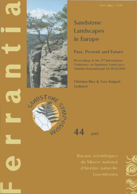
Page de couverture:<br />
Logo du symposium. Réalisation: Anita Faber, Service graphique du MNHN.<br />
Grès de Luxembourg avec Pinus sylvestris près de Berdorf. Photo: Yves Krippel.<br />
Citation:<br />
Ries C. & Krippel Y. (Editors) 2005. - Sandstone Landscapes in Europe - Past, Present and Future.<br />
Proceedings of the 2 nd Inter<strong>national</strong> Conference on Sandstone Landscapes. Vianden (Luxembourg)<br />
25-28.05.2005. Ferrantia 44, 256 p. MNHN, Luxembourg.<br />
Date de publication:<br />
31 décembre 2005<br />
(réception du manuscrit: 15 août 2005)<br />
Impression:<br />
Imprimerie Graphic Press Sàrl, Mamer, Luxembourg<br />
© <strong>Musée</strong> <strong>national</strong> d’histoire <strong>naturelle</strong> Luxembourg, 2005 ISSN 1682-5519
Ferrantia<br />
44<br />
Sandstone Landscapes in Europe<br />
Past, Present and Future<br />
Proceedings of the 2 nd Inter<strong>national</strong> Conference<br />
on Sandstone Landscapes<br />
Vianden (Luxembourg) 25-28.05.2005<br />
Christian Ries & Yves Krippel (Editors)<br />
Luxembourg, 2005<br />
Travaux scientifiques du <strong>Musée</strong> <strong>national</strong> d’histoire <strong>naturelle</strong> Luxembourg
Table of contents - Table des matières<br />
Preface of the editors 7<br />
Conference poster 12<br />
Conference programme 13<br />
Conference opening<br />
Frantzen-Heger, Gaby. - Allocution de bienvenue de la bourgmestre<br />
(Welcome speech of the mayor) 15<br />
Werner, Jean. - Allocution de bienvenue de la part des organisateurs<br />
(Organizers welcome speech) 17<br />
Oral communications - Communications orales<br />
1. Evolution of sandstone landscapes: geology and geomorphology<br />
Evolution des paysages de grès: géologie et géomorphologie<br />
Adamovič, Jiří. - Sandstone cementation and its geomorphic and hydraulic implications. 21<br />
Juilleret, Jérôme, Jean-Francois Iffly, Patrick Matgen, Cyrille Taillez, Lucien Hoffmann &<br />
Laurent Pfister. - Soutien des débits d’étiage des cours d’eau du Grand-Duché du<br />
Luxembourg par l’aquifère du Grès du Luxembourg. 25<br />
Jung, Jürgen. - Sandstone-Saprolite and its relation to geomorphological processes -<br />
examples from Spessart/Germany as a sandstone-dominated highland-region. 31<br />
Mikuláš, Radek. - Features of the sandstone palaeorelief preserved: The Osek area,<br />
Miocene, Czech Republic. 37<br />
Robinson, D.A. & R.B.G. Williams. - Comparative morphology and weathering characteristics<br />
of sandstone outcrops in England, UK. 41<br />
Thiry, Médard. - Weathering morphologies of the Fontainebleau Sandstones and related silica<br />
mobility. 47<br />
Vařilová, Zuzana & Jiří Zvelebil. - Sandstone Relief Geohazards and their Mitigation:<br />
Rock Fall Risk Management in Bohemian Switzerland National Park. 53<br />
2. Archaeology of sandstone landscapes: from Prehistory to the Middle Ages<br />
Archéologie des paysages de grès: de la Préhistoire au Moyen-Âge<br />
Auffret, Marie-Claude & Jean-Pierre Auffret. - Similitudes et différences dans l’art rupestre<br />
post glaciaire de Cantabrie (Espagne), Bassin parisien sud (France), Picardie, Oise et<br />
Aisne (Tardenois, France), Vosges du nord (Bas Rhin et Moselle, France) et Luxembourg. 59<br />
Bénard, Alain. - Aperçu de l’art rupestre des chaos gréseux stampien du Massif de<br />
Fontainebleau, France. 65<br />
Dimitriadis, George. - A Prehistoric Sandstone Landscape: Camonica Valley, Italy. 69<br />
Hauzeur, Anne & Foni Le Brun-Ricalens. - Grès et préhistoire au Luxembourg: Rupture et<br />
continuité dans les stratégies d’implantation et d’approvisionnement liées aux<br />
formations gréseuses durant le Néolithique. 71<br />
Le Brun-Ricalens, Foni & François Valotteau. - Patrimoine archéologique et Grès de<br />
Luxembourg: un potentiel exceptionnel méconnu. 77<br />
Schwenninger, Jean-Luc. - Optical dating of sand grains: Recent advances and applications<br />
in archaeology and Quaternary research. 83
4<br />
3. Flora, fauna and microclimate of sandstone ecosystems<br />
Flore, faune et microclimat des écosystèmes gréseux<br />
Colling, Guy & Sylvie Hermant. - Genetic variation in an isolated population of<br />
Hymenophyllum tunbrigense. 89<br />
Harbusch, Christine. - Bats and sandstone: the importance of sandstone regions in<br />
Luxembourg for the ecology and conservation of bats. 93<br />
Hoffmann, Lucien & Tatyana Darienko. - Algal biodiversity on sandstone in Luxembourg. 99<br />
Härtel, Handrij & Ivana Marková. - Phytogeographic importance of sandstone landscapes. 103<br />
Pokorný, Petr & Petr Kuneš. - Holocene acidification process recorded in three pollen profiles<br />
from Czech sandstone and river terrace environments. 107<br />
Monnier, Olivier, Martial Ferréol, Frédéric Rimet, Alain Dohet, Christophe Bouillon,<br />
Henry-Michel Cauchie, Lucien Hoffmann & Luc Ector. - Le Grès du Luxembourg:<br />
un îlot de biodiversité pour les diatomées des ruisseaux. 115<br />
Muller, Serge. - Les phytocénoses d’indigénat du Pin sylvestre (Pinus sylvestris L.) sur les<br />
affleurements de grès du Pays de Bitche (Vosges du Nord). 119<br />
Signoret, Jonathan. - Les pineraies à caractère naturel au Grand-Duché de Luxembourg:<br />
caractéristiques, conservation et suivi. 123<br />
Świerkosz, Krzysztof & Marek Krukowski. - Main features of the sandstone flora and plant<br />
communities of the North-Western part of Sudetes Foreland. 127<br />
Werner, Jean. - Intérêt et richesse de la flore bryologique du Grès hettangien (Luxembourg,<br />
Eifel et Lorraine). 133<br />
4. Human impact on sandstone landscapes: threats and protection<br />
Impacts humains sur les paysages de grès: menaces et conservation<br />
Alexandrowicz, Zofia & Jan Urban. - Sandstone regions of Poland – Geomorphological types,<br />
scientific importance and problems of protection. 137<br />
Duchamp, Loïc. - Une charte pour la pratique de l’escalade sur les rochers du Parc naturel<br />
régional des Vosges du Nord. 143<br />
Krippel, Yves. - Is the conservation of the natural and cultural heritage of sandstone<br />
landscapes guaranteed? Case study of the Petite Suisse area in Luxembourg. 147<br />
Ferrantia • 44 / 2005
Posters<br />
1. Evolution of sandstone landscapes: geology and geomorphology<br />
Evolution des paysages de grès: géologie et géomorphologie<br />
Colbach, Robert. - Overview of the Geology of the Luxembourg Sandstone(s). 155<br />
Faber, Alain & Robert Weis. - Le Grès de Luxembourg: intérêt scientifique et patrimonial<br />
de ses sites fossilifères. 161<br />
Jung, Jürgen. - Cretaceous-Tertiary weathering in sandstones of the Southwest Spessart/<br />
Germany. 165<br />
Mertlík, Jan & Jiří Adamovič. - Some significant geomorphic features of the Klokočí Cuesta,<br />
Czech Republic. 171<br />
Schweigstillová, Jana, Veronika Šímová & David Hradil. - New investigations of the salt<br />
weathering of Cretaceous sandstones in Northern Bohemia, Czech Republic. 177<br />
Urban, Jan. - Pseudokarst caves as an evidence of sandstone forms evolution – a case study<br />
of Niekłań, the Świętokrzyskie Mts., central Poland. 181<br />
2. Archaeology of sandstone landscapes: from Prehistory to the Middle Ages<br />
Archéologie des paysages de grès: de la Préhistoire au Moyen-Âge<br />
Le Brun-Ricalens, Foni. - Grès de Luxembourg et Art rupestre: L’œuvre du Dr E. Schneider<br />
et la correspondance inédite (1937-1949) avec l’abbé H. Breuil. 187<br />
Le Brun-Ricalens, Foni, Jean-Noël Anslijn, Frank Broniewski & Susanne Rick. - Le projet FNR<br />
«Espace et Patrimoine Culturel»: un outil de gestion informatisé au service du<br />
Patrimoine luxembourgeois. L’exemple de la zone-pilote du Müllerthal. 193<br />
Valotteau, François & Foni Le Brun-Ricalens. - Grès de Luxembourg et Mégalithisme : bilan<br />
après 5 années de recherche. 199<br />
3. Flora, fauna and microclimate of sandstone ecosystems<br />
Flore, faune et microclimat des écosystèmes gréseux<br />
Colling Guy, Thierry Helminger & Jim Meisch. - Microclimatic conditions in a sandstone<br />
gorge with Hymenophyllum tunbrigense. 205<br />
Krippel, Yves. - The Hymenophyllaceae (Pteridophyta) in Luxembourg. Past, present and future. 209<br />
Liron, Marie Nieves & Médard Thiry. - Peaty micro-zones on the sandstone ridges of the<br />
Fontainebleau Massif (France): hydrology and vegetation biodiversity. 215<br />
Marková, Ivana. - Bryophyte diversity of Bohemian Switzerland in relation to microclimatic<br />
conditions. 221<br />
Stomp, Norbert & Wanda M. Weiner. - Some remarkable species of Collembola (Insecta,<br />
Apterygota) of the Luxembourg sandstone area. 227<br />
Turoñová, Dana. - Mapping and monitoring of Killarney Fern (Trichomanes speciosum) in the<br />
Czech Republic. 233<br />
Urbanová, Hana & Jan Procházka. - Kokořínsko Protected Landscape area – Rare species,<br />
protection and conservation. 237<br />
Photos of the conference - Photos de la conférence 239<br />
On behalf of the participants - Au nom des participants 245<br />
List of participants - Liste des participants 247<br />
Ferrantia • 44 / 2005<br />
5
6<br />
Ferrantia • 44 / 2005
C. Ries & Y. Krippel Preface of the Editors<br />
Preface of the Editors<br />
Introduction<br />
You hold in hands the proceedings of the second<br />
inter<strong>national</strong> conference on sandstone landscapes<br />
that took place in Vianden (Luxembourg) from<br />
May 25 to May 28 2005. The conference entitled<br />
“Sandstone landscapes in Europe - Past, present and<br />
future” brought together a range of scientists,<br />
experts, teachers and students from all over<br />
Europe.<br />
This inter<strong>national</strong> sandstone symposium followed<br />
the initial conference “Sandstone Landscapes:<br />
Diversity, Ecology and Conservation” that took place<br />
in Doubice in Saxonian-Bohemian Switzerland,<br />
Czech Republic in September 2002 (Härtel et al.<br />
2002).<br />
The proposal for the follow-up symposium was brought<br />
to Luxembourg by a Luxembourg participant who<br />
attended the Czech symposium.<br />
The “Groupe d’études ayant pour objet la conservation<br />
du patrimoine naturel de la Petite-Suisse luxembourgeoise”,<br />
an advisory group created by the Luxembourg<br />
Government to promote the conservation<br />
of remarkable natural sites in the Luxembourg<br />
sandstone area, the Müllerthal, also known as<br />
the “Petite-Suisse luxembourgeoise”, supported<br />
the initiative to organize the next sandstone<br />
symposium in Luxembourg.<br />
So the idea made its way, a partnership was set up<br />
and the symposium was scheduled for May 2005.<br />
Organization<br />
Organizations and persons are listed in alphabetical<br />
order.<br />
Main organizers<br />
• Administration des eaux et forêts (Water and<br />
forestry administration)<br />
Ferrantia • 44 / 2005<br />
Christian RIES<br />
Department of Ecology, National Museum of Natural History<br />
25, rue Münster, L-2160 Luxembourg<br />
cries@mnhn.lu<br />
Yves KRIPPEL<br />
Research associate of the Luxembourg National Museum of Natural History<br />
18A, rue de Rollingen, L-7475 Schoos<br />
yves.krippel@mnhn.lu<br />
• <strong>Musée</strong> <strong>national</strong> d’histoire <strong>naturelle</strong> (National<br />
Museum of Natural History)<br />
• <strong>Musée</strong> <strong>national</strong> d’histoire et d’art (National<br />
Museum of History and Art)<br />
• Société des naturalistes luxembourgeois<br />
(Luxembourg Naturalist Society)<br />
Partner organizations<br />
• Amis de la géologie, de la minéralogie et de<br />
la paléontologie du Luxembourg (Friends of<br />
geology, mineralogy and palaeontology in<br />
Luxembourg)<br />
• Association des géologues luxembourgeois<br />
(Luxembourg geologists association)<br />
• Fondation Hëllef fir d’Natur (Help for nature<br />
foundation)<br />
• LAG LEADER+ Mullerthal (Local action group<br />
Leader +)<br />
• NATURA - Ligue luxembourgeoise pour la<br />
protection de la nature et de l'environnement<br />
(Luxembourg league for the environment and<br />
nature conservation)<br />
• Naturerkundungsstation Teufelsschlucht<br />
(Nature visitor center)<br />
• Oeko-Zenter Lëtzebuerg (Environmental and<br />
nature conservation foundation)<br />
• Service géologique du Luxembourg (Geological<br />
survey of Luxembourg)<br />
• Société préhistorique luxembourgeoise<br />
(Luxembourg prehistorical society)<br />
Conference coordination and secretariate<br />
• Christian Ries, curator at the National Museum<br />
of Natural History, president of the Luxembourg<br />
Naturalist Society<br />
7
C. Ries & Y. Krippel Preface of the Editors<br />
8<br />
Conference scientific committee<br />
• Guy Colling, researcher at the National<br />
Museum of Natural History<br />
• Alain Faber, curator at the National Museum of<br />
Natural History<br />
• Yves Krippel, research associate of the National<br />
Museum of Natural History<br />
• Christian Ries, curator at the National Museum<br />
of Natural History, president of the Luxembourg<br />
Naturalist Society<br />
• Jean-Marie Sinner, head of Diekirch forestry<br />
district, Water and Forests Administration<br />
• Fernand Spier, president of the Luxembourg<br />
Prehistory Society<br />
• Norbert Stomp, honorary director of the<br />
National Museum of Natural History<br />
• François Valotteau, researcher at the National<br />
Museum of History and Art<br />
• Jean Werner, president of the Study group<br />
for the preservation of the natural heritage of<br />
Luxembourg Little Switzerland<br />
Conference organizing committee<br />
• Georges Bechet, director of the National<br />
Museum of Natural History<br />
• Marie-Paule Kremer, Ministry of Environment<br />
• Frantz-Charles Muller, president of Foundation<br />
'Hëllef fir d’Natur' and NATURA<br />
• Christian Ries, curator at the National Museum<br />
of Natural History, president of the Luxembourg<br />
Naturalist Society<br />
• Jean-Marie Sinner, head of Diekirch forestry<br />
district, Water and Forests Administration<br />
• François Valotteau, researcher at the National<br />
Museum of History and Art<br />
Background and aims<br />
of the conference<br />
Sandstone regions are scattered all over Europe.<br />
Even if different in age and composition, they<br />
all show a great number of similitudes. Distinct<br />
geomorphologic features often create strong<br />
gradients in mesoclimatic conditions and generate<br />
high levels of natural disturbance and resulting<br />
patch dynamics. In sandstone regions these<br />
dynamic geomorphologic processes occur at rates<br />
unseen in the surroundings. The special climatic<br />
or microclimatic conditions in sandstone regions<br />
induce a mosaic of biotopes hosting specific flora<br />
and fauna. The occurring species are often of relict<br />
nature and a testimony of climatic conditions and<br />
vegetation in place earlier in this interglacial.<br />
Sandstone areas are not only a phenomenon of<br />
geological and biological interest. They are well<br />
known for their prehistoric past, and rock shelters<br />
provided excellent opportunities for human<br />
settlements. Later, the outstanding landscapes of<br />
sandstone regions have attracted human attention,<br />
particularly since the Romantic period. It was<br />
the beginning of tourism, a phenomenon that<br />
nowadays often causes irreversible problems in<br />
these fragile environments.<br />
In order to preserve the invaluable landscapes and<br />
ecosystems, associated to sandstone landscapes,<br />
there is a strong need for research, nature and<br />
landscape conservation with concrete management<br />
plans, environmental friendly tourism, etc.<br />
The first sandstone conference in Doubice, Czech<br />
Republic, revealed that the uniqueness of geomorphologic<br />
and ecological processes in sandstone<br />
regions calls for a much more intimate link<br />
between geomorphology, climatology, landscape<br />
history and biology/ecology, etc. and initiated<br />
the so-called 'sandstone community', a database<br />
of people interested in research and conservation<br />
of sandstone landscapes. More information can<br />
be found on the 'Sandstone Landscapes' website<br />
www.sandstones.org, providing information<br />
about the research and events on sandstone<br />
landscapes, especially in Europe (Härtel 2005).<br />
This second inter<strong>national</strong> conference on sandstone<br />
tried to carry on the effort devoted to bridging<br />
all the concerned disciplines. The organizers<br />
intended that this conference would - amongst<br />
others - identify which general research topics<br />
can use sandstone regions as particularly suitable<br />
model systems; permit the comparison of different<br />
sandstone regions in Europe and point out similarities;<br />
establish new contacts and further collaboration<br />
among people interested in sandstone<br />
regions; address conservation issues specific for<br />
sandstone regions (tourism, rock climbing, restoration<br />
management); etc.<br />
Scientific programme<br />
The scientific programme consisted of plenary<br />
lectures, poster sessions, discussions and excursions.<br />
Four major topics were covered by 26 oral<br />
communications and 16 posters:<br />
1. Evolution of sandstone landscapes:<br />
geology and geomorphology<br />
Sandstone is a quite common rock type, which<br />
characterizes different regions and yet each<br />
Ferrantia • 44 / 2005
C. Ries & Y. Krippel Preface of the Editors<br />
sandstone formation differs somehow from the<br />
other by its mineralogical composition or by its<br />
origin. Today the geological evolution of these<br />
areas shows a landscape revealing many erosion<br />
features, joint patterns and rockslides from<br />
recent time, as well as a lot of elements from the<br />
geological past. The erosion often formed either<br />
narrow valleys into a sandstone plateau, or slopes<br />
of a cuesta, or buttes as residual hills or outliers,<br />
etc.<br />
2. Archaeology of sandstone landscapes:<br />
from Prehistory to the Middle Ages<br />
There is no doubt about the importance of<br />
sandstone landscapes from Prehistory to the<br />
Middle Ages. Archaeology contributes to the<br />
knowledge of the old populations within the<br />
limits given by the subject. Following topics are<br />
of special interest: the habitat and its additional<br />
activities, as well as architecture; burials, anthropology<br />
and taphonomy in sandy context; petroglyphs<br />
and rupestral art.<br />
3. Flora, fauna and microclimate of<br />
sandstone ecosystems<br />
Sandstone formations with their typical erosion<br />
features are known for special microclimatic<br />
conditions. Great variations in both humidity and<br />
temperature - including temperature inversion -<br />
are responsible for a huge diversity of plants and<br />
animals. The proliferation of Atlantic and sub-<br />
Atlantic species is remarkable; the presence of<br />
mountain and sub-mountain species is significant.<br />
Besides higher plants, the diversity of pteridophytes<br />
and the richness of nonvascular cryptogams<br />
like bryophytes and lichens of sandstone regions<br />
is in general outstanding. On the other hand, the<br />
sandstone outcrops, as well as extended woods<br />
and moist valleys offer habitats for a rich wildlife.<br />
4. Human impact on sandstone<br />
landscapes: threats and protection<br />
Sandstone landscapes often became the victims<br />
of their own success. Exploited and inhabited<br />
by man since prehistory, visited and solicited by<br />
modern man, seeking relaxation and ventures in<br />
these spectacular landscapes, the extreme fragile<br />
sandstone habitats are more and more threatened.<br />
In order to preserve the natural and cultural<br />
heritage of sandstone landscapes, concrete<br />
measures must be initiated and a tourism in accordance<br />
with the environment promoted.<br />
Ferrantia • 44 / 2005<br />
Course of the Symposium<br />
88 participants attended the conference, including<br />
speakers and translation staff (cf. list of participants).<br />
Pre-conference excursion<br />
The pre-conference excursion on Wednesday<br />
May 25 took the participants by bus to the heart<br />
of the “Petite Suisse” area. The participants were<br />
split into two groups according to the conference<br />
languages English and French.<br />
On the programme: sandstone formations, forests<br />
and valleys around Berdorf and Beaufort (Fig. 1).<br />
The prehistoric sites of 'Kalekapp', petroglyphs<br />
and vandalism, rock formations and erosion,<br />
different forest associations, flora (including filmy<br />
ferns), fauna, rock climbing and related problems,<br />
tourism as well as nature conservation, were only<br />
some of the topics.<br />
The field trip was rather demanding, but the<br />
barbecue during lunch break in the stunning<br />
scenery of Beaufort castle helped to forget aching<br />
legs and sunburn.<br />
The guides were: Guy Colling, Alain Faber, Anne<br />
Hauzeur, Yves Krippel, Jean-Marie Sinner and<br />
François Valotteau.<br />
The conference<br />
The plenary sessions lasted the next two days, from<br />
Thursday May 26 to Friday May 27. The venue<br />
was the 'Centre culturel Larei', a former tannery<br />
complex transformed by the city of Vianden into a<br />
cultural centre. An abstract book was provided by<br />
the organizers (Ries 2005).<br />
Instead of grouping the communications by major<br />
themes into distinct Symposia, the organizing<br />
committee was so audacious to mix up the<br />
contributions independently of their topic (cf.<br />
Fig. 1: Pre-conference excursion in the Müllerthal area,<br />
May 25 2005. Photo: Milkuláš Radek.<br />
9
C. Ries & Y. Krippel Preface of the Editors<br />
10<br />
programme). Under the bottom line, as everybody<br />
agreed, this atypical method was of great success.<br />
It is quite unusual that the last speaker of the day<br />
can find himself in front of a full auditory, most<br />
people having attended all day long. Of course<br />
this fact is also due to the excellent quality of the<br />
contributions and to the fact that the programme<br />
was reliable, all speakers perfectly respecting their<br />
allocated time.<br />
We are especially thankful to Handrij Härtel and<br />
Jan Čeřovský who draw general conclusions at<br />
the conference closure and called for joining the<br />
sandstone community and for meeting again at the<br />
next conference which will be held in Poland in a<br />
couple of years. Jan Čeřovský draw the attention<br />
to the range of activities and working groups<br />
of the IUCN and proposed that the sandstone<br />
community should create an IUCN-working<br />
group covering the issues of sandstone areas.<br />
On Friday May 27, after the second morning<br />
session, the organizers were happy to present<br />
the book about the Petite-Suisse area and to offer<br />
a copy to each participant (Fig. 2). The book<br />
comprises 251 pages and covers all the topics of<br />
the conference (Krippel 2005).<br />
After the conference closure, the tourist train<br />
'Benni' took the participants to a guided visit of the<br />
hydro electrical power plant SEO near Stolzembourg.<br />
The conference dinner took place the same<br />
evening in the Hotel Victor Hugo in Vianden.<br />
Post-conference excursion<br />
The post-conference excursion took the participants<br />
by bus to the German part of the Luxembourg<br />
sandstone area near Ernzen and Ferschweiler.<br />
Again the participants were split into two<br />
groups according to the conference languages<br />
English and French.<br />
Fig. 2: Presentation of the book about the Petite-Suisse<br />
area in front of the conference venue Larei, May 27<br />
2005. Photo: Milkuláš Radek.<br />
Fig. 3: Post-conference excursion, Luxembourg-city,<br />
view on the Alzette valley and the Grund district, May<br />
28 2005. Photo: Jiří Adamovič.<br />
After a glance at the visitor centre 'Naturerkundungszentrum<br />
Teufelsschlucht', a trail took the<br />
participants through sandstone formations and<br />
deciduous woods to the valley of the Prüm and<br />
the 'Irreler Wasserfälle', small waterfalls caused by<br />
enormous rock boulders.<br />
The afternoon was spent in Luxembourg-city<br />
covering geological, historical and botanical topics<br />
(Fig. 3). The excursion ended with a visit of two<br />
major museums, the National Museum of Natural<br />
History and the National Museum of History and<br />
Art.<br />
The guides were: Georges Bechet, Alain Faber,<br />
Anne Hauzeur, François Valotteau and Holger<br />
Weber.<br />
Conclusion<br />
On behalf of the organizers we thank all the<br />
participants having attended the conference and<br />
especially those who have contributed to the<br />
programme excellence with a high diversity and<br />
quality of oral communications and poster presentations.<br />
The magnificent weather conditions, the gorgeous<br />
conference venue and last but not least the sociability<br />
and sincerity of the participants made this<br />
symposium a remarkable event that will not be<br />
forgotten soon.<br />
The conference showed clearly the similitude of<br />
the different sandstone landscapes scattered all<br />
over Europe and the similarities of the problematic<br />
of conservation of natural and cultural heritages<br />
in the different regions. By gathering participants<br />
of other countries, the Sandstone Community was<br />
enlarged and there was a clear consensus to join<br />
efforts in the future.<br />
Ferrantia • 44 / 2005
C. Ries & Y. Krippel Preface of the Editors<br />
We hope these proceedings will contribute to<br />
spread knowledge about one of the most sensible<br />
landscape types in Europe and will increase<br />
networking amongst the scientific community<br />
working in and on sandstone areas.<br />
Acknowledgements<br />
We are grateful to a range of persons and institutions<br />
which have helped in many ways and thus<br />
contributed to the success of the conference. These<br />
persons and institutions are listed by type and<br />
in alphabetical order. We express these thanks<br />
on behalf of the main organizers, the partner<br />
organizations and the scientific and organizing<br />
committees.<br />
Excursion guides<br />
• Georges Bechet (National Museum of Natural<br />
History, Luxembourg)<br />
• Guy Colling (National Museum of Natural<br />
History, Luxembourg)<br />
• Alain Faber (National Museum of Natural<br />
History, Luxembourg)<br />
• Anne Hauzeur (research associate, National<br />
Museum of History and Art, Luxembourg)<br />
• Yves Krippel (research associate, National<br />
Museum of Natural History, Luxembourg)<br />
• Jean-Marie Sinner (Forestry administration,<br />
Diekirch)<br />
• François Valotteau (National Museum of<br />
History and Art, Luxembourg)<br />
• Holger Weber (Naturerkundungszentrum<br />
Teufelsschlucht, Germany)<br />
Staff<br />
• Bastin Jonny (Municipality<br />
conference venue Larei)<br />
of Vianden,<br />
• Pascal Dellea (driver)<br />
• Nadine De Sousa (student, Hotel school<br />
Diekirch)<br />
• Véronique Maurer (student, Hotel school<br />
Diekirch)<br />
• Tom Müller (Forestry administration, Beaufort)<br />
and his team (barbecue in Beaufort Castle)<br />
Graphical work<br />
• Anita Faber (National Museum of Natural<br />
History, Luxembourg)<br />
• Thierry Helminger (National Museum of<br />
Natural History, Luxembourg)<br />
Sponsors<br />
• Fonds <strong>national</strong> de la recherche, Luxembourg<br />
(National Research Fund)<br />
Ferrantia • 44 / 2005<br />
• Luxembourg Presidency of the Council of the<br />
European Union<br />
• Ministry of Culture, Higher Education and<br />
Research, Luxembourg<br />
• Ministry of Environment, Luxembourg<br />
• Ministry of Foreign Affairs, Luxembourg<br />
• Mrs. Anne-Marie Linkels (Castle of Beaufort)<br />
• Municipality of Beaufort<br />
• Municipality of Vianden<br />
• SEO, Société électrique de l’Our, Vianden<br />
• Tourist office of Vianden<br />
Companies<br />
• Accents sprl, Brussels (Simultaneous translation)<br />
• Alltec solution providers, Luxembourg<br />
(Materials)<br />
• Autolux sàrl, Luxembourg (Car rental)<br />
• Dorel Doreanu, Senningen (Music)<br />
• Economat Stronska Fons, Vianden (Catering)<br />
• E.G.E. Stienon sprl, Brussels (Sound and simultaneous<br />
translation technique)<br />
• Hammes sàrl, Vianden (Tourist train Benni)<br />
• Hotel Victor Hugo, Vianden (Catering)<br />
• Hotel Petry, Vianden (Catering)<br />
• Maison Bernard Bergh, Vianden (Materials)<br />
• Shop Vinandy, Vianden (Fuel)<br />
• Voyages Demy Schandeler, Keispelt (Bus transportation)<br />
References<br />
Härtel H. 2005. - Sandstone Landscapes. Website<br />
of the Sandstone Community. Url: http://www.<br />
sandstones.org/s_conf.htm [15.11.2005].<br />
Härtel H., Herben T. & Cílek V. 2002. - Sandstone<br />
Landscapes: Diversity, Ecology and Conservation.<br />
Conference homepage. Url: http://<br />
www.sandstones.org/ibot_sandstone/index.<br />
htm [15.11.2005].<br />
Krippel Y. [ed.] 2005. - Die Kleine Luxemburger<br />
Schweiz - Geheimnisvolle Felsenlandschaft im<br />
Wandel der Zeit. Luxembourg. 251p. ISBN 2-<br />
919877-09-7.<br />
Ries C. 2005. - Sandstone landcapes in Europe<br />
- Past, present and future. 2nd Inter<strong>national</strong><br />
Conference on sandstone landcapes. Conference<br />
abstracts - Préactes de la conférence.<br />
Url: http://www.symposium.lu/symposium/<br />
sandstone/preactes.pdf [15.11.2005]<br />
11
Conference poster Poster de la conférence<br />
12<br />
Poster layout: Thierry Helminger (MNHNL). Logo design: Anita Faber (MNHNL)<br />
Ferrantia • 44 / 2005
Conference programme Programme de la conférence<br />
Conference programme<br />
Programme de la conférence<br />
Note of the editors: the authors who presented the<br />
oral communication at the conference are marked<br />
with the sign * after their last name.<br />
Wednesday May 25 2005<br />
Pre-conference excursion (Müllerthal, L)<br />
Thursday May 26 2005<br />
Conference opening<br />
Welcome speeches by Mrs. Gaby Frantzen-Heger,<br />
Mayor of Vianden, and Mr. Jean Werner on behalf<br />
of the organizers.<br />
Session I<br />
Chairman: Yves Krippel (L)<br />
Handrij Härtel* & Ivana Marková. - Phytogeographic<br />
importance of sandstone landscapes (CZ)<br />
Jiří Adamovič*. - Sandstone cementation and its<br />
geomorphic and hydraulic implications (CZ)<br />
Krzysztof Świerkosz & Marek Krukowski*. -<br />
Main features of the sandstone flora and plant<br />
communities of the North-Western part of Sudetes<br />
Foreland (PL)<br />
Session II<br />
Chairman: Handrij Härtel (CZ)<br />
Zuzana Vařilová & Jiří Zvelebil*. - Sandstone Relief<br />
Geohazards and their Mitigation: Rock Fall Risk<br />
Management in Bohemian Switzerland National<br />
Park (CZ)<br />
Médard Thiry*. - Weathering morphologies of<br />
the Fontainebleau Sandstones and related silica<br />
mobility (F)<br />
Alain Bénard*. - Aperçu de l’art rupestre des chaos<br />
gréseux stampien du Massif de Fontainebleau,<br />
France (F)<br />
Petr Pokorný* & Petr Kuneš. - Holocene acidification<br />
process recorded in three pollen profiles<br />
from Czech sandstone and river terrace environments<br />
(CZ)<br />
Ferrantia • 44 / 2005<br />
Session III<br />
Chairman: Jean-Luc Schwenninger (UK)<br />
David A. Robinson* & Rendel B. G. Williams. -<br />
Comparative morphology and weathering characteristics<br />
of sandstone outcrops in England, UK<br />
(UK)<br />
Radek Mikuláš*. - Features of the sandstone<br />
palaeorelief preserved: The Osek area, Miocene,<br />
Czech Republic (CZ)<br />
Guy Colling* & Sylvie Hermant. - Genetic variation<br />
in an isolated population of Hymenophyllum tunbrigense<br />
(L)<br />
Loïc Duchamp*. - Une charte pour la pratique de<br />
l’escalade sur les rochers du Parc naturel régional<br />
des Vosges du Nord (F)<br />
Poster session<br />
Session IV<br />
Chairwoman: Anne Hauzeur (B)<br />
Foni Le Brun-Ricalens & François Valotteau*. -<br />
Patrimoine archéologique et Grès de Luxembourg:<br />
un potentiel exceptionnel méconnu (L)<br />
Handrij Härtel*. - Sandstone landscapes: research,<br />
conservation and future co-operation within the<br />
Sandstone Community (CZ)<br />
Informal discussion on sandstone community<br />
during and after dinner<br />
Friday May 27 2005<br />
Session V<br />
Chairman: Guy Colling (L)<br />
Jérôme Juilleret*, Jean-Francois Iffly, Patrick<br />
Matgen, Cyrille Taillez, Lucien Hoffmann &<br />
Laurent Pfister. - Soutien des débits d’étiage des<br />
cours d’eau du Grand-Duché du Luxembourg par<br />
l’aquifère du Grès du Luxembourg (L)<br />
Lucien Hoffmann* & Tatyana Darienko. - Algal<br />
biodiversity on sandstone in Luxembourg (L &<br />
UA)<br />
Christine Harbusch*. - Bats and sandstone: the<br />
importance of sandstone regions in Luxembourg<br />
for the ecology and conservation of bats (D)<br />
13
Conference programme Programme de la conférence<br />
14<br />
Anne Hauzeur* & Foni Le Brun-Ricalens. -<br />
Grès et Préhistoire au Luxembourg: Rupture<br />
et continuité dans les stratégies d’implantation<br />
et d’approvisionnement liées aux formations<br />
gréseuses durant le Néolithique (B & L)<br />
Session VI<br />
Chairman: Jan Urban (PL)<br />
Jean Werner*. - Intérêt et richesse de la flore<br />
bryologique du Grès hettangien (Luxembourg,<br />
Eifel et Lorraine) (L)<br />
Olivier Monnier*, Martial Ferréol, Frédéric Rimet,<br />
Alain Dohet, Christophe Bouillon, Henry-Michel<br />
Cauchie, Lucien Hoffmann & Luc Ector. - Le Grès<br />
du Luxembourg: un îlot de biodiversité pour les<br />
diatomées des ruisseaux (L)<br />
Jürgen Jung*. - Sandstone-Saprolite and its relation<br />
to geomorphological processes - examples from<br />
Spessart/Germany as a sandstone-dominated<br />
highland-region (D)<br />
Marie-Claude Auffret* & Jean-Pierre Auffret. -<br />
Similitudes et différences dans l’art rupestre post<br />
glaciaire de Cantabrie (Espagne), Bassin parisien<br />
sud (France), Picardie, Oise et Aisne (Tardenois,<br />
France), Vosges du nord (Bas Rhin et Moselle,<br />
France) et Luxembourg (F)<br />
Session VII<br />
Chairman: Jan Cerovsky (CZ)<br />
Serge Muller*. - Les phytocénoses d’indigénat du<br />
Pin sylvestre (Pinus sylvestris L.) sur les affleurements<br />
de grès du Pays de Bitche (Vosges du Nord)<br />
(F)<br />
Jean-Luc Schwenninger*. - Optical dating of<br />
sand grains: Recent advances and applications in<br />
archaeology and Quaternary research (UK)<br />
Zofia Alexandrowicz & Jan Urban*. - Sandstone<br />
regions of Poland - Geomorphological types,<br />
scientific importance and problems of protection<br />
(PL)<br />
George Dimitriadis*. - A Prehistoric Sandstone<br />
Landscape: Camonica Valley, Italy (I)<br />
Poster session<br />
Session VIII<br />
Chairman: Jean-Marie Sinner (L)<br />
Jonathan Signoret* & Sandrine Signoret. - Les<br />
pineraies à caractère naturel au Grand-Duché de<br />
Luxembourg: caractéristiques, conservation et<br />
suivi (F)<br />
Yves Krippel*. - Is the conservation of the natural<br />
and cultural heritage of sandstone landscapes<br />
guaranteed? Case study of the Petite Suisse area<br />
in Luxembourg (L)<br />
Conference closing<br />
Conference dinner (Hotel Victor Hugo)<br />
Saturday May 28 2005<br />
Post-conference excursion (Teufelsschlucht,<br />
D; Luxembourg-city)<br />
Ferrantia • 44 / 2005
G. Frantzen-Heger Allocution de bienvenue<br />
Allocution de bienvenue<br />
Mesdames et Messieurs,<br />
Cette petite ville de Vianden, située aux confins Est<br />
du Grand-Duché de Luxembourg, vous souhaite la<br />
plus cordiale bienvenue.<br />
En choisissant Vianden comme lieu du colloque,<br />
vous avez succombé, et c’est compréhensible, à la<br />
double tentation de la nature et tourisme.<br />
La nature d’abord: du point de vue géographique<br />
physique, le Luxembourg ne forme pas une unité<br />
régionale homogène, mais réunit, dans ses étroites<br />
frontières, des fragments d’entités <strong>naturelle</strong>s<br />
auxquelles participent les pays voisins.<br />
La partie méridionale du pays constitue le<br />
prolongement des vallonnements de la plaine<br />
lorraine. Au sud-ouest, le Luxembourg reprend une<br />
bande du gisement de minerai oolithique lorrain.<br />
Au sud-est, il se rattache au domaine viticole de<br />
la Moselle allemande. Sa partie septentrionale,<br />
l’Oesling, et donc notre petite ville de Vianden,<br />
fait partie du massif schisteux rhénan et constitue<br />
un paysage de transition entre l’Eifel allemande et<br />
l’Ardenne belge. Le centre est occupé par le paysage<br />
rupestre et forestier du grès du Luxembourg,<br />
« Sandstone » – le thème de votre colloque, qui, lui<br />
aussi, s’étend au-delà de la frontière orientale.<br />
Empruntant ainsi à des régions <strong>naturelle</strong>s très<br />
diverses, le Luxembourg réunit sur une très faible<br />
étendue territoriale une grande variété de paysages.<br />
C’est là un des secrets de l’attrait qu’il exerce sur<br />
le touriste étranger et l’explication du fait qu’il est<br />
un terrain de prédilection pour les étudiants en<br />
géologie.<br />
Un géographe anglais, George Renwick, a pu dire<br />
qu’ici le grand tome de la nature est condensé en<br />
format de poche.<br />
Il est difficile, en parlant à des professionnels que<br />
vous êtes, de trouver les mots et les définitions<br />
justes pour vanter les beautés de nos sites. Et si,<br />
pour parler avec un poète, qui fut aussi un noble<br />
orateur, il conviendrait peut-être de dire qu’en<br />
pareille occasion «seul le silence est grand».<br />
Ferrantia • 44 / 2005<br />
Gaby FRANTZEN-HEGER<br />
Bourgmestre, Administration communale de la ville de Vianden<br />
B.P. 10, L-9401 Vianden<br />
bourgmestre@vianden.lu<br />
La voix d’un autre poète me souffle à l’oreille une<br />
sorte d’invocation qui supplée heureusement à mon<br />
inspiration défaillante. Cet autre poète, vous l’avez<br />
deviné, c’est le grand, le majestueux Victor Hugo.<br />
Et cette invocation, la voici, extraite d’une note de<br />
juin 1871 que l’auteur des 'Burgraves' dédia à la cité<br />
de Vianden: «Dans un paysage splendide que viendra<br />
visiter un jour toute l’Europe, Vianden se compose de<br />
deux choses également consolantes et magnifiques,<br />
l’une, sinistre: une ruine, l’autre, riante: un peuple.»<br />
En guise de reconnaissance, la ville de Vianden<br />
a transformé la maison où habitait jadis le grand<br />
homme en musée, le seul musée littéraire du<br />
Grand-Duché, très intéressant à visiter.<br />
On se plait aujourd’hui à voir en Victor Hugo le<br />
précurseur de l’Europe. Il a entrevu des possibilités<br />
de rapprochement des peuples, de l’union<br />
nécessaire de notre continent. Toute l’Europe, vous<br />
la représentez aujourd’hui en ce qu’elle a de plus<br />
avide à connaître.<br />
Le plus illustre visiteur de Vianden parle d’une<br />
chose sinistre: la ruine. Aujourd’hui il n’écrirait plus<br />
ce mot et il puiserait dans son riche vocabulaire<br />
pour chanter les beautés du château palais reconstruit,<br />
un des plus grands et plus beaux bâtiments<br />
des époques romane et gothique de notre Europe,<br />
joyau d’architecture visité annuellement par<br />
quelque 200.000 visiteurs. Et si seulement il avait<br />
pu se servir du télésiège, quelle vue magnifique son<br />
regard d‘aigle aurait embrassé.<br />
A cet égard, Mesdames et Messieurs, vous êtes des<br />
privilégiés par rapport au poète qui, les pieds bien<br />
sur notre terre viandenoise, ne pouvait que monter<br />
nos collines ou se complaire dans les hauteurs de sa<br />
méditation olympienne.<br />
Vianden n’est pas de ces endroits qu’on fait entre<br />
deux trains. Il faut savoir le regarder. Il faut quitter<br />
la grande route et grimper sur les rochers, écouter le<br />
chant de la rivière qui longe ici le centre culturel et<br />
laisser planer ses regards au loin. Il faut aller dans<br />
les ravins boisés, humer le parfum de la bruyère. Et<br />
s’engager dans la grande forêt pour se gonfler les<br />
poumons du souffle de la brise qui murmure dans<br />
les vieux chênes.<br />
15
G. Frantzen-Heger Allocution de bienvenue<br />
16<br />
Après la période d’occupation (lors de la 2ème guerre<br />
mondiale), la petite ville de Vianden a été reconstruite,<br />
adaptée aux exigences modernes, tout en<br />
gardant autant que possible le style médiéval qui<br />
fait de Vianden « La perle du Grand-Duché ».<br />
Il faut emprunter le circuit botanique et le circuit<br />
«extra-muros - intra-muros», visiter l’église des<br />
Trinitaires avec son cloître, le musée d’art rustique<br />
et le musée des poupées, le barrage de l’Our avec<br />
la plus grande centrale hydro-électrique d’Europe,<br />
se détendre à la piscine, avec une magnifique vue<br />
sur le château.<br />
Quant à la chose riante par laquelle le poète<br />
désigne notre peuple, Mesdames et Messieurs, ce<br />
n’est pas à moi de vous en chanter les louanges.<br />
J’espère que vous le connaîtrez par vous-mêmes,<br />
dans une franchise totale et qui permet, je pense,<br />
de nouer de cordiales et durables relations.<br />
C’est au nom de ce peuple viandenois que j’ai<br />
le grand honneur de vous souhaiter une bien<br />
cordiale bienvenue et de formuler tous mes vœux<br />
pour que votre passage à Vianden constitue pour<br />
vous une expérience agréable dans votre colloque<br />
de ces journées.<br />
Ferrantia • 44 / 2005
J. Werner Discours de bienvenue - Welcome speech<br />
Discours de bienvenue<br />
Madame la bourgmestre, chers collègues,<br />
c’est avec un grand plaisir qu’au nom des organisateurs<br />
je vous souhaite la bienvenue à ce symposium.<br />
En convergeant vers ce joyau des Ardennes, vous<br />
réalisez à votre tour la vision de Victor Hugo, qui a<br />
évoqué Vianden «dans son paysage splendide que<br />
viendra visiter un jour toute l’Europe».<br />
On m’a demandé de faire ce petit discours de<br />
bienvenue alors que l’idée du symposium a germé<br />
au sein du groupe d’études dont je suis le président.<br />
Le botaniste Yves Krippel, un de nos membres les<br />
plus actifs, venait d’assister en septembre 2002,<br />
en République tchèque, au premier congrès interdisciplinaire<br />
de ce genre et il a réussi sans peine<br />
à nous enthousiasmer pour l’organisation d’un<br />
symposium dans notre pays.<br />
Le Luxembourg est prédestiné à accueillir ce<br />
symposium, alors que le Grès hettangien (Jurassique)<br />
affleure sur le cinquième environ de son<br />
territoire, avec notamment la «Petite Suisse<br />
Luxembourgeoise», située à moins de 20 km de<br />
cet endroit! En guise d’introduction je vous dirai<br />
quelques mots sur le «Groupe d’études ayant pour<br />
objet la conservation du patrimoine naturel de la<br />
Petite-Suisse Luxembourgeoise».<br />
Nous sommes en juin 1989. Quelques mois<br />
s’étaient écoulés depuis une mémorable excursion<br />
bryologique qui venait de réunir une trentaine des<br />
plus éminents bryologues du continent, sous la<br />
houlette de mon ami René Schumacker, professeur<br />
à l’Université de Liège. Toutes ces personnes<br />
n’avaient pas quitté la Petite-Suisse sans signer<br />
un appel solennel aux autorités publiques, à fin<br />
qu’elles protègent cette région <strong>naturelle</strong> remarquable<br />
à l’échelle de l’Europe, dont les gorges<br />
et vallées boisées hébergent de nombreuses<br />
bryophytes rares. Comme on n’est souvent pas<br />
prophète dans son pays, il fallait que d’éminents<br />
spécialistes étrangers le clament tout haut! En juin<br />
1989, donc, cet appel fut entendu et le Ministre de<br />
l’Environnement de l’époque, le regretté Robert<br />
Krieps, me demanda de présider un nouveau<br />
groupe d’études qu’il voulait créer. Il me remit<br />
un billet destiné à son administration, portant la<br />
Ferrantia • 44 / 2005<br />
Jean WERNER<br />
Président du Groupe d’études ayant pour objet la conservation<br />
du patrimoine naturel de la Petite-Suisse luxembourgeoise<br />
Collaborateur scientifique du <strong>Musée</strong> <strong>national</strong> d‘histoire <strong>naturelle</strong><br />
32, rue Michel-Rodange, L-7248 Bereldange<br />
jean.werner@mnhn.lu<br />
phrase laconienne suivante: «Veuillez faire un<br />
règlement pour M. Werner». Au ministère je reçus<br />
évidemment un accueil plutôt glacial, d’autant plus<br />
qu’il restait de nombreux règlements à faire passer<br />
avant les élections imminentes. Je me résignai<br />
alors à rédiger moi-même le texte de droit, lequel<br />
fut, à peine amendé, soumis à la signature du<br />
ministre. Ce dernier promulgua à la même époque<br />
un règlement limitant sévèrement l’escalade<br />
sportive sur les falaises de grès de la région. Il y<br />
eut aussi des échos au niveau communal avec une<br />
résolution du conseil de la ville d’Echternach, la<br />
capitale de la Petite-Suisse, qui reprenait mot à<br />
mot le manifeste des bryologues.<br />
Voilà près de seize ans que le groupe de travail est<br />
actif; il a connu des succès et des déceptions. Parmi<br />
les succès j’évoquerai la fermeture par deux grilles<br />
de la principale gorge à Hymenophyllum et le rôle<br />
de conseil - parfois efficace - que nous avons pu<br />
jouer en matière de mise en œuvre de la Directive<br />
«Habitats» et de quelques autres réglementations<br />
spécifiques. La visite que nous organisons chaque<br />
année pour notre chef d’Etat, Son Altesse Royale<br />
le Grand-Duc Henri, un «aficionado» de la Petite-<br />
Suisse, sont l’occasion de motiver les élus locaux<br />
et de sensibiliser la presse.<br />
Depuis quelques années nous avons élargi notre<br />
champ d’action à la préhistoire. Cet élargissement<br />
nous a beaucoup profité et les nouvelles synergies<br />
qui en résultent sont prometteuses.<br />
Notre groupe n’aurait pas réussi à lui seul<br />
l’organisation d’un congrès. C’est pourquoi il me<br />
faut remercier d’une part les autorités luxembourgeoises<br />
qui en assurent le financement,<br />
et d’autre part les administrations publiques -<br />
Administration des eaux et forêts, <strong>Musée</strong> <strong>national</strong><br />
d’histoire <strong>naturelle</strong>, <strong>Musée</strong> <strong>national</strong> d’histoire et<br />
d’art- qui ont fait tout le travail logistique. C’est<br />
le moment de dire ma gratitude particulière au<br />
<strong>Musée</strong> <strong>national</strong> d’histoire <strong>naturelle</strong> et plus particulièrement<br />
à son directeur G. Bechet, membre de<br />
notre groupe d’études, et à l’infatigable et inventif<br />
Christian Ries, qui est aussi président de la Société<br />
des naturalistes luxembourgeois. Un grand merci<br />
17
J. Werner Discours de bienvenue - Welcome speech<br />
18<br />
aussi à Madame Gaby Frantzen-Heger, bourgmestre<br />
de Vianden, pour avoir mis à notre disposition<br />
ces splendides locaux !<br />
Ladies and gentlemen, dear colleagues,<br />
I wish you a pleasant stay in this romantic little<br />
town. I am sure that you will enjoy the lectures<br />
and the posters, which cover such diverse subjects<br />
as botany, zoology, conservation, prehistoric<br />
dwellings and art. They pertain not solely to the<br />
sandstone rock itself, but also to the whole natural<br />
landscape, with forests and streams.<br />
Our colleague Andy Jackson, a bryologist from<br />
Kew Gardens, reminded us in a recent paper that<br />
extensive sandstone landscapes, at low altitude,<br />
are rare within the European Continent: He<br />
mentions the Weald in SE England (where he is<br />
active himself), the Petite-Suisse Luxembourgeoise,<br />
the Bohemian-Saxon sandstone area, and<br />
the Forêt de Fontainebleau; he could have added<br />
some other areas like the Northern Vosges, some<br />
parts of Rheinland-Pfalz etc. It is urgent to set up a<br />
complete list of all those areas, indeed!<br />
But, while fostering a better scientific understanding,<br />
one should not forget public action at a<br />
European level. Un updated version of "Habitats"<br />
Directive, for instance, should hopefully refer,<br />
in its annexes, more explicitly to those precious<br />
sandstone rock ecosystems.<br />
Let us hope that those who make environmental<br />
decisions in Europe will read the proceedings<br />
of this symposium. Conservation issues are<br />
often perceived as a nuisance in a society just<br />
preoccupied by material success and efficiency.<br />
Beyond those many rational arguments which<br />
can be put forth to preserve sandstone rock,<br />
there is something which cannot be proved just<br />
at the level of rational thinking: It is the Beauty<br />
of nature and the happiness it can give to many<br />
people. The mossy, pink or yellow sandstone<br />
scenery of Luxembourg Petite Suisse or of the<br />
Vosges area, surrounded by beeches or conifers,<br />
eventually embellished by prehistoric pictograms,<br />
against a clear blue summer sky, is indeed simply<br />
beautiful.<br />
I thank you for your attention.<br />
Ferrantia • 44 / 2005
Ferrantia • 44 / 2005<br />
Oral communications<br />
Communications orales<br />
19
20<br />
Ferrantia • 44 / 2005
J. Adamovič Sandstone cementation and its geomorphic and hydraulic implications<br />
Sandstone cementation and its geomorphic and<br />
hydraulic implications.<br />
Ferrantia • 44 / 2005<br />
Jiří ADAMOVIČ<br />
Institute of Geology, Academy of Sciences of the Czech Republic<br />
Rozvojová 135, CZ-165 02 Praha 6<br />
adamovic@gli.cas.cz<br />
Keywords: Sandstone; Siliceous cement; Carbonate cement; Ferruginous cement; Paleohydraulics;<br />
Geomorphology; Sandstone landforms<br />
Introduction<br />
Mineral cement is the most important intrinsic<br />
factor in estimating erosion rates in sandstone<br />
regions. Its composition is a function of mineral<br />
availability in the basin and burial/thermal history<br />
of the basin. Post-depositional tectonic setting of<br />
particular segments of the basin may then control<br />
cement distribution, especially through differential<br />
fluid circulation. Most cemented sandstones<br />
are relatively resistant to weathering in outcrops,<br />
giving rise to a variety of forms of positive relief.<br />
In the subsurface, however, where flushing rate is<br />
higher, silica and carbonate cements get readily<br />
dissolved producing large volumes of easily<br />
eroded loose sand. Impressive solutional forms<br />
in quartzite can be observed in tropical (Chalcraft<br />
& Pye 1984), subtropical (Busche & Erbe 1987) as<br />
well as temperate (Battiau-Queney 1984) climatic<br />
zones, and quartz dissolution is considered a<br />
process playing a major role in the karstification<br />
of even weakly cemented quartzose sandstones<br />
worldwide (Wray 1997).<br />
Silica cement<br />
The very low solubilities of quartz at normal pH<br />
and temperature (~5 ppm) rapidly increase with<br />
increasing pH values, especially above the pH of<br />
9.83 which corresponds to the first dissociation<br />
constant of silicic acid (Eby 2004), reaching values<br />
of >20 ppm at pH 10 and 25 °C. Comparable<br />
solubilities of quartz can be also achieved by rising<br />
temperature: at normal pH, 20 ppm SiO 2 (quartz)<br />
dissolve at temperatures of around 50 °C. Solubilities<br />
of cryptocrystalline and amorphous silica are<br />
by one order of magnitude higher than those of<br />
crystalline quartz. Laboratory experiments are<br />
consistent with observations from deeply buried<br />
sandstones where secondary quartz overgrowths<br />
typically appear on detrital quartz grains at<br />
depths of over 1 km and temperatures of over<br />
40 °C (McBride 1989). The main source of diagenetic<br />
silica is pressure solution at grain contacts<br />
and stylolites, and conversion of primary clay<br />
minerals due to sediment burial.<br />
Where rapid silica precipitation takes place,<br />
chalcedony and opal are the dominant phases.<br />
This is the case of hydrothermally mobilized SiO 2<br />
in areas of siliceous hot springs (Guidry & Chafetz<br />
2003) or near contacts of sandstone with volcanic<br />
bodies.<br />
A wide range of silica phases are present in<br />
silcretes, products of surface and near-surface<br />
diagenesis generally conforming to surface topography<br />
and formed either within a weathering<br />
profile or at stable groundwater levels. Silica<br />
mobilization in such settings (normal pH and<br />
low temperatures) is explained by high flushing<br />
rates over a prolonged time. The best known<br />
silcrete examples in Europe are the Fontainebleau<br />
sandstone in France (Thiry et al. 1988) and the<br />
sarsen and puddingstone sandstones of southern<br />
England (Hepworth 1998).<br />
Carbonate cement<br />
Unlike silica, carbonates can be transported in<br />
solutions of low pH and low temperature. Calcite,<br />
dolomite and siderite cements generally form<br />
patchy, strata-bound bodies in the sandstone, or<br />
isolated concretions. CaCO 3 is mostly derived from<br />
shells and skeletal remains of fossil organisms, or is<br />
precipitated directly from pore waters. Carbonate<br />
cement is of early diagenetic origin, and its precipitation<br />
predates deeper sediment burial.<br />
21
J. Adamovič Sandstone cementation and its geomorphic and hydraulic implications<br />
22<br />
Ferruginous cement<br />
Iron is mobile in its bivalent form, in environments<br />
of low redox potential. In oxidative environments,<br />
within the reach of meteoric waters, ferrous iron<br />
turns into ferric iron which is difficult to mobilize,<br />
unless by fluids of very low pH.<br />
Red colouration of sandstones (commonly referred<br />
to as red beds) indicates the presence of ferric iron:<br />
dispersed goethite/limonite after weathering of<br />
iron-rich detrital minerals, which gets transformed<br />
into hematite grain coatings after burial-induced<br />
goethite dehydration. Small amounts of cement<br />
in the red-beds sandstones have, however, only a<br />
weak effect on their permeability or geomorphic<br />
expression. Massive filling of pores in sandstone<br />
by hematite and/or goethite to form sheet-like,<br />
tube-like and spherical concretionary bodies of<br />
ferruginous sandstone is caused by fault-parallel<br />
circulation of saline fluids and hydrocarbons in<br />
the red-beds sandstones (Navajo Sandstone, Utah<br />
- Chan et al. 2000) or fluids laden with Fe 2+ from the<br />
adjacent volcanic bodies (Bohemian Cretaceous<br />
Basin, Czech Republic - Adamovič et al. 2001).<br />
Lateritic horizons are formed by in situ chemical<br />
weathering of rocks under tropical humid<br />
conditions favouring removal of alkalis, alkali<br />
earths and silicon and enrichment in iron and<br />
aluminium. A related term ferricrete was introduced<br />
for surface sands and gravels cemented<br />
into a hard mass by iron oxide derived from the<br />
oxidation of percolating solutions of iron salts.<br />
The process of pedogenic laterite formation is<br />
equivalent to podzolization in temperate humid<br />
regions, leading to the formation of Ortstein.<br />
Cementation and permeability<br />
Less permeable sheet-like and concretionary<br />
bodies of early cemented sandstone tend to be<br />
elongated parallel to the groundwater flow and<br />
are often hosted by pre-existing higher-permeability<br />
fault and fracture zones. This way, early<br />
cementation may control the direction of later<br />
fluid flow and seal the tectonically predisposed<br />
paths of fluid ascent from the basement rocks. A<br />
series of drawings in Fig. 1 schematically illustrates<br />
a progressive hydraulic compartmentation<br />
of a sandstone-filled basin after three consecutive<br />
episodes of cementation.<br />
Porosity reduction due to quartz and chalcedony<br />
cementation of quartzose sandstone has been<br />
documented at Milštejn, northern Bohemian<br />
Cretaceous Basin, Czech Republic (Adamovič &<br />
Kidston 2004). Total porosity was measured on<br />
a profile transverse to a phonolite dyke, which<br />
supplied alkaline fluids responsible for silica<br />
redistribution. A 12 m broad proximal zone of<br />
secondary porosity due to quartz dissolution<br />
(limited outcrops but large cavities nearby) passes<br />
to a 3–5 m broad zone where porosity drops to<br />
5 % due to grain compaction, pressure solution<br />
and microquartz precipitation. Lenses 0.2 m thick<br />
of chalcedonized sandstone with only 0.5 % total<br />
porosity follow a subvertical brecciation zone. At<br />
22 m from the dyke, porosity increases to 25 % in a<br />
sandstone with occasional quartz overgrowths.<br />
Cementation and morphology<br />
Cemented sandstones are generally more resistant<br />
to weathering and form positive relief. Large<br />
cementation-induced landforms include plateaus<br />
and table mountains, ridges and walls. Rock<br />
mushrooms, arches and bridges with tops of<br />
cemented sandstone are the typical landforms on<br />
plateau rims. Microforms like ledges, knob- and<br />
tube-shaped protrusions as well as fine sculptation<br />
on rock walls are generally controlled by<br />
uneven cement distribution and the presence<br />
of concretions. In contrast, silicified sandstones<br />
shaped by silica dissolution tend to form negative<br />
relief (spherical cavities, caves) and have the<br />
appearance of karst forms in carbonate rocks.<br />
Parallels with carbonate karst also exist in the<br />
presence of accumulation forms of silica speleothems<br />
(Wray 1999).<br />
In the Bohemian Cretaceous Basin, uneven<br />
cementation of thick bodies (>100 m) of quartzose<br />
sandstone with iron oxyhydroxides and silica<br />
results from their interaction with intrusive and<br />
effusive bodies of volcanic rocks, and produces a<br />
variety of landforms of various size (Müller 1928;<br />
Adamovič et al. 2001; Adamovič & Cílek 2002).<br />
The research was conducted within Project<br />
A3013302 of the Grant Agency of the Academy of<br />
Sciences of the Czech Republic.<br />
Ferrantia • 44 / 2005
J. Adamovič Sandstone cementation and its geomorphic and hydraulic implications<br />
Fig. 1: A model example of the evolution of a sand-dominated sedimentary basin subjected to three stages of cementation.<br />
A. Sandstone packages thin away from the tectonically active basin margin on the right (source area),<br />
with conglomerate beds and shell layers preserved on sequence boundaries/flooding surfaces. B. Compaction of<br />
the basin fill is accompanied by formation of poikilotopic calcite cement in shell layers. C. Tectonic reactivation<br />
results in pulses of iron-rich fluids from the basement rocks and precipitation of ferruginous cement in high-permeability<br />
zones. D. Tectonic subsidence of the basin produces silica cementation along faults and in deeper-buried<br />
parts of the basin (quartz overgrowts). E. After tectonic inversion and emergence of the basin fill, cemented<br />
sandstones show higher resistance to weathering and erosion. Note the increasing compartmentation of the basin<br />
during its evolution, restricting the fluid circulation.<br />
References<br />
Adamovič J. & Cílek V. (eds.) 2002. - Železivce<br />
české křídové pánve. Ironstones of the<br />
Bohemian Cretaceous Basin. Knihovna ČSS 38:<br />
146-151. Praha.<br />
Adamovic J. & Kidston J. 2004. - Porosity reduction<br />
in coarse detrital rocks along dike contacts:<br />
evidence from basaltic and phonolitic dikes.<br />
AAPG European Region Conference with GSA,<br />
October 10-13, 2004, Prague. Official Program<br />
& Abstract Book, 56. Praha.<br />
Adamovič J., Ulrych J. & Peroutka J. 2001. - Geology<br />
of occurrences of ferruginous sandstones in<br />
N Bohemia: famous localities revisited. Geol.<br />
Saxonica – Abh. Mus. Miner. Geol. Dresden<br />
46/47: 105-123.<br />
Battiau-Queney Y. 1984. - The pre-glacial evolution<br />
of Wales. Earth Surf. Proc. Landf. 9: 229-252.<br />
Ferrantia • 44 / 2005<br />
Busche D. & Erbe W. 1987. - Silicate karst landforms<br />
on the southern Sahara, northeastern Niger<br />
and southern Libya. Z. Geomorphol. (Suppl.)<br />
64: 55-72.<br />
Chalcraft D. & Pye K. 1984. - Humid tropical<br />
weathering of quartzite in southeastern<br />
Venezuela. Zeitschr. Geomorphologie 28: 321-<br />
332.<br />
Chan M.A., Parry W.T. & Bowman J.R. (2000):<br />
Diagenetic hematite and manganese oxides and<br />
fault-related fluid flow in Jurassic sandstones,<br />
southeastern Utah. AAPG Bull. 84: 1281-1310.<br />
Eby G. N. 2004. - Principles of environmental<br />
geochemistry. Thomson Brooks/Cole, Pacific<br />
Grove, 514 p.<br />
Guidry S. A. & Chafetz H. S. 2003. - Anatomy of<br />
siliceous hot springs: examples from Yellowstone<br />
National Park, Wyoming, USA. Sed.<br />
Geol. 157: 71-106.<br />
23
J. Adamovič Sandstone cementation and its geomorphic and hydraulic implications<br />
24<br />
Hepworth J. V. 1998. - Aspects of the English<br />
silcretes and comparison with some Australian<br />
occurrences. Proc. Geol. Assoc. 109: 271-288.<br />
McBride E. F. 1989. - Quartz cement in sandstone:<br />
a review. Earth Sci. Rev. 26: 69-112.<br />
Müller B. 1928. - Der Einfluss der Vererzungen<br />
und Verkieselungen auf die Sandsteinlandschaft.<br />
Firgenwald 1: 145-155.<br />
Thiry M., Ayrault M. B. & Grisoni J.-C. 1988. -<br />
Ground-water silicification and leaching in<br />
Résumé de la présentation<br />
Le liant du grès et ses implications géomorphologiques et hydrauliques<br />
Les ciments siliceux, ferrugineux et de carbonate sont<br />
les constituants secondaires les plus communs des grès,<br />
remplissant souvent <strong>complète</strong>ment tous les espaces<br />
intergranulaires. La présence du ciment minéral rend<br />
nécessaire, d’une part, une source interne ou externe au<br />
bassin sédimentaire des éléments requis, d’autre part,<br />
la mobilisation des fluides de chimisme appropriée, du<br />
pH, et de la température pour transporter ces éléments.<br />
Et en final, rend nécessaire, la mise en place des conditions<br />
physico-chimiques dans la fenêtre de stabilité des<br />
minéraux de cimentage particuliers au bassin sédimentaire.<br />
La variété des ciments minéraux dans les grès est une<br />
fonction du chimisme du fond du bassin, de la présence<br />
de corps intrusifs et extrusifs à proximité du bassin, et<br />
de l’histoire tectonique du bassin, particulièrement la<br />
profondeur d’enfouissement du sédiment.<br />
Après enfouissement profond (à des profondeurs<br />
supérieures à 2,5 km), les minéraux primaires d’argile<br />
de même que les grains détritiques de quartz sont<br />
modifiés en silice mobile. La précipitation de cette silice,<br />
la plupart du temps sous forme de croissance syntaxial<br />
de quartz sur des grains de quartz eux-mêmes peut<br />
mener à la diminution importante de porosité sur de<br />
grands volumes de grès enfouis. Une faible dissolution<br />
du quartz, se produit même à des températures et des<br />
pressions beaucoup plus basses, comme mis en évidence<br />
par la silicification de grès le long des corps des roches<br />
volcaniques alcalines et par des exemples multiples de<br />
karst de quartzite partout dans le monde. Le ciment de<br />
carbonate a la plupart du temps une provenance interne<br />
au bassin, dérivé des coquilles de mollusque mises en<br />
solution lors des premières étapes de la diagenèse du<br />
sands: example of the Fontainebleau Sand<br />
(Oligocene) in the Paris Basin. Geol. Soc. Amer.<br />
Bull. 100: 1283-1290.<br />
Wray R. A. L. 1997. - A global review of solutional<br />
weathering forms on quartz sandstone. Earth<br />
Sci. Rev. 42: 137-160.<br />
Wray R. A. L. 1999. - Opal and chalcedony speleothems<br />
on quartz sandstones in the Sydney<br />
region, southeastern Australia. Austr. J. Earth<br />
Sci. 46: 623-632.<br />
Mots-clés: Grès; Ciment silicieux; Ciment de carbonate; Ciment ferrugineux; Paléohydraulique;<br />
Géomorphologie; Reliefs de paysages de grès<br />
sédiment. Les sources du fer pour le ciment ferrugineux<br />
peuvent être multiples, s’étendant des minéraux détritiques<br />
riches en fer présents dans le bassin aux roches<br />
encaissantes mafiques (foncées).<br />
Comme la distribution du ciment est commandée par<br />
le flux de fluide dans le bassin, les corps concrétionnés<br />
ou en forme de feuillet du grès cimenté tendent à être<br />
allongés parallèlement au paléoflux des eaux souterraines<br />
et sont souvent accueillis par des zones de faille<br />
ou de fracture de haute perméabilité. Le ciment précoce<br />
réduit la porosité du grès, et de ce fait, limite les mouvements<br />
de liquide dans le bassin en soutenant une modification<br />
du compartimentage hydraulique.<br />
Les grès cimentés sont généralement plus résistants à<br />
l’altération et forment des reliefs positifs. Les formes de<br />
relief de ces cémentation induites sont de diverses tailles,<br />
depuis des plateaux et des ‘montagne-table’, arêtes et<br />
murs, rebords de roche en forme de champignons, de<br />
bouton et de tube comme autant de fines sculptures dans<br />
les murs de roche. Beaucoup de formes de relief dans les<br />
grès silicifiés ont été dessinées par la dissolution de silice<br />
et partagent le caractère des formes de karst des roches<br />
carbonatées.<br />
Les principes donnés peuvent être illustrés par des<br />
exemples de, par exemple, des paysages tempérés de la<br />
République Tchèque et de l’Angleterre ou des paysages<br />
arides du sud-ouest américain.<br />
Cette recherche fut menée dans le cadre du projet<br />
A3013302 de l’office des subsides de l’Académie des<br />
sciences de la République Tchèque.<br />
Ferrantia • 44 / 2005
J. Juilleret et al. Soutien des débits d’étiage par l’aquifère du Grès du Luxembourg<br />
Soutien des débits d’étiage des cours d’eau du<br />
grand-duché du Luxembourg par l’aquifère du<br />
Grès du Luxembourg<br />
Ferrantia • 44 / 2005<br />
Jérôme JUILLERET, Fabrizio FENICIA, Patrick MATGEN, Cyrille TAILLIEZ,<br />
Lucien HOFFMANN & Laurent PFISTER<br />
Cellule de Recherche en Environnement et Biotechnologies<br />
Centre de Recherche <strong>Publi</strong>c-Gabriel Lippmann<br />
41, rue du Brill, L-4422 Belvaux<br />
juillere@lippmann.lu<br />
Mots-clés: débits spécifiques d’étiage; Grès du Luxembourg; bassin versant; lithologie; aquifère<br />
Introduction<br />
Au Luxembourg, la tendance pour l’avenir à<br />
des étés plus chauds et plus secs (Drogue et al.<br />
2005) souligne la vulnérabilité des rivières et<br />
des aquifères tant quantitativement que qualitativement.<br />
Le réseau hydrographique luxembourgeois<br />
appartient en quasi-totalité au bassin<br />
versant de la Sûre qui traverse le pays depuis la<br />
frontière belgo-luxembourgeoise au nord-ouest<br />
vers l’est où elle rejoint la Moselle à Wasserbillig.<br />
A l’amont d’Ettelbrück, la Sûre s’écoule sur le<br />
substrat principalement schisteux de la région<br />
<strong>naturelle</strong> de l‘Oesling. L’Alzette qui conflue avec<br />
la Sûre à Ettelbrück draine l’autre région <strong>naturelle</strong><br />
appelée Gutland, où les principales lithologies<br />
sont des alternances marno-calcaro-gréseuses et le<br />
Grès du Luxembourg.<br />
Le réseau de mesure de débits mis en place par le<br />
Centre de Recherche <strong>Publi</strong>c- Gabriel Lippmann et<br />
l’Administration de la Gestion de l’Eau enregistre<br />
les débits journaliers de la Sûre et de ses affluents.<br />
Le débit étant tributaire d’une part des eaux<br />
souterraines et d’autre part du ruissellement lié<br />
à la nature lithologique ainsi qu’aux sols (Pfister<br />
et al. 2002) il est possible d’analyser les hydrogrammes<br />
à la lumière de la nature du substrat du<br />
bassin versant. Le but de cette étude est de mettre<br />
en évidence l’influence des différentes lithologies<br />
sur le débit de manière générale et le rôle des Grès<br />
du Luxembourg en particulier.<br />
Méthodologie<br />
L’analyse du régime hydrologique est basée<br />
sur les hydrogrammes de débits spécifiques<br />
estivaux des années 2003 et 2004 ainsi que sur<br />
l’analyse des courbes de récession des débits.<br />
Les hydrogrammes ont été dressés à partir des<br />
débits journaliers enregistrés aux stations hydrométriques<br />
de Winseler pour la Wiltz, Hagen et<br />
Hunnebour pour l’Eisch et Mamer et Schoenfels<br />
pour la Mamer. Le débit spécifique rapporté<br />
à la superficie du bassin versant, exprimé en<br />
l.s -1 .km -2 permet de comparer les débits des<br />
rivières des sous-bassins versants entre eux en<br />
s’affranchissant de l’influence de leur surface.<br />
Présentation lithologique des<br />
bassins et sous bassins<br />
Les lithologies des bassins versants étudiés<br />
ont été simplifiées en 3 grands types: schistes,<br />
marnes pour les alternances marno-calcareogréseuses<br />
et le Grès du Luxembourg (Fig. 1). Les<br />
débits de l’Eisch et de la Mamer sont enregistrés<br />
à deux stations hydrométriques délimitant deux<br />
sous-bassins versants aux lithologies différentes.<br />
Les lithologies marneuses sont dominantes (Tab.<br />
1) à l’amont des stations de Hagen pour l’Eisch<br />
et de Mamer pour la Mamer. A l’aval des deux<br />
stations se trouve la zone d’affleurement du Grès<br />
du Luxembourg. A l’affleurement, le Grès du<br />
Luxembourg altéré en sables possède une bonne<br />
perméabilité à l’infiltration. L’interface entre la<br />
zone des marnes au mur du Grès du Luxembourg<br />
est le siège de nombreuses sources de contact<br />
lithologique. Ainsi, les débits enregistrés aux<br />
stations de Hagen et de Mamer sont représentatifs<br />
25
J. Juilleret et al. Soutien des débits d’étiage par l’aquifère du Grès du Luxembourg<br />
26<br />
Fig. 1: Lithologies simplifiées du Luxembourg et de certaines<br />
régions limitrophes.<br />
de sous bassins marneux, les débits enregistrés à<br />
Hunnebour et Schoenfels étant représentatifs d’un<br />
bassin à lithologie mixte marneuse et gréseuse.<br />
Le bassin versant de la Wiltz est dominé par une<br />
roche mère schisto-phylladeuse imperméable.<br />
Fonctionnement hydroclimatologique<br />
des bassins versants<br />
Au Luxembourg, le régime hydrologique des<br />
rivières est de type pluvio-évaporal, avec de<br />
forts débits entre novembre et mars et de faibles<br />
débits entre avril et octobre (Pfister 2000). Dans<br />
notre étude nous définissons les débits spécifiques<br />
d’étiage par les débits spécifiques les plus<br />
faible uniquement alimentés par les eaux souterraines.<br />
Le rapport R entre le débit mensuel moyen<br />
maximal et minimal d’une année est un indicateur<br />
du régime hydrologique (Tab. 2). Le rapport élevé<br />
de la Mamer à Mamer est caractéristique d’un<br />
régime hydrologique excessif, mais la valeur plus<br />
faible à Schoenfels indique une pondération du<br />
régime hydrologique entre Mamer et Schoenfels.<br />
Cette pondération du régime se fait également<br />
pour l’Eisch entre Hagen et Hunnebour, bien que<br />
le régime soit moins excessif. Le rapport peu élevé<br />
de la Wiltz à Winseler n’est pas aussi excessif que<br />
le laisserait supposer le substrat schisteux a priori<br />
peu propice à l’infiltration.<br />
Analyses des hydrogrammes des<br />
étiages de 2003 et 2004<br />
Les figures 2 et 3 montrent les hydrogrammes<br />
des débits spécifiques pour la période de mai à<br />
novembre des années 2003 et 2004. Pour ces années<br />
Tableau 1: Pourcentage en surface du bassin versant des lithologies simplifiées.<br />
Lithologie Wiltz à Eisch à Eisch à Mamer à Mamer à<br />
Winseler Hunnebour Hagen Mamer Schoenfels<br />
Schistes 90 0 0 0 0<br />
Grès du Luxembourg 0 33 0 0 31<br />
Marnes au toit et mur du<br />
Grès du Luxembourg<br />
0 58 86 83 60<br />
Alluvions 10 9 14 17 9<br />
Tableau 2: Rapport R entre le débit mensuel moyen maximal et minimal.<br />
Qmensuel<br />
max<br />
R =<br />
Qmensuel<br />
min<br />
Wiltz à<br />
Winseler<br />
Eisch à<br />
Hunnebour<br />
Eisch à<br />
Hagen<br />
Mamer à<br />
Mamer<br />
Mamer à<br />
Schoenfels<br />
8.3 4.3 11.8 48.2 10.5<br />
Ferrantia • 44 / 2005
J. Juilleret et al. Soutien des débits d’étiage par l’aquifère du Grès du Luxembourg<br />
et exception faite des pics dus aux pluies estivales,<br />
les débits spécifiques de l’Eisch à Hunnebour sont<br />
les plus élevés. Ils varient peu, allant de 5 l.s -1 .<br />
km -2 début mai 2003, pour atteindre 3.8 l.s -1 .km -2<br />
fin août 2003. La Mamer à Schoenfels présente la<br />
même tendance, cependant les débits spécifiques<br />
sont plus faibles allant de 1.4 à 0.8 l.s -1 .km -2 en 2003<br />
et de 2.5 à 1.8 l.s -1 .km -2 en 2004. Le faible taux de<br />
récession des débits de l’Eisch et de la Mamer<br />
montre que le grès constitue un réservoir d’eau<br />
important permettant un soutien des débits en<br />
période d’étiage. A l’opposé, les débits spécifiques<br />
de la Mamer à Mamer et de l’Eisch à Hagen sont les<br />
plus faibles proches de 0 l.s -1 .km -2 pour la Mamer<br />
et entre 0.5 et 0.8 l.s -1 .km -2 pour l’Eisch. Ces valeurs<br />
s’expliquent par l’absence d’aquifère permettant<br />
l’alimentation du cours d’eau. Les pics de débit<br />
montrent la forte production d’écoulements de<br />
surface et de subsurface des marnes. La Wiltz<br />
présente un régime intermédiaire aux bassins<br />
marneux et gréseux. Pour les deux années on<br />
observe que le taux de récession est plus fort<br />
pour la Wiltz que pour l’Eisch à Hunnebour.<br />
Ainsi, un réservoir d’eaux souterraines permettant<br />
l’alimentation de la rivière est présent. Ce réservoir<br />
est probablement constitué par la zone altérée et<br />
fracturée des schistes qui permet un stockage et<br />
Fig. 2: Hydrogrammes 2003.<br />
Ferrantia • 44 / 2005<br />
une restitution progressive des eaux. Les différentes<br />
caractéristiques des réservoirs d’eaux souterraines<br />
entre les sous-bassins deviennent plus<br />
apparentes par l’analyse des courbes de récession<br />
des débits.<br />
Analyse des courbes de récession de<br />
débits<br />
La courbe de récession est la partie d’un hydrogramme<br />
qui s’étend d’un pic de débit à la base<br />
de l’élévation du prochain pic en absence de<br />
−K<br />
. t<br />
Q =<br />
Q e<br />
t<br />
0<br />
nouvelles précipitations. Horton (1933) a montré<br />
que la courbe de récession peut être définie par<br />
une relation représentant dans le temps la vidange<br />
d’un réservoir linéaire :<br />
avec Q débit au temps t [V/T]<br />
t<br />
Q débit à t=0 [V/T]<br />
0<br />
t pas de temps [T]<br />
K coefficient de récession [T]<br />
27
J. Juilleret et al. Soutien des débits d’étiage par l’aquifère du Grès du Luxembourg<br />
28<br />
Fig. 3: Hydrogrammes 2004.<br />
La technique des Master Recession Curves (MRC)<br />
consiste à extraire toutes les périodes de récession<br />
d’un hydrogramme, et à former une nouvelle<br />
courbe par combinaison des différentes périodes<br />
de récessions (Lamb & Beven 1977). La MRC<br />
représente la courbe de récession à long terme d’un<br />
bassin versant, en absence de nouveaux apports<br />
de pluie. La figure 4 nous présente les MRC des<br />
différents bassins versants avec une représentation<br />
logarithmique de l’axe Y des débits. La pente de la<br />
droite de régression nous indique le coefficient de<br />
récession K. Plus K est faible, plus la récession des<br />
débits est lente, et plus important est le soutien<br />
des débits d’étiage. En période de récession le<br />
débit Q est uniquement tributaire des apports de<br />
l’eau stockée dans le réservoir (aquifères et sol).<br />
Les coefficients K les plus faibles sont ceux de<br />
l‘Eisch à Hunnebour et de la Mamer à Schoenfels.<br />
Ces deux bassins versants possèdent un temps de<br />
vidange du réservoir élevé. Ceci s’explique par un<br />
volume important d’eau stocké dans l’aquifère du<br />
Grès du Luxembourg permettant un soutien des<br />
débits d’étiage même en période de sécheresse. Les<br />
coefficients K de l’Eisch à Hagen et de la Mamer à<br />
Mamer sont les plus élevés, le temps de vidange<br />
du réservoir est par conséquent écourté. Ces<br />
bassins versants marneux présentent de faibles<br />
réserves d’eaux souterraines localisées dans le sol,<br />
les formations superficielles et/ou d’éventuelles<br />
couches gréseuses ou calcaires. Le coefficient K<br />
de la Wiltz à Winseler est intermédiaire entre les<br />
coefficients des bassins marneux et des bassins<br />
marno-gréseux. Ceci montre que le bassin de la<br />
Wiltz possède une certaine réserve en eaux souterraines<br />
cependant moins importante que celle des<br />
bassins où affleure le Grès du Luxembourg. Ainsi,<br />
un ou des aquifères sont présents dans ce bassin<br />
versant. Ces aquifères correspondent soit à une<br />
zone altérée et fissurée des schistes relativement<br />
importante, soit à une présence d’autres aquifères<br />
comme des grès.<br />
Conclusion<br />
L’analyse des débits spécifiques d’étiage et des<br />
coefficients de récession de débit de l’Eisch, de la<br />
Mamer et de la Wiltz dont les bassins versants sont<br />
représentatifs des trois lithologies dominantes au<br />
grand-duché du Luxembourg (marnes, schistes et<br />
Grès du Luxembourg) nous montrent que:<br />
Ferrantia • 44 / 2005
J. Juilleret et al. Soutien des débits d’étiage par l’aquifère du Grès du Luxembourg<br />
Fig. 4: Master Recession Curves des bassins versants étudiés.<br />
- Le long d’un même cours d’eau, les débits<br />
spécifiques d’étiage varient suivant la lithologie<br />
du sous bassin versant drainé.<br />
- Les rivières présentant les plus hauts débits<br />
spécifiques d’étiage et les plus faibles coefficients<br />
de récession K sont celles des bassins<br />
versants où le Grès aquifère du Luxembourg<br />
affleure.<br />
- Les rivières présentant les plus faibles débits<br />
spécifiques d’étiage et les plus forts coefficients<br />
de récession K sont celles où la surface<br />
d’affleurement des terrains à lithologie<br />
marneuse est dominante sur le bassin versant.<br />
Ces observations mettent en évidence la variabilité<br />
spatiale des débits d’étiage le long d’un cours d’eau.<br />
Cette variabilité est liée à la nature lithologique des<br />
terrains du bassin versant. Les bassins versants<br />
présents sur la zone d’affleurement du Grès du<br />
Luxembourg se démarquent de manière significative<br />
par leurs débits spécifiques relativement constants<br />
et la vidange lente du réservoir d’eaux souterraines.<br />
Le Grès du Luxembourg est une roche perméable<br />
capable de stocker et de restituer de manière différée<br />
de grandes quantités d’eau, permettant un soutien<br />
des débits d’étiage pour les rivières qu’il alimente à<br />
la différence des marnes ou des schistes. Il représente<br />
le principal réservoir souterrain d’alimentation en<br />
eau potable du grand-duché du Luxembourg.<br />
Ferrantia • 44 / 2005<br />
Bibliographie<br />
Drogue G., Hoffmann L., Matgen P., Pfister L.<br />
& Levandier T. 2005. - Trajectoire climatique<br />
et réponse hydrologique à l’horizon 2050:<br />
l’exemple de deux cours d’eau luxembourgeois.<br />
Ferrantia 43: 101-138.<br />
Horton R. E. 1933. - The role of infiltration in<br />
the hydrological cycle. Transactions of the<br />
American Geophysical Union 14: 446-456.<br />
Lamb R. & Beven K.J. 1997. - Using interactive<br />
recession curve analysis to specify a general<br />
catchment model. Hydrology and Earth System<br />
Sciences 1: 101-113.<br />
Pfister L. 2000. - Analyse spatio-temporelle du<br />
fonctionnement hydro-climatique du bassin<br />
versant de l’Alzette (Grand-Duché de Luxembourg)<br />
- Détection des facteurs climatiques,<br />
anthropiques et physiogéographies générateurs<br />
de crues et d’inondations. Thèse de<br />
doctorat, Université Louis Pasteur- Strasbourg,<br />
France, 240p.<br />
Pfister L., Iffly J. F., El Idrissi A. & Hoffmann L.<br />
2002. - Spatial variability of low water discharge<br />
in the river network of the Grand Duchy of<br />
Luxembourg. Archives de l’Institut Grand-<br />
Ducal de Luxembourg section des sciences<br />
Nouvelle Série Tome XLIV: 195-210.<br />
29
J. Juilleret et al. Soutien des débits d’étiage par l’aquifère du Grès du Luxembourg<br />
30<br />
Abstract of the presentation<br />
Low river discharge sustained by the Luxembourg sandstone aquifer in the Grand-Duchy of<br />
Luxembourg<br />
Keywords: specific low flow; Luxembourg sandstone; catchments; lithology; aquifer<br />
A dense observation network monitoring river discharge<br />
in Luxembourg, set up by the public authorities and the<br />
CRP-Gabriel Lippmann, makes it possible to study the<br />
hydrological regime of a wide fan of river basins with<br />
different geological substrata.<br />
We analysed the specific discharge of three river basins<br />
in Luxembourg during the recession period of the<br />
summers 2003 and 2004. The aim was to highlight the<br />
influence of lithology on specific discharge in general,<br />
and the role of Luxembourg Sandstone in particular.<br />
An analysis of the Master Recession Curve (MRC), which<br />
is representative for the long term recession period,<br />
shows that:<br />
- River basins with the highest specific low summer<br />
discharge and with the lowest reservoir coefficient<br />
are those basins of which the outcrop area consists<br />
dominantly of Luxembourg Sandstone.<br />
- River basins with the lowest specific low summer<br />
discharge and with the highest reservoir coefficient<br />
are those basins of which the outcrop area consists<br />
dominantly of a marly or schistose lithology.<br />
The spatial variability of low discharge is mainly related<br />
to the lithology varying with and within river basins.<br />
Thus, basins located on the Luxembourg Sandstone<br />
outcrop zone are significantly distinguishable.<br />
The Luxembourg Sandstone is a permeable rock, capable<br />
of storing great quantities of water; it permits a good<br />
sustained low discharge in river basins, compared to<br />
the low discharges in basins with a dominant marly or<br />
schistose lithology. The Luxembourg Sandstone is one of<br />
the main subterranean drinking water reservoirs of the<br />
Grand Duchy of Luxembourg.<br />
Ferrantia • 44 / 2005
J. Jung Sandstone-Saprolite and its relation to geomorphological processes in Spessart, Germany<br />
Sandstone-Saprolite and its relation to geomorphological<br />
processes - examples from Spessart/<br />
Germany as a sandstone-dominated highland-region<br />
Ferrantia • 44 / 2005<br />
Jürgen JUNG<br />
Research Station for Highlands, Research Institute Senckenberg<br />
Lochmühle 2, D-63599 Biebergemünd/Bieber<br />
juergen.jung@senckenberg.de<br />
Keywords: Spessart; Germany; Triassic; Sandstone; Sandstone-Saprolite; Geomorphology; Tertiary<br />
The recent period of a temperate climate is characterized<br />
by more or less morphological stability.<br />
Changes in the landscapes are mainly connected<br />
with the influence of human activities, e.g. farming<br />
(agriculture). Actually weathering processes cover<br />
a thin layer of the geological underground, influenced<br />
by wetness, temperature, geomorphology,<br />
geology, human activities and time. The results<br />
are different soil-types, which emanate from<br />
physical and chemical weathering in consideration<br />
of the named factors. Deeply grounded<br />
weathering, which affects the rocks 10 meters<br />
and more, represents an geochemical hangover<br />
from further geological periods. This weathering<br />
processes depend on an palaeoenvironment,<br />
which is characterized by an para-tropic climate.<br />
These conditions predominated in Central Europe<br />
nearly in the whole Mesozoic period. The red<br />
beds of the lower Triassic unit, which are spread<br />
over the investigation area Spessart, stand for<br />
that palaeoenvironment (Schwarzbach 1993).<br />
The period of sedimentation, which starts in the<br />
upper Permian and has been continued with the<br />
mentioned red beds, proceeded up to Jurassic,<br />
mainly with marine layers. At the end of the<br />
Jurassic period the marine environment changed<br />
to continental conditions because of tectonic<br />
activities, which led to an regional uplifting. From<br />
the time of this geological event, morphological<br />
activities started in the investigation area. The hothumid-climate,<br />
differentiated in climatic optima,<br />
held in the Cretaceous and lasted up to the end of<br />
Tertiary. The surface was to be exposed to weathering<br />
processes and erosion activities. The history<br />
of the natural landscape "Spessart" started.<br />
The current highland region Spessart is set within a<br />
natural frame, outlined by the rivers Main, Kinzig<br />
and Sinn. In total the Spessart spans an area of<br />
2,260 km², mainly covered by forests. This makes<br />
the Spessart the largest continuous forest region in<br />
the central German highlands. With the view on<br />
the cultural landscape the Archaeological Spessart<br />
Project (ASP, www.spessartprojekt.de, www.pcleu.de)<br />
acts in the Spessart. The Research Institute<br />
Senckenberg (www.senckenberg.de) operates<br />
with a numerous regional scientific studies. The<br />
regional scientific interests are well founded,<br />
because the Spessart mountains can be representative<br />
for a big part of the German highlands.<br />
Comparable with other regions, e.g. Odenwald,<br />
Rhön, Schwarzwald, Solling, a.s.o., the Spessart is<br />
dominated by sandstones as fluvial deposits from<br />
the lower Triassic period (Buntsandstein; Fig. 1).<br />
The Sandstones are characterized by a reddish<br />
colour, which results from a patina of iron-oxids.<br />
The Tertiary weathering effected an intensive and<br />
deep-grounded decolourisation. Clay minerals,<br />
especially caolinites were synthesised from disassociated<br />
weathering products. Structures of<br />
sediment-rocks, e.g. bedding and stratification<br />
are maintained (Fig. 2), but the physical hardness<br />
is significantly reduced. Sandstones with these<br />
characters are defined according to Felix-<br />
Henningsen (1990) as "Sandstone-Saprolite". They<br />
are assigned to the pallid zone (mC(j)ew) of the<br />
deeply grounded weathering-mantle as relicts of<br />
the Tertiary landscape. Sandstone-Saprolites do not<br />
exist area-wide. Some are concentrated on special<br />
tectonic structures, which protect them against<br />
erosion processes (Jung 1996). Furthermore they<br />
have been found in very exposed positions. They<br />
exist e.g. along the escarpment and the preliminary<br />
hills. This fact is not easy to explain from a<br />
morphological point of view. The escarpment is<br />
adapted to the layers of the lower triassic units,<br />
which are named as "Heigenbrücker Sandstein"<br />
and "Miltenberger Sandstein". Palaeozoic basement<br />
rocks, which are spread over the western part of<br />
the Spessart, are overlaid by this sandstone-layers.<br />
The sandstone-dominated area, which is about 70<br />
% of the hole Spessart, is labelled by the sequence<br />
from old units in the west and younger units in<br />
the eastern part. This constellation communicates<br />
with the general subsidence of Mesozoic layers,<br />
31
J. Jung Sandstone-Saprolite and its relation to geomorphological processes in Spessart, Germany<br />
32<br />
Fig. 1: Geology of the Spessart-region – Stratigraphy and spreading of Lower Triassic Sandstones, furthermore Tertiary<br />
sediments and weathering products. Modified from Geyer (2002), Schwarzmeier & Weinelt (1993).<br />
starting from the Rhenian Rift-System in the west<br />
to east/south-east directions.<br />
In the central part of the Spessart Sandstone-Saprolites<br />
appear as exclusive indicators of Tertiary<br />
landscaping. In marginal areas sediments and<br />
vulcanic rocks represents Tertiary markers (Boldt<br />
et al. 2001). For the most part of the investigation<br />
area, there are no concrete geological documents<br />
of the Tertiary period. Only morphological<br />
aspects can be used, to reconstruct the development<br />
of the Tertiary landscapes. The spectrum<br />
of shapes, especially etchplains/peneplains and<br />
synclinal valleys, give an idea of the geomorphological<br />
processes during the Tertiary. Relicts<br />
of etchplains/peneplains are spread all over<br />
the Spessart mountains in different levels of<br />
altitude. It is verified, that the tertiary landscape<br />
is designed as a wide etchplain/peneplain. It is the<br />
original stadium of the further differentiation of<br />
the landscape. The glacial processes and fluvial<br />
erosion in the quarternary ice-age-period leads to<br />
an comprehensive deformation and differentiation<br />
of the natural flat surface. Relicts of the etchplain/<br />
peneplain surface are conserved on the top of the<br />
ridge-system. Other are located along the slopes<br />
of the big valleys in special levels. They reprenst<br />
former levels of river systems and also processes of<br />
restrictive denudation. This restrictive processes,<br />
which produce spatially limited etchplains/<br />
peneplains, corresponds with the change of the<br />
climatic environment in the late Miocene and in the<br />
Pliocene (Boldt 2001). In highland-regions, which<br />
are build up by sedimentary rocks, the adaptation<br />
to structural characteristics of sediment bedrocks is<br />
frequently discussed (Boldt 1998). This relation to<br />
tertiary peneplation-processes is not visible everywhere,<br />
because correlative weathering products in<br />
the underground are mostly lacking. The surface<br />
is directly adapted to sedimentary structures of<br />
the original rocks below.<br />
In a forest-dominated region like the Spessart it<br />
is almost impractically to get an impression of<br />
the (morphological) structure of the landscape,<br />
because of the reduced visibility and accesebility.<br />
In this case a Geographic Information-System (GIS)<br />
is a komfortable tool for landscape-analyses. GIS<br />
enables the analysis of the functional relationship<br />
of surface and geology. Relicts of peneplations,<br />
which are maped and digitized for the hole investigation<br />
area, can be displayed and analysed<br />
Ferrantia • 44 / 2005
J. Jung Sandstone-Saprolite and its relation to geomorphological processes in Spessart, Germany<br />
Fig. 2: Sandstone Saprolite with differentiated mechanic hardness in a quarry near Sailauf/Eichenberg. Photo: J. Jung.<br />
together with geological informations, e.g. layers<br />
of the lower triassic sandstone or tectonic structures.With<br />
the use of GIS it could be verified, that<br />
at least 30 % of etchplains/peneplains were cutting<br />
geological structures, e.g. different lithological<br />
beds or faults. Especially for those etchplains/<br />
peneplains it could be noticed, that their origin<br />
resulted substantially from tertiary weatheringand<br />
erosion-processes. Their surface is mostly<br />
modified by a Neogenous change of climatic<br />
parameters which lasted up to the Quarternary<br />
ice-age-periode. The surface gradually adapted to<br />
the closest sufficiently consolidated stratigraphic<br />
layer in the underground.<br />
For the Spessart as a sandstone-dominated<br />
highland region can be resumed, that flat areas are<br />
not directly connected with stratigraphic structure<br />
of the sedimentary rocks below. For their origin<br />
a complex morphological evolution must be<br />
supposed, which starts in Tertiary with an area<br />
wide etchplain/peneplain. Relicts are still remained<br />
as small flat surfaces, mainly in exposed positions.<br />
Deeply grounded chemical weathering communicates<br />
with this morphological documents. Relicts<br />
Ferrantia • 44 / 2005<br />
of the palaeo-surface and relicts of the former<br />
weathering mantle are significant arguments for<br />
the Tertiary landscaping and their relation to the<br />
recent landscape in highland regions.<br />
References<br />
Boldt K.-W. 1998. - Das Modell der restriktiven<br />
Flächenbildung – ein Ansatz zur Erfassung<br />
von Regeln der Landschaftsgenese im Bereich<br />
wechselnd widerständiger Sedimentgesteine.<br />
Z. Geomorph., N.F., 42: 21-37, Berlin, Stuttgart.<br />
Boldt K.-W. 2001. - Känozoische Geomorphogenese<br />
im nordöstlichen Mainfranken. Würzburger<br />
Geogr. Arb., 96, 413 S., Würzburg.<br />
Boldt K.-W., Busche D. & Jung J. 2001. - Verwitterung<br />
und Sedimente als Indikatoren der<br />
tertiären Landschaftsgeschichte – vergleichende<br />
Studien im Spessart und im nordöstlichen<br />
Mainfranken. Trierer Geogr. Arb., Heft<br />
33
J. Jung Sandstone-Saprolite and its relation to geomorphological processes in Spessart, Germany<br />
34<br />
Fig. 3: Relicts of Peneplains in the Southeast-Spessart. Modified from Jung (in prep.).<br />
Ferrantia • 44 / 2005
J. Jung Sandstone-Saprolite and its relation to geomorphological processes in Spessart, Germany<br />
25, AK Geomorphologie 2000 in Trier, Beitr. der<br />
26. Jahrestagung: 91-114, Trier.<br />
Felix-Henningsen P. 1990. - Die mesozoisch-tertiäre<br />
Verwitterungsdecke (MTV) im Rheinischen<br />
Schiefergebirge. Relief, Boden, Paläoklima, 6,<br />
192 S., Berlin, Stuttgart.<br />
Geyer G. 2002. - Geologie von Unterfranken<br />
und angrenzenden Regionen. Busche, D.<br />
[Hrsg.]: Fränkische Landschaft - Arbeiten zur<br />
Geographie von Franken. 2, 588 S., Gotha.<br />
Jung J. 1996. - Die quartäre Aufbereitung der<br />
kretazo-tertiären Verwitterungsdecke im südwestlichen<br />
Buntsandstein-Spessart – dargestellt<br />
Les saprolites dans la zone tempérée actuelle<br />
représentent un processus de désagrégation sous un<br />
paléoclimat de type tropical. Ces conditions climatiques<br />
se sont mises en place dans les montagnes du Spessart<br />
vers la fin de la période jurassique, alors qu’on passait<br />
d’un environnement marin à des conditions continentales.<br />
Le climat chaud et humide a duré jusqu’à la fin du<br />
Tertiaire.<br />
Les grès du Trias inférieur, qui forment le substratum<br />
rocheux dans les montagnes centrales du Spessart, sont<br />
caractérisés par une couleur rougeâtre. La couleur est<br />
due aux oxydes de fer du liant (ciment). L’altération au<br />
Tertiaire a effectué une décoloration intense et profonde.<br />
Des minéraux argileux, en particulier des kaolinites, ont<br />
été synthétisés à partir de produits d’altération dissociés.<br />
Les structures de roches sédimentaires, par exemple le<br />
litage et la stratification, sont maintenues, mais la dureté<br />
physique est sensiblement réduite. Des grès avec ces<br />
caractères sont définis selon Felix-Henningsen (1990) en<br />
tant que (saprolite de grès). Ils sont assignés à la zone<br />
pâle (mC(j)ew) du manteau d’altération tertiaire profond.<br />
Le saprolite de grès n’existe pas sur une surface large.<br />
Certains sont concentrés sur des structures tectoniques<br />
spéciales, qui les protègent contre les processus d’érosion<br />
(Jung 1996). D’autres ont été trouvés en positions très<br />
exposées, par exemple le long d’escarpement et de<br />
collines préexistantes.<br />
Dans la partie centrale des montagnes de Spessart le<br />
(saprolite de grès) apparaît comme indicateur de la<br />
Ferrantia • 44 / 2005<br />
anhand einiger Hangprofile bei Kleinwallstadt<br />
am Main. Unveröff. Dipl.-Arb., Geogr. Inst.<br />
Univ. Würzburg, 129 S., Würzburg.<br />
Jung J. (in prep.). - Reliefgeschichte des Spessarts<br />
und angrenzender Mittelgebirgsregionen mit<br />
Beispielen einer GIS-gestützten Reliefanalyse.<br />
– Diss. In prep. Univ. Würzburg.<br />
Schwarzbach M. 1993. - Das Klima der Vorzeit.<br />
Eine Einführung in die Paläoklimatologie. 380<br />
S., Stuttgart.<br />
Schwarzmeier J. & Weinelt W. 1993. - Geologische<br />
Karte 1:100 000 Naturpark Spessart. Bayer.<br />
Geol. L.-Amt München [Hrsg.], München.<br />
Résumé de la présentation<br />
Grès-Saprolite et sa relation avec les processus géomorphologiques - exemples du Spessart/Allemagne,<br />
région montagneuse dominée par le grès<br />
formation des paysages au Tertiaire. Dans des secteurs<br />
marginaux les sédiments et les roches volcaniques<br />
constituent des marqueurs du Tertiaire (Boldt, Busche<br />
et Jung 2001). En outre la variété des formes, en particulier<br />
les pénéplaines et les vallées syncli§nales, donnent<br />
une idée des processus géomorphologiques pendant le<br />
Tertiaire. Des reliques de la pénéplaine sont répandues<br />
sur l’ensemble des montagnes du Spessart. Cette relation<br />
avec le processus de pénéplanation durant le Tertiaire<br />
n’est pas visible partout dans le secteur d’étude, puisque<br />
les produits de désagrégation corrélative manquent la<br />
plupart du temps dans le sous-sol. La surface prend<br />
fréquemment la forme des structures sédimentaires des<br />
roches sous-jacentes.<br />
Le SIG (Systèmes d’information géographique, développés<br />
par le projet archéologique du Spessart et par<br />
Senckenberg Institut) permet l’analyse du rapport<br />
fonctionnel entre la surface et la géologie. On a<br />
démontré, qu’au moins 30% de pénéplaines coupaient<br />
des structures géologiques, par exemple différentes<br />
couches lithologiques ou failles. En particulier on a<br />
noté que l’origine de ces pénéplaines résulte surtout du<br />
processus de désagrégation et d’érosion tertiaire. Leur<br />
surface est pour la plupart du temps modifiée par un<br />
changement des paramètres climatiques au Néogène et<br />
qui a duré jusqu’à la période glaciaire du Quaternaire. La<br />
surface s’est graduellement adaptée à la strate suivante<br />
suffisamment consolidée dans le sous-sol.<br />
35
36<br />
Ferrantia • 44 / 2005
R. Mikuláš Features of sandstone palaeorelief preserved in the Osek area, Czech Republic<br />
Features of sandstone palaeorelief preserved:<br />
The Osek area, Miocene, Czech Republic<br />
Ferrantia • 44 / 2005<br />
Radek MIKULÁŠ<br />
Institute of Geology, Academy of Sciences of the Czech Republic<br />
Rozvojová 135, CZ-165 02 Praha 6<br />
mikulas@gli.cas.cz<br />
Keywords: Sandstone landscape; palaeorelief; silcrete; fossil roots; Neogene; Pleistocene; Czech<br />
Republic<br />
Abstract:<br />
Not only karst features can be fossilized: also features<br />
falling within the pseudokarst or sandstone phenomenon<br />
have a certain fossilization potential. The area of Salesius<br />
Hill at Osek (North Bohemia, Czech Republic) is built<br />
of Miocene quartzose sandstones strongly hardened<br />
by quartz cement. Certain portions of the Salesius Hill<br />
sandstone outcrops contain subvertical zones with<br />
silicified plant roots. The root systems are constrained<br />
Introduction<br />
Fossilization of karst features has been a subject<br />
of numerous studies, but pseudokarst phenomena<br />
in the broadest sense (including the non-live part<br />
of the sandstone phenomenon) are not generally<br />
recognized as features preservable in the fossil<br />
record. However, the present study shows certain<br />
possibilities of preservation of ancient sandstone<br />
landscapes. In the studied area, even two different<br />
stages of the landscape development are clearly<br />
recorded: (1) late Neogene, and (2) Pleistocene<br />
(probably one of the glacial periods).<br />
Geologic settings<br />
Salesius Hill at Osek (NW Bohemia) represents a<br />
small area of the sandstone phenomenon, situated<br />
near the zone of major polyphase fault structures.<br />
The "rock city" is formed by huge rock blocks and<br />
pillars which are, in the central part of the site,<br />
split by a network of roughly orthogonal fissures.<br />
The cliffs are built of coarse-grained quartzose<br />
sandstones to pebble conglomerates. They overlie<br />
the Miocene lignite-bearing strata of the Most<br />
Basin. The body of massive sandstones is min.<br />
20 m thick. At present, the sandstones are of low<br />
porosity, strongly hardened by quartz cement. As<br />
exclusively to these zones. The plausible explanation<br />
of their preservation is that the roots were fossilized<br />
close to the surface by SiO 2 solutions (i.e., silcretization)<br />
close to the ancient (Neogene) surface; the rocks must<br />
have been lithified to some extent during that time. In<br />
conclusion, impregnation of porous rocks by quartzrich<br />
solutions can augment the fossilization potential of<br />
ancient sandstone landscapes.<br />
a result, block accumulations and debris are the<br />
most typical product of erosion in the central part;<br />
loose sandy talus is not present.<br />
Ancient landscape features<br />
Certain portions of the Salesius Hill sandstone<br />
outcrops (comprising the area of ca. 2 km 2 ) contain<br />
subvertical zones, up to 10 cm thick, with preserved<br />
silicified systems of plant roots (probably trees,<br />
considering their large sizes). The root systems<br />
are constrained exclusively to these zones; they<br />
do not penetrate to the surrounding rock. Other<br />
parts of the Salesius sandstone show analogously<br />
preserved but "three-dimensional" root systems,<br />
which are not limited to these zones. Similar situations<br />
can be frequently encountered in sandy<br />
and sandstone substrates, e.g., of the Bohemian<br />
Paradise area of the Bohemian Cretaceous Basin.<br />
Live roots are limited to sand-filled fissures in<br />
weakly lithified sandstones and are well visible<br />
after falls of rock blocks or in sandstone quarries;<br />
a common pine (Pinus sylvestris) is the most<br />
frequent agent of this effect. Loose sandy talus<br />
and sandstone bodies with secondarily dissolved<br />
cement show usual forms of root systems, not<br />
limited to the fissures. As the root must indicate a<br />
proximity of the surface, the meso- to microforms<br />
37
R. Mikuláš Features of sandstone palaeorelief preserved in the Osek area, Czech Republic<br />
38<br />
Fig. 1: Mesorelief of the sandstone landscape at Salesius Hill (the "Rock City").<br />
Fig. 2: A fissure of the Letohrádek Rock on Salesius Hill shows fossil roots. Subvertical movements of individual<br />
blocks can be – at least partly – dated to the late Neogene.<br />
Ferrantia • 44 / 2005
R. Mikuláš Features of sandstone palaeorelief preserved in the Osek area, Czech Republic<br />
Fig. 3: Uppermost block of the whole sandstone area at<br />
Osek (called Letohrádek) showing features of the Pleistocene<br />
eolian erosion ("areoxysts").<br />
preserved near these surfaces must be very old,<br />
very probably of late Neogene age (Fig. 2).<br />
Uppermost parts of the present outcrops (the socalled<br />
Letohrádek Rock) show surfaces strongly<br />
modelled by eolian erosion. Such a process is of<br />
marginal importance on recent sandstone surfaces<br />
of European temperate zones (cf. Mikuláš 2001),<br />
even in the case of poorly lithified sandstones. In<br />
addition, the eolian erosion, augmented by shallow<br />
pits elongated in roughly north-south direction, is<br />
limited to a small part of the present rock surface.<br />
Therefore, it must represent a yet another palaeorelief<br />
feature. The eolian erosion is expected to be<br />
strong during the Pleistocene glacial periods; this<br />
possibility fits well with the geological position of<br />
the Salesius Hill area, as regards possible changes<br />
of the mesorelief as well as the degree of preservation<br />
of the "aeroxysts" (Fig. 3).<br />
Ferrantia • 44 / 2005<br />
Discussion<br />
The unique paleontological content of the Salesius<br />
sandstones, i.e. the root traces, shows that, during<br />
a certain part of the Miocene period, (1) the present<br />
rocks formed surfaces of sandstone mesorelief, and<br />
(2) the degree of their lithification was probably<br />
comparable to the present "soft sandstones" of the<br />
Bohemian Cretaceous Basin (e.g., Mikuláš 2001).<br />
Such a situation could have been transferred into<br />
the fossil record by means of rapid silicification<br />
of porous substrates (i.e., sand fissures and the<br />
surrounding sandstone body). Therefore, in the<br />
Osek area, the silicification must have taken place<br />
on the Earth surface (because of the presence of<br />
roots). Coupled with the fact that the whole thick<br />
sandstone body is cemented more-or-less equally,<br />
we can conclude that the siliceous cement probably<br />
originated through tropical exogenous processes<br />
(silcretization; cf. Summerfield 1983) rather than<br />
by the effect of hydrothermal processes.<br />
Not only karst features can be fossilized: also<br />
features falling within the pseudokarst or<br />
sandstone phenomenon have a certain fossilization<br />
potential. Impregnation of porous rocks<br />
by SiO solutions can be the process augmenting<br />
2<br />
the fossilization potential of an ancient sandstone<br />
landscape. Root traces preserved in a "silicified<br />
sandstone landscape" can be considered a reliable<br />
indicator of a former substrate hardness (i.e. degree<br />
of lithification) and a proximity to the surface.<br />
Acknowledgement. The study is financially<br />
supported by the Grant Agency of the Academy<br />
of Sciences of the Czech Republic, Project No<br />
A3013302 "Tectonic and volcanic controls on<br />
hydrothermal silicification in marginal zones of<br />
the Ohře Rift".<br />
References<br />
Mikuláš R. 2001. - Gravity and orientated pressure<br />
as factors controlling «honeycomb weathering»<br />
of the Cretaceous castellated sandstones<br />
(northern Bohemia, Czech Republic). Bulletin<br />
of the Czech Geological Survey 76(4): 217-226.<br />
Summerfield M. A. 1983. - Silcrete, in A.S. Goudie<br />
and K. Pye (ed.), Chemical Sediments and<br />
Geomorphology: Precipitates and Residua in<br />
the Near Surface Environment: 59-91, Academic<br />
Press, London.<br />
39
R. Mikuláš Features of sandstone palaeorelief preserved in the Osek area, Czech Republic<br />
40<br />
Résumé de la présentation<br />
Aspects conservés de paléorelief d’un grès: la région d’Osek, République Tchèque, Miocène<br />
La colline de Salesius à Osek (Nord-Ouest de la Bohême),<br />
située près de la zone des principales structures de failles<br />
polyphasées, montre le grès sur une petite surface. La<br />
«ville rocheuse» est constituée par d’immenses blocs et<br />
piliers rocheux qui sont, dans la partie centrale du site,<br />
parcourus par un réseau de fissures perpendiculaires.<br />
Ces roches ont une granulométrie variant des grès<br />
quartzeux à grains grossiers jusqu’aux conglomérats de<br />
galets. Elles recouvrent les couches de lignite du Miocène<br />
du Bassin de Most. La formation des grès massifs a 20<br />
mètres d’épaisseur au minimum.<br />
De nos jours, les grès ont une faible porosité, et sont<br />
fortement durcis par le ciment quartzeux. L’érosion a<br />
ainsi formé des accumulations et des débris de blocs<br />
plutôt qu’un talus de sable non cohérent. Cependant,<br />
le contenu paléontologique unique des grès de Salesius<br />
montre que pendant une certaine partie de la période<br />
miocène (1) les roches présentes formaient des surfaces<br />
de mésorelief du grès, et (2) leur degré de lithification<br />
était probablement comparable «aux grès mous» actuels<br />
du bassin crétacé de Bohème (cf. Mikulás 2001).<br />
Certaines parties des affleurements de grès de la colline<br />
de Salesius contiennent des pavés subverticaux, ayant<br />
jusqu’à 10 centimètres d’épaisseur, qui sont constitués<br />
de grès différant par sa taille de grains et/ou son ciment<br />
de la roche environnante. Ces pavés ont préservé<br />
les systèmes racinaires remplis de sable des plantes<br />
(probablement des arbres, vu leurs grandes tailles). Les<br />
systèmes racinaires sont localisés exclusivement dans les<br />
pavés ; ils ne pénètrent pas dans la roche environnante.<br />
Des situations analogues peuvent être fréquemment<br />
observées dans la région du Paradis bohémien, après<br />
des chutes de blocs de roche ou dans des carrières de<br />
grès. Le grès faiblement lithifié est pénétré localement<br />
par des fissures verticales remplies de sable de quartz<br />
presque pur ; les fissures sont envahies par des systèmes<br />
racinaires de pin commun (Pinus sylvestris). Une telle<br />
situation pourrait se transformer en fossilisation par une<br />
silicification rapide des substrats poreux (c’est-à-dire<br />
les fissures sableuses et le corps environnant de grès).<br />
Voilà pourquoi dans la région d’Osek, la silicification<br />
doit avoir eu lieu à la surface de la terre (en raison de la<br />
présence des racines).<br />
En observant de plus que la formation de grès est<br />
cimentée de manière plus ou moins homogène sur toute<br />
son épaisseur, nous pouvons conclure que le ciment de<br />
quartz pourrait probablement naître par des processus<br />
exogènes tropicaux (silcrètisation) plutôt que par l’effet<br />
des processus hydrothermaux.<br />
L’étude est financièrement soutenue par la Commission<br />
des Subventions de l’Académie des Sciences de la République<br />
Tchèque, Projet n° A3013302 «Influences tectonique<br />
et volcanique sur la silicification hydrothermale dans les<br />
zones marginales du Rift d’Ohre».<br />
Ferrantia • 44 / 2005
D. A. Robinson & R. B. G. Williams Sandstone cliffs and weathering in England, UK<br />
Comparative morphology and weathering characteristics<br />
of sandstone outcrops in England, UK<br />
Keywords: sandstone; weathering; inland cliffs; crags; England<br />
Abstract<br />
Free-standing, inland exposures of sandstone cliffs are<br />
found in four regions of England: the Central Weald in the<br />
southeast; the Welsh Borders, North and West Midlands;<br />
the Pennines and Peak District of North Central England,<br />
and the North-East. Each of these groups of exposures is<br />
developed in sandstone of different age and geological<br />
characteristics. In the Weald the exposures are found in<br />
fine grained Cretaceous sandstones; in the Midlands and<br />
Welsh Borders, they occur in Triassic red-bed sandstones;<br />
in the Pennine uplands and the North-East they are<br />
developed in Carboniferous sandstones and gritstones.<br />
Introduction<br />
This paper examines the distribution of weathering<br />
and erosive features on inland sandstone cliffs and<br />
crags in England. It is not concerned with coastal<br />
cliffs, or actively eroding river cliffs. England has<br />
a broad range of sandstones varying in age from<br />
Devonian to Tertiary, but only the more massive<br />
and/or strongly cemented form cliffs and crags.<br />
Inland cliffs and crags are restricted to four<br />
sandstone formations. The oldest sandstone that<br />
gives rise to inland cliffs is the Fell Sandstone, of<br />
Lower Carboniferous (Dinantian) age. It outcrops<br />
over a small area in the extreme north east of<br />
England (Fig. 1), and consists of a series of massive,<br />
deltaic, often cross-bedded sandstones (Sparks<br />
1971; Turner & Smith 1995). The formation reaches<br />
a maximum thickness of around 330 m and forms<br />
impressive west-facing, often crag-topped escarpments,<br />
that reach a maximum elevation of 430 m<br />
OD.<br />
Fell Sandstone is quartz-rich, but generally with<br />
< 10% feldspar and < 5% mica (Bell 1978). It is<br />
mostly fine to medium grained, with a mean grain<br />
size of 0.3 - 0.4 mm (Hodgson 1970; Bell 1978),<br />
though coarser, gritty and pebbly layers are found<br />
occasionally. It is a relatively strong sandstone<br />
(Table 1) with a moderately low porosity.<br />
Ferrantia • 44 / 2005<br />
David A. ROBINSON & Rendel B.G. WILLIAMS<br />
Geography Department, University of Sussex<br />
Falmer, UK-BN1 9SJ Brighton<br />
d.a.robinson@sussex.ac.uk, r.b.g.williams@sussex.ac.uk<br />
Despite their geological variation, sandstone exposures<br />
in these four regions exhibit considerable similarities in<br />
morphology and weathering. However, there are also<br />
significant differences in the dominance and frequency<br />
of different weathering features. This paper compares<br />
the morphological features of the different outcrops,<br />
the prevalence of different weathering phenomena and<br />
discusses their origin in relation to the geological characteristics<br />
of the sandstones, their environmental history<br />
and present day conditions.<br />
Further south and west, a later series of Carboniferous<br />
(Namurian) sandstones, known collectively<br />
as the Millstone Grit, also form cliffs and crags.<br />
They outcrop over a large area of the Pennine<br />
Uplands and the Peak District (Fig. 1). In the<br />
Pennines they reach a maximum thickness of 1800<br />
m, in the Peak District their maximum thickness is<br />
about 1100 m.<br />
The Millstone Grit sandstones alternate with<br />
finer-grained, argillaceous rocks. The argillaceous<br />
rocks dominate the lower part of the succession,<br />
the sandstones are more frequent towards the<br />
top. Some of the sandstones are fine grained and<br />
"flaggy", but most are medium or coarse-grained.<br />
Known locally as "grits" or "gritstones", their past<br />
use as millstones gave name to the formation.<br />
Many are feldspathic, and the feldpar contents<br />
may reach 27.5%, making them sub-arkosic or in<br />
extreme cases arkosic (Aitkenhead et al. 1985: 92).<br />
Cross-bedding is often present, sometimes on an<br />
impressively large scale.<br />
The sandstones show marked lateral variations in<br />
thickness, and some persist only for short distances,<br />
passing laterally into shales. Physical properties<br />
vary, but generally they exhibit relatively high<br />
strength and low porosity (Fig. 1). Because of their<br />
resistance to weathering the sandstones often cap<br />
plateaus and escarpments, frequently outcropping<br />
as bold cliffs and crags. Isolated pinnacles, tor-<br />
41
D. A. Robinson & R. B. G. Williams Sandstone cliffs and weathering in England, UK<br />
42<br />
like masses, block fields and clitter slopes are also<br />
quite common (Palmer and Radley 1961; Linton<br />
1964). Most outcrops are angular to sub-angular,<br />
but more rounded crags and boulders can also be<br />
found. Apart from use as millstones, they have<br />
been exploited extensively for building stone.<br />
The third group of cliffs are formed in the Triassic<br />
New Red Sandstone. Laid down under desert<br />
conditions, the predominant red coloration is due<br />
to haematite coatings around the grains (Hains<br />
& Horton 1969). Individual beds vary from well<br />
sorted, fine grained sandstones to poorly sorted,<br />
coarse grained pebble beds. Generally less well<br />
cemented, weaker and more porous (Table 1) than<br />
the Carboniferous sandstones, they form rather<br />
rounded or sub-rounded, discontinuous cliffs and<br />
crags, often capping low cuestas, that run south<br />
from the Mersey estuary through Cheshire and<br />
the North Midlands to the West Midlands and<br />
Fig. 1: Distribution of sandstone strata forming inland cliffs and crags in England.<br />
the Welsh Borders (Fig. 1). Occasionally they form<br />
pillars and low isolated masses resembling the<br />
stumps of tors.<br />
The fourth group of cliff-forming sandstones, the<br />
Ardingly and Ashdown Sandstones, are early<br />
Cretaceous in age and outcrop as discontinuous<br />
lines of rather rounded valley-side crags and<br />
cliffs, occasional pillars and tor-like masses in<br />
central southeast England (Robinson & Willams<br />
1976). The sandstones are poorly cemented and<br />
porous but exhibit sufficient strength (Table 1) to<br />
be used locally as a building stone. On exposure<br />
to the weather, the sandstone develops a crust<br />
which, as on many other sandstones, strengthens<br />
the surface and reduces porosity (Robinson &<br />
Williams 1987).<br />
Ferrantia • 44 / 2005
D. A. Robinson & R. B. G. Williams Sandstone cliffs and weathering in England, UK<br />
Weathering features<br />
The sandstones display a range of weathering<br />
features characteristic of temperate sandstone<br />
outcrops (Robinson & Williams 1994), but the extent<br />
to which individual features are developed varies<br />
between the four sandstones (Table 1). However,<br />
there is no clear relationship between the distribution<br />
of features and their glacial history. The<br />
Fell sandstone outcrops entirely within the area<br />
covered by the Devensian ice sheets (Fig. 1); the<br />
Millstone Grit and the New Red Sandstone outcrop<br />
on either side of the Devensian ice limit, but entirely<br />
within the area covered by earlier Quaternary ice<br />
sheets; the Wealden sandstones outcrop far to the<br />
south of the maximum limit of glaciation. Despite<br />
this, bare sandstone platforms or pavements<br />
are uncommon and limited in extent on all four<br />
sandstones, whilst relatively fragile, pillars and<br />
tors occur within the areas covered by Devensian<br />
ice. All four sandstones were subject to severe<br />
periglacial conditions during the Quaternary, and<br />
clitter slopes and blockfields most probably result<br />
from freeze-thaw processes under a periglacial<br />
climate. They are most common on the Millstone<br />
Grit which was immediately peripheral to the<br />
ice limits for much of the Devensian. Angularity<br />
of the cliffs and blockfields appears to be more<br />
closely related to rock hardness than to glacial or<br />
periglacial history, as evidenced by the rounded<br />
or sub-rounded forms of many of the glaciated<br />
outcrops of New Red Sandstone compared to the<br />
angularity of the Millstone Grit.<br />
The development of honeycomb weathering<br />
depends on the porosity and mechanical strength,<br />
developing only rarely in the Millstone Grit<br />
compared to the more porous, and weaker<br />
Wealden, New Red and Fell Sandstones. In<br />
contrast, tafoni-like weathering is less clearly<br />
linked to these two properties. The world distribution<br />
of polygonal cracking suggests strongly<br />
that it develops best on rocks with a marked<br />
Ferrantia • 44 / 2005<br />
surface rind or crust (Williams & Robinson 1989).<br />
The lesser development of polygonal cracking on<br />
the Millstone Grit agrees with this conclusion. In<br />
contrast, weather pits and runnels, which require<br />
storage and flow of water on and over the surface<br />
of the sandstone, are both developed best on<br />
the relatively impervious Millstone Grit and are<br />
almost entirely absent from the porous Wealden<br />
sandstones. They are quite well developed also<br />
on the Fell Sandstone and on some New Red<br />
Sandstone exposures.<br />
The ease with which rock surfaces suffer granular<br />
disintegration and abrasion is clearly related<br />
to cementation and surface strength. The New<br />
Red and Wealden Sandstones suffer significant<br />
losses whenever their protective surface crust is<br />
lost. There appears to be a cycle of crusting and<br />
spalling which periodically exposes a weakened<br />
sub-surface to granular disintegration. However<br />
at some sites, especially in the Weald, the process<br />
is accelerated by climbers and climbing ropes, and<br />
by foot traffic.<br />
Undercutting is most common on the Wealden<br />
outcrops where cliffs outcrop on steep valley<br />
sides. Widened joints are best developed on these<br />
outcrops also, where they are believed to result<br />
from cambering under periglacial conditions.<br />
Caves are uncommon on all outcrops.<br />
The role of climate and vegetation change is<br />
uncertain. The Millsone Grit and Fell Sandstones<br />
outcrop on high moorland and suffer significant<br />
winter snowfalls and frequent frosts but splitting<br />
of any rock is rare. The Wealden and New Red<br />
Sandstone outcrops are extensively wooded, but<br />
were probably less so at times in the past. Increased<br />
shade and dampness may reduce the incidence of<br />
honeycomb weathering which appears to develop<br />
best on surfaces subject to wetting and drying<br />
cycles. The most marked influence appears to be<br />
on some New Red Sandstone outcrops, where<br />
afforestation with conifers during the 20th century<br />
seems to be causing accelerated spalling and<br />
granular disintegration of the surface.<br />
43
D. A. Robinson & R. B. G. Williams Sandstone cliffs and weathering in England, UK<br />
44<br />
Table 1: Rock properties and weathering features of the four sandstones.<br />
Fell<br />
Sandstone<br />
Millstone Grit New Red<br />
Sandstone<br />
Wealden<br />
Sandstone<br />
ROCK<br />
PROPERTIES1 Dry strength (MPa) 74.1 39-104 11.6 31.5-51.9<br />
Wet strength (MPa) 52.8 24.3 4.8 13.4-51.4<br />
Porosity (%) 9.4-14.0 7.0-17.0 8.9-25.8 26-27<br />
Water saturation<br />
LARGE SCALE<br />
FEATURES<br />
0.51-0.74 0.62 0.67-0.72<br />
Basal<br />
undercutting<br />
rare occasional occasional<br />
fairly<br />
frequent<br />
Controlling<br />
Factor(s)<br />
Rock Strength<br />
Slope erosion<br />
Pedestal rocks rare occasional very rare occasional Undercutting<br />
Pillars rare fairly frequent very rare occasional<br />
Erosion of joints<br />
Cambering<br />
Pavements<br />
rare and<br />
limited in<br />
extent<br />
rare and<br />
limited in<br />
extent<br />
occasional<br />
occasional,<br />
but limited<br />
in extent<br />
Erosion of<br />
soil cover, not<br />
associated with<br />
glaciation<br />
Widened joints rare fairly frequent occasional abundant<br />
Cambering<br />
Gelifluction<br />
Caves rare rare rare very rare<br />
Widened joints<br />
and undercutting<br />
Deep<br />
Tors absent fairly frequent very rare very rare<br />
weathering?<br />
Freeze/thaw and<br />
gelifluction<br />
Blockfields/<br />
clitter slopes<br />
SMALLER SCALE<br />
FEATURES<br />
fairly frequent fairly frequent very rare rare<br />
Gelifluction<br />
Cambering<br />
Surface crust inconspicuous inconspicuous conspicuous conspicuous Porosity<br />
Surface abrasion<br />
and granular<br />
disintegration<br />
limited limited<br />
common<br />
and<br />
widespread<br />
common and<br />
widespread<br />
Rock Strength<br />
Loss of crust<br />
Rock basins fairly frequent fairly frequent occasional very rare Porosity<br />
Flutes fairly frequent fairly frequent occasional absent Porosity/salts<br />
Porosity/<br />
Honeycombs fairly frequent occasional<br />
fairly<br />
frequent<br />
abundant<br />
Exposure to<br />
wetting/drying<br />
cycles<br />
Crust<br />
Polygonal cracking fairly frequent very rare occasional<br />
fairly<br />
frequent<br />
development<br />
Wet/dry, heating/<br />
cooling cycles?<br />
Tafoni very rare very rare very rare absent Porosity/salts<br />
Cyclical Crust<br />
Surface spalling rare rare<br />
fairly<br />
frequent<br />
occasional<br />
development<br />
Vegetation<br />
change<br />
1 Data collated from Bell (1983), Leary (1986), Natural Stone Directory (1991).<br />
Ferrantia • 44 / 2005
D. A. Robinson & R. B. G. Williams Sandstone cliffs and weathering in England, UK<br />
References<br />
Aitkenhead M., Chisholm J. I. & Stevenson I. P.<br />
1985. - Geology of the country around Buxton,<br />
Leek and Bakewell. British Geological Survey,<br />
London.<br />
Bell F. G. 1978. - Petrographical factors relating to<br />
porosity and permeability in the Fell Sandstone.<br />
Quarterly Journal of Engineering Geology 11:<br />
113-126.<br />
Bell F. G. 1983. - Engineering properties of soils<br />
and rocks, 2nd edit. Butterworth, London.<br />
Hains B. A. & Horton A. 1969. - Central England,<br />
British Regional Geology. Inst. Geol. Sciences,<br />
NERC/HMSO, London.<br />
Linton D. L. 1964. - The origin of Pennine tors; an<br />
essay in analysis. Zeitschrift für Geomorphologie<br />
NF 8: 5-24.<br />
Leary E. 1986. - The building sandstones of the<br />
British Isles. Building Research Establishment,<br />
Watford.<br />
Natural Stone Directory 1991, 8th edit. Stone Industries,<br />
Maidenhead.<br />
Palmer J. & Radley J. 1961 - Gritstone tors of the<br />
English Pennines. Zeitschrift für Geomorphologie,<br />
NF5: 37-52.<br />
Ferrantia • 44 / 2005<br />
Robinson D. A. & Williams R. B. G. 1976. - Aspects<br />
of the geomorphology of the sandstone cliffs of<br />
the Central Weald. Proceedings of the Geologists<br />
Association 87: 93-100.<br />
Robinson D. A. & Williams R. B. G. 1987. - Surface<br />
crusting of sandstones in southern England<br />
and northern France, in Gardiner V. (ed.), Inter<strong>national</strong><br />
Geomorphology 1986, Part 2: 623-635,<br />
Wiley, Chichester.<br />
Robinson D. A. & Williams R. B. G. 1994. -<br />
Sandstone weathering and landforms in Britain<br />
and Europe, in Robinson D.A. & Williams<br />
R.B.G. (eds.), Rock Weathering and Landform<br />
Evolution: 371-391, Wiley, Chichester.<br />
Williams R. B. G. & Robinson D. A. 1989. - Origin<br />
and distribution of polygonal cracking of rock<br />
surfaces. Geografiska Annalar 71A: 145-159.<br />
Sparks B. W. 1971. - Rocks and relief. Longman,<br />
London.<br />
Turner B. & Smith A. 1995. - The Lower Carboniferous<br />
at Bowden Doors, Roddam Dene and the<br />
Coquet Gorge, in Scrutton C. (ed.), Northumberland<br />
rocks and landscape, a field guide: 105-<br />
113, Yorkshire Geological Society, Leeds.<br />
45
D. A. Robinson & R. B. G. Williams Sandstone cliffs and weathering in England, UK<br />
46<br />
Résumé de la présentation<br />
Comparaisons des caractéristiques de la morphologie et de la désagrégation des affleurements<br />
de grès en Angleterre, R-U<br />
Des affleurements <strong>naturelle</strong>s de grès à l’intérieur de l’île<br />
existent dans quatre régions distinctes de l’Angleterre:<br />
le District de Wealden dans le sud-est; le pays de Galles<br />
et l’Ouest des Midlands; le haut pays des Pennines au<br />
nord de l’Angleterre centrale, et le Nord-est. Chacun de<br />
ces paysages gréseux est développé dans des strates de<br />
grès d’âge différent et de caractéristiques géologiques<br />
différentes. Dans le District de Wealden affleure un grès<br />
fin fin d’âge crétacé. Dans l’ouest des Midlands et le pays<br />
de Galles, on rencontre avant tout des formations rouges<br />
de grès permo-triassique. Dans le haut pays de Pennine<br />
et dans le Nord-est les affleurements elles sont dans des<br />
grès et des gritstones plus durs d’âge carbonifère.<br />
Pendant la période quaternaire les affleurements gréseux<br />
ont subi des conditions environnementales et des oscillations<br />
sensiblement différentes. Ceci a continué au<br />
cours de la période historique jusqu’à nos jours. Chacun<br />
des quatre secteurs était sujet à des périodes intenses<br />
d’activité périglaciale et de tous sauf celui du Sudest,<br />
subissaient les glaciers qui recouvraient la grande<br />
Bretagne au moins pendant une des périodes froides<br />
des dernières glaciations. Cependant, l’intensité de ces<br />
processus et de la fréquence du couvert de glace change<br />
d’une région à l’autre. Pendant l’Holocène, l’ampleur<br />
d’une couverture forestière et d’une végétation plus<br />
dégagée a différé sensiblement d’une région à l’autre,<br />
tout comme l’utilisation économique des grès pour la<br />
construction et pour les loisirs.<br />
En dépit de ces différences, les expositions de grès dans<br />
ces quatre régions montrent de grandes similitudes dans<br />
leur morphologie et dans leur altération. Cependant, il<br />
existe des différences significatives, en particulier dans<br />
la dominance et la fréquence de certains phénomènes<br />
d’altération.<br />
Cet article compare les phénomènes morphologiques<br />
visibles sur les différents affleurements, la prédominance<br />
de différents processus d’altération et discute leur<br />
origine par rapport aux caractéristiques géologiques des<br />
grès, de leur histoire environnementale et des conditions<br />
actuelles.<br />
Ferrantia • 44 / 2005
M. Thiry Weathering morphologies of the Fontainebleau Sandstone and related silica mobility<br />
Weathering morphologies of the Fontainebleau<br />
Sandstone and related silica mobility<br />
Keywords: sandstone; weathering; morphology; Paris Basin; France<br />
Introduction<br />
The Fontainebleau Sandstone is formed of very<br />
tightly cemented sandstone lenses (Thiry &<br />
Maréchal 2001) that form spectacular elongated<br />
ridges, up to 10 km long and 0.5 km wide.<br />
Denudation of the quartzite pans lead to a highly<br />
contrasted landscape, with sandstone ridges<br />
towering the sandy depressions by 50 to 80 m.<br />
Weathering of the sandstone brings up a variety<br />
of characteristic morphologies by dissolution of<br />
the primary quartz cement, but also by precipitation<br />
of secondary silica. Silica movement in the<br />
sandstone landscape can be followed from centimetric<br />
to plurimetric scales. A first attemp to link<br />
the morphologies with geochemical processes has<br />
been done by Thiry et al. (1984).<br />
Morphologies of the ridges<br />
The sandstone ridges are characterized by a<br />
discontinuous sand cover on which grow Calluna,<br />
Molinia as well as small birches. Peaty depressions<br />
and small ponds develop between the bare<br />
sandstones that outcrop like "whale backs". Wet<br />
zones and ponds extend to the edge of the ridges,<br />
pointing out that the sandstone pans are primarly<br />
fairly impermeable and have no open fractures.<br />
At the edges of the ridges, drawing of the sand<br />
by erosion brings up yielding and fracturing of<br />
the sandstone pan. Decametric blocks are released<br />
and slip along the slope, labyrinth-like wide<br />
corridors form between the blocks (Fig. 1 & 2A).<br />
The fractured blocks are roughly parallelipipedic.<br />
Subhorizontal fractures also develop and cut the<br />
sandstone in 0.1 to 0.2 m-tick superposed slabs.<br />
These fractures develop only in the lower part of<br />
the sandstone pan and are strictly limited to the<br />
Ferrantia • 44 / 2005<br />
Médard THIRY<br />
Géoscience - École des Mines de Paris<br />
35, rue St Honoré, F-77305 Fontainebleau<br />
medard.thiry@ensmp.fr<br />
ridge escarpments, leading to typical morphologies<br />
of stacked plates (Fig. 2B).<br />
Vertical and horizontal fractures are often covered<br />
with a lustreous silica skin (Fig. 2D). The silica<br />
skins don’t show in the sandstones exposed in<br />
open pits, they develop only at outcrops and are<br />
better expressed and thicker towards the edge of<br />
the ridges. These skins are not true silica deposits<br />
but rather result from silica impregnating the<br />
fracture walls with small quartz crystals and/or<br />
microquartz. Some fractures also show iron oxyde<br />
deposits. The silica and iron oxyde deposit in the<br />
fractures helps to the impermeability of the ridges<br />
and the development of ponds until their edges.<br />
Breakup of the ridges<br />
The dismantling of the sandstone pan at the edge<br />
of the ridges gives way to masses of rockfall on<br />
the sandy slopes, called rock chaos. These are<br />
prismatic blocks at the head and become more<br />
and more rounded, with dome-like outlines,<br />
away from the ridge escarpment. Several typical<br />
morphologies develop.<br />
Calcareous sandstone and<br />
"sponge-rocks"<br />
In places, the upperpart of the sandstone pan<br />
contains calcareous nodules related to former<br />
calcareous palaeosols and rhyzolithes. At outcrop,<br />
these sandstones develop numerous centi- to<br />
decimetric hollows by dissolution of the calcitic<br />
cement (Fig. 2C). The exposed nodules are<br />
dissolved, while those isolated within the siliceous<br />
sandstone remain unaltered.<br />
47
M. Thiry Weathering morphologies of the Fontainebleau Sandstone and related silica mobility<br />
48<br />
RIDGE<br />
"whale backs" of bare sandstone<br />
discontinuous sand cover<br />
50-100 m<br />
Dome-like morphologies with silica<br />
crusts<br />
After break up, the blocks acquire rounded shapes.<br />
In this way, at the ridge escarpment, the sandstone<br />
plates resulting from horizontal fracturing become<br />
rounded at their upper edge, whereas their lower<br />
plane show a prominent lipp-like flange. The silica<br />
deposits formed in the fractures are put into relief<br />
by this weathering.<br />
The more massive facies also round out and form<br />
dome-shaped boulders at the top of the ridges and on<br />
the rockfall on the sandy slopes. Boulders diminish<br />
regularly in size away from the escarpment and the<br />
domes become coated with a 0.5 to 2 cm-thick silica<br />
crust, harder than the sandstone body (Fig. 2E &<br />
2F). This silica crust is restricted to the top of the<br />
domes, and is lacking on the lower parts and on the<br />
overhanging surfaces. It is put into relief by differential<br />
alteration at the periphery of the domes.<br />
Thin sections across the silica crust show that the<br />
overgrowthed quartz grains of the sandstone are<br />
split off by tiny cracks, from 1 to 20 µm-wide,<br />
along the grain contacts, mostly parallel to the crust<br />
surface. Quartz grains are only seldom fractured.<br />
These cracks are cemented by brown to clear opal<br />
which forms the harder and less alterable crust at the<br />
top of the domes. Nor empty cracks, nor cracks with<br />
clay or organic-rich illuviations are never observed.<br />
This may indicate that opal precipation itself brings<br />
up the disjunction of the quartz grains.<br />
ESCARPMENT<br />
drawing of the sand - breakup of the<br />
ridge - labyrinth-like corridors<br />
SLOPE<br />
rock chaos – dome-like<br />
boulders with silica crusts<br />
Fig. 1: Schematic sketch showing the dismantling of the Fontainebleau Sandstone ridges by vertical and horizontal<br />
fractures and development of the dome-like shaped boulders on the sand slopes.<br />
Polygonal dissolution grooves<br />
Polygonal networks of grooves develop on the<br />
dome flanks and on the overhanging surfaces<br />
(Fig. 2G). Such polygonal grooves never impress<br />
in the silica crusts capping the domes and coating<br />
the fractures. The network is generally isometric,<br />
forming polygones of about 5 to 10 cm in diameter,<br />
they may become in horizontal elongated. In<br />
places, the layout of the overhanging surfaces of<br />
the sandstone blocks, and even larger pans, clearly<br />
point out that these surfaces are related to a former<br />
landsurface supporting a paleosol which has been<br />
stripped off by erosion. Thus development of the<br />
polygonal networks of grooves may be related<br />
to processes occuring within the soil and not in<br />
contact with the atmosphere.<br />
Thin sections show development of large intergranular<br />
voids which come with preferential<br />
dissolution of the quartz overgrowths. These<br />
voids remain empty, or may contain tiny quartz<br />
chips often blended with iron oxydes. No preexisting<br />
structure within the sandstone is related<br />
to the development of the dissolution voids, nor<br />
the polygonal grooves.<br />
Nevertheless, if the development of the polygonal<br />
grooves indicates weathering-dissolution rocesses,<br />
the mechanism leading to the polygonal structure<br />
remains unknown.<br />
Ferrantia • 44 / 2005
M. Thiry Weathering morphologies of the Fontainebleau Sandstone and related silica mobility<br />
A ~ 50 m B 1 m C<br />
0,1 m<br />
D 0,1 m E 0,5 m F<br />
0,5 m<br />
G 0,5 m H<br />
Ferrantia • 44 / 2005<br />
0,1 m<br />
Fig. 2: A. Aerial view of the breakup of sandstone ridges with formation of the rock chaos. B. Subhorizontal<br />
fractures at the ridge escarpment, the upper part of the sandstone pan is not fractured and displays dome-like<br />
morphologies. C. “Sponge-rock” resulting from the dissolution of calcareous nodules. D. Lustreous silica skin on an<br />
uneven vertical fracture. E & F. Dome-like shaped boulders capped with a well developed silica crust. G. Mushroom-like<br />
rock resulting from enhanced sandstone weathering at the level of former soil horizons which have been<br />
eroded. Note the associated polygonal network of dissolution grooves. H. Dissolution bowl showing the indurated<br />
silica lipp at its mouth.<br />
49
M. Thiry Weathering morphologies of the Fontainebleau Sandstone and related silica mobility<br />
50<br />
Dissolution bowls with silica flange<br />
Circular decimetric-sized bowls often form on the<br />
bare sandstones flats of the ridges, as well as on the<br />
domes (Fig. 2H). These bowls are water filled and<br />
frequently overflow during autumn and winter<br />
time. During spring and summer, their water level<br />
varies and they often dry up completly. The bottom<br />
is generally covered by an organic-rich sand, and<br />
water pH is about 5.<br />
The mouth of these bowls is systematically<br />
underlined by an indurated roll. A silica crust<br />
also often lines the inside of the bowls, above the<br />
mean water level. The bottom of the bowls, nearly<br />
flat, is devoid of silica crust and on the contrary<br />
shows grooves about 1 cm-deep and which form<br />
polygonal networks. In this way these small<br />
weathering features are highly interesting : they<br />
show in the same structure silica leaching and<br />
deposition. Some tilted blocks show several generations<br />
of dissolution bowls : the younger ones<br />
being in "living" position, whereas the older ones,<br />
that have undergone the tipping, do not longer<br />
keep water.<br />
Silica mobilty and weathering<br />
rate<br />
In the Fontainebleau Forest, the sandstones<br />
do not display any mechanical, nor aeolian or<br />
glacial erosion feature. The morphologies of the<br />
sandstones mainly result from silica dissolution<br />
and to a lesser extent from silica deposition.<br />
The silica dissolution first wears away the edges<br />
of the angular fractured blocks, which become<br />
rounded, and lastly leads to the development of<br />
very regular dome-shaped boulders. Further dissolution<br />
arise with the hollowing of alveoles and<br />
bowls. These dissolutions occur on outcropping<br />
blocks, above the ground level. Other major dissolution<br />
features are related to the formation of<br />
overhangs which bring up mushroom-like rocks<br />
topped by larger domes (Fig. 2G), or even linear<br />
concave features on massive sandstone pans. These<br />
latter features, which often show typical polygonal<br />
grooves, may form at depth, on buried or partly<br />
buried sandstones, in contact with the soil. Organic<br />
compounds in soils and pound deposits may<br />
favour silica dissolution and chelation (Bennett<br />
1991).<br />
In parallel, quartz crystallization occurs at depth,<br />
in the fractures, often together with iron oxydes<br />
deposition, beneath the discontinuous sand cover<br />
and the podzolic soils of the ridges. Due to the<br />
lack of feldspars and clay minerals in the upper<br />
leached Fontainebleau Sand, the deposited silica<br />
may mainly originate at depth from destruction of<br />
the chelates formed in the top soils and also from<br />
leaching of biogenic silica related to the vegetation<br />
cover. Silica deposition in form of opal occurs above<br />
the ground level, in the outcropping sandstones .<br />
These opal-enriched crusts form at the top of the<br />
sandstone domes and around the temporary water<br />
bowls. These deposits most probably originate<br />
from the pore water of the sandstone, pore water<br />
rising up to surface by capillarity and concentrating<br />
under severe evaporating conditions that occur on<br />
the bare stone. The climate in Fontainebleau (mean<br />
annual temperatures of 10.2°C and 722 mm rainfall<br />
in 180 days) a priori seems not very favourable,<br />
sandstone ridge<br />
sandstone boulder<br />
dissolution bowl<br />
organic-rich soil<br />
Fontainebleau Sandstone<br />
Fontainebleau Sand<br />
water<br />
level<br />
1 m<br />
0,5 m<br />
primary shape of the<br />
sandstone block<br />
0,2 m<br />
silica deposition<br />
silica dissolution<br />
silica migration<br />
Fig. 3: Sketches of silica mobility during weathering of<br />
the Fontainebleau Sandstone. Silica dissolution occurs<br />
on the bare sandstone, but is enhanced in contact with<br />
soils and in the pounds, due to complexation with organic<br />
compounds.<br />
Ferrantia • 44 / 2005
M. Thiry Weathering morphologies of the Fontainebleau Sandstone and related silica mobility<br />
but evaporation is nevertheless important on the<br />
bare sandstones that become very warm in sunny<br />
summer days.<br />
In this manner, development of the typical<br />
morphologies of the Fontainebleau Sandstone<br />
results from concomitant and contrasted weathering<br />
processes: silica dissolution during wet<br />
periods or seasons alternates with local silica<br />
deposition during times of dryness. Different<br />
dissolution and precipitation mechanisms occur<br />
at depth, beneath or in soils horizons, or at the<br />
surface in contact with the atmosphere (Fig. 3).<br />
Silica dissolution is enhanced in the soil<br />
horizons by formation of compexes with organic<br />
compounds and lastingless of humidity. Silica<br />
deposition occurs at depth in the sandstone pans<br />
by destruction of organic complexes and at surface<br />
by solution concentration during dryness. Nevertheless,<br />
the final mass balance is a massive loss of<br />
silica which is exported through groundwater.<br />
Even on the very steep and unstable sandy slopes<br />
beneath the sandstone ridge escarpements, all<br />
the sandstone blocks and boulders display these<br />
morphologies, which moreover are in "active"<br />
position. The tilted blocks rapidely recover<br />
Ferrantia • 44 / 2005<br />
equilibrium morphologies. The sandstone weathering<br />
, thus is a current and rapid phenomenon.<br />
References<br />
Bennett P. C. 1991. - Quartz dissolution in organicrich<br />
aqueous systems. Geochimica et Cosmochimica<br />
Acta 55: 1782-1797.<br />
Thiry M. & Maréchal B. 2001. - Development<br />
of tightly cemented sandstone lenses in<br />
uncemented sand: example of the Fontainebleau<br />
Sand (Oligocene) in the Paris Basin.<br />
Journal of Sedimentary Research 71/3: 473-483.<br />
Thiry M., Paziera J.P. & Schmitt J.M. 1984. - Silicification<br />
et désilicification des grès et des sables<br />
de Fontainebleau. Evolutions morphologiques<br />
des grès dans les sables et à l’affleurement. Bull.<br />
Inf. Géol. Bassin Paris, 21/2: 23-32.<br />
Thiry M. & Schmitt J.-M. 2005. - Les rochers de<br />
Fontainebleau : pourquoi et comment ces<br />
formes? Internet: http://www.cig.ensmp.fr/<br />
~thiry/FBL_rochers/fbl-rochers-00.htm<br />
[15.05.2005].<br />
51
M. Thiry Weathering morphologies of the Fontainebleau Sandstone and related silica mobility<br />
52<br />
Résumé de la présentation<br />
Morphologies des Grès de Fontainebleau et mobilité de silice associée<br />
Mots-clés: grès; altération; morphologie; Bassin de Paris; France<br />
L’altération des Grès de Fontainebleau conduit à des<br />
morphologies variées par dissolution du ciment de<br />
quartz primaire, mais aussi par précipitation de silice<br />
secondaire. Le mouvement de la silice dans le paysage<br />
gréseux peut être suivi de l’échelle centimétrique à plurimétrique.<br />
Les fractures verticales et horizontales qui se<br />
forment en bordure des platières sont souvent couvertes<br />
par des placages de silice lustrée n’apparaissant que sur<br />
les grès à l’affleurement et jamais sur les grès recoupés<br />
par les carrières. Ces placages sont de la silice secondaire<br />
déposée en profondeur dans les dalles de grès à l’affleurement,<br />
nourris par des dissolutions de silice qui se font<br />
en surface dans les sols podzoliques. A l’affleurement, les<br />
surfaces dénudées des grès acquièrent des morphologies<br />
caractéristiques en dôme. Les dômes montrent deux<br />
morphologies de surface: des «crevasses» polygonales<br />
de dissolution sur les flancs des dômes et une «croûte»<br />
indurée sur leur sommet. Des dissolutions de silice se<br />
font sur les flancs des dômes où l’eau ruisselle, alors que<br />
de la silice secondaire, sous forme d’opale, précipite sous<br />
la surface sommitale où l’eau des pores se concentre par<br />
évaporation. Des vasques de dissolution, circulaires, de<br />
taille décimétrique, se forment au sommet des platières<br />
gréseuses et des dômes. Ces vasques, périodiquement<br />
remplies et asséchées, montrent aussi deux comportements<br />
distincts de la silice: dissolution sur le fond des<br />
creux et dépôt de silice secondaire dans un bourrelet<br />
induré sur l’ouverture de la vasque. Certains blocs<br />
tournés montrent différentes générations de vasques<br />
de dissolution. Les vasques les plus récentes étant en<br />
position de «vie», alors que les plus anciennes, qui ont<br />
subi une rotation, ne retiennent plus d’eau. Le développement<br />
de ces processus d’altération sur des pentes<br />
sableuses, instables et à forte déclivité, indique que ces<br />
altérations sont récentes et que leur vitesse d’évolution<br />
est rapide.<br />
Ferrantia • 44 / 2005
Z. Vařilová & J. Zvelebil Rock Fall Risk Management in Bohemian Switzerland National Park<br />
Sandstone Relief Geohazards and their<br />
Mitigation: Rock Fall Risk Management in the<br />
Bohemian Switzerland National Park<br />
Ferrantia • 44 / 2005<br />
Zuzana VAŘILOVÁ<br />
Bohemian Switzerland National Park Administration<br />
Pražská 52, CZ-407 46 Krásná Lípa<br />
z.varilova@npcs.cz<br />
Jiří ZVELEBIL<br />
Czech Geological Survey<br />
Klárov 3, CZ-118 21 Prague 1<br />
zvelebil@cgu.cz<br />
Keywords: Sandstones; rock-slope instability; rock fall; risk evaluation and mitigation; monitoring<br />
net; remedial works<br />
Introduction<br />
Characteristic sandstone landscape with<br />
plateaus, deep canyons, rock cities and labyrinths<br />
developed on massive, sub-horizontally stratified<br />
sandstones of Cretaceous age, and the rich biodiversity<br />
related with this landscape were the main<br />
reasons to established the Bohemian Switzerland<br />
National Park in the NW of Bohemia. Picturesque,<br />
tourist attracting, high energy relief of high rock<br />
walls in sides of deep canyons and on rims of<br />
plateau mountains is the reason for higher degree<br />
of occurrence of natural geohazards causally<br />
connected with exogeneous geological processes,<br />
mainly with weathering and erosion there (e.g.<br />
Vařilová 2002, Vařilová & Zvelebil 2005). Frequent<br />
rock falls are the main, most typical, disastrous<br />
phenomenon characterising the National Park<br />
area.<br />
The rock falls constitute an integral part of<br />
natural, contemporary development of sandstone<br />
landscape, so they are a part of the protected<br />
natural environment. At the same time, there is<br />
also a strong need to protect safety and lives of<br />
National Park visitors and property of local inhabitants.<br />
To fulfil both those tasks, an integrated<br />
system of effective management of rock fall<br />
risks has been launched in the National Park.<br />
Nowadays, this system is under a trial run.<br />
Description of the system<br />
Geo-risk management is always a multidisciplinary<br />
task. On one hand, methods are based on<br />
the latest results from various field of geoscience<br />
and should be implemented into its scheme. On<br />
the other one, results of such, sometimes highly<br />
scientific deduction, have to be transformed into<br />
enough simple and definite form to be understandable<br />
and ready-to-use for final users – deputy<br />
of municipalities and other executive entities<br />
acting within the area of interest.<br />
The system, which is under trial performance in<br />
the Bohemian Switzerland territory now, promotes<br />
forward the best experiences from the forerunning<br />
one, which had been operated outside the National<br />
Park boundary - mainly within area of the Labe<br />
river Canyon (Zvelebil 1989; Zvelebil & Stemberk<br />
2000). Scheme of the new system is depicted on<br />
Fig. 1.<br />
A) Regional geomorphological rock fall risk<br />
zoning, 1:10 000, identifies areas prone to<br />
preparation of rock falls. In the same time,<br />
areas of special interest are demarcated within<br />
the former ones - marking populated areas,<br />
traffic corridors, and main tourist trails (Fig.<br />
2A). This zoning is based on our knowledge<br />
of development of sandstone landscape with<br />
special interest to slope development, and to<br />
the succession of processes taking the leading<br />
role in destruction of sandstone landforms.<br />
Resulting rock fall prone zones match with<br />
the areas in certain stages of rock walls devel-<br />
53
Z. Vařilová & J. Zvelebil Rock Fall Risk Management in Bohemian Switzerland National Park<br />
54<br />
Fig.1: Scheme of an integrated system for effective management of rock-fall danger, which is under implementation<br />
in the Bohemian Switzerland National Park.<br />
opment. Those stages are characterised by<br />
considerably higher frequency of preparation<br />
rock fall of certain type. E.g. disastrous rockslides<br />
characterise early developmental stages,<br />
toppling slope failures the medium ones, and<br />
ravelling domination with sparse broken off<br />
rock overhangs for the very matured and senile<br />
rock slopes (cf. e.g. Zvelebil 1989; Zvelebil &<br />
Vařilová 2005 in print).<br />
B) For areas of high rock fall risk, detailed engineeringgeological<br />
mapping of rock slopes and unstable<br />
objects inventory in scales 1:1000, 1:2000 are<br />
carried out (Fig. 2B). To assess the degree of actual<br />
instability within the fourth degree scale, simple<br />
numerical equilibrium calculations are combined<br />
with phenomenological models of failure development<br />
in sandstone slope.<br />
Only the unquestionably immediately unstable<br />
objects are technically treated – or stabilized, or<br />
removed.<br />
C) The other dangerous rock objects – being in<br />
one of three degrees of potential instability,<br />
become supervised by the systematic longtime<br />
monitoring. Displacements between rock<br />
blocks on selected, kinematically and safety<br />
key-sites are measured together with selected<br />
items of micro-climatic characteristics – mainly<br />
temperature.<br />
Aims of such monitoring is to obtain quantitative<br />
information about real degree of mass<br />
disturbation activity, its detailed dynamics,<br />
kinematics and possible triggering factors<br />
of accelerating events. By it, that monitoring<br />
helps substantially lower uncertainties in input<br />
data and to compensate some other drawbacks<br />
of geomechanical schemes for rock slope<br />
stability evaluation. Moreover, the monitoring<br />
data characterised above are also substantially<br />
helpful in remedial measures planning.<br />
Monitoring instrumentation includes, besides<br />
portable rod dilatometer which represent the<br />
main method, tiltmeters and extensometric tape.<br />
Recently, an automatic system for remote, online<br />
data acquisition and Internet DB Storage,<br />
Ferrantia • 44 / 2005
Z. Vařilová & J. Zvelebil Rock Fall Risk Management in Bohemian Switzerland National Park<br />
Fig.2: A. A map showing the distribution of areas prone to creation dangerous rock falls within the National Park<br />
territory. B. Inventory map of unstable rock objects endangering the Hřensko village with an assessment of their<br />
actual instability in a four-degree scale. C. An example of numerical evidence of individual unstable object in<br />
selected part within the Hřensko village area.<br />
data processing, and on-line, interactive result<br />
visualizations has been introduced.<br />
D) Different developmental stages of the process<br />
of rock fall preparation, including the early<br />
warning precursors of rock fall immediate<br />
occurrence, are detected using characteristic<br />
differences in slope movement dynamics.<br />
Quite reliable diagnostics of immediate danger<br />
state (with reading and evaluation intervals in<br />
seconds), as well as its short and medium time<br />
forecasting (from days to 2 years) are at our<br />
disposal now (cf. Fig. 3; Zvelebil & Moser 2001).<br />
Phenomenological models, which are predominantly<br />
used for monitoring data evaluation<br />
and rock fall danger assessment and which<br />
had been mainly empirically based (cf. Zvelebil<br />
1995, 1996), have been now accompanying by<br />
mathematically rigorous numerical analyses<br />
and modelling according the latest challenges<br />
of complex dynamical systems theory (Paluš<br />
et al. 2004). For wider practical use of the latter<br />
Ferrantia • 44 / 2005<br />
and of their result visualisations, as well as<br />
for improvement of implementation of the<br />
progressive information technologies enabling<br />
it all, a four years project of establishing and<br />
testing of the unique, highly automated expert<br />
system for safety evaluation of monitoring data<br />
has started in the National Park this year.<br />
Set of possible stabilising technologies has been<br />
optimised regarding as monitoring results<br />
and actual danger of rock fall occurrence and<br />
its possible negative consequences, and also<br />
as regarding their economical and technical<br />
demands of each method in question with<br />
regards to demands of nature preservation.<br />
Two basic types of remedial technologies have<br />
been use there:<br />
1) The simple one – which is possible to accomplish<br />
by hand-work, using technically very<br />
simple and relatively cheap means. Special<br />
position within the simple technologies holds<br />
55
Z. Vařilová & J. Zvelebil Rock Fall Risk Management in Bohemian Switzerland National Park<br />
56<br />
Fig. 3: Irreversible shear displacement of a system of sandstone blocks (with total volume 35 m 3 ) above muchfrequented<br />
tourist trail, identified by the automatic control monitoring. These dangerous rock objects collapsed<br />
two days before the planned realization of stabilizing works.<br />
the systematic, long-time monitoring. This<br />
monitoring can substitute the costly technical<br />
stabilization or removal works for tens of years.<br />
And, in the same time, limit those works only to<br />
the ones, which dangerous state had been rigorously<br />
proven by monitoring data. The simple<br />
works are systemically carried out by special,<br />
alpinist group of National Park employees.<br />
2) The second is technically, economically, organizationally<br />
(e.g. emergency evacuation of part<br />
of a village) highly demanding. Such tasks are<br />
realized on commercial platform by specialised<br />
geotechnical enterprises, which are supervised<br />
by an expert team delegated by the National<br />
Park Administration together with the Ministry<br />
of Environment. The most dangerous cases are<br />
treated according to the Emergency Law of<br />
the Czech Republic in collaboration with the<br />
State Police and the Army, and coordinated by<br />
the Integrated Rescue Body of the Ministry of<br />
Internal Affairs.<br />
Experience<br />
Long-term experiences from 21 year operation of<br />
safety monitoring system in the Labe river Canyon<br />
demonstrate (Zvelebil & Stemberk 2000; Zvelebil<br />
& Park 2001) that from all 400 monitored objects<br />
only on 26% there were no movements at all – i.e.<br />
the rock fall risk primary assessment had been<br />
too pessimistic. But for 74% of objects, activity of<br />
slope stability failure in the form of slow creep<br />
movements had been proved by monitoring.<br />
Moreover, if we could take number of those sites<br />
with proven activity as another 100%, then as for<br />
much as 90% of them, monitoring had substituted<br />
the technical remedial measures, and only in 10%<br />
of proven emergency cases, such measures were<br />
realized.<br />
Statistics from the National Park area is as<br />
follows. The monitoring net consists of 482<br />
manual measuring sites on 217 rock objects. On<br />
the most dangerous 10 objects, 25 automatically<br />
Ferrantia • 44 / 2005
Z. Vařilová & J. Zvelebil Rock Fall Risk Management in Bohemian Switzerland National Park<br />
measuring sites were established. Frequency of<br />
manual readings is twice per month, and every<br />
five minutes for the automatic ones. Emergency<br />
technical treatment had been given to 11 sites in<br />
the 3 introducing years of the system.<br />
Trial runs of the online presentation of data have<br />
been launched. Information from an automatic<br />
dilatometric monitoring is delivered on the<br />
website http://www.geo-tools.cz; for information<br />
on manual dilatometry from the Hřensko village<br />
area visit the website http://ig-exp.i-dol.cz.<br />
Finally, we would like to stress that an optimal<br />
decision should be reached in an argumentation<br />
among scientists, economists and decision-makers<br />
from politics and state administration. Therefore<br />
the forms of clear, simple presentation of scientific<br />
data are of outmost importance, otherwise the<br />
gap between the practical decision makers and<br />
those data providers cannot be still successfully<br />
bridged. This aspect of rock fall risk management<br />
is also treated within the frame of special project.<br />
Acknowledgements<br />
Our long-term work was successively supported<br />
by several grant projects. The project VaV 610/7/01<br />
of the Ministry of Environment of the Czech<br />
Republic and the project No.T110190504 in the<br />
frame of an "Information Society Program" of the<br />
Academy of Sciences of the Czech Republic were<br />
the most recent ones.<br />
References<br />
Paluš, M., Novotná, D. & Zvelebil, J. 2004. - Fractal<br />
rock slope dynamics anicipating collapse. Phys.<br />
Review E, 70.<br />
Vařilová Z. 2002. - A review of selected sandstone<br />
weathering forms in the Bohemian Switzerland<br />
National Park, Czech Republic, in Přikryl R. &<br />
Viles H. (eds.), Understanding and managing of<br />
Ferrantia • 44 / 2005<br />
stone decay (SWAPNET 2001): 243-261, Charles<br />
University of Prague, The Karolinum Press,<br />
Prague.<br />
Vařilová Z. & Zvelebil J. 2005 (in print). - Catastrophic<br />
and episodic events in sandstone<br />
landscape: slope movements and weathering<br />
issue, in Cílek V., Härtel H. & Herben, T. (eds.),<br />
Sandstone Landscapes / Treatise (main chapter<br />
- 18 pages).<br />
Zvelebil J. 1985. - Time prediction of a rock fall from<br />
a sandstone rock slope. Proc. 4th Int. Symp. on<br />
Landslides 3:93-96, Toronto.<br />
Zvelebil J. 1989. - Enginnering geological aspects<br />
of rock slope development in Děčín Highland,<br />
NW Bohemia (in Czech). PhD Thesis, Charles<br />
University, Prague.<br />
Zvelebil J. 1995. - Determination of characteristic<br />
features of slope movements prent day activity<br />
by monitoring in thick-bedded sandstones of<br />
the Bohemian Cretaceous basin. Acta Universitatis<br />
Carolinae, Geographica, Supp. 79-113,<br />
Praha.<br />
Zvelebil J. 1996. - A Conceptional Phenomenological<br />
Model to Stability Interpretaqtion of<br />
Dilatometric Data from Rock Slope Monitoring,<br />
in Seneset K. (ed.), Landslides, Proc VIIth Int.<br />
Symp. on Landslides: 1473-1480. Balkema,<br />
Rotterdam.<br />
Zvelebil J. & Moser M. 2001. - Monitoring Based<br />
Time-Prediction of Rock Falls: Three Case-<br />
Histories. Phys. Chem. Earth (b) 26,2:159-167.<br />
Zvelebil J. & Park H. D. 2001. - Rock Slope<br />
Monitoring for Environment – Friendly<br />
Management of Rock Fall Danger. Proc.<br />
UNESCO/IGCP Symposium «Landslide Risk<br />
Mitigation and Protection of Cultural and<br />
Natural Heritage», 15-19 January, Tokyo: 199-<br />
209.<br />
Zvelebil J. & Stemberk J. 2000. - Slope Monitoring<br />
in Nature-Friendly of Rock Fall Danger from<br />
Sandstone Rock Walls in Děčín Highland, NW<br />
Bohemia. Proc VIIIth Int. Symp. on Landslides,<br />
Cardiff.<br />
57
Z. Vařilová & J. Zvelebil Rock Fall Risk Management in Bohemian Switzerland National Park<br />
58<br />
Résumé da la présentation<br />
Risques géologiques dans un relief gréseux et possibilités de les réduire: gestion du risque de<br />
chutes de roches au parc naturel de la «Suisse de Bohème»<br />
Mots-clés: Grès; instabilité de déblais de pente; chute de roche; évaluation et réduction de risque;<br />
réseau de surveillance; travaux réparateurs<br />
Les grès stratifiés massifs à stratification subhorizontale<br />
d’âge Crétacé constituent le substrat rocheux du parc<br />
<strong>national</strong> de la Suisse de Bohème (au nord-ouest de la<br />
Bohême). Le relief propre au grès et la grande biodiversité<br />
liée au relief, qui attirent les touristes, vont de pair<br />
avec un risque élevé de chute de roche. Néanmoins, les<br />
chutes de roches doivent être considérées comme partie<br />
intégrante de l’évolution <strong>naturelle</strong> et actuelle des pentes<br />
dans le grès du parc. Pour diminuer le risque pour les<br />
gens et pour l’infrastructure, un système intégré pour la<br />
gestion efficace du risque par chute de pierre, respectant<br />
la conservation de nature et nécessitant un aménagement<br />
raisonnable, a été présenté et se trouve en phase d’essai.<br />
La gestion débute par l’identification à l’échelle régionale<br />
(1:10.000) de zones à risque pour les chutes de roches<br />
spécialement dans des endroits particuliers: dans les<br />
secteurs peuplés, le long des voies de communications<br />
et des principaux sentiers touristiques. Pour ces secteurs<br />
on établit à l’échelle de 1:1000 et 1:2000, des cartes<br />
géologiques pour ingénieurs et un relevé des objets<br />
instables. L’instabilité de chaque objet instable est classée<br />
de 1 à 4, en fonction de l’évolution de la pente dans le<br />
temps. Seuls les objets incontestablement et immédiatement<br />
dangereux subissent un traitement technique,<br />
sont stabilisés ou enlevés. Les autres sont surveillés<br />
afin d’obtenir des informations quantitatives sur le<br />
mouvement réel de la masse rocheuse et sur la cinématique<br />
actuelle des glissement de terrain. Par cette surveillance<br />
on diminue les incertitudes des données recueillies<br />
et on compense certains inconvénients des approches<br />
geomécaniques de l’évaluation de la stabilité des pentes<br />
de roche. En conséquence, le nombre de demandes<br />
d’interventions techniques a sensiblement diminué. En<br />
fait, pour 90% des roches instables de l’inventaire, la<br />
surveillance peut se substituer respectivement retarder<br />
pour des dizaines d’années les mesures réparatrices<br />
techniques.<br />
A côté des dilatomètres portatifs, des tiltmètres et des<br />
bandes extensométriques, un système automatique pour<br />
l’acquisition de données, un transfert à longue distance,<br />
la visualisation en ligne (Internet), et le stockage des<br />
résultats la surveillance ont été récemment présentés.<br />
Les différentes étapes du processus de préparation d’une<br />
chute de roche, y compris la détection les précurseurs<br />
immédiats d’une chute, sont détectées en considérant<br />
les différentes caractéristiques de la dynamique du<br />
mouvement de pente. Le diagnostic tout à fait fiable de<br />
l’état immédiat de danger (avec des intervalles de lecture<br />
et d’évaluation toutes les secondes), aussi bien que ses<br />
prévisions à court et moyen terme (d quelques jours à 2<br />
ans) sont actuellement à notre disposition.<br />
Les modèles empiriques et phénoménologiques,<br />
jadis seuls, sont maintenant accompagnés d’analyses<br />
numériques et de modèles tenant compte des théories<br />
récentes de la dynamique des mouvements en pente.<br />
Particulièrement sur ce dernier point, un projet de quatre<br />
ans a démarré cette année-ci au parc en vue d’établir<br />
et tester un système d’expertise unique et hautement<br />
automatisé basé sur l’évaluation du risque à partir des<br />
données de la surveillance.<br />
Ferrantia • 44 / 2005
M.-C. & J.-P. Auffret Comparaison d’art rupestre post glaciaire d’Espagne, de France et du Luxembourg<br />
Similitudes et différences dans l’art rupestre<br />
post glaciaire de Cantabrie (Espagne), Bassin<br />
parisien sud (France), Picardie, Oise et Aisne<br />
(Tardenois, France), Vosges du nord (Bas Rhin<br />
et Moselle, France) et Luxembourg<br />
Résumé<br />
Les pétroglyphes des zones précitées comportent de<br />
nombreuses analogies tant au niveau du graphisme<br />
lui-même que de la répartition spatiale des gravures.<br />
Le sillon apparaît comme constante majeure de toutes<br />
ces zones. Les cupules, quadrillages, marelles, cruciformes,<br />
lancéolés et soléiformes sont également souvent<br />
présents. Les dissemblances sont essentiellement liées<br />
au contexte géologique. Les zones gréseuses possèdent<br />
des formes variées telles que chaos rocheux présentant<br />
de nombreuses cavités dans le Bassin Parisien et en<br />
Similitudes<br />
Similitudes des principaux<br />
pétroglyphes<br />
Le motif prépondérant de toutes ces zones, le<br />
sillon est généralement naviforme. Les sillons<br />
sont habituellement perpendiculaires au sol ou<br />
à la bordure de la roche sur laquelle ils ont été<br />
gravés. Si l’on établi une comparaison au niveau<br />
des sillons on constate une analogie dans les<br />
longueurs, largeurs, profondeurs moyennes et<br />
l’espacement.<br />
L’autre motif omniprésent est la cupule. Dans le<br />
massif de Fontainebleau les cupules se rencontrent<br />
en grand nombre elles sont rarement reliées entre<br />
elles par un sillon comme au Luxembourg. On<br />
trouve quelquefois des cupules au bord desquelles<br />
ont été gravés des sillons (Fontainebleau, Luxembourg).<br />
Les grilles, motif principal du Massif du Fontainebleau,<br />
se rencontrent également dans les Vosges<br />
Ferrantia • 44 / 2005<br />
Marie-Claude AUFFRET & Jean-Pierre AUFFRET<br />
303, Quai aux fleurs, F-91000 Evry<br />
jean-pierre.auffret5@wanadoo.fr<br />
GERSAR - Groupe d’études, de recherches et de sauvegarde de l’art rupestre<br />
Picardie et falaises gréseuses en Cantabrie, dans les<br />
Vosges du Nord et le Luxembourg. La différence la<br />
plus significative se situe au niveau de la datation<br />
des sites qui va du mésolithique (région parisienne et<br />
Picardie) à l’Age de Bronze (Cantabrie), en passant par<br />
le néolithique pour les Vosges du Nord et le Luxembourg.<br />
Néanmoins ce patrimoine semble menacé par des<br />
facteurs naturels (l’érosion) et des facteurs anthropiques<br />
(fréquentation importante des zones gréseuses, pollution<br />
atmosphérique)<br />
du Nord. Les lancéolés sont présents dans le<br />
massif de Fontainebleau et au Luxembourg. Les<br />
cruciformes se rencontrent dans le massifs de<br />
Fontainebleau et Ermenonville; les soléiformes<br />
dans les massifs de Fontainebleau, Ermenonville,<br />
Tardenois et Vosges. Les marelles diverses<br />
se trouvent également présentes dans presque<br />
tous les massifs. L’utilisation des formes apparaît<br />
dans la plupart de ces massifs (sillons sur arête,<br />
utilisation de dépressions <strong>naturelle</strong>s, utilisation<br />
d’excroissances rocheuses).<br />
Nous pouvons également constater que l’on peut<br />
rencontrer dans toutes les régions gréseuses<br />
précitées des incisions variables dans leur<br />
dimension et avec un profil soit arrondi soit triangulaire.<br />
La plupart des gravures ont été exécutées<br />
par frottement-abrasion.en général avec des outils<br />
en pierre soit silex soit grès dur. Il existe quelques<br />
pétroglyphes piquetés.<br />
Une autre constante: les pétroglyphes se rencontrent<br />
généralement sur des parois lisses, facilement<br />
accessibles, soit verticales, soit inclinées ou<br />
horizontales. Dans les régions de Fontainebleau,<br />
Ermenonville et du Tardenois les pétroglyphes se<br />
59
M.-C. & J.-P. Auffret Comparaison d’art rupestre post glaciaire d’Espagne, de France et du Luxembourg<br />
60<br />
situent toujours dans des grès de bonne qualité.<br />
La répartition spatiale des pétroglyphes elle aussi<br />
présente une analogie. L’écartement entre les<br />
sillons possède des dimensions similaires. Quant<br />
à des motifs plus complexes, tels qu’un ensemble<br />
de grilles, pour lesquels il n’a pas encore été établi<br />
d’organisation on peut rapprocher la répartition<br />
spatiale des sous ensembles (par exemple entre<br />
la distribution des grilles de Fontainebleau et<br />
le panneau d’Hinterfelsen dans les Vosges du<br />
Nord).<br />
Orientation des gravures<br />
Il semble que dans aucunes des régions précitées<br />
les pétroglyphes connaissent une orientation<br />
géographique préférentielle ou une altitude<br />
privilégiée. Ce qui diverge est le degré de concentration<br />
des gravures. Certaines vallées du massif<br />
de Fontainebleau et du Tardenois connaissent de<br />
forte concentration. Dans ce cas il existe en général<br />
un abri majeur et d’autres abris d’un intérêt moins<br />
élevé.<br />
Fig. 1: Exemple de similitude : cupules et sillons (cf. Fig. 2).<br />
Similitude dans l’environnement<br />
Il semblerait que de la Cantabrie jusqu’au Luxembourg<br />
les graveurs préhistoriques n’aient pas<br />
été insensibles à la beauté des lieux. On trouve<br />
souvent les pétroglyphes à des emplacements d’un<br />
pittoresque remarquable (point de vue, parois<br />
rocheuses vertigineuses, roches sculptées par<br />
l’érosion, roches présentant des formes animales<br />
ou humaines). Nous pouvons légitimement<br />
penser que les hommes préhistoriques associaient<br />
l’imaginaire naturel à la représentation du beau.<br />
Habitat et mobilier<br />
Les pétroglyphes ne sont systématiquement liés à<br />
des habitats. A Fontainebleau la plupart des abris<br />
ornés n’ont pas été habités au demeurant très<br />
peu sont habitables. Dans l’ensemble des zones<br />
étudiées il a été trouvé des outils en pierre, parfois<br />
des tessons de poteries et des traces de foyer près<br />
de quelques sites. De nombreux endroits n’ont pas<br />
encore fait l’objet de fouille. Néanmoins le trait<br />
commun vient du fait qu’il malaisé d’établir une<br />
stratigraphie étant donné la qualité des sols.<br />
Ferrantia • 44 / 2005
M.-C. & J.-P. Auffret Comparaison d’art rupestre post glaciaire d’Espagne, de France et du Luxembourg<br />
Premiers chercheurs<br />
Les premiers écrits relatifs aux pétroglyphes datent<br />
du milieu du XIXème siècle : Jean Engling (1847)<br />
pour le Luxembourg, Amand de Vertus (1864)<br />
pour le Tardenois, Jules Quicherat et Capitaine<br />
Castan (1876) pour le Massif de Fontainebleau,<br />
Charles Matthis (1911) pour les Vosges du Nord.<br />
Sauvegarde<br />
Un autre point commun se situe au niveau de<br />
la conversation de ce patrimoine qui se voit<br />
menacé par des facteurs naturels (l’érosion) et des<br />
facteurs anthropiques (fréquentation importante<br />
des zones gréseuses, pollution atmosphérique,<br />
urbanisation, exploitation du grès, et extraction<br />
du sable). L’érosion est particulièrement sensible<br />
dans les Vosges du Nord et le Luxembourg. Quant<br />
aux dégradations aucune région n’est à l’abri du<br />
vandalisme. Tous ces sites connaissent à l’heure<br />
actuelle ce que nous appellerons les «graffiti de<br />
touristes».<br />
Fig. 2: Exemples de similitude : cupules et sillons<br />
(suite).<br />
Ferrantia • 44 / 2005<br />
Les parades pour éviter ces dégradations sont<br />
similaires dans toutes les zones : pose de grilles,<br />
pose de murets cimentés pour les abris sous<br />
roche à entrée étroite, détournement de sentier de<br />
randonnée et d’escalade.<br />
Autres utilisations préhistoriques<br />
des rochers<br />
Au niveau des manifestions pré et protohistoriques<br />
outre l’art rupestre nous pouvons observer<br />
sur la plupart de ces zones, des pierres à glissades<br />
(Massif de Fontainebleau, Picardie et Vosges du<br />
Nord) ou des glissoirs rupestres au Luxembourg<br />
Légendes et toponymie<br />
De nombreuses légendes s’attachent aux roches<br />
portant des pétroglyphes et ces légendes restent<br />
vivaces dans les zones peu urbanisées telles que<br />
les Vosges du Nord.<br />
Le nom même des sillons au Luxembourg «Schleifrillen»<br />
(rainures de polissage) et dans les Vosges<br />
du Nord «Teufelsrillen» (griffes du diable) semble<br />
lourd de signification.<br />
Nous pouvons également nous interroger sur les<br />
noms tels que Mare aux Fées, Roche aux Fées,<br />
Hottée du Diable, Goetzenberg, Hüttenberg,<br />
Wolfsfels.<br />
Différences<br />
Le cas des anthropomorphes<br />
Si nous pouvons aisément établir des comparaisons<br />
entre différents signes, les: anthropomorphes,<br />
quant à eux, sont représentés de façons totalement<br />
dissemblables entre les différentes zones et<br />
également distinctes au sein de ces zones voire<br />
même au sein d’un même abri. Nous trouvons<br />
des représentations anthropomorphiques en<br />
Cantabrie, massif de Fontainebleau, Tardenois et<br />
Luxembourg.<br />
Différences géologiques<br />
La différence la plus frappante entre ces zones est<br />
directement liée au facteur géologique. Les grès<br />
ont été formés à des périodes différentes ce qui<br />
entraîne des roches aux formes et à la texture assez<br />
éloignées.<br />
61
M.-C. & J.-P. Auffret Comparaison d’art rupestre post glaciaire d’Espagne, de France et du Luxembourg<br />
62<br />
Fig. 3: Exemple de similitude : cupules et sillons (fin).<br />
A Fontainebleau et environs nous rencontrons<br />
des grès stampiens (oligocène), en Picardie des<br />
grès auversiens (eocène) dans les Vosges du Nord<br />
des grès allant du trias inférieur au jurassique<br />
supérieur, au Luxembourg du grès hettangien<br />
dit grès du Luxembourg (Jurassique inférieur)<br />
enfin en Cantabrie des grès wealdiens (crétacé<br />
inférieur)<br />
Ces différents grès présentent un grain et une<br />
couleur variée (jaune en Cantabrie et au Luxembourg,<br />
gris/blanc Bassin Parisien et Picardie, rose<br />
dans les Vosges du Nord). Ils donnent des massifs<br />
aux formes variées telles que chaos rocheux<br />
gréseux présentant de nombreuses cavités dans<br />
le Bassin Parisien et en Picardie, falaises verticales<br />
en Cantabrie, falaises rocheuses et quelques abris<br />
sous roche dans les Vosges du Nord et le Luxembourg.<br />
Les pétroglyphes du Massif de Fontainebleau,<br />
d’Ermenonville et du Tardenois ont été effectués<br />
dans des abris sous roche et généralement dans la<br />
zone éclairée par la lumière du jour de ces cavités.<br />
Il existe peu d’abris de plein air dans ces secteurs,<br />
la plupart sont des dalles qui semblent avoir été<br />
déplacées ou des rochers qui ont basculé. Nous<br />
utilisons le terme « d’abri orné ». Au contraire<br />
dans les Vosges du Nord et au Luxembourg les<br />
pétroglyphes se trouvent rarement dans des abris<br />
mais en général au pied de falaises rocheuses.<br />
L’érosion n’est pas un facteur égal dans toutes les<br />
zones étudiées. Elle est modérée dans le massif de<br />
Fontainebleau et la Picardie et notable dans les<br />
Vosges du Nord et le Luxembourg. Dans le bassin<br />
parisien on peut constater une dislocation de la<br />
table de grès entraînant des ruptures de roches<br />
et l’accroissement de l’ensablement. Dans l’est de<br />
la France et le Luxembourg les photos et relevés<br />
nous permettent de mesurer à quel point l’érosion<br />
est actuellement en phase de croissance.<br />
Différence de datation<br />
La différence la plus significative se situe au niveau<br />
de la datation des sites qui va du mésolithique<br />
Ferrantia • 44 / 2005
M.-C. & J.-P. Auffret Comparaison d’art rupestre post glaciaire d’Espagne, de France et du Luxembourg<br />
(région parisienne et Picardie) à l’Age de Bronze<br />
(Cantabrie), en passant par le néolithique pour les<br />
Vosges du Nord.<br />
Si ces dates sont difficilement contestables il semble<br />
possible, compte-tenu des similitudes énoncées cidessus,<br />
de penser que la culture du pétroglyphe<br />
depuis le mésolithique a connu une diffusion vers<br />
le nord puis vers le sud.<br />
Bibliographie<br />
Engling J. 1847. – Volume III Publ. Sect. Hist.<br />
Fischer R. 2003. - Rochers des Vosges du Nord et<br />
du Sud Palatinat. Vol. 1-3. Editions Scheuer.<br />
García Guinea M. A. 1996. – Cantabria Guía<br />
Artística. Ediciones de Libreria Estudio.<br />
The sandstone rock engravings of these zones present<br />
many similarities. The resemblances exist as well on the<br />
level of the graphics itself as on that of the spatial distribution<br />
of the rock engravings. The grooves are the main<br />
constant pattern of all these zones. Grid and cruciform<br />
patterns - although least frequent on some areas - are<br />
found in almost all the mentioned places.<br />
Another common feature is the preservation of this<br />
heritage which is threatened by natural factors (erosion)<br />
and anthropic ones (high people frequency of the sandy<br />
zones, air pollution).<br />
Erosion is particularly sensitive in the Northern Vosges<br />
and Luxembourg. Vandalism spares no area.<br />
Ferrantia • 44 / 2005<br />
Hinout J. 1974. - Abris ornés des Massifs gréseux<br />
du Tardenois (Aisne). Cahier Archéologiques<br />
de Picardie.<br />
Matthis C. 1911. – La préhistoire de Niederbronn.<br />
Bulletin de la société préhistorique Française.<br />
Poignant J. 1995. - Histoire des recherches sur l’art<br />
rupestre de l’Ile de France. GERSAR.<br />
Quicherat J. 1868. – Rochers inscrits à Ballancourt<br />
sur Essonne. Bull. de la Soc. des Antiquaires de<br />
France.<br />
Schneider E. 1939. - Material zu Einer archäologischen<br />
Felskunde des Luxemburger Landes.<br />
Druck und Verlag Hofbuchdruckerie Victor<br />
Bück, Luxembourg, 324 p.<br />
Vertus, de A. 1864. – Histoire de Coincy, La Fère,<br />
Oulchy. Laon.<br />
Abstract of the presentation<br />
Similarities and differences in post glacial rupestral art of Cantabria (Spain), southern Paris basin<br />
(France), Picardy, Oise and Aisne (Tardenois, France), Vosges du Nord (Lower Rhine and Moselle,<br />
France) and Luxembourg<br />
Keywords: rock art; ornamented shelters; grooves and grids; conservation<br />
In addition to rupestral art stones with slips and<br />
polishing stones can be observed on the majority of these<br />
zones, dating from the pre- and proto-historic times.<br />
The differences are mainly related to the fact that the<br />
sandy zones have varied features such as rock chaos<br />
including many cavities in the Paris Basin and in<br />
Picardy, and sandy cliffs in Cantabria, in the Northern<br />
Vosges and Luxembourg. In the first case engravings<br />
are produced under rock shelters whereas in the second<br />
case engravings are present in open air spaces. The<br />
most significant difference is at the level of the dating<br />
of the sites that goes from the Mesolithic (Paris area and<br />
Picardy) till the Bronze Age (Cantabrie), passing by the<br />
Neolithic for the Northern Vosges.<br />
63
64<br />
Ferrantia • 44 / 2005
A. Bénard L’Art rupestre des chaos gréseux stampien du Massif de Fontainebleau, France<br />
Aperçu de l’art rupestre des chaos gréseux<br />
stampien du Massif de Fontainebleau (France)<br />
Ferrantia • 44 / 2005<br />
Alain BÉNARD<br />
GERSAR - Groupe d’études, de recherches et de sauvegarde de l’art rupestre<br />
59, square Georges Guynemer, F-91070 Bondoufle<br />
alain.benard.gersar@wanado.fr<br />
Mots-clés: grès stampiens; abris ornés; gravures; répertoire non figuratif; mésolithique<br />
Résumé<br />
Cet art rupestre est conditionné par la présence des grès<br />
dits de Fontainebleau, datant de l’ère Tertiaire, période<br />
Oligocène, étage du Stampien. Cette formation géologique<br />
occupe tout le sud de l’Ile-de-France. Elle se présente<br />
sous forme de chaos résultant du démantèlement du<br />
banc initial appelé localement platière et qui constituent<br />
des cavités de taille réduite et de faible profondeur.<br />
Ces cavités,dénommées abris ornés,renferment un art<br />
rupestre gravé au répertoire stéréotypé et peu varié. Il<br />
est constitué en grande majorité de quadrillages qui sont<br />
le motif emblématique de l’art rupestre de Fontainebleau,<br />
de cupules, de sillons isolés ou par paires ou bien<br />
en séries parallèles. Nous avons également des chevrons,<br />
des lancéolés et des motifs géométriques plus élaborés<br />
comme les triples enceintes ou les rouelles. Des tracés<br />
semi-figuratifs sont présents: zoomorphes, anthropomorphes,<br />
haches…<br />
La répartition des gravures dans les abris ne semble pas<br />
répondre à une quelconque organisation. L’impression<br />
de désordre et de juxtaposition aléatoire des motifs est<br />
dominante.<br />
Les tracés ont été obtenu par des mouvements abrasifs<br />
répétitifs à l’aide d’un fragment de grès appelé gravoir<br />
dont les arêtes fonctionnelles montrent un émoussé<br />
caractéristique. La technique dite linéaire est également<br />
utilisée mais moins souvent. Le piquetage est très rare.<br />
Les grandes caractéristiques<br />
de l’art rupestre bellifontain<br />
Le support rocheux, le grès, roche sédimentaire<br />
est ici d’une dureté très variable. Il se présente<br />
sous forme d’un banc appelé localement platière,<br />
disloqué par l’érosion sur ses bordures et constituant<br />
ainsi des chaos de pente. Les abris sont<br />
constitués par des auvents sous platières, des<br />
Cet art rupestre est attribué pour l‘essentiel au<br />
Mésolithique. La présence de gravures protohistoriques a<br />
été récemment mise en évidence. Nous avons également<br />
un ensemble gravé daté des périodes médiévales.<br />
La signification de l’art rupestre de Fontainebleau reste<br />
hypothétique. Sa présence exclusivement sous abris,<br />
sa grande dispersion avec plus de 1200 abris ornés,<br />
l’absence d’organisation, son caractère non figuratif et<br />
stéréotypé amènent une hypothèse de rites répétitifs<br />
de nature votive. Cette interprétation ne vaut que pour<br />
les gravures attribuées au Mésolithique. Les autres<br />
corpus, protohistoriques ou médiévaux, sont trop peu<br />
représentés pour nourrir des hypothèses sur leur signification.<br />
Signalé pour la première fois en 1864 à Ballancourt,<br />
Essonne, l’art rupestre dit de Fontainebleau est<br />
représenté à ce jour par près de 1200 abris ornés, d’intérêt<br />
variable, répartis dans l’ensemble de la zone gréseuse<br />
stampienne du sud de l’Ile-de-France dénommée par<br />
commodité «massif de Fontainebleau». Depuis 1864,<br />
les découvertes se sont succédées pendant de longues<br />
années, fruits des prospections d’un grand nombre de<br />
chercheurs parmi lesquels G. Courty (de 1901 à 1929) et<br />
J. Baudet (de 1947 à 1963). En 1975, la création par une<br />
équipe constituée de bénévoles, du Groupe de recherches<br />
et de sauvegarde de l’art rupestre (GERSAR) a permis la<br />
reprise en profondeur du sujet : inventaire exhaustif des<br />
abris ornés et multiplication des campagnes de relevés<br />
intégraux.<br />
chambres formées de blocs d’éboulement ou de<br />
cavités dites géodiques car subsphériques situées<br />
dans l’épaisseur des blocs rocheux.<br />
Les gravures sont toujours disposées sous abris,<br />
plus ou moins cachées par des surplombs. Le souci<br />
de discrétion est évident. Elles ont été obtenues<br />
essentiellement par des mouvements d’usure, en<br />
vas et vient répétitifs, sur une profondeur variable.<br />
La technique de tracé dite linéaire est présente<br />
mais peu répandue compte tenu de la dureté du<br />
65
A. Bénard L’Art rupestre des chaos gréseux stampien du Massif de Fontainebleau, France<br />
66<br />
Fig.1: Villeneuve-sur-Auvers. Essonne.Abri orné du Village. Panneau de droite. 1. cuvettes <strong>naturelle</strong>s. 2. cupule.<br />
D. desquamation superficielle de la roche. E. enlèvement anthropique. F. fissures <strong>naturelle</strong>s. Relevé GERSAR.<br />
grès et de sa texture qui se prêtent peu à cette<br />
méthode contrairement au calcaire par exemple.<br />
Le tracé par piquetage est très rare.<br />
La répartitions des gravures dans les abris ne<br />
semble pas répondre à des règles bien précises<br />
et le désordre est apparent. Seuls quelques sous<br />
ensembles, sillons parallèles le long d’une fissure<br />
ou d’une corniche ou cupules avec sillons radiants,<br />
peuvent indiquer un début d’organisation.<br />
Les motifs représentés<br />
Le répertoire de base de l’art rupestre bellifontain<br />
est peu varié et stéréotypé. Le motif le plus<br />
fréquent est le quadrillage dont les très nombreux<br />
exemplaires sont de tailles et de factures variables.<br />
Nous trouvons également un très grand nombre<br />
de sillons simples, isolés, par paire, en séries<br />
parallèles ou en semis. Nous avons également<br />
des arboriformes, des scalariformes et des motifs<br />
ovalaires vulviformes.<br />
A ce répertoire schématique géométrique<br />
s’ajoutent quelques motifs moins fréquents, au<br />
style semi-figuratif: anthropomorphes, lancéolés,<br />
armes, zoomorphes, rouelles, soléïformes …<br />
Enfin, un répertoire hétérogène et plus figuratif<br />
nous montre la pérennité de l’art rupestre à<br />
Fontainebleau, de la préhistoire nos jours : croix à<br />
socles, outils, triples-enceintes …<br />
La datation et ses difficultés<br />
Les motifs gravés, mêmes les semi-figuratifs, sont<br />
peu parlants et ne permettent pas de rapprochements<br />
pertinents avec des sujets bien datés par<br />
ailleurs. Les comparaisons stylistiques avec<br />
d’autres sites d’art rupestres similaires n’apportent<br />
que peu d’information.<br />
L’approche de la datation est donc indirecte:<br />
niveaux archéologiques recouvrant des parois<br />
ornées ou présence de fragments de grès ou de<br />
silex aux tranchants émoussés interprétés comme<br />
des outils à graver et dénommés gravoirs.<br />
A ce jour, un seul abri orné, la «grotte à la peinture»<br />
à Larchant, fouillée par J. Hinout, a donné un<br />
début de solution à la datation des pétroglyphes de<br />
Fontainebleau. Dans cet abri, un panneau orné de<br />
motifs caractéristiques était effondré et recouvert<br />
par des niveaux archéologiques, ce qui a permis<br />
au fouilleur de dater les gravures du Mésolithique<br />
et plus particulièrement du Sauveterrien.<br />
Ferrantia • 44 / 2005
A. Bénard L’Art rupestre des chaos gréseux stampien du Massif de Fontainebleau, France<br />
Fig.2: Rochefort-en-Yvelines, Yvelines. Abri orné du Normont. Panneau orné de gauche. c. concavités <strong>naturelle</strong>s.<br />
e. enlèvements superficiels de la roche. f. fissures <strong>naturelle</strong>s. B. zones bouchardées. P. zones piquetées. Relevé<br />
GERSAR.<br />
Il reste à préciser la datation des motifs semifiguratifs,<br />
dont l’appartenance à l’ensemble gravé<br />
attribué au Mésolithique n’est pas prouvée. Des<br />
attributions chronologiques aux périodes protohistoriques<br />
ou historiques sont avancées. L’existence<br />
de gravures remontant à l’Age du Bronze a été<br />
récemment mise en évidence sous formes d’une<br />
composition constituée de trois motifs associés,<br />
une pointe de lance, un bouclier et une épée.<br />
Bien que de facture maladroite, cette association<br />
ne peut être fortuite et présente un stéréotype se<br />
retrouvant sur les stèles dites «ibériques» datées<br />
de l’Age du Bronze Final. Cette découverte très<br />
éloignée de ses points de comparaisons est surprenante.<br />
Nous citerons pour mémoire la présence dans<br />
le massif de Fontainebleau de témoins de l’art<br />
rupestre paléolithique : le cheval peint de<br />
Boutigny-sur-Essonne et le cheval gravé de Noisysur-Ecole.<br />
Interprétation et signification<br />
L’art rupestre de Fontainebleau est peu parlant: non<br />
figuratif pour l’essentiel, absence d’organisation<br />
et de composition, graphisme élémentaire.<br />
L’extension de l’aire de répartition des abris ornés<br />
de type Fontainebleau, mise en évidence par des<br />
prospections récentes, aux régions voisines comme<br />
le massif forestier de Rambouillet, enlève au<br />
massif de Fontainebleau la qualité possible de site<br />
Ferrantia • 44 / 2005<br />
Fig. 3: 3. Forêt domaniale de Fontainebleau. Seine-et-<br />
Marne. Mont Aiveu. Anthropomorphe. Relevé GERSAR.<br />
4. Noisy-sur-Ecole. Seine-et-Marne.La Roche aux Sabots.<br />
Arboriformes. Relevé GERSAR. 5. Forêt domaniale<br />
de Fontainebleau. Seine-et-Marne. Abri orné des Béorlots.<br />
Cervidés se suivant. Relevé A. Bénard.<br />
67
A. Bénard L’Art rupestre des chaos gréseux stampien du Massif de Fontainebleau, France<br />
68<br />
sanctuaire, lieu privilégié et géographiquement<br />
bien défini où les «fidèles» devenaient pèlerins<br />
pour graver dans les abris.<br />
La présence des cavités est néanmoins un point<br />
essentiel et signifiant. Le caractère rudimentaire,<br />
non organisé et répétitif du répertoire gravé<br />
pourrait correspondre à ne succession de gestes<br />
votifs de la part des graveurs, se succédant de<br />
façon espacée sans associer leurs gestes aux précédents.<br />
Il est difficile d’aller plus avant dans la<br />
compréhension des pétroglyphes de Fontainebleau<br />
sans tomber dans le spéculatif non fondé.<br />
This rock art is conditioned by the presence of the socalled<br />
Fontainebleau sandstones, dated from the Tertiary<br />
era, Oligocene period, stage of Stampien. This geological<br />
formation is found in all the southern part of Île-de-<br />
France. It looks like a chaos resulting from the dismantling<br />
of the initial bench locally called water-splash and<br />
which forms cavities of reduced size and depth.<br />
These cavities, called ornamented shelters, contain an<br />
engraved rock art with stereotyped and weakly varied<br />
catalogue of patterns. It consists mostly of grid patterns<br />
which are emblematic for rock art at Fontainebleau, cups,<br />
single or double grooves or organised in parallel series.<br />
Chevron, lance shaped patterns can be observed as more<br />
elaborate geometrical patterns like triple enclosures or<br />
the round slices. Semi-figurative layouts are present:<br />
zoomorphic and anthropomorphic figures, axes...<br />
The distribution of engravings in the rock shelters<br />
does not seem to answer to a specific organization. The<br />
impression of disorder and random juxtaposition of the<br />
motives are dominant.<br />
Bibliographie<br />
Bénard A. 1993. - La notion de site sanctuaire<br />
dans l’art rupestre du massif de Fontainebleau.<br />
Actes de la journée archéologique de l’Essonne:<br />
34-39, Brunoy. Centre municipal de culture et<br />
de loisirs.<br />
Bénard A. 2000. - L’art rupestre de Fontainebleau :<br />
actualité de la recherche. Actes des congrès<br />
nationaux des sociétés historiques et scientifiques,<br />
125ème: 169-181, Lille.<br />
G.E.R.S.A.R. 1988. - Initiation à l’art rupestre du<br />
massif de Fontainebleau. Milly-la-Forêt, 32 p.<br />
Hinout J. 1993. - La grotte à la peinture à Larchant<br />
(Seine-et-Marne). Préhistoire et Protohistoire<br />
en Champagne-Ardenne ?: 25-57.<br />
Tassé G. 1982. - Pétroglyphes du Bassin Parisien.<br />
Supplément à Gallia Préhistoire, CNRS, Paris,<br />
185 p.<br />
Abstract of the presentation<br />
Outline of the rupestral art of the stampian sandstone landscape in the ridges of Fontainebleau<br />
(France)<br />
Keywords: Stampien sandstone; ornamented shelters; engravings; non-figurative catalogue;<br />
Mesolithic<br />
The design is obtained by repetitive abrasive movements<br />
using a sandstone fragment called graver whose<br />
functional edges show a characteristic blunt. The<br />
technique known as linear is also but less often used,<br />
while the staking is very rare.<br />
This rock art is mostly dated from the Mesolithic. The<br />
presence of proto-historic engravings was recently<br />
highlighted. An engraved unit is also dated from the<br />
medieval age.<br />
The meaning of the Fontainebleau rock art remains<br />
hypothetical. Its location exclusively under shelters,<br />
its great widespread with more than 1200 decorated<br />
sites, the absence of organization, its non-figurative and<br />
stereotyped character bring an assumption of repetitive<br />
rites of votive nature. This interpretation is worth only<br />
for the Mesolithic engravings. The other proto-historic<br />
or medieval corpuses are too much weakly represented<br />
to fill out hypotheses on their meaning.<br />
Ferrantia • 44 / 2005
G. Dimitriadis A Prehistoric Sandstone Landscape: Camonica Valley, Italy<br />
A Prehistoric Sandstone Landscape:<br />
Camonica Valley, Italy<br />
Keywords: Camonica Valley; Prehistoric Art; Sandstone<br />
Abstract of the presentation:<br />
Valcamonica is a 90 km long alpine valley situated on<br />
the northwest department of Brescia. It is the longest<br />
Italian valley, delimitated to the north by Aprica mountain<br />
along Tonale pass and opening southwards to lake<br />
Iseo in which runs the river Oglio.<br />
Approximately during two million years, since the beginning<br />
of the Quaternary, Valcamonica has been covered<br />
several times by thousand metres of ice. At that<br />
time the landscape reminded Iceland or the Antarctic.<br />
Erosion activity of the glaciers dragged amounts of detritus<br />
and sand, giving the valley its U-shape profile.<br />
In the same way the harder cliffs were smoothed and<br />
streaked shaping natural oil cakes. After the last glacier<br />
tongue withdrew around 10.000 B.C. inhabitants started<br />
to express their iconographical art. In fact the large<br />
glaciers of the Pleistocene withdrew from northern Italian<br />
plains between 14.000 and 10.000 years B.C.<br />
Like all alpine valleys Valcamonica is very sensitive to<br />
climatic variations, due to the influence of the fluctuations<br />
of perennial snow lines impressed on the environment.<br />
As it turns out from the granulometric analysis<br />
recovered in datable layers, the valley’s climate has<br />
constantly changed during the last 12.000 years. The<br />
Ferrantia • 44 / 2005<br />
George DIMITRIADIS<br />
Department of Archivistics, University of Lecce<br />
Via Golgi, 24, I-25038 Rovato (Bs)<br />
giorgio.dimitriadis@cheapnet.it<br />
steep walls of the mountains are limekilns, violet sandstone<br />
(Pietra Simona) or red/green and grey sandstone<br />
(Verucano Lombardo), gneiss, schist, mica-schist and<br />
quartzose mica-schist (Schist of Edolo).<br />
Generalizing, the lithologic distribution of the valley,<br />
rich in rock engravings, can be divided in three great<br />
areas: 1. the southern part of the valley (Gianico and<br />
Piancamuno) with presence of mica-schist and gneiss;<br />
2. the central part (Darfo, Nadro, Capo di Ponte and<br />
Sellero) with presence of sandstone and quartzose<br />
schist vein, in which the highest percent of rock art<br />
concentration is recorded; 3. the northern part (Edolo)<br />
with quartzose mica-schist and granite.<br />
The stylistic evolution of prehistoric art of Valcamonica<br />
can be divided synthetically in three major periods:<br />
1. Proto-Camuno (Epi-Palaeolithic,
G. Dimitriadis A Prehistoric Sandstone Landscape: Camonica Valley, Italy<br />
70<br />
Résumé da la présentation<br />
Un paysage gréseux préhistorique: Val Camonica, Italie<br />
Mots-clés: Valcamonica; Vallée de Camonica; art préhistorique; grès; Italie<br />
Valcamonica est une vallée alpestre longue de 90 kilomètres<br />
située sur le département de Brescia, au nordouest<br />
de l’Italie. C’est la plus longue vallée italienne,<br />
délimitée au nord par la montagne d’Aprica le long de<br />
la passe de Tonale et s’ouvrant au sud sur le lac Iseo<br />
dans lequel se jette la rivière Oglio.<br />
Approximativement pendant deux millions d’années,<br />
depuis le début du quaternaire, Valcamonica a été<br />
couverte plusieurs fois par des milliers de mètres de<br />
glace. À ce moment-là le paysage rappelait l’Islande<br />
ou l’Antarctique. L’activité de l’érosion des glaciers,<br />
charriant des masses de détritus et de sable a donné<br />
à la vallée son profil en «U». Les falaises les plus tenaces<br />
ont été lissées et striées par le même phénomène,<br />
formant les tourteaux normaux. Après que la dernière<br />
langue de glacier se soit retirée autour de 10 000 B.C.,<br />
les populations ont commencé d’exprimer leur art iconographique.<br />
En fait les grands glaciers du pléistocène<br />
se sont retirés des plaines italiennes nordiques entre 14<br />
000 et 10 000 ans B.C.<br />
Comme toutes les vallées alpestres, Valcamonica est<br />
très sensible aux variations climatiques, dues à l’influence<br />
des fluctuations des lignes de neiges éternelles.<br />
Au regard de l’analyse granulométrique effectuée dans<br />
des couches datable, le climat de la vallée a constamment<br />
changé pendant les 12 000 dernières années. Les<br />
parois abruptes des montagnes sont les limekilns, le<br />
grès violet (Pietra Simona) ou les grès rouge/vert et gris<br />
(Verucano Lombardo), le gneiss, le schiste, le micaschiste<br />
et le micaschiste de quartzose (schiste d’Edolo).<br />
En gros, la distribution lithologique de la vallée, riche<br />
en gravures rupestres, peut être divisée en trois grands<br />
secteurs: 1. la partie méridionale de la vallée (Gianico<br />
et Piancamuno) avec la présence du micaschiste et du<br />
gneiss; 2. la partie centrale (Darfo, Nadro, Capo di Ponte<br />
et Sellero) avec la présence de la veine de grès et de<br />
schiste de quartzose, en laquelle la plus forte concentration<br />
d’art rupestre est enregistrée; 3. la partie nord<br />
(Edolo) avec le micaschiste et le granit de quartzose.<br />
L’évolution stylistique de l’art préhistorique de Valcamonica<br />
peut être divisée synthétiquement en trois périodes<br />
principales:<br />
1. Proto-Camuno (Epi-Palaeolithic, < 6,000 B.C.) ;<br />
2. Camuno I-IV, subdivisé en :<br />
2.a. Néolithique I (~5.000-3.800 B.C.) ; Néolithique II<br />
ABC (~3.800-2.800 B.C.) ;<br />
2.b. EBA III A (2,800-2,000 B.C.) ;<br />
2.c. MBA III BCD (2,000-1,100 B.C.) ;<br />
2.d. Fer IV ABCDEF (1,100-16 B.C.) ;<br />
3. Post-Camuno (romain et médiéval).<br />
Ferrantia • 44 / 2005
A. Hauzeur & F. Le Brun-Ricalens Grès et Préhistoire au Luxembourg<br />
Grès et Préhistoire au Luxembourg:<br />
Rupture et continuité dans les stratégies<br />
d’implantation et d’approvisionnement liées<br />
aux formations gréseuses durant le Néolithique<br />
Ferrantia • 44 / 2005<br />
Anne HAUZEUR<br />
Section Anthropologie et Préhistoire de l’Institut royal des Sciences <strong>naturelle</strong>s de Belgique<br />
Section Préhistoire du <strong>Musée</strong> <strong>national</strong> d’histoire et d’art de Luxembourg<br />
anne.hauzeur@mnha.etat.lu<br />
Foni LE BRUN-RICALENS<br />
Section Préhistoire du <strong>Musée</strong> <strong>national</strong> d’histoire et d’art de Luxembourg<br />
241, rue de Luxembourg, L-8077 Bertrange<br />
foni.le-brun@mnha.etat.lu<br />
Mots clés: Bassin de la moyenne Moselle; Gutland; Buntsandstein; Hettangien; Néolithique ancien et<br />
moyen; habitats; matières premières; outillage en grès; meules; polissoirs<br />
Depuis 1990, la pratique croissante de fouilles<br />
extensives a permis d’approfondir les connaissances<br />
sur les cultures de tradition danubienne<br />
présentes au Luxembourg entre la fin du VI e<br />
millénaire et la première moitié du V e millénaire<br />
(cultures du Rubané et de Rössen). L’examen des<br />
substrats géologiques sur lesquels ont été implantés<br />
certains habitats, et la mise en perspective diachronique<br />
de l’exploitation et de l’utilisation de différentes<br />
variétés de grès par les premières sociétés<br />
agro-pastorales du Bassin de la moyenne Moselle<br />
permet de dresser un état de la question.<br />
Les occupations néolithiques<br />
sur substrat gréseux<br />
À travers l’analyse de deux cas, l’un pour le<br />
Néolithique ancien (Altwies) et l’autre pour le<br />
Néolithique moyen (Waldbillig), certaines spécificités<br />
topographiques ont pu être mise en exergue<br />
par rapport à l’implantation traditionnelle des<br />
habitats de ces deux périodes.<br />
Dans l’état actuel des connaissances, les sites du<br />
Rubané luxembourgeois sont essentiellement<br />
implantés dans le Gutland. Ils sont en général<br />
installés en fond de vallée (3) ou sur les faibles<br />
reliefs des plateaux à substrat liasique gréseux<br />
(8), sous-jacents à une importante couverture<br />
limoneuse, permettant une implantation aisée des<br />
structures domestiques (maisons et fosses détritiques).<br />
Dans ce contexte, l’occupation rubanée à<br />
Altwies-«Op dem Boesch», installée en bordure<br />
de plateau directement sur le substrat des grès<br />
paraît originale, contraignant le groupe à trouver<br />
des solutions alternatives au schéma classique<br />
d’implantation des structures d’habitat (Hauzeur<br />
2003).<br />
Le village rubané occupe une position<br />
topographique dominante dans le paysage, en<br />
direction de la Moselle. Des failles tectoniques<br />
secondaires sont à l’origine de l’affleurement des<br />
Grès de Luxembourg et ont été comblées par<br />
des dépôts sédimentaires. Il est vraisemblable<br />
que la configuration du terrain a conditionné<br />
l’organisation générale du village, qui suit la ligne<br />
de faille. Normalement creusées le long des longs<br />
côtés des maisons, les fosses détritiques sont, dans<br />
ce cas-ci, installées en chapelet suivant la ligne<br />
de faille, perpendiculairement aux maisons. Par<br />
contre, l’orientation des bâtiments a conservé l’axe<br />
traditionnel NO-SE du Rubané nord-occidental,<br />
qui suggère que l’orientation des maisons possède<br />
une valeur socio-culturelle, voire symbolique,<br />
plus forte que le modèle d’implantation des fosses<br />
autour des habitations (Hauzeur 2005). Enfin,<br />
aucune trace d’extraction du grès n’a été observée.<br />
Parmi les vestiges attribuables au Rössen, une<br />
occupation de plein air sur substrat gréseux à<br />
Bourglinster-«Staekaulen» est attestée et deux<br />
sites ont été implantés dans les substrats de grès<br />
dans le Müllerthal: un site sous abri à Christnach<br />
et une grotte-diaclase à Waldbillig.<br />
Alors que les éléments de la culture matérielle de<br />
Waldbillig-«Karelslé» témoignent d’un mode de<br />
vie a priori similaire à celui des sites de vallées<br />
(Le Brun-Ricalens 1993), son implantation particulière<br />
dans une cavité peu accessible entre deux<br />
71
A. Hauzeur & F. Le Brun-Ricalens Grès et Préhistoire au Luxembourg<br />
72<br />
miroirs de faille prône plutôt pour un espace voué<br />
à des activités spécialisées ou à un habitat-refuge.<br />
L’occupation de la fin du Rössen moyen est caractérisée<br />
par l’abondance des récipients céramique<br />
et les graines de céréales carbonisées. Plusieurs<br />
foyers y ont été repérés, ainsi que quelques trous de<br />
piquet, qui correspondraient à une claie, renforçant<br />
l’interprétation du site comme aire de stockage,<br />
voire de grillage de céréales (orge), sans annihiler<br />
la nature domestique du lieu.<br />
L’implantation sur des plateaux, l’utilisation d’abris<br />
et de diaclases caractérisent la culture Rössen<br />
dans sa répartition occidentale et témoignent de<br />
l’extension du peuplement au-delà des aires et des<br />
niches écologiques habitées par les porteurs de la<br />
culture rubanée (Waringo 1989; Le Brun-Ricalens<br />
1995).<br />
Exploitation et utilisation des<br />
grès au Néolithique<br />
Le grès occupe en général une place bien précise<br />
dans l’outillage en pierre utilisé au Rubané,<br />
réservé en particulier à la fabrication du matériel<br />
de mouture et de polissage.<br />
Le site rubané de Remerschen-«Schengerwis», sur<br />
le rivage de la Moselle, a livré le plus grand nombre<br />
d’éléments en grès (N=168), avec des éléments de<br />
mouture réalisés en Grès de Luxembourg; sauf une<br />
pièce en grès bigarré fin très dur (Fig. 1:4). Les polissoirs<br />
sont plutôt façonnés dans les variétés fines<br />
des grès du Buntsandstein (Fig. 1:2,3), au contraire<br />
de la Lorraine où les Grès de Luxembourg seraient<br />
plus fréquemment employés (Blouet V., comm.<br />
orale). Un polissoir plat a été réalisé dans un grès<br />
fortement micacé, dont l’origine serait à rechercher<br />
du côté mosan à la frontière franco-belge (Faber A.,<br />
MNHN, comm. orale).<br />
Les sites des plateaux limoneux, Altwies (Fig.<br />
1:1), Alzingen et Weiler-la-Tour, n’ont souvent<br />
livré qu’un ou deux éléments de mouture.<br />
Cette «absence» de meules contraste en particulier<br />
à Altwies avec la relative abondance des<br />
armatures de faucille en silex. Plusieurs blocs<br />
de Grès de Luxembourg en cours d’altération<br />
physico-chimique ont été observés dans les fosses<br />
et pourraient expliquer cette sous-représentation.<br />
Quelques rares exemples témoignent de<br />
l’utilisation des grès à conglomérat de base du<br />
Keuper et du grès coquiller dolomitique (Philippo<br />
S., MNHN, comm. orale). La nature vacuolée de<br />
ce dernier apparaît comme un choix très original.<br />
Outre un avantage fonctionnel, il pourrait avoir<br />
une connotation chronologique. Les polissoirs<br />
en Grès de Luxembourg sont seulement majoritaires<br />
à Alzingen, ce qui le rend proche des sites<br />
lorrains.<br />
De manière générale, les quelques éléments<br />
de mouture soulignent une certaine diversité<br />
morphologique du matériel luxembourgeois,<br />
dépendant non seulement des variétés de grès<br />
utilisées mais aussi de leur remploi. L’épaisseur<br />
est en général moindre que pour les exemplaires<br />
plus tardifs. La notion de remploi est particulièrement<br />
perceptible par l’abondance des polissoirs<br />
à double cuvette.<br />
Sur le niveau d’occupation Rössen de la «Karelslé»<br />
à Waldbillig, trois éléments de mouture ont<br />
été récoltés à proximité d’une grande structure<br />
de combustion centrale. Il s’agit d’un moulin<br />
complet apparié (Fig. 1:5-6), en grès bigarré, dont<br />
la structure pourrait avoir été fortement indurée<br />
par une chauffe intentionnelle. Le façonnage a été<br />
réalisé par un épannelage périphérique, puis une<br />
régularisation par bouchardage.<br />
Un sondage sur le plateau de Bourglinster<br />
(Waringo 1989) livra un fragment lissé avec une<br />
cupule d’âge Rössen (Fig. 1:7) et de nombreux<br />
éléments de mouture furent récoltés en surface.<br />
La majorité des pièces sont des meules mobiles<br />
brisées, réalisées en Buntsandstein, en grès du<br />
Keuper et de l’Hettangien. Les meules dormantes<br />
sont rares, une constante observée sur tous les<br />
sites néolithiques que ce soit en contexte domestique<br />
ou funéraire. Les éléments de mouture sont<br />
souvent mis en forme par un épannelage partiel<br />
des bords. Un dos a été entièrement façonné par<br />
polissage et un autre correspond à un miroir<br />
de faille. Les surfaces de travail portent le plus<br />
souvent des traces de bouchardage et de polissage,<br />
témoignant de l’utilisation intensive des pièces et<br />
de leur remploi.<br />
Les polissoirs en cuvette sont soit des pièces<br />
conçues comme telles au départ, soit des remplois<br />
de meules. Mis à part une pièce en grès hettangien,<br />
les autres ont été façonnées dans les variétés<br />
de grès bigarré. Deux pièces se distinguent de<br />
l’ensemble par la présence d’une cupule façonnée<br />
par piquetage au centre d’un polissoir plat. L’une<br />
de ces pièces est très épaisse et ses extrémités ont<br />
été arrondies par bouchardage.<br />
Interprétation diachronique:<br />
rupture ou continuité?<br />
Les deux cas de sites implantés sur ou dans le<br />
substrat gréseux témoignent d’une certaine originalité<br />
dans le choix de l’installation. Le site rubané<br />
d’Altwies apparaît comme un choix contraignant<br />
mais géo-stratégique par sa position en bordure<br />
de plateau en éperon, tandis que le site Rössen de<br />
Waldbillig semble répondre à un choix fonctionnel.<br />
Par ailleurs, les sites en grotte étant attestés dès le<br />
Ferrantia • 44 / 2005
A. Hauzeur & F. Le Brun-Ricalens Grès et Préhistoire au Luxembourg<br />
Fig. 1: Exemples d’outillage en grès. 1. Meule-polissoir (Altwies). 2. Grès à sillons. 3. Polissoir mixte. 4. Meule<br />
mobile (Remerschen). 5-6. Moulin (Waldbillig). 7. Grès à cupule (Bourglinster).<br />
Ferrantia • 44 / 2005<br />
73
A. Hauzeur & F. Le Brun-Ricalens Grès et Préhistoire au Luxembourg<br />
74<br />
Fig. 2: 1. Remerschen-«Schengerwis»; 2. Altwies-«Op dem Boesch»; 3. Weiler-la-Tour; 4. Alzingen ; 5. Bourglinster-«Staekaulen»;<br />
6. Waldbillig-«Karelslé». Les sites du Rubané sont indiqués par des symboles pleins, les sites<br />
du Rössen par des symboles vides.<br />
Ferrantia • 44 / 2005
A. Hauzeur & F. Le Brun-Ricalens Grès et Préhistoire au Luxembourg<br />
Rubané et les sites en éperon étant caractéristiques<br />
du Néolithique moyen/récent, ces observations<br />
évoquent également une certaine continuité temporelle.<br />
L’implantation de sites circonscrits au milieu<br />
gréseux du Gutland semble une constante de la<br />
période Néolithique, mais pourrait bien s’avérer<br />
surévaluée, vu l’intensité des prospections.<br />
L’outillage en grès néolithique montre globalement<br />
une pérennité typo-fonctionnelle pour les meules<br />
et les polissoirs. Les moulins croisés à meule mobile<br />
débordante caractérisent l’aire septentrionale du<br />
Rubané et perdurent au Néolithique moyen, voire<br />
jusqu’au Premier Age du Fer. Quel que soit l’âge<br />
des meules de ce type reconnues à Bourglinster,<br />
elles documentent la position géographique<br />
périphérique de la vallée de la Moselle, tant pour<br />
le Rubané que pour le Rössen. L’examen des<br />
éléments de mouture de différents sites tend à<br />
montrer l’emploi au Néolithique ancien de meules<br />
dormantes et mobiles d’épaisseur moyenne en<br />
grès de l’Hettangien ou du Keuper, puis progressivement<br />
l’introduction au Néolithique moyen<br />
de meules à section plus épaisse en grès rouge<br />
bigarré du Buntsandstein. Si on suppose que les<br />
deux blocs à cupule de Bourglinster sont Rössen,<br />
leur découverte illustre une certaine continuité<br />
morphologique et chronologique entre Néolithique<br />
ancien et moyen.<br />
L’approvisionnement en matière première pour le<br />
matériel en grès du Néolithique d’Europe nordoccidentale<br />
témoigne d’une homogénéité récurrente.<br />
Les sources sont essentiellement locales,<br />
souvent à moins d’une dizaine de kilomètres<br />
des gîtes ou d’une rivière fournissant des blocs<br />
suffisamment conséquents pour les transformer<br />
en matériel de mouture ou de polissage. Les<br />
sites luxembourgeois obéissent à ce schéma<br />
d’approvisionnement local. Les grès hettangiens<br />
proviennent en général des gîtes à proximité des<br />
sites, installés non loin d’affleurements gréseux du<br />
Gutland. De même, les grès du Keuper moyen sont<br />
présents à proximité immédiate des sites du plateau<br />
de Bourglinster. Par contre l’approvisionnement<br />
des variétés de grès du Buntsandstein est plus<br />
lointain pour les sites rubanés de plateau, pour<br />
Waldbillig et Bourglinster (entre 15 et 30 km), sauf<br />
pour le site rubané de Remerschen, proches des<br />
affleurements du Stromberg.<br />
L’outillage en grès néolithique étant par essence un<br />
matériel lourd, peu transportable sur de longues<br />
Ferrantia • 44 / 2005<br />
distances, les circuits d’approvisionnement se sont<br />
organisés dans chaque région, en sélectionnant les<br />
matériaux les plus appropriés et en pratiquant une<br />
économie de la matière première, illustrés par les<br />
outils arrivés à exhaustion ou les remplois.<br />
Épilogue<br />
Plus tard, le matériel de mouture employé dans<br />
le Bassin de la moyenne Moselle s’orientera<br />
de préférence vers d’autres matériaux, comme<br />
l’arkose ardennaise et le basalte de l’Eifel, préférés<br />
aux âges des Métaux, jusqu’à l’époque galloromaine.<br />
À partir de l’époque romaine et jusqu’au<br />
Moyen-Âge, les diverses formations de Grès de<br />
Luxembourg seront également exploitées comme<br />
carrière (Müllerthal, Berdorf-«Houllay») pour<br />
produire des éléments de plus grand volume.<br />
Bibliographie<br />
Hauzeur A. 2003. - Contribution à l’étude du<br />
Rubané du Nord-Ouest: sites du Grand-Duché<br />
de Luxembourg en Bassin mosellan. Thèse de<br />
doctorat européen des universités de Strasbourg<br />
et de Liège, 2 vol.<br />
Hauzeur A. 2005. - Houses of the Lienar Pottery<br />
Culture: Orientation and use of Landscape<br />
in cultural context. Case studies of the Great<br />
Duchy of Luxembourg. In: XVI Congresso degli<br />
Antropologi Italiani (Genova, 29-31 ottobre<br />
2005). Il processo di umanizzazione, 9 p.<br />
Le Brun-Ricalens F. 1995. - Le Néolithique du<br />
Grand-Duché de Luxembourg - Essai de<br />
synthèse. Bulletin de la Société Préhistorique<br />
luxembourgeoise 16 (1994): 99-124.<br />
Le Brun-Ricalens F. 1993. - Les fouilles de la grottediaclase<br />
«Karelslé», commune de Waldbillig<br />
(Grand-Duché de Luxembourg). Notae Praehistoricae,<br />
12 (1992): 181-191.<br />
Waringo R. 1989. - Keramikfunde der rössener<br />
Kultur aus Luxemburg. Archaeologia<br />
Mosellana 1: 11-25.<br />
75
A. Hauzeur & F. Le Brun-Ricalens Grès et Préhistoire au Luxembourg<br />
76<br />
Abstract of the presentation<br />
Sandstone and prehistory in Luxembourg: Rupture and continuity in the strategies of settlement<br />
and procurement related to the sandy formations during the Neolithic<br />
Keywords: Grand Duchy of Luxembourg; Middle Mosel Basin; Gutland, Hettangian Luxembourg<br />
sandstone; motley Bundsandstein sandstone; Early and Middle Neolithic; Linear Pottery Culture;<br />
Rössen; settlements; exploitation and circulation of raw materials; lithic industry; grinding stones;<br />
polishing stones<br />
Excavations carried out in Luxembourg over the last<br />
few decades have taught us more about the Danubian<br />
cultures dating from the Early Neolithic (Linear Pottery<br />
Culture, 5200-4900 BC) to the Middle Neolithic (Rössen<br />
Culture 4900-4300 BC. A diachronic study of how the<br />
first Neolithic farmer-breeder societies extracted and<br />
used different types of sandstone allows to grasp cultural<br />
and behavioural changes. The exam of the geological<br />
substrata on which were established some settlements<br />
on the one hand, and on the other one the study of<br />
the household tools for grinding and polishing will be<br />
tackled and discussed.<br />
With regard to territorial occupation, the sandstone<br />
plateaux of the Gutland region appear to have been<br />
increasingly populated from the end of the Linear Pottery<br />
Culture through to the Rössen Culture, as evidenced by<br />
the establishment of dwellings (open-air settlements,<br />
rock-shelters, caves, etc.). A dichotomy between the<br />
settling place and the use of sandstone can be observed<br />
both during the Early and Middle Neolithic. The LPC<br />
site of Altwies-"Op dem Boesch", for example, is the only<br />
village built on the edge of a spur where Luxembourg<br />
sandstone is outcropping directly beneath the surface of<br />
the arable layer. This has suggested an economic choice<br />
lead by intensive extraction of raw material on the slopes<br />
(initial hypothesis of a sandstone quarry?). However,<br />
excavation work has revealed the opposite. The scarcity<br />
of grinding tools made from sandstone, and also finished<br />
pieces (fixed and running parts) and by-products<br />
(shaping flakes, preforms, etc.), is in stark contrast to<br />
the abundance of sickle elements made from imported<br />
flint. Furthermore, whereas the Rössen occupation of<br />
the "Karelslé" site in Waldbillig has been installed in a<br />
Hettangian sandy cleft cave, the raw material used for<br />
making grindstones was an imported Bundsandstein<br />
sandstone.<br />
The sandstone set of tools has in general a very specific<br />
purpose among the stoned implements used during<br />
the Neolithic. The use of sandstone, often overlooked<br />
in archaeological studies, was particularly devoted to<br />
make grinding and polishing stones. From the end of the<br />
6th to the 5th millennium BC, an early distribution of<br />
raw materials as finished tools (grinding and polishing<br />
stones) has been noticed on the territory of Luxembourg.<br />
The regional outcroppings have still to be determined.<br />
The analysis of a hundred of grinding pieces<br />
coming from different sites tends to demonstrate the<br />
use of different shapes. Fixed and running stones of flat<br />
surface and middle thickness were realised in the yellow<br />
Hettengian Luxembourg sandstone and used during<br />
the Early Neolithic. Grinding stones of flat surface but<br />
thick section made in red Bundsandstein sandstone<br />
were gradually introduced during the Middle Neolithic.<br />
In conclusion, reference will be made to the preferential<br />
use of other raw materials (such as arkose and basalt)<br />
observed during more recent periods in the Middle<br />
Mosel Basin.<br />
Ferrantia • 44 / 2005
F. Le Brun-Ricalens & F. Valotteau Patrimoine archéologique et Grès de Luxembourg<br />
Patrimoine archéologique et Grès de Luxembourg:<br />
un potentiel exceptionnel méconnu<br />
Ferrantia • 44 / 2005<br />
Foni LE BRUN-RICALENS & François VALOTTEAU<br />
Section Préhistoire du <strong>Musée</strong> <strong>national</strong> d’histoire et d’art de Luxembourg<br />
241, rue de Luxembourg, L-8077 Bertrange<br />
foni.le-brun@mnha.etat.lu, francois.valotteau@mnha.etat.lu<br />
Mots-clés: Bassin de la moyenne Moselle; Grand-Duché de Luxembourg; Gutland; Grès de<br />
Luxembourg; patrimoine archéologique; habitats; sépultures; exploitations et circulations de<br />
matières premières; monolithe; matériaux de construction; meule; pétroglyphes<br />
Introduction: un potentiel<br />
exceptionnel oublié<br />
Méconnues à l’étranger, mais aussi par nos propres<br />
concitoyens, les formations du Grès de Luxembourg<br />
qui couvrent près de 15% du territoire<br />
grand-ducal constituent d’excellents «conservatoires»<br />
du patrimoine archéologique. Les fouilles<br />
effectuées ces quinze dernières années sous l’égide<br />
du <strong>Musée</strong> National d’Histoire et d’Art de Luxembourg,<br />
montrent qu’un exceptionnel patrimoine<br />
archéologique – encore peu connu – est conservé<br />
dans le sous-sol luxembourgeois. Malheureusement,<br />
en raison du manque d’effectif<br />
spécialisé et d’infrastructures d’informations, face<br />
à l’essor des travaux d’aménagement du territoire<br />
moderne, cet héritage historique et culturel<br />
est menacé de dégradations et de destructions<br />
irréversibles. A ces nuisances sont venus s’ajouter<br />
ces derniers temps la recrudescence de fouilles<br />
clandestines et le développement d’un tourisme<br />
vert peu encadré. Cette contribution présente<br />
quelques exemples de sites archéologiques en<br />
contexte gréseux pour illustrer l’importance et la<br />
diversité de ce patrimoine méconnu appartenant<br />
à différentes époques allant de la Préhistoire au<br />
Moyen-âge. Ces sites archéologiques de natures<br />
variées concernent aussi bien des vestiges renseignant<br />
sur les modalités d’habitats (plein-air,<br />
abri, grotte) que sur les rites funéraires de nos<br />
ancêtres (inhumation, incinération, sépultures<br />
sous tumulus ou non, etc.), que sur leurs activités<br />
quotidiennes (tâches domestiques, artisanats,<br />
activités agro-pastorales, etc.).<br />
Grès et archéologie du<br />
paysage: des occupations<br />
millénaires<br />
Hormis les nombreux artefacts relevés lors<br />
de prospections pédestres à la surface des<br />
plateaux gréseux, la Préhistoire est attestée par<br />
divers vestiges paléolithiques (ossements, silex)<br />
relevés notamment dans des diaclases comme<br />
à Heffingen-«Atsebach», Oetrange-«Kakert» et<br />
«Schlaed». Le Mésolithique se rencontre sur les<br />
plateaux (Altwies-«Haed», Hesperange, Itzig,<br />
Ermsdorf, etc.) et sous de nombreux abris-sousroche<br />
avec des structures d’habitats (Berdorf-<br />
«Kalekapp», etc.) et des sépultures comme celle<br />
de Heffingen-«Loschbour» où a été découvert en<br />
particulier le plus ancien squelette humain pour<br />
le Luxembourg. Le Néolithique est représenté<br />
en plein-air aussi bien avec des fondations de<br />
villages sur plateau (Altwies-«Op dem Boesch»,<br />
Bourglinster-«Staekaulen», Kehlen-«Juckelsboesch»,<br />
etc.), que sous abri (Christnach-<br />
«Immendelt») et en milieu souterrain (grottediaclase<br />
de Waldbillig-«Karelslé»), certaines<br />
cavités <strong>naturelle</strong>s ayant été utilisées comme lieux<br />
d’occupation, d’activités agro-pastorales spécialisées<br />
ou de sépultures (Larochette-«Manzebaach»).<br />
A signaler le menhir de Mersch, premier<br />
mégalithe luxembourgeois reconnu, constitué<br />
d’un monolithe en grès déplacé sur plus de 2<br />
km. Pour les âges protohistoriques et historiques,<br />
ont été répertoriés des abris (Berdorf-«Fünfter»,<br />
Heffingen-«Atsebach», Beaufort-«Kleijesdelt»,<br />
etc.), des cavités (Berdorf-«St Matthieu», Berdorf-<br />
«Keltenhohle», Waldbillig-«Karelslé», etc.), des<br />
fossés et éperons barrés (Nommern-«Aleburg»,<br />
Larochette, Berdorf, etc.) délimitant d’anciens<br />
camps, des tertres, tumulus et monuments<br />
funéraires parfois sculptés dans le rocher naturel<br />
comme à Godbrange-«Haertgeslay», mais aussi<br />
77
F. Le Brun-Ricalens & F. Valotteau Patrimoine archéologique et Grès de Luxembourg<br />
78<br />
des vestiges d’édifices et de voiries romaines<br />
et de nombreux pétroglyphes. Enfin, parmi les<br />
nombreux stigmates anthropiques observables<br />
sur les paysages actuels, il y a lieu de mentionner<br />
les carrières pour extraire des matériaux de<br />
construction (Nommern-«Auf den Leyen», etc.),<br />
en particulier pour l’édification de châteaux<br />
(Beaufort, Larochette, Herringerburg, etc.), sans<br />
oublier l’importante production de meules de<br />
moulin comme à Berdorf-«Hohlay», symbolisée<br />
par la «vallée des meuniers» du Müllerthal.<br />
Grès de Luxembourg: gardien<br />
durable de la mémoire<br />
collective luxembourgeoise<br />
Avec ces quelques exemples – qui ne constituent<br />
que la partie «émergée de l’iceberg» –, il ressort que<br />
les zones gréseuses constituent d’exceptionnelles<br />
«réserves» archéologiques. Importantes sources<br />
d’informations pour comprendre l’évolution<br />
des modes de vie des populations ayant vécues<br />
sur le territoire luxembourgeois, elles s’avèrent<br />
être de véritables «bibliothèques d’Histoire».<br />
Contrairement à d’autres formations géologiques<br />
gréseuses, la nature pétrographique du Grès de<br />
Luxembourg (présence de ciment calcaire entre les<br />
grains de silice) favorise la conservation des restes<br />
organiques (ossements, etc.). La mise en œuvre de<br />
procédures et de moyens pour étudier, gérer et<br />
protéger à l’avenir ces exceptionnels patrimoines<br />
naturels et culturels serait bienvenue. Dans cette<br />
perspective de préservation et de valorisation, les<br />
initiatives et synergies existantes, notamment entre<br />
les administrations de l’Etat et communales, sont<br />
à encourager et à poursuivre afin que les massifs<br />
de Grès de Luxembourg puissent continuer à<br />
être des «gardiens» durables de notre mémoire<br />
collective à léguer aux futures générations. Dans<br />
ce sens, le projet soutenu par le Fonds National<br />
de la Recherche (FNR) intitulé «Espace et Patrimoine<br />
Culturel» (EPC) est en train de développer<br />
une méta-base de données couplée à un système<br />
cartographique informatisé des ressources<br />
culturelles à l’échelle du pays en commençant par<br />
diverses zones pilotes.<br />
Fig. 1: Les différents aspects des formes d’érosion de la région du Grès de Luxembourg. Extrait de Lucius 1952.<br />
Ferrantia • 44 / 2005
F. Le Brun-Ricalens & F. Valotteau Patrimoine archéologique et Grès de Luxembourg<br />
Fig. 2: Monument funéraire romain sculpté de Godbrange-«Haertgeslay».<br />
Photo: MNHA.<br />
Bilan<br />
Au Luxembourg, l’activité des recherches archéologiques<br />
est restée, jusqu’il y a peu, timide, œuvre<br />
longtemps de quelques particuliers plus ou moins<br />
éclairés, élans personnels souvent coupés par les<br />
guerres, puis d’amateurs passionnés regroupés en<br />
associations. L’Etat, timidement à son tour, tente<br />
depuis la fin du XX ème siècle de prendre le relais.<br />
Dans l’attente de moyens financiers et humains<br />
suffisants, nous espérons de nos élus une politique<br />
active au service du patrimoine archéologique.<br />
Pourquoi cette lenteur, en particulier par comparaison<br />
avec les structures des pays frontaliers ?<br />
Peut-être par «péché de jeunesse», en raison de<br />
notre (petite) «taille» et de notre (jeune) «âge».<br />
L’intérêt manifesté pour nos origines semble<br />
s’être développé parallèlement à l’autonomie du<br />
Luxembourg en quête d’écrire sa propre Histoire.<br />
La lente prise de conscience d’un Luxembourg<br />
indépendant assez grand pour ne pas emprunter<br />
son Histoire à celle de ses pays voisins, aura<br />
amené lentement mais progressivement à la prise<br />
Ferrantia • 44 / 2005<br />
de conscience de la responsabilité des Luxembourgeois<br />
envers leur héritage historique et culturel.<br />
Cette quête aura cependant durée près de un<br />
siècle avec la création des <strong>Musée</strong>s de l’Etat en 1960,<br />
puis des <strong>Musée</strong>s Nationaux d’Histoire et d’Art et<br />
d’Histoire Naturelle en 1988. Pour mieux gérer,<br />
mieux respecter et mieux protéger ce patrimoine<br />
qui est le nôtre, il est nécessaire de nous aider à<br />
mieux le connaître et à le faire connaître. En ce<br />
sens, nous proposons la création d’une structure<br />
d’accueil, de sensibilisation et de recherche.<br />
Perspectives: plaidoyer pour<br />
l’aménagement d’un centre<br />
du Patrimoine naturel et<br />
culturel<br />
Afin de remédier à cette carence et de protéger<br />
certains sites des dégradations contemporaines, il<br />
est de notre devoir de préserver ce milieu particulier<br />
pour transmettre, aujourd’hui et demain avant<br />
qu’il ne soit trop tard, les témoins de notre passé<br />
à nos enfants. En espérant que prochainement les<br />
pouvoirs publics, avec à leur tête les décideurs<br />
politiques, agissent concrètement en mettant en<br />
œuvre les moyens nécessaires, il faut essayer en<br />
premier lieu de protéger cette région qu’est le<br />
Müllerthal car elle est une véritable réserve de<br />
l’Histoire de notre pays.<br />
Fig. 3: Château de Beaufort. Photo: MNHA.<br />
79
F. Le Brun-Ricalens & F. Valotteau Patrimoine archéologique et Grès de Luxembourg<br />
80<br />
Fig.4: Abri sous roche de Berdorf - "Kalekapp" II. occupé aux temps préhistoriques (Mésolithique Néolithique).<br />
Photo: F. Le Brun-Ricalens<br />
Dans cette perspective qui favoriserait l’essor d’une<br />
économie locale et participerait au développement<br />
d’un tourisme culturel original, la création d’une<br />
«Maison/Domaine du Patrimoine» pour la région<br />
du Grès de Luxembourg, et en particulier du<br />
Müllerthal, serait bienvenue. Avec des structures<br />
d’accueil pour sensibiliser et répondre à l’attente<br />
du public, des scolaires et du tourisme estival, une<br />
telle infrastructure muséale, équipée également<br />
de laboratoires et de dépôts pour assurer le<br />
suivi scientifique et la gestion administrative,<br />
constituerait, sans nul doute, un formidable outil<br />
de transmission aux futures générations de ce<br />
Patrimoine naturel et culturel unique.<br />
Remerciements<br />
Nous adressons nos chaleureux remerciements à<br />
Lorraine Campbell pour avoir assuré la traduction<br />
en anglais du résumé.<br />
Bibliographie<br />
Baudet J.-L. 1953. - Problèmes préhistoriques<br />
pouvant être élucidés par l’exploration des<br />
gisements luxembourgeois. Actes du congrès de<br />
Luxembourg, 72e session de l’Assoc. Française<br />
pour l’avancement des sciences. Publ. Litt. Et<br />
sc. Min. Educ. Nat. Gr.-Duché de Luxembourg.<br />
Bourg-Bourger, Luxembourg. C.N.R.S. Paris<br />
1957, fasc. 4b: 147-152.<br />
Baudet J.-L., Heuertz M. & Schneider E. 1953. - La<br />
préhistoire au Grand-Duché de Luxembourg.<br />
Bull. Soc. Anthr. (Paris) 4: 101-137.<br />
Blouet V., Kartheiser J., Leesch D. & Schwenninger<br />
J.-L. 1984. - Le gisement mésolithique Kalekapp<br />
2 (commune de Berdorf). Bulletin de la Société<br />
Préhistorique Luxembourgeoise 6: 1-30.<br />
Ewers M. 1993. - Die vorgeschichtliche Besiedlung<br />
der Hochebene von Befort, in Beaufort. Im<br />
Wandel der Zeiten, Bd. 1: 19-53, Imprimerie<br />
Saint-Paul, Luxemburg.<br />
Ferrantia • 44 / 2005
F. Le Brun-Ricalens & F. Valotteau Patrimoine archéologique et Grès de Luxembourg<br />
Goedert J. 1987. - De la Société archéologique à la<br />
Section historique de l’Institut Grand-Ducal:<br />
tendances, méthodes et résultats du travail<br />
historique de 1845 à 1985. <strong>Publi</strong>cations de la<br />
Section Historique de l‘Institut Grand-Ducal<br />
de Luxembourg 101, 539 p.<br />
Heuertz M. 1969. - Documents préhistoriques du<br />
territoire luxembourgeois. Le milieu naturel.<br />
L’homme et son oeuvre. Publ. <strong>Musée</strong> d’Histoire<br />
Naturelle Luxembourg et Soc. Naturalistes<br />
Luxembourgeois, fasc. 1, Luxembourg,<br />
295 p., 190 fig.<br />
Le Brun-Ricalens F. 1994. - Le Néolithique sur le<br />
territoire luxembourgeois - Essai de synthèse.<br />
Bulletin de la Société Préhistorique Luxembourgeoise<br />
16: 99-124.<br />
Le Brun-Ricalens F. 1995. - Quel avenir pour notre<br />
passé? Bulletin de la Société Préhistorique<br />
Luxembourgeoise 17: 7-11.<br />
Le Brun-Ricalens F. 2000. - Le Mullerthal et la<br />
Préhistoire – Aperçu historique de 150 ans<br />
de recherches et perspectives. Bulletin de la<br />
Société Préhistorique Luxembourgeoise 20-21<br />
(1998-1999): 21-31.<br />
Leesch D. 1983. - Le gisement préhistorique<br />
Kalekapp 2 - Berdorf (Grand-Duché de Luxembourg).<br />
Diplomarbeit, Seminar für Ur- u.<br />
Frühgesch. Basel.<br />
Lucius M. 1952. - Correspondance inédite du 29<br />
octobre 1952 adressée au Dr. E. Schneider.<br />
Archives MNHA n°inv. 2002-13.<br />
Muller J. J. 1989. - Un demi-siècle de fouilles pré- et<br />
protohistoriques. Bulletin de la Société Préhistorique<br />
Luxembourgeoise 11: 155-168.<br />
Ferrantia • 44 / 2005<br />
Schneider E. 1939. - Material zu einer archäologischen<br />
Felskunde des Luxemburger Landes.<br />
Victor Bück, Luxembourg, 324 p.<br />
Schwenninger J.-L. 1992. - Réserve <strong>naturelle</strong> forestière<br />
de Berdorf-Consdorf-Echternach, Rapport<br />
d’étude interne du Ministère de l’Aménagement<br />
du Territoire et de l’Environnement,<br />
Administration des Eaux et Forêts, Service de<br />
conservation de la Nature.<br />
Schwenninger J.-L. 1998. - La gestion et l’aménagement<br />
des rochers d’escalade en forêt de<br />
Berdorf. Rapport d’étude interne du Ministère<br />
de l’Aménagement du Territoire et de l’Environnement,<br />
Administration des Eaux et Forêts,<br />
Service de conservation de la Nature.<br />
Spier F. 1994. - L’Epipaléolithique et le Mésolithique<br />
du Grand-Duché de Luxembourg –<br />
Essai de synthèse. Bulletin de la Société Préhistorique<br />
Luxembourgeoise 16: 65-96.<br />
Valotteau F. 2002. - La pierre dressée du «Béisenerbierg»<br />
à Reckange-lès-Mersch : premier menhir<br />
attesté au Grand-Duché de Luxembourg,<br />
Archaeologia Mosellana 4(2002): 19-35.<br />
Werveke N., van 1901. - Les découvertes préhistoriques<br />
dans le Grand-Duché de Luxembourg.<br />
Ann. Inst. Arch. Luxembourg 36: 10-14, Arlon,<br />
Belgique.<br />
Ziesaire P. 1986. - Das Abri Berdorf-Hamm<br />
Kalekapp 1. Zur Interpretation der Grabung<br />
von 1953. Bulletin de la Société Préhistorique<br />
Luxembourgeoise 8: 35-51.<br />
Ziesaire P. 1994. - Le Paléolithique supérieur<br />
du Grand-Duché de Luxembourg - Essai de<br />
synthèse. Bulletin de la Société Préhistorique<br />
Luxembourgeoise 16: 35-61.<br />
81
F. Le Brun-Ricalens & F. Valotteau Patrimoine archéologique et Grès de Luxembourg<br />
82<br />
Abstract of the presentation<br />
Archaeological heritage and Luxembourg sandstone: tremendous hidden potential<br />
Keywords: Middle Mosel Basin; Grand Duchy of Luxembourg; Gutland; Luxembourg sandstone;<br />
archaeological heritage; dwellings; graves; extraction and movement of raw materials; monolith;<br />
building material; millstone; petroglyphs<br />
The Luxembourg sandstone formations covering<br />
nearly 15 % of the surface area of the Grand Duchy<br />
are excellent 'keepers' of the country’s archaeological<br />
heritage. Excavations conducted over the past 15 years<br />
have revealed that an outstanding — and still largely<br />
unknown — archaeological heritage has been preserved<br />
in the Luxembourg subsoil. Regrettably, in the face of<br />
the rapid increase in modern spatial planning work, this<br />
historical and cultural heritage is under threat of being<br />
disfigured and irreversibly damaged. This paper presents<br />
several examples of archaeological sites associated with<br />
sandstone in order to demonstrate the significance and<br />
diverse nature of this hidden heritage belonging to<br />
various periods, from Prehistory to the Middle Ages,<br />
and involving remains that provide evidence both of<br />
dwelling/settlements types (open-air, shelter, cave) and<br />
of our ancestors' funerary rites.<br />
Sandstone and archaeology of the landscape<br />
The Palaeolithic presence is demonstrated by the<br />
discovery of various remains (bones, flint, etc.) recovered<br />
mainly from rock clefts. Evidence of the Mesolithic can be<br />
found on the 'plateaux' and beneath several rock shelters<br />
(dwelling structures, graves, etc.). Neolithic dwellings<br />
can be found on open-air sites (village foundations),<br />
beneath shelters and underground, where some natural<br />
hollows were used as living space, for specific farmerpastoralist<br />
activities or as graves. The Mersch menhir, the<br />
first megalith to be discovered in Luxemburg, consists<br />
of a sandstone monolith displaced over a distance of<br />
more than 2 km. Discoveries dating from the protohistoric<br />
and historic ages include ditches and spur blocks<br />
demarcating ancient camps, barrows, burial mounds<br />
and funerary monuments, but also remains of buildings<br />
and Roman roads and several petroglyphs. The<br />
numerous and evident anthropogenic stigmata spotted<br />
on the current landscape include quarries that were<br />
used for extracting building material, particularly for<br />
the construction of castles, and also material employed<br />
in large-scale millstone production, as symbolised by the<br />
Müllerthal region.<br />
Luxembourg sandstone: perennial guardian of Luxembourg’s<br />
collective memory<br />
Luxembourg’s sandstone areas consist of outstanding<br />
archaeological 'reserves' — rich sources of information<br />
for the understanding of the how the past populations<br />
once lived in the Luxemburg Territory. Indeed, they<br />
are genuine 'libraries of History'. The implementation<br />
of procedures and means for studying, managing<br />
and protecting the future of this outstanding natural<br />
and cultural heritage would be most welcome. In this<br />
perspective of preservation and enhancement, existing<br />
initiatives and synergies, especially between state and<br />
local authorities, are to be encouraged and pursued<br />
in order that the Luxemburg sandstone massifs might<br />
remain the perennial 'guardians' of our collective<br />
memory, one to be passed on to future generations.<br />
Ferrantia • 44 / 2005
J-L. Schwenninger Recent advances and applications to the dating of Quaternary sediments from sandstone crevices<br />
Optical dating of sand grains: Recent advances<br />
and applications to the dating of Quaternary<br />
sediments from sandstone crevices<br />
1 Introduction<br />
The application of optically stimulated luminescence<br />
(OSL) dating to sand-sized quartz mineral<br />
grains is rapidly emerging as a key dating method<br />
for establishing chronological frameworks at sites<br />
of geological or archaeological interest. This paper<br />
will outline the general principles of luminescence<br />
dating and highlight some of the latest developments.<br />
Preliminary results obtained from several<br />
samples collected inside sandstone crevices in<br />
Luxembourg are encouraging and highlight the<br />
potential of the technique for improving our<br />
current understanding of the timing of landscape<br />
development, palaeo-environmental changes and<br />
sedimentary processes. Optical dating should also<br />
be highly relevant to archaeological applications in<br />
this region, particularly in view of the poor preservation<br />
of organic matter which often restricts the<br />
use and reliability of radiocarbon dating within<br />
sandstone regions.<br />
2 General principles<br />
Some common silicate minerals such as quartz<br />
and most feldspar are able to store energy within<br />
their crystal lattice as a result of crystalline defects<br />
which can create localized charge deficiencies.<br />
Over geological or archaeological time, ionizing<br />
radiation (e.g. alpha, beta and gamma radiation)<br />
resulting from the decay of naturally occurring<br />
radioisotopes (mainly uranium, thorium and<br />
potassium) in the environment as well as from<br />
cosmic rays leads to the accumulation of a ‘trapped’<br />
population of electrons at crystal defects.<br />
When a mineral grain is subjected to intense heat<br />
(>200 °C) as a result of firing or is exposed to daylight<br />
(particularly UV radiation) during sedimentary<br />
erosion and transport, the pre-existing charge<br />
acquired from previous radiation exposures over<br />
geological or archaeological time periods is effec-<br />
Ferrantia • 44 / 2005<br />
Jean-Luc Schwenninger<br />
Research Laboratory for Archaeology and the History of Art.<br />
6, Keble Road, OX1 3QJ Oxford, UK.<br />
jean-luc.schwenninger@rlaha.ox.ac.uk<br />
tively removed and the thermal or optical ‘clock’<br />
is set to zero. As soon as the grain cools down or is<br />
shielded from daylight (e.g. sediment burial), the<br />
amount of trapped charge will once again begin to<br />
build-up in response to continued ionization from<br />
the surrounding sediment.<br />
Following a zeroing event, the amount of stored<br />
energy increases with the amount of radiation to<br />
which the crystal is exposed during its depositional<br />
history. This energy can be released in the<br />
laboratory by optically stimulating the sample<br />
with light or by subjecting it to heat. During this<br />
treatment, a portion of the accumulated energy is<br />
released in the form of light, and this phenomenon<br />
is referred to as luminescence. The luminescence<br />
signal emitted by the sample (Fig. 1) is generally<br />
too weak to be visible to the human eye but it can<br />
be measured with a highly sensitive device such as<br />
a photomultiplier tube (PMT) or a charge coupled<br />
device (CCD).<br />
Fig. 1: Example of the natural quartz OSL signal derived<br />
from a sediment sample collected in a sandstone crevice<br />
near Berdorf, Luxembourg.<br />
83
J-L. Schwenninger Recent advances and applications to the dating of Quaternary sediments from sandstone crevices<br />
84<br />
Quartz is a very common mineral and is efficiently<br />
stimulated using blue or green light sources (~420-<br />
550nm wavelength). It emits strongly in the blue<br />
and ultraviolet part of the spectrum at circa 365nm.<br />
This UV emission is separated from the stimulation<br />
light using glass filters placed in front of<br />
the detection device. Samples collected in the field<br />
are sealed in special lightproof containers and are<br />
prepared in the laboratory under filtered lighting<br />
conditions. The processing of samples involves<br />
many stages of physical and chemical preparation<br />
generally aimed at isolating pure sand-sized<br />
mineral quartz grains although luminescence<br />
measurements can also be performed on other<br />
types of mineral.<br />
The level of natural luminescence observed in the<br />
sample is dependent on the absorbed radiation<br />
dose, and hence can be related to the time elapsed<br />
since the last exposure to daylight once the dose<br />
received per year (during burial) has been calculated.<br />
Luminescence measurements enable to<br />
estimate the dose of radiation absorbed by the<br />
sample. The latter is known as the equivalent dose<br />
(D ) or palaeodose. The dose is defined as the<br />
E<br />
energy absorbed per kilogram and is measured in<br />
the SI unit of the gray (Gy; 1Gy=1J/kg).<br />
In order to calculate a luminescence age, the<br />
natural dose rate at which the sample was exposed<br />
to radiation whilst it was buried also needs to be<br />
determined. The internal radioactivity of a sample<br />
and its natural surroundings can be derived from<br />
laboratory based chemical analyses (usually by<br />
instrumental neutron activation analysis [INAA]<br />
or inductively coupled plasma mass spectrometry<br />
[ICP-MS] or by in-situ radiometric methods using<br />
dosimeters or γ-ray spectrometry. These measurements<br />
enable to evaluate the natural dose rate<br />
which is generally expressed as gray per thousand<br />
years (Gy ka-1) or as milligray per year (mGy a-1 ).<br />
The age of a sample is obtained by dividing the<br />
palaeodose by the dose rate:<br />
Age (ka) = Palaeodose (Gy) / Dose rate (Gyka-1 )<br />
Time is often expressed as ka (1000 years) but<br />
other units of time can be substituted.<br />
3 Applications and recent<br />
advances<br />
The first application of the luminescence<br />
phenomena as a dating technique was developed<br />
in the context of dating heated materials such as<br />
ceramics and burnt stones from archaeological<br />
sites by thermoluminescence (TL). The basic<br />
concept was worked out during the 1960’s and the<br />
early 1970’s primarily by the Oxford laboratory<br />
under the leadership of Martin Aitken (Aitken<br />
1985; Roberts 1997). During the 1990’s the dating<br />
context shifted largely to geological applications<br />
as a result of the extension of luminescence dating<br />
to sediments using optically stimulated luminescence<br />
(Huntley et al. 1985, Rhodes 1988, Aitken<br />
1998).<br />
For the dating of sediments, the event being dated<br />
is the last exposure of mineral grains to daylight<br />
prior to their deposition. In the last few years,<br />
increased appreciation of the value of OSL dating<br />
in the Earth Sciences especially with respect to<br />
palaeoclimatic reconstructions, coupled with<br />
methodological advances (Murray & Wintle 2000)<br />
and amazing improvements in instrumentation<br />
and miniaturization (Bøtter-Jensen et al. 2000,<br />
1999, Duller & Murray 2000, Duller et al. 2000)<br />
have enabled to achieve enhanced precision and<br />
accuracy. This recent progress and the ability to<br />
directly provide absolute dates for sedimentary<br />
events are revolutionizing the fields of archaeology<br />
and Quaternary science. Optical dating<br />
is now capable of rivalling radiocarbon and is<br />
rapidly emerging as a key chronometric tool.<br />
Arguably, there are few situations where optical<br />
dating is not applicable and where it is not the<br />
preferred dating technique.<br />
Compared to TL dating, OSL has the advantage<br />
of making measurements on parts of the luminescence<br />
signal which are most sensitive to light.<br />
Thus, sediments require only very brief exposure<br />
times of the order of minutes or seconds in order<br />
to reset the optical signal. Aeolian depositional<br />
environments are ideally suited to optical dating<br />
(Gilbertson et al. 1999; Hesse et al. 2003) but fluvial,<br />
colluvial, lacustrine and marine sediments may<br />
also be dated by this metod.<br />
Among the most important recent advances are<br />
our improved understanding of the physics of the<br />
luminescence process especially with respect to<br />
quartz (Bailey 2001), the adoption of single-aliquot<br />
measurement procedures (Murray & Wintle 2000)<br />
and the continued technical sophistication of the<br />
instrumentation and the software used in the<br />
analysis of luminescence measurements (Bøtter-<br />
Jensen et al. 2000, 1999, Duller & Murray 2000,<br />
Duller et al. 2000).<br />
The technological refinement of the apparatus<br />
now even enables to obtain dates for single sandsized<br />
grains (100-300µm) using a laser guided<br />
single-grain measurement systems. Up to 48<br />
aliquots of sample material can be irradiated<br />
with a radioactive ceramic beta source ( 90Sr/ 90Y). These can be optically stimulated using arrays of<br />
blue (470 nm) or infrared (875 nm) light emitting<br />
diodes (LED). The emitted light is usually detected<br />
with a bialkali photomultiplier tube (PMT) with<br />
a maximum detection efficiency at ~400 nm. The<br />
dating of individual sand-sized grains may be<br />
achieved using a single-grain attachment. A solid<br />
state diode-pumped laser (10 mW ND:YVO ) or a<br />
4<br />
Ferrantia • 44 / 2005
J-L. Schwenninger Recent advances and applications to the dating of Quaternary sediments from sandstone crevices<br />
150 mW 830 nm IR laser can be used to generate<br />
a beam of light focused onto a spot of ~20µm<br />
on individual grains each placed into tiny holes<br />
drilled into special aluminium discs.<br />
Small sample requirements of the order of a few<br />
grams or even milligrams offer the possibility of<br />
securing dating evidence in situations where very<br />
little material is available for analysis. This may be<br />
the case with museum specimens or in situations<br />
when sampling is to be carried out using minimal<br />
intrusion or disturbance. This latest technique also<br />
offers the advantage of being able to help identify<br />
and understand complex mixed assemblages<br />
of grains. Such situations can result through<br />
a variety of processes including bioturbation,<br />
contamination, micro-dosimetric variations in<br />
the β-dose rate, radioactive disequilibrium or the<br />
presence of grains which have retained a residual<br />
luminescence signal due to insufficient bleaching<br />
at deposition.<br />
Intense optical stimulation using light from blue<br />
light emitting diodes or a focused green (532<br />
nm) laser beam directed at individual grains also<br />
enable to measure the minute luminescence signal<br />
emitted from very young samples or samples with<br />
low sensitivity. This makes it possible to apply<br />
OSL dating on sediments deposited within the<br />
late historic period and to obtain dates that can<br />
be more accurate than using radiocarbon. At the<br />
other extreme, the upper age limit of the method is<br />
constantly being challenged. Reliable age estimates<br />
in excess of 300 ka can often be achieved. Under<br />
very favourable circumstances, especially in low<br />
dose environments with a common occurrence of<br />
highly sensitive quartz, dates in excess of 500 ka<br />
or even approaching 1Ma may be obtained. This<br />
tremendous age range and the ability to obtain<br />
depositional age estimates with an average error of<br />
5-10% have contributed to the rapid development<br />
of the technique and its growing popularity in<br />
the fields of Quaternary geology, environmental<br />
science or archaeology.<br />
OSL dating may be particularly appropriate when<br />
radiocarbon dating is not possible (either when no<br />
suitable material is available as is often the case in<br />
sandstone regions, or for ages beyond the radiocarbon<br />
age limit) or when the relationship between<br />
the organic materials and the archaeological<br />
context is uncertain. The particular advantage of<br />
OSL dating is that the method provides a direct<br />
date for the depositional event itself, rather than<br />
for material in assumed association.<br />
Ferrantia • 44 / 2005<br />
4 OSL dating of sediments<br />
from a sandstone crevice<br />
In order to test the feasibility of OSL dating to the<br />
dating of sedimentary fills in sandstone crevices, a<br />
small series of three samples were collected from<br />
an exposed section within the 'Binzeltschloeff'<br />
near Berdorf (Fig. 2). The samples were collected<br />
back in 1994 and 1999 and stored in lightproof<br />
containers. Additional in-situ γ-ray spectrometry<br />
measurements were carried out in 2005.<br />
The concentration of radionuclides (Table 1) was<br />
determined by ICP-MS using a fusion preparation<br />
method on pulverized sub-samples. Spectral data<br />
were used to determine the appropriate gamma<br />
dose rate and combined with the activity concentrations<br />
of uranium, thorium and potassium in<br />
order to enable their conversion to infinite matrix<br />
dose rates. The dose rate to 180-250 µm quartz<br />
grains was calculated using attenuation factors<br />
given by Mejdahl (1979) and correction factors for<br />
contributions from cosmic rays (Prescott & Hutton<br />
0 m<br />
15 m<br />
Crevice<br />
OSL 1: 4.2 +/- 0.5 ka<br />
OSL 2: 10.4 +/- 0.8 ka<br />
OSL 3: 15.1 +/- 1.0 ka<br />
Sandstone bedrock Sandy sediment<br />
Sandstone blocks OSL sample<br />
Fig. 2: Schematic diagram showing the location of three<br />
samples collected for OSL dating in a sandstone crevice<br />
near Berdorf, Luxembourg.<br />
85
J-L. Schwenninger Recent advances and applications to the dating of Quaternary sediments from sandstone crevices<br />
86<br />
Table 1: OSL and radioactivity data.<br />
Sample 238 U (ppm) 232 Th (ppm) 40 K (%) Dose rate (Gy ka -1 ) Palaeodose (Gy) Age (ka)<br />
OSL 1 0.06 0.70 0.30 0.27 ± 0.02 1.14 ± 0.14 4.2 ± 0.5<br />
OSL 2 0.17 0.90 0.50 0.37 ± 0.02 3.90 ± 0.26 10.4 ± 0.8<br />
OSL 3 0.16 0.80 0.30 0.34 ± 0.02 5.10 ± 0.21 15.1 ± 1.0<br />
OSL signal intensity (counts x10 3 )<br />
Fig. 3: Example of a dose response curve for a single<br />
aliquot from sample OSL 3. The red diamond represents<br />
the initial natural signal (integretated PMT counts for<br />
the first second of the OSL signal). The black diamonds<br />
represent measurements carried out after increased<br />
laboratory dose including a zero dose.<br />
1994). The dose rate was calculated using a water<br />
content of 5 ± 3 % (based on estimated moisture<br />
contents of similar samples from the region) and<br />
using attenuation factors given by Zimmerman<br />
(1971).<br />
A typical example of a dose response curve based<br />
on OSL measurements is shown in Figure 3.<br />
The final palaeodose estimates are based on the<br />
weighted mean derived from repeat measurements<br />
performed on twelve separate aliquots.<br />
The age estimates are in stratigraphic order and<br />
indicate that sediment accumulation started<br />
prior to 15000 years and continued into the Late<br />
Holocene. The basal sample (OSL 3) was collected<br />
from the accessible lower part of the natural<br />
section but does not provide a date for the early<br />
onset of sedimentation within the crevice. It is<br />
likely that several metres of sandy infill are to be<br />
found below the location of this sample and their<br />
age may well be in excess of 20 ka. The dose rate<br />
is generally very low (~0.3 Gy ka-1 ) and this offers<br />
the possibility of dating much older deposits<br />
from these types of sedimentary environments.<br />
No signal saturation was noticed for aliquots<br />
irradiated up to 300 Gy thus offering the prospect<br />
of being able to extend the OSL age range within<br />
the Luxembourg sandstone region to perhaps 1<br />
million years.<br />
Deep crevice deposits represent a unique archive<br />
of palaeo-environmental change in the sandstone<br />
outcrops of Luxembourg (Baales & Le Brun-<br />
Ricalens 1996, Heuertz 1969, Ziesaire 1988) and<br />
can contain evidence of human occupation and<br />
anthropogenic activity. Optical dating provides<br />
a means to directly date the sedimentary events<br />
associated with Quaternary and/or archaeological<br />
records contained in such types of depositional<br />
environment. In the absence of material suitable<br />
for radiocarbon dating or in situations where the<br />
deposits are older than circa 50 ka, OSL dating<br />
can provide a secure and robust chronological<br />
framework.<br />
5 References<br />
Aitken M.J. 1998. - An Introduction to Optical<br />
Dating. Oxford University Press, Oxford.<br />
Aitken M.J. 1985. - Thermoluminescence Dating.<br />
Academic Press, London.<br />
Bailey R.M. 2001. - Towards a general kinetic model<br />
for optically and thermally stimulated luminescence<br />
of quartz. Radiation Measurements 33:<br />
17-45.<br />
Baales M. & Le Brun-Ricalens F. 1996. - Eine 14C datierte jungpleistocäne Grosskatze und weitere<br />
Funde aus einer Sandstein-Diaclase bei Altwies<br />
(Luxembourg). Bulletin de la Société préhistorique<br />
luxembourgeoise 18; 57-72.<br />
Bøtter-Jensen L., Bulur E., Duller G.A.T. & Murray<br />
A.S. 2000. - Advances in luminescence instrument<br />
systems. Radiation Measurements 32: 523-528.<br />
Bøtter-Jensen L., Mejdahl V. & Murray A.S. 1999. -<br />
New light on OSL: Quaternary Geochronology.<br />
Quaternary Science Reviews 18: 303-309.<br />
Ferrantia • 44 / 2005
J-L. Schwenninger Recent advances and applications to the dating of Quaternary sediments from sandstone crevices<br />
Duller G.A.T. & Murray A.S. 2000. - Luminescence<br />
Dating of sediments using individual mineral<br />
grains. Geologos 5: 88-106.<br />
Duller G.A.T., Bøtter-Jensen L. & Murray A.S. 2000.<br />
- Optical Dating of single sand-sized grains<br />
of quartz: sources of variability. Radiation<br />
Measurements 32: 453-457.<br />
Gilbertson D.D., Schwenninger J.-L., Kemp R.A. &<br />
Rhodes E.J. 1999. - Sand-drift and soil formation<br />
along an exposed North Atlantic coastline: 14,000<br />
years of diverse geomorphological, climatic<br />
and human impacts. Journal of Archaeological<br />
Science 26: 439-469.<br />
Heuertz M. 1969. - Documents Préhistoriques du<br />
Territoire Luxembourgeois: Le Milieu Naturel<br />
L’Homme et son Oeuvre. Fascicule I. <strong>Publi</strong>cation<br />
du <strong>Musée</strong> d’Histoire Naturelle et de<br />
la Société des Naturalistes Luxembourgeois,<br />
Luxembourg.<br />
Hesse P.P., Humphreys G.S., Selkirk P., Adamson D.A.,<br />
Gore D.B., Nobes D.C., Price D.M., Schwenninger<br />
J.-L., Smith B., Tulau M. & Hemmings F. 2003. - Late<br />
Quaternary aeolian dunes on the presently humid<br />
Blue Mountains, Eastern Australia. Quaternary<br />
Inter<strong>national</strong> 108: 13-32.<br />
Résumé de la présentation<br />
La luminescence (lumière) émise par un crystal lorsqu’il<br />
soumis à une excitation thermique (thermoluminescence;<br />
TL) ou optique (luminescence stimulée optiquement;<br />
OSL) est due à la libération d’énergie accumulée dans la<br />
matrice crystalline sous l’effet des radiations ionisantes<br />
provenants de la décroissance progressive d’éléments<br />
radioactifs présents dans l’environnement (radioactivité<br />
<strong>naturelle</strong>) et par l’influence des rayons cosmiques.<br />
Lorsque un grain de silicate est exposé à la lumière du<br />
soleil, la luminescence préalablement acquise durant<br />
des temps géologiques ou archéologiques est effacée.<br />
Un grain de sable peut donc constituer un chronomètre<br />
qui est remis à zéro lors de chaque rechauffement ou<br />
exposition à la lumière du jour. Pendant la période<br />
d’enfouissment du grain de sable et son incorporation<br />
dans le sédiment, la luminescence s’accumule en réponse<br />
à la radiation ionisante. Dans le cas de l’OSL, le niveau<br />
de luminescence observé dans un echantillon dépend de<br />
la dose d’irradiation absorbée, et par conséquent est lié<br />
au temps écoulé depuis le dernier éclairage ainsi qu’à<br />
la dose annuelle prévalent à l’endroit précis ou l’échantillon<br />
est pris.<br />
Ferrantia • 44 / 2005<br />
Huntley D.J. Godfrey-Smith D.I. & Thewalt M.L.W.<br />
1985. - Optical dating of sediments. Nature 313:<br />
105-107.<br />
Mejdahl V. 1979. - Thermoluminescence dating:<br />
beta dose attenuation in quartz grains. Archaeometry<br />
21: 61-72.<br />
Murray A.S. & Wintle A.G. 2000. - Luminescence<br />
dating of quartz using an improved singlealiquot<br />
regenerative-dose protocol. Radiation<br />
Measurements 32: 57-73.<br />
Rhodes E.J. 1988. - Methodological considerations<br />
in the optical dating of quartz. Quaternary<br />
Science Reviews 7: 395-400.<br />
Roberts R.G. 1997. - Luminescence Dating in<br />
archaeology: from origins to optical. Radiation<br />
Measurements 27: 819-892.<br />
Ziesaire P. 1988. - Oetringen – Kakert. Chronologie<br />
und Interpretation der Altgrabungen. Bulletin<br />
de la Société Préhistorique Luxembourgeoise<br />
10: 109-137.<br />
Zimmerman D.W. 1971. - Thermoluminescent<br />
dating using fine grains from pottery. Archaeometry<br />
13: 29-52.<br />
Datation optique des grains de sable : Avances et applications récentes dans l’archéologie et la<br />
recherche quaternaire<br />
La communication se concentre sur l’application de la<br />
datation par luminescence stimulée optiquement (OSL)<br />
et introduira l’auditoire aux derniers développements<br />
méthodologiques de cette nouvelle technique de datation<br />
absolue. L’accent sera mis sur le potentiel élevé de l’OSL<br />
pour établir des cadres chronostratigraphiques dans les<br />
sites à intérêts archéologiques ou géologiques.<br />
La datation par luminescence s’avère particulièrement<br />
appropriée lorsque la datation au C14 n’est pas possible<br />
(quand on ne dispose pas de matériel adéquat, ce qui<br />
est souvent le cas dans les régions gréseuses, ou pour<br />
des périodes situées à la limite de l’applicabilité de la<br />
datation au radiocarbone) ainsi que dans les situations<br />
où le rapport entre l’échantillon et le contexte archéologique<br />
ou sédimentologique que l’on souhaite dater est<br />
incertain ou problématique. L’avantage particulier de<br />
l’OSL réside dans le fait que cette méthode fournit une<br />
date directe pour les dépôts sédimentaires plutôt que<br />
pour les vestiges trouvés en association présumée.<br />
87
88<br />
Ferrantia • 44 / 2005
G. Colling & S. Hermant Genetic variation in an isolated population of Hymenophyllum tunbrigense<br />
Genetic variation in an isolated population of<br />
Hymenophyllum tunbrigense<br />
Introduction<br />
We studied the genetic structure of an isolated<br />
population of the extremely rare filmy fern Hymenophyllum<br />
tunbrigense that occurs in the sandstone<br />
area near Berdorf in Eastern Luxembourg. We<br />
sampled a total of 20 leaves along 3 transects in a<br />
gorge containing the largest known Luxembourg<br />
population (Figs 1; 2). Plants at three rock faces<br />
were considered as different subpopulations. The<br />
genetic variation among samples was tested using<br />
the RAPD method (Fig. 3).<br />
Fig. 1: Sampling of Hymenophyllum tunbrigense leaves<br />
in a large sandstone gorge near Berdorf. Photo: Mnhnl.<br />
Ferrantia • 44 / 2005<br />
Guy COLLING & Sylvie HERMANT<br />
<strong>Musée</strong> <strong>national</strong> d’histoire <strong>naturelle</strong>, Service biologie des populations<br />
25, rue Münster, L-2160 Luxembourg<br />
guy.colling@mnhn.lu<br />
Y (m)<br />
Height (m)<br />
5<br />
4<br />
3<br />
2<br />
1<br />
0<br />
0 2 4 6 8<br />
(m) X<br />
Fig. 2: Schematic representation of the transect sampling<br />
of leaves of H. tunbrigense in the rock face shown<br />
on Fig. 1. X: distance from an arbitrary starting point.;<br />
Y: height above same arbitrary starting point.<br />
Fig. 3: Electrophoresis gel showing RAPD band patterns<br />
from three distinct subpopulations of Hymenophyllum<br />
tunbrigense. Each column corresponds to one individual.<br />
89
G. Colling & S. Hermant Genetic variation in an isolated population of Hymenophyllum tunbrigense<br />
90<br />
Table 1: Summary of analysis of molecular variance (AMOVA). Plants represented 3 subpopulations of<br />
Hymenophyllum tunbrigense. The analysis is based on RAPD phenotypes consisting of 24 band<br />
states. Levels of significance are based on 1000 iteration steps.<br />
Level of variation df Variance component<br />
RAPD variation of populations<br />
and gene flow<br />
There was strong genetic differentiation (RAPD<br />
patterns) among subpopulations (24% of total<br />
variation) (P < 0.001) (Tab. 1). The strong genetic<br />
variation among subpopulations and the mean<br />
number of individuals exchanged between<br />
subpopulations per generation (N em = 0.78)<br />
indicates that gene flow between subpopulations<br />
is low. The pairwise genetic distances (PhiST) were<br />
significant between all subpopulations (P < 0.001).<br />
UPGMA cluster analysis based on Nei’s distances<br />
between RAPD phenotypes clearly separated the<br />
three subpopulations (Fig. 4). A possible explanation<br />
for the observed genetic differentiation is a<br />
restricted dispersal of the spores (Fig. 5).<br />
Conclusions<br />
Our results show that the three subpopulations<br />
forming together the largest Luxembourg<br />
Absolute % P<br />
Among subpopulations 2 0.939 24.27
G. Colling & S. Hermant Genetic variation in an isolated population of Hymenophyllum tunbrigense<br />
Résumé de la présentation<br />
Variation génétique dans une population isolée d’Hymenophyllum tunbrigense<br />
Nous avons étudié la structure génétique d’une<br />
population isolée d’Hymenophyllum tunbrigense, une<br />
fougère extrêmement rare que l’on trouve dans la zone de<br />
grès près de Berdorf, à l’Est du Luxembourg. Nous avons<br />
collecté un total de 20 feuilles le long de 3 transects, dans<br />
une gorge contenant la plus grande population luxembourgeoise<br />
connue. Les individus, issus de trois parois<br />
rocheuses, sont considérés comme des sous-populations<br />
distinctes. On a testé la variation génétique au sein des<br />
échantillons à l’aide de la méthode RAPD.<br />
La différentiation génétique au sein des sous-populations<br />
est forte (empreintes RAPD) (24% de la variation totale)<br />
(P
92<br />
Ferrantia • 44 / 2005
C. Harbusch The importance of sandstone regions for bats in Luxembourg<br />
Bats and sandstone: the importance of<br />
sand stone regions in Luxembourg for the<br />
ecology and conservation of bats<br />
Keywords: Bats; Luxembourg; roosts; threats; protection measures<br />
Summary<br />
The caves and crevices of the sandstone landscapes in<br />
Luxembourg are important habitats for bats. 12 out of<br />
19 bats species occurring in Luxembourg were found<br />
roosting in those structures. They are used during<br />
different periods within the life cycle of the bats and in<br />
different extent, according to the species, the sexes and<br />
the season. The best known use of caves and crevices is<br />
their importance as winter roosts. Due to their special<br />
microclimate (frost-free and humid), these structures<br />
offer adequate conditions for hibernation. Besides,<br />
caves might also be used as swarming sites during the<br />
autumnal migration and as mating sites. In summer,<br />
Central-European caves are not warm enough to be used<br />
as maternity roosts of female bats. Males however have<br />
lesser demands on the microclimate of their roosts and<br />
frequently use crevices and entrances of caves to spend<br />
the day.<br />
In Luxembourg, all sandstone caves lay within forested<br />
areas. Those deciduous forests represent preferred<br />
foraging areas for almost all bat species occurring. This<br />
Introduction<br />
Bats are a very diverse mammal order, being<br />
distributed all over the world - except for the polar<br />
regions - and living in all kinds of ecosystems.<br />
With more than 1,000 species, the order Chiroptera<br />
is the second most numerous mammal order of<br />
the world, only outnumbered by the rodents. All<br />
bat species need adequate roosts during their lifecycle.<br />
In the temperate climate of Europe, bats need<br />
summer roosts to spend the day and to rear their<br />
young, and winter roosts for hibernation. Male<br />
bats have lesser demands on the microclimatic<br />
characteristics of their summer roost, they may<br />
even prefer cooler roosts to profit from lethargy<br />
during cool weather periods. Males usually spend<br />
the summer solitary or in small groups and in most<br />
Ferrantia • 44 / 2005<br />
Christine HARBUSCH<br />
<strong>Musée</strong> <strong>national</strong> d‘histoire <strong>naturelle</strong> Luxembourg<br />
Orscholzer Str. 15, D-66706 Perl-Kesslingen<br />
ProChirop@aol.com<br />
proximity of foraging areas and roosts is vital for the<br />
population ecology of most bats.<br />
Most sandstone caves and crevices lay in designated<br />
Natura 2000 sites and are themselves a special protected<br />
habitat type, listed in Annex I of the Flora-Fauna-Habitat<br />
Directive. Also all European bats are listed in Annex IV,<br />
some additionally in Annex II of the Habitats Directive.<br />
But in many cases the practical protection of the<br />
roosts (for example by grills) is insufficient. The caves,<br />
important parts of the natural heritage, are vandalised by<br />
fire, graffities and other disturbances. The roosting bats<br />
are disturbed by tourism (noise, disturbance at roosting<br />
sites) and vandalism (fire, waste), which is especially<br />
detrimental during winter, when the bats are in deep<br />
hibernation and not able to escape those dangers.<br />
In order to fullfil the demands of the Habitats Directive<br />
and other European and <strong>national</strong> legal obligations, there<br />
is an urgent need to find a compromise between tourism<br />
(choice of trails, protection of sites) and bat protection.<br />
cases they roost separately from the female bats.<br />
The females have higher demands on the quality<br />
of their roosts, the so-called maternity roosts, since<br />
they need a warm and balanced microclimate to<br />
rear their young. Being born naked, juvenile bats<br />
are dependend on being warmed by their mothers,<br />
or when these are away feeding, to profit from a<br />
warm roost.<br />
The bats occurring in Central-Europe differ into<br />
two ecological groups: the tree-dwelling bats,<br />
using mainly tree roosts during summer and<br />
winter, and the cave-dwelling bats. The latter<br />
group uses natural caves and crevices, or other<br />
artificial underground habitats providing a cavelike<br />
microclimate for hibernation. In summer,<br />
those underground roosts are too cold to be used<br />
as maternity roosts. Therefore those bats use as a<br />
93
C. Harbusch The importance of sandstone regions for bats in Luxembourg<br />
94<br />
substitute man-made warm caves: the attics and<br />
lofts of buildings. But for hibernation, caves and<br />
crevices are used again. During hibernation, bats<br />
reduce their body temperature according to the<br />
ambient temperature of the cave; their metabolism<br />
is greatly reduced and they are unable to<br />
move quickly or even fly away. Disturbances<br />
during hibernation cause arousal from these low<br />
body temperatures, which means high energy<br />
expenditure and loss of body fat - which might<br />
have lasted the bat for up to three more days of<br />
hibernation. Therefore undisturbed hibernacula<br />
are of greatest importance to bats and otherwise<br />
favourable roosts, where bats were severely<br />
disturbed, are not used any more.<br />
Besides the importance of summer and winter<br />
roosts, transitory roosts and swarming sites are<br />
also an important factor in the life of bats. During<br />
migration in autumn and spring, bats need roosts<br />
were to rest or to spend some unfavourable days.<br />
Some species use underground sites for their<br />
swarming activities and mating in autumn.<br />
Another most important factor in the life of bats<br />
is the availability of adequate foraging habitats in<br />
proximity to the summer roosts. Those habitats<br />
have to provide the preferred insect taxa for the<br />
bat species concerned and they must be available<br />
during the whole summer season. Especially<br />
females need foraging habitats close to their<br />
maternity roosts, because they have to return<br />
during the night to suckle their newborn young.<br />
Most bat species prefer foraging habitats within<br />
a circle of about 2 -3 km around their roost,<br />
sometimes up to 5 km. Only few species fly further<br />
distances. Many bat species use deciduous forests<br />
as foraging sites, either all the time or as part of a<br />
more diverse foraging area.<br />
The bats species occuring in<br />
Luxembourg and their roosts<br />
In Luxembourg, the bat fauna has been systematically<br />
surveyed during the last decade by the<br />
National Museum of Natural History, and the<br />
results of this study, as well as previous findings,<br />
are published (Harbusch et al. 2002). Major parts of<br />
this communication are based on this publication.<br />
Table 1: List of bat species occurring in Luxembourg during summer and winter. Explanation in the<br />
text.<br />
Species Occurrence in summer<br />
Occurrence in winter<br />
in caves in trees<br />
or crevices<br />
Rhinolophus ferrumequinum<br />
– Greater horseshoe bat<br />
X X<br />
Rhinolophus hipposideros<br />
– Lesser horseshoe bat *<br />
X X<br />
Myotis daubentonii – Daubenton‘s bat X X<br />
M. mystacinus – Whiskered bat X X<br />
M. brandtii – Brandt‘s bat X ( X )<br />
M. emarginatus – Geoffroy‘s bat X X<br />
M. nattereri – Natterer‘s bat X X<br />
M. bechsteinii – Bechstein‘s bat X X ( X )<br />
M. myotis – Greater mouse-eared bat X X<br />
Nyctalus noctula – Noctule X ( X ) X<br />
N. leisleri – Leisler‘s bat X ( X ) ( X )<br />
Eptesicus serotinus – Serotine X X<br />
E. nilssonii – Northern bat X ( X )<br />
Vespertilio murinus – Parti-colored-bat X ( X )<br />
Pipistrellus pipistrellus – Common pipistrelle X X<br />
P. nathusii – Nathusius bat X ( X )<br />
Plecotus auritus – Common long-eared bat X X<br />
P. austriacus – Grey long-eared bat X X<br />
Barbastella barbastellus – Barbastelle * X X<br />
Ferrantia • 44 / 2005
C. Harbusch The importance of sandstone regions for bats in Luxembourg<br />
Althogether 19 bat species are known to occur<br />
in Luxembourg, (Tab. 1) but unfortunatly two<br />
species have to be called extinct since they were<br />
not sighted any more within the past 10 years<br />
(marked by *).<br />
Of those bat species, 12 species were found hibernating<br />
in caves and crevices, and when taking<br />
into consideration the ecological demands of the<br />
remaining species, all besides one species can<br />
occasionnally or even regularly been found in<br />
caves or crevices for hibernation.<br />
The brackets indicate that the species has not<br />
yet been found hibernating in the given roost<br />
type in Luxembourg, but according to its known<br />
behaviour it is expected to use this roost type.<br />
Species listed in Annex II of the Fauna-Flora-<br />
Habitat Directive (92/43/EC) are printed in bold.<br />
In Luxembourg, about 200 underground roosts<br />
are known as bat roosts. They are distributed over<br />
the country and most of them are man-made, due<br />
to mining (ores, slate, limestone). The sandstone<br />
regions provide most natural caves and crevices.<br />
In the Southwest of Luxembourg, old iron ore<br />
mines now provide underground habitats, used by<br />
the bats as swarming and mating sites and hibernacula.<br />
Some of those mines are used for tourism,<br />
but several sites are closed for the public and were<br />
protected for bats during a EU-LIFE Project (LIFE<br />
95/D/A22/EU/00045). Today, they are designated<br />
Natura 2000 sites.<br />
In NW Luxembourg, old slate mines exist, but<br />
most of them are not protected for bats. Only one<br />
site was set aside and protected during the EU-<br />
LIFE Project.<br />
In the Northeast, old ore mines could offer<br />
adequate roosts, but most are not protected, some<br />
are used for tourism.<br />
In the Southeast, limestone quarries are used by<br />
several bat species as hibernacula, among them<br />
some highly endangered species. As far as these<br />
quarries are abandoned, they are protected as<br />
Natura 2000 sites for bats. Natural and artificial<br />
cliffs with deep crevices exist in this area along the<br />
Moselle river and those are used by bats during<br />
migration and hibernation.<br />
In Central and East Luxembourg, sandstone caves<br />
and crevices represent a natural roosting site for<br />
hibernation. Only four caves are grilled and closed<br />
during winter to protect the bats. All caves within<br />
the Mamer and Eisch stream valleys and the<br />
Ernz Noire and Ernz Blanche stream valleys are<br />
included within larger Natural 2000 sites, since<br />
they are a protected habitat type of Annex I (code<br />
8310) of the Habitats Directive.<br />
Having poor soils, the sandstone regions are<br />
covered by large deciduous forests, mainly<br />
Ferrantia • 44 / 2005<br />
dominated by beeches (Fagus sylvatica) and oaks<br />
(Quercus robur) to a lesser extent. Since many bat<br />
species rely on forests for foraging, the highest<br />
numbers of species was found in the sandstone<br />
regions of Luxembourg. Up to 13 species occur<br />
for example in the area of the Mamerlayen, the<br />
sandstone caves of the Mamer valley, and up to 11<br />
species around the caves of the Müllerthal.<br />
Among those, there are some highly endangered<br />
bat species and in the following, some examples<br />
are given:<br />
- Lesser horseshoe bat (Rhinolophus hipposideros)<br />
Listed on Annex II of the Habitat Directive,<br />
this species is unfortunatly extinct today.<br />
Maternity colonies and hibernacula were<br />
found in past times in the valleys of the Eisch<br />
and Mamer streams and the last sighting was<br />
made there in 1992. It used lofts and caves of<br />
buildings as maternity and summer roosts,<br />
and the sandstone caves for hibernation. This<br />
species is highly dependend on a narrow web<br />
of structured habitats, in this case meadows<br />
Fig. 1: Greater horseshoe bat (Rhinolophus ferrumequinum).<br />
Photo: François Schwaab.<br />
95
C. Harbusch The importance of sandstone regions for bats in Luxembourg<br />
96<br />
and pastures lined by hedgerows or other<br />
linear landscape elements, linked to deciduous<br />
forests. For roosting, it prefers the direct vicinity<br />
of warm maternity roosts and adequate winter<br />
roosts.<br />
- Greater horseshoe bat (Rhinolophus ferrumequinum)<br />
(Fig. 1)<br />
Also listed on Annex II of the Habitats<br />
Directive, the greater horseshoe bat is a highly<br />
endangered species in Luxembourg. There is<br />
only one maternity colony known and several<br />
hibernacula. The sandstone caves are regularly<br />
used by single individuals for hibernation.<br />
- Greater mouse-eared bat (Myotis myotis)<br />
This species is also listed in Annex II of the<br />
Habitat Directive, but is occurring in Luxembourg<br />
with rather stable populations. It should<br />
be called the characteristic bat species for<br />
the sandstone regions, because the highest<br />
population density is found there. The mouseeared<br />
bats use roof voids for their maternity<br />
colonies, but forage in the nearby forests. In<br />
autumn they are swarming in front of the caves,<br />
and in winter they are regularly found hibernating<br />
there. In warmer climates of southern<br />
and southeastern Europe those bats live in<br />
Fig. 2: Natterer’s bat (Myotis nattereri). Photo: François Schwaab.<br />
caves year-round.<br />
- Bechstein’s bat (M.bechsteinii) and Natterer’s bat<br />
(M.nattereri) (Fig. 2)<br />
The Bechstein’s bat is listed on Annex II, the<br />
Natterer’s bat on Annex IV of the Habitats<br />
Directive. Both species are dependend on<br />
forested areas for roosting and foraging and<br />
information on their population level is scarce<br />
because of the low visibility. But both species<br />
use sandstone caves for their swarming and<br />
mating activities and are regularly found there.<br />
During severe winter weather, they leave their<br />
tree roosts and seek shelter in the milder microclimate<br />
of the caves.<br />
Protection of bats and<br />
sandstone caves<br />
In Luxembourg, as in all other states of the<br />
European Community, bats are legally protected<br />
by <strong>national</strong> and European laws. Those are the<br />
"Agreement on the Conservation of Populations<br />
of European Bats - EUROBATS" and the Fauna-<br />
Ferrantia • 44 / 2005
C. Harbusch The importance of sandstone regions for bats in Luxembourg<br />
Flora-Habitat-Directive (92/43/EC). The Habitats<br />
Directive lists all European bat species in Annex<br />
IV, meaning that they have to be protected, also<br />
outside special protection areas. Some species<br />
are also listed in Annex II, meaning that special<br />
protection sites have to be designated for the<br />
conservation of their roosts and feeding sites.<br />
Natural caves, not open to the public, are also<br />
listed in the Habitats Directive as a protected<br />
habitat type (Annex I). The assessment form used<br />
to evaluate the condition of those caves takes into<br />
consideration the importance of caves to bats and<br />
asks for:<br />
• the quality and quantity of structures within<br />
the cave;<br />
• an inventory of bat species according to Annexe<br />
II and IV of the Habitats Directive;<br />
• an assessment of negative influences on<br />
bats such as: disturbances, waste, closure of<br />
entrances;<br />
• the definition of protection measures to take,<br />
such as: grills, taking out waste, or no measures<br />
necessary.<br />
Although bats and their roosts, in this case the<br />
sandstone caves and crevices, are legally protected,<br />
Fig. 3: Sandstone gallery grilled for bats. Photo: Christine Harbusch.<br />
Ferrantia • 44 / 2005<br />
there is still an urgent need to enforce these laws.<br />
Threats to the bats are mainly due to:<br />
• disturbance by climbing, tourism in caves,<br />
vandalism;<br />
• destruction of roosts, f.ex. by safety measures.<br />
During winter, the disturbances by tourism or<br />
vandalism in caves are most detrimental to the<br />
hibernating bats, being in deep lethargy and<br />
unable to react within short. Even a short visit in<br />
these narrow caves changes the microclimate and<br />
is noisy. If fire is used for illumination or a camp<br />
fire is lightened in front of the entrance, the smoke<br />
can ruin the cave for years.<br />
Many caves of the sandstone regions of Luxembourg<br />
lay along hiking trails and can be visited<br />
by hikers. Besides the danger for unexperienced<br />
people, especially for children, vandalism is often<br />
observed, including graffities on the cave walls,<br />
waste and fire places.<br />
Bats roosting in crevices on the outside of cliffs<br />
may be disturbed by climbing, which is again<br />
most detrimental in winter.<br />
The destruction of roosts is a more local problem<br />
and mainly concerns the crevices. A case of roost<br />
destruction was observed in the city of Luxembourg.<br />
In the crevices of the sandstone rocks near the<br />
97
C. Harbusch The importance of sandstone regions for bats in Luxembourg<br />
98<br />
Alzette stream, noctule bats (Nyctalus noctula) and<br />
pipistrelles (Pipistrellus pipistrellus) were known<br />
to hibernate for about three years. This roost was<br />
then distroyed by cementing of the crevices as part<br />
of safety measures.<br />
To prevent those threats to the bats as well<br />
to the caves, being an important part of our<br />
natural heritage, several protection measures are<br />
proposed:<br />
• Exclude caves and crevices used by bats from<br />
tourism, such as climbing routes, hiking trails<br />
and cave visiting. Physical protection is best<br />
done by putting grills in front of the caves<br />
entrances (Fig. 3). As a compromise between<br />
tourism and bat / cave protection, a less<br />
important cave may be left open to the public.<br />
• Exclude known roosts from safety measures.<br />
References<br />
Harbusch C., Engel E. & Pir J. B. 2002. - Die Fledermäuse<br />
Luxemburgs. Ferrantia 33, Trav. Sci.<br />
Mus. Nat. Hist. Nat. Luxembourg. 156 p.<br />
Résumé de la présentation<br />
Chauves-souris et grès: l’importance des régions de grès au Luxembourg pour l’écologie et la<br />
conservation des chauves-souris<br />
Mots-clés: chauve-souris; Luxembourg; gîtes; mesures de protection<br />
Maintes espèces européennes de chauves-souris sont<br />
connues pour utiliser les cavernes et les crevasses<br />
rocheuses <strong>naturelle</strong>s comme gîtes transitoires. Les plus<br />
importantes caractéristiques de ces types de gîtes sont<br />
le manque de perturbations humaines, l’humidité élevée<br />
et les températures stables à l’intérieur du dortoir, ne<br />
passant pas en dessous de zéro en hiver.<br />
La distribution de plusieurs de ces espèces de chauvessouris<br />
dépend considérablement de la disponibilité<br />
de gîtes appropriés à proximité des gîtes d’été et des<br />
habitats de chasse.<br />
Dix-neuf espèces de chauve-souris sont actuellement<br />
recensées au Luxembourg, parmi lesquelles douze<br />
espèces utilisent des cavernes et des crevasses rocheuses<br />
<strong>naturelle</strong>s comme gîtes. Une étude conduite par le<br />
<strong>Musée</strong> <strong>national</strong> d’histoire <strong>naturelle</strong> a révélé que la plus<br />
grande densité d’espèces de chauves-souris se trouve<br />
dans les régions gréseuses, à savoir dans les vallées<br />
de l’Ernz (Mullerthal), de l’Eisch et de la Mamer, dans<br />
lesquelles une variété de gîtes appropriés sont utilisés<br />
par les chauves-souris. Ces régions de grès, exploitées<br />
en général de manière extensive par l’agriculture, offrent<br />
également des habitats de chasse appropriés.<br />
Pour renforcer la conservation des populations existantes<br />
de chauves-souris, des mesures spécifiques de protection<br />
doivent être prévues pour l’avenir. Ces mesures incluent<br />
principalement la protection légale et concrète des<br />
cavernes et des grandes crevasses de roche appropriées<br />
pour exclure les perturbations humaines, telles la spéléologie<br />
et le tourisme d’escalade.<br />
Ferrantia • 44 / 2005
L. Hoffmann & T. Darienko Algal biodiversity on sandstone in Luxembourg<br />
Algal biodiversity on sandstone in Luxembourg<br />
Ferrantia • 44 / 2005<br />
Lucien HOFFMANN<br />
<strong>Publi</strong>c Research Center - Gabriel Lippmann<br />
41, rue du Brill, L-4422 Belvaux<br />
hoffmann@lippmann.lu<br />
Tatyana DARIENKO<br />
Department Lichenology and Bryology, M. H. Kholodny Institute of Botany<br />
National Academy of Sciences of Ukraine<br />
2, Tereschenkivska, UA-03142 Kyiv<br />
Keywords: sandstone; lithophytic algae; algal communities; Chlorophyta; Cyanophyta<br />
Introduction<br />
Aerophytic algae often inhabit stony substrates,<br />
especially light and porous stony outcrops to<br />
which belong sandstones. The colonization of<br />
natural sandstone outcrops by blue-green algae is<br />
well-studied in hot arid areas of Africa (Wessels<br />
& Büdel 1995; Weber et al. 1996), Asia (Friedmann<br />
& Galun 1974; Friedmann & Ocampo-Friedmann<br />
1984), Australia (Büdel & Wessels 1991) and of<br />
the cold icy deserts of Antarctica (Friedmann<br />
1982; Friedmann & Ocampo- Friedmann 1984;<br />
Friedmann et al. 1988; Broady 1996). So far, the<br />
algal communities thriving on natural sandstones<br />
are, however, very poorly known in the temperate<br />
regions of Europe. Few data are available on<br />
artificial sandstone walls under moderate oceanic<br />
climate in Ireland (Rindi & McGuiry 2003) as well<br />
as under Mediterranean climatic conditions in<br />
Spain (Ortega-Calvo et al. 1991).<br />
The aim of this work was to investigate the species<br />
composition of algal communities colonizing the<br />
surface of sandstone outcrops in Luxembourg.<br />
To this end the biofilms growing in the hypogean<br />
artificial galleries of the 'casemates' in Luxembourg-town<br />
and exposed to artificial light were<br />
compared to the algal communities living on the<br />
shaded surfaces of the sandstone in the Müllerthal<br />
exposed to natural light.<br />
Materials and Methods<br />
The samples of algal biofilms on sandstone<br />
outcrops exposed to natural light were collected<br />
at 4 sites near Berdorf of the Müllerthal region, in<br />
spring 2003. In addition, the biofilms growing in<br />
the hypogean artificial sandstone galleries of the<br />
'Bock and Pétrusse casemates' in Luxembourg-<br />
town and exposed to natural and artificial light<br />
were sampled in spring 2003. The samples were<br />
studied by direct microscopy of the field collections<br />
as well as by studying mixed and pure<br />
cultures. The material was grown on agarised<br />
Bold Basal medium (3 NBBM) (Bischoff & Bold<br />
1963). Cyanophyta from enrichment cultures were<br />
inoculated on Drewes medium (Allen 1952).<br />
Results and Discussion<br />
61 algal species were recorded in the samples<br />
of the sandstone outcrops of the Müllerthal: 38<br />
Chlorophyta, 15 Cyanophyta, 5 Bacillariophyta, 1<br />
Xanthophyta and 2 Eustigmatophyta. The representatives<br />
of Chlorophyta dominated in the samples.<br />
The diversity of Cyanophyta, Eustigmatophyta,<br />
Xanthophyta was significantly lower than<br />
Chlorophyta. The most common algae were Desmococcus<br />
olivaceus, Pseudendoclonium printzii, Gloeocapsa<br />
dermochroa, Chlorella ellpsoidea. A number<br />
of rare species (e.g. Podohedra falcata, Dyctiochloropsis<br />
reticulata, Stichococcus undulatus, Scotiellopsis<br />
terrestris) mainly known from sandstone outcrops<br />
of the Alps were also observed. Besides, five strains<br />
which probably represent new taxa were isolated.<br />
On the sandstone outcrops of the Müllerthal,<br />
Chlorophyta are mainly represented by (1)<br />
filamentous types with package-like cell accumulations<br />
(species of the genera Apatococcus, Desmococcus,<br />
Diplosphaera), (2) unicellular and colonial<br />
autospore-forming types (species of Chlorella,<br />
Elliptochloris, Pseudococcomyxa, Coccomyxa, Schizochlamydella,<br />
Neocystis, Gloeocystis, Coenocystis), and<br />
(3) disintegrating filamentous forms (species of<br />
Klebsormidium, Stichococcus, Geminella, Fottea).<br />
In the samples collected from the walls of the<br />
'casemates' 59 algal species were found: 15<br />
Cyanophyta, 31 Chlorophyta, 10 Bacillariophyta, and<br />
99
L. Hoffmann & T. Darienko Algal biodiversity on sandstone in Luxembourg<br />
100<br />
2 Eustigmatophyta. Chlorophyta and Cyanophyta<br />
dominated the species composition, although Bacillariophyta<br />
were also present in a high diversity. The<br />
most common algae in this habitat were Pseudendoclonium<br />
printzii, Chlorella ellpsoidea, Lobosphaera<br />
sp. and Diadesmis contenta.<br />
Green algae are largely dominating the algal<br />
communities on Luxembourg's sandstone. The<br />
dominance of representatives of Chlorophyta in the<br />
algal flora of stony substrates is characteristic of<br />
temperate zones, whereas in tropical areas bluegreen<br />
algae generally dominate (Nienow 1996;<br />
Hoffmann 1989). The comparative analysis of<br />
the species composition of the sandstone under<br />
open conditions and the 'casemates' shows that<br />
the first habitat is characterized by a higher<br />
species diversity of Chlorophyta and by a rather<br />
low diversity of Cyanophyta and Bacillariophyta.<br />
The dominance of Chlorophyta in the open space<br />
is probably explained by the lack of light in the<br />
'casemates', where the lighting is periodical and<br />
absent for several months.<br />
References<br />
Allen M. B. 1952. - The cultivation of Myxophyceae.<br />
Archiv für Mikrobiologie 17: 34-53.<br />
Bischoff H. & Bold H. C. 1963. - Phycological<br />
Studies IV. Some soil algae from Enchanted<br />
Rock and related algal species. University of<br />
Texas <strong>Publi</strong>cations 6318: 1-95.<br />
Broady P. 1996. - Diversity, distribution, and<br />
dispersal of Antarctic terrestrial algae. Biodiversity<br />
and Conservation 5: 1307-1335.<br />
Büdel B. & Wessels D. C. J. 1991. - Rock-inhabiting<br />
blue-green algae/cyanobacteria from hot arid<br />
regions. Archiv für Hydrobiologie, Supplement<br />
92 (Algological Studies 64): 385-398.<br />
Friedmann I. 1982. - Endolithic microorganisms<br />
in the Antarctic Cold Desert. Science 215: 1045-<br />
1053.<br />
Friedmann I. & Galun M. 1974. - Desert algae,<br />
lichens and fungi. In: Brown G.W. Jr. (ed.):<br />
Desert Biology, II: 165-212. Academic Press,<br />
London-New York.<br />
Friedmann I., Hua M. & Ocampo-Friedmann R.<br />
1988. - Cryptoendolithic lichens and cyanobacterial<br />
communities of the Ross Desert,<br />
Antarctica. Microbial Ecology 25: 251-259.<br />
Friedmann I. & Ocampo- Friedmann R. 1984.<br />
- Endolithic microorganisms in extreme<br />
dry environments: Analysis of lithobiontic<br />
microbial habitat. In: Klug M.J. & Reddey<br />
C.A. (eds.): Current Perspectives in Microbial<br />
Ecology, 177-185. American Society for Microbiology,<br />
Washington, D.C.<br />
Hoffmann L. 1989. - Algae of terrestrial habitats.<br />
The Botanical Review 55: 77-105.<br />
Nienow J.A. 1996. - Ecology of subaerial algae.<br />
Nova Hedwigia 112: 537-552.<br />
Ortega-Calvo J.J., Hernandez-Marine M. & Saiz-<br />
Jimenez C. 1991. - Biodeterioration of building<br />
material by cyanobacteria and algae. Inter<strong>national</strong><br />
Biodeterioration and Biodegradation 28:<br />
165-185.<br />
Rindi F. & McGuiry M. 2003. - Composition and<br />
distribution of subaerial algal assemblages in<br />
Galway City, western Ireland. Cryptogamie,<br />
Algologie 24: 245-267.<br />
Weber B., Wessels D.C.J. & Büdel B. 1996. - Biology<br />
and ecology of cryptoendolithic cyanobacteria<br />
of a sandstone plateau in North-Transvaal,<br />
Southafrica. Archiv für Hydrobiologie,<br />
Supplement 117 (Algological Studies 83): 565-<br />
579.<br />
Wessels D.C.J. & Büdel B. 1995. - Epilithic and<br />
cryptoendolithic cyanobacteria of Clarens<br />
sandstone cliffs in the Golden Gate Highlands<br />
National Park, South Africa. Botanica Acta 108:<br />
220-226.<br />
Ferrantia • 44 / 2005
L. Hoffmann & T. Darienko Algal biodiversity on sandstone in Luxembourg<br />
Résumé de la présentation<br />
Biodiversité algale sur le grès au Luxembourg<br />
Mots-clés: grès; algues lithophytiques; communautés algales; Chlorophytes; Cyanophytes<br />
Les algues aérophytiques habitent souvent les substrats<br />
rocheux, en particulier les affleurements rocheux légers<br />
et poreux auxquels appartiennent les grès. A présent, les<br />
communautés d’algues prospérant sur les grès naturels<br />
sont très mal connues dans les régions tempérées de<br />
l’Europe. Le but de ce travail était d’étudier la composition<br />
floristique des communautés d’algues colonisant<br />
la surface des affleurements de grès au Luxembourg.<br />
À cet effet, les biofilms croissant dans les galeries artificielles<br />
hypogées des «casemates» à Luxembourg-ville<br />
et exposés à la lumière artificielle ont été comparés aux<br />
communautés algales vivant sur les surfaces ombragées<br />
du grès dans le Müllerthal.<br />
61 espèces d’algues ont été enregistrées dans les échantillons<br />
des affleurements de grès du Müllerthal: 38<br />
Chlorophyta, 15 Cyanophyta, 5 Bacillariophyta, 1 Xanthophyta<br />
et 2 Eustigmatophyta. Les représentants des Chlorophyta<br />
ont dominé dans les échantillons. La diversité des<br />
Cyanophyta, Eustigmatophyta, Xanthophyta était sensiblement<br />
inférieure à celle des Chlorophyta. Les algues les<br />
plus communes étaient Desmococcus olivaceus, Pseudendoclonium<br />
printzii, Gloeocapsa dermochroa, Chlorella ellpsoidea.<br />
On a également observé un certain nombre d’espèces<br />
Ferrantia • 44 / 2005<br />
rares (par exemple Podohedra falcata, Dyctiochloropsis<br />
reticulata, Stichococcus undulatus, Scotiellopsis terrestris)<br />
principalement connues des affleurements de grès des<br />
Alpes. En outre, cinq souches qui représentent probablement<br />
de nouveaux taxa ont été isolées.<br />
Dans les échantillons récoltés sur les murs en grès des<br />
«casemates», 59 espèces d’algues ont été trouvées:<br />
15 Cyanophyta, 31 Chlorophyta, 10 Bacillariophyta, et 2<br />
Eustigmatophyta. Chlorophyta et Cyanophyta ont dominé<br />
la composition en espèces, bien que les Bacillariophyta<br />
aient été également présents à une diversité élevée. Les<br />
algues les plus communes dans cet habitat sont Pseudendoclonium<br />
printzii, Chlorella ellpsoidea, Lobosphaera sp. et<br />
Diadesmis contenta.<br />
L’analyse comparative de la composition d’espèces du<br />
grès dans les conditions <strong>naturelle</strong>s du Müllerthal et<br />
dans les «casemates» a montré que le premier habitat<br />
est caractérisé par une diversité plus élevée d’espèces de<br />
Chlorophyta et par une diversité plutôt basse de Cyanophyta<br />
et de Bacillariophyta. Ce fait est probablement<br />
expliqué par le manque de lumière dans les «casemates»,<br />
où l’éclairage est périodique, respectivement fait défaut<br />
pendant plusieurs mois.<br />
101
102<br />
Ferrantia • 44 / 2005
H. Härtel & I. Marková Phytogeographic importance of sandstone landscapes<br />
Phytogeographic importance of sandstone<br />
landscapes<br />
Ferrantia • 44 / 2005<br />
Handrij HÄRTEL 1,2 , Ivana MARKOVÁ 1<br />
1 Institute of Botany, Academy of Sciences of the Czech Republic<br />
Zámek 1, CZ-25243 Průhonice<br />
hartel@ibot.cas.cz<br />
2 Bohemian Switzerland National Park Administration<br />
Pražská 52, CZ-40746 Krásná Lípa<br />
i.markova@npcs.cz<br />
Keywords: phytogeography; islands; Bohemian Cretaceous Basin; sandstone landscapes<br />
Summary<br />
The sandstone regions – despite many common features<br />
(close relationship among relief, microclimate and<br />
vegetation, habitat fragmentation, relic character of<br />
habitats, high patch dynamics) – vary significantly in their<br />
flora. At a large geographical scale, these differences are<br />
determined basically by climate (pertinence to various<br />
biogeographical regions). At regional level (e.g. Central<br />
Europe), the variations can be explained by different<br />
combinations of basic factors determining biodiversity:<br />
chemistry of the substrata, relief, altitude, microclimate,<br />
oceanity/continentality. Generally, sandstone landscapes<br />
are characterized by steep environmental gradients,<br />
implying a high β-diversity (diversity among habitats)<br />
Introduction<br />
Although a detailed overview of the distribution<br />
of sandstone landscapes at European scale, or<br />
even over the world, is still missing, there exists at<br />
least a basic knowledge of the important European<br />
sandstone regions, their geology, geomorphology<br />
and biota (Härtel et al. in prep. a). These regions<br />
vary significantly in their area, age, petrography,<br />
morphology and biodiversity. However, differences<br />
in the biota of sandstone regions at the<br />
European or even global scale are generally determined<br />
by the differences in climate, i.e., they can<br />
be explained by the pertinence to a particular<br />
biogeographical region. Therefore, a phytogeographical<br />
comparison of sandstone regions e.g. in<br />
Central Europe with those in the Mediterranean<br />
is indeed possible, although such comparison<br />
would hardly indicate the variation of flora due<br />
to different geology and morphology. By contrast,<br />
such phytogeographical analyses make more sense<br />
despite the low α-diversity (species richness within<br />
a habitat). Therefore, from phytogeograhical point of<br />
view, flora of the sandstone regions usually consists of<br />
contrasting elements (oceanic vs. continental, montane<br />
vs. thermophilous, etc.). Moreover, as the sandstones<br />
usually form distinctive islands in the landscape with<br />
pronounced refugial environment, the flora is characterized<br />
by relic isolation and many exclave elements,<br />
recruiting mainly from (sub)-Atlantic (e.g., Trichomanes<br />
speciosum, Hymenophyllum tunbrigense, Kurzia sylvatica,<br />
Hypericum pulchrum) and (boreo)-montane or Arctic-<br />
Alpine species (e.g., Viola biflora, Hygrobiella laxifolia,<br />
Anastrophyllum michauxii, Geocalyx graveolens, Lophozia<br />
grandiretis, Dicranum majus).<br />
in regions with comparable climate, e.g., among<br />
sandstone regions within the Central Europe. In<br />
such case, phytogeographical differences among<br />
individual sandstone regions result from different<br />
combinations of basic factors determining biodiversity<br />
of sandstone landscapes: chemistry of the<br />
substrata, relief, microclimate, altitude, oceanity/<br />
continentality. In spite of the pertinence of the<br />
sandstone landscapes to various biogeographical<br />
regions, their flora and vegetation are determined<br />
by some common features resulting from specific<br />
geology and geomorphology of the sandstones.<br />
These include close relationships among relief,<br />
microclimate and vegetation, habitat fragmentation,<br />
relic character of habitats, high patch<br />
dynamics, and extremely steep environmental<br />
gradients. Furthermore, since the sandstone<br />
regions as landscape units are usually surrounded<br />
by distinctly different landscapes, they form<br />
pronounced ecological islands with all the consequences<br />
to biogeography (Herben et al. in prep.).<br />
103
H. Härtel & I. Marková Phytogeographic importance of sandstone landscapes<br />
104<br />
The role of sandstone<br />
landscapes in phytogeography<br />
Sandstone landscapes, at least in Central Europe,<br />
are often considered to be species-poor areas in<br />
contrast to other substrata, such as limestones.<br />
However, this is true only for quartzose sandstones,<br />
not for calcareous sandstones (Buntsandstein), and<br />
even in quartzose sandstones just for phanerogams,<br />
not for cryptogams. Cryptogams, especially<br />
bryophytes and pteridophytes, can occupy the<br />
niche of phanerogams on the sandstones (Sádlo<br />
et al. in prep.). Species diversity of phanerogams<br />
in a sandstone landscape formed by quartzose<br />
sandstones can be very low. Only 150–160<br />
phanerogam species are present in some map<br />
quadrangles of 2 km2 in the core zone of the<br />
Bohemian Switzerland National Park (Elbe<br />
Sandstones). Flora on the quartzose sandstones<br />
is thus a good example of how the species<br />
diversity does not necessarily respond to the<br />
degree of naturalness of an area. However, the<br />
low species diversity within a habitat, i.e., αdiversity<br />
(Whittaker 1960), is in a sharp contrast<br />
with the high diversity among the habitats, i.e.,<br />
β-diversity. Due to steep environmental gradients,<br />
plants of very different ecological groups can be<br />
found among very close habitats. Therefore, one<br />
of the important phytogeographic features of<br />
Central European sandstone regions is an unusual<br />
floristic combination of continental and oceanic,<br />
thermophilous and boreo-montane, xerophilous<br />
and hygrophilous elements. One example might be<br />
the Ralsko-bezdězská tabule Plateau in the Czech<br />
Republic, where sub-Atlantic species, such as<br />
Hydrocotyle vulgaris, Chrysosplenium oppositifolium,<br />
Rhynchospora alba, Teesdalia nudicaulis, Arnoseris<br />
minima, Aira praecox, Corynephorus canescens,<br />
Trichomanes speciosum (gametophytes), and continental<br />
species, such as Scabiosa canescens, Astragalus<br />
arenarius, Anemone sylvestris, Carex pediformis subsp.<br />
macroura, Pulsatilla patens, Gypsophila fastigiata, can<br />
be found in one region (Sádlo et al. in prep.; Härtel<br />
et al. in prep. b). Similarly, in the Elbe Sandstones,<br />
sub-Arctic-Alpine species, such as Viola biflora, and<br />
thermophilous species, such as Centaurea stoebe,<br />
occur at a distance of only few kilometres.<br />
The role of sandstone landscapes as ecological<br />
islands is evident in two ways. (i) Due to the pure<br />
substrate (in the case of quartzose sandstones), the<br />
sandstone region can be characterized primarily in<br />
a negative way, i.e., by a high number of vascular<br />
plants that are missing on sandstones but present<br />
in the surrounding landscape. (ii) Sandstone<br />
landscapes as isolated islands with specific relief<br />
and microclimate represent a refugial environment,<br />
permitting the occurrence of relic species and<br />
communities. Many species find their isolated occurrences<br />
in sandstone regions, hundreds kilometres<br />
away from the nearest localities. Such example<br />
Fig. 1: Viola biflora, a sub-Arctic-Alpine element, occurs<br />
in the gorges with climatic inversion in the Elbe<br />
Sandstones (Saxon-Bohemian Switzerland) at the altitudes<br />
of only 130–160 m a.s.l. Photo: Handrij Härtel.<br />
is Carex pediformis subsp. macroura, a continental<br />
element known from the Ralsko-bezdězská tabule<br />
Plateau (Czech Republic), which has their closest<br />
occurrences in the European part of Russia. These<br />
exclave elements can recruit from different species<br />
groups (continental, oceanic, (boreo)-montane<br />
etc.); however, two species groups are particularly<br />
significant for Central European sandstone regions<br />
due to the specific microclimate with deep, wet<br />
gorges, characterized by strong climatic inversion:<br />
(sub)-Atlantic and (boreo)-montane species. (Sub)-<br />
Atlantic elements represent a significant proportion<br />
of the flora of Central European sandstone<br />
regions. They include Chrysosplenium oppositifolium,<br />
Corynephorus canescens, Galium saxatile,<br />
Hypericum humifusum, H. pulchrum, Juncus acutiflorus,<br />
J. filiformis, J. squarrosus, Lathyrus linifolius,<br />
Litorella uniflora, Lotus uliginosus, Luronium natans,<br />
Ornithopus perpusillus, Potentilla anglica, Teesdalia<br />
nudicaulis, and Vulpia myuros, among bryophytes<br />
e.g. Kurzia sylvatica, Plagiothecium undulatum. Some<br />
Atlantic species find the easternmost limit of their<br />
distribution in the Central European sandstone<br />
regions: Hymenophyllum tunbrigense (extinct in<br />
the Elbe Sandstones) or gametophytes of Trichomanes<br />
speciosum, known from almost all sandstone<br />
regions in the Bohemian Cretaceous Basin, with the<br />
easternmost occurrence in Poland (Krukowski &<br />
Świerkosz 2004). Similarly, sandstone regions are<br />
important as exclave occurrences of some (boreo)montane,<br />
or even (sub)-Alpine or (sub)-Arctic-<br />
(sub)-Alpine species in landscapes in the colline<br />
or submontane belt. Among the Central European<br />
sandstone regions, the Elbe Sandstones occupy the<br />
lowest altitudes, so the species as Viola biflora, Streptopus<br />
amplexifolius, Huperzia selago, Trienatlis europaea,<br />
Picea abies, Lycopodium annotinum, the liverworts<br />
Hygrobiella laxifolia (Müller 2003), Anastrophyllum<br />
michauxii, Geocalyx graveolens, Lophozia grandiretis,<br />
Ferrantia • 44 / 2005
H. Härtel & I. Marková Phytogeographic importance of sandstone landscapes<br />
Harpanthus scutatus, and the mosses Dicranum<br />
majus, Tetrodontium repandum and T. brownianum<br />
can be found at extremely low altitudes of 150–200<br />
m a.s.l. Some European montane species might<br />
probably find their absolute altitudinal minimum<br />
of distribution in this region (e.g. Lonicera nigra), or<br />
at least a minimum in Central Europe in the case<br />
of species with Arctic-Alpine or boreal distribution<br />
(e.g. Hygrobiella laxifolia (Müller 2003), Viola biflora).<br />
References<br />
Härtel H., Adamovič J. & Mikuláš R. (in prep. a).<br />
- General overview of European Sandstone<br />
Landscapes, in Härtel H., Cílek V., Herben T.,<br />
Jackson A. & Williams R. B. G. (eds), Sandstone<br />
Landscapes.<br />
Härtel H., Sádlo J., Świerkosz K. & Marková I. (in<br />
prep. b). - Phytogeography of the sandstone<br />
areas in the Bohemian Cretaceous Basin, in<br />
Härtel H., Cílek V., Herben T., Jackson A. &<br />
Williams R. B. G. (eds), Sandstone Landscapes.<br />
Résumé de la présentation<br />
Importance phytogéographique des paysages de grès<br />
Comparés à d’autres substrats les paysages gréseux<br />
constitués de grès quartzeux acides sont la plupart<br />
du temps considérés comme des secteurs pauvres en<br />
espèces. Ceci est bien souvent valable pour les phanérogames,<br />
mais cependant pas pour les cryptogames.<br />
Les paysages de grès, îlots à environnement sensiblement<br />
différent, revêtent une grande importance<br />
phytogéographique en hébergeant nombre d’espèces<br />
isolées, principalement (1) des espèces (sub-) atlantiques<br />
(du à un microclimat humide dans les gorges), par<br />
exemple Trichomanes speciosum, Hymenophyllum tunbrigense,<br />
Chrysosplenium oppositifolium, et (2) des espèces<br />
montagnardes (ou même alpestres, du à l’inversion<br />
climatique), par exemple Viola biflora, Streptopus amplexifolius,<br />
Hygrobiella laxifolia, Anastrophyllum michauxii,<br />
Lophozia grandiretis.<br />
Ferrantia • 44 / 2005<br />
Herben T., Härtel H., Trýzna M. & Marková I.<br />
(in prep.). - Biota in sandstone habitats: sandstones<br />
as ecological islands, in Härtel H., Cílek<br />
V., Herben T., Jackson A. & Williams R. B. G.<br />
(eds), Sandstone Landscapes.<br />
Krukowski M. & Świerkosz K. 2004. - Discovery<br />
of the gametophytes of Trichomanes speciosum<br />
(Hymenophyllaceae: Pteridophyta) in Poland<br />
and its biogeographical importance. Fern Gaz.<br />
17(2): 79-85.<br />
Müller F. 2003. - Hygrobiella laxifolia (Hook.) Spruce<br />
– eine neue Lebermoosart für die Tschechische<br />
Republik. Bryonora, Praha 31: 10-12.<br />
Sádlo J., Härtel H. & Marková I. (in prep.).<br />
- Diversity of flora and vegetation of the<br />
sandstone areas in the Bohemian Cretaceous<br />
Basin, in Härtel H., Cílek V., Herben T., Jackson<br />
A. & Williams R. B. G. (eds), Sandstone Landscapes.<br />
Whittaker R. H. 1960. - Vegetation of the Siskiyou<br />
Mountains, Oregon and California, Ecological<br />
Monographs 30: 279-338.<br />
Mots-clés: phytogéographie; îles; bassin crétacé de Bohème; espèces atlantiques; microclimat<br />
Les régions de grès du bassin crétacé de Bohème<br />
(République Tchèque, Allemagne, Pologne), en dépit de<br />
beaucoup similitudes, varient de manière significative<br />
dans leur flore. Ces différences phytogéographiques<br />
résultent d’une combinaison différente des facteurs de<br />
base déterminant la biodiversité : chimie, relief et climat<br />
(altitude, microclimat, océanité / continentalité). Les<br />
paysages de grès sont caractérisés par de forts gradients<br />
environnementaux de sorte qu’en dépit d’une diversité<br />
α inférieure (richesse d’espèces d’un habitat) on y trouve<br />
une diversité β élevée (diversité parmi des habitats).<br />
Par conséquent, du point de vue phytogéograhique, la<br />
flore d’une région de grès se compose habituellement<br />
d’éléments contrastants (océanique / continental, montagnard<br />
/ thermophile, etc.).<br />
105
106<br />
Ferrantia • 44 / 2005
P. Pokorný & P. Kuneš Holocene acidification process recorded in pollen profiles, Czech Republic<br />
Holocene acidification process recorded in<br />
three pollen profiles from Czech sandstone<br />
and river terrace environments<br />
Introduction<br />
Late Quaternary climatic changes had dramatic<br />
effect on the terrestrial biosphere. In temperate<br />
mid-latitude regions of the Northern Hemisphere,<br />
vegetation belts migrated over several thousands<br />
of kilometers. These macroscale vegetational<br />
changes were accompanied (and were partly in<br />
response to) changes in soil properties. The ways in<br />
which soil-vegetation relationships have evolved,<br />
and particularly the response of vegetational and<br />
pedogenetic processes to climatic change, are of<br />
fundamental importance in understanding the<br />
dynamics of contemporary ecosystems. Viewed<br />
in this light, acidification is a long-term natural<br />
process that occurs especially during warm phases<br />
of Quaternary climatic cycle (Iversen 1958; Birks<br />
1986). It is characterized by loss of cations (namely<br />
bivalent bases - Ca 2+ and Mg 2+ ) that are normally<br />
bound to clay minerals in the soils. Under wet and<br />
warm conditions, bases are leached from these<br />
complexes, being dissolved in percolating water<br />
and transported out of the ecosystem (and finally<br />
through the rivers to the sea). This process results<br />
in change in species composition and productivity<br />
of the ecosystems. The dynamics of acidification<br />
is seriously modified by climatic changes,<br />
biotic influences, and, during the Holocene, also<br />
by human intervention (Bell & Walker 1992).<br />
Antropogenic activities contribute to the acidification<br />
through removal of biomass (grazing,<br />
mowing, woodcutting, harvesting without subsequent<br />
manuring) and through triggering the soil<br />
erosion. Positive backbound mechanisms may<br />
play an important role in case of biological control<br />
of acidification. To give a simple example from<br />
Central Europe: At the first stage of acidification,<br />
coniferous trees (namely Pinus sylvestris, Picea abies,<br />
and Abies alba) spread within broadleaf forests.<br />
Ferrantia • 44 / 2005<br />
Petr POKORNÝ<br />
Institute of Archaeology, Academy of Sciences of the Czech Republic<br />
Letenská 4, CZ-118 01 Praha 1<br />
pokorny@arup.cas.cz<br />
Petr KUNEŠ<br />
Department of Botany, Charles University in Prague<br />
Benátská 2, CZ-128 01 Praha 2<br />
cuneus@natur.cuni.cz<br />
During the decomposition of coniferous falloff,<br />
humic acids are produced in great quantities.<br />
Organic compounds in soils change from mull<br />
to mor humus. This efficiently speeds up further<br />
acidification and soils structure is changed in the<br />
process called podzolisation. Usually also upper<br />
layer of underlying bedrock is being leached and<br />
decalcified.<br />
Due to its long long-term nature, acidification<br />
processes can be best studied in secular to<br />
millennial time scale. Pollen analysis is appropriate<br />
tool for this as it enables to record time<br />
scales long enough and because vegetation corresponds<br />
directly to local geochemical changes.<br />
The pollen and sediment<br />
chemistry evidence<br />
Soils developed on relatively acidic bedrock are<br />
often more sensitive to loss of nutrients than those<br />
on calcareous substrata. This is why best evidence<br />
for Holocene acidification in the Czech Republic<br />
comes from sandstone regions and from river<br />
environment with extensive cover of acidic sands<br />
and gravel. In the following, we will give three<br />
examples of profiles, where acidification process<br />
can be studied (location of profiles indicated in<br />
Fig. 1).<br />
Anenské údolí, Broumovsko<br />
sandstone region<br />
The site, a topogenic mire in the bottom of a valley<br />
at 645 m a.s.l. altitude, is surrounded by dramatic<br />
107
P. Pokorný & P. Kuneš Holocene acidification process recorded in pollen profiles, Czech Republic<br />
relief with sandstone rocks and gorges. Present<br />
vegetation is dominated by acidic pine woodland<br />
in relatively dryer situations and by spruce plantations<br />
in the bottoms of the valleys. Climate of the<br />
region is oceanic and relatively cold (mean annual<br />
temperature around 7°C and rainfall around 800<br />
mm).<br />
In the pollen diagram (Fig. 2) we see gradual<br />
vegetation change from mixed oak woodlands to<br />
communities dominated by spruce (Picea abies),<br />
beech (Fagus sylvatica), and silver fir (Abies alba).<br />
This change can be observed between 150 and 85<br />
cm – i.e. between ca 4 100 and 3 400 B.P. according<br />
to radiocarbon chronology. While the decrease in<br />
demanding tree species is gradual, expansion of<br />
constituents of oligotrophic woodland communities<br />
is stepwise: In the first step this is the expansion<br />
of Picea abies, followed by strong increase in Fagus<br />
sylvatica and Abies alba. Also hornbeam (Carpinus<br />
betulus) appears in this stage. As human impact<br />
indicators virtually lacking in the pollen record we<br />
may assume that above-described process of acidi-<br />
108<br />
Fig. 1: Territory of the Czech Republic and the location of sites and regions mentioned in the text.<br />
fication was controlled entirely by natural influences<br />
in this case.<br />
To get more insight to process of acidification,<br />
samples for chemical analysis of Ca2+ and Mg2+ cations (Fig. 5) were taken directly from abovedescribed<br />
peat profile. At first, concentration of<br />
both elements steadily rises (from about 190 to 95<br />
cm). This must be the result of increased leaching<br />
from the soils in the catchment after invasion of<br />
beech (Fagus sylvatica). Leached cations were than<br />
bound into peat organic matter (Digerfeldt 1972).<br />
Maximum concentrations are found at the level of 95<br />
cm – this is probably the result of silver fir invasion<br />
(see Abies alba curve in pollen diagram). As already<br />
described above, the decomposition of coniferous<br />
falloff may speed up acidification process. Spread<br />
of coniferous forest in the catchment caused more<br />
Ca2+ and Mg2+ to be released from the soils. After<br />
the maximum at 95 cm, the concentrations of both<br />
Ca2+ and Mg2+ started to decline as their availability<br />
slowly decreased in the catchment. At this time<br />
finally, acidification process was completed.<br />
Ferrantia • 44 / 2005
P. Pokorný & P. Kuneš Holocene acidification process recorded in pollen profiles, Czech Republic<br />
Fig. 2: Simplified percentage pollen diagram from Anenské údolí site. The period of acidification indicated at<br />
right.<br />
Jelení louže, České Švýcarsko<br />
sandstone region<br />
This pollen profile comes from a topogenic mire<br />
that is situated in relatively shallow sandstone<br />
gorge, about 400 m a.s.l. The site is surrounded<br />
by large sandstone plateau bordered by welldeveloped<br />
rock formations. Today, this area is<br />
extremely acidic with species-poor vegetation<br />
dominated by pine and birch. Surface pollen<br />
spectrum (0 cm in the pollen profile) reflects the<br />
present vegetation conditions. Local climate is<br />
rather oceanic with relatively high annual rainfall<br />
(nearby station at Chřipská: 934 mm).<br />
Acidification process is seen in the pollen diagram<br />
between the depth of 210 and 120 cm (Fig. 3).<br />
This corresponds to the time period between<br />
about 4700 B.P. and 2900 B.P. according to radiocarbon<br />
dating. As in the case of Anenské údolí<br />
site, although final consequences of acidifications<br />
are very deep, the process itself is rather gradual.<br />
Vegetation response to acidification has a stepwise<br />
character. The starting point is the vegetation<br />
of rich mixed oak woodlands with significant<br />
admixture of hazel (Corylus avelana). In the first<br />
step, the curves of demanding trees (Quercus,<br />
Tilia, Ulmus, Acer, Fraxinus, and Corylus) decline in<br />
Ferrantia • 44 / 2005<br />
favor to expanding beech (Fagus sylvatica). During<br />
the second step we may observe another decrease<br />
in demanding broadleaf trees, but also the decline<br />
in Fagus that is replaced by silver fir (Abies alba).<br />
In the same period, anthropogenic indicators are<br />
very low in the pollen diagram, excluding again<br />
the possibility of anthropogenic control of acidification<br />
process.<br />
Tišice, middle Labe region<br />
Unlike the previous two cases, this site is situated<br />
at low elevation (165 m a.s.l.) and in very different<br />
geomorphologic situation - in a flat landscape<br />
within a broad valley of Labe River, adjacent<br />
to Polomené hory sandstone area. The valley is<br />
filed with sandy and gravel substrata of Pleistocene<br />
river terraces. We may trace the history of<br />
human impact in the region deep into Neolithic<br />
period from the pollen-analytical investigations<br />
and according to archaeological excavations<br />
(Dreslerová & Pokorný 2004). Today, this is an<br />
agricultural landscape with some little remains of<br />
acidic pine woodlands. Local climate is warm, dry,<br />
and relatively continental (mean annual climatic<br />
characteristics of nearby city of Mělník: 8.7 °C, 527<br />
mm).<br />
109
P. Pokorný & P. Kuneš Holocene acidification process recorded in pollen profiles, Czech Republic<br />
110<br />
Fig. 3: Simplified percentage pollen diagram from the Jelení louže site. The period of acidification is indicated on<br />
the right side.<br />
Older part of the pollen diagram (Fig. 4) is characterized<br />
by high pollen curves of Quercus, Tilia,<br />
Ulmus, Fraxinus, and Corylus. Acidification is<br />
much more dramatic process than in previous two<br />
examples. It is seen in pollen diagram as sudden<br />
vegetation change between 185 and 175 cm depth.<br />
This period corresponds roughly to 3 000 B.P.<br />
according to radiocarbon chronology. Demanding<br />
trees of mixed oak woodlands decline in this point<br />
and curves of Pinus and Abies alba increase significantly.<br />
This event is synchronous with sudden<br />
rise in antropogenic indicators – both arable<br />
and grazing indicators. Close correlation of both<br />
phenomena suggests an anthropogenic control of<br />
acidification process. This was probably the reason<br />
why vegetation change is so sharp in this case.<br />
Discussion and conclusions<br />
Sandstone and river terrace landscapes in the<br />
Czech Republic experienced considerable changes<br />
in their productivity, species richness and composition<br />
during the Late Holocene. These areas, today<br />
extremely acidic and oligotrophic, were much<br />
more nutrient rich during most of their Holocene<br />
history. In the example of three pollen profiles we<br />
could see how process of acidification may differ<br />
in the timing and in its dynamics. These differences<br />
are due to different local climatic setting<br />
and, more important, due to different human<br />
impact histories.<br />
First evidence for Late Holocene acidification<br />
of Czech sandstone landscapes was given by<br />
V. Ložek (1998). His arguments are based on<br />
palaeomalacological finds from sedimentary<br />
fills of rock shelters at Polomené hory sandstone<br />
area. Middle Holocene snail communities were<br />
surprisingly rich in species, whereas at present<br />
the areas in question are characterized by only<br />
very poor communities consisting of few most<br />
resistant species. Strong decrease in snail species<br />
richness – from 41 species to only 6 in case of a<br />
single site - coincides with the Final Bronze Age<br />
period (about 3 000 B.P.). This suggests a dramatic<br />
transformation of ecosystem during respective<br />
time. For the explanation of this phenomenon,<br />
Ložek proposes model of environmental collapse<br />
induced by climatic change associated with<br />
human activity - woodland clearance and grazing.<br />
This model corresponds very well to our present<br />
Ferrantia • 44 / 2005
P. Pokorný & P. Kuneš Holocene acidification process recorded in pollen profiles, Czech Republic<br />
Fig. 4: Simplified percentage pollen diagram from the Tišice site. The moment of acidification is indicated on the<br />
right side.<br />
data from Tišice site, where vegetation change to<br />
more acidic conditions is synchronous with significant<br />
increase in human impact. Also the timing of<br />
both acidification events is about the same (Late<br />
to Final Bronze Age). In contrast to this, pollen<br />
evidence from Broumovsko and České Švýcarsko<br />
sandstone regions suggests more gradual acidification<br />
that took place between ca 4 700 and 3 000<br />
B.P. (Late Neolithic to Final Bronze Age according<br />
to archaeological chronology). This difference<br />
is probably due to the lack of prehistoric human<br />
influence which was negligible in two later<br />
mentioned regions.<br />
According to arguments presented in this paper,<br />
soil acidification and ecosystem depauperization<br />
is a process that is natural under climatic conditions<br />
of Central Europe. Sandstone substrata<br />
are especially sensitive to loss of basic nutrients.<br />
Around 3 000 B.P., natural process of acidification<br />
culminated in both sandstone regions under<br />
study. This happened obviously without influence<br />
of man. Nevertheless, human impact may have<br />
been an important factor that speeded up this<br />
process. This happened during Late and Final<br />
Ferrantia • 44 / 2005<br />
Fig. 5: Ca 2+ and Mg 2+ total concentrations diagram from<br />
Anenské the údolí site. The period of acidification (derived<br />
from pollen diagram; Fig. 2) is indicated on the<br />
right side.<br />
111
P. Pokorný & P. Kuneš Holocene acidification process recorded in pollen profiles, Czech Republic<br />
112<br />
Bronze Age (i.e. at about 3 000 B.P. again) in case<br />
of Polomené hory sandstone area and in nearbysituated<br />
terraces of Middle Labe River. Woodland<br />
clearance, grazing and subsequent soil erosion<br />
were probably most important control mechanisms<br />
that played a role.<br />
Acknowledgements<br />
This study was supported by Ministry of the<br />
Environment of the Czech Republic, project no.<br />
VaV 620/7/03. The authors owe a great deal to the<br />
organizers of II. Sandstone symposium at Vianden<br />
for partial sponsorship of the presentation of this<br />
paper.<br />
References<br />
Bell M. & Walker M. J. C. 1992. - Late Quaternary<br />
Environmental Change. Physical and Human<br />
Perspectives. Longman Scientific and Technical,<br />
copublished with John Wiley and Sons, New<br />
York. 663 p.<br />
Birks H. J. B. 1986. - Late Quaternary biotic changes<br />
in terrestrial and lacustrine environments, with<br />
particular reference to north-west Europe. In:<br />
Berglund, B.E. (ed.), Handbook of Holocene<br />
Palaeoecology and Palaeohydrology, John<br />
Willey and Sons, Chichester and New York,<br />
pp. 3-65.<br />
Digerfeldt G. 1972. - The Post-glacial development<br />
of Lake Trummen. Regional vegetation history,<br />
water level changes and palaeolimnology. Folia<br />
Limnologica Scandinavica 16.<br />
Dreslerová D. & Pokorný P. 2004. - Settlement<br />
and prehistoric land-use in middle Labe<br />
valley, Central Bohemia. Direct comparison<br />
of archaeological and pollen-analytical data.<br />
Archeologické rozhledy 56: 79-762.<br />
Iversen J. 1958. - The bearing of glacial and interglacial<br />
epochs on the formation and extinction<br />
of plant taxa. Upsala Universiteit Arssk 6: 210-<br />
215.<br />
Ložek V. 1998. - Late Bronze Age environmental<br />
collapse in the sandstone areas of northern<br />
Bohemia. In: Hänsel, B. (ed.), Man and<br />
Environment in European Bronze Age, Oetker-<br />
Voges Verlag, Kiel, pp. 57-60.<br />
Ferrantia • 44 / 2005
P. Pokorný & P. Kuneš Holocene acidification process recorded in pollen profiles, Czech Republic<br />
Résumé de la présentation<br />
Histoire de la végétation des paysages de grès tchèques dérivée du profil de tourbières<br />
Mots-clés: paléoécologie; palynologie; analyse de pollen; développement de la végétation;<br />
changement environnemental; holocène; acidification<br />
En République Tchèque, les paysages de grès représentent<br />
un phénomène important. En dépit de ce fait,<br />
on ne sait que peu de choses au sujet de quelques<br />
aspects importants de leur histoire environnementale.<br />
Les régions gréseuses České Švýcarsko et Broumovsko<br />
ont été récemment soumises à des analyses polliniques<br />
qui ont apporté des informations significatives<br />
sur le développement de leur végétation au cours de<br />
l’holocène. De ce point de vue, l’histoire de ces paysages<br />
de grès se révèle étonnamment dramatique.<br />
D’une part documentées par des recherches paléomalacologiques,<br />
leurs conditions nutritives dans le<br />
passé pourraient avoir été sensiblement différentes de<br />
celles que nous connaissons aujourd’hui. De nouveaux<br />
résultats palynologiques de České Švýcarsko confirment<br />
cette trouvaille. Dans l’holocène moyen, les forêts mixtes<br />
de chêne à grande abondance de noisettier, de tilleul<br />
et d’orme formaient l’essentiel des espaces boisés. Plus<br />
tard, des substrats riches en éléments nutritifs ont été<br />
soumis à un appauvrissement provoqué très probablement<br />
par des changements climatiques. L’expansion<br />
du hêtre et du sapin argenté en fut le résultat. Le rôle<br />
de l’impact humain dans ce processus fut négligeable.<br />
Ferrantia • 44 / 2005<br />
L’influence humaine s’accélère seulement à partir de la<br />
période moderne.<br />
D’autre part, l’existence dans le passé d’une végétation<br />
contrastante à échelle spatiale très réduite a été également<br />
largement soutenue par les analyses polliniques. Les<br />
données de la région de Broumovsko démontrent<br />
l’expansion et l’établissement de forêts d’épicéas dans des<br />
stations à inversion climatique. En revanche, on trouvait<br />
des chênaies mélangées au noisettier quelques centaines<br />
de mètres au-dessus dans des stations plus lumineuses<br />
et plus chaudes. L’hypothèse de stations rélictuelles de<br />
grandes pinèdes dans tous les paysages de grès a été<br />
également rejetée du au très faible contenu de pollen de<br />
pin. En conclusion le transport de pollen et le processus de<br />
sédimentation dans des profils de tourbe ont apparemment<br />
eu lieu à échelle locale. C’est pourquoi on peut y retracer<br />
surtout l’historique de la végétation des alentours<br />
immédiats, moins celui de l’espace régional ou global.<br />
Les résultats font ressortir clairement que les régions<br />
de grès diffèrent significativement dans leur histoire<br />
environnementale. Les différences climatiques et géologiques<br />
ainsi que les historiques de migration distinctes<br />
en sont la cause.<br />
113
114<br />
Ferrantia • 44 / 2005
O. Monnier et al. Diatomées des ruisseaux sur grès du Luxembourg<br />
Le Grès du Luxembourg: un îlot de biodiversité<br />
pour les diatomées des ruisseaux<br />
Ferrantia • 44 / 2005<br />
Olivier MONNIER, Martial FERRÉOL, Alain DOHET,<br />
Lucien HOFFMANN, Henry-Michel CAUCHIE & Luc ECTOR<br />
Centre de recherche public-Gabriel Lippmann<br />
Cellule de recherche en environnement et biotechnologies<br />
41, rue du Brill, L-4422 Belvaux<br />
monnier@lippmann.lu<br />
Mots-clés: assemblages; diatomées; écologie; grès; Luxembourg; ruisseaux<br />
Introduction<br />
Depuis 1994, de nombreux inventaires de<br />
diatomées ont été réalisés dans les rivières et les<br />
ruisseaux du Luxembourg à des fins d’évaluation<br />
de la biodiversité et de suivi de la qualité biologique<br />
des eaux. L’étude de la répartition des 156 taxons<br />
les plus significatifs en terme d’occurrence montre<br />
tout d’abord une séparation marquée entre les<br />
deux principales régions géologiques du Luxembourg,<br />
l’Oesling et le Gutland. Par ailleurs, le<br />
Müllerthal, région du Gutland dominée par<br />
les formations gréseuses, présente une richesse<br />
spécifique supérieure aux secteurs encadrants.<br />
Cette originalité est attestée par la découverte<br />
récente d’une espèce nouvelle, Achnanthidium<br />
atomoides Monnier, Lange-Bertalot et Ector 2004<br />
(Monnier et al. 2004). Les cours d’eau (bassins de<br />
l’Ernz Blanche et de l’Ernz Noire) du Müllerthal<br />
constituent probablement une zone refuge pour<br />
cette espèce fréquente dans les rivières calcaires<br />
des Alpes françaises, des Pyrénées et de la chaîne<br />
Cantabrique (Espagne). Faisant suite à ces observations,<br />
cette étude tente de dégager la spécificité<br />
de la flore des diatomées des zones gréseuses du<br />
Luxembourg et de la relier à une spécificité des<br />
caractéristiques environnementales des cours<br />
d’eau sur substrat gréseux.<br />
Matériel et méthodes<br />
105 échantillons ont été prélevés dans des<br />
ruisseaux dont la longueur n’excède pas 4,25 km:<br />
44 échantillons proviennent de ruisseaux gréseux<br />
et 61 échantillons proviennent de cours d’eau au<br />
bassin versant développé sur d’autres substrats<br />
sédimentaires au Luxembourg. Parallèlement,<br />
19 variables physio-géographiques et physicochimiques<br />
ont été relevées. 104 taxons de niveaux<br />
spécifique et infra-spécifique ont été inventoriés<br />
avec une fréquence relative égale ou supérieure à<br />
1 % dans au moins un échantillon.<br />
L’analyse de cette base de données s’est faite en<br />
plusieurs étapes. Plusieurs méthodes ont été<br />
utilisées, dans un souci de confirmation mutuelle<br />
des résultats obtenus et de complémentarité,<br />
afin de dégager les spécificités des peuplements<br />
de diatomées des ruisseaux sur grès, en termes<br />
d’assemblages, de taxons et de leurs relations avec<br />
les paramètres environnementaux.<br />
A partir du tableau des inventaires taxinomiques<br />
(données biotiques), les taxons les plus caractéristiques<br />
des ruisseaux sur grès ont été déterminés<br />
suivant la méthode des espèces indicatrices<br />
de Dufrêne & Legendre (1997). Les groupes<br />
d’échantillons présentant des assemblages de<br />
diatomées similaires ont été définis suivant la<br />
méthode de classification de Ward (1963) (Fig.<br />
1a). Dans le but de confirmer cette classification<br />
et de visualiser les taxons les plus représentatifs,<br />
les données biotiques ont également été traitées<br />
par analyse factorielle des correspondances,<br />
donnant deux ordinations couplées, celle des<br />
assemblages (Fig. 1b) et celle des taxons (Fig. 1c).<br />
Une analyse canonique des correspondances de la<br />
matrice des données biotiques par la matrice des<br />
données abiotiques a été faite afin de déterminer<br />
la relation entre paramètres biotiques (taxons, Fig.<br />
1e) et paramètres environnementaux (Fig. 1d). Le<br />
rapport de l’inertie totale de l’analyse canonique<br />
des correspondances sur celle de l’analyse factorielle<br />
des correspondances, visualisable sur la<br />
figure 1f, a permis de déterminer l’importance<br />
du lien entre composition des assemblages et<br />
paramètres environnementaux.<br />
115
O. Monnier et al. Diatomées des ruisseaux sur grès du Luxembourg<br />
116<br />
(a) (b)<br />
(c) (d)<br />
(e) (f)<br />
Fig. 1: Graphiques des différents traitements statistiques. Pour les graphiques b à f, l’axe horizontal est l’axe<br />
de la première valeur propre, l’axe vertical est l’axe de la seconde valeur propre. (a) Classification de Ward des<br />
inventaires de diatomées; quatre groupes sont retenus. (b) Scores de l’analyse factorielle des correspondances des<br />
inventaires de diatomées. Les numéros correspondent aux quatre groupes de la classification de Ward. (c) Scores<br />
de l’analyse factorielle des correspondances des taxons de diatomées. Les codes correspondent aux acronymes des<br />
taxons (logiciel OMNIDIA, Lecointe et al. 1993). (d) Scores de l’analyse canonique des correspondances des variables<br />
abiotiques. (e) Scores de l’analyse canonique des correspondances des taxons de diatomées. (f) Scores de<br />
l’analyse factorielle des correspondances des inventaires de diatomées et prédiction de leur position en fonction<br />
des variables abiotiques. Les numéros correspondent aux inventaires diatomiques.<br />
Ferrantia • 44 / 2005
O. Monnier et al. Diatomées des ruisseaux sur grès du Luxembourg<br />
Résultats et discussion<br />
51 taxons sont communs aux deux substrats<br />
géologiques: 27 sont spécifiques des grès et 26 sont<br />
spécifiques des autres types de terrains sédimentaires,<br />
essentiellement marneux. Proportionnellement<br />
au nombre de points de prélèvement, la<br />
richesse spécifique des diatomées des ruisseaux<br />
sur grès est 1,42 fois supérieure à celle observée<br />
pour les autres ruisseaux.<br />
La classification de Ward (1963) répartit les assemblages<br />
de diatomées en quatre groupes majoritaires<br />
(Fig. 1a), dont le plus important est aussi représentatif<br />
à 76 % des sites sur grès (groupe 2), ce qui en<br />
montre la spécificité. Inversement, les trois autres<br />
groupes (1, 3 et 4) sont principalement composés<br />
d’assemblages de sites marneux.<br />
L’analyse factorielle des correspondances des inventaires<br />
de diatomées (Fig. 1b) confirme que les quatre<br />
groupes d’assemblages sont bien différenciés.<br />
Les groupes 1, 3 et 4, dans lesquels dominent les<br />
assemblages de sites marneux, se répartissent<br />
selon l’axe horizontal. Le groupe 2, dominé par<br />
les assemblages de sites gréseux, se positionne par<br />
rapport à l’axe vertical. Le trai tement des taxons<br />
par analyse factorielle des corres pondances (Fig.<br />
1c) montre la même tendance que le traitement au<br />
niveau des assemblages (Fig. 1b). La répartition<br />
des espèces selon l’axe horizontal correspond à un<br />
gradient de pollution, puisqu’on trouve à gauche<br />
les taxons les plus sensibles et à droite les plus<br />
tolérants (Fig. 1c). Les espèces positionnées vers<br />
le haut par rapport à l’axe vertical (Fig. 1c) correspondent<br />
aux taxons qui possèdent les valeurs<br />
indicatrices les plus fortes avec l’analyse des<br />
espèces indicatrices de Dufrêne & Legendre (1997).<br />
Les huit taxons les plus représentatifs du grès sont:<br />
Achnanthidium subatomus (Hustedt) Lange-Bertalot<br />
1999, Geissleria acceptata (Hustedt) Lange-Bertalot<br />
et Metzeltin 1996, Diatoma mesodon (Ehrenberg)<br />
Kützing 1844, Adlafia sp. aff. suchlandtii (Hustedt)<br />
Moser, Lange-Bertalot et Metzeltin 1998, Diatoma<br />
moniliformis Kützing 1833, Fragilaria vaucheriae<br />
(Kützing) Petersen 1938, Encyonema minutum<br />
(Hilse ex Rabenhorst) D. G. Mann 1990 et Amphora<br />
pediculus (Kützing) Grunow 1875. Le traitement<br />
par analyse canonique des correspondances des<br />
19 variables environnementales (Fig. 1d) montre<br />
que beaucoup d’entre elles sont auto-corrélées.<br />
Les fortes valeurs propres confirment la présence<br />
de paramètres structurants. Ces valeurs propres,<br />
comparées à celles de l’analyse factorielle des<br />
correspondances, indiquent que les paramètres<br />
abiotiques pris en compte dans la présente étude<br />
expliquent 25,5 % de la composition des assemblages<br />
diatomiques. La charge en nitrates, à<br />
l’exclusion de tout autre paramètre de pollution,<br />
apparaît comme le critère le plus important pour<br />
expliquer la composition des assemblages sur<br />
grès. La température, l’oxygène dissous, le pH et<br />
la pente du cours d’eau, liés aux caractéristiques<br />
Ferrantia • 44 / 2005<br />
physiques des cours d’eau, apparaissent moins<br />
déterminants. En ce qui concerne l’ensemble des<br />
sites, d’autres paramètres de pollution, surtout<br />
organique, apparaissent comme les facteurs les<br />
plus structurants. La minéralisation de l’eau semble<br />
également jouer un rôle. L’analyse canonique des<br />
correspondances entre les variables abiotiques et<br />
les variables biotiques (Fig. 1e) confirme la relation<br />
qui existe entre la répartition des taxons et les<br />
conditions environnementales. A quelques exceptions<br />
près, la distribution des taxons apparaît donc<br />
conditionnée par les paramètres de qualité des<br />
eaux. Ces conclusions concordent avec celles de<br />
Rimet et al. (2004), établies à l’échelle du Luxembourg.<br />
Enfin, les différences entre les assemblages<br />
prédits en fonction des paramètres abiotiques et<br />
les assemblages observés sont relativement faibles<br />
(Fig. 1f) et la structure d’ensemble est conservée.<br />
En conclusion, la flore diatomique des ruisseaux<br />
s’écoulant sur substrat gréseux apparaît présenter<br />
de réelles spécificités, qui sont le reflet de conditions<br />
de milieux sensiblement différentes de celles<br />
rencontrées dans les ruisseaux s’écoulant sur<br />
d’autres substrats sédimentaires au grand-duché<br />
de Luxembourg.<br />
Remerciements<br />
Ce travail est une contribution au projet MODELE-<br />
COTOX, financé par le Fonds <strong>national</strong> de la<br />
recherche du Luxembourg.<br />
Bibliographie<br />
Dufrêne M. & Legendre P. 1997. - Species assemblages<br />
and indicator species: the need for a<br />
flexible asymmetrical approach. Ecological<br />
Monographs 67: 345-366.<br />
Lecointe C., Coste M. & Prygiel J. 1993. -<br />
“OMNIDIA” software for taxonomy, calculation<br />
of diatom indices and inventories<br />
management. Hydrobiologia 269/270: 509-513.<br />
Monnier O., Lange-Bertalot H., Rimet F., Hoffmann<br />
L. & Ector L. 2004. - Achnanthidium atomoides<br />
sp. nov., a new diatom from the Grand-Duchy<br />
of Luxembourg. Vie et Milieu 54: 129-138.<br />
Rimet F., Ector L., Cauchie H.-M. & Hoffmann L.<br />
2004. - Regional distribution of diatom assemblages<br />
in the headwater streams of Luxembourg.<br />
Hydrobiologia 520: 105-117.<br />
Ward J. H. 1963. - Hierachical grouping to optimize<br />
an objective function. Journal of the American<br />
Statistical Association 58: 236-244.<br />
117
O. Monnier et al. Diatomées des ruisseaux sur grès du Luxembourg<br />
Abstract of the presentation<br />
Sandstone of Luxembourg: a small island of biodiversity for the diatoms of the brooks<br />
118<br />
Keywords: assemblages; brooks; diatoms; ecology; Luxembourg; sandstone<br />
The diversity of the epilithic diatoms in the rivers of<br />
Luxembourg is organized according to the two great<br />
natural areas: the schisto-quartzose plateau of the<br />
Oesling in the north, and the sedimentary (mainly marls),<br />
partly gritty, formations of the Gutland in the south of<br />
the country. The mineralization of water appears as the<br />
primary cause of the distribution of these algae. More<br />
locally, other environmental characteristics and human<br />
activities seem to explain the distribution of the taxa.<br />
In the Gutland, the occurrence of many taxa mainly<br />
distributed on the sandstones, raised the question of<br />
the influence of the gritty substrates on the diversity of<br />
the diatoms. Ward’s classification and correspondence<br />
analyses show that assemblages on sandstone are quite<br />
different than those on marl. The same trend is displayed<br />
when species are taken into account. Canonical correspondence<br />
analysis of abiotic variables explains 25.5 % of<br />
the specificity of diatom assemblages on sandstone. The<br />
most indicative species of sandstone is Achnanthidium<br />
subatomus (Hustedt) Lange-Bertalot.<br />
Ferrantia • 44 / 2005
S. Muller Phytocénoses d’indigénat du Pin sylvestre sur affleurements de grès des Vosges du Nord, France<br />
Les phytocénoses d’indigénat du Pin sylvestre<br />
(Pinus sylvestris L.) sur les affleurements de<br />
grès du Pays de Bitche (Vosges du Nord)<br />
L’indigénat du Pin sylvestre sur les affleurements de<br />
grès du Pays de Bitche (Vosges du Nord) est attesté par<br />
des données historiques, dendrologiques et palynologiques.<br />
L’étude phytosociologique et phytodynamique<br />
des écosystèmes forestiers de ce territoire a permis de<br />
préciser les phytocénoses d’indigénat de cette essence<br />
dans ce territoire: les pineraies à Cladonia sur pitons<br />
rocheux (Leucobryo-Pinetum cladonietosum), les<br />
pineraies à Sphagnum et Vaccinium uliginosum des basfonds<br />
tourbeux (Vaccinio uliginosi-Pinetum) et les<br />
pineraies xérophiles sur affleurements sableux dunaires<br />
Ferrantia • 44 / 2005<br />
Serge MULLER<br />
Laboratoire biodiversité & fonctionnement des écosystèmes<br />
Université Paul Verlaine – Metz, UFR Sciences fondamentales et appliquées<br />
Campus Bridoux, Avenue du Général Delestraint, F-57070 Metz<br />
muller@univ-metz.fr<br />
Mots-clés: Phytosociologie; dynamique; climax; sylvigenèse; pineraie; dune; grès vosgien<br />
Résumé:<br />
Introduction<br />
Le Pin sylvestre est une espèce à large répartition<br />
eurasiatique, distribuée en Europe entre<br />
les latitudes de 40°N (au Sud de l’Espagne) et<br />
70°N (au Nord de la Norvège), mais fragmentée<br />
en Europe de l’Ouest en différents territoires.<br />
L’espèce présente une grande variabilité morphologique<br />
et physiologique, ayant conduit les systématiciens<br />
à y distinguer des sous-unités, considérées<br />
comme des types, sous-espèces ou variétés<br />
(Gaussen 1960). Cette variabilité a été confirmée<br />
par des études sur le polymorphisme polyphénolique<br />
(Lebreton et al., 1990), ainsi qu’à l’aide<br />
de marqueurs mitochondriaux (Sinclair et al.<br />
1999; Soranzo et al. 2000). Des travaux récents ont<br />
permis de préciser les refuges glaciaires de cette<br />
espèce dans le Sud et le centre de l’Europe et les<br />
voies et modalités de la migration post-glaciaire<br />
ayant conduit à sa distribution actuelle (Sinclair et<br />
al. 1999; Cheddadi et al. 2004).<br />
à texture grossière (Leucobryo-Pinetum typicum). A<br />
partir de ces stations post-glaciaires, où le Pin sylvestre<br />
a établi des peuplements pérennes depuis la période<br />
boréale, il a également pu coloniser temporairement,<br />
comme essence pionnière occasionnelle, des trouées<br />
dans la chênaie-hêtraie (Luzulo-Quercetum), qui<br />
constitue le climax climatique des cuvettes du Pays de<br />
Bitche. L’extension de l’espèce dans ce territoire résulte<br />
toutefois des plantations massives effectuées à partir de<br />
la fin du 19 ème siècle.<br />
Critères d’indigénat du Pin<br />
sylvestre dans le Massif Vosgien<br />
Les territoires d’indigénat du Pin sylvestre dans<br />
le massif vosgien ont été analysés et discutés par<br />
Guinier (1961) sur la base de documents d’archives<br />
forestières dépouillées en particulier par Vidron<br />
(1927) et Noël (1934).<br />
L’indigénat de cette essence dans la région de<br />
Bitche est attesté par les critères suivants:<br />
- Des critères palynologiques: Les rares études<br />
palynologiques réalisées dans les tourbières<br />
de la région de Bitche (Hatt 1937; Dubois et al.<br />
1938) y indiquent la permanence de la présence<br />
du Pin sylvestre depuis la période du Boréal.<br />
- Des arguments historiques: L’ancienneté de la<br />
présence du Pin sylvestre a été établie par des<br />
études sur l’histoire de ces forêts (Noël 1934;<br />
Glath 1958), qui ont permis de déterminer les<br />
secteurs où l’espèce était déjà présente au XVIIIè<br />
et même au XVIè siècle et y était vraisemblablement<br />
indigène.<br />
119
S. Muller Phytocénoses d’indigénat du Pin sylvestre sur affleurements de grès des Vosges du Nord, France<br />
120<br />
- Des critères dendrométriques: L’existence,<br />
dans la région de Bitche, d’un « type » particulier<br />
de Pin sylvestre, appelé « race de Hanau »<br />
(selon Vidron 1927), plaide pour son indigénat<br />
dans ce territoire.<br />
- Des critères floristiques: La présence du lichen<br />
épiphyte Imshaugia aleurites est caractéristique,<br />
selon Diederich & Schwenninger (1990), des<br />
peuplements autochtones de Pinus sylvestris des<br />
sommets de rochers. Or l’existence de ce lichen<br />
sur des Pins sylvestres de la région de Bitche<br />
est connue depuis plus d’un siècle (Kieffer<br />
1895) et a été confirmée récemment (Signoret<br />
& Diederich 2003). De même, la présence sur<br />
quelques rochers de Cladonia alpestris, espèce<br />
typique des pineraies <strong>naturelle</strong>s boréales, peut<br />
également être utilisée comme un critère d’indigénat<br />
du Pin sylvestre. Ces critères floristiques<br />
doivent toutefois être maniés avec prudence,<br />
car certaines espèces peuvent être relictuelles<br />
de pineraies de la période du Boréal, qui ont<br />
ensuite évolué vers des chênaies. Cela a été<br />
montré en particulier pour Pulsatilla vernalis et<br />
Daphne cneorum, deux espèces spécifiques des<br />
pineraies d’Europe continentale, mais qui sont<br />
inféodées actuellement dans le Pays de Bitche<br />
à des landes du Daphno-Callunetum issues du<br />
déboisement des chênaies-hêtraies du Luzulo-<br />
Quercetum (Muller 1997).<br />
Les phytocénoses d’indigénat<br />
du Pin sylvestre dans la région<br />
de Bitche<br />
Toutefois ces différents critères n’ont pas permis<br />
de définir les habitats et sites précis d’indigénat<br />
du Pin sylvestre dans ce territoire. Ceux-ci ont<br />
pu être précisés grâce à l’étude phytosociologique<br />
des forêts du Pays de Bitche (Muller 1986,<br />
1988a). Celle-ci a permis d’identifier trois habitats<br />
principaux d’indigénat du Pin sylvestre dans la<br />
région de Bitche (Muller 1985, 1992):<br />
- les pineraies à Cladonia sur pitons rocheux de grès<br />
vosgien (Leucobryo-Pinetum cladonietosum). Ce<br />
groupement à affinités boréales très marquées<br />
peut être rapproché de communautés de la taïga<br />
boréale (Muller 2002);<br />
- les pineraies à Sphagnum et Vaccinium uliginosum<br />
des bas-fonds tourbeux (Vaccinio uliginosi-<br />
-<br />
Pinetum). Cette forêt représente le stade terminal,<br />
à affinités biogéographiques boréo-continentales,<br />
de la dynamique des tourbières de la région de<br />
Bitche (Muller 1988b);<br />
les pineraies xérophiles sur habitat sableux plus ou<br />
moins dunaire à texture sableuse grossière à faibles<br />
réserves en eau (Leucobryo-Pinetum typicum).<br />
A partir de ces stations post-glaciaires, où le Pin<br />
sylvestre a établi des peuplements pérennes depuis<br />
la période du Boréal (il y a environ 8000 années),<br />
il a pu également coloniser, comme essence<br />
pionnière nomade et occasionnelle, des trouées<br />
dans la chênaie-hêtraie (Luzulo-Quercetum), qui<br />
constitue le climax climatique des cuvettes du<br />
Pays de Bitche.<br />
Le boisement en pin de telles forêts de chênes<br />
conduit à des pineraies secondaires qui correspondent,<br />
sur le plan phytosociologique, à un<br />
Leucobryo-Pinetum pteridietosum, dont les<br />
espèces différentielles (Frangula alnus, Pteridium<br />
aquifolium, Molinia caerulea) expriment la granulométrie<br />
plus fine et donc de meilleures réserves en<br />
eau du sol. Ces critères floristiques et édaphiques<br />
permettent de distinguer, et donc aussi de cartographier,<br />
les pineraies secondaires des pineraies<br />
primaires de cette région.<br />
Discussion<br />
Le Pin sylvestre apparaît ainsi inféodé dans la<br />
région de Bitche à des climax stationnels déterminés<br />
par des conditions édaphiques et microclimatiques<br />
particulières et extrêmes, ne permettant<br />
pas l’expression des essences (Chêne sessile et<br />
Hêtre) du climax climatique (Luzulo-Quercetum).<br />
Dans les régions semi-continentales, comme la<br />
moyenne vallée du Main (Zeidler & Straub 1967)<br />
ou le Brandebourg (Müller-Stoll & Krausch 1968),<br />
ce pin participe davantage à un climax climatique<br />
de chênaie-pineraie (Calamagrostido-Quercetum),<br />
alors que dans des régions encore plus continentales<br />
comme la forêt de Bialowieza à l’Est<br />
de la Pologne (Matuszkiewicz 1954), il devient<br />
l’essence dominante du climax climatique (Pineto-<br />
Quercetum), ici souvent accompagné par l’épicéa.<br />
Cette comparaison met en évidence l’intérêt<br />
biogéographique des forêts de la région de Bitche,<br />
maillon original de la transition zonale Ouest-Est<br />
allant des forêts feuillues atlantiques aux forêts<br />
résineuses continentales sur substrat sableux.<br />
Bibliographie<br />
Cheddadi R., Vendramin G., Litt T. & de Beaulieu<br />
J.-L. 2004. - Impact des environnements de<br />
la dernière période glaciaire sur la diversité<br />
génétique actuelle de Pinus sylvestris: approche<br />
multidisciplinaire. Deuxièmes Journées de<br />
l’Institut français de la Biodiversité, Marseille,<br />
25-28 mai 2004, pp. 21-24.<br />
Diederich P. & Schwenninger J.-L. 1990. - Les<br />
peuplements relictuels de Pinus sylvestris L. au<br />
Luxembourg. Bulletin de la Société des Naturalistes<br />
luxembourgeois 90: 143-152.<br />
Ferrantia • 44 / 2005
S. Muller Phytocénoses d’indigénat du Pin sylvestre sur affleurements de grès des Vosges du Nord, France<br />
Dubois G., Dubois C., Hée A. & Walter E. 1938.<br />
- La végétation et l’histoire de la tourbière<br />
d’Erlenmoos en Vasgovie. Bulletin de la Société<br />
d’Histoire Naturelle de la Moselle 35: 41-53.<br />
Gaussen H. 1960. - Les Gymnospermes actuelles et<br />
fossiles. Faculté des Sciences de Toulouse éd.<br />
Glath P. E. 1958. - La forêt de Bitche. Bulletin de la<br />
Société niederbronnoise d’Histoire et d’Archéologie<br />
7: 129-156.<br />
Guinier Ph. 1961. - Trois conifères de la flore<br />
vosgienne. Bulletin de la Société botanique<br />
de France 106, 85ème session extraordinaire<br />
Vosges-Alsace: 168-183.<br />
Hatt J. P. 1937. - Contribution à l’analyse pollinique<br />
des tourbières du Nord-Est de la France.<br />
Bulletin du Service de la Carte Géologique d’<br />
Alsace et de Lorraine 4: 1-79.<br />
Kieffer J.-J. 1895. - Notice sur les lichens de Bitche.<br />
Bulletin de la Société d’Histoire Naturelle de<br />
Metz 19: 1-94.<br />
Lebreton P., Laracine-Pittet C., Bayet C. &<br />
Lauranson J. 1990. - Variabilité polyphénolique<br />
et systématique du pin sylvestre Pinus<br />
sylvestris L. Annales des Sciences Forestières<br />
47: 117-130.<br />
Matuszkiewicz A. & Matuszkiewicz W. 1954. - Die<br />
Verbreitung der Waldassoziationen des Nationalparks<br />
von Bialowieza. Ekologia Polska 2:<br />
33-60.<br />
Muller S. 1985. - Les phytocénoses d’indigénat du<br />
Pin sylvestre (Pinus sylvestris L.) dans le pays<br />
de Bitche (Vosges du Nord). Comptes Rendus<br />
de l’Académie des Sciences de Paris 301, série<br />
III n°3: 73-76.<br />
Muller S. 1986. - La végétation du Pays de Bitche<br />
(Vosges du Nord). Analyse phytosociologique.<br />
Application à l’étude synchronique des successions<br />
végétales. Thèse d’Etat, Université Paris<br />
XI.<br />
Muller S. 1988a. - Les groupements végétaux forestiers<br />
du Pays de Bitche (Vosges du Nord). Leur<br />
originalité phytosociologique et phytogéographique<br />
dans le contexte médio-européen. Actes<br />
du 14è colloque inter<strong>national</strong> de Phytosociologie:<br />
« Phytosociologie et Foresterie », Nancy,<br />
1985, pp. 175-184.<br />
Muller S. 1988b. - Affinités biogéographiques de<br />
la végétation des milieux tourbeux du Pays de<br />
Bitche (Vosges du Nord). Modalités de gestion<br />
conservatoire des milieux secondaires. Actes<br />
du 15è colloque inter<strong>national</strong> de Phytosociologie:<br />
« Phytosociologie et Conservation de la<br />
Nature », Strasbourg, 1987, pp. 441-452.<br />
Muller S. 1992. - Natural acidophilous Quercus and<br />
Pinus forests in the Northern Vosges, France,<br />
Ferrantia • 44 / 2005<br />
from a geographical perspective. Journal of<br />
Vegetation Science 3: 631-636.<br />
Muller S. 1997. - The post-glacial history of Pulsatilla<br />
vernalis and Daphne cneorum in Bitcherland,<br />
inferred from the phytosociological study of<br />
their current habitat. Global Ecology and Biodiversity<br />
Letters 6: 129-137.<br />
Muller S. 2002. - Les habitats naturels d’intérêt<br />
communautaire (Directive européenne 92/43)<br />
présents dans la Réserve de Biosphère des<br />
Vosges du Nord. Intérêt biogéographique,<br />
état de conservation, mesures de gestion et<br />
de restauration à promouvoir. Annales Scientifiques<br />
de la Réserve de Biosphère transfrontalière<br />
Vosges du Nord-Pfälzerwald 10: 45-59.<br />
Müller-Stoll W. R. & Krausch H. D. 1968. - Der<br />
azidophile Kiefern-Traubeneichenwald<br />
und seine Kontaktgesellschaften in Mittel-<br />
Brandenburg. Mitteilungen der floristischsoziologischen<br />
Arbeitsgemeinschaft N.F. 13:<br />
101-121.<br />
Noël P. 1934. - Le pin sylvestre en Lorraine.<br />
Document manuscrit, ENGREF, Nancy, 74 p.<br />
Signoret J. & Diederich P. 2003. - Inventaire des<br />
Champignons lichénisés et lichénicoles de la<br />
Réserve Naturelle des rochers et tourbières<br />
du Pays de Bitche. Annales Scientifiques de la<br />
Réserve de Biosphère transfrontalière Vosges<br />
du Nord-Pfälzerwald 11: 193-222.<br />
Sinclair W. T., Morman J. D. & Ennos R. A. 1999.<br />
- The postglacial history of Scots pine (Pinus<br />
sylvestris L.) in western Europe: evidence<br />
from mitochondrial DNA variation. Molecular<br />
Ecology 8: 83-88.<br />
Soranzo N., Alia R., Provan J. & Powell W. 2000.<br />
- Patterns of variation at a mitochondrial<br />
sequence-tagged-site locus provides new<br />
insights into the postglacial history of European<br />
Pinus sylvestris populations. Molecular Ecology<br />
9: 1205-1211.<br />
Vidron F. 1927. - Le Pin sylvestre de race noble de<br />
Hanau. Ed. Berger-Levrault, Paris, 46 p.<br />
Zeidler H. & Straub R. 1967. - Waldgesellschaften<br />
mit Kiefer in der heutigen potentiellen natürlichen<br />
Vegetation des mittleren Maingebietes.<br />
Mitteilungen der floristisch-soziologischen<br />
Arbeitsgemeinschaft N.F. 11/12: 88-126.<br />
121
S. Muller Phytocénoses d’indigénat du Pin sylvestre sur affleurements de grès des Vosges du Nord, France<br />
Abstract of the presentation<br />
Indigenous Scots Pine (Pinus sylvestris L.) communities on sandstone outcrops in the Bitche<br />
region (Northern Vosges)<br />
122<br />
Keywords: pine forest; sandstone; plant communities; Cladonia; Sphagnum<br />
The native character of Scots Pine on the sandstone<br />
outcrops in the Bitche region is assessed by historical,<br />
dendrological and palynological data. Phytosociological<br />
and phytodynamical studies of the forest ecosystems of<br />
that area allowed to establish the indigenous communities<br />
of Scots Pine in this area: Pine forests with Cladonia<br />
on sandstone outcrops (Leucobryo-Pinetum cladonietosum),<br />
pine forests with Sphagnum and Vaccinium uliginosum<br />
in peaty bottoms (Vaccinio uliginosi-Pinetum)<br />
and dry pine forests on sandy dunes (Leucobryo-<br />
Pinetum typicum). From these post-glacial locations,<br />
where Scots Pine established permanent settlements<br />
since the boreal period, it could also play the role of a<br />
transitory pioneer tree in the oak-beech forest (Luzulo-<br />
Quercetum), which is the climatic climax in the Bitche<br />
area. Nevertheless extension of this species in that area<br />
comes from the massive plantations made since the end<br />
of the 19th century.<br />
Ferrantia • 44 / 2005
J. Signoret & S. Signoret Les pineraies à caractère naturel au Grand-Duché de Luxembourg<br />
Les pineraies à caractère naturel au Grand-Duché<br />
de Luxembourg: caractéristiques, conservation et<br />
suivi<br />
Ferrantia • 44 / 2005<br />
Jonathan SIGNORET<br />
3, rue Saint Louis, F-57950 Montigny-lès-Metz<br />
j_signoret@yahoo.fr<br />
Sandrine SIGNORET<br />
FloraGIS, 3, rue Saint Louis, F-57950 Montigny-lès-Metz<br />
floragis@wanadoo.fr<br />
Mot-clés: Biologie de la conservation; cartographie; lichen; gestion forestière; impact touristique<br />
Introduction<br />
Après la dernière glaciation, plus précisément<br />
de 8300-6200 avant J.-C., le Pin sylvestre (Pinus<br />
sylvestris L.) dominait la végétation forestière des<br />
plateaux de grès au Luxembourg (Schwenninger<br />
1989). Pendant les périodes suivantes, le pin s’est<br />
raréfié à cause de la concurrence des feuillus et il<br />
était considéré comme ayant disparu du Luxembourg<br />
depuis plusieurs milliers d’années. Il existe<br />
pourtant encore au Grand-Duché et plus particulièrement<br />
dans la Petite-Suisse luxembourgeoise<br />
quelques vestiges de la pineraie originelle sur les<br />
bords saillants des plateaux gréseux. Ces peuplements<br />
relictuels, peu perturbés ou inexploités<br />
depuis très longtemps, ont conservé un aspect,<br />
une composition et un fonctionnement proche des<br />
forêts <strong>naturelle</strong>s originelles.<br />
Ces forêts, dites «à caractère naturel», présentent<br />
de nombreux attraits écologiques, scientifiques,<br />
économiques, sociaux et culturels. Caractérisées<br />
entre autres par des biotopes extrêmes (exposition,<br />
température et vent), tels des rochers saillant audessus<br />
des cimes des arbres, elles abritent le lichen<br />
héliophile Imshaugia aleurites (Ach.) S.L.F. Meyer<br />
qui est fort probablement lié à des populations<br />
spontanées de pins (Diederich & Schwenninger<br />
1990). En raison de son faible pouvoir de colonisation,<br />
ce lichen, qui vit essentiellement sur les<br />
écorces des pins, manque presque <strong>complète</strong>ment<br />
dans les plantations éloignées des escarpements<br />
rocheux, ou sur d’autres arbres. Son inventaire<br />
est donc nécessaire car il permet de caractériser<br />
la naturalité des pineraies à Pin sylvestre. C’est<br />
pourquoi, le MnhnL a commandé au cabinet<br />
d’expertise FloraGIS, en collaboration avec le<br />
lichénologue J. Signoret, une cartographie fine<br />
de ces habitats. Ce travail présente les résultats<br />
consécutifs à une mission effectuée en automne<br />
2004 en une vingtaine de sites éclatés sur la région<br />
méridionale du Luxembourg.<br />
Méthodes<br />
Nos investigations ont été effectuées dans le<br />
Gutland, dont la Petite-Suisse luxembourgeoise,<br />
sur la base d’indications fournies par la bibliographie<br />
et les naturalistes. Elles consistaient à<br />
parcourir à pied les escarpements rocheux de grès<br />
à la recherche des pineraies où P. sylvestris était<br />
colonisé par le lichen épiphyte I. aleurites. Toutes<br />
ces pineraies, appelées ici stations, ont été localisées<br />
sur le terrain par GPS. Les observations relatives à<br />
leurs habitats ont été enregistrées manuellement<br />
(dessin à main levée, mètre, compas) puis digitalisées<br />
à l‘aide d’un SIG (ArcGIS 8.3 d’ESRI) sur<br />
différentes couches thématiques en fonction de<br />
la nature des données: aménagement touristique,<br />
arbre (essence, diamètre, orientation et nombre<br />
de thalles du lichen), bois mort, photographie,<br />
sentier, topographie et végétation. La limite de<br />
station était définie par un changement d’habitat<br />
ou une discontinuité topographique.<br />
Résultats<br />
Au total, 20 stations ont été visitées dans 9 zones<br />
(Z1-Z9) représentant une surface prospectée de<br />
277 ha:<br />
Z1: 8 stations au sud-est de Beaufort, vallée<br />
du Halerbaach, entre Follmillen et Köppeglee.<br />
123
J. Signoret & S. Signoret Les pineraies à caractère naturel au Grand-Duché de Luxembourg<br />
Z2: 6 stations au sud-est de Berdorf, vallée de<br />
l’Aesbech et de l’Halsbaach. Z3: 3 stations au nord<br />
d’Hollenfels, vallée de Mandelbaach. Z4: 2 stations<br />
à l’E de Berdorf, vallée de l’Ernz-Noire, entre<br />
Binzelschlëff et le Siweschlëff. Z5: 1 station au SW<br />
de Consdorf, vallée de l’Hardbaach. Z6: aucune<br />
station au N de Graulinster, vallée de Gluedbaach.<br />
Le lichen I. aleurites n’a pas été retrouvé<br />
là où il avait été signalé par Lambinon en 1966<br />
(comm. pers. Diederich). Z7: aucune station au<br />
sud de Nommern, au lieu-dit Noumerléen, entre<br />
Albuerg et Kauzelee. Z8: aucune station à l’ouest<br />
de Mersch, vallée du Bierschbaach, à Bencherlee,<br />
entre Bënzrat et Rëpper. Z9: aucune station au N<br />
de Godbrange, au nord-ouest de Schwäibësch.<br />
Sur l’ensemble des 20 stations, plus de 6100 m<br />
de linéaire d’escarpements rocheux ont été<br />
cartographiés. Dans les pineraies à I. aleurites, 2733<br />
arbres et arbustes ont été localisés et leur inventaire<br />
montre la distribution suivante: 66% de Pinus<br />
sylvestris (n=1809) dont à 21% avec I. aleurites;<br />
17,5% de Fagus (n=479); 6,3% de Sorbus (n=173),<br />
6,3% de Quercus (n=158), 2,9% de Betula (n=80),<br />
0,8% d’arbres morts sur pied (n=21), 0,2% de Picea<br />
(n=6) et 0,2% d’Acer (n=6). Nous avons observé<br />
I. aleurites uniquement sur P. sylvestris. De rares<br />
thalles se développent directement sur du grès (au<br />
Perekop, Z2).<br />
L’interprétation des cartes (exemple Fig. 1) montre<br />
que les Pinus colonisés par I. aleurites sont tous<br />
situés à quelques dizaines de mètres de la falaise<br />
(max. 70 m). Aucun thalle d’I. aleurites n’a été<br />
observé sur les arbres de la hêtraie-chênaie ou<br />
d’autres peuplements voisins des pineraies. Dans<br />
les pineraies réduites à quelques ares, les pins à<br />
I. aleurites sont localisés immédiatement au bord<br />
des affleurements rocheux. Dans les pineraies<br />
plus vastes, des thalles d’I. aleurites peuvent se<br />
développer sur des pins situés à plus grande<br />
distance du bord de la falaise, à condition que la<br />
luminosité en direction du SW soit forte. En effet,<br />
les données recueillies montrent que les thalles<br />
d’I. aleurites sont en moyenne exposés à 235° soit la<br />
direction SW. Dans tous les cas, seuls les troncs de<br />
P. sylvestris exposés à la pleine lumière ou situés<br />
sous la canopée claire des pineraies hébergent I.<br />
aleurites.<br />
124<br />
Discussion<br />
Les bords de falaises de grès les plus exposés<br />
hébergent des peuplements forestiers dominés<br />
par P. sylvestris. Ce résineux y trouve des conditions<br />
favorables à son cycle de vie: pleine lumière,<br />
sécheresse estivale, substrat acide, pauvreté<br />
minérale du sol, faible concurrence avec les<br />
feuillus. Au cours de sa croissance, le tronc de P.<br />
sylvestris se desquame, de haut en bas, jusqu’à<br />
une hauteur d’env. 3-5 m. Le lichen I. aleurites ne<br />
se développe jamais sur le tronc desquamé. De<br />
plus, cette espèce héliophile n’est jamais présente<br />
sur les troncs de Pinus continuellement ombragés.<br />
De façon moins fréquente, le lichen peut se développer<br />
sur les racines rampantes de P. sylvestris<br />
et plus exceptionnellement sur des rochers très<br />
fortement exposés à la lumière. La luminosité joue<br />
donc un rôle déterminant pour le maintien tant du<br />
lichen que des pineraies. Notons que l’orientation<br />
principale des thalles au sud-ouest, qui contraste<br />
fortement avec l’absence de ces derniers au sudest,<br />
révèle le rôle des précipitations, associées aux<br />
vents dominants d’ouest, sur le métabolisme du<br />
lichen et sa dispersion sur d’autres troncs.<br />
Les peuplements forestiers localisés au pied<br />
des falaises les moins saillantes au-dessus des<br />
cimes peuvent engendrer de l’ombre sur les<br />
dalles à Pinus et par conséquent influencer la<br />
régénération <strong>naturelle</strong> du Pin sylvestre (espèce<br />
de pleine lumière) et la présence du lichen. En<br />
effet, les peuplements de feuillus à la base des<br />
falaises présentent des avantages par rapport<br />
aux conifères: les feuillus ont leurs cimes moins<br />
hautes (20-40 m au lieu de 50 m), des feuillages qui<br />
disparaissent en hiver et des densités surfaciques<br />
moins fortes que les conifères. Les plantations<br />
denses de résineux peuvent conduire, sur des<br />
échelles de temps rapides et d’espaces étendues, à<br />
un ombrage suffisant pour entraîner la disparition<br />
du lichen, une diminution de la régénération de P.<br />
sylvestris et une fermeture du milieu en faveur de<br />
la hêtraie-chênaie.<br />
Sur les dalles et les falaises de grès, le tourisme<br />
et l’escalade (au Siweschlëff, Z4) sont des menaces<br />
potentielles pour la conservation des pineraies.<br />
Ces activités de loisirs entraînent souvent le<br />
piétinement des pousses en germination, le<br />
dégagement et l’accumulation des cônes hors des<br />
dalles, l’usure prématurée des troncs, la dégradation<br />
rapide du bois mort, l’utilisation du bois<br />
comme combustible ainsi que la destruction du<br />
sol, parfois jusqu’à l’érosion du substrat gréseux.<br />
Si les sites les moins accessibles présentent des<br />
pineraies en libre évolution, les autres sont<br />
dégradés par les activités humaines, de façon<br />
probablement irréversibles (Perekop, Z2), ou<br />
amorcent une dynamique secondaire grâce à<br />
certains aménagements limitant la fréquentation.<br />
L’exemple le plus frappant est le Köppeglee (Z1)<br />
où l’aménagement d’un nouveau sentier invite les<br />
randonneurs à ne plus circuler sur certaines dalles,<br />
actuellement en voie de restauration spontanée;<br />
l’ancien sentier étant bouché par de simples tas de<br />
branches mortes. De même, l’abandon du chemin<br />
forestier menant au Huelbaach (Z1) a conduit à<br />
la conservation d’une pineraie sur dalle abritant<br />
une population d’I. aleurites sur plusieurs dizaines<br />
d’arbres. Au Follmillen (Z1), le développement<br />
d’une vaste plantation de résineux au pied de la<br />
falaise a conduit à la disparition du point de vue,<br />
qui n’attire plus les visiteurs. Mais l’ombrage de ces<br />
Ferrantia • 44 / 2005
J. Signoret & S. Signoret Les pineraies à caractère naturel au Grand-Duché de Luxembourg<br />
Fig 1: Cartographie fine des pineraies du Siweschlëff, nord-ouest de Berdorf, Luxembourg, 2004. Réalisation:<br />
FloraGIS.<br />
Ferrantia • 44 / 2005<br />
125
J. Signoret & S. Signoret Les pineraies à caractère naturel au Grand-Duché de Luxembourg<br />
126<br />
grands conifères a entraîné à la fois la régénération<br />
de la hêtraie-chênaie et la réduction importante<br />
des thalles d’I. aleurites.<br />
Conclusions<br />
Les pineraies à caractère naturel du Luxembourg<br />
étant souvent de taille très réduite (d’un are à<br />
moins d’un hectare) et isolées au sein de massifs<br />
forestiers exploités, il conviendrait d’augmenter à<br />
l’avenir la naturalité des forêts mitoyennes pour<br />
contrecarrer les effets néfastes de leur fragmentation.<br />
La gestion conservatoire de ces milieux<br />
naturels remarquables consisterait, par exemple,<br />
à promouvoir le maintien ou la restauration des<br />
hêtraies situées à la base des falaises dont les<br />
bords, à plusieurs dizaines de mètres plus haut,<br />
abritent du Pin sylvestre.<br />
En plus de leur rareté, ces pineraies sont encore<br />
fortement menacées et leur surface continue à<br />
diminuer. Véritables promontoires fréquentés<br />
par les touristes, elles sont malheureusement<br />
dégradées par un piétinement excessif qui érode<br />
After the last ice age (8300-6200 B.C.), the Scots Pine<br />
(Pinus sylvestris) dominated the forest vegetation of<br />
the sandstone plateaux in Luxembourg. During the<br />
following time periods, the pine rarefied due to the<br />
relentless competition from deciduous leaf trees and it<br />
was considered to have disappeared from Luxembourg<br />
since several thousand years. Non native planted pine<br />
forests, managed by man, greatly differ from the original<br />
forests. Some vestiges of the original pine forests however<br />
still exist on the rims of the sandstone plateaux. These<br />
relict pine populations, undisturbed or unexploited for a<br />
very long time, preserve the aspect, the composition and<br />
the functioning of the original native forests.<br />
These forests known for their «natural character» present<br />
many ecological, scientific, economic, social and cultural<br />
values. They are characterized inter alias by extreme<br />
biotopes, such as rocks protruding above tree summits<br />
where the heliophytic lichen Imshaugia aleurites occurs.<br />
This lichen is closely associated to the spontaneous pine<br />
populations. Because of its low dispersal, and the fact<br />
that it occurs primarily on pine bark and not on other<br />
trees species, this lichen is almost completely absent<br />
in pine plantations at a greater distance from the rock<br />
escarpments. Thus the inventory of the populations of<br />
this lichen is crucial because it permits to identify native<br />
pine forests. A first survey in 20 geographical areas in the<br />
les rochers, mais aussi qui freine la régénération<br />
<strong>naturelle</strong> et spontanée des pins. Compte tenu de<br />
leurs intérêts, de leur rareté et de leur fragilité, il est<br />
nécessaire de prendre des mesures de protection<br />
afin de canaliser le grand public, et de suivi afin<br />
d’en évaluer l’efficacité.<br />
Bibliographie<br />
Diederich P. & Schwenninger J.-L. 1990. - Les<br />
peuplements relictuels de Pinus sylvestris L. au<br />
Luxembourg. Bulletin de la Société des naturalistes<br />
luxembourgeois 90: 143-152.<br />
Schwenninger J.-L. 1989. - Pollen analysis and<br />
community structure of Holocene forests: A<br />
regional palynological study of the Middle<br />
and Upper Postglacial from semi-subhydric<br />
alder carr sediments at Berdorf (Luxembourg).<br />
Bulletin de la Société des naturalistes luxembourgeois<br />
89: 157-196.<br />
Abstract of the presentation<br />
Native pine woods in Luxembourg: characteristics, conservation and monitoring<br />
Keywords: conservation biology; biodiversity; lichens; forest management; touristic impact<br />
southern part of Luxembourg resulted in the following<br />
management proposals.<br />
Most native populations of Scotch pine in Luxembourg<br />
cover a small area (from 1 are to less than 1 ha) and<br />
are often isolated within managed forest massifs. We<br />
suggest to promote in the future the naturalness of the<br />
neighbouring forests in order to compensate the harmful<br />
effects of their fragmentation. The conservation of these<br />
remarkable natural environments would consist, for<br />
example, to promote the conservation or restoration<br />
of beech forests at the basement of the sandstone cliffs<br />
whose edges, several tens of meters higher, shelter the<br />
native pines. Such measures in favour of decidious trees<br />
would prevent that the negative shadowing effect of the<br />
high canopy of coniferous forests during many years.<br />
Because of their rareness, these pine forests are strongly<br />
threatened and their area is continuously declining.<br />
Frequently visited by tourists, the biotopes of native pine<br />
forests are threatened by excessive trampling eroding<br />
the rocks. These negative effects slow down the spontaneous<br />
regeneration of the pine populations. In order to<br />
avoid their local extinction, it is urgent to take severe<br />
protection measures to channel the general public and to<br />
monitor the effectiveness of the suggested conservation<br />
measures.<br />
Ferrantia • 44 / 2005
K. Świerkosz & M. Krukowski Sandstone flora and plant communities in the Sudetes Foreland, Poland<br />
Main features of the sandstone flora and plant<br />
communities of the North-Western part of<br />
Sudetes Foreland<br />
Ferrantia • 44 / 2005<br />
Krzysztof ŚWIERKOSZ<br />
Museum of Natural History, Wrocław University<br />
ul. Sienkiewicza 21, PL-50-335, Wrocław<br />
krissw@biol.uni.wroc.pl<br />
Marek KRUKOWSKI<br />
Institute of Environmental Management and Conservation, Agricultural University<br />
pl. Grunwaldzki 24, PL-50-363, Wrocław<br />
mkruk@miks.ar.wroc.pl<br />
Keywords: flora; plant communities; Trichomanes speciosum; sandstones; North-Sudetian<br />
Depression; Creatceous Basin; Sudetes Foreland; Poland<br />
Abstract:<br />
The north-western part of Sudetes Foreland encompasses<br />
North-Sudetian Depression filled up with cenomansanton<br />
sandstones. It forms the northernmost part of<br />
Cretaceous Basin which flora and geobotany has not<br />
been studied in last decades. The whole area was heavily<br />
transformed by intensive agriculture and forestry, so<br />
nowadays only small remnants of natural habitats have<br />
been preserved. The most valuable are: oak-hornbeam<br />
forest Galio sylvatici-Carpinetum betuli, which remains<br />
mainly in sandstone ravines; ash-elm riparian forest<br />
Ficario-Ulmetum minoris along river valleys and ashalder<br />
alluvial forest Stellario nemorum-Alnetum glutinosae<br />
occurring along smaller streams. Other natural<br />
plant communities include chasmophytic communities<br />
on rocks cliffs and in cervices (Woodsio-Asplenietum<br />
septentrionalis and Hypno-Polypodietum) or forest<br />
springs Caricetum remotae. Almost all communities<br />
has a lowland character without small admixture of<br />
montane species. Rare and endangered plant taxa cover:<br />
forest species (Cephalanthera damasonium, Equisetum<br />
telmateia, Matteucia struthiopteris, Moneses uniflora, Orthilia<br />
Introduction<br />
The north-western part of the Sudetes Foreland,<br />
stretching between the towns of Bolesławiec,<br />
Nowogrodziec and Złotoryja constitutes a small<br />
sandstone area. The area is divided by Bóbr River<br />
secunda); bog species which could be found in secondary<br />
peat-bogs (Drosera rotundifolia, Equisetum variegatum,<br />
Juncus tenageia, Ledum palustre, Lycopodiella inundata);<br />
thermophilous taxa which are common in the whole<br />
area but mostly occuring on non-sandstone bedrock<br />
like basalt (Alyssum alyssoides, Stachys germanica, Viola<br />
rupestris); the outposts of montane species migrating<br />
along Bóbr river valley (Aconitum variegatum, Allium<br />
ursinum, Aruncus sylvestris, Cardaminopsis halleri, Carduus<br />
personata, Leucoium vernum ssp. vernum, Lunaria rediviva).<br />
Also a significant representation of the sub-Atlantic<br />
phytoelement (Aira caryophyllea, Blechnum spicant,<br />
Chrysosplenium oppositifolium, Corynephorus canescens,<br />
Juncus tenageia, Lonicera periclymenum, Spergula morisonii)<br />
was found on this area. But the most curious and interesting<br />
groups are pteridophytes with extinct locality of<br />
Asplenium adiantum-nigrum var. melanea and two present<br />
localities of Trichomanes speciosum gametophytes on the<br />
sandstone bedrock discovered in 2002, the new taxon for<br />
Polish flora.<br />
in two separate geographical mesoregions: Izerskie<br />
Piedmont in the west, and Kaczawskie Piedmont<br />
in the eastern part. The altitude ranges from ca 180<br />
up to around 390 m a.s.l. on Grodziec basalt hill.<br />
The whole area forms a North-Sudetian Depression<br />
filled up with cenoman-santon sandstones with<br />
numerous basaltic intrusions (Fig. 1). The local<br />
127
K. Świerkosz & M. Krukowski Sandstone flora and plant communities in the Sudetes Foreland, Poland<br />
geomorphology is dominated by wide, not high<br />
ridges and hills (cuesta) accompanied with some<br />
pseudo-karst caves in the vicinity of Złotoryja<br />
(Maciejak & Migoń 1990). Majority of the area<br />
cover arable fields and pastures whereas forests<br />
are covering mostly top of the ridges (Figs 2; 3). The<br />
whole area is strongly modified by long history<br />
of human settlement and intensive agriculture.<br />
Thus the most of the plant communities are seminatural<br />
and of anthropogenic origin.<br />
The geological history of this sandstone area<br />
is strictly connected with the whole Cretaceous<br />
Basin. However, this interesting area was<br />
frequently omitted both in geological and geobotanical<br />
analyses.<br />
The climatic conditions are relatively mild but<br />
differ from neighbouring Saxonian-Bohemian<br />
Switzerland massif in greater continentality<br />
marked by lower mean air temperature – ca. +7<br />
°C to +8 °C, and rainfall – ca. 650 mm to 720 mm<br />
respectively (Wiszniewski 1973; Vogel et al. 1993).<br />
128<br />
Fig. 1: Main geological units of North Sudetian Depression. Source: adapted from Stupnicka (1997). 1. Main cities.<br />
2. Rivers. 3. Range of sedimentary rocks of North Sudetian Depression. 4. Upper Cretaceous sedimentary rocks. 5.<br />
Lower Permian volcanic rocks.<br />
Material and methods<br />
The paper summarizes botanical and phytogeographical<br />
investigations of this area carried out<br />
between 2000 and 2004. During the field investigation<br />
some interesting higher plant species and<br />
plant communities were documented.<br />
The classification of plant communities follows<br />
Matuszkiewicz (2005) and Pott (1995). The Latin<br />
nomenclature of plant species follows Mirek et al.<br />
(2002).<br />
Results<br />
Plant communities<br />
The majority of the forest communities, heavily<br />
transformed by forestry management, are composed<br />
Ferrantia • 44 / 2005
K. Świerkosz & M. Krukowski Sandstone flora and plant communities in the Sudetes Foreland, Poland<br />
Fig. 2: The characteristic landscape of North-Western part of Sudetes Foreland.<br />
of spruce, pine or oak plantations with significant<br />
admixture of birch and larch. The small patches of<br />
oak-hornbeam forest Galio sylvatici-Carpinetum<br />
betuli Oberd. 1957 remain mainly in ravines. Along<br />
Bóbr and Kwisa river valleys ash-elm riparian<br />
forest Ficario-Ulmetum minoris Knapp 1942 em. J.<br />
Mat. 1976 could be found. Ash-alder alluvial forest<br />
Stellario nemorum-Alnetum glutinosae Lohm. 1957<br />
occur often along smaller streams. Distribution of<br />
forest patches, especially of Galio-Carpinetum, is<br />
linked with the occurrence of sandstone rocks and<br />
ravines. In such places forestry management is still<br />
more difficult and limited, so it is the main factor<br />
for the preservation of these valuable forest habitats<br />
till now.<br />
Semi natural hay meadows and tall herb communities<br />
(Arrhenatheretum elatioris Br.-Bl. ex Scherr.<br />
1925, Angelico-Cirsietum oleracei R. Tx. 1937 em.<br />
Oberd. 1967, Filipendulo-Geranietum W. Koch 1926,<br />
Scirpetum silvatici Ralski 1931) or pastures (Lolio-<br />
Cynosuretum R. Tx. 1937, Festuco-Cynosuretum<br />
Büker 1941) are prevailing among non-forest<br />
communities. Only few of them are of natural origin<br />
e.g. chasmophytic communities of Woodsio-Asplenietum<br />
septentrionalis R. Tx. 1937 and Hypno-<br />
Polypodietum Jurko et Pecir 1963 occurring on rocks<br />
cliffs and in crevices or spring forest Caricetum<br />
Ferrantia • 44 / 2005<br />
remotae (Kastner 1941) Schwickerath 1944, which<br />
occurs around the sources of streams and brooks.<br />
The most interesting anthropogenic vegetation are<br />
sparse fissure communities of old walls Cymbalarietum<br />
muralis Görs 1966 and Asplenietum<br />
rutae-murariae-trichomanis Kuhn 1937, colourful<br />
communities of segetal weeds with Agrosthema<br />
githago, Centaurea jacea and Papaver rhoeas.<br />
Almost all communities has a lowland character<br />
without small admixture of montane species.<br />
Vascular plants<br />
Some interesting plant species e.g. Cephalanthera<br />
damasonium (Mill.) Druce, Equisetum telmateia<br />
Ehrh., Matteucia struthiopteris (L.) Tod., Moneses<br />
uniflora (L.) A.Gray or Orthilia secunda (L.) House<br />
still occur in the forest communities. These<br />
rare species are endangered or vulnerable to<br />
extinction in the Polish part of the Sudetes massif<br />
(Fabiszewski & Kwiatkowski 2002). In some of<br />
the old kaolin quarries secondary curious peatbogs<br />
gathering numerous rare plant taxa have<br />
developed like Drosera rotundifolia L., Equisetum<br />
variegatum Schleich., Juncus tenageia Ehrh., Ledum<br />
palustre L. and Lycopodiella inundata (L.) Houlb.<br />
The prevailing part of rare and interesting<br />
plant species and communities have a mainly<br />
129
K. Świerkosz & M. Krukowski Sandstone flora and plant communities in the Sudetes Foreland, Poland<br />
lowland character (Kwiatkowski 2000; Świerkosz<br />
& Narkiewicz 2004). Thermophilous taxa are<br />
common in the whole area, but in the most cases<br />
they are growing on non-sandstone bedrock like<br />
basalt. The most interesting and one of the best<br />
preserved basalt intrusions in this area is nature<br />
reserve "Wilcza Góra", where Alyssum alyssoides<br />
(L.) L., Stachys germanica L. and Viola rupestris F. W.<br />
Schmidt were found (Kwiatkowski 2001).<br />
Montane species such as Aconitum variegatum<br />
L., Allium ursinum L., Aruncus sylvestris Kostel.,<br />
Cardaminopsis halleri (L.) Hayek, Carduus personata<br />
(L.) Jacq., Leucoium vernum ssp. vernum L. and<br />
Lunaria rediviva L. were found only at single localities.<br />
Most of them occur along deep valley of<br />
Bóbr River near Lwówek Śląski and for some taxa<br />
there are the lowest localities in the whole Sudetes<br />
massif (Kwiatkowski 2000, 2001).<br />
The westernmost location of this part of Sudetes<br />
Foreland in Poland is also pronounced by the<br />
significant representation of the sub-Atlantic<br />
phytoelement e.g. Aira caryophyllea L., Blechnum<br />
spicant (L.) Roth, Chrysosplenium oppositifolium<br />
L., Corynephorus canescens (L.) P. Beauv., Juncus<br />
tenageia Ehrh., Lonicera peiclymenum L., Spergula<br />
morisonii Boreau.<br />
130<br />
Fig. 3: The sandstone cliffs near the village of Skałka.<br />
Pteridophytes are one of the most interesting<br />
group among vascular plants of this area. Locality<br />
of Asplenium adiantum-nigrum L. var. melanea<br />
near Złotoryja became extinct in the beginning<br />
of XXth century (Świerkosz & Szczęśniak 2003),<br />
but not only the impoverishment of local flora<br />
was observed. Last discovery of two localities of<br />
Trichomanes speciosum Willd. gametophytes on<br />
the sandstone bedrock (Krukowski & Świerkosz<br />
2004) was one of the most surprising inputs of this<br />
area into the biodiversity of Poland (Zając & Zając<br />
2003).<br />
Discussion<br />
The described northern-easternmost location<br />
within the Central European sandstone areas<br />
influences its community diversity and richness of<br />
local flora. The highest proportion have got there<br />
Atlantic and sub-Atlantic phytoelements.<br />
Geobotanical analysis of plant taxa and plant<br />
communities show theirs general lowland<br />
character, with almost any montane element,<br />
except single localities of some mountain species<br />
along the Bóbr River.<br />
Ferrantia • 44 / 2005
K. Świerkosz & M. Krukowski Sandstone flora and plant communities in the Sudetes Foreland, Poland<br />
The first discovery of Trichomanes speciosum<br />
gametophytes in Poland, extended the northeastern<br />
border of the distributional range of this<br />
species in Europe in fact emphasize the importance<br />
of this area for protecting biodiversity.<br />
These studies helped also in designation of new<br />
protected areas as a part of Natura 2000 network.<br />
References<br />
Fabiszewski J. & Kwiatkowski P. 2002. - Threatened<br />
Vascular Plants of the Sudeten Mountains. Acta<br />
Societatis Botanicorum Poloniae 71(4): 339-350.<br />
Härtel H., Sádlo J., Świerkosz K. & Marková I. (in<br />
press). - Phytogeography of sandstone areas of<br />
the Bohemian Cretaceous Basin, in Härtel H.,<br />
Cilek V., Herben T., Jackson A. & Williams R.<br />
B. G. (eds.), Sandstone Landscapes. Academia<br />
Press, Praha.<br />
Krukowski M. & Świerkosz K. 2004. - Discovery<br />
of the gamethophytes of Trichomanes speciosum<br />
Willd. (Hymenophyllaceae: Pteridophyta) in<br />
Poland and their biogeographical importance.<br />
Fern Gazette 17(2): 79-85.<br />
Kwiatkowski P. 2000. - Floristic notes from<br />
Kaczawskie Mountains and their Foreland<br />
(Western Sudetes). Part I. Fragmenta Floristica<br />
et Geobotanica Polonica 7: 105-116. (in Polish<br />
with English summary).<br />
Kwiatkowski P. 2001. - The project of plant conservation<br />
of Kaczawskie Mountains and their<br />
Foreland. Annales Silesiae 31: 5-26. (in Polish).<br />
Maciejak K. & Migoń P. 1990. – The geomorphology<br />
of the cuestas of Izerskie and Kaczawskie<br />
Piedmonts. Chrońmy Przyrodę Ojczystą. 46:<br />
73-81 (in Polish).<br />
Ferrantia • 44 / 2005<br />
Matuszkiewicz W. 2005. - A guide to determination<br />
of the plant communities of Poland.<br />
PWN, Warszawa, 537 p. (in Polish).<br />
Mirek Z., Piękoś-Mirkowa H., Zając A. & Zając<br />
M. (eds.) 2002. - Flowering plants and pteridophytes<br />
of Poland. A checklist. W. Szafer<br />
Institute of Botany PAS, Kraków, 442 p.<br />
Pott R. 1995. - Die Pflanzengesellschaften Deutschlands<br />
2. Auflage. Verlag Eugen Ulmer,<br />
Stuttgart, 622 p.<br />
Stupnicka E. 1997. - Regional geology of Poland.<br />
Warsaw University, Warszawa, 348 p. (in<br />
Polish).<br />
Świerkosz K. & Narkiewicz C. 2004. - Flora and<br />
the plant communities of Izerskie Piedmont<br />
and the Żytawa-Zgorzelec Depression. Prace<br />
Wrocławskiego Towarzystwa Naukowego 213:<br />
45-58 (in Polish with English summary).<br />
Świerkosz K. & Szczęśniak E. 2003. - The state of<br />
populations and threats to chosen petricolous<br />
plant species in Lower Silesia: 69-83, in Kącki<br />
Z. (ed.), Endangered vascular plants of Lower<br />
Silesia. University of Wrocław & PTPP «pro<br />
Natura», Wrocław (in Polish with English<br />
summary).<br />
Vogel J. C., Jessen S., Gibby M., Jermy A. C. &<br />
Ellis L. 1993. - Gametophytes of Trichomanes<br />
speciosum (Hymenophyllaceae: Pteridophyta)<br />
in Central Europe. Fern Gazette 14: 227-232.<br />
Wiszniewski W. (ed.) 1973. - Climatic atlas of<br />
Poland. PPWK. Warszawa (in Polish).<br />
Zając M. & Zając A. 2003. - Biodiversity - vascular<br />
plants and others, in Andrzejewski R. &<br />
Weigle A. (eds.), Biodiversity of Poland: 67-<br />
82. National Foundation of Environment<br />
Protection, Warszawa (in Polish).<br />
131
K. Świerkosz & M. Krukowski Sandstone flora and plant communities in the Sudetes Foreland, Poland<br />
Résumé da la présentation<br />
Caractéristiques principales de la flore des collines de grès de la partie nord des Sudètes<br />
132<br />
Mots-clés: flore gréseuse; communautés végétales; Trichomanes speciosum; Monts Sudètes; Pologne<br />
La partie occidentale des Sudètes, s’étendant entre les<br />
villes de Bolesławiec, Nowogrodziec et Złotoryja entre<br />
200 et 350 m d’altitude, constitue un petit paysage<br />
gréseux peu connu. Elle est composée de grès d’âge<br />
cénomanien à santonien, formant des collines hautes et<br />
larges couvertes de forêts, de champs et de pâturages.<br />
Le secteur entier est sous forte pression humaine, c’est<br />
pourquoi la plupart des communautés végétales sont<br />
semi <strong>naturelle</strong>s et d’origine anthropique. La majorité<br />
des communautés forestières sont transformées par la<br />
sylviculture et dominées par des plantations d’épicea, de<br />
pin et de chêne, fortement imprégnées de bouleau et de<br />
mélèze. Il subsiste uniquement de petites aires isolées de<br />
chênaies charmaies Galio sylvatici-Carpinetum (principalement<br />
dans de profonds ravins gréseux), d’ormaies<br />
frênaies ripicoles Ficario-Ulmetum (dans les vallées des<br />
fleuves Bóbr et Kwisa) et d’aulnaies frênaies alluviales<br />
Stellario-Alnetum (en bordure de ruisseaux). Cependant,<br />
quelques espèces intéressantes sont toujours présentes,<br />
par exemple Cephalanthera damasonium, Moneses uniflora,<br />
Orthilia secunda, Equisetum telmateia, Matteucia struthiopteris.<br />
Dans quelques anciennes carrières de kaolin se<br />
sont développées des marais tourbeux avec Lycopodiella<br />
inundata, Drosera rotundifolia et Ledum palustre. Toutes<br />
les espèces mentionnées sont menacées ou vulnérables<br />
dans la partie polonaise des Sudètes (Fabiszewski &<br />
Kwiatkowski 2002).<br />
Beaucoup d’éléments intéressants de la flore et des<br />
communautés végétales sont typiques pour les plaines<br />
(Świerkosz & Narkiewicz 2004). Les taxons thermophiles<br />
sont très communs dans toute cette région, par<br />
contre certaines espèces montagnardes n’occupent que<br />
quelques stations isolées, p.ex. Aconitum variegatum,<br />
Aruncus dioicus, Leucoium vernum ssp. vernum.<br />
Cette partie des Sudètes est située à l’extrême ouest de la<br />
Pologne, ce qui explique la représentation significative<br />
d’espèces sub-atlantiques, par exemple Blechnum spicant,<br />
Juncus tenageia, Lonicera periclymenum, Corynephorus<br />
canescens, Spergula morisonii, Aira caryophyllea.<br />
Deux stations à gamétophytes de Trichomanes speciosum,<br />
découvertes en 2002, sont de la plus grande importance<br />
pour la biodiversité de la région. Ces localités marquent<br />
la frontière nord-est de l’aire de distribution de cette<br />
espèce en Europe (Krukowski & Świerkosz 2004).<br />
Ferrantia • 44 / 2005
J. Werner Intérêt et richesse de la flore bryologique du grès hettangien<br />
Intérêt et richesse de la flore bryologique<br />
du Grès hettangien (Luxembourg, Eifel<br />
et Lorraine)<br />
Ferrantia • 44 / 2005<br />
Jean WERNER<br />
Collaborateur scientifique du <strong>Musée</strong> <strong>national</strong> d‘histoire <strong>naturelle</strong><br />
32, rue Michel-Rodange, L-7248 Bereldange<br />
jean.werner@mnhn.lu<br />
Mots-clés: Grès hettangien; Bryophytes; Biodiversité; Luxembourg; Eifel; Lorraine<br />
1. Le «grès de Luxembourg» correspond à l’étage<br />
hettangien du Jurassique inférieur (à l’ouest le<br />
faciès transgresse vers le Sinémurien). La roche<br />
jaunâtre, généralement riche en calcaire, affleure<br />
dans trois pays. Dans Eifel méridional (Allemagne)<br />
le grès occupe une superficie d’environ 110 km2 ,<br />
sur la rive gauche de la Sûre; il y forme un triangle<br />
effilé vers le nord, recoupé notamment par la vallée<br />
de la Prüm. Au Luxembourg il s’étend sur plus de<br />
500 km2 , y compris la «Petite-Suisse luxembourgeoise»,<br />
située sur la rive droite de la Sûre (175<br />
km2 ). Nous distinguons encore au Luxembourg<br />
deux autres secteurs: les vallées de la Mamer et de<br />
l’Eisch, à l’ouest de l’Alzette et les affleurements<br />
au sud-est du Gutland, autour de Luxembourgville.<br />
En Lorraine (France) le grès affleure sur 30<br />
km2 environ, entre Hettange-Grande (stratotype !)<br />
et la frontière luxembourgeoise, dans une région<br />
marquée par de nombreuses failles.<br />
2. La flore bryologique du grès est relativement<br />
bien connue, mais la littérature est dispersée:<br />
Dans son travail sur l’Eifel méridional Holz (1997)<br />
cite les travaux antérieurs (Breuer, Düll e.a.) et<br />
présente de nombreux relevés phytosociologiques;<br />
quelques ajoutes sont données par Werner<br />
(2000b). De nombreuses recherches ont été consacrées<br />
à la Petite-Suisse luxembourgeoise, depuis<br />
l’exploration de Dumortier, vers 1830. Barkman<br />
(1949) y réalisa des travaux bryosociologiques<br />
pionniers. Une cartographie (Hans 1998) et une<br />
synthèse récentes (Werner 1998) sont à compléter<br />
par Werner (2001) et Werner & Hans (2003). Les<br />
autres secteurs luxembourgeois sont bien explorés<br />
(De Zuttere et al. 1985; plusieurs publications<br />
postérieures et données inédites). Les affleurements<br />
de Lorraine possèdent une flore bryologique<br />
méconnue (Werner 1985; Werner et al. 2005).<br />
3. La richesse floristique des rochers et sols<br />
sablonneux est appréciable:<br />
a) Au 1er avril 2005 le nombre de bryophytes<br />
rupicoles ou arénicoles du grès hettangien s’élève<br />
à 359, dont 100 hépatiques. 96 espèces (26,7%)<br />
sont rares dans la grande région. La biodiversité<br />
du grès se compare à celle des schistes dévoniens<br />
(Werner 2000a), qui occupent pourtant un territoire<br />
beaucoup plus étendu! 22 espèces ne sont<br />
connues, dans la grande région, que du grès<br />
hettangien.<br />
b) La plus grande richesse floristique se trouve<br />
dans la Petite-Suisse (311 taxons), suivie de l’Eifel<br />
(235), du sud-est luxembourgeois (229), des vallées<br />
de l’Eisch et de la Mamer (203) et du secteur lorrain<br />
(137), y compris la vallée frontalière de la Gander<br />
(Fig. 1).<br />
c) Au point de vue phytogéographique on note<br />
une forte part d’espèces (sub-) océaniques - mais<br />
aussi boréales -, particulièrement dans la Petite-<br />
Suisse et dans l’Eifel (Fig. 2), ces deux secteurs<br />
présentant une grande similitude floristique<br />
(77,7 %). Le secteur lorrain - qui n’a que 54,9 %<br />
d’espèces communes avec la Petite-Suisse - et le<br />
sud-est du Luxembourg sont riches en éléments<br />
méridionaux. La part des orophytes est fort élevée<br />
à si basse altitude, notamment dans l’Eifel et la<br />
Petite-Suisse (Fig. 3), où elle dépasse 40% !<br />
d) La Petite-Suisse héberge 41 taxons non connus<br />
des autres secteurs; l’Eifel possède 17 exclusivités,<br />
les autres secteurs entre 3 et 7 seulement.<br />
4. La richesse floristique (biodiversité) est tributaire<br />
des nombreuses niches et habitats particuliers,<br />
grâce aux qualités physiques et chimiques<br />
du grès et aux microclimats qu’il engendre. Selon<br />
la teneur en calcaire on peut avoir côte à côte des<br />
bryophytes basiphiles et acidophiles. Les milieux<br />
les plus remarquables sont les gorges humides,<br />
tempérées et ombragées de la Petite-Suisse<br />
(Zickzackschlëff !) et de l’Eifel (Teufelsschlucht).<br />
Dans ces secteurs, mais aussi près de Hollenfels, on<br />
trouve des vallées boisées humides, parsemées de<br />
133
J. Werner Intérêt et richesse de la flore bryologique du grès hettangien<br />
blocs et de pierriers (L-Halerbaach !), des sources<br />
calcaires (Cratoneurion) (D-Dillingerbrück !) ou<br />
acides (L-Biirkbaach, D-Felsenweiher), des pointements<br />
rocheux exposés et secs (D-plateau de<br />
Ferschweiler, L-Kalekapp, Kauzelay) et des talus<br />
sablonneux acides et ombragés, souvent riches.<br />
Des sites remarquables existent à Luxembourg-<br />
Ville (vallée de la Pétrusse; Werner 1987b).<br />
Signalons aussi les carrières abandonnées (D-<br />
Wolsfeld, L-Eischen, Steinfort, F-Puttelange-lès-<br />
Thionville, Hettange-Grande) et les rares pelouses<br />
134<br />
Fig. 1: Richesse bryologique du Grès hettangien<br />
(rochers et sables).<br />
Fig. 2: Eléments phyographiques.<br />
Fig. 3: Eléments montagnards (orophytes).<br />
sablonneuses (L-Eichelbour-Lock, F-Puttelange).<br />
Des bryophytes hydrophiles colonisent les blocs<br />
de grès tombés dans la Sûre (L-Weilerbach !) et<br />
dans la Prüm (D-Irreler Wasserfälle). Certaines<br />
niches sont méconnues, par exemple les berges<br />
sablonneuses des cours d’eau et les ornières des<br />
chemins.<br />
Ces régions de grès hébergent encore de<br />
nombreuses autres bryophytes (épiphytes,<br />
épixyles !) non commentées ici. 385 bryophytes,<br />
par exemple, sont connues - au total - de la Petite-<br />
Suisse.<br />
5. Des espèces rares et remarquables ont été<br />
recensées dans la dition:<br />
a) Les fleurons de la Petite-Suisse luxembourgeoise<br />
(Werner 1998: Tableau 1) comprennent les<br />
hépatiques eu-océaniques Aphanolejeunea microscopica<br />
(Taylor) A. Evans, Plagiochila spinulosa (Dicks.)<br />
Dumort., P. punctata (Taylor) Taylor, P. bifaria<br />
(Sw.) Lindenb., Lepidozia cupressina (Sw.) Lindenb.<br />
et Lophocolea fragrans (Morris et De Not) Gottsche<br />
& al., mais aussi Anastrophyllum hellerianum (Nees<br />
ex Lindenb.) R. M. Schust (Schumacker et al.1982),<br />
Bazzania flaccida (Dumort.) Grolle, Buxbaumia<br />
aphylla Hedw., Conardia compacta (C.Müll.) Robins.<br />
(Hans 1998), Dichodontium flavescens (Dicks.)<br />
Lindb. (Werner 2002), Didymodon glaucus Ryan<br />
(Werner 1987a), Fissidens rufulus (Werner & Hans<br />
2003), Heterocladium wulfsbergii Hag. (Werner<br />
2001), Leptodontium gemmascens (Mitt. ex Hunt)<br />
Braithw. et Sematophyllum demissum (Wilson) Mitt.<br />
b) De nombreuses espèces rares sont communes<br />
à la Petite-Suisse et à l’Eifel, par exemple Anastrophyllum<br />
hellerianum ou Geocalyx graveolens<br />
(Schrad.) Nees, mais on a signalé encore dans le<br />
dernier secteur Cephaloziella rubella (Nees) Warnst.,<br />
Ptilidium ciliare (L.) Hampe, Archidium alternifolium<br />
(Hedw.) Schimp. (Werner 2000b), Bryoerythrophyllum<br />
ferruginascens (Stirt.) Giacom., Dicranum<br />
spurium Hedw. et Trichostomum crispulum Bruch,<br />
espèces non connues ailleurs dans la dition.<br />
c) Près de Hollenfels (Secteur Eisch-Mamer) on<br />
a trouvé Sphagnum girgensohnii Russow et Sphaerocarpos<br />
texanus Austin, ainsi que des hépatiques<br />
(Harpanthus scutatus [F. Weber et D .Mohr] Spruce,<br />
Lophozia incisa [Schrad.] Dumort.) connues, dans la<br />
dition, seulement de la Petite-Suisse ou de l’Eifel.<br />
d) Les hépatiques Leicolea heterocolpos (Thed.ex<br />
Hartm.) Howe, Lophozia longiflora (Nees) Schiffn.,<br />
Scapania aequiloba (Schwägr.) Dumort., S. mucronata<br />
H. Buch, Preissia quadrata (Scop.) Nees et Reboulia<br />
hemisphaerica (L.) Raddi ont été observées en pleine<br />
ville de Luxembourg; Dans la forêt de Grunewald<br />
on a récolté Blasia pusilla L., Diplophyllum obtusifolium<br />
(Hook) Dumort. et Racomitrium fasciculare<br />
(Hedw.) Brid.<br />
e) Leicolea turbinata (Raddi) H.Buch fut signalé<br />
dans une ancienne carrière près d’Altwies (Werner<br />
Ferrantia • 44 / 2005
J. Werner Intérêt et richesse de la flore bryologique du grès hettangien<br />
1988). Tout près de là, en territoire français, se<br />
trouve l’une des rares pelouses sablonneuses, avec<br />
Syntrichia papillosissima (Coppey) Loeske dans son<br />
unique localité lorraine connue (deuxième citation<br />
pour la France, Werner et al., in prep.).<br />
6. Cet exposé n’aborde pas les problèmes de<br />
conservation, notamment la surfréquentation<br />
touristique. La liste rouge des bryophytes du<br />
Luxembourg apporte quelques réflexions à ce<br />
sujet (Werner 2003).<br />
Bibliographie<br />
Barkman J. J. 1949. - Notes sur quelques associations<br />
épiphytiques de la Petite-Suisse luxembourgeoise.<br />
Archives de l’Institut Grand-Ducal<br />
des Sciences Naturelles, Physiques et Mathématiques<br />
N.S. 18: 79-84.<br />
De Zuttere P., Werner J. & Schumacker R. 1985. -<br />
La bryoflore du Grand-Duché de Luxembourg,<br />
taxons nouveaux, rares ou méconnus. Travaux<br />
Scientifiques du <strong>Musée</strong> d’Histoire Naturelle<br />
Luxembourg V, 153 p. & 42 cartes.<br />
Hans F. 1998. - Die Moosflora der Kleinen Luxemburger<br />
Schweiz (Großherzogtum Luxemburg).<br />
Eine systematische Rasterkartierung als Basis<br />
für den Moosschutz. Travaux Scientifiques du<br />
<strong>Musée</strong> d’Histoire Naturelle Luxembourg, 177<br />
p.<br />
Holz I. 1997. - Moosflora und -vegetation<br />
der Liassandsteinfelsen und -blöcke des<br />
Ferschweiler Plateaus (Naturpark Südeifel).<br />
Limprichtia 9: 1-84 & annexes .<br />
Schumacker R., Paton J. & de Zuttere P. 1982. -<br />
Sphenolobus hellerianus (Nees in Lindb.) Steph.<br />
dans les gorges à Hymenophyllum tunbrigense<br />
(L.) Smith à Berdorf (Grand-Duché de Luxembourg).<br />
Dumortiera 23: 2-8.<br />
Werner J. 1985. - Observations bryologiques dans<br />
le nord de la Lorraine. Cryptogamie, Bryologie,<br />
Lichénologie 6: 65-75.<br />
Werner J. 1987a. - Didymodon glaucus Ryan (Musci)<br />
dans la Petite Suisse Luxembourgeoise. Bulletin<br />
de la Société des naturalistes luxembourgeois<br />
87: 61-68.<br />
Werner J. 1987b. - Les bryophytes de la vallée de<br />
la Pétrusse (Ville de Luxembourg). Archives de<br />
l’Institut Grand-Ducal des Sciences Naturelles,<br />
Ferrantia • 44 / 2005<br />
Physiques et Mathématiques N.S. 40: 103-121.<br />
Werner J. 1988. - Lophozia turbinata (Raddi) Steph.<br />
(Hepaticae) dans le sud-est du Grand-Duché<br />
de Luxembourg, Dumortiera 42: 11-16.<br />
Werner J. 1989. - A geological approach to bryophyte<br />
ecology and distribution in the Grand-Duchy<br />
of Luxembourg and neighbouring areas. In:<br />
Proceedings of the sixth CEBWG Meeting,<br />
Liblice, Czechoslovakia. Czech Academy of<br />
Sciences, Pruhonice, 128-138.<br />
Werner J. 1998. - La bryoflore de la Petite-Suisse<br />
Luxembourgeoise, un bilan de synthèse.<br />
Bulletin de la Société des naturalistes luxembourgeois<br />
99: 3-27.<br />
Werner J. 2000a. - Les bryophytes épilithiques<br />
au Luxembourg et dans la grande région.<br />
Archives de l’Institut Grand-Ducal des Sciences<br />
Naturelles, Physiques et Mathématiques 43:<br />
101-140.<br />
Werner J. 2000b. - Eine Teilkartierung in der<br />
südlichen Eifel (3.Beitrag zur Moosflora der<br />
Eifel). Abhandlungen der Delattinia 26: 267-<br />
280.<br />
Werner J. 2001. - A propos de Heterocladium wulfsbergii<br />
I. Hagen dans la Petite-Suisse Luxembourgeoise.<br />
Dumortiera 78: 16-17.<br />
Werner J. 2002. - A comparison of Dichodontium<br />
flavescens (Dicks.) Lindb. and D. pellucidum<br />
(Hedw.) Lindb. (Bryopsida). Journal of<br />
Bryology 24: 215-221.<br />
Werner J. 2003. - Liste rouge des bryophytes du<br />
Luxembourg. Mesures de conservation et<br />
perspectives. Ferrantia 35, travaux scientifiques<br />
du <strong>Musée</strong> <strong>national</strong> d’histoire <strong>naturelle</strong>, 71p.<br />
Werner J. 2004. - Observations bryologiques au<br />
Grand-Duché de Luxembourg Bryophytes<br />
remarquables observées en 2003 (18 e série).<br />
Bulletin de la Société des naturalistes luxembourgeois<br />
105: 9-15.<br />
Werner J. & Hans F. 2003. - Observations bryologiques<br />
au Luxembourg: espèces remarquables<br />
observées en 2002. Bulletin de la Société des<br />
naturalistes luxembourgeois 104: 13-20.<br />
Werner J., Schneider T., Schneider C. & Mahévas T.<br />
2005 (in print). - Les bryophytes de la Lorraine<br />
extra-vosgienne. Liste critique annotée. Cryptogamie,<br />
Bryologie.<br />
135
J. Werner Intérêt et richesse de la flore bryologique du grès hettangien<br />
Abstract of the presentation<br />
Interest and richness of the bryological flora of Hettangien Sandstone (Luxembourg, Eifel and<br />
Lorraine)<br />
Hettangien sandstone rock (Luxembourg sandstone,<br />
Lower Jurassic) is a yellowish, calcareous and normally<br />
hard rock, which occurs in Germany, Luxembourg and<br />
France. The bryophyte flora on rock and sands is rich<br />
(359 taxa), with many rare or remarkable taxa. This is<br />
due to the microclimates and microniches of sandstone<br />
landscapes, such as ravines and wooded, humid valleys,<br />
but also to some neglected biocenoses, such as siliceous<br />
grassland, ruts and disused quarries. The interesting<br />
phytogeography of the these bryophytes is illustrated<br />
by a high percentage of mountainous species at low<br />
altitude and by the importance of (sub-) oceanic and<br />
boreal floristic elements.<br />
Five sectors are recognized: The Luxembourg Petite-<br />
Suisse is well explored, has the most characterised<br />
136<br />
Keywords: Bryophyta; Hepaticae; Musci; Epiliths; Sandstone; Sands; Lorraine; Eifel; Luxembourg;<br />
Biodiversity<br />
oceanic microclimates and the highest species-richness<br />
(311 taxa) on rock and sands. The Southern Eifel sector<br />
(Germany) is a little less rich (235 taxa) and is equally<br />
well explored (including bryosociological work); it<br />
features some remarkable species, not known from the<br />
other sectors. The valleys of Mamer and Eisch (213 taxa)<br />
and the remaining sandstone area of SE Luxembourg<br />
(229 taxa) are also remarkable, even within the city of<br />
Luxembourg. The small sector of N Lorraine (France) is<br />
poorer (137 taxa); mountainous, boreal and sub-oceanic<br />
species, for instance are less frequent, but some species<br />
are of great floristic interest.<br />
A bibliographic orientation is given; the most characteristic<br />
biotope types are indicated and some rare or<br />
remarkable species are commented.<br />
Ferrantia • 44 / 2005
Z. Alexandrowicz & J. Urban Sandstone regions of Poland<br />
Sandstone regions of Poland<br />
Geomorphological types, scientific importance<br />
and problems of protection<br />
There are three regions of natural sandstone forms<br />
(exposures) occurrence on the territory of Poland:<br />
Outer Carpathians, Stołowe Mts. in the Sudetes<br />
and Świętokrzyskie Mts. (Fig. 1). The Outer<br />
Carpathians (Beskidy Mts.) represent mountain<br />
ranges (500-1500 m a.s.l) formed of the Paleogene<br />
and Cretaceous flysch rocks strongly folded<br />
and faulted. More than one hundred groups or<br />
individual sandstone forms – crags, tors, rock<br />
pillars, also "rock pulpits" and "rock mushrooms",<br />
etc. – are scattered in the region (Fig. 2). They<br />
are situated mainly in the ridge or near-ridge<br />
positions (Fig. 3). Lithology and structural features<br />
of the sediments have been the important factors<br />
stimulating origin and evolution of these forms.<br />
They are formed of thick-bedded sandstones and<br />
conglomeratic sandstones representing coarsegrained<br />
units (often defined as fluxoturbidites),<br />
Fig. 1: Sandstone regions of Poland: 1 – Outer Carpathians<br />
– Beskidy Mts., 2 – Świętokrzyskie (Holy Cross) Mts.,<br />
3 – Sudetes (a – Stołowe Mts. and their vicinity, b – Sudetic<br />
Foothills).<br />
Ferrantia • 44 / 2005<br />
Zofia ALEXANDROWICZ & Jan URBAN<br />
Institute of Nature Conservation, Polish Academy of Sciences<br />
al. A. Mickiewicza 33, PL-31-120 Kraków<br />
alexandrowicz@iop.krakow.pl , urban@iop.krakow.pl<br />
several tens to several hundreds metres thick<br />
within the flysch sequence. The most favourable<br />
sandstone complexes for the cliffs, crags and tors<br />
formation are following: Magura Beds (Fm) and<br />
Krynica Member (Zarzecze Fm) in the Magura<br />
Unit (nappe), Ciężkowice Fm and Godula Beds in<br />
the Silesian Unit as well as Mszanka Sandstones in<br />
the Dukla Unit (Alexandrowicz 1978, 1987, 1990).<br />
The rock outcrops were primarily stripped along<br />
the joints’ systems, but their subsequent shaping<br />
has been controlled with bedding, differentiated<br />
lithology and sedimentary structures (Alexandrowicz<br />
1978, 1990). The rock forms are polygenic<br />
and have been modelled during the Late Pleistocene<br />
and Holocene. Most of them have been<br />
stripped due to gravitational mass movements<br />
active in various climatic periods of the last glacial<br />
(Vistulian, Würm) and Holocene. Other processes,<br />
especially weathering-erosional lowering of ridges<br />
and recession of slopes (related to periglacial<br />
conditions: cryoplanation, solifluction, etc.) as<br />
well as deepening of the stream valleys (still<br />
active) contributed to the rock forms stripping and<br />
transformation, too (Alexandrowicz 1978, 1990;<br />
Margielewski 1997).<br />
Stołowe Mts. (500-900 m a.s.l.) represent the<br />
mountain group of table type, formed of the<br />
Upper Cretaceous, sub-horizontally oriented<br />
series of sandstones, siltstones and marls ca 300<br />
m thick, geologically located in the central part of<br />
the intra-Sudetic trough (Fig. 4). Typical sandstone<br />
landforms of this region are large cliffs, "rock towns"<br />
and "rock castles" occurring on two or three levels<br />
of the tableland. The "rock towns" are composed of<br />
crags, rock pillars, "rocks mushrooms" and blocks<br />
of massive and thick-bedded sandstones, which<br />
are separated by maze systems of "corridors"<br />
developed along joints (Pulinowa 1986).<br />
The lithology and jointing of the rocks have<br />
governed the relief formation. Subsurface water<br />
flows (horizons) related to marly intercalations<br />
in the middle part of the series and marly-clayey<br />
siltstones of the sandstone substratum are responsible<br />
for general morphological pattern of the<br />
137
Z. Alexandrowicz & J. Urban Sandstone regions of Poland<br />
mountains. The subsurface water erosion has<br />
stimulated fragmentation of the massif, its subsequent<br />
gravitational disintegration and backward<br />
erosion of rock cliffs in the areas of water outflows.<br />
Gravitational movements on the slopes, surface<br />
water erosion, solifluction, cryoplanation as well as<br />
weathering have affected the morphogenesis of the<br />
rock forms during the Quaternary (Dumanowski<br />
1961; Pulinowa 1986).<br />
The crags and tors formed of the Upper Cretaceous<br />
sandstones are located also in the Krzeszów Basin<br />
(north-western margin of the intra-Sudetic trough),<br />
in the Kłodzko Basin near the Bystrzyca Kłodzka<br />
(Bystrzyca Kłodzka graben) and in the several<br />
sites of the Sudetic foothills (in the north-Sudetic<br />
trough) between Złotoryja and Lwówek Śląski<br />
(Fig. 1). Their shapes are similar to the landforms<br />
of the Stołowe Mts.<br />
In the central part of the Świętokrzyskie Mts.<br />
(composed of several low mountain ranges, 400-<br />
600 m a.s.l.) representing outcrop of the Paleozoic<br />
sedimentary rocks, ca 20 tors and crags (or groups<br />
of these objects) formed of the Devonian and<br />
Cambrian quartzitic sandstones occur (Fig. 5).<br />
The forms are situated in the ridge and near-ridge<br />
positions above steep slopes. Some of them are<br />
connected with block fields, which are still not<br />
overgrown remnants of periglacial solifluction<br />
blankets developed in the Late Pleistocene (Klatka<br />
1962; Alexandrowicz 1990).<br />
138<br />
Fig. 2: Distribution of protected sandstone forms in relation to geological structure of the Beskidy Mts.<br />
Explanation of signatures: 1 – nature monument – small group of tors (crags) or single tor, 2 – nature reserve with<br />
sandstone forms, 3 – <strong>national</strong> park with sandstone forms, 4 – Tatric Units, 5 – Podhale flysch, 6 – Pieniny Klippen<br />
Belt, 7 – Neogene deposits, 8 – Magura Unit, 9 – Dukla Unit, 10 – Silesian Unit, 11 – sub-Silesian Unit, 12 – Skole<br />
Unit, 13 – Stebnik Unit.<br />
In the marginal zone of the Świętokrzyskie Mts.<br />
(upland, 250-400 m a.s.l.), encircling the Paleozoic<br />
core and formed of the Permian-Mesozoic rocks<br />
more than 40 groups and individual sandstone free<br />
standing forms have been listed (Fig. 5). They are<br />
formed of the Lower Triassic and Lower Jurassic<br />
thick-bedded or indistinctly bedded sandstones<br />
and conglomeratic sandstones (Urban 1987, 1990;<br />
Fig. 3: Examples of the sandstone forms in the Beskidy<br />
Mts: A. Okno Zbójeckie (Robbers’ Window) – near-ridge<br />
crag in the Beskid Mały, B. Białe Skały (White Tors)<br />
– near-ridge crag in the Gorce, C. Kamień Grzyb (Mushroom<br />
Stone) – ridge tor in the Beskid Sądecki, D. Kamienie<br />
Brodzińskiego (Brodziński Stones) – ridge tors in<br />
the Beskidy Foothill.<br />
Ferrantia • 44 / 2005
Z. Alexandrowicz & J. Urban Sandstone regions of Poland<br />
Fig. 4: Schematic geo(morpho)logical cross-sections of the Stołowe Mts (A) and their north-eastern slope (B), after<br />
Pulinowa (1989, modified). Explanation of signatures: 1 – Permian, 2 – Upper Cretaceous, Cenomanian sandstones,<br />
3 – Upper Cretaceous, Turonian marls and siltstones, 4 – Upper Cretaceous, Turonian sandstones.<br />
Fig. 5: Sandstone and quartzitic sandstone forms in the Świętokrzyskie (Holy Cross) Mts. Explanation of signatures:<br />
1 – nature monument - small group of sandstone crags (tors) or single crag, 2 – nature reserve with sandstone crags<br />
(tors), 3 – nature monument - small group of quartzitic sandstone tors or single tor, 4 – nature reserve with quartzitic<br />
sandstone tors (crags) , 5 – sandstone form legally not protected, 6 – <strong>national</strong> park, 7 – Neogene and Paleogene<br />
(Tertiary), 8 – Cretaceous, 9 – Middle and Upper Jurassic, 10 – Lower Jurassic, 11 – Middle and Upper Triassic,<br />
12 – Lower Triassic and Permian, 13 – Devonian and Carboniferous, 14 – Lower Paleozoic, mainly Cambrian.<br />
Ferrantia • 44 / 2005<br />
139
Z. Alexandrowicz & J. Urban Sandstone regions of Poland<br />
Alexandrowicz 1990). They represent mainly nearridge<br />
forms: crags (often horizontally expanded<br />
cliffs), "rock pulpits", occasionally rock pillars<br />
(Fig. 6). Hypothesis of their aeolian genesis during<br />
the last Pleistocene glacial was presented (Lindner<br />
1972, Chlebowski, Lindner 1991) on the basis of<br />
observations of the most picturesque sandstone<br />
forms’ group near Niekłań village. But recent study<br />
has suggested important or even essential role of<br />
other processes in their transformation, especially<br />
subsurface water erosion caused by flowing down<br />
the fissures and selective weathering related to<br />
capillary water diffusion (Urban 1996).<br />
Sandstone landforms of Poland are important<br />
evidences of morphological evolution of the<br />
areas in the Quaternary. Moreover the rock’<br />
surfaces, slowly sculptured by natural processes,<br />
represent exposures of sedimentary, diagenetic<br />
and tectonic structures, which are more useful for<br />
scientific studies and educational presentations<br />
than artificial outcrops. Natural sandstone forms<br />
of every described region are characterised by<br />
specific microforms on the rock walls reflecting<br />
processes of selective weathering and capillary<br />
water circulation: ledges, furrows, caverns,<br />
honeycomb forms (aeroxysts) etc. Aesthetic and<br />
landscape values of the forms have stimulated<br />
their cultural importance and determined touristic<br />
attractiveness. Their importance in the folklore<br />
and culture is documented by the names: Hell<br />
(at least 5 sites in the Świętokrzyskie Mts.), Devil<br />
Stone, Robbers’ Window, Rocky Town, Spinners,<br />
Sphinx, Speaker’s Stone, Brodziński (poet) Stones<br />
etc. Several chapels are situated in the sandstone<br />
caverns. The most picturesque Carpathian tors:<br />
Skamieniałe Miasto (Rocky Town) near Ciężkowice<br />
and Prządki (Spinners) near Krosno (Fig. 2), were<br />
the first abiotic objects legally protected in natural<br />
reserves at the beginning of 1930. They represent<br />
typical weathering relief reflecting sedimentary<br />
structures of the Ciężkowice Fm (Alexandrowicz<br />
1970, 1987, 1990).<br />
The sandstone forms of the Beskidy Mts. are<br />
protected in 4 <strong>national</strong> parks, 7 nature reserves<br />
and as 36 nature monuments, however significant<br />
140<br />
Fig. 6: Examples of the sandstone crags in the<br />
Świętokrzyskie Mts: A – near-ridge crag in the Skarżysko-<br />
Rejów, B – near-ridge crag in Krynki, C – near-ridge crag<br />
in Adamów.<br />
number of these in the region are still legally not<br />
protected (Fig. 2) (Alexandrowicz & Poprawa<br />
2000). Stołowe Mts. are protected as the <strong>national</strong><br />
park, whereas the forms scattered in the other parts<br />
of the Sudetes are protected in one nature reserve<br />
and as several nature monuments (Gawlikowska<br />
2000). The quartzite tors of the Świętokrzyskie<br />
Mts. are protected in the <strong>national</strong> park, 3 nature<br />
reserves and several nature monuments. The<br />
sandstone crags and cliffs of the region are<br />
protected in 7 nature reserves as well as 25 nature<br />
monuments and several documentary sites (Fig, 5)<br />
(Urban 1990; Wróblewski 2000).<br />
The essential problems of the rock forms protection<br />
have been (for the last years): human impact on<br />
the sites accessible for public as well as climbing<br />
activity (especially rocks’ surfaces destruction<br />
by installation of fixed anchors). Depreciation of<br />
landscape values of these landforms is also caused<br />
by afforestation related to change of human<br />
management of the areas. In many cases it takes<br />
place in the protected areas (nature reserves, nature<br />
monuments) and can be changed by proper evaluation<br />
of nature elements and subsequent adequate<br />
management.<br />
References<br />
Alexandrowicz Z. 1970 – Sandstone rocks in<br />
the vicinity of Ciężkowice on the Biała river<br />
(English sum.). Ochrona Przyrody 35: 281-335.<br />
Alexandrowicz Z. 1978 – Sandstone tors of the<br />
western Flysch Carpathians (English sum.).<br />
PAN-Oddział w Krakowie, Kom. Nauk Geol.,<br />
Prace Geologiczne 113, pp. 87.<br />
Alexandrowicz Z. 1987 – Inanimate nature of the<br />
Czarnorzecki Landscape Park (English sum.).<br />
Ochrona Przyrody 45 263-293.<br />
Alexandrowicz Z. 1990 – The optimum system of<br />
tors protection in Poland. Ochrona Przyr. 47:<br />
277-308.<br />
Alexandrowicz Z., Poprawa D. eds. 2000. – Geodiversity<br />
conservation of the Polish Carpathians<br />
(English sum.). Polish Geological Institute,<br />
Warszawa, pp. 142.<br />
Chlebowski R., Lindner L. 1991 – Sources of<br />
sediments and sedimentary environment of<br />
younger loesses in the Małopolska Upland<br />
(English sum.). Biul. Geol. Wydz. Geol. Uniw.<br />
Warsz. 32: 15-50.<br />
Dumanowski B 1961 – The problem of slope<br />
evolution in view of conditions on Góry Stołowe<br />
(English sum.). Czasop. Geogr. 32: 311-324.<br />
Gawlikowska E. 2000 – Geodiversity conservation<br />
of the Lower Silesia. Polish Geological Institute,<br />
Warszawa, pp. 72.<br />
Ferrantia • 44 / 2005
Z. Alexandrowicz & J. Urban Sandstone regions of Poland<br />
Klatka T. 1962 – Champs de pierres de Łysogóry.<br />
Origine et age. (French sum.). Acta Geographica<br />
Lodzensia 12, pp. 124.<br />
Lindner L. 1972 – Origin and age of the sandstone<br />
rocklets of Mt. Piekło near Niekłań (Holy Cross<br />
Mts) (English sum.). Acta Geologica Polonica<br />
22, 1: 168-180.<br />
Margielewski W. 1997. – Landslide forms of<br />
the Jaworzyna Krynicka Range and their<br />
connection with the geological structure of<br />
the region (English sum.). Kwartalnik AGH,<br />
Geologia 23, 1: 45-102.<br />
Pulinowa M. 1989 – The relief of the Stołowe Góry<br />
Mts. (English sum.). Pr. Uniw. Śląskiego 1008,<br />
pp. 215.<br />
Ferrantia • 44 / 2005<br />
Urban J. 1987 – Mezozoiczne skałki piaskowcowe<br />
północnej części województwa kieleckiego (in<br />
Polish). Kwart. Geol. 30, 2: 421-422.<br />
Urban J. 1990 – Protection of inanimate nature<br />
objects in the Góry Świętokrzyskie (Holy<br />
Cross Mts.) Province (English sum.). Rocznik<br />
Świętokrzyski KTN 17: 47-79.<br />
Urban J. 1996 – Pseudokarst caves in the Lias<br />
sandstones „Piekło pod Niekłaniem” (English<br />
sum.). Kras i Speleologia 8: 113-123.<br />
Wróblewski T. 2000 – Geodiversity conservation in<br />
the Góry Świętokrzyskie region (English sum.).<br />
Polish Geological Institute, Warszawa, pp. 88.<br />
141
Z. Alexandrowicz & J. Urban Sandstone regions of Poland<br />
Résumé de la présentation<br />
Régions de grès de Pologne - types géomorphologiques, importance scientifique et problèmes de<br />
conservation<br />
Il y a 3 régions d’occurrence de roches de grès sur le territoire<br />
de la Pologne : Carpathes Externes, Sudètes (principalement<br />
les Monts Stołowe) et les Monts Świętokrzyskie.<br />
Les Carpathes Externes (Beskidy Mts., 500-1500 m)<br />
représentent une série de flysch couvrant d’importants<br />
espaces en Pologne méridionale. De nombreux groupes<br />
ou de simples formes rocheuses dispersés dans la région<br />
sont constitués de grès à bancs épais et de conglomérats<br />
représentant, souvent des complexes à grains grossiers<br />
de type fluxoturbidite au sein du flysch paléogène et<br />
crétacé. Les rochers représentent des formes de relief<br />
situées principalement en position de crêtes ou de crêtes<br />
secondaires : tours, massues, champignons, seuils,<br />
murs de roche, etc. La lithologie du grès a été le facteur<br />
important stimulant l’évolution des buttes rocheuses,<br />
qui ont été isolés sous l’influence du processus de<br />
dénudation pendant la dernière glaciation du Pléistocène<br />
et de l’Holocène. La plupart d’entre eux ont été<br />
dépouillés dus aux mouvements de masse , mais d’autres<br />
processus (désintégration par le gel, aplanissement<br />
structural, altération sélective etc.) ont aussi contribué à<br />
leur transformation (Alexandrowicz 1978, 1990).<br />
Les Monts Stołowe (500-900 m) représentent le groupe de<br />
montagne de type plateau constitué des grès du Crétacé<br />
supérieur du bassin intra-Sudètes. De larges « villes » et<br />
« châteaux » en roche, avec des systèmes de passages de<br />
style labyrinthe, développés le long des diaclases, sont<br />
présents sur les deux niveaux du plateau. La lithologie et<br />
la tectonique (diaclasage) des grès sub-horizontaux ont<br />
apparemment controllé la formation du relief. Les eaux<br />
souterraines et de surface, les mouvements de gravité<br />
(lents et rapides) et l’altération représentent les facteurs<br />
et processus les plus efficaces, ayant affecté la morphogénèse<br />
pendant le Pléistocène tardif et l’Holocène. Les<br />
flux d’eau souterraines liés à l’intercalation limonoargileux<br />
et des marnes du substratum grèseux sont<br />
responsables des traits spécifiques des formes rocheuses<br />
(Pulinowa 1986). Quelques formes constituées de grès<br />
du Trias et du Crétacé sont dispersées dans les autres<br />
parties des Sudètes et de leurs collines.<br />
Dans les Monts Świętokrzyskie (300-600 m) des groupes<br />
et des formes rocheuses isolées constitués de grès<br />
(conglomérats) triasiques et jurassiques sont situés en<br />
marge de la zone permo-mésozoïque de la région, tandis<br />
142<br />
Mots-clés: grès; géomorphologie du paysage; conservation de la nature; Pologne<br />
que quelques rochers et champs de bloc constitués de<br />
quartzites dévoniens et cambriens sont présents dans<br />
la partie centrale de ce secteur. Les buttes représentent<br />
principalement des reliefs de crêtes secondaires de<br />
diverses formes : pupitres, massues, seuils, murs, etc...<br />
L’occurrence des rochers est liée aux désagrégations<br />
d’horizons multiples de roches à banc épais et mal stratifiées.<br />
L’hypothèse de la genèse éolienne des formes de<br />
grès pendant la dernière glaciation a été présentée dans<br />
certaines publications (Lindner 1972, Chlebowski et<br />
Lindner 1991). Mais les études récentes (non achevées)<br />
suggèrent le rôle important ou même essentiel d’autres<br />
processus dans la désagrégation et l’évolution des<br />
buttes, par exemple l’érosion par l’eau de surface et du<br />
sous-sol, glissement de pentes aussi bien que l’altération<br />
sélective.<br />
Les formes de relief de grès en Pologne sont des<br />
preuves importantes de l’évolution morphologique des<br />
secteurs montagneux dans le Pléistocène et l’Holocènes.<br />
D’ailleurs la surface de la roche, sculptée lentement par<br />
des processus naturels, représente des affleurements de<br />
structures sédimentaires, qui sont plus utiles pour des<br />
études scientifiques que les affleurements artificiels. Les<br />
valeurs esthétiques des formes rocheuses et leur rôle<br />
dans le paysage ont stimulé une importance culturelle<br />
et ont donné une attraction touristique. La majorité des<br />
formes de relief de grès des Monts Beskidy (Carpathes<br />
Externes) sont protégées par trois parcs nationaux, huit<br />
réserves <strong>naturelle</strong>s et environ 30 monuments naturels,<br />
toutefois un nombre significatif des rochers de la région<br />
ne sont toujours pas protégées par la loi. Les Monts<br />
Stolowe sont protégés en tant que parc <strong>national</strong>, tandis<br />
que des formes dispersées dans les autres parties des<br />
Sudètes sont protégées comme réserves <strong>naturelle</strong>s et<br />
en tant que plusieurs monuments naturels. Les rochers<br />
de grès et de quartzite des Monts Swietokrzyskie sont<br />
protégés comme parc <strong>national</strong>, sept réserves <strong>naturelle</strong>s<br />
et environ vingt-cinq monuments naturels. Malgré la<br />
protection légale, des problèmes d’activités d’escalades<br />
(et particulièrement la destruction des surfaces des<br />
roches par l’installation de grappins fixes) se sont développés<br />
pendant les dernières années.<br />
Ferrantia • 44 / 2005
L. Duchamp Charte pour la pratique de l’escalade dans le Parc naturel régional des Vosges du Nord, France<br />
Une charte pour la pratique de l’escalade sur<br />
les rochers du Parc naturel régional des<br />
Vosges du Nord<br />
Un patrimoine rupestre riche<br />
et sensible<br />
Le Parc naturel régional des Vosges du Nord,<br />
classé Réserve de Biosphère par l’UNESCO en<br />
1989, est un territoire riche en patrimoines naturel<br />
et culturel où s’exercent de nombreuses activités<br />
humaines. Dans les années 90, un conflit s’est<br />
exacerbé entre les grimpeurs et les protecteurs de<br />
la nature. En effet les rochers de grès si caractéristiques<br />
de cette région, constituent un écosystème<br />
remarquable nécessaire à la reproduction de<br />
nombreuses espèces animales dont certaines sont<br />
rares et protégées à l’échelle européenne comme le<br />
faucon pèlerin, le hibou grand-duc, des chauvessouris,<br />
ainsi qu’au maintien et au développement<br />
de nombreuses espèces végétales spécialisées.<br />
Entre autres, deux fougères très particulières<br />
se maintenant dans les fissures des rochers des<br />
Vosges du Nord, le trichomanès radicant, protégé<br />
à l’échelle européenne, et la doradille de Billot, rare<br />
et protégée en Alsace et en Lorraine ou des lichens<br />
peu communs sous nos latitudes appartenant<br />
Fig. 1: Faucons pèlerins (Falco peregrinus).<br />
Photo: A. Lutz, SOS Faucon pélerin.<br />
Ferrantia • 44 / 2005<br />
Loïc DUCHAMP<br />
SYCOPARC, Maison du Parc - Château, B.P. 24, F-67290 La Petite Pierre<br />
l.duchamp@parc-vosges-nord.fr<br />
Fig. 2: Doradille de Billot (Asplenium obovatum ssp.<br />
lanceolatum). Photo: L. Duchamp, SYCOPARC.<br />
au groupe des lichens des rennes, par exemple<br />
Cladonia stellaris (Duval et al. 2000; Jérôme 2000;<br />
Jérôme & Bizot 2001; Signoret & Diederich 2003).<br />
Par ailleurs, certains rochers sont riches de vestiges<br />
archéologiques témoignant d’une occupation<br />
humaine historique. Les plus visibles et les plus<br />
connus sont les ruines de châteaux moyenâgeux<br />
mais d’autres vestiges, tout aussi remarquables et<br />
sensibles, sont plus discrets et nécessitent l’œil du<br />
spécialiste. Parmi ces sites, certains sont classés<br />
«monument historique».<br />
Une pratique sportive<br />
ancienne<br />
Ces mêmes rochers ont commencé à attirer les<br />
adeptes de l’escalade au cours du 20 e siècle.<br />
Certains sont devenus des enjeux au cœur d’un<br />
conflit d’usage entre grimpeurs et protecteurs de<br />
la nature. Le Syndicat de Coopération pour le Parc<br />
143
L. Duchamp Charte pour la pratique de l’escalade dans le Parc naturel régional des Vosges du Nord, France<br />
144<br />
Fig. 3: Pineraie à cladonies sur dalle rocheuse. Photo: L. Duchamp, SYCOPARC.<br />
naturel régional des Vosges du Nord (SYCOPARC)<br />
a été sollicité pour solutionner cette question dans<br />
le cadre plus large du schéma d’aménagement<br />
touristique des forêts, inscrit dans la Charte du<br />
Parc. Ce schéma prévoit entre autres la mise en<br />
place d’un code de conduite des usagers de la<br />
nature.<br />
Elaboration d’une charte<br />
C’est pourquoi, un groupe de travail, créé à l’initiative<br />
du SYCOPARC et réunissant les partenaires<br />
concernés par cette question (la Fédération<br />
Française de la Montagne et de l’Escalade<br />
(FFME), l’Association S.O.S. Faucon pèlerin,<br />
l’Office National des Forêts et les forestiers privés<br />
concernés ainsi que les administrations de l’environnement<br />
et celle de la jeunesse et des sports)<br />
a élaboré une Charte signée en décembre 1997<br />
(Sycoparc 2000). Des amendements sont en cours<br />
d’étude au courant de l’année 2005. Les signataires<br />
reconnaissent en préambule qu’en respectant<br />
certaines règles, l’homme et la nature peuvent<br />
cohabiter.<br />
Pour des raisons évidentes de courtoisie mais aussi<br />
juridiques, les propriétaires des rochers (l’Etat, des<br />
collectivités publiques ou des privés) ont besoin<br />
de conventions d’usage avec les représentants des<br />
grimpeurs pour autoriser la pratique de ce loisir<br />
sportif et clarifier les responsabilités de gestion et<br />
d’entretien des équipements mis en place.<br />
Une pratique exemplaire<br />
Les associations sportives pratiquant l’escalade<br />
reconnaissent la nécessité de mesures de protection<br />
pour certains rochers interdisant leur activité et<br />
elles se déclarent prêtes à limiter leur pratique sur<br />
d’autres rochers et pendant certaines périodes.<br />
Ainsi, en 2005, 15 rochers sont totalement interdits<br />
à l’escalade, dans le cadre de mesures de protection<br />
réglementaire et 21 rochers dont quelques sites de<br />
Ferrantia • 44 / 2005
L. Duchamp Charte pour la pratique de l’escalade dans le Parc naturel régional des Vosges du Nord, France<br />
Fig. 4: Un exemple de falaise de grès vosgien. Photo: L.<br />
Duchamp, SYCOPARC.<br />
blocs sont d’ores et déjà ouverts à la pratique de<br />
ce sport dans le cadre de conventions écrites aux<br />
conditions suivantes :<br />
• En l’absence de nidification du Faucon pèlerin<br />
ou de quelque autre restriction imposée conventionnellement<br />
par le propriétaire, l’escalade<br />
pourra être pratiquée toute l’année sur le site.<br />
• Lorsqu’un Faucon pèlerin est présent pour sa<br />
nidification sur un site rocheux, la pratique<br />
d’escalade engendre un dérangement qui<br />
peut compromettre celle-ci. Les associations<br />
sportives s’engagent à recommander le respect<br />
des interdictions lors de la période de reproduction<br />
comprise entre le 1er février et le 1er juillet de l’année civile sur le secteur rocheux<br />
concerné.<br />
Les grimpeurs se sont engagés à respecter un code<br />
de conduite dont une des règles consiste à ne pas<br />
détériorer les rochers, notamment à ne pas détruire<br />
les végétaux qui se développent sur la paroi du<br />
rocher et au sommet de celui-ci ou aux abords.<br />
En application de cette charte, les rochers conventionnés<br />
pour l’escalade disposent d’un panneau<br />
de signalisation financé par le SYCOPARC et mis<br />
en place par la FFME afin de rappeler les règles<br />
de conduite et l’interdiction de grimper en cas de<br />
Ferrantia • 44 / 2005<br />
nidification du faucon pèlerin. En effet, certains<br />
rochers ouverts à l’escalade sont utilisés par le<br />
faucon et font l’objet d’un zonage du site entre<br />
escalade et protection. Une liste des sites ouverts à<br />
l’escalade dans les Vosges du Nord est accessible<br />
sur Internet (Anonyme 2005).<br />
D’autres projets de conventionnement sont en<br />
cours d’étude.<br />
Les divers partenaires se réunissent annuellement<br />
à l’initiative du SYCOPARC pour établir le bilan<br />
de l’efficacité de la charte et les éventuelles actions<br />
communes à mener.<br />
Références<br />
Anonyme 2005. - Escalade sur le grès des Vosges.<br />
Internet URL: http://escalade-alsace.ifrance.<br />
com/<br />
Duval T., Conrad J. & Signoret J. 2000. - Etude de<br />
l’impact du tourisme sur les rochers des Vosges<br />
du Nord et du Palatinat. Rapport d’étude,<br />
Parc naturel régional des Vosges du Nord -<br />
Naturpark Pfälzerwald, 89p.<br />
Jérôme C. 2000. - Nouvelles observations sur la<br />
présence d’Asplenium obovatum Viv. Subsp.<br />
Lanceolatum (Fiori) Pinto da Silva dans les<br />
Vosges gréseuses. Bauhinia 14: 89–91.<br />
Jérôme C. & Bizot A. 2001. - La Réserve de<br />
Biosphère des Vosges du Nord : un paradis<br />
pour les gamétophytes de la fougère Trichomanes<br />
speciosum Willd. Ann. Sci. Rés. Bios.<br />
Trans. Vosges du Nord-Pfälzerwald 9: 63-72.<br />
Signoret J. & Diederich P. 2003. - Inventaire des<br />
champignons lichénisés et lichénicoles de la<br />
réserve <strong>naturelle</strong> des rochers et tourbières<br />
du Pays de Bitche. Ann. Sci. Rés. Bios. Trans.<br />
Vosges du Nord-Pfälzerwald 11: 193-222.<br />
Sycoparc 2000. - Charte du Parc naturel régional<br />
des Vosges du Nord. Internet URL: http://<br />
www.parc-vosges-nord.fr/html/comprendre/<br />
charte_2001_parc.pdf<br />
145
L. Duchamp Charte pour la pratique de l’escalade dans le Parc naturel régional des Vosges du Nord, France<br />
Abstract of the presentation<br />
A charter for rock climbing in the «Parc naturel régional des Vosges du Nord» (France)<br />
A rich and sensible rupestral heritage<br />
The regional Nature Park of the Northern Vosges,<br />
Biosphere reservate, is a territory rich in natural and<br />
cultural heritages in which many human activities<br />
take place. The largely dominant rock is the sandstone<br />
(Buntsandstein). In the Nineties, a conflict came up<br />
between climbers and nature protectors. The rocks<br />
so characteristic of this area constitute a remarkable<br />
ecosystem necessary to the reproduction of animal and<br />
plant species amongst which some are rare and under<br />
a protection status. They are also rich in archaeological<br />
vestiges.<br />
An old sporting practice<br />
These same rocks started to attract climbers during the<br />
20th century. Some became stakes within the heart of a<br />
conflict of use between climbers and nature protectors.<br />
The Park Co-operation Syndicate (SYCOPARC) was<br />
asked to solve this question.<br />
Development of a charter<br />
This is why partners concerned with this question<br />
(the French Mountain and Climbing Federation, the<br />
association “S.O.S. Peregrine falcon”, the SYCOPARC,<br />
the National Forest office and the private foresters<br />
concerned as well as the environment administrations<br />
and those of youth and sports) worked out a Charter<br />
signed in December 1997.<br />
Conventions of use between the owners of the sites and<br />
the climbers are signed under cover of this charter to<br />
146<br />
Keywords: charter; protection; climbing; Northern Vosges; Regional nature park; France<br />
clarify the responsibilities for management and maintenance<br />
of the equipment.<br />
An exemplary practice<br />
Climbing associations recognize the need for protection<br />
measures for certain rocks prohibiting their activity and<br />
they declared ready to restrict their practice on other<br />
rocks and during certain periods.<br />
In 2004, climbing is completely prohibited on 15 rocks<br />
within the framework of lawful protection measures<br />
and 20 rocks are officially opened for climbing within<br />
the conditions of the charter:<br />
- In the absence of nesting of the Peregrine falcon or any<br />
other restriction imposed conventionally by the owner,<br />
climbing can be practised on the site during the whole<br />
year.<br />
- When a Peregrine falcon is nesting on a rock site,<br />
climbing generates a disturbance which can compromise<br />
nesting. The sports associations commit to recommend<br />
the respect of prohibitions at the time of the period of<br />
reproduction ranging between February 1 and July 1 on<br />
the concerned rock sector.<br />
The officially agreed rocks are marked with a sign<br />
financed by the SYCOPARC and set up by the FFME in<br />
order to remind the codes of behaviour and the prohibition<br />
to climb in case of nesting of the peregrine falcon.<br />
The various partners meet annually to establish the<br />
assessment of the effectiveness of the charter and the<br />
possible common actions to be taken.<br />
Ferrantia • 44 / 2005
Y. Krippel Conservation of the natural and cultural heritage of sandstone landscapes in Luxembourg<br />
Is the conservation of the natural and cultural<br />
heritage of sandstone landscapes guaranteed?<br />
Case study of the Petite Suisse area in<br />
Luxembourg<br />
Ferrantia • 44 / 2005<br />
Yves KRIPPEL<br />
Research associate of the National Museum of Natural History of Luxembourg<br />
18A, rue de Rollingen, L-7475 Schoos<br />
yves.krippel@mnhn.lu<br />
Keywords: natural and cultural heritage; conservation; nature reserves; special areas of<br />
conservation; tourism; nature park; Petite Suisse<br />
Introduction<br />
The ‘Petite Suisse luxembourgeoise’, an area of<br />
approximately 170 square kilometres situated in<br />
the eastern part of Luxembourg, is one of the most<br />
outstanding regions of the country. The sandstone<br />
landscape is characterised by a huge concentration<br />
of natural, cultural and historical treasures.<br />
The area is inter<strong>national</strong>ly known for it’s relict<br />
populations of Tunbridge Filmy-fern (Hymenophyllum<br />
tunbrigense), and actually more than 90%<br />
of all pteridophytes known in Luxembourg occur<br />
or have occurred in the ‘Petite Suisse’ area. The<br />
special microclimatic conditions and the great<br />
variety of base-status have also favoured the<br />
luxuriant development of mosses, liverworts and<br />
lichens. So, the area is considered as being one<br />
of the 50 most important regions of bryological<br />
interest in Europe. Considering higher plants,<br />
the species encountered are in general characteristic<br />
of fresh mixed deciduous woodlands. On<br />
the exposed outcrops however, dry calcifugous<br />
plant communities can be observed, and on some<br />
of these outcrops, relict populations of Pinus<br />
sylvestris are present (Fig. 1). The extended beech<br />
forests can mostly be characterised as ‘ancient’<br />
woods (Diederich 1991), and a great percentage<br />
is classified as Habitats of European Interest<br />
(in accordance with the Natura 2000 Network);<br />
some forest associations are on a European level<br />
classified as ‘priority’ habitat types regarding<br />
conservation (Directive 92/43/CEE). From the<br />
fauna point of view, the sandstone outcrops as<br />
well as the extended natural woods and moist<br />
valleys offer habitats for a rich wildlife and host<br />
some rare or interesting animals (different bat<br />
species, peregrine falcon, eagle owl, …).<br />
The sandstone area also houses numerous sites<br />
of high geological interest. Not to be underestimated,<br />
the sites of hydrological interest like<br />
sources, calcareous tuff, bog pools, marsh lands,<br />
peat, … These formations are often holding<br />
quaternary sediments of high interest for palaeoclimatic<br />
and biogeographic studies. On a prehistoric<br />
viewpoint, the region is well known for its<br />
Palaeolithic, Mesolithic and Neolithic past. In the<br />
area numerous sites of high archaeological or<br />
historical importance were recorded, that reach<br />
from the stone age, over the Celts and the Romans,<br />
to more recent times (ECAU-EFOR 1992).<br />
This concentration of elements of great ecological,<br />
historical and cultural value on a relatively<br />
small area confers to the entire ‘Petite Suisse’ its<br />
outstanding character in Europe.<br />
Pressures and threats in the 'Petite<br />
Suisse' area<br />
Fact is, that this scenic area with its extended beech<br />
forests (Fig. 2), conspicuous sandstone outcrops,<br />
scree-covered slopes, narrow valleys, as well as<br />
large plateaus with rural character attracts every<br />
year an enormous number of visitors. Since the<br />
19 th century, tourism has played a major role in the<br />
economic development of this region and over the<br />
years, the Luxembourg’s Petite Suisse sandstone<br />
area became one of the touristic highlights of the<br />
country and the greater region. The diversity of<br />
the leisure-time activities in the area can hardly<br />
been beaten. The stunning scenery of the woods<br />
and sandstone outcrops has led to the creation of<br />
an extensive network of public footpaths which<br />
exploit almost every corner of the forests, including<br />
most of the outstanding rock formations (Fig. 3).<br />
147
Y. Krippel Conservation of the natural and cultural heritage of sandstone landscapes in Luxembourg<br />
The major problem is, that the most spectacular<br />
and outstanding habitats are also the most fragile<br />
ones (Schwenninger 1992a, b).<br />
It is therefore more than astonishing, that the<br />
area is absolutely lacking in all kind of protection<br />
status.<br />
One part of the 'Petite Suisse' region is integrated<br />
in the 'Parc Naturel Germano-Luxembourgois',<br />
created in 1964 and at that time the first inter<strong>national</strong><br />
nature park in Europe. From the point of<br />
view of nature conservation and conservation of<br />
the historical and cultural heritage however, the<br />
impact of this 'Nature Park' was rather insignificant.<br />
On the other hand, the ‘Déclaration d’Intention<br />
Générale’ of the Luxembourg Government from<br />
1981 has planned a series of nature reserves in<br />
the area. Until now though none of these nature<br />
conservation areas was created. Special conservation<br />
measures were taken so far only for Hymenophyllum<br />
tunbrigense by withdrawing public access<br />
to the main site. Even if all ferns, mosses and<br />
lichens growing on sandstone rock in the area are<br />
148<br />
Fig. 1: On some exposed sandstone outcrops relict populations of Pinus sylvestris are present. Photo: Y. Krippel.<br />
protected by law (Règlement grand-ducal du 19<br />
août 1989), the collection or destruction of high<br />
specialised species can hardly be stopped.<br />
Nature conservation<br />
A new chance for the region could well be the<br />
revised nature protection law of 2004 (Loi du 19<br />
janvier 2004 concernant la protection de la nature<br />
et des ressources <strong>naturelle</strong>s), which integrates<br />
some European Directives, amongst others the<br />
European ‘Habitats Directive’ (Directive 92/43/<br />
CEE). So the ‘Petite Suisse’ area is going to be<br />
part of the European ‘Natura 2000’ Network. Two<br />
major Special Areas of Conservation according<br />
to the ‘Habitats Directive’ were designated for<br />
the region: LU0001011 - Vallée de l’Ernz noire /<br />
Beaufort / Berdorf (42 km 2 ) and LU0001015 - Vallée<br />
de l’Ernz blanche (20 km 2 ). Being part of ‘Natura<br />
2000’ means that the selected areas benefit from<br />
increased protection as set out in the Directive.<br />
Ferrantia • 44 / 2005
Y. Krippel Conservation of the natural and cultural heritage of sandstone landscapes in Luxembourg<br />
Let’s hope that specific action and management<br />
plans are elaborated and initiated soon.<br />
In addition to these Special Areas of Conservation<br />
(Zones protégées d’intérêt communautaire),<br />
a series of <strong>national</strong> nature protection and/<br />
or landscape protection areas (Zones protégées<br />
d’intérêt <strong>national</strong>) as well as protected areas<br />
on district level (Zones protégées d’importance<br />
communale) are provided for by statute. This<br />
could in the future substantially boost the effective<br />
protection of some the most valuable habitats<br />
within the ‘Petite Suisse’ area. In addition to these<br />
conservation areas, the restoration of the natural<br />
forests modified by the former forestry practices<br />
should be carried on, in order to create a network<br />
of extended natural and mostly unexploited<br />
woods. These Natural Forest areas are known as<br />
‘Réserves forestières intégrales’. Concerning the<br />
agricultural activities on the plateaus, the progress<br />
of extensive farming should be stimulated and the<br />
original landscape protected or restored. All these<br />
Ferrantia • 44 / 2005<br />
measures are currently promoted by financial aids<br />
(Règlement grand-ducal du 22 mars 2002).<br />
The Luxembourg government (in accordance<br />
with its obligations within the European Union)<br />
promised a ‘<strong>national</strong> nature conservation plan’,<br />
in which the guidelines regarding environmental<br />
and nature protection are to be specified until<br />
2010. According to this document, the procedure<br />
to create nature reserves and landscape protection<br />
areas (including the ‘Petite Suisse’ region) should<br />
be accelerated.<br />
Concerning rock climbing, direct measures in the<br />
field (anti erosion walls, removal of illegal pitons,<br />
…) were supported by a new set of local bylaws<br />
(Fig. 4) governing the legal conditions under which<br />
rock climbing is permitted and which amongst<br />
other things, prohibit any such activity from<br />
taking place outside clearly designated climbing<br />
areas (Règlement grand-ducal du 14 mars 2002).<br />
Fig. 2: Extended beech forests are characteristic for the ‘Petite Suisse’ sandstone area. Photo: Y. Krippel.<br />
149
Y. Krippel Conservation of the natural and cultural heritage of sandstone landscapes in Luxembourg<br />
Fig. 3: The pressure of touristic activities in the region is incredible. Photo: Y. Krippel.<br />
150<br />
Prospects<br />
Serious efforts have still to be made to conserve<br />
the beauty and integrity of the landscape and<br />
to protect species from whom it is assumed that<br />
their isolated inland occurrences within the<br />
European continent are a testimony to the once<br />
wider distribution earlier in this interglacial.<br />
The natural and cultural heritage of the 'Petite<br />
Suisse' area can not be preserved without specific<br />
action or management plans in order to protect<br />
rare and threatened species as well as sites of<br />
great value. Scientific studies and monitoring of<br />
rare and protected species (especially Hymenophyllum<br />
tunbrigense) have to be carried on. On the<br />
other hand, all possible efforts have to be made<br />
to increase the public awareness (guided tours,<br />
nature trails, nature education and consciousnessraising<br />
campaigns, ...). Seen in the long term, the<br />
development of a sustainable tourism is essential<br />
to preserve the exceptional character of the region.<br />
In parallel, the economic and social development of<br />
the region ought to be promoted (a good example<br />
is here given by the LEADER+ initiative).<br />
The creation of a Nature Park 'Mëllerdall' or 'Petite<br />
Suisse' - the creation of such a nature park in the<br />
region is currently discussed - could well be the<br />
right step to conserve the beauty and integrity of<br />
this outstanding landscape.<br />
References<br />
Diederich P. 1991. - Les forêts luxembourgeoises<br />
à longue continuité historique. Bull. Soc. nat.<br />
luxemb. 92: 31-39.<br />
ECAU-EFOR 1992. - Dossier de classement: Réserve<br />
<strong>naturelle</strong> Berdorf-Consdorf-Echternach, RN<br />
RF 05, Version détaillée. Ministère de l’Environnement,<br />
Adm. des Eaux et Forêts, 73 p. et<br />
annexes (unpublished).<br />
Directive 92/43/CEE du Conseil du 21 mai 1992<br />
concernant la conservation des habitats naturels<br />
ainsi que de la faune et de la flore sauvages. -<br />
JOCE L 206 du 22.7.1992: 7-50.<br />
Ferrantia • 44 / 2005
Y. Krippel Conservation of the natural and cultural heritage of sandstone landscapes in Luxembourg<br />
Fig. 4: A new set of local bylaws governs the legal conditions under which rock climbing is permitted.<br />
Photo: Y. Krippel.<br />
Loi du 19 janvier 2004 concernant la protection<br />
de la nature et des ressources <strong>naturelle</strong>s. -<br />
Mémorial A, Recueil de législation du Journal<br />
officiel du Grand-Duché de Luxembourg - N°<br />
10 du 29 janvier 2004: 148-169.<br />
Règlement grand-ducal du 19 août 1989 concernant<br />
la protection intégrale et partielle de certaines<br />
espèces végétales de la flore sauvage. -<br />
Mémorial A, Recueil de législation du Journal<br />
officiel du Grand-Duché de Luxembourg - N°<br />
61 du 20 septembre 1989: 1103-1106.<br />
Règlement grand-ducal du 14 mars 2002<br />
concernant la pratique de l’escalade en milieu<br />
naturel. - Mémorial A, Recueil de législation<br />
du Journal officiel du Grand-Duché de Luxembourg<br />
- N° 34 du 3 avril 2002: 561-562.<br />
Règlement grand-ducal du 22 mars 2002 instituant<br />
un ensemble de régimes d’aides pour la sauvegarde<br />
de la diversité biologique. - Mémorial<br />
A, Recueil de législation du Journal officiel<br />
Ferrantia • 44 / 2005<br />
du Grand-Duché de Luxembourg - N° 36 du 4<br />
avril 2002: 584-630.<br />
Schwenninger J.-L. 1992a. - Réflexions sur la<br />
conservation du patrimoine naturel et culturel<br />
de la réserve forestière Berdorf-Consdorf-<br />
Echternach. Analyse, évaluation et gestion<br />
des ressources. ECAU - EFOR, 98 p. (unpublished).<br />
Schwenninger, J.-L., 1992b. - Promenades:<br />
Révision du tracé et de la gestion des sentiers<br />
touristiques en forêt de Berdorf. Ministère de<br />
l’Environnement. Administration des Eaux et<br />
Forêts. Service de Conservation de la Nature,<br />
67 p. + cartes (unpublished)..<br />
151
Y. Krippel Conservation of the natural and cultural heritage of sandstone landscapes in Luxembourg<br />
Résumé de la présentation<br />
La sauvegarde du patrimoine naturel et culturel des paysages gréseux est-elle assurée?<br />
Réflexions sur la Petite Suisse luxembourgeoise<br />
La «Petite Suisse luxembourgeoise», un territoire de ± 170<br />
km2 , situé dans la partie Est du Grand-Duché de Luxembourg<br />
entre la vallée de la Sûre (frontière allemande)<br />
et la vallée de l'Alzette, est une des régions les plus<br />
spectaculaires du pays. La richesse, tant du point de vue<br />
écologique, que du point de vue historique et culturel<br />
est immense. Ce paysage pittoresque - avec ses forêts<br />
étendues à longue continuité historique, ses falaises et<br />
éperons rocheux de grès, ses vallons encaissés et ses<br />
haut-plateaux à caractère rural - attire par sa beauté une<br />
foule innombrable de visiteurs. Or, plus les milieux sont<br />
spectaculaires et hors pairs, plus ils sont fragiles.<br />
Il est d'autant plus étonnant que cette région ne possède<br />
jusqu'à présent d'aucun statut de protection. Une partie<br />
de la «Petite Suisse Luxembourgoise» fait partie du Parc<br />
Naturel germano-luxembourgeois, crée en 1964 et à<br />
l'époque le premier parc naturel transfrontalier en Europe.<br />
Du point de vue conservation de la nature et du patrimoine<br />
historique et culturel, l'impact de ce «Parc naturel»<br />
fut cependant fort faible. D'un autre côté, la déclaration<br />
d'intention générale du Gouvernement luxembourgeois<br />
de 1981 a prévu une série de réserves <strong>naturelle</strong>s dans la<br />
région; jusqu'à présent, toutefois, aucune de ces réserves<br />
n'a vu le jour. De nombreuses études ont montré l'impact<br />
néfaste de visiteurs trop nombreux, concentrés sur des<br />
sites extrêmement sensibles. Or, du point de vue canali-<br />
152<br />
Mots-clés: patrimoine naturel et culturel; conservation; réserves <strong>naturelle</strong>s; directives<br />
européennes; tourisme; parc naturel<br />
sation et sensibilisation des touristes, les démarches sont<br />
fort traînantes. Des premières actions ont cependant déjà<br />
été réalisées et le fait de supprimer l'accès à une gorge<br />
étroite abritant une colonie importante d'Hymenophyllum<br />
tunbrigense a même donné des résultats très encourageants.<br />
La nouvelle réglementation de la pratique<br />
d'escalade devrait en principe également porter ses<br />
fruits à long terme.<br />
Dans le cadre de la récente directive communautaire<br />
«Natura 2000», deux sites «Habitat» sont prévus dans la<br />
région: LU0001011 - Vallée de l'Ernz noire / Beaufort /<br />
Berdorf (42 km2 ) et LU0001015 - Vallée de l'Ernz blanche<br />
(20 km2 ). Espérons que les plans de gestion respectifs ne<br />
tarderont pas à être élaborés et surtout exécutés.<br />
Le patrimoine naturel et culturel de la région ne peut<br />
être conservé que si des mesures de gestion concrètes<br />
sont mises en œuvre afin de protéger les espèces et/ou<br />
sites sensibles ou de valeur importante, ceci en parallèle<br />
avec une information et une sensibilisation des visiteurs.<br />
Enfin la région doit viser à long terme le développement<br />
d'un tourisme doux et de qualité afin de préserver le<br />
caractère exceptionnel de la région. La création d'un<br />
Parc naturel «Mëllerdall» ou «Petite Suisse», dont les<br />
premières discussions sont enfin entamées, est peut-être<br />
un pas décisif dans la bonne direction.<br />
Ferrantia • 44 / 2005
Ferrantia • 44 / 2005<br />
Posters<br />
153
154<br />
Ferrantia • 44 / 2005
R. Colbach Overview of the geology of the Luxembourg Sandstone(s)<br />
Overview of the geology of the Luxembourg<br />
Sandstone(s)<br />
In the northeastern tip of the Paris Basin ("Luxembourg-Trier<br />
Gulf") the Lower Liassic, otherwise<br />
formed by blueish grey limestone-shale alternations<br />
("Blue Liassic") also called "Lorraine<br />
facies", shows lenticular insertions of arenaceous<br />
sediments referred to as the Luxembourg<br />
Sandstone(s) Formation. This unit includes, from<br />
SE to NW, the local denominations of Hettange,<br />
Ernzen, Metzert, Virton, Orval or Florenville<br />
sandstones (Fig. 1).<br />
Palaeogeography<br />
The lower mesozoic history of the considered area<br />
was strongly influenced by the "Eifel Depression",<br />
Fig. 1: Extension of the Luxembourg Sandstone(s) Formation.<br />
Ferrantia • 44 / 2005<br />
Robert COLBACH<br />
Service géologique du Luxembourg<br />
43, bd G.-D. Charlotte, L-1331 Luxembourg<br />
robert.colbach@pch.etat.lu<br />
a N-S striking subsidence zone separating the<br />
Ardennes from the Rhenish Shield through which<br />
the northern german sea progressively reached<br />
the "Lorraine depression". On its western border,<br />
N-S oriented triassic shorelines gradually turned<br />
to NE-SW directions as the liassic sedimentary<br />
series advanced upon the Ardennian continent.<br />
Sands and silts were carried southwards through<br />
the Eifel Depression into this flat marine area. This<br />
marine channel was limited to the south by the<br />
Sierck Sill, the western tip of the hercynian heights<br />
of the Hunsrück, thus limiting the depositional<br />
area of the sandstone to the south (Fig. 1).<br />
Sources: Berners 1983, 1985; Guérin-Franiatte et al.<br />
1991.<br />
155
R. Colbach Overview of the geology of the Luxembourg Sandstone(s)<br />
156<br />
Petrography<br />
Due to a bimodal distribution of the calcium<br />
carbonate content, the Luxembourg Sandstone<br />
appears in the outcrop as an alternation of<br />
yellowish ochre, poorly cemented sandstones (10-<br />
20 % carbonate) and grey to whitish, cement-rich<br />
sandy limestones (30-60 % carbonate) (Fig. 2; 3).<br />
But extreme terms with less than 1 or up to 90 % of<br />
carbonate also occur.<br />
Under the cover of younger sediments and in<br />
permanently water saturated zones, where it is<br />
protected from a deep weathering, the sandstone<br />
appears in a blueish grey, due to the presence of<br />
pyrite.<br />
Fig. 2: Outcrop showing an alternation of carbonate<br />
rich, whitish, sandy limestone and carbonate poor, yellowish<br />
sandstone, Luxembourg.<br />
Fig. 3: Well cemented sandstone, optical microscope<br />
image (natural light).<br />
The changing carbonate content has a primary<br />
synsedimentary, bioclastic origin, but was influenced<br />
by secondary diagenetic redistribution<br />
processes. The proportion of high-carbonate layers<br />
rises from the east towards the west.<br />
Grain sizes are dominated by well-sorted, fine<br />
to medium sands; in the east, proximal facies<br />
show mostly fine and very fine sands, associated<br />
to medium sands, whereas western, distal facies<br />
show more very fine sands and silts.<br />
Very well rounded quartzitic pebbles, intraformational<br />
sandstone pebbles, fossil debris-rich sandy<br />
limestones ("lumachelle") and thin recurrences of<br />
limestone-shale alternations also occur.<br />
Sources: Berners 1983, 1985; Guérin-Franiatte et al.<br />
1991; Bock 1989.<br />
Fig. 4: Structure of the sandwaves in the Luxembourg Sandstone(s) (Bock & Muller 1989, modified). A. Lorraine<br />
facies. B. Initial Sandwave subfacies. C. Sandbar subfacies. D. Sandbank subfacies.<br />
Ferrantia • 44 / 2005
R. Colbach Overview of the geology of the Luxembourg Sandstone(s)<br />
Table 1: Sedimentological subdivisions of the Luxembourg Sandstone(s) sandwaves.<br />
Evolution stage Subfacies<br />
Individualization phase - inter sandwave subfacies: bioturbated silts and silty<br />
sandstones, bioclastic sandy limestones ("sheet sands")<br />
- initial sandwave subfacies: fine to medium grained<br />
sandstones with rare pebbles and low-angle cross bedding<br />
Accumulation phase - sandbar subfacies: fine to medium grained sandstones<br />
with large-scale cross bedding ("sandwaves") and internal<br />
erosional surfaces<br />
Stabilization phase<br />
Sedimentology<br />
The sedimentary analysis shows that the Luxembourg<br />
Sandstone formed on a flat, shallow marine<br />
shelf as offshore sandwaves. These subtidal, shoreparallel<br />
deposits are organized into 10 to 20 meters<br />
thick sequences of different subfacies, related to<br />
different evolution stages (Tab. 1; Fig. 4).<br />
Sources: Berners 1983, 1985; Guérin-Franiatte et al.<br />
1991; Bock & Muller 1989.<br />
Stratigraphy<br />
Ammonite content proved the Luxembourg<br />
Sandstone formation to be diachronic: the first<br />
sand deposits appear during the lower Hettangian<br />
Ferrantia • 44 / 2005<br />
- sandbank subfacies: wave and storm-influenced, bioclast<br />
rich, fine to medium sandstones with frequent erosion<br />
channels and hardgrounds<br />
in central Luxembourg. The depositional area<br />
extended towards southeastern and western<br />
Luxembourg during the middle and upper<br />
Hettangian and reached its westernmost extent<br />
only during the Sinemurian (Fig. 5).<br />
The lower boundary of the sandstone consists<br />
in a gradual "sanding-up" of the Lorraine facies,<br />
whereas its upper limit is often sharp and marked<br />
by a hardground, equivalent to the Hettangian-<br />
Sinemurian contact in the southeast, but getting<br />
progressively younger towards the west. The<br />
duration of the sand sedimentation events is<br />
evaluated to 9 Ma.<br />
The outcrops near Hettange-Grande (Moselle, F)<br />
were proposed as a stratotype for the Hettangian<br />
stage in 1864 by Renevier.<br />
Sources: Guérin-Franiatte et al. 1991; Bock 1989.<br />
Fig. 5: Stratigraphic position of the Luxembourg Sandstone(s) Formation (Bock 1989, modified).<br />
157
R. Colbach Overview of the geology of the Luxembourg Sandstone(s)<br />
158<br />
Structural setting<br />
Formation thicknesses reach 100 meters in central<br />
Luxembourg and stay more or less constant in the<br />
SW-NE direction, whereas they are subjected to<br />
changes in the NW-SE direction, thus suggesting<br />
that hercynian tectonic features must have been<br />
active already during sedimentation (Berners<br />
1985).<br />
Structurally, the Mesozoic sediments of Luxembourg<br />
are characterized by mainly SW-NE striking<br />
horsts and grabens, associated to large undulations<br />
like the Weilerbach syncline. Associated to<br />
a general SW dip towards the centre of the basin,<br />
they explain the outcropping of the Luxembourg<br />
Sandstone over a wide area. This setting is<br />
thought to be essentially due to the reactivation of<br />
hercynian structures.<br />
Its slight dip (
R. Colbach Overview of the geology of the Luxembourg Sandstone(s)<br />
Fig. 8: Wide open fracture with stalactites; roadcut<br />
near Altwies.<br />
Ferrantia • 44 / 2005<br />
Calcium carbonate redistribution by groundwater<br />
is also a key process in the shaping of the<br />
sandstone cliffs: holes are created by dissolution of<br />
the carbonate cement, which in turn can reprecipitate<br />
on the cliff's walls, giving it a smooth aspect<br />
and creating characteristic alveoli (Fig. 7).<br />
Sources: Struffert 1994; Gronemeier 1976; von<br />
Hoyer 1971.<br />
Natural resources<br />
The Luxembourg Sandstone Formation provides<br />
different building materials (Wies & Wertz 2004):<br />
in Luxembourg alone, over 150 old quarries are<br />
known and 11 extraction sites are still active today.<br />
Besides sands and different granulates, especially<br />
the whitish carbonate-rich sandy limestone has<br />
been appreciated as building stone and freestone<br />
for several centuries beyond the countries borders.<br />
Its main characteristics are: density 2.06-2.24, water<br />
absorption 3-7 mass %, compressive strength 44-<br />
57 Mpa, elastic modulus 6500 Mpa.<br />
Bibliography<br />
Berners H.-P. 1983. - A lower liassic offshore bar<br />
environment. Contribution to the sedimentology<br />
of the Luxemburg Sandstone. Annales<br />
de la Société Géologique de Belgique 106: 87-<br />
102.<br />
Berners H.-P. 1985. - Der Einfluss der Siercker<br />
Schwelle auf die Faziesverteilungen mesokänozoischer<br />
Sedimente im NE des Pariser<br />
Beckens: ein Sedimentationsmodell zum<br />
Luxemburger Sandstein (Lias), spezielle<br />
Aspekte zur strukturellen Änderung der<br />
Beckenkonfiguration und zum naturräumlichen<br />
Potential, Dissertation RWTH Aachen,<br />
320 p.,100 fig., 24 tab.<br />
Bock H. 1989. - Ein Modell zur Beckenausdehnung<br />
und Fazieszonierung am Westrand der Eifeler<br />
Nord-Süd-Zone während der Trias und zur<br />
Transgresson des Unteren Lias am Ardennensüdrand<br />
, Dissertation RWTH Aachen, 417<br />
p., 114 fig., 48 tab.<br />
Bock H. & Muller A. 1989. - Environnements<br />
sédimentaires et écologiques dans le Quart NE<br />
du Bassin parisien au Trias terminal et au Lias<br />
inférieur, Atti 3° Simposio di Ecologia e Paleontologia<br />
delle Communita Bentoniche: 157-178,<br />
8 fig., 2 tab.<br />
Gronemeier K.-U. 1976. - Das Grundwasser im<br />
Luxemburger Sandstein: Geologie, Wasserhaushalt<br />
und Umweltbelastung am Beispiel von<br />
159
R. Colbach Overview of the geology of the Luxembourg Sandstone(s)<br />
160<br />
drei Grosstestflächen, Doktorat der Naturwissenschaft,<br />
Johannes Gutenberg-Universität<br />
Mainz, 195 p.<br />
Guérin-Franiatte S., Armand H. & Muller A. 1991.<br />
- La formation des Grès du Luxembourg, au<br />
Lias inférieur: reconstitution dynamique du<br />
paléoenvironnement. Bulletin de la Société<br />
Géologique de France 162 [4]: 763-773.<br />
Owenier F. 2001. - Beiträge zur Charakterisierung<br />
des südöstlichen Sedimentationsareals -<br />
Gandertal - der Sandsteine von Luxemburg<br />
(Unterer Lias) im Rahmen des Sedimentationsmodells<br />
von BERNERS (1985) unter Berücksichtigung<br />
der Erkenntnisse beim Ausbau der<br />
Autobahn Luxemburg-Saarland, Dissertation<br />
RWTH Aachen, 136 p. , non publié.<br />
Résumé de la présentation<br />
Aperçu de la géologie des Grès de Luxembourg<br />
Mots-clés: Lias; Grès de Luxembourg; Dépression Eifélienne; ridins sableux<br />
Dans le Nord-Est du Bassin de Paris, des sédiments<br />
arénacés s'intercalent dans l'alternance de marnes et<br />
calcaires liasiques du « faciès lorrain ». Connus, suivant<br />
les régions, sous les noms de Grès de Florenville, d'Orval,<br />
de Virton, de Metzert ou de Hettange, cette formation<br />
« des Grès de Luxembourg » se répartit sur 4 pays: de la<br />
région de Bitburg (D) dans l'Est par la Gaume (B) jusqu'à<br />
la région de Sedan-Charleville (F) à l'Ouest et jusqu'à<br />
Thionville (F) au Sud.<br />
Ce grand corps sableux a été déposé durant l'Hettangien<br />
et le Sinémurien sur une plate-forme marine peu profonde<br />
sous forme d'un ensemble de barres et de ridins sableux<br />
parallèles à la côte du continent hercynien (ardennais)<br />
par des courants marins en provenance du chenal de la<br />
Dépression Eifélienne. En allant du SE vers le NW l'âge<br />
de cette formation varie de l'Hettangien inférieur au<br />
Sinémurien. Son épaisseur atteint 100 mètres au centre<br />
du Luxembourg.<br />
Partant d'une distribution bimodale du ciment carbonaté<br />
d'origine bioclastique, deux types principaux de roches<br />
peuvent être distingués : du grès jaune ocre avec moins<br />
de 20 % de CaCO , alternant avec du calcaire gréseux<br />
3<br />
blanchâtre présentant 50 à 80 % de CaCO . La granulo-<br />
3<br />
métrie est dominée par des sables fins à très fins, mais<br />
Struffert F.-J. 1994. - Hydrogeologische Detailuntersuchungen<br />
im Rahmen der «Solution de<br />
rechange» (Ersatzlösung) in Luxemburg : eine<br />
Synthese aus Methoden der Hydraulik, Isotopenhydrologie<br />
und Hydrochemie. <strong>Publi</strong>cations<br />
du Service Géologique du Luxembourg,<br />
Volume 28, 194 p.<br />
von Hoyer M. 1971. - Hydrogeologische und<br />
hydrochemische Untersuchungen im Luxemburger<br />
Sandstein, <strong>Publi</strong>cations du Service<br />
Géologique du Luxembourg, Volume 21, 61 p.<br />
Wies P. & Wertz P. 2004. - Les carrières de Grès<br />
d’Ernzen (Larochette). Guide d’excursion<br />
Geologica Belgica du 30.09.2004. 13 p., non<br />
publié.<br />
des sables moyens et des silts existent également dans<br />
les faciès proximaux, respectivement distaux. Des galets<br />
de quartz très bien roulés, des grès lumachelliques et<br />
des récurrences de l'alternance marno-calcaire existent<br />
également.<br />
Du point de vue structural, le Mésozoïque luxembourgeois<br />
se caractérise par un système en horsts et<br />
grabens, associés à des plis à grand rayon de courbure,<br />
d'orientations SW-NE. Ensemble avec le pendage<br />
général des couches vers le centre du bassin, ces structures<br />
expliquent la présence de la cuesta du Grès de<br />
Luxembourg sur une grande région géographique. Des<br />
zones de fractures, principalement de direction NE et<br />
NW, affectent la formation et favorisent localement une<br />
érosion plus importante.<br />
Grâce à sa perméabilité double de pores et de fractures,<br />
le Grès de Luxembourg est le plus important aquifère du<br />
pays, fournissant 2/3 de l'eau potable. La dissolution et la<br />
reprécipitation du ciment calcitique par les eaux souterraines<br />
sont les processus-clé de la création d'épaisses<br />
couches de produits d'altération et du façonnage des<br />
falaises de grès et sont, ensemble avec sa disposition<br />
structurale, à l'origine de paysages caractéristiques.<br />
Ferrantia • 44 / 2005
A. Faber & R. Weis Intérêt scientifique et patrimonial des sites fossilifères du Grès de Luxembourg<br />
Le Grès de Luxembourg: intérêt scientifique et<br />
patrimonial de ses sites fossilifères<br />
Abstract<br />
The Luxembourg Sandstone constitutes a particular<br />
facies within the marls and limestones of the Lower<br />
Lias. As a diachronic formation, the sandstone is of<br />
Hettangian age in the Grand Duchy, passing on into<br />
the Sinemurian at the Belgian border. Fossils are mostly<br />
concentrated in conglomeratic layers. Biostratigraphically,<br />
the index fossils are ammonites ranging from the<br />
Le Grès de Luxembourg:<br />
une formation géologique<br />
particulière<br />
Le Grès de Luxembourg (Fig. 1) constitue un<br />
faciès régional atypique au sein des marnes et<br />
calcaires du Lias inférieur (faciès lorrain) qui<br />
l`encadrent tant stratigraphiquement par la<br />
Formation d`Elvange et la Formation de Strassen<br />
que géographiquement avec les Calcaires à<br />
gryphées de Lorraine. Cette formation gréseuse<br />
est diachronique: elle est d`âge hettangien au<br />
grand-duché de Luxembourg, mais les parties<br />
supérieures deviennent d`âge sinémurien vers<br />
la frontière belge. Les fossiles, plutôt rares sur<br />
la totalité de la puissance du grès, se retrouvent<br />
concentrés dans des niveaux lumachelliques. Ces<br />
niveaux coïncident souvent avec le faciès terminal<br />
des séquences gréseuses décrites par H. P. Berners<br />
(1983) et correspondent à un environnement<br />
de plus haute énergie. Pouvant atteindre 110m<br />
d`épaissseur, le grès se termine souvent par une<br />
surface taraudée avec incrustations d’huîtres et<br />
des perforations de mollusques lithophages.<br />
Un patrimoine naturel de<br />
renommée mondiale<br />
Au 19ième siècle, la formation des grès de Luxembourg<br />
et d`Hettange a été le sujet de recherches<br />
de nombreux pionniers en paléontologie, tels<br />
Terquem et Chapuis & Dewalque. Sa richesse en<br />
Ferrantia • 44 / 2005<br />
Alain FABER & Robert WEIS<br />
<strong>Musée</strong> <strong>national</strong> d‘histoire <strong>naturelle</strong> – Section Paléontologie<br />
25, rue Münster L-2160 Luxembourg<br />
afaber@mnhn.lu, rweis@mnhn.lu<br />
Planorbis- to the Angulata-Zone. The sequences can be<br />
followed in the quarry "Reckingerwald" near Brouch/<br />
Mersch, which has yielded a rich fossil fauna, and more<br />
particularly a well-preserved an diversified gastropod<br />
fauna. The geological trail in the Pétrusse-valley, in the<br />
heart of Luxembourg-City, presents the lithology and<br />
genesis of the sandstone.<br />
Fig. 1: Affleurement du Grès de Luxembourg dans la Vallée<br />
de la Pétrusse, Luxembourg-Ville. Photo: R.Weis.<br />
fossiles incita en 1864 le géologue suisse Eugène<br />
Renevier à y établir la référence du premier étage<br />
du Jurassique, l'Hettangien, nommé d`après le<br />
village de Hettange-Grande en Lorraine.<br />
161
A. Faber & R. Weis Intérêt scientifique et patrimonial des sites fossilifères du Grès de Luxembourg<br />
162<br />
La collection paléontologique du <strong>Musée</strong> <strong>national</strong><br />
d‘histoire <strong>naturelle</strong> de Luxembourg (MnhnL)<br />
donne un aperçu assez complet de cette faune et<br />
flore fossile (Fig. 2). Biostratigraphiquement les<br />
fossiles indexes du grès sont les ammonites des<br />
zones à Planorbis, Liasicus et Angulata. Les paléoenvironnements,<br />
décrits par le biais des traces ichnofossiles,<br />
correspondent au faciès à Cruziana. Les<br />
mollusques y sont abondants avec les gastéro-<br />
c<br />
a<br />
podes, les lamellibranches et les ammonites, ces<br />
dernières furent étudiées par P.L. Maubeuge, S.<br />
Guérin-Franiatte et G. Bloos. Les échinodermes,<br />
les coelentérés et les vertébrés (ichthyosaure) sont<br />
plus rares. La flore a été étudiée par A. Carpentier<br />
et par P. L. Maubeuge. Plus récemment, des<br />
recherches sur les vertébrés, bélemnites et ophiures<br />
ont été menées par Delsate (2005), Weis & Delsate<br />
(2005) et Thuy (2005).<br />
Fig.2: Patrimoine paléontologique: exemples de fossiles du Grès de Luxembourg.<br />
a. Ammonite, Caloceras luxembourgense Guérin-Franiatte & Muller. Hettangien, zone à Planorbis; Kopstal. Photo:<br />
Collection MnhnL GL110.<br />
b. Ophiure, Ophiocoma sp. Hettangien; Côte d’Eich, Ville de Luxembourg. Photo: Collection MnhnL GL122.<br />
c. Plante, Dictyophyllum cf. muensteri (Goeppert). Hettangien; Goeblange. Photo: Collection MnhnL GL105.<br />
d. Corail ramifié, indéterminé. Hettangien, zone à Angulata; Brouch/Mersch. Photo: Collection MnhnL BR800.<br />
b<br />
d<br />
Ferrantia • 44 / 2005
A. Faber & R. Weis Intérêt scientifique et patrimonial des sites fossilifères du Grès de Luxembourg<br />
La carrière de Brouch – un site<br />
paléontologique de premier ordre<br />
Le site de la carrière «Reckingerwald» près de<br />
Brouch/Mersch permet de retracer les séquences<br />
lithologiques du grès et de les dater par des<br />
ammonites relevées à plusieurs niveaux (Fig. 3).<br />
Deux lumachelles, situées respectivement dans<br />
les zones à Planorbis et Angulata, y livrent une<br />
riche faune bien conservée d`invertébrés marins<br />
tels ammonites, gastéropodes, lamellibranches et<br />
coraux. La faune de gastéropodes, qui comprend<br />
plus de 30 espèces, est particulièrement intéressante<br />
(Fig. 4; 5). Après une première étude menée<br />
par Meier & Meiers (1988), elle fait actuellement<br />
l`objet d`une révision dans le cadre d`un projet<br />
de recherche entre le <strong>Musée</strong> <strong>national</strong> d`histoire<br />
<strong>naturelle</strong> de Luxembourg et l`Université de Rome.<br />
Des mesures de valorisation<br />
à développer<br />
Le stratotype de l'Hettangien, la carrière Gries<br />
à Hettange/Grande, est déjà protégée par la loi<br />
française sur les réserves <strong>naturelle</strong>s et géologiques.<br />
Le site est valorisé par des sentiers balisés, un<br />
centre de documentation et un programme<br />
pédagogique. Le site de la vallée de la Pétrusse à<br />
Luxembourg-Ville profite d’initiatives parallèles.<br />
Pour la Petite Suisse luxembourgeoise il n‘existe<br />
pas encore de site protégé mais, vu l‘intérêt de ce<br />
paysage gréseux, certains affleurements mériteraient<br />
une attention particulière.<br />
Fig. 3: Vue de la partie supérieure (zone à Angulata)<br />
de la carrière «Reckingerwald», Brouch/Mersch.<br />
Photo: K. Meiers.<br />
Ferrantia • 44 / 2005<br />
Fig. 4: Gastropode, Pleurotomaria hettangiensis Terquem.<br />
Hettangien, zone à Angulata; Brouch/Mersch.<br />
Photo: Collection MnhnL BR375.<br />
Fig. 5: Gastropode, Microschiza clathrata (Deshayes).<br />
Hettangien, zone à Angulata; Brouch/Mersch.<br />
Photo: Collection MnhnL BR340.<br />
163
A. Faber & R. Weis Intérêt scientifique et patrimonial des sites fossilifères du Grès de Luxembourg<br />
164<br />
Références<br />
Berners H.-P. 1983. - A lower liassic offshore bar<br />
environment, contribution to the sedimentology<br />
of the Luxembourg Sandstone. Annales<br />
de la Société Géologique de Belgique 106: 87-<br />
102, Liège.<br />
Delsate D. 2005. - Vertébrés de l'Hettangien<br />
inférieur du Grand-Duché et de la Province<br />
belge de Luxembourg, in Delsate D. (éd.)<br />
2005, Biostratigraphie et Paléontologie de<br />
l'Hettangien en Belgique et au Grand-Duché<br />
de Luxembourg. Royal Institute of Natural<br />
Sciences, Memoirs of the Geological survey of<br />
Belgium 51: 59-93.<br />
Meier H. & Meiers K. 1988. - Die Gastropodenfauna<br />
der “Angulata-Zone” des Steinbruchs<br />
The Luxembourg Sandstone constitutes a particular<br />
facies within the marls and limestones of the lower Lias<br />
(Lorraine facies): underlying we find the Formation<br />
d’Elvange and overlying the Formation de Strassen.<br />
To the south, the sandstone passes into the ‘Calcaire<br />
à Gryphées’ of Lorraine. As a diachronic formation,<br />
the Luxembourg sandstone is of Hettangian age in the<br />
Grand Duchy, and attains a Sinemurian age at the Belgian<br />
border. The fossils are rare on the whole thickness of the<br />
sandstone and are mostly concentrated in conglomeratic<br />
layers. These layers generally correspond to the<br />
final, higher-energy facies of the sandstone sequences<br />
described by Berners (1983).<br />
Biostratigraphically, the index fossils are ammonites<br />
of the Planorbis- to Angulata-Zone. The fossil environments<br />
are indicated by ichnofossils (Cruziana-facies) and<br />
by paleo-surfaces showing incrustations of oysters and<br />
mollusk perforations.<br />
”Reckingerwald” bei Brouch. Travaux scientifiques<br />
du <strong>Musée</strong> <strong>national</strong> d`histoire <strong>naturelle</strong><br />
de Luxembourg 13, 88pp.<br />
Weis R. & Delsate D. 2005. - Présence de bélemnites<br />
précoces dans l'Hettangien de Belgique,<br />
in Delsate D. (éd.) Biostratigraphie et Paléontologie<br />
de l'Hettangien en Belgique et au<br />
Grand-Duché de Luxembourg. Royal Institute<br />
of Natural Sciences, Memoirs of the Geological<br />
survey of Belgium 51: 27-31.<br />
Thuy B. 2005. - Les Ophiures de l'Hettangien<br />
inférieur de Vance (B), Béreldange/Bridel et<br />
Bourglinster (L), in Delsate D. (éd.) Biostratigraphie<br />
et Paléontologie de l'Hettangien en<br />
Belgique et au Grand-Duché de Luxembourg.<br />
Royal Institute of Natural Sciences, Memoirs of<br />
the Geological survey of Belgium 51: 33-57.<br />
Abstract of the presentation<br />
The Luxembourg Sandstone: scientific and patrimonial importance of its fossiliferous sites<br />
The quarry “Reckingerwald” near Brouch allows to<br />
follow the lithological sequences of the sandstone<br />
and to correlate them to the biostratigraphic scale by<br />
the ammonites collected on several levels. The site is<br />
particularly interesting as almost the total thickness of<br />
the sandstone is outcropping. A “Lumachelle” within<br />
the Angulata-Zone, Complanata-Subzone, yielded an<br />
abundant and well-preserved fauna including ammonites,<br />
gastropods, bivalves and corals etc. which are currently<br />
reviewed. The stratotype of the Hettangian stage, the<br />
Gries quarry in Hettange/Grande, has been protected by<br />
the French law on the natural and geological reserves.<br />
The site is valorized by a geological and a nature trail,<br />
an exhibition centre and a pedagogic program. The site<br />
of the Pétrusse valley in Luxembourg-City benefits from<br />
similar initiatives. In the Petite Suisse luxembourgeoise<br />
(Müllerthal region) there are no protected site although<br />
certain outcrops would deserve an accurate attention.<br />
Ferrantia • 44 / 2005
J. Jung Cretaceous-Tertiary Weathering in sandstones of the Southwest Spessart, Germany<br />
Cretaceous-Tertiary weathering in sandstones<br />
of the Southwest Spessart/Germany<br />
Ferrantia • 44 / 2005<br />
Jürgen JUNG<br />
Research Station for Highlands, Research Institute Senckenberg<br />
Lochmühle 2, D-63599 Biebergemünd/Bieber<br />
juergen.jung@senckenberg.de<br />
Keywords: Spessart; Germany; Triassic; Sandstone; Sandstone-Saprolite; Gray-loam; Tertiary;<br />
Pleistocene<br />
The Spessart is classified as a sandstone-dominated<br />
highland region in the center of Germany, which<br />
is regional defined by the rivers Main, Sinn and<br />
Kinzig. The geology is dominated by sandstones of<br />
the lower triassic periode (Buntsandstein). Sandy<br />
sediments deposited after a fluvial transport in a<br />
wide bassin 250-245 Ma ago, which is known as<br />
“Germanisches Becken” (Mader 1985). Typical<br />
is the pink to reddish colour, which results from<br />
iron-oxids. They build up a thin patina on the<br />
silica based components. All in all the different<br />
layers of Buntsandstein have a thikness more than<br />
500 m in the Spessart region (Geyer 2002). In the<br />
northern part of the investigation area mainly<br />
sandstones of the lower units are located. The<br />
Sand- and Siltstones of the middle and upper units<br />
are spread over the southern part in orographic<br />
lower positions, which are connected with a<br />
rift-structure (Schwarzmeier & Weinelt 1993). It<br />
results from palaeogen activities at the Oberrheingraben-system<br />
(Upper Rheinian Rift) and contains<br />
the well known “Klingenberger Tone” (Dobner<br />
et al. 1987). The high quality of the clays allows<br />
special applications, for example as additional<br />
components for leads in pencils. The rift-system<br />
close to the investigation area leads to a mosaic<br />
structure of Triassic sandstones in the underground<br />
and to an interesting geomorphological<br />
situation. A study already deals with aspects of<br />
geomorphology, geology and pedology of this<br />
area (Jung 1996). The investigation area covers<br />
the hills westerly of Kleinwallstadt a. Main, which<br />
belongs to the Southwest-Spessart (Fig. 1). The<br />
scientific interests have been concentrated on the<br />
younger Mesozoic and Neozoic periode, where<br />
mainly continental conditions exists in that area.<br />
The history of landsape, which is connected with<br />
weathering and erosion of sedimentary rocks,<br />
especially the Buntsandstein, starts at this point.<br />
The Cretaceous and Tertiary is characterized<br />
by a para-tropic climate (Schwarzbach 1993).<br />
Especially the sequences of climatic optima<br />
are dominated by higher temperatures and a<br />
Fig. 1: Research area in the Southwest-Spessart and<br />
extension of Grayloam near to the surface. Modified<br />
from Jung (1996).<br />
extreme wet environment. The climatic palaeoenvironment<br />
leads to weathering activities, which<br />
are dominated by chemical processes. In the<br />
underground of the Cretaceous and Tertiary flat<br />
surface is a deeply grounded weathering mantle<br />
165
J. Jung Cretaceous-Tertiary Weathering in sandstones of the Southwest Spessart, Germany<br />
developed. Relicts can be found in the highland<br />
region in authochtonous positions or as transported<br />
material. In iron-rich, reddish sandstones,<br />
like in the investigation area, chemical weathering<br />
processes reduce iron-oxides and create a pallid<br />
zone of a deep grounded weathering mantle. The<br />
result is so called Sandstone-Saprolite, accordíng<br />
to Felix-Henningsen (1990).<br />
In exposed highland regions like the Spessart,<br />
documents from Tertiary periode are rare. Still<br />
existing Tertiary documents are located in the<br />
Southwest-Spessart. Sandstone-Saprolites as<br />
relicts of the Tertiary weathering mantle are<br />
spread over this area. They build up the underground<br />
of hills next to Kleinwallstadt a. Main in<br />
a level of 250-300 m above the sea. Furthermore<br />
Saprolites are found north of Eichelsbach at 400<br />
m above sea-level. There are no big quarries in<br />
that terrain, so it is necessary to analyse findings<br />
of Sandstones on the recent surface. Relicts of<br />
peneplains represents morphological documents<br />
of the Tertiary landscape and corresponds with the<br />
Saprolites below. Saprolites in the underground<br />
can be identified by white-coloured Soils on the<br />
166<br />
Fig. 2: Gray Loam modified by recent soil processes in<br />
the profile “Harzofen”, Plattenberg/Kleinwallstadt a.<br />
Main, Southwest-Spessart. Photo: J. Jung.<br />
recent surface. This soils results from a solifluidal<br />
dynamic concerning the pallid zone of Sandstone-<br />
Saprolites. The material can be defined as Gray<br />
Loam (Felix-Henningsen 1990). Very typical are<br />
hydromorphic processes, which can be recognised<br />
on spots of orange-coulered iron-oxides.<br />
The Profile Harzofen represents an hydromorphic<br />
soil type, which is developed in a Gray Loamsubstrate<br />
on the Plattenberg-plateau (Jung 1996).<br />
The layer structure, with different contents of<br />
clay-granularity, affects hydromorphic processes<br />
in the soils. A clay-rich horizon in the lower profile<br />
(Ha6, Fig. 3) depends a slack flow and a reduction<br />
of iron-components. Aerobic processes during<br />
dry-seasons leads to an oxidative environment<br />
and a blotched concentration on iron-oxides. The<br />
layer structure promoted the origin of hydromorphic<br />
soil types especially on plateaus. With<br />
two different overlapping sections shown, it could<br />
be assured that the soil development is found in<br />
the composition of periglacial slope deposits,<br />
which are divided according to Semmel (1964)<br />
into the basal layer (Gray loam) and upper layer<br />
as a deposit of the Younger Tundra Age.<br />
The different layers of the Profile "Harzofen"<br />
can be characterized by grain-sizes, pH-value,<br />
carbonates (nearly free) and organic components.<br />
Aeolian particles in the upper horizon (Ha2, Fig.<br />
3) can be realised as a dislocation of loess in the<br />
early Holocene. The clay-substrate in horizon Ha6<br />
results from a vertical differentiation in a parent<br />
clay-rich Gray Loam. With methods of x-raydiffraction<br />
the clay minerals could be identified<br />
as mainly caolinites. These are a solid indicator<br />
for a tropic-like climate of the Tertiary. A few<br />
smectites in the spectrum of clay minerals shows<br />
the influence of the ice-age periode. Sandstone<br />
fragments, which are completely bleached are<br />
involved especially in the lower layers. It helps,<br />
to identify the Gray Loam, which is displayed in<br />
the profile "Harzofen" as a solifluction layer of the<br />
younger Pleistocene periode.<br />
The morphodynamic processes especially in<br />
depressions and in lower orographic positions are<br />
much more complex as it was shown in the profile<br />
"Harzofen". In connection with loess deposits<br />
grain-size and colour helps to recognise different<br />
layers and to reconstruct morphodynamic<br />
processes in that area. The "Buschgraben"-profile<br />
(Fig. 4) displays very impressive a succession of<br />
Saprolite, fluvial deposits, Gray loam and loessial<br />
loam. The sediments were mined by a series of<br />
some drillings. The raw material is represented<br />
by the Sandstone-Saprolite in the underground.<br />
Erosion processes and fluvial activities mainly<br />
in the Pliocene-periode are demonstrated by<br />
clay horizons as slack water-deposits. The Pleistocene<br />
part contents solifluidal products from the<br />
Sandstone-Saprolite an fluvial sediments. They<br />
changes with loess deposites as raw material for<br />
further solifluction processes. All layers were<br />
cutting by a Gray Loam, which results from a<br />
Ferrantia • 44 / 2005
J. Jung Cretaceous-Tertiary Weathering in sandstones of the Southwest Spessart, Germany<br />
Fig. 3: Texture and chemical parameters of the Gray Loam in the profile “Harzofen”, Plattenberg/Kleinwallstadt<br />
a. Main, Southwest-Spessart. Modified from Jung (1996).<br />
Sandstone-Saprolite on a higher position and<br />
which was modified by hydromorphic processes.<br />
The introduced profiles displays Sandstone-<br />
Saprolites as a typical weathering product of the<br />
cretaceous and Tertiary periode in a Sandstone<br />
dominated landscape (Jung in prep.). The palaeoenvironment<br />
was characterized by a paratropic<br />
climate which changes at the end of Tertiary to the<br />
ice age periode in the Pleistocene. The Gray Loam,<br />
which still exists in the Southwest-Spessart, represents<br />
the solifluidal modified Sandstone-Saprolit. It<br />
stands for solifluction and cryoturbation processes<br />
during the hole Pleistocene Sandstone-Saprolites<br />
and Gray Loam advance to an important indicator<br />
for the landscaping in sandstone-regions like the<br />
Spessart (Boldt et al. 2001).<br />
Ferrantia • 44 / 2005<br />
References<br />
Boldt K.-W., Busche D. & Jung J. 2001. - Verwitterung<br />
und Sedimente als Indikatoren der<br />
tertiären Landschaftsgeschichte - vergleichende<br />
Studien im Spessart und im nordöstlichen<br />
Mainfranken. Trierer Geogr. Arb., Heft<br />
25, AK Geomorphologie 2000 in Trier, Beitr. der<br />
26. Jahrestagung: 91-114., Trier.<br />
Dobner A. et al. 1987. - Der Bergbau in Bayern.<br />
Geol. Bavarica, 91, 216 S., München.<br />
Felix-Henningsen P. 1990. - Die mesozoisch-tertiäre<br />
Verwitterungsdecke (MTV) im Rheinischen<br />
Schiefergebirge. Relief, Boden, Paläoklima 6,<br />
192 S., Berlin, Stuttgart.<br />
167
J. Jung Cretaceous-Tertiary Weathering in sandstones of the Southwest Spessart, Germany<br />
168<br />
Fig. 4: Sedimentology of Grayloam and Loess close to the Buschgraben/Kleinwallstadt a. Main, Southwest-Spessart.<br />
Modified from Jung (1996).<br />
Geyer G. 2002. - Geologie von Unterfranken<br />
und angrenzenden Regionen. Busche, D.<br />
[Hrsg.], Fränkische Landschaft - Arbeiten zur<br />
Geographie von Franken. 2, 588 S., Gotha.<br />
Jung J. 1996. - Die quartäre Aufbereitung der<br />
kretazo-tertiären Verwitterungsdecke im südwestlichen<br />
Buntsandstein-Spessart – dargestellt<br />
anhand einiger Hangprofile bei Kleinwallstadt<br />
am Main. - Unveröff. Dipl.-Arb., Geogr. Inst.<br />
Univ. Würzburg, 129 S., Würzburg.<br />
Jung J. (in prep.). - Reliefgeschichte des Spessarts<br />
und angrenzender Mittelgebirgsregionen mit<br />
Beispielen einer GIS-gestützten Reliefanalyse.<br />
Diss. In prep. Univ. Würzburg.<br />
Mader D. 1985. - Entstehung des germanischen<br />
Buntsandsteins. Carolinea 43: 5-60, Karlsruhe.<br />
Schwarzbach M. 1993. - Das Klima der Vorzeit.<br />
Eine Einführung in die Paläoklimatologie. 380<br />
S., Stuttgart.<br />
Schwarzmeier J. & Weinelt W. 1993. - Geologische<br />
Karte 1:100 000 Naturpark Spessart. – Bayer.<br />
Geol. L.-Amt München [Hrsg.], München.<br />
Semmel A. 1964. - Junge Schuttdecken in<br />
hessischen Mittelgebirgen. – Notitzbl. Hess. L.-<br />
Amt Bodenforsch. 92: 275-285, Wiesbaden.<br />
Ferrantia • 44 / 2005
J. Jung Cretaceous-Tertiary Weathering in sandstones of the Southwest Spessart, Germany<br />
Résumé de la présentation<br />
Désagrégation crétacé-tertiaire de grès du sud-ouest du massif du Spessart, Allemagne<br />
Le Spessart est classifié comme une région montagneuse<br />
de grès au centre de l’Allemagne, qui est délimitée par<br />
les fleuves Main, Sinn et Kinzig. Une structure de rift au<br />
sud-ouest du Spessart est liée aux activités de l’Oberrheingraben<br />
(fossé du Haut Rhin) durant le Paléogène.<br />
Ceci mène à une structure en mosaïque des grès<br />
triasiques dans le sous-sol et à une situation géomorphologique<br />
intéressante. Une autre étude traite déjà<br />
des aspects géomorphologiques, géologiques et pédologiques<br />
de ce secteur (Jung 1996).<br />
Le terrain étudié couvre les collines à l’ouest de<br />
Kleinwallstadt à côté du fleuve Main. Y existe un<br />
manteau d’altération profonde autochtone («saprolite»,<br />
Felix-Henningsen 1990) dans le sous-sol, qui correspond<br />
aux optimums climatiques du Crétacé et du Tertiaire.<br />
Les recherches ne se sont pas concentrées sur le manteau<br />
d’altération mais plutôt sur ses produits d’érosion. Ceuxci<br />
ont été déposés dans l’arrière-pays (hinterland), par<br />
exemple après un transport sur une courte distance en<br />
tant que sédiments fluviatiles. Une série de quelques<br />
forages ont extrait ces sédiments. Une recherche stratigraphique<br />
a été systématiquement effectuée avant<br />
d’employer des méthodes d’analyse de laboratoire,<br />
particulièrement ceux d’identification des argiles par<br />
Ferrantia • 44 / 2005<br />
diffraction aux rayons X. Le spectre des minéraux<br />
argileux est dominé par des Kaolinites. Ceux-ci constituent<br />
un solide indicateur d’un climat du type tropicale<br />
et des processus d’altération correspondants. En outre<br />
les processus morphodynamiques fluviatiles ont été<br />
mis en relation avec la genèse de la vallée du Main,<br />
qui commence vers la fin du Tertiaire, à plus de 120 m<br />
au-dessus de la position orographique récente, sur une<br />
partie de la pénéplaine tertiaire.<br />
Un autre but de cette étude est de démontrer quelques<br />
processus morphodynamiques pendant le Pléistocène<br />
avec ses périodes chaudes et froides. Cryoturbation et<br />
solifluxion ont conduit à une remobilisation du saprolite<br />
de grès et des sédiments fluviatiles comme «terre<br />
glaise grise» (Graulehm). Le profil du «Buschgraben»<br />
montre une succession de terre glaise grise et de lœss,<br />
qui résultent de dépôts de lœss au Pléistocène récent.<br />
Comme les deux sections présentées se recouvrent, on<br />
peut être sûr que le développement du sol se trouve<br />
dans la composition des dépôts de pente périglaciaires,<br />
qui sont divisés en couche basale (terre glaise grise) et<br />
en couche supérieure comme un dépôt d’âge Dryas plus<br />
récent (Jung 1996). Ceci a favorisé l’origine des types de<br />
sol hydromorphes, particulièrement sur des plateaux.<br />
169
170<br />
Ferrantia • 44 / 2005
J. Mertlík & J. Adamovič Some significant geomorphic features of the Klokočí Cuesta, Czech Republic<br />
Some significant geomorphic features of the<br />
Klokočí Cuesta, Czech Republic<br />
Ferrantia • 44 / 2005<br />
Jan MERTLÍK<br />
Tisovka 2, CZ-511 01 Turnov<br />
j.m.had@wo.cz<br />
Jiří ADAMOVIČ<br />
Institute of Geology, Academy of Sciences of the Czech Republic<br />
Rozvojová 135, CZ-165 02 Praha 6<br />
adamovic@gli.cas.cz<br />
Keywords: Sandstone landforms; Klokočí Cuesta; Deformation bands; Karren; Caves; Siliceous<br />
cement<br />
Introduction<br />
Sandstones of the Klokočí Cuesta in NE Bohemia<br />
are some of the geomorphologically most diverse<br />
rocks in Europe. This is generally caused by<br />
their proximity to the Lusatian Fault, one of the<br />
prominent tectonic structures of the Elbe Fault<br />
System (Scheck et al. 2002), traversing much of the<br />
present northern and central Europe. The processes<br />
immediately contributing to the relief complexity<br />
include tectonic tilting, faulting and jointing, shear<br />
deformations with grain cataclasis, silica mobilization<br />
and precipitation, and ferruginization.<br />
Mesoforms and microforms traditionally formed<br />
due to grain-size variations and differential<br />
cementation coupled with atmospheric influence<br />
(Rubín & Balatka 1986; Young &Young 1992) show<br />
their specific character in the studied area and bear<br />
clear imprints of tectonic influence. In the last few<br />
years, landforms of all sizes on the Klokočí Cuesta<br />
have been thoroughly documented.<br />
Geological setting<br />
The overall geometry of the Klokočí Cuesta is<br />
controlled by the gentle tectonic tilting of blocks<br />
within the Bohemian Cretaceous Basin near its<br />
northern tectonic margin, represented by the<br />
Lusatian Fault (1–4 km to the NE), see Fig. 1. The<br />
cuesta surface can be divided into two sandstone<br />
areas: Klokočské skály Cliffs (southern and central<br />
part) and Betlémské skály Cliffs (northern part).<br />
The sandstones are ranked within the Teplice<br />
Formation of Upper Turonian to Coniacian age.<br />
Fig. 1: A relief contour map (interval 5 m) of the northern<br />
edge of the Bohemian Cretaceous Basin near Turnov,<br />
NE Bohemia. The Klokočí Cuesta formed by the Teplice<br />
Formation sandstones lies in the centre.<br />
The package of medium-grained quartzose<br />
sandstones is ca. 140 m thick. Most of the package<br />
is represented by a body of a shallow marine delta<br />
prograding into the basin with >80 m water column.<br />
The topmost ca. 20 m are arranged into upwardscoarsening<br />
cycles due to periodical changes in<br />
relative sea level. Bedding planes of delta foresets<br />
now dip towards the SSW at an angle of 12-15°,<br />
and their original dip angle can be calculated by<br />
subtracting 5° of tectonic dip (towards SW) of the<br />
whole sandstone block. Sets of cross-bedding up<br />
to several metres thick document the migration of<br />
subaquatic dunes towards N and S.<br />
The Lusatian Fault is a major reverse fault with<br />
vertical displacement magnitude of ~1000 m.<br />
171
J. Mertlík & J. Adamovič Some significant geomorphic features of the Klokočí Cuesta, Czech Republic<br />
172<br />
Tectonic movements on this fault zone controlled<br />
not only the depositional setting but also subsequent<br />
tectonic deformations. It is a representative<br />
of NW-striking set of thrust faults stretching across<br />
the whole northern–central Europe. Peak displacements<br />
connected with thrusting of NE (N) blocks<br />
over SW (S) blocks and block rotations about<br />
horizontal axes can be dated to the Subhercynian<br />
phase (ca. 87–72 Ma) and Laramide phase (ca.<br />
63–55 Ma) in the Late Cretaceous and Paleogene,<br />
with vertical displacement magnitudes generally<br />
exceeding 1000 m (Coubal 1990). Post-Paleogene<br />
deformations are evidenced by normal faulting,<br />
which can be paralleled to that in the Ohře Rift, and<br />
later oblique dextral reverse faulting under N–S<br />
compression (Oligocene–Miocene). Post-Miocene<br />
movements on the Lusatian Fault are suggested by<br />
young effusions of basaltic rocks (6.6–3.9 Ma) on<br />
the northern rim of the Klokočí Cuesta pertaining<br />
to the Kozákov volcano, by the drainage pattern<br />
development and prominent fault-scarps, by<br />
the concentration of seismic microevents and by<br />
faulted Quaternary sediments.<br />
Faults, joints and deformation<br />
bands<br />
Minor faults strike almost parallel to the main<br />
Lusatian Fault structure (NW–SE) and show<br />
pressure solution of quartz grains and newly<br />
formed silica cement. Ferruginous impregnations<br />
in sandstone have the form of tubes and joint<br />
fillings elongated parallel to the cuesta edge.<br />
Very common are series of deformation bands,<br />
produced by shearing. Deformation bands (or,<br />
shear bands) are tabular zones 1–10 cm broad,<br />
occasionally branching or braided, in which stress<br />
is released by mere grain rearrangement and<br />
crushing (Main et al. 2001). No discontinuity corresponding<br />
to a plane of displacement develops,<br />
and the displacement magnitude is mostly less<br />
than several grain diameters. Porosity in the<br />
shear bands is reduced, and positive relief (ribs)<br />
or negative relief (grooves) develop depending on<br />
the amount of quartz cement present. Subvertical<br />
deformation bands striking NW–SE to NNW–SSE,<br />
parallel to the Lusatian Fault zone, are the most<br />
common, occasionally intersecting with denser,<br />
moderately dipping series of deformation bands<br />
striking WSW–ENE. Bands of the latter orientation<br />
may thin out after a few metres in the whole<br />
series, forming a kind of a “fringe”, and reappear<br />
some distance away with the same orientation. At<br />
the “Pod Pětichlapkou” locality (Fig. 2), about 30<br />
bands are present on several square metres of rock<br />
surface (their spacings are several centimetres to<br />
tens of centimetres).<br />
Fig. 2: Two intersecting series of deformation bands at<br />
Pod Pětichlapkou locality, Klokočské skály Cliffs. Steeper<br />
bands strike NW–SE, moderately inclined bands strike<br />
ENE–WSW. View towards ENE. Photo: J. Adamovič.<br />
Mesorelief and microrelief<br />
controlled by faults, joints<br />
and deformation bands<br />
Silicified fault planes give rise to ribs reaching<br />
out from rock walls; this also applies to isolated<br />
examples of deformation bands. Jointing parallel<br />
to the cuesta edge is responsible for the formation<br />
of narrow and deep passages, occasionally<br />
bridged by fallen blocks, and for the alignment<br />
of sinkholes on the cuesta surface (Vítek 1987).<br />
Joints lined with iron oxyhydroxides show a very<br />
specific microrelief (Adamovič 2002).<br />
Fig. 3: Cylindrical fault planes on a rock wall near Rozumov,<br />
axes of the planes dip 4° WNW. Surfaces inside the<br />
caves above this wall bear fine, dense striae (tectonic<br />
mirrors). Photo: J. Adamovič.<br />
Ferrantia • 44 / 2005
J. Mertlík & J. Adamovič Some significant geomorphic features of the Klokočí Cuesta, Czech Republic<br />
Fig. 4: A rock wall in the Rozumov quarry with morphologically<br />
accentuated coarse tectonic striae, forming<br />
oblique karren. Deformation bands are present but<br />
form no prominent relief. Photo: J. Mertlík.<br />
Rarely, cylindrical fault planes with subhorizontal<br />
axes orientated WNW–ESE, over 1 m in diameter<br />
and 10 m in length, were encountered on rock<br />
walls (Fig. 3). Kinematic indicators on these<br />
planes suggest a strike-slip tectonic movement.<br />
Oblique dip-slip movement on some fault planes<br />
is documented by coarse striae accentuated by<br />
erosion to produce oblique karren on rock walls<br />
(Fig. 4).<br />
Besides perfectly developed pitted surfaces<br />
on vertical walls, many phenomena reflect the<br />
specific tectonic deformations of the Klokočí<br />
Cuesta sandstones. Deformation bands mostly<br />
show negative relief on horizontal as well as<br />
vertical surfaces, giving rise to rillenkarren and<br />
wandkarren usually several centimetres deep but<br />
occasionally >20 cm deep on vertical walls (Fig.<br />
5). On inclined surfaces beneath rock-shelters,<br />
they show additional influence of dripping water.<br />
Bottoms of the grooves are flat, and the final shape<br />
resembles a miniature of a deeply incised farmtrack<br />
path. At other sites, often only tens of centimetres<br />
apart, the deformation bands are impreg-<br />
Ferrantia • 44 / 2005<br />
Fig. 5: A series of deformation bands forming deeply incised<br />
wandkarren near the Koník Cliff, Betlémské skály<br />
Cliffs. A view towards SSE. Photo: J. Adamovič.<br />
nated with secondary quartz cement and form<br />
prominent ribs.<br />
Pit karren several centimetres broad and ca. 10<br />
cm long were discovered in the proximity of the<br />
deformation bands, over 10 cm deep. Long axes<br />
of the karren run oblique to the strike of the deformation<br />
bands, and are probably controlled by<br />
incipient Riedel shears to the deformation band<br />
planes (Fig. 6).<br />
Spherical cavities<br />
Some of the typical landforms in the Klokočské<br />
skály Cliffs are spherical or ellipsoidal cavities.<br />
Their sizes range from several centimetres to first<br />
metres in diameter. They are often filled with<br />
weakly lithified sandstone to loose sand (Fig. 7).<br />
They probably represent solutional cavities after<br />
siliceous concretions. These cavities are locally<br />
interconnected and give rise to large caves.<br />
173
J. Mertlík & J. Adamovič Some significant geomorphic features of the Klokočí Cuesta, Czech Republic<br />
174<br />
Fig. 6: Pit karren on a horizontal surface, Betlémské<br />
skály Cliffs. Long axes of the karren run oblique to the<br />
course of the deformation bands (strike NNW–SSE) in<br />
their proximity, which suggests that their origin is controlled<br />
by incipient Riedel shears to the deformation<br />
bands. Photo: J. Mertlík.<br />
Fig. 7: Spherical cavities of various sizes are sometimes<br />
filled with less resistant sandstone. Betlémské skály<br />
Cliffs, Koník Cliff area. Photo: J. Mertlík.<br />
Caves<br />
About 300 caves are developed in the Klokočí<br />
Cuesta, in an area of only ca. 3 km2 . These include<br />
fissure caves, crevasse caves and talus caves. The<br />
most prominent are strata-bound rock-shelters<br />
and caves, some of which are tens of metres long.<br />
Strata-bound caves commonly occur in groups but<br />
do not follow a specific bedding plane (cf. Fig. 8).<br />
Instead, cave entrances cluster into certain altitude<br />
levels. As indicated by the presence of tectonic<br />
mirrors (slickensides) in these caves and other<br />
kinematic indicators, their formation is rather<br />
controlled by rock deformation along subhorizontal<br />
fault planes, and not by weathering of less<br />
resistant strata.<br />
The research was conducted within Project<br />
A3013302 of the Grant Agency of the Academy of<br />
Sciences of the Czech Republic.<br />
Fig. 8: Cave entrances in the Rozumov area cluster<br />
to the same altitude some 15 m below the cuesta top<br />
surface. Polished fault planes in cave interiors suggest<br />
that their origin is controlled by rock deformation during<br />
movements on subhorizontal fault planes. Photo: J.<br />
Adamovič.<br />
References<br />
Adamovič J. 2002. - Shrnutí nových poznatků: co<br />
nám říkají o genezi železivců v české křídě, in<br />
Katalog vybraných významných geologických<br />
lokalit pískovcových oblastí. Železivce české<br />
křídové pánve. Knihovna ČSS 38: 146-151.<br />
Praha.<br />
Coubal M. 1990. - Compression along faults:<br />
example from Bohemian Cretaceous Basin.<br />
Mineralia Slovaca 22: 139-144.<br />
Ferrantia • 44 / 2005
J. Mertlík & J. Adamovič Some significant geomorphic features of the Klokočí Cuesta, Czech Republic<br />
Main I., Mair K., Kwon O., Elphick S. & Ngwenya<br />
B. 2001. - Experimental constraints on the<br />
mechanical and hydraulic properties of deformation<br />
bands in porous sandstone: a review, in<br />
Holdsworth R. E. et al. (eds), The nature and<br />
tectonic significance of fault zone weakening.<br />
Geol. Soc. London Spec. Publ. 186: 43-63.<br />
London.<br />
Rubín J. & Balatka B. (eds) 1986. - Atlas skalních,<br />
zemních a půdních tvarů. Academia, Praha,<br />
388 p.<br />
Les falaises de Klokočské skály sont situées dans le<br />
bassin crétacé de Bohème et représentent une cuesta<br />
découpée selon un pendage SSO. Elles sont constituées<br />
par des grès quartzeux de granulométrie moyenne<br />
d’âge Turonien supérieur à Coniacien. La proximité de<br />
la faille Lusacienne (1-4 kilomètres au NE), une faille<br />
inverse majeure avec un rejet vertical de l’ordre de 1000<br />
m, contrôle non seulement les conditions de dépôt mais<br />
également les déformations tectoniques associées.<br />
La Cuesta de Klokočí montre un certain nombre de formes<br />
de relief conditionnées par des structures tectoniques<br />
spécifiques. Les joints (diaclases) parallèles au bord de<br />
cuesta sont responsables des passages étroits et profonds<br />
et de l’alignement des effondrements. Un autre fait très<br />
commun est une série des bandes de déformation, de 1<br />
à 10 centimètre de large, à pendage raide, produite par<br />
le cisaillement. Elles forment généralement un système<br />
orthogonal oblique à la direction de la faille Lusacienne.<br />
Elles montrent la plupart du temps un relief négatif bien<br />
que quelques zones avec un ciment secondaire de quartz<br />
forment des éperons en relief. Tout récemment, des trous<br />
de plusieurs centimètres de larges et de 10 centimètres<br />
Ferrantia • 44 / 2005<br />
Scheck M., Bayer U., Otto V., Lamarche J., Banka D.<br />
& Pharaoh T. 2002. - The Elbe Fault System in<br />
North Central Europe – a basement controlled<br />
zone of crustal weakness. Tectonophysics 360:<br />
281-299.<br />
Vítek J. 1987. - Pseudokrasové tvary v pískovcích<br />
Klokočských skal. Československý Kras 38: 71-<br />
85.<br />
Young R. & Young A. 1992. - Sandstone Landforms.<br />
Springer Verlag, Berlin, Heidelberg, 163 p.<br />
Résumé de la présentation<br />
Quelques aspects géomorphiques significatifs de la Cuesta de Klokočí, République Tchèque<br />
de long ont été découverts à proximité. La profondeur<br />
des trous karren est de 10 centimètres. Les axes allongés<br />
des trous karren sont obliques à la direction des bandes<br />
de déformation, et sont probablement commandées par<br />
les cisaillements naissants de Riedel aux plans de bande<br />
de déformation.<br />
Certaines des formes de relief typiques dans les falaises<br />
de Klokocské skály sont les cavités sphériques ou elliptiques.<br />
Leur taille s’étend de plusieurs centimètres au<br />
mètre. Elles sont souvent remplies de grès faiblement<br />
lithifié ou de sable libre. Ces cavités sont localement<br />
reliées entre elles et peuvent donner de plus grandes<br />
cavités.<br />
La Cuesta Klokočí est spécifique par sa large distribution<br />
de cavités inter-stratifiées, dont certaines atteignent<br />
une dizaine de mètres de longs. Les entrées des cavités<br />
sont groupées de manière typique à certains niveaux<br />
d’altitude. Comme marquées par la présence des miroirs<br />
de faille (slickensides) dans ces cavernes, elles se sont<br />
développées majoritairement sur les plans de faille<br />
horizontaux, et pas sous l’effet de l’altération préférentielle<br />
des couches moins résistantes.<br />
175
176<br />
Ferrantia • 44 / 2005
J. Schweigstillová et al. Salt weathering of Cretaceous sandstones in Northern Bohemia,Czech Republic<br />
New investigations on the salt weathering of<br />
Cretaceous sandstones, Czech Republic<br />
Ferrantia • 44 / 2005<br />
Jana SCHWEIGSTILLOVÁ<br />
Institute of Rock Structure and Mechanics, Academy of Sciences of the Czech Republic<br />
V Holešovičkách 41, CZ-182 09 Prague 8<br />
finy@seznam.cz<br />
Veronika ŠÍMOVÁ & David HRADIL<br />
Institute of Inorganic Chemistry, Academy of Sciences of the Czech Republic<br />
CZ-250 68 Řež<br />
hradil@iic.cas.cz<br />
Keywords: Aluminium; rainwater; sandstone; salt crust<br />
Introduction<br />
The results discussed previously show that the<br />
presence of calcium-rich salts in crusts from<br />
sandstone of Bohemian Cretaceous Basin does<br />
not necessarily indicate the reaction of water with<br />
calcite or lime; extra inputs of K + + and NH are not<br />
4<br />
critically needful to form e.g. syngenite, boussingaultite<br />
or alums, found also in weathering<br />
crusts. The only element, concentration of that is<br />
principally insufficient in the pure rainwater, is<br />
aluminium (Soukupová et al. 2002).<br />
Because the matrix of North Bohemian sandstones<br />
is fairly kaolinitic, we discuss clay minerals as a<br />
probable source of aluminium. Within this work,<br />
we focus on the distribution of elements in the salt<br />
crust to demonstrate the reaction of the penetrating<br />
solution with the low pH values in the sandstone<br />
matrix, especially with clay minerals (kaolinite).<br />
Crust stratigraphy and<br />
morphology<br />
Selected samples of salt crusts were cast in a<br />
polyester resin and polished cross-sections were<br />
created. They were observed in a normal optical<br />
microscope and in a scanning electron microscope<br />
(SEM) with Energy Dispersive X-Ray Microanalysis<br />
(EDX).<br />
SEM/EDX analyses confirmed the presence of<br />
gypsum and alums in the salt crusts. They showed<br />
that gypsum crystals appears homogenously in free<br />
pores as both efflorescence and subflorescence but<br />
alums crystallize only locally in pores as subflorescence<br />
(Fig. 1). It could indicate the local reaction of<br />
acid-sulphate solutions with Al-rich phases in the<br />
sandstone. Similarly to previous XRD results some<br />
amounts of Mg-sulphate (e.g. boussingaultite)<br />
were observed. Contrarily to XRD analyses, SEM/<br />
EDX analyses indicated the high content of P-rich<br />
phases in some cases together with aluminium<br />
abundance. Amorphous clay mineral P-alophane<br />
is also expected by Cílek et al. (1998), aluminium<br />
phosphates of the crandallite group are described<br />
from North Bohemian sandstones of the Cenom-<br />
Fig. 1: Crystals of potassium alum KAl(SO 4 ) 2 .12H 2 O<br />
in the pore space of the sandstone from Bohemian<br />
Switzerland, cross-section, normal visible light.<br />
Photo: J. Schweigstillová.<br />
177
J. Schweigstillová et al. Salt weathering of Cretaceous sandstones in Northern Bohemia,Czech Republic<br />
anian age (e.g. Hradil & Hostomský 1999). Because<br />
of their reactivity, amorphous or poorly crystalline<br />
Al-rich phases could be locally very important<br />
source of aluminium to form alums, instead of<br />
clay minerals.<br />
Several distinct layers in the sample of opaline crust<br />
from Bohemian Paradise are visible in normal and<br />
UV light in the figures 2a and 2b, respectively. Each<br />
layer is finished by a thin cover of atmospheric<br />
impurities (dust). "Young" solutions migrate from<br />
the pores of the stone through the "old" compact<br />
layers causing their ruptures. More difficult<br />
migration caused by the previous impregnation of<br />
stone leads to the effect of different thickness of<br />
layers – "younger" (upper) layers are thinner. The<br />
places of infiltration and evaporation are different.<br />
The migration of solutions through the sandstone<br />
before their evaporation is evident.<br />
178<br />
a<br />
b<br />
Fig. 2: Opaline (SiO 2 .nH 2 O) crust from on the sandstone<br />
from Bohemian Paradise with many layers covered by<br />
atmospheric dust. a. Under normal visible light (magnification<br />
250×). b. Under UV light (magnification 250×).<br />
Photo: J. Hradilová.<br />
Fig. 3: Sulphate crust on the sandstone from Bohemian<br />
Paradise with two different sulphate layers, cross-section,<br />
SEM image, back-scattered electrons. 1,4. Syngenite<br />
K 2 Ca(SO 4 ) 2 .H 2 O. 2,3. Gypsum CaSO 4 .2H 2 O.<br />
Photo: V. Šímová.<br />
Layered profile of the salt crust on the sandstone<br />
is clearly visible in figure 3 where the layer of<br />
gypsum (Fig. 3: 2, 3) is overlapped by younger<br />
layer of syngenite (Fig. 3: 1, 4).<br />
Conclusions<br />
Scanning electron microscopy with EDX helped<br />
to answer the question of aluminium origin. The<br />
reaction of penetrating low pH acid-sulphate<br />
solutions with Al-phosphates or even clay<br />
minerals in the sandstone matrix is leading to<br />
a local formation of alums seems to be evident<br />
from the elemental composition in the salt crosssection.<br />
It confirms our previous assumption<br />
that aluminium derives from local source, based<br />
on theoretical reaction model (Schweigstillová<br />
and Hradil, in press). The stratigraphy of neoformed<br />
layers of salt crusts clearly indicates the<br />
penetration of "younger" solutions through the<br />
older generation of salts.<br />
Acknowledgments<br />
This work was supported by the research plan of<br />
the Institute of Rocks Structures and Mechanics<br />
AS CR (A VOZ3046908). Janka Hradilová from the<br />
Academy of Fine Arts in Prague is acknowledged<br />
for her help with photos.<br />
Ferrantia • 44 / 2005
J. Schweigstillová et al. Salt weathering of Cretaceous sandstones in Northern Bohemia,Czech Republic<br />
References<br />
Hradil D. & Hostomský J. 1999. - Dissolution<br />
kinetics of natural kaolinites at low pH sulfuric<br />
acid solutions – an example from Stráž pod<br />
Ralskem mineral deposit. Acta Universitatis<br />
Carolinae, Geologica 43: 537–543.<br />
Soukupová J., Hradil D. & Přikryl R. 2002. -<br />
Chemical weathering of clay – rich sandstone<br />
Les résultats établis précédemment montrent que la<br />
présence de sels riches en calcium en croûtes dans le<br />
grès du bassin crétacé de Bohème n’indique pas nécessairement<br />
la réaction de l’eau avec la calcite ou la chaux.<br />
Des additions supplémentaires de K+ et de NH4+ ne sont<br />
pas strictement nécessaires pour former par exemple la<br />
syngenite, la boussingaultite ou les aluns - l’eau de pluie<br />
est suffisante. Le seul élément, dont la concentration<br />
est en principe insuffisante pour former des aluns très<br />
abondants, est l’aluminium. Nous avons évoqué des<br />
minéraux des argiles dans la matrice du grès comme<br />
source locale potentiel de cet élément.<br />
Un exemple, nous nous sommes concentrés sur la distribution<br />
des éléments dans la croûte de sel pour démontrer<br />
la réaction de la solution pénétrante dans la matrice<br />
du grès à valeur de pH plus basique, particulièrement<br />
avec de la kaolinite. Des échantillons choisis de croûtes<br />
de sel ont été moulées dans une résine de polyester et<br />
des sections polies transversales ont été créées. On les a<br />
observés au microscope optique et au microscope d’élec-<br />
Ferrantia • 44 / 2005<br />
matrix: controls and case studies, in Přikryl<br />
R. & Viles H. A. (eds.), Understanding and<br />
Managing Stone Decay. Proceeding of the Inter<strong>national</strong><br />
Conference Stone Weathering and<br />
Atmospheric Pollution Network (SWAPNET<br />
2001), pp. 263–271. Karolinum Press.<br />
Schweigstillová J., Hradil D. (in press). - Salt<br />
formation on the Cretaceous sandstones in the<br />
North and Northwest Bohemia.<br />
Résumé de la présentation<br />
Nouvelles études sur la désagrégation de sel du Crétacé de Bohême, République Tchèque<br />
trons à balayage (SEM) avec microanalyse au rayon X<br />
(EDX).<br />
L’analyse EDX a confirmé la présence de gypse et d’aluns<br />
dans les croûtes de sel, mais également a indiqué une<br />
teneur élevée de phosphore dans certains cas ainsi que<br />
l’abondance d’aluminium. Des phosphates d’aluminium<br />
n’ont jamais été identifiés auparavant par diffraction de<br />
rayon X sur poudre. Basé sur la distribution des éléments<br />
dans les pores observé par l’intermédiaire de SEM/EDX,<br />
une substitution directe de minéraux argileux par des<br />
aluns semble possible. Ceci confirme des hypothèses<br />
postulées antérieurement par des modèles théoriques de<br />
cette réaction. Le gypse cristallise à la surface ou dans les<br />
pores vides. Plusieurs couches distinctes ont été trouvées<br />
sur l’échantillon de la croûte d’opale, chacune d’elles se<br />
termine par un film mince d’impuretés atmosphériques<br />
(poussières). La stratigraphie des couches d’opale néoformées<br />
indique clairement une pénétration d’une<br />
solution «plus jeune» à travers les sels de génération<br />
antérieur.<br />
179
180<br />
Ferrantia • 44 / 2005
J. Urban Pseudokarst caves as an evidence of sandstone forms evolution in central Poland<br />
Pseudokarst caves as an evidence of sandstone<br />
forms evolution – a case study of Niekłań, the<br />
Świętokrzyskie Mts., central Poland<br />
Introduction<br />
Non-karst caves develop due to various processes<br />
in different rocks and in almost every region.<br />
Some of them reflect the processes responsible<br />
for their development and thus they are suitable<br />
for geological and geomorphologic studies. In<br />
mountains of the Central Europe especially caves<br />
of crevice and talus types (according to classification<br />
of Vitek 1983) have been used for analyses<br />
of the gravitational evolution of mountain slopes.<br />
But strict determination of factors controlling<br />
development of fissure type caves (genetically<br />
connected with erosion and weathering) is<br />
usually not so easy. The presented paper is aimed<br />
Ferrantia • 44 / 2005<br />
Jan URBAN<br />
Institute of Nature Conservation, Polish Academy of Sciences<br />
al. A. Mickiewicza 33, PL-31-120 Kraków<br />
urban@iop.krakow.pl<br />
at description and genetic interpretation of two<br />
fissure type caves occurring in the sandstone<br />
crags and tors situated in the region belonging to<br />
the Central European uplands. This interpretation<br />
gives arguments for analyse of an evolution of the<br />
sandstone forms.<br />
Geomorphological settings<br />
The group of crags and tors near Niekłań village<br />
(called "Piekło pod Niekłaniem") is situated in the<br />
marginal zone of the Świętokrzyskie (Holy Cross)<br />
Mts, which represent upland (300-400 m a.s.l.)<br />
Fig. 1: Map of the sandstone forms in Niekłań. Explanations of signatures: 1 – large sandstone form (higher than 2 m),<br />
2 – small sandstone form, 3 – contour line, 4 – fragment of the crags’ group shown on fig. 2.<br />
181
J. Urban Pseudokarst caves as an evidence of sandstone forms evolution in central Poland<br />
182<br />
in this part. The rocks are formed of the Lower<br />
Jurassic sandstones of the Ostrowiec Beds (Cieśla,<br />
Lindner & Semik 1999). The group of sandstone<br />
forms is located in the marginal part of extensive<br />
hill (platteau) and composed of three subgroups:<br />
two located on the south-western and northeastern<br />
margins of the hill and third, which covers<br />
south-eastern and eastern fragments of the hill (Fig.<br />
1). Crags and tors of the south-western subgrup<br />
represent the most picturesque side-ridge forms<br />
in the region, 5-8 m high (Lindner 1972; Alexandrowicz<br />
1990). Two fissure type caves (according<br />
to Vitek, 1983 classification) have been registered<br />
there (Urban 1996 a). The characteristic microforms<br />
of rock relief are: caverns, pockets, honeycomb<br />
forms (aeroxysts), ledges and furrows.<br />
Methods<br />
Study of the sandstone forms and caves in Niekłań<br />
consisted in observations of shape and microrelief<br />
of the rock forms of the south-western subgroup.<br />
Special attention was devoted to signs of water<br />
circulation in the massif (structures on cave floors,<br />
wet surfaces of cave walls, ice covers and icicles),<br />
traces of weathering, gravitational processes and<br />
transport of loose material. The sandstone forms<br />
and caves were mapped.<br />
Observations<br />
The general shape of the south-western subgroup<br />
of crags and tors is controlled by not dense, but<br />
apparent vertical joints of NE-SW to NNE-SSW<br />
direction. Position of the joints determines outlines<br />
of the individual rock forms and their elements<br />
(Fig. 2).<br />
The entrances of the caves are situated in the rock<br />
cliff. Each cave is totally 8 m long. The western one,<br />
called Jama Agi (Urban 1996 a, b) represents single<br />
passage formed on several joints and having three<br />
entrances. The passage, high near the entrances,<br />
Fig. 2: Fragment of the south-western subgroup of the crags in Niekłań. Explanations of signatures: 1 – slope and<br />
other inclined ground surface, 2 – boundary between inclined and horizontal surfaces, 3 – maximum outline of rock<br />
form (in the upper part of crag), 4 – minimum outline of rock form (in the lower part of crag), 5 – rock block (ex<br />
situ), 6 – pseudokarst sinkhole, 7 – direction of slope dipping, 8 – joints observed (A) and probable (B).<br />
Ferrantia • 44 / 2005
J. Urban Pseudokarst caves as an evidence of sandstone forms evolution in central Poland<br />
Fig. 3: Maps and cross-sections of the pseudokarst caves in Niekłań. Explanations of signatures: 1 - cave outline,<br />
2 – micro-scarp on the floor of a cave (height in metres), 3 – holes after water drips in the floor of a cave, 4 – other<br />
traces of water dripping on a cave floor, 5 – pothole in a cave floor, 6 – rock clasts on a cave floor, 7 – line of crosssection<br />
(on the map), 8 – cross-section of a cave (vertical scale is the same as the horizontal scale), 9 – furrow<br />
marking joint on a cave wall or ceiling, 10 – area of water percolation or precipitation on a cave wall (ceiling)<br />
marked by ice or water drops.<br />
becomes narrow in the short distance and it is<br />
ended with small chamber developed on the<br />
transversal joint (Figs 2, 3). The walls of the cave<br />
are smooth, with furrows formed only in places of<br />
joints outlets. There are no microforms and only<br />
little signs of rock surface cementation (developed<br />
out of the cave) on the walls. The floor of the<br />
passage is partly covered with sand blankets and<br />
steeply dips toward the entrances. Its inclination<br />
makes possible flow of ephemeral stream from the<br />
passage head to one of the entrance (Figs 2, 3).<br />
The second cave – Tomkowa Dziura (Urban 1996<br />
a, b) – is composed of three chambers. Two ones<br />
are opened outside and interconnected, whereas<br />
the third chamber is situated deeper and joins one<br />
of the chamber with short, narrow passage. The<br />
position and shape of the chambers are controlled<br />
by joints (Figs 2, 3). The shape of the walls is<br />
similar to Jama Agi cave. The floor is covered with<br />
Ferrantia • 44 / 2005<br />
sand blankets. It is slightly inclined displaying<br />
several micro-escarpments. Similarly to the first<br />
cave, the dipping of the floor enables formation of<br />
the ephemeral streams linking the head parts of<br />
the chambers with one of the entrances (although<br />
the stream channel is usually destroyed by people<br />
trampling the floor).<br />
Also other signs of water occurrence and circulation<br />
in the rock massif were observed in the caves<br />
(Fig. 3): (1) ice covers and icicles on the ceiling<br />
and walls below the joints and bedding planes,<br />
(2) water drops on the walls of the head chamber<br />
of Jama Agi cave, (3) traces of water dripping on<br />
the floors, (4) small pothole formed in the water<br />
channel. The wet surfaces can form due to water<br />
precipitation from the air, but ice covers and icicles<br />
proove water circulation in the rock. The different<br />
state of water in the same time indicates different<br />
microclimate in the cave in such a short distance.<br />
183
J. Urban Pseudokarst caves as an evidence of sandstone forms evolution in central Poland<br />
184<br />
In the Tomkowa Dziura cave and its vicinity<br />
phenomena documenting gravitational processes<br />
are also observed (Figs 2, 3): (1) sandstone clasts<br />
fallen down from the ceiling of the third chamber,<br />
(2) pseudokarst sinkhole ca 1 m deep developed on<br />
the surface of the platteau above the cliff. Location<br />
of the sinkhole indicates occurrence of subsurface<br />
caverns connected with the third chamber but not<br />
accessible for people, yet.<br />
Discussion<br />
The sandstone forms near Niekłań must have<br />
been stripped after the South-Polish (Mindel)<br />
Glacials, during which the region was covered<br />
by ice-sheet. According to L. Lindner (1972) the<br />
natural sandstone outcrops of the western part of<br />
the Świętokrzyskie Mts. were stripped and sculptured<br />
during the last Pleistocene glacial (Vistulian,<br />
Würm) by western winds. In that time this part<br />
of the region "was some kind of deflation basin",<br />
from which the quartz dust was blown out and<br />
deposited in the central part of the region as a loess<br />
(Lindner 1972; Chlebowski & Lindner 1991). Frost<br />
weathering was essential factor disintegrating the<br />
rocks on the ground surface and preparing them<br />
to aeolian transport (Lindner 1996). Hypothesis<br />
of the eolian genesis of the sandstone tors in the<br />
region was stated by Lindner (1972) on the basis<br />
of a study in Niekłań. This author argued his<br />
opinion with: (1) south-western exposition of the<br />
most diverse crags and tors (the south-western<br />
subgroup), (2) shape of these forms, especially the<br />
concave (narrowed) lower section of the morphological<br />
profile of the crags, (3) microrelief of the<br />
sandstone surfaces, (4) occurrence of blankets of<br />
the fine-grained sand to the east of the sandstone<br />
forms.<br />
According to current state of knowledge on<br />
sandstone forms evolution three arguments of<br />
Lindner (1972) have lost their importance. It has<br />
been proved that morphological profile of these<br />
forms is generally controlled by microclimatic<br />
conditions and capillary water diffusion in the<br />
rock massif. Both these interrelated factors are<br />
also responsible for development of microrelief<br />
and this process is too fast so as to preserve<br />
microforms developed during last glacial (see e.g.<br />
Alexandrowicz & Pawlikowski 1982; Alexandrowicz<br />
& Brzeźniak 1989; Čilek 1998). Also the first<br />
argument of L. Lindner should be regarded only<br />
as a suposition, because south-western exposition<br />
of the crags could have been controlled by slope<br />
processes related to insolation and temperature<br />
changes.<br />
Study in the caves documents significant role<br />
of subsurface water erosion in the shaping of<br />
the cliff. In the inner parts of the caves activity<br />
of typical egzogenic denudational factors<br />
is excluded (insolation, eolian erosion, rain<br />
erosion) or restricted (freezing and temperature<br />
changes). Subsurface water erosion, gravitational<br />
movements and weathering (rather chemical than<br />
physical) represent the most efficient denudational<br />
processes active in the caves. Water seeping along<br />
the joints and bedding planes and subsequent<br />
water flow down the cave passages is evidenced<br />
by observations described above. Capillary water<br />
circulating in the sandstone stimulates its local<br />
weakening, whereas water flows along the joints<br />
and bedding planes cause disintegration of the<br />
slackened rock into sand grains and walls’ retreat<br />
especially near the fissure outlets. During the<br />
heavy rains or snow thaws the flows pass into<br />
ephemeral streams energetic enough to transport<br />
sand and finer grains down the cave floors. In<br />
the widened fissures and other caverns gravitational<br />
destruction and transport of sand grains<br />
or sandstone clasts contribute to denudation (as<br />
it is manifested in the third chamber of Tomkowa<br />
Dziura cave and the sinkhole).<br />
The caves in the Niekłań rock forms have originated<br />
and existed because subsurface water<br />
erosion along the joints has been more effective<br />
(faster) than superficial denudational retreat of the<br />
rock cliff. Assuming, that climatic, topographic<br />
and environmental conditions have not changed<br />
significantly since the Early Holocene, one can<br />
suppose that the caves have developed for several<br />
thousands years and have been permanently<br />
moved toward the rock massif (backward). It<br />
means that the "corridors" separated the particular<br />
tors (Fig. 2), could have been cave passages in the<br />
past. In this case the subsurface water erosion has<br />
been the most efficient process shaping the cliff,<br />
even if the sandstone forms had been formerly<br />
stripped due to aeolian erosion, as it was stated by<br />
Lindner (1972).<br />
Conclusions<br />
Study of the rock forms and pseudokarst caves<br />
located in the south-western subgroup prooved<br />
that the subsurface water erosion is one of the<br />
most efficient factor of morphological evolution<br />
of the sandstone cliff, which has controlled its<br />
main morphological features. The morphological<br />
profile and relief of the crags have been governed<br />
by interrelations between external microclimatic<br />
conditions and internal water diffusion in a porous<br />
rock. In consequence, if even the sandstone forms<br />
in Niekłań were stripped due to aeolian erosion,<br />
the morphological relics of this process should not<br />
be observed in their relief now.<br />
Ferrantia • 44 / 2005
J. Urban Pseudokarst caves as an evidence of sandstone forms evolution in central Poland<br />
References<br />
Alexandrowicz Z. 1990. – The optimum system of<br />
tors protection in Poland. Ochrona Przyrody<br />
47: 277-308.<br />
Alexandrowicz Z. & Brzeźniak E. 1989. – Dependences<br />
of weathering processes on surface<br />
sandstone rocks as a result of thermo-humidity<br />
changes in the Flysch Carpathians (English<br />
sum.). Folia Geographica, Series Geographica<br />
Physica 21, 17-36.<br />
Alexandrowicz Z. & Pawlikowski M. 1982. –<br />
Mineral crusts of the surface weathering zone<br />
of sandstone tors in the Polish Carpathians.<br />
Mineralogica Polonica 13, 2: 41-56.<br />
Chlebowski R. & Lindner L. 1991. – Sources of<br />
sediments and sedimentary environment of<br />
younger loesses in the Małopolska Upland<br />
(English sum.). Biuletyn Geologiczny Wydziału<br />
Geologii Uniwersytetu Warszawskiego 32: 15-<br />
50.<br />
Cieśla E., Lindner L. & Semik J 1999. – Szczegółowa<br />
mapa geologiczna Polski 1:50 000, arkusz<br />
Niekłań. Państwowy Instytut Geologiczny,<br />
Warszawa.<br />
Ferrantia • 44 / 2005<br />
Čilek V. 1998. – The physical and chemical<br />
processes of sandstone pseudokarst formation.<br />
In: Das Sandsteinphanomen: Klima, Leben und<br />
Georelief. Library of the Czech Speleological<br />
Society 32: 134-153.<br />
Lindner L. 1972. – Origin and age of the sandstone<br />
rocklets of Mt. Piekło near Niekłań (Holy Cross<br />
Mts) (English sum.). Acta Geologica Polonica<br />
22, 1: 168-180.<br />
Lindner L. 1996. – Frost weathering of the pre-<br />
Quaternary rocks and its influence on landscape<br />
evolution in the northwestern margin of the<br />
Holy Cross Mts (English sum.). Acta Geographica<br />
Lodzensia 71: 149-161.<br />
Urban J. (ed.) 1996 a. – Jaskinie regionu<br />
świętokrzyskiego (in Polish). Polskie<br />
Towarzystwo Przyjaciół Nauk o Ziemi,<br />
Warszawa, pp. 322.<br />
Urban J. 1996 b. – Pseudokarst caves in the Lias<br />
sandstones „Piekło pod Niekłaniem” (English<br />
sum.). Kras i Speleologia 8: 113-123.<br />
Vitek J. 1983. - Classification of pseudokarst forms<br />
in Czechoslovakia. Inter<strong>national</strong> Journal of<br />
Speleology, 13: 1-18.<br />
185
J. Urban Pseudokarst caves as an evidence of sandstone forms evolution in central Poland<br />
Résumé de la présentation<br />
Cavernes pseudokarstiques comme évidence de l’évolution de massifs gréseux - une étude de<br />
cas de Nieklan, monts Swietokrzyskie, Pologne centrale<br />
186<br />
Mots-clés: grès; morphologie du paysage; relief rocheux; cavernes pseudokarstiques; Pologne<br />
Le groupe de formes rocheuses dans le Nieklan est situé<br />
sur la bordure nord des Monts Swietokrzyskie (Holy<br />
Cross) et il est constitué de grès du Jurassique inférieur.<br />
Les roches sont caractérisées par la variété exceptionnelle<br />
de formes et de microformes, conséquence de la<br />
diversité lithologique et des conditions de genèse. Elles<br />
sont situées dans la partie supérieure du bas-plateau.<br />
Le groupe de roches se compose de trois sous-groupes<br />
situés respectivement sur les bords SO et NE et (la<br />
troisième) - sur les fragments SE, E et NE du plateau.<br />
Les roches du sous-groupe sud-ouest présentent les<br />
formes les plus pittoresques de la région : des «chaires»,<br />
des «barres» et des «champignons» etc. hauts de 5 à 8 m.<br />
Les microformes caractéristiques du relief rocheux sont<br />
des cavernes, des poches, des structures alvéolaires aussi<br />
bien que des rebords et des sillons.<br />
Les roches de Nieklan, et particulièrement leur sousgroupe<br />
sud-ouest, ont été décrites comme exemple<br />
typique de reliefs formés par des processus éoliens. Selon<br />
Lindner (1972), Chlebowski et Lindner (1991), les vents<br />
occidentaux soufflant durant la dernière glaciation, dans<br />
la période de sédimentation du loess, ont joué un rôle<br />
essentiel en décapant et modelant les formes rocheuses.<br />
Cette opinion se base sur l’observation de l’exposition<br />
et du relief des roches et des couches de sable éolien à<br />
proximité.<br />
L’observation actuel du relief et l’étude de deux petites<br />
cavernes de pseudokarst (chacune longue de 8 m) situées<br />
dans le sous-groupe sud-ouest prouvent que l’évolution<br />
morphologique des formes a été relativement rapide:<br />
l’érosion de l’eau étant un des facteurs les plus efficaces<br />
de cette évolution (Urban 1996). Les deux cavernes<br />
sont formées le long des joints dus à l’érosion d’eau<br />
souterraine. Ce qui est documenté par : l’inclination<br />
du plancher de la caverne, les dépressions de pseudokarst<br />
à la surface du plateau au-dessus des rochers,<br />
etc.. Les formes situées près des cavernes a suggéré une<br />
formation due à un retrait par érosion des entrées des<br />
cavernes. D’ailleurs, comme il a été démontré dans les<br />
autres formes (par exemple Alexandrowicz, Brzezniak<br />
1989, Cilek 1998), la morphologie de leur profil et de<br />
leur relief n’a pas été régie par des facteurs strictement<br />
externes, mais plutôt par des interdépendances entre<br />
des conditions microclimatiques externes et la diffusion<br />
interne de l’eau dans la roche poreuse.<br />
En conséquence, même si les formes rocheuses de<br />
Nieklan ont été érodées par un processus éolien, les<br />
reliques morphologiques de ce processus ne devraient<br />
plus être observées dans le relief. L’érosion par l’eau, par<br />
contre a été le processus le plus efficace commandant les<br />
dispositifs morphologiques principaux au passé et au<br />
présent.<br />
Ferrantia • 44 / 2005
F. Le Brun-Ricalens Grès de Luxembourg et Art rupestre<br />
Grès de Luxembourg et Art rupestre:<br />
L’œuvre du Dr. E. Schneider et la correspondance<br />
inédite (1937-1949) avec l’abbé H. Breuil<br />
Ferrantia • 44 / 2005<br />
Foni LE BRUN-RICALENS<br />
Section Préhistoire du <strong>Musée</strong> <strong>national</strong> d’histoire et d’art de Luxembourg<br />
241, rue de Luxembourg, L-8077 Bertrange<br />
foni.le-brun@mnha.etat.lu<br />
Mots-clés: Bassin de la moyenne Moselle; Grand-Duché de Luxembourg; Gutland; Grès de<br />
Luxembourg; patrimoine archéologique; art rupestre; pétroglyphes; archives; correspondances<br />
Introduction<br />
En 2002, le <strong>Musée</strong> <strong>national</strong> d’Histoire et d’Art de<br />
Luxembourg (MNHA) a acquis l’important fonds<br />
d’archives archéologiques du Dr. Ernest Schneider.<br />
Conservé désormais par la section Préhistoire du<br />
MNHA, ce fonds est constitué, d’une part, par<br />
près de 300 négatifs argentiques et 250 plaques<br />
photographiques en verre essentiellement de<br />
format 18 x 13 cm en bon état de conservation, et<br />
d’autre part, d’environ 250 lettres de correspondances<br />
scientifiques et 500 varias (notes, fiches<br />
plans, coupures de presse, etc.). Cette collection,<br />
inventoriée sous le n° d’inventaire 2002-13, a été<br />
acquise grâce à la bienveillance de Nico Schroeder,<br />
collaborateur des <strong>Musée</strong>s de l’Etat.<br />
Le Dr. E. Schneider:<br />
un pionnier méconnu de<br />
l’archéologie luxembourgeoise<br />
Pendant une vingtaine d’années entre les deux<br />
grandes guerres, le Dr. E. Schneider (1885-1954),<br />
médecin-dentiste de profession à Luxembourgville<br />
au 24 avenue Marie-Thérèse, recherche, inventorie,<br />
photographie et étudie lors de ses loisirs les<br />
nombreux «pétroglyphes» qui ornent les rochers<br />
gréseux du territoire luxembourgeois. Il publie le<br />
résultat de ses longues investigations en 1939 dans<br />
une synthèse intitulée «Material zu einer Archäologischen<br />
Felskunde des Luxemburger Landes».<br />
Malgré la grande qualité de son travail scientifique<br />
et la quantité de signes recensés, le Dr. E.<br />
Schneider reste encore méconnu des archéologues<br />
et du public.<br />
Le Dr. E. Schneider est plus connu pour son mécénat<br />
avec notamment le soutien de jeunes artistes du<br />
mouvement «sécessionniste» dès les années 20’<br />
- comme l’expressionniste avant-gardiste Joseph<br />
Kutter (1894-1941) - ainsi que pour son activité<br />
dans les milieux intellectuels et son engagement<br />
dans la vie culturelle luxembourgeoise comme<br />
en témoigne les nombreuses personnalités qu’il<br />
compte parmi ses amis (J. Bech, P. Stein, J. Tockert,<br />
J. Vannérus, M. Lucius, etc.). Or, la riche correspondance<br />
du Dr. E. Schneider entretenue avec de<br />
nombreux préhistoriens et savants internationaux<br />
de l’époque (H. Obermaier, D. Peyrony, E. Vogt,<br />
etc.), ainsi que des instituts de renom (<strong>Musée</strong> des<br />
Antiquités Nationales de St Germain-en-Laye,<br />
British Museum à Londres, <strong>Musée</strong> Curtius à<br />
Liège, jusqu’à l’université de Honolulu à Hawaï,<br />
etc.) témoigne qu’il était également un scientifique<br />
apprécié de tout premier ordre. Parmi ces écrits,<br />
plusieurs feuillets, lettres et cartes postales sont de<br />
la main du célèbre préhistorien français de l’Entre-<br />
Deux guerres: l’abbé Henri Breuil (1877-1961), de<br />
8 ans son aîné.<br />
Rencontres épistolaires entre<br />
hommes de sciences et de foi<br />
Le Dr. E. Schneider, homme de sciences de<br />
formation naturaliste, était également un esthète<br />
et un grand humaniste. Ses intérêts pour l’Art et<br />
la Préhistoire, science humaine par excellence,<br />
semble lui avoir permis d’aborder diverses interrogations<br />
d’ordre métaphysique relative à la place<br />
de l’Homme dans l’univers. En témoigne quelques<br />
clichés-autoprotraits, où il s’est mis en scène avec<br />
une pose de méditation accompagné d’un crâne<br />
et d’une horloge pour évoquer le temps qui passe<br />
187
F. Le Brun-Ricalens Grès de Luxembourg et Art rupestre<br />
188<br />
Fig. 1: Dr. Ernest Schneider (1885-1954). Photo: MNHN. Fig. 2: Abbé Henri Breuil (1877-1961). Source: Sonneville-<br />
Bordes 1967.<br />
et la destinée humaine… Ces investigations et<br />
aspirations étaient en harmonie avec les interrogations<br />
de l’homme d’église. Leurs préoccupations<br />
métaphysiques respectives communes n’ont pu<br />
que favoriser leurs rencontres épistolaires.<br />
Correspondances avec l’abbé Henri<br />
Breuil: le «Pape» de la Préhistoire<br />
D’après les documents conservés, le Dr. E. Schneider<br />
et l’abbé H. Breuil ont correspondu entre 1937 et<br />
1949 au minimum à douze reprises, probablement<br />
treize (une enveloppe malheureusement vide qui<br />
porte une adresse manuscrite de la main de l’abbé<br />
H. Breuil étant datée du 22 décembre 1938 selon le<br />
cachet de la poste), pour partager leurs points de<br />
vue sur l’interprétation des gravures relevées sur<br />
les rochers gréseux luxembourgeois.<br />
Echanges entre deux scientifiques<br />
Hormis les enveloppes, la documentation est<br />
constituée de 7 correspondances sur feuillets<br />
(papier de format 13 x 20 cm) dont 2 écrites sur<br />
papier à en-tête de l’Institut de Paléontologie<br />
Humaine (IPH) de Paris et, d’autre part, de 5<br />
cartes (format 14 x 10 cm) dont 1 à en-tête de l’IPH,<br />
de 2 cartes vierges genre carte-réponse à dos<br />
neutre et de 2 cartes postales illustrées, figurant<br />
en l’occurrence les photographies des mégalithes<br />
de Locmariaquer (dolmen des pierres plates et<br />
intérieur du Mané Lud). Tous ces documents sont<br />
écrits à l’encre de chine noire et signés par l’abbé<br />
H. Breuil. Ces missives débutées en 1937 ont été<br />
écrites par l’ecclésiaste presque exclusivement<br />
depuis Paris, sauf deux; lorsqu’il reprend des<br />
fouilles à Abbeville (juillet 1939) et lors de cours<br />
qu’il donne à Bordeaux (janvier 1940). Ces écrits<br />
ont été réalisés essentiellement avant la seconde<br />
guerre mondiale pendant laquelle l’abbé H. Breuil<br />
se rendra en Afrique du Sud. Leurs correspondances<br />
ne reprendra alors qu’en 1945. "Nous avons<br />
«avant le déluge» correspondu à diverses reprises<br />
sur vos gravures rupestres…" (extrait de la correspondance<br />
du 28 juillet 1945).<br />
Commentaires préliminaires<br />
Les réponses manuscrites et «illustrées» de la main<br />
de l’abbé H. Breuil montrent son intérêt pour toutes<br />
les formes d’art pré-et protohistoriques et son souci<br />
de divulguer et partager son savoir (hypothèses<br />
d’interprétation, références bibliographiques, etc.).<br />
Elles offrent également un éclairage particulier sur<br />
les activités de recherches pratiquées sur les formations<br />
gréseuses dans la première moitié du XX ème<br />
siècle. A partir des années cinquante et jusqu’à la<br />
disparition de l’abbé H. Breuil en 1961, les relations<br />
entre l’Institut de Paléontologie Humaine de Paris<br />
et le Luxembourg demeureront entretenus avec<br />
les contacts étroits établis par l’assistant de l’abbé<br />
H. Breuil: son élève James-Louis Baudet. Ce<br />
dernier, d’origine belge, viendra sur les conseils<br />
de son Maître après qu’il l’ait recommandé dans<br />
sa dernière lettre de 1949 (voir infra) à plusieurs<br />
reprises au Grand-Duché donner des conférences,<br />
étudier des collections publiques et privées, entre-<br />
Ferrantia • 44 / 2005
F. Le Brun-Ricalens Grès de Luxembourg et Art rupestre<br />
prendre des fouilles en collaboration avec Marcel<br />
Heuertz (1904-1981) sous les auspices du <strong>Musée</strong><br />
d’histoire <strong>naturelle</strong>, et réaliser des publications<br />
scientifiques, parmi les premières après guerre,<br />
pour valoriser le patrimoine préhistorique luxembourgeois<br />
(Heuertz 1969).<br />
Extrait de la dernière lettre en date du 24 décembre<br />
1949 de l’abbé H. Breuil adressée au Dr. E.<br />
Schneider qui mourra 5 ans plus tard. Dans cette<br />
missive, l’homme de science et de foi est toujours<br />
aussi pragmatique, il recommande un de ses jeunes<br />
élèves J.-L. Baudet qui travaille sur des sites de la<br />
forêt de Fontainebleau et effectue des relations<br />
entre artefacts découverts aux pieds et à proximité<br />
des rochers gravés.<br />
«Il y a là un pas sérieux dans l’étude et la datation<br />
de telles roches, qu’il serait intéressant de constater<br />
aussi ailleurs. Et ceci est l’objet de cette lettre que<br />
de vous en informer.»…«Je tiens maintenant à la<br />
retraite du Collège de France et j’en profite pour<br />
voyager, tant j’en ai la force: j’ai 73 ans. Je vous prie<br />
d’agréer, avec mon bon souvenir, tous mes vœux<br />
de Noël et de l’an.»<br />
Avec humilité, ce n’est que dans cette dernière<br />
lettre, qui sera la dernière entre les deux protagonistes,<br />
qu’il signe: «Prof(esseur) l’Abbé H. Breuil<br />
de l’Institut», alors qu’il a été nommé depuis<br />
1938.<br />
Ferrantia • 44 / 2005<br />
Le Dr. E. Schneider décèdera en 1954 à l’âge de<br />
69 ans, soit sept années avant l’abbé H. Breuil.<br />
Contrairement à J.-L. Baudet, qui succédera<br />
ensuite au prêtre à l’IPH, ils semblent qu’ils ne se<br />
soient, à notre connaissance, jamais physiquement<br />
rencontrés. Pourtant, les archives du MNHA<br />
recèle des ouvrages de H. Breuil qui portent une<br />
dédicace pour le Dr. E. Schneider; lui a-t-il remis<br />
ceux-ci en main propre où par un intermédiaire ?<br />
Perspectives<br />
Le destin ayant permis à ces précieux documents<br />
d’échapper aux malheurs de la guerre et aux affres<br />
du temps, afin de garantir leur pérennité pour les<br />
générations futures, il est heureux que ce patrimoine<br />
ait pu rejoindre le domaine public. Dans<br />
la perspective de permettre leur consultation<br />
et étude, il est désormais nécessaire de trouver<br />
les moyens pour en assurer la conservation<br />
dans de bonnes conditions. L’important fonds<br />
que constitue les archives du Dr. E. Schneider<br />
est un précieux héritage qu’il faut en premier<br />
lieu restaurer, inventorier, archiver, copier pour<br />
pouvoir être accessible aux chercheurs travaillant<br />
tant sur l’Art rupestre luxembourgeois, que sur<br />
l’historiographie des préhistoriens du XX ème siècle.<br />
La réalisation d’une telle initiative a pour but de<br />
Fig. 3: Extrait d’une correspondance du 1er septembre 1037 avec signature autographe de Henri Breuil.<br />
189
F. Le Brun-Ricalens Grès de Luxembourg et Art rupestre<br />
Tableau 1: Inventaire de la correspondance Breuil/Schneider conservée au MNHA (inventaire n° 2002-13).<br />
190<br />
Ferrantia • 44 / 2005
F. Le Brun-Ricalens Grès de Luxembourg et Art rupestre<br />
convenablement géré et analysé ce patrimoine et<br />
de le valoriser.<br />
Les personnes intéressées peuvent contacter<br />
l’auteur à l’adresse électronique suivante: foni.lebrun@mnha.etat.lu.<br />
Pour en savoir plus sur l’abbé<br />
H. Breuil, l’adresse électronique suivante peut<br />
être consultée: http://www.mmsh.univ-aix.fr/iea/<br />
d_fichiers/ACIfauvelle.html<br />
Remerciements<br />
J’exprime ma cordiale gratitude à Nico Schroeder<br />
pour avoir assurer la conservation provisoire<br />
des archives du Dr. E. Schneider, ainsi que mes<br />
chaleureux remerciements à Laura Welter pour<br />
avoir patiemment déchiffré les documents<br />
auto graphes de l’abbé H. Breuil et en avoir assuré<br />
leur transcription informatique. Je remercie<br />
également Lorraine Campbell pour avoir effectué<br />
la traduction anglaise du résumé et Laurent Brou<br />
pour son aide à la préparation des documents.<br />
Bibliographie<br />
Anonyme 1966. - Henri Breuil (1877-1961),<br />
Catalogue d’exposition organisée par les soins<br />
de la Fondation Singer-Polignac (29 oct. 1966-31<br />
mars 1967), 72 p.<br />
Baudet J.-L. 1955. - L’Abbé Breuil et son œuvre.<br />
Revue d’Anthropologie 1955: 124-127.<br />
Breuil H. 1956. - Science et religion: sont-elles<br />
incompatibles? La Table Ronde 107: 168-177.<br />
Ewers M. & Arensdorff G. 2003. - Kulturelles Erbe in<br />
Gefahr. Alarmierender Zustand archâologischer<br />
Felsbilder. Bulletin de la Société préhistorique<br />
luxembourgeoise 23-24 (2001-2002): 13-19.<br />
Gaucher G. 1993. - Henri Breuil, Abbé. Bulletin de<br />
la Société préhistorique française, tome XC: 104-<br />
112.<br />
Heuertz M. 1953. - Survivance de signes préhistoriques,<br />
in Association pour l’Avancement des<br />
Ferrantia • 44 / 2005<br />
Sciences, Actes du Congrès de Luxembourg:<br />
423-425.<br />
Heuertz M. 1969. - Documents préhistoriques du<br />
territoire luxembourgeois. Fasc. 1. Le milieu<br />
naturel. L’Homme et son œuvre. <strong>Publi</strong>cation du<br />
<strong>Musée</strong> d’Histoire Naturelle et de la Société des<br />
Naturalistes luxembourgeois, 292 p.<br />
Hurel A. 2003. - Aux origines de l’Homme.<br />
Un prêtre, un savant dans la marche vers<br />
l’institutionnalisation de la Préhistoire. L’Abbé<br />
Henri Breuil (1877-1961), in La revue pour<br />
l’Histoire du CNRS n° 8.<br />
Le Brun-Ricalens F. 2002. - «Mullerthal graffitis».<br />
Patrimoine archéologique en danger: une<br />
situation alarmante. Bulletin du <strong>Musée</strong> <strong>national</strong><br />
d’histoire et d’art, Luxembourg, <strong>Musée</strong> info 15:<br />
17-19.<br />
Le Brun-Ricalens F. 2003. - Acquisition des archives<br />
du Dr. Ernest Schneider (1885-1954). Découverte<br />
d’un pionnier de l’Archéologie luxembourgeoise.<br />
Bulletin du <strong>Musée</strong> <strong>national</strong> d’histoire et<br />
d’art, Luxembourg, <strong>Musée</strong> info 16: 28-31.<br />
Muller J.-J. 1996. - Marcel Heuertz - Gravures<br />
rupestres. Textes établis par J.-J. Muller-<br />
Schneider d’après le manuscrit dactylographié<br />
de M. Heuertz. Bulletin de la Société préhistorique<br />
luxembourgeoise 18 (1996): 14-21.<br />
Schneider E. 1939. - Material zu einer Archäologischen<br />
Felskunde des Luxemburger Landes.<br />
Imprimerie Victor Bück, Luxembourg, 324 p.<br />
Schneider E. 1952. - Archäologische Spuren im<br />
Raume von Burglinster. An der Burg. Eine<br />
heimatkundliche Monographie von Burglinster.<br />
Das Erste aus der Reihe der Kompass-Bücher<br />
der Luxemburger Jugendhernergzentrale.<br />
Imprimerie J. Befort, Luxembourg, 16-20.<br />
Schneider E. 1968. - Vingt-sept camps retranchés du<br />
territoire luxembourgeois levés par G. Lemmer.<br />
Documents édités et présentés par Marcel<br />
Heuertz. Imprimerie Victor Bück. Les Amis des<br />
<strong>Musée</strong>s.<br />
Skrotzky N. 1964. - L’Abbé Breuil et la Préhistoire.<br />
Paris, Seghers, 192 p.<br />
Sonneville-Bordes (de) D. 1967. - La Préhistoire<br />
moderne. Editions Pierre Fanlac, Périgueux.<br />
191
F. Le Brun-Ricalens Grès de Luxembourg et Art rupestre<br />
Abstract of the presentation<br />
Luxembourg sandstone and rock art: The work of Dr. E. Schneider and his unpublished correspondence<br />
(1937-1949) with Abbot H. Breuil<br />
In 2002, the '<strong>Musée</strong> <strong>national</strong> d’histoire et d'art du Luxembourg'<br />
(Luxembourg National Museum of History and<br />
Art) has acquired the extensive archaeological archives<br />
depot of Dr. Ernest Schneider. Preserved by the Prehistory<br />
Section at the MNHAL, these resource comprise almost<br />
300 negatives and 250 glass photographic plates, plus<br />
approximately 250 letters of scientific correspondence<br />
and 500 various literary works (notes, cards, sketches,<br />
press clippings, etc.).<br />
Dr. E. .Schneider: an unknown pioneer of Luxemburg<br />
archaeology<br />
In his free time over approximately twenty years during<br />
the interwar period (WW I and WW II), Dr. E. Schneider<br />
(1885–1954), a dentist practising in Luxembourg City,<br />
searched for, made an inventory of and studied the<br />
numerous 'petroglyphs' that adorn the sandstone cliffs<br />
of the Luxemburg territory. He published his results<br />
in 1939 in a synthesis work entitled 'Material zu einer<br />
Archäologischen Felskunde des Luxemburger Landes'.<br />
Despite the high standard of his work and the large<br />
number of findings documented, he remains relatively<br />
unknown among archaeologists and the general public.<br />
Dr. E. Schneider is more well known for his patronage,<br />
with the particular support of young artists, of the<br />
'Secessionist' Movement as early as the 1920s, and also<br />
for his work in academic circles and his commitment to<br />
192<br />
Keywords: Middle Mosel Basin; Grand Duchy of Luxembourg; Gutland; Luxembourg sandstone;<br />
archaeological heritage; rock art; petroglyphs; archives; correspondence<br />
the cultural life of Luxemburg, as witnessed by several<br />
individuals whom he considered his friends (J. Bech, P.<br />
Stein, J. Tockert, etc.). However, the tremendous amount<br />
of correspondence sent by Dr. E. Schneider to numerous<br />
prehistorians and inter<strong>national</strong> scholars of the time<br />
show that he was also rated as a first-class scientist.<br />
Among these writings are several pages, letters and post<br />
cards written by the famous French prehistorian of the<br />
interwar period, Abbot Henri Breuil (1877–1961).<br />
Correspondence with Abbot Henri Breuil: the 'Pope' of<br />
Prehistory<br />
According to preserved documents, Dr. E.Schneider and<br />
Abbot H. Breuil corresponded with each other at least<br />
a dozen written exchanges between 1937 and 1949 in<br />
order to share their points of view on the interpretation<br />
of engravings found on Luxembourg sandstone cliffs.<br />
This paper presents two main themes: firstly, a general<br />
overview of the outstanding reference material compiled<br />
by Dr. Schneider on the 'petroglyphs'; and, secondly,<br />
extracts from the correspondence that took place<br />
between the two scientists. The handwritten and 'illustrated'<br />
replies from Abbot H. Breuil show his interest in<br />
all forms of pre- and protohistoric Art. These documents<br />
give a new light on the research work conducted on<br />
sandstone formations in the first half of the 20 th century.<br />
Ferrantia • 44 / 2005
F. Le Brun-Ricalens et al. Outil de gestion informatisé au service du patrimoine culturel luxembourgeois<br />
Le projet FNR «Espace et Patrimoine Culturel»:<br />
un outil de gestion informatisé au service du<br />
patrimoine luxembourgeois.<br />
L’exemple de la zone-pilote du Müllerthal<br />
Ferrantia • 44 / 2005<br />
Foni LE BRUN-RICALENS, Jean-Noël ANSLIJN, Frank BRONIEWSKI & Susanne RICK<br />
Section Préhistoire et Cellule EPC du <strong>Musée</strong> <strong>national</strong> d’histoire et d’art de Luxembourg<br />
241, rue de Luxembourg, L-8077 Bertrange<br />
foni.le-brun@mnha.etat.lu<br />
Mots-clés: Grand Duché de Luxembourg; Bassin de la moyenne Moselle; Gutland; Müllerthal; Grès de<br />
Luxembourg; gestion du patrimoine archéologique; potentiel historique et culturel; archéoprognose;<br />
modèle prédictif<br />
Introduction: Projet FNR<br />
«Espace & Patrimoine Culturel»<br />
Cette contribution présente l’état d’avancement<br />
du projet «Espace et Patrimoine Culturel» (EPC)<br />
soutenu par le Fonds National de la Recherche<br />
luxembourgeois (FNR) en prenant l’exemple des<br />
données en cours d’acquisition pour la région<br />
située au centre-est du Grand-Duché appelée<br />
«Müllerthal». Dans le cadre du programme «Vivre<br />
demain au Luxembourg» proposé par le FNR, la<br />
section Préhistoire du <strong>Musée</strong> <strong>national</strong> d’Histoire<br />
et d’Art de Luxembourg (MNHA) développe<br />
ce projet sur 5 ans (2003-2008) grâce à un partenariat<br />
avec d’autres administrations <strong>national</strong>es,<br />
en particulier l’Administration du Cadastre et<br />
de la Topo graphie (ACT), le Service des Sites<br />
et Monuments Nationaux (SSMN), le <strong>Musée</strong><br />
<strong>national</strong> d’Histoire Naturelle (MNHN), le Service<br />
Archéologique et le Service Géologique des Ponts<br />
et Chaussées (SGL), l’Administration des Eaux et<br />
Forêts (ADEF), la Direction de l’Aménagement<br />
du Territoire et de l’Urbanisme (DATUR), ainsi<br />
que diverses Administrations communales et le<br />
concours d’instituts étrangers. Ce projet a pour<br />
objectif d’élaborer une banque de données cartographiques<br />
géoréférencées couplée à un Système<br />
d’Information Géographique figurant les servitudes<br />
culturelles à respecter lors des travaux de<br />
construction. Cet instrument informatisé d’éva-<br />
luation et de suivi administratif et scientifique<br />
est destiné à servir d’outil d’aide à la décision,<br />
de gestion et de système de consultation des<br />
ressources culturelles (archéologiques, architecturales,<br />
historiques, etc.) à l’échelle du Luxembourg<br />
pour les différents acteurs de l’aménagement du<br />
territoire, tant publics (ministères, administrations<br />
et municipalités) que privés (maîtres d’ouvrage,<br />
bureaux d’études et particuliers).<br />
Modélisation prédictive selon<br />
des standards internationaux<br />
Les grands projets d’aménagement du territoire,<br />
et en particulier les travaux impliquant des<br />
interventions en profondeur dans le sous-sol,<br />
comptent parmi les facteurs de risque les plus<br />
problématiques qui conduisent à la destruction<br />
de l’héritage historique et culturel. De nos jours,<br />
dans l’ensemble, seul peu de sites du patrimoine<br />
culturel sont visibles en surface, si l’on considère<br />
toutes les occupations humaines depuis les<br />
origines jusqu’à nos jours. Malgré les informations<br />
et données contenues dans les réserves et collections,<br />
les cartes archéologiques et historiques, les<br />
prospections ponctuelles menées dans le cadre des<br />
projets de construction et malgré l’engagement,<br />
sur le terrain, des chercheurs amateurs, moins de<br />
10% du patrimoine culturel <strong>national</strong> est connu,<br />
documenté ou simplement examiné.<br />
193
F. Le Brun-Ricalens et al. Outil de gestion informatisé au service du patrimoine culturel luxembourgeois<br />
194<br />
Fig. 1: Exemples d’applications interactives en cours d’élaboration dans le cadre du projet EPC.<br />
Un Patrimoine culturel<br />
en danger<br />
Au Grand-Duché de Luxembourg, rien qu’au<br />
cours de la dernière décennie (1990 à 2000), il y a<br />
eu autant de surfaces aménagées qu´en 20 siècles.<br />
Malheureusement, les fouilles d’urgence ou de<br />
sauvetage ne permettent actuellement d’examiner<br />
qu’à peine 1 à 2 % des surfaces concernées. Compte<br />
tenu des projets de construction prévus dans le<br />
pays, nous pouvons considérer que dans l’intervalle<br />
d’une seule génération, près d’un quart de<br />
notre Patrimoine culturel sera irrémédiablement<br />
détruit, sans qu’une documentation appropriée ne<br />
puisse être récoltée. En réponse à cette problématique,<br />
une équipe composée d’une archéologue,<br />
d’un archéologue-informaticien et d’un géographe<br />
élabore un Système d’Information Géographique<br />
orienté Patrimoine depuis le mois d’avril 2003,<br />
sous l’égide du <strong>Musée</strong> <strong>national</strong> d’Histoire et d’Art,<br />
Section Préhistoire. Ce système, constitué d’un SIG<br />
permettant de gérer les bases de données du patrimoine<br />
<strong>national</strong>, inclut également une approche<br />
proactive via l’établissement d’une modélisation<br />
prédictive (predictive modelling) du sous-sol,<br />
destinée à établir une cartographie des potentiels<br />
archéologiques du Grand-Duché de Luxembourg.<br />
Le projet “Espace et Patrimoine Culturel” (FNR<br />
02/05/24 - EPC) est soutenu financièrement par le<br />
Fonds National de la Recherche, dans le cadre du<br />
programme “Vivre demain au Luxembourg” - Axe<br />
5 “l’organisation de l’espace”. Développé dans<br />
un premier temps autour de zones pilotes spécifiques,<br />
le projet sera ensuite étendu à l’ensemble<br />
du territoire <strong>national</strong>, de manière à assembler et<br />
fusionner les données patrimoniales historiques,<br />
archéologiques, architecturales, géospatiales et<br />
culturelles.<br />
La Culture au service de<br />
l’Aménagement du Territoire<br />
Le projet EPC offrira la possibilité d’intégrer dès<br />
la phase de planification et/ou dans les études<br />
préalables les sites culturels, qu’ils s’agissent de<br />
sites existants ou de zones à fort potentiel culturel<br />
(modèles prédictifs). Dans cette perspective, les<br />
cartes en cours d’élaboration sont réalisées de<br />
manière à mettre en évidence les zones patrimoniales<br />
sensibles, avec leurs différents degrés de<br />
potentiel culturel. A terme, ce système permettra<br />
de visualiser et de distinguer la valeur culturelle<br />
des sites existants, des secteurs potentiels, et de<br />
Ferrantia • 44 / 2005
F. Le Brun-Ricalens et al. Outil de gestion informatisé au service du patrimoine culturel luxembourgeois<br />
définir des zones de construction avec ou sans<br />
servitudes culturelles. En ce sens, le Projet EPC<br />
prend en considération la notion de développement<br />
durable et de la protection permanente.<br />
Protection du patrimoine et<br />
archéoprognose:<br />
nécessité d’élaborer des<br />
modèles prédictifs<br />
Le modèle actuellement en cours d’élaboration<br />
s’articule sur deux axes de travail : le développement<br />
(structuration et saisie) d’une métabase<br />
de données patrimoniales et la réalisation d’un<br />
serveur de cartes. Le «serveur de cartes» permet<br />
un accès aux «cartes-couches thématiques»<br />
fournies par les administrations <strong>national</strong>es partenaires<br />
ou élaborées par les services du MNHA<br />
au travers d’un simple navigateur internet (web<br />
Browser). Le serveur de carte EPC (Map server -<br />
Carte interactive du Patrimoine luxembourgeois)<br />
utilise des solutions logicielles opensource, afin<br />
de garantir tant l’interopérabilité des systèmes<br />
qu’un accès et une utilisation libre de droits. Cette<br />
démarche parallèle a pour objectif d’interroger in<br />
fine les modules «cartes» et «bases de données»<br />
dans un même processus de consultation.<br />
Méthodes pour l’élaboration<br />
d’une cartographie prédictive<br />
des sites du patrimoine<br />
culturel<br />
Les résultats des fouilles (fouilles programmées,<br />
fouilles préventives, fouilles de sauvetage…), des<br />
prospections systématiques et des découvertes<br />
signalées par des chercheurs associés enregistrés<br />
ces 15 dernières années dans les zones pilotes<br />
(zones artisanales, industrielles et de loisir,<br />
constructions urbaines et périurbaines, assainissement<br />
de la vieille ville de Luxembourg, exploitations<br />
de gravières dans la vallée de la Moselle,<br />
Autoroute de la Sarre, Müllerthal, Bassin minier…)<br />
ont permis de déterminer des paramètres et des<br />
critères d’implantation préférentielle des sites et<br />
de cerner des zones privilégiées pour la découverte<br />
de sites archéologiques. Cette analyse multicritères<br />
sert de base pour la détermination du<br />
potentiel archéologique d’une zone donnée. La<br />
modélisation prédictive repose sur l’hypothèse<br />
que nos prédécesseurs ont sélectionné leurs sites<br />
d’implantations sur la base de critères rationnels<br />
Ferrantia • 44 / 2005<br />
et qu’il est possible de modéliser les facteurs<br />
topographiques et environnementaux cruciaux<br />
liés à une zone afin de transposer cette analyse<br />
dans d’autres zones. Dans cette perspective,<br />
l’approche SIG occupe une place prépondérante au<br />
regard des possibilités qu’elle offre en matières de<br />
production de cartographies, mais aussi et surtout<br />
au travers des capacités d’analyse, de modélisation<br />
et de calculs qui permettent l’analyse des<br />
facteurs d’implantation propres à chaque sites et<br />
la reconstruction des environnements passés avec<br />
leur potentiel d’implantation, selon l’époque et le<br />
lieu. A cet effet, outre les cartes topographiques et<br />
les photographies aériennes, il est important de<br />
pouvoir disposer de cartes thématiques concernant<br />
la qualité et l’évolution des sols (pédologie), la<br />
géologie, la géomorphologie, le couvert végétal,<br />
l’hydrographie… Ainsi par exemple, la distance<br />
des points d’eau, le pendage et la courbure des<br />
terrains, la visibilité des sites, la direction des<br />
vents, l’ensoleillement, ainsi que l’altitude et la<br />
géomorphologie absolue sont des paramètres pris<br />
en considération lors du choix d’un site d’installation<br />
(campement, village, agglomération…). Les<br />
diffé rentes données existantes sont évaluées au<br />
travers d’un ensemble de modèles de calcul statistiques<br />
comme la régression logistique, l’analyse<br />
des clusters, l’analyse des réseaux neuronaux, afin<br />
de calculer la valeur du potentiel archéologique<br />
d’une zone.<br />
Le Müllerthal: «région pilote»<br />
pour le Grès de Luxembourg<br />
La prochaine étape consiste à analyser et encoder<br />
des informations patrimoniales provenant de<br />
zones pilotes présélectionnées en fonction de leur<br />
représentativité pour le territoire luxembourgeois<br />
(vallée de la Moselle, Bassin minier, Gutland,<br />
Oesling). Pour représenter les formations du<br />
Grès de Luxembourg du Gutland, la région du<br />
Müllerthal a été choisie en raison de sa richesse et<br />
diversité en données. Les premiers inventaires et<br />
cartographies réalisés montrent l’extrême densité<br />
culturelle de la région (occupations archéologiques,<br />
sites historiques et paysagers, monuments<br />
…). Ces informations sont en cours d’examen<br />
selon divers paramètres et critères pertinents<br />
préa lablement définis. Au delà d’un simple inventaire<br />
des ressources connues, l’analyse critique des<br />
données a pour but de réaliser pour la région de la<br />
«petite suisse luxembourgeoise» une modélisation<br />
prédictive, l’objectif étant, à terme, de proposer<br />
avec un «système de monitoring spatial» des<br />
cartes des potentialités archéologiques indiquant<br />
des zones avec différents degrés de sensibilité.<br />
195
F. Le Brun-Ricalens et al. Outil de gestion informatisé au service du patrimoine culturel luxembourgeois<br />
196<br />
Fig. 2: Aperçu de la densité en sites culturels pour la région du Müllerthal. Carte géoréférencée avec indications<br />
des Ressources culturelles en cours de saisie et d’analyse (D’après Schwenninger et cartes archéologiques du<br />
MNHA).<br />
Agir avant qu’il ne soit trop<br />
tard: un projet responsable<br />
pour répondre à un problème<br />
de société<br />
Dans les pays limitrophes, au cours des 10<br />
dernières années, de bons résultats ont été obtenus<br />
avec l’élaboration de modèles prédictifs appliqués<br />
à la recherche archéologique. Les projections<br />
théoriques ont résisté à un examen approfondi sur<br />
le terrain et ont encouragé la coopération avec les<br />
maîtres d’ouvrage.<br />
Soutenu par le Ministère de la Culture et le Fonds<br />
National de la Recherche, le projet EPC occupe une<br />
position de précurseur au Luxembourg, prenant<br />
en compte, pour la première fois, la protection du<br />
Patrimoine culturel menacé par des projets d’aménagement<br />
du territoire et ce conformément aux<br />
principales directives <strong>national</strong>es et européennes.<br />
Le système sera en outre exploité comme module<br />
d’administration et base d’évaluation pour le<br />
calcul des coûts utiles.<br />
En raison de sa conception innovatrice et conviviale,<br />
couplant gestion et recherche, ce projet<br />
s’adressera non seulement aux organismes publics<br />
(ministères, administrations, communes) mais<br />
Ferrantia • 44 / 2005
F. Le Brun-Ricalens et al. Outil de gestion informatisé au service du patrimoine culturel luxembourgeois<br />
aussi à des personnes privées (aménageurs,<br />
entrepreneurs, associations et grand public),<br />
ainsi qu’aux scientifiques, comme instrument de<br />
recherche.<br />
La préservation durable de notre passé et de la<br />
diversité de notre identité culturelle se joue dès<br />
aujourd’hui.<br />
Remerciements<br />
Nous remercions vivement toutes les institutions<br />
et personnes qui contribuent et soutiennent la<br />
réalisation du projet EPC.<br />
Nous adressons nos chaleureux remerciements à<br />
Lorraine Campbell pour la traduction en anglais<br />
du résumé.<br />
Bibliographie<br />
Dalla – Bona L. 1994. - Volume 3 - methodological<br />
considerations in: Archaeological predictive<br />
modelling in ontarios forests. Centre for<br />
Archaeological Resource Prediction MNR<br />
Report Series, URL: http://modelling.pictographics.com/pdfs/carpvol3.pdf.<br />
Duncan R. B. & Beckman K. A. 2000. - The application<br />
of GIS predictive site location models<br />
within pennsylvania and west virginia. In:<br />
Westcott K. L. & Brandon R. J., eds. - Practical<br />
Applications of GIS for Archaeologists - A<br />
Predictive Modelling Kit. Taylor and Francis,<br />
London.<br />
Ebert J. L. 2000. - The state of the art in inductive<br />
predictive modelling. In: Westcott K. L. &<br />
Brandon R. J. (eds.), Practical Applications of<br />
GIS for Archaeologists - A Predictive Modelling<br />
Kit. Taylor and Francis, London.<br />
Hosmer D. & Lemeshow S. 2000. - Applied Logistic<br />
Regression. Wiley, New York.<br />
Ferrantia • 44 / 2005<br />
Kuiper J. A. & Westcott K. L. 1999. - A GIS approach<br />
for predicting prehistoric site locations.<br />
GISCafe, GIS – Portal on the web, URL: http://<br />
www01.giscafe.com/technical papers/Papers/<br />
paper057/.<br />
Kvamme K. 1995. - A view from across the water:<br />
The north american experience in archaeological<br />
GIS. In: Lock G. & Stancic Z. eds. -<br />
Archaeology and GIS: A European Perspective.<br />
Taylor and Francis, London.<br />
Le Brun-Ricalens F., Rippert J. & Schoelle A. 2003.<br />
- Archéologie et Grande Voirie. Le “projet<br />
pilote” de Liaison avec la Sarre : un exemple<br />
à suivre de politique de gestion du Patrimoine<br />
archéologique luxembourgeois. Bulletin de<br />
la Société préhistorique luxemb. 23-24 (2001-<br />
2002): 131-143.<br />
Minnesota Department of Transportation 2002.<br />
- A predictive model of precontact archaeological<br />
site location for the state of minnesota.<br />
Minnesota Department of Transportation: Final<br />
Report, URL: http://www.mnmodel.dot.state.<br />
mn.us/TOC.html.<br />
Posluschny A. 2002. - Die hallstattzeitliche<br />
Besiedlung im Maindreieck – GIS-gestützte<br />
Fundstellenanalysen. Inaugural-Dissertation<br />
zur Erlangung der Doktorwürde des Fachbereiches<br />
6 (Geschichte und Kulturwissenschaften)<br />
der Philips Universität Marburg.<br />
Stancic Z. & Kvamme K. L. 1999. - Settlement<br />
patterns modelling through boolean overlays<br />
of social and environmental variables. Centre<br />
for Spatial Studies Scientific Research Centre<br />
of the Slovene Academy of Sciences and<br />
Arts, URL: http://www.zrc-sazu.si/pic/pub/<br />
predictive/predictive.htm.<br />
Warren R. E. & Asch D. L. 2000. - A predictive<br />
model of archaeological site location in the<br />
eastern prairie peninsula, in Westcott K. L. &<br />
Brandon R. J. (eds), Practical Applications of<br />
GIS for Archaeologists - A Predictive Modelling<br />
Kit. Taylor and Francis, London.<br />
197
F. Le Brun-Ricalens et al. Outil de gestion informatisé au service du patrimoine culturel luxembourgeois<br />
Abstract of the presentation<br />
The FNR ‘Espace et Patrimoine Culturel’ Project: A computer aided Cultural Heritage management<br />
tool* for the Great-Duchy of Luxemburg<br />
198<br />
Keywords: Grand Duchy of Luxembourg; Middle Mosel Basin; Gutland; Müllerthal; Luxembourg<br />
sandstone; management of archaeological heritage; historical and cultural potential;<br />
‘archäoprognose’; predictive model<br />
Example of the Müllerthal pilot area<br />
This paper presents the progress of the 'Espace et<br />
Patrimoine Culturel' (EPC) project, backed by the<br />
Luxembourg National Research Fund (FNR), through<br />
the example of the data currently being acquired and<br />
digitised for the region located in the east-center of the<br />
Grand Duchy, known as the 'Müllerthal'. As part of the<br />
FNR's 'Vivre demain au Luxembourg' program, the<br />
Prehistory department of the '<strong>Musée</strong> National d'Histoire<br />
et d'Art' of Luxemburg (MNHA) is working on this<br />
five-year project (2003–2008) in partnership with other<br />
Luxemburg <strong>national</strong> Administration, e.g. the 'Administration<br />
of Cadaster and Topography' (Administration du<br />
Cadastre et de la Topographie- ACT), 'Service des Sites<br />
et Monuments Nationaux' (Department of National<br />
Sites and Monuments - SSMN), the '<strong>Musée</strong> National<br />
d'Histoire Naturelle' (National Museum of Natural<br />
History - MNHN), the 'Services Archéologiques et<br />
Géologiques des Ponts et Chaussées - Archaeological<br />
and Geological Departments of the Highways Administration<br />
- SGL), the 'Administration des Eaux et Forêts'<br />
(Forestry Commission - ADEF), the 'Administration de<br />
l'Aménagement du Territoire et de l'Urbanisme' (Administration<br />
of Land Planning and Urbanism - DATUR), and<br />
with the cooperation of various local authorities and<br />
foreign institutions. The aim of this project is to create<br />
a georeferenced Cultural Heritage database interfaced<br />
with a Geographic Information System (GIS) including<br />
the cultural obligations to be observed when carrying<br />
out any construction and land planning work. This IT<br />
Application for evaluation and monitoring application<br />
is designed to be used as a support tool for decisionmaking<br />
and to enable the various public and private<br />
actors involved in spatial planning to manage and<br />
consult cultural (archaeological, architectural, historical,<br />
etc.) resources regarding Luxemburg.<br />
Protecting the Cultural Heritage and 'archäoprognose'**:<br />
the need to develop predictive models<br />
The Application currently under development focuses<br />
on two main subject areas: the development (planning<br />
and processing) of a meta database for managing the<br />
Cultural Heritage data and the creation of a map server.<br />
The map server allows access to map layers provided by<br />
partners (<strong>national</strong> administrations and private cabinets)<br />
or produced by departments of the MNHA, and the<br />
SSMN, simply by using a Web browser. The EPC map<br />
server (Interactive Map of the Luxembourg Heritage) is<br />
being developed as an open-source software solution in<br />
order to ensure system interoperability and copyrightfree<br />
access and use. The objective of this parallel<br />
approach is ultimately to allow both the 'map' and<br />
'database' modules to be searched as part of the same<br />
consultation process.<br />
Müllerthal: 'pilot region' for Luxembourg sandstone<br />
The next stage is to analyse and encode heritage information<br />
derived from pilot areas, preselected on the basis<br />
of how well they represent Luxemburg (Mosel Valley,<br />
coal basin, Gutland, Oesling, etc.). The 'Müllerthal'<br />
region was chosen to represent the Luxemburg sandstone<br />
formations of the Gutland regarding the critical mass<br />
and the variety of its information resources. This information<br />
is currently being examined according to various<br />
guidelines and relevant criteria laid down in advance.<br />
Beyond a simple inventory of known resources, the<br />
aim of the critical data analysis is to conduct predictive<br />
modeling by region, produce the map of the archaeological<br />
and Cultural heritage Potentialities and, with the<br />
help this 'spatial monitoring system', to specify areas<br />
with different degrees of sensitivity.<br />
* i.e. Cultural Heritage oriented GIS<br />
** German Term: predictive modeling<br />
Ferrantia • 44 / 2005
F. Valotteau & F. Le Brun-Ricalens Grès de Luxembourg et Mégalithisme<br />
Grès de Luxembourg et Mégalithisme:<br />
bilan après 5 années de recherche<br />
Ferrantia • 44 / 2005<br />
François VALOTTEAU et Foni LE BRUN-RICALENS<br />
Section Préhistoire du <strong>Musée</strong> <strong>national</strong> d’histoire et d’art<br />
241, rue de Luxembourg, L-8077 Bertrange<br />
francois.valotteau@mnha.etat.lu, foni.le-brun@mnha.etat.lu<br />
Mots-clés: Grand-Duché de Luxembourg; Bassin de la moyenne Moselle; Gutland; Grès de<br />
Luxembourg; Néolithique; mégalithisme; menhir; rite funéraire; sépulture<br />
Dans le cadre de la mise en oeuvre récente d’un<br />
programme de recherche par la section Préhistoire<br />
du <strong>Musée</strong> <strong>national</strong> d’Histoire et d’Art du<br />
Luxembourg (MNHA) visant à dresser un état de<br />
la question sur le mégalithisme au Luxembourg,<br />
différents sites ont été sélectionnés et analysés avec<br />
un examen critique de la documentation disponible<br />
(Le Brun-Ricalens 1995) précédant des investigations<br />
de terrain. Dans cette perspective, des<br />
recherches ont été entreprises entre 2000 et 2004 à<br />
Berdorf-«Schnellert», sur le menhir de Reckangelès-Mersch-<br />
«Béisenerbierg», sur un bloc isolé lors<br />
des fouilles de Nommern-«Auf den Leyen» et sur<br />
le site du «Deiwelselter» à Diekirch (Fig. 2).<br />
Berdorf-«Schnellert»<br />
Considéré comme un dolmen depuis la fouille de<br />
Nicolas van Werveke de 1908, le pseudo-dolmen<br />
du «Schnellert» à Berdorf a fait l’objet de nouvelles<br />
investigations en septembre 2000. Ces recherches<br />
ont permis de compléter la série d’ossements<br />
humains préhistoriques ainsi que de démontrer<br />
le caractère entièrement naturel de la sépulture<br />
(chaos de blocs de Grès de Luxembourg).<br />
Cependant, sa forte ressemblance avec un dolmen<br />
a incité une population de la fin du Néolithique<br />
à y inhumer un homme d’environ 40 ans et un<br />
enfant d’une douzaine d’années, aux alentours de<br />
2700 ans avant J.-C. (Fig. 1) (Valotteau et al. 2000;<br />
Le Brun-Ricalens et al. 2003).<br />
Mersch-«Béisenerbierg»<br />
En 2001, à l’emplacement d’une imposante pierre<br />
allongée, la fouille d’une fosse de calage a permis<br />
d’affirmer l’ancienneté du monument mégalithique<br />
du «Beisenerbierg» à Reckange-les-Mersch.<br />
Ce menhir a près de 3 m de hauteur. Sa forme<br />
Fig. 1: Berdorf-«Schnellert», vue du site à la fin des<br />
fouilles. Ce chaos naturel évoquant l’aspect d’un dolmen<br />
simple a abrité une sépulture de la fin du Néolithique.<br />
Photo: C. Weber.<br />
symétrique, obtenue volontairement par l’enlèvement<br />
de nombreux gros éclats périphériques<br />
alternés, évoque une silhouette humaine suggérée<br />
par un rétrécissement à la taille et par deux<br />
épaulements dégageant une tête (Fig. 3) (Le Brun-<br />
Ricalens & Valotteau 2003). Cette pierre dressée<br />
anthropomorphe est le premier mégalithe attesté<br />
au Luxembourg. Il constitue l’un des plus vieux<br />
monuments connus au Grand-Duché (Valotteau<br />
2002).<br />
Nommern-«Auf den Leyen»<br />
En 2002, lors des sondages de l’ensemble de<br />
rochers gravés de Nommern-«Auf den Leyen»,<br />
un rocher isolé situé au sud-ouest du plateau de<br />
2 m de haut et de forme un peu pyramidale aux<br />
199
F. Valotteau & F. Le Brun-Ricalens Grès de Luxembourg et Mégalithisme<br />
200<br />
Fig. 2: Localisation des sites présentés. Pointillés: Grès de Luxembourg (F. Tessier & F. Valotteau).<br />
Ferrantia • 44 / 2005
F. Valotteau & F. Le Brun-Ricalens Grès de Luxembourg et Mégalithisme<br />
Fig. 3: Pierre dressée de Mersch-«Béisenerbierg», face<br />
dorsale présentant des stigmates de taille.<br />
Photo: T. Lucas.<br />
bords arrondis avait retenu l’attention, évoquant<br />
par sa morphologie un monument néolithique<br />
de type pierre dressée (menhir). Ne semblant pas<br />
être en place géologiquement, possédant de plus<br />
un fort réseau d’érosion à son sommet (Fig. 4), ce<br />
bloc isolé présentait suffisamment d’indices pertinents<br />
pour motiver un sondage de contrôle. Suite<br />
aux recherches pratiquées, on a pu prouver que ce<br />
rocher «Solitaire» s’est mis en place <strong>naturelle</strong>ment<br />
par glissement ou roulement à une date ancienne<br />
indéterminée. Le secteur a été fréquenté au<br />
Mésolithique ancien ou moyen, peut-être comme<br />
poste d’observation des vallées situées au sud et<br />
à l’ouest. Par ailleurs, un glissement de terrain<br />
s’est produit à une date plus récente, peut-être à<br />
l’Âge du Fer. Il a entraîné un amas pierreux qui<br />
s’est bloqué contre le rocher et a scellé le niveau<br />
mésolithique. Enfin, des indices de fréquentation<br />
Ferrantia • 44 / 2005<br />
Fig. 4: Nommern-«Auf den Leyen», rocher «Solitaire».<br />
Menhir potentiel, il est en fait un bloc isolé déplacé lors<br />
d’un glissement naturel. Photo: F. Valotteau.<br />
de l’Âge du Fer (groupe de Laufeld et La Tène<br />
ancienne) ont été également recueillis (Valotteau<br />
à paraître).<br />
Diekirch-«Deiwelselter»<br />
En 2004 s’est déroulée une fouille programmée<br />
visant à renseigner sur l’état d’origine du<br />
monument de Diekirch-«Deiwelselter» considéré<br />
comme un dolmen détruit et reconstitué de manière<br />
fantaisiste (Fig. 5). La fouille permit de constater<br />
que toutes les éventuelles structures résiduelles<br />
avaient été oblitérées par la reconstitution de 1892<br />
et aucun artefact n’a été mis au jour. Cependant,<br />
l’existence d’un squelette humain découvert lors<br />
de la «reconstitution» de 1892 a été récemment<br />
Fig. 5: Vue des fouilles de Diekirch- «Deiwelselter».<br />
L’aspect fantaisiste du momunent est du à une reconstitution<br />
«romantique» malheureuse en 1892.<br />
Photo: F. Valotteau.<br />
201
F. Valotteau & F. Le Brun-Ricalens Grès de Luxembourg et Mégalithisme<br />
202<br />
Fig. 6: Tableau synoptique des datations réalisées sur ossements humains au Luxembourg. En rouge : sites présentés<br />
dans le texte.<br />
daté de la fin du Vème millénaire avant J.-C. Il<br />
atteste l’existence d’une sépulture néolithique. Si<br />
le caractère mégalithique ne peut être prouvé, on<br />
peut néanmoins proposer de voir dans le Deiwelselter<br />
un chaos naturel ou un monument inédit<br />
ayant abrité une sépulture (Valotteau 2005).<br />
Bilan et perspectives<br />
A l’issue de 5 années de recherche programmée<br />
sur le «mégalithisme au Grand-Duché de Luxembourg»,<br />
on constate la difficulté de ce type d’investigations.<br />
Chaque site doit être critiqué, afin d’établir<br />
le caractère mégalithique ou non, sur la base de<br />
critères définis (Toussaint et al. 2005). Parfois un<br />
simple examen suffit, le plus souvent une fouille<br />
est nécessaire. En cinq ans, si plusieurs mégalithes<br />
potentiels ont pu être déclassés (rocher «Solitaire»<br />
de Nommern, pierres erratiques de Beckerich,<br />
faux menhir d’Oberpallen, bornes historiques<br />
diverses…) et que quelques ensembles demeurent<br />
à vérifier (comme la Pierre du Diable sur le<br />
Grauenstein à Manternach), l’existence sur le territoire<br />
luxembourgeois de ce type de monument a<br />
pu être mis en évidence avec le menhir de Mersch.<br />
Par ailleurs, cette problématique a permis d’étudier<br />
quelques sépultures préhistoriques sous chaos<br />
naturel, évoquant par leur forme des mégalithes.<br />
Parallèlement, un autre projet de recherche de la<br />
section Préhistoire concernant les rites funéraires<br />
préhistoriques consiste à inventorier, étudier,<br />
dater, restaurer, conserver et publier tous les restes<br />
humains anciens (Fig. 6) mis au jour au Grand-<br />
Duché notamment dans des cavités <strong>naturelle</strong>s (Le<br />
Brun-Ricalens 2004). Ces découvertes attestent<br />
des excellentes conditions de conservation des<br />
ossements, conservation rendue possible grâce à la<br />
matrice calcaire présente dans le grès hettangien.<br />
Ces diverses observations corroborent l’important<br />
potentiel archéologique de la région du Grès de<br />
Luxembourg (Fig. 2).<br />
Ferrantia • 44 / 2005
F. Valotteau & F. Le Brun-Ricalens Grès de Luxembourg et Mégalithisme<br />
Bibliographie<br />
Le Brun-Ricalens F. 1995. - Le Néolithique du<br />
Grand-Duché de Luxembourg - Essai de<br />
synthèse. Bulletin de la Société préhistorique<br />
luxembourgeoise 16 (1994): 99-124.<br />
Le Brun-Ricalens F. 2004. - Ossements préhistoriques<br />
: les collections de Marcel Heuertz, in<br />
150 Joer <strong>Musée</strong> <strong>national</strong> d’histoire <strong>naturelle</strong>,<br />
Luxembourg: 146-153.<br />
Le Brun-Ricalens F., Hauzeur A., Toussaint M., Jost<br />
C. & Valotteau F. 2003. - Les deux sépultures<br />
campaniformes d’Altwies- «Op dem Boesch»<br />
(Grand-Duché de Luxembourg) : matériel<br />
archéologique et contexte régional. Bulletin de<br />
la Société Préhistorique Luxembourgeoise 23-<br />
24 (2001-2002): 285-300.<br />
Le Brun-Ricalens F. & Valotteau F. (à paraître). -<br />
Mégalithe et tailleur de pierre : l’exemple du<br />
menhir taillé du «Béisenerbierg» à Reckangelès-Mersch<br />
(G.-D. de Luxembourg). 26ème<br />
colloque interrégional sur le Néolithique,<br />
Luxembourg, 2003.<br />
Toussaint M., Pirson S., Frébutte C. & Valotteau<br />
F. 2005. - Critères d’identification des menhirs<br />
dans la préhistoire belgo-luxembourgeoise.<br />
Bulletin de la Société Préhistorique Française<br />
102/3: 597-611.<br />
Valotteau F. & Toussaint M. 2000. - Dolmen<br />
du Schnellert Commune de Berdorf (G.-D.<br />
de Luxembourg). Rapport d’Archéologie<br />
programmée n°2, Fouilles programmées,<br />
archives internes de la section Préhistoire du<br />
MNHAL.<br />
Valotteau F. 2001. - Pierre dressée du «Béisenerbierg»,<br />
commune de Mersch. Rapport<br />
d’Archéologie programmée n°3, Fouilles<br />
programmées, archives internes de la section<br />
Préhistoire du MNHAL.<br />
Ferrantia • 44 / 2005<br />
Valotteau F. 2002. - La pierre dressée du «Béisenerbierg»<br />
à Reckange-lès-Mersch : premier menhir<br />
attesté au Grand-Duché de Luxembourg.<br />
Archaeologia Mosellana 4 (2002): 19-35.<br />
Valotteau F. 2002. - Le menhir du «Béisenerbierg»<br />
à Reckange-lès-Mersch : un des premiers<br />
«monuments» luxembourgeois. <strong>Musée</strong> Info 15:<br />
22-23.<br />
Valotteau F. 2003. - Ensemble de rochers gravés<br />
de Nommern- «Auf den Leyen» Commune de<br />
Nommern (G.-D. de Luxembourg). Rapport<br />
d’Archéologie programmée n°5, Fouilles<br />
programmées, archives internes de la section<br />
Préhistoire du MNHAL.<br />
Valotteau F. 2004. - Monument mégalithique (?) de<br />
Diekirch- «Deiwelselter». Rapport d’Archéologie<br />
programmée n°6, Fouilles programmées,<br />
archives internes de la section Préhistoire du<br />
MNHAL.<br />
Valotteau F. (à paraître). - Ensemble de rochers<br />
gravés de Nommern- «Auf den Leyen», bilan<br />
des connaissances à l’issue de la campagne de<br />
fouille 2002. Bulletin de la Société Préhistorique<br />
Luxembourgeoise 25/2003.<br />
Valotteau F., Le Brun-Ricalens F. & Toussaint M.<br />
2001. - Fouilles du «dolmen» du Schnellert dans<br />
le Müllerthal - Redécouverte d’une sépulture<br />
collective néolithique vieille de près de 4750<br />
ans. <strong>Musée</strong> Info 14 : 30-31.<br />
Valotteau F., Toussaint M. & Le Brun-Ricalens<br />
F. 2002. - Le pseudo-dolmen du Schnellert,<br />
commune de Berdorf (Grand-Duché de<br />
Luxembourg) : état de la question à l’issue de la<br />
campagne de fouille 2000. Bulletin de la Société<br />
Préhistorique Luxembourgeoise 22 (2000): 131-<br />
161.<br />
Valotteau F., Le Brun-Ricalens F. & Arensdorff G.<br />
2003. - Fouilles archéologiques à Nommern-<br />
«Auf den Leyen». <strong>Musée</strong> Info 16: 22-25.<br />
203
F. Valotteau & F. Le Brun-Ricalens Grès de Luxembourg et Mégalithisme<br />
Abstract of the presentation<br />
Luxembourg sandstone and megalithism: A five years of research review<br />
204<br />
Keywords: Grand Duchy of Luxembourg; Middle Mosel Basin; Gutland; Luxembourg sandstone;<br />
Neolithic; megalithism; menhir; funerary rites; graves<br />
Following the implementation of a research program by<br />
the Prehistory Section of the '<strong>Musée</strong> <strong>national</strong> <strong>d'histoire</strong> et<br />
d'art' reporting on megalithism in Luxembourg, various<br />
sites have been selected and analysed, on the basis of a<br />
critical examination of the reference material available,<br />
prior to conducting investigations on the ground. To<br />
that end, research was carried out at the 'Schnellert'<br />
site in Berdorf in 2000, on the 'Béisenerbierg' menhir in<br />
Reckange-lès-Mersch in 2001, on an isolated stone during<br />
excavations at the 'Auf den Leyen' site in Nommern in<br />
2002, and at the 'Deiwelselter' site in Diekirch in 2004.<br />
The main findings of this research will be presented on<br />
a poster.<br />
The research program on 'megalithism in the Grand<br />
Duchy of Luxembourg' has revealed the difficulties and<br />
issues in the conduct such an investigation. Each site<br />
must be analysed in order to establish the presence or<br />
absence of megalithic structures, on the basis of specific<br />
criteria. Sometimes a very basic examination is sufficient,<br />
but, more often , excavation work proves necessary. Over<br />
the five years of research, despite several suspected<br />
megaliths having been dismissed as such ('Solitaire' rock<br />
in Nommern, erratic stones in Beckerich, pseudo-menhir<br />
in Oberpalen, various historical boundary stones, etc.),<br />
the existence of this type of prehistoric monument has<br />
nevertheless been revealed for the first time in Luxembourg<br />
in the form of the Mersch menhir. Furthermore,<br />
this issue made it possible to study several Neolithic<br />
graves beneath natural boulder fields whose appearance<br />
was suggestive of megaliths. Alongside this programme,<br />
a second complementary research project currently being<br />
developed by the Prehistory Section concerns prehistoric<br />
funerary rites and consists in making an inventory of,<br />
studying, dating, restoring, preserving and publishing<br />
all human remains recovered from natural hollows in<br />
the Grand Duchy. These discoveries are evidence of<br />
the excellent conditions for the preservation of bones,<br />
made possible thanks to the limestone matrix present in<br />
Hettangien sandstone. All the observations corroborate<br />
the tremendous archaeological potential of the Luxembourg<br />
sandstone region.<br />
Ferrantia • 44 / 2005
G. Colling et al. Microclimatic conditions in a sandstone gorge with Hymenophyllum tunbrigense<br />
Microclimatic conditions in a sandstone gorge<br />
with Hymenophyllum tunbrigense<br />
Introduction<br />
We studied the microclimatic conditions of a<br />
sandstone gorge with a large population of<br />
Hymenophyllum tunbrigense in Luxembourg near<br />
Fig. 1: Population of Hymenophyllum tunbrigense in a<br />
sandstone gorge. Photo: Jim Meisch 2003.<br />
Ferrantia • 44 / 2005<br />
Guy COLLING, Thierry HELMINGER & Jim MEISCH<br />
<strong>Musée</strong> <strong>national</strong> d’histoire <strong>naturelle</strong><br />
25 rue Münster, L-2160 Luxembourg<br />
guy.colling@mnhn.lu, thelminger@mnhn.lu, jmeisch@mnhn.lu<br />
Berdorf (Fig. 1; 2). Data on temperature and<br />
relative humidity (RH) were hourly registered<br />
with automatic data loggers from November 2001<br />
to March 2003. One data logger (T1) had been<br />
placed at two m height above ground on the rock<br />
face with the main Luxembourg population of H.<br />
tumbrigense. The second data logger (T2) had been<br />
placed at the upper limit of the same population<br />
at ten m above ground. The third data logger (T3)<br />
had been placed outside the sandstone gorge at<br />
three m height on the trunk of a tree growing on<br />
the plateau at ten meters distance from the gorge.<br />
Fig. 2: Hymenophyllum tunbrigense.<br />
Photo: Oliver Schneider 2002.<br />
205
G. Colling et al. Microclimatic conditions in a sandstone gorge with Hymenophyllum tunbrigense<br />
206<br />
a<br />
b<br />
Fig. 3: Mean values of a) temperature b) maximum temperature c) minimum temperature and d) temperature<br />
difference (max-min) inside and outside a sandstone gorge with Hymenophyllum tunbrigense.<br />
Temperature and RH<br />
Temperatures were buffered in the sandstone<br />
gorge i.e. the summers were less hot and winters<br />
less cold (Figs 3a, b, c). Temperature ranges (maxmin)<br />
were also less important (Fig. 3d). However,<br />
mean RH was more variable inside the gorge<br />
(Fig. 4). Mean relative humidity over the whole<br />
measurement period did not differ significantly in<br />
and outside the gorge but the frequency of hourly<br />
measures with RH=100% was much higher inside<br />
c<br />
d<br />
the gorge (T1 = 42.7%, T2 = 35.5%) then outside<br />
(T3 = 25%). One possible explanation for this<br />
difference is a higher frequency of dew formation<br />
inside the gorge. As air temperature inside the<br />
gorge during the vegetation period is much lower<br />
than in the surrounding forests, warm humid air<br />
from the surrounding forests is cooled down in the<br />
gorge until the dew point is reached. Furthermore<br />
H. tunbrigense only occurs on the slightly inclined<br />
rock face (Fig. 1), which receives additional water<br />
from surface runoff during precipitations.<br />
Ferrantia • 44 / 2005
G. Colling et al. Microclimatic conditions in a sandstone gorge with Hymenophyllum tunbrigense<br />
Fig. 4: Mean values of relative humidity inside and<br />
outside a sandstone gorge with Hymenophyllum tunbrigense.<br />
Nous avons étudié les conditions microclimatiques au<br />
sein d’une gorge de grès abritant une grande population<br />
d’Hymenophyllum tunbrigense, près de Berdorf au<br />
Luxembourg. Les données de température et d’humidité<br />
relative (RH) ont été mesurées toutes les heures grâce<br />
à des enregistreurs automatiques, et ce de novembre<br />
2001 à mars 2003. Un enregistreur (T1) a été placé à deux<br />
mètres au-dessus du sol sur la face rocheuse où se trouve<br />
la principale population d’H. tumbrigense au Luxembourg.<br />
Un autre enregistreur (T2) a été installé à la limite<br />
supérieure de cette même population, à dix mètres audessus<br />
du sol. Enfin, le troisième enregistreur (T3) a été<br />
mis à l’extérieur de la gorge de grès, à trois mètres de<br />
haut, sur le tronc d’un arbre poussant sur le plateau à<br />
une distance de dix mètres de la gorge.<br />
Ces enregistreurs ont montré que les températures<br />
subissaient un effet tampon dans la gorge de grès,<br />
c’est-à-dire que les étés y étaient moins chauds et les<br />
hivers moins froids. Les écarts de température (maxmin)<br />
étaient également moins importants. Néanmoins,<br />
l’humidité relative moyenne était plus variable à l’intérieur<br />
de la gorge. La RH moyenne durant l’ensemble de<br />
Ferrantia • 44 / 2005<br />
Conclusions<br />
H. tunbrigense is not dependent on water uptake<br />
through the vascular system and can absorb water<br />
through its leaves (Härtel 1940). Therefore we<br />
conclude that it is the combination of increased<br />
dew formation, rain runoff and buffered temperatures<br />
that maintains a favourable Atlantic microclimate<br />
for the populations of H. tunbrigense inside<br />
the Luxembourg sandstone gorges.<br />
Reference<br />
Härtel O. 1940. - Physiologische Studien an<br />
Hymenophyllaceen. II Wasserhaushalt und<br />
Resistenz. Protoplasma 34: 489-514.<br />
Résumé de la présentation<br />
Conditions microclimatiques dans une gorge de grès abritant Hymenophyllum tunbrigense<br />
la période de mesure ne différait pas significativement à<br />
l’intérieur et à l’extérieur de la gorge mais la fréquence<br />
des mesures horaires avec 100% d’humidité relative était<br />
bien plus élevée à l’intérieur de la gorge (T1 = 42.7%, T2<br />
= 35.5% et T3 = 25%). Pour expliquer cette différence, on<br />
peut émettre l’hypothèse d’une plus grande fréquence<br />
de formation de rosée dans la gorge. Comme la température<br />
de l’air à l’intérieur de la gorge pendant la période<br />
de végétation est très inférieure à celle des forêts aux<br />
alentours, l’air humide et chaud de ces forêts est refroidi<br />
dans la gorge jusqu’à ce que le point de rosée soit atteint.<br />
De plus, H. tunbrigense est présent seulement sur la face<br />
rocheuse légèrement inclinée qui reçoit en supplément<br />
l’eau de ruissellement pendant les pluies. H. tunbrigense<br />
ne dépend pas de l’assimilation d’eau par le système<br />
vasculaire et peut absorber de l’eau par les feuilles.<br />
Ainsi, nous pouvons conclure que c’est la combinaison<br />
d’une formation accrue de rosée, de l’écoulement de la<br />
pluie et des températures subissant un effet tampon qui<br />
maintient un microclimat de type Atlantique favorable<br />
aux populations d’H. tunbrigense à l’intérieur des gorges<br />
de grès luxembourgeoises.<br />
207
208<br />
Ferrantia • 44 / 2005
Y. Krippel The Hymenophyllaceae (Pteridophyta) in Luxembourg. Past, present and future<br />
The Hymenophyllaceae (Pteridophyta) in<br />
Luxembourg. Past, present and future<br />
Ferrantia • 44 / 2005<br />
Yves KRIPPEL<br />
Research associate of the Luxembourg National Museum of Natural History<br />
18A, rue de Rollingen, L-7475 Schoos<br />
yves.krippel@mnhn.lu<br />
Keywords: Hymenophyllum tunbrigense, Trichomanes speciosum, Luxembourg, Petite Suisse<br />
Introduction<br />
Luxembourg, and in particular the 'Petite Suisse'<br />
sandstone region, is one of the few continental<br />
areas ever known for Hymenophyllum tunbrigense<br />
(L.) Smith, a species that generally occurs in a<br />
more Atlantic range (Jalas & Suominen 1972). The<br />
Tunbridge filmy-fern was first discovered in this<br />
continental island in 1823, but the location of the<br />
major colonies remained uncertain until the early<br />
20 th century following its re-discovery in 1873.<br />
In 1993 the gametophytes of another filmy-fern,<br />
the Killarney fern (Trichomanes speciosum Willd.),<br />
were first discovered for continental Europe in the<br />
same region. Investigations showed however, that<br />
unlike Hymenophyllum tunbrigense, the gametophytes<br />
of Trichomanes speciosum are quite common<br />
in the 'Petite Suisse' area, as well as on Devonian<br />
schist in the Luxembourg Ardennes region.<br />
Tunbridge Filmy-fern<br />
(Hymenophyllum tunbrigense)<br />
History of its discovery<br />
Hymenophyllum tunbrigense (Fig. 1) was first<br />
discovered in Luxembourg - and so within continental<br />
Europe - by the Belgium Botanist B.C. Du<br />
Mortier on a botanical trip with his friend P. Michel<br />
in 1823 [1821 as often mentioned in literature is<br />
not correct (Reichling 2005)]. At that time however<br />
nobody seemed very impressed by the discovery<br />
of that Atlantic species in this continental island.<br />
Half a century passed, and it was in 1873, that J.-<br />
P. J. Koltz rediscovered the plant near Berdorf in<br />
the valley of the Roitzbach (Koltz 1873). After the<br />
first discoveries in Luxembourg, numerous investigations<br />
were made in the region and several<br />
Fig. 1: Patch of Hymenophyllum tunbrigense (Tunbridge<br />
Filmy-fern) with leaves in good condition, near Berdorf<br />
(Luxembourg). Photo: Y. Krippel.<br />
sites were found in the 'Petite Suisse', but the<br />
long-awaited discovery in the German part of the<br />
Luxembourg sandstone area was only made in<br />
1963 (Nieschalk 1964). Within continental Europe<br />
the Tunbridge Filmy-fern was also found in the<br />
Elbsandsteingebirge (sites unfortunately extinct)<br />
and in the French Vosges (Jalas & Suominen 1972).<br />
Nowadays the populations of Hymenophyllum<br />
tunbrigense have seriously suffered and many sites<br />
are extinct in the region, as well as in other parts<br />
of Europe.<br />
Distribution and status<br />
The 'Petite Suisse' area in Luxembourg is one of<br />
the few continental areas ever known for Hymenophyllum<br />
tunbrigense. Due to environmental<br />
changes and external pressures (specimen collections,<br />
tourism and outdoor activities, …) a certain<br />
amount of sites have disappeared in the last<br />
decades (Fig. 2). Recent surveys have now shown<br />
a certain population increase.<br />
209
Y. Krippel The Hymenophyllaceae (Pteridophyta) in Luxembourg. Past, present and future<br />
210<br />
Fig. 2: Distribution map of Hymenophyllum tunbrigense (yellow squares: extinct sites, red squares: still existing<br />
sites). Grid: Gauss-Luxembourg, square kilometres.<br />
Ferrantia • 44 / 2005
Y. Krippel The Hymenophyllaceae (Pteridophyta) in Luxembourg. Past, present and future<br />
An initial survey, realised in 1988, revealed the<br />
existence of 240 patches of filmy-fern which are<br />
scattered amongst 27 sites. Their distribution<br />
shows a cluster of 5 major rock complexes which<br />
are situated circa one kilometre apart. A total of<br />
20849 leaves covering a surface area estimated<br />
at 11.88 m2 were identified. Of these, only 40%<br />
were considered to be in good conditions and the<br />
majority of the population comprised either dead<br />
or dying leaves, with only one of the colonies<br />
containing a few fertile leaves. (Schwenninger<br />
1988).<br />
A new survey carried out in 2000 has shown that<br />
the number of filmy-fern patches has increased to<br />
360 and the entire population now spreads over<br />
a surface area estimated at 12.38 m2 , consisting of<br />
some 74700 leaves of which 74% are considered<br />
to be in good condition. Fertile leaves totalled 212<br />
and were encountered in most sites. For the first<br />
time, filmy-fern gametophytes and young sporophytes<br />
were identified, thereby confirming that it is<br />
capable of reproducing both by vegetative spread<br />
and spores in its continental refuge. (Schwenninger<br />
2001). Although the majority of sites generally<br />
reflect this population increase, the remarkable<br />
recovery is due largely to the contribution of the<br />
two sites from which the public has been excluded<br />
since 1993. On a global level however, the number<br />
of sites is continuing to dwindle. Those sites<br />
where the fern was considered to be in danger of<br />
becoming extinct in 1988 have now disappeared<br />
and the total number of individual sites which<br />
are physically separated from each other appears<br />
to have gradually decreased throughout the 20th century.<br />
Prospects and conservation<br />
The collection of botanical specimens, undesirable<br />
silvicultural interventions in the past, activities<br />
related to tourism as well as rock climbing,<br />
represent the major threats for the Hymenophyllum<br />
sites. Not surprising that the drastic measures<br />
to remove the massive human presence at some<br />
sites - by setting up gates in 1993 - have well<br />
contributed to the expansion of some populations.<br />
It is however possible that overall climatic conditions<br />
may have been particularly beneficial to the<br />
growth rates of the filmy-fern colonies in recent<br />
years, perhaps as a consequence of global warming<br />
or that we may be dealing with long-term fluctuations<br />
in population cycles.<br />
Besides the mentioned gates, some other minor<br />
measures and a new set of local bylaws governing<br />
the legal conditions under which rock climbing<br />
is permitted were carried out. But attempts to<br />
enhance the legal protection of filmy-fern sites<br />
and boost conservation initiatives in the area by<br />
officially designating the entire forest as a <strong>national</strong><br />
nature reserve failed so far.<br />
Ferrantia • 44 / 2005<br />
Killarney Fern<br />
(Trichomanes speciosum)<br />
History of its discovery<br />
Although primarily a species of the UK, Ireland,<br />
Brittany and the Atlantic Islands (Canaries,<br />
Madeira and Azores), the filmy-fern Trichomanes<br />
speciosum (Killarney fern) is also found in Europe<br />
at scattered locations in other parts of France,<br />
Spain, Portugal and Italy (Jalas & Suominen 1972).<br />
The gametophytic generation of Trichomanes<br />
speciosum can however be found independently<br />
of the sporophyte and seems to be widespread<br />
in Europe, in contrast to the sporophyte (Rumsey<br />
et al. 1999). It appears however to exist in a state<br />
of arrested development, unable to produce the<br />
mature form under present conditions. In Luxembourg<br />
the independent gametophyte of Trichomanes<br />
speciosum was first discovered in 1993 (Jermy<br />
pers. comm., Rasbach, Rasbach & Jérôme 1993).<br />
And again this was the first observation of this -<br />
even more Atlantic - species inside the continent!<br />
After the first discoveries in the "Petite Suisse" in<br />
Luxembourg, the gametophytes of T. speciosum<br />
were found in many places on the continent<br />
(France, Germany, Belgium, Czech Republic and<br />
more recently in Poland (Krukowski & Świerkosz<br />
2004)). In Luxembourg, systematic investigations<br />
revealed a great number of populations, not only<br />
in the Luxembourg Sandstone region, but also on<br />
Devonian Schist in the Ardennes region (Krippel<br />
2001).<br />
Fig. 3: Gametophytes of Trichomanes speciosum (Killarney<br />
fern) on Luxembourg sandstone. Photo: Y. Krippel.<br />
211
Y. Krippel The Hymenophyllaceae (Pteridophyta) in Luxembourg. Past, present and future<br />
212<br />
Fig. 4: Distribution map of Trichomanes speciosum. Grid: Gauss-Luxembourg, square kilometres.<br />
Ferrantia • 44 / 2005
Y. Krippel The Hymenophyllaceae (Pteridophyta) in Luxembourg. Past, present and future<br />
Distribution and status<br />
Trichomanes speciosum is growing in Luxembourg<br />
as an 'independent gametophyte' with vegetative<br />
reproduction and dispersion by the way of<br />
gemmae (Fig. 3). Different studies and systematic<br />
investigations over the last 5 years showed that<br />
the gametophytes of Trichomanes speciosum are<br />
relatively well distributed throughout the 'Petite<br />
Suisse' sandstone area with nevertheless 2 major<br />
distribution spots. The first one is situated on<br />
both sides of the 'Ernz noire' between Echternach,<br />
Berdorf, Beaufort, Waldbillig, Christnach and<br />
Consdorf, the second one between the 'Ernz<br />
blanche' and the Valley of the Alzette. A third<br />
major distribution area is situated in the Ardennes<br />
region, especially in the valley of the Upper-Sûre.<br />
At present date, more than 120 sites are known in<br />
80 different square kilometres (Fig. 4). Even if the<br />
species is quite widespread in Luxembourg, the<br />
populations occurring in the 'Petite Suisse' are the<br />
most luxuriant ones. The status of the independent<br />
Trichomanes speciosum gametophyte populations<br />
in Luxembourg is - as far as no major site alterations,<br />
resulting in drastic climatic changes, occur<br />
- considered as not threatened.<br />
Conclusion<br />
Luxembourg, and in particular the 'Petite Suisse'<br />
sandstone area, is one of the few regions in continental<br />
Europe where two species of the Hymenophyllaceae<br />
family occur. Hymenophyllum tunbrigense<br />
is - no doubt about that - the greatest treasure.<br />
Despite the recent increase in the overall Hymenophyllum<br />
population and the apparent success<br />
at securing the protection of the most 'valuable'<br />
sites, the further loss of small sites is regrettable.<br />
The survival of the species isn't guaranteed, as the<br />
most important group of sites are all restricted<br />
to a single crevasse, currently holding 74% of<br />
the overall population. A global conservation<br />
management plan, integrating the recent microclimatic<br />
and genetic studies is therefore imperative in<br />
order to maintain the species. Concerning Trichomanes<br />
speciosum, only the gametophytic stage is to<br />
be found in Luxembourg. The gametophytes are<br />
quite widespread in Luxembourg and the species<br />
is considered as not threatened. However, pteridologists<br />
don't give up, and perhaps one day the<br />
sporophytic generation will also be found in the<br />
region.<br />
Ferrantia • 44 / 2005<br />
References<br />
Jalas J. & Suominen J. (eds.) 1972. - Atlas Florae<br />
Europae. Distribution of vascular plants in<br />
Europe. Vol.1: Pteridophyta (Psilotaceae to<br />
Azollaceae). - The Commitee for Mapping the<br />
Flora of Europe and Societas Biologica Fennica<br />
Venamo, Helsinki, 121 p.<br />
Koltz J.-P. J. 1873. - Hymenophyllum tunbridgense<br />
Sm. - Bull. Soc. roy. Bot. Belg. XII : 449-453.<br />
Krippel Y. 2001. - Aire de répartition et statut de<br />
Trichomanes speciosum Willd. (Hymenophyllaceae)<br />
au Grand-Duché de Luxembourg. -<br />
Bull. Soc. Nat. luxemb. 102: 3-13.<br />
Krukowski M. & Świerkosz K. 2004. - Discovery<br />
of the gametophytes of Trichomanes speciosum<br />
(Hymenophyllaceae: Pteridophyta) in Poland<br />
and its biogeographical importance. Fern Gaz.<br />
17(2): 79-84.<br />
Nieschalk A. et C., 1964. - Hymenophyllum<br />
tunbrigense (L.) Sm. (Englischer Hautfarn) im<br />
westlichen Deutschland. - Decheniana 117, 1/2:<br />
151-152. 2 pl h.t.<br />
Rasbach H., Rasbach K. & Jérôme C. 1993. - Über<br />
das Vorkommen des Hautfarns Trichomanes<br />
speciosum (Hymenophyllaceae) in den Vogesen<br />
(Frankreich) und dem benachbarten Deutschland.<br />
Carolinea 51: 51-52.<br />
Reichling L. (coll. Y. Krippel) 2005. - Die Farnpflanzen<br />
(Pteridophyta) des Müllerthalgebietes.<br />
- In: Y. Krippel (ed.). - Die Kleine Luxemburger<br />
Schweiz. Geheimnisvolle Felsenlandschaft im<br />
Wandel der Zeit, 251 p.<br />
Rumsey F.J., Vogel J.C., Russel S.J., Barret J.A. &<br />
Gibby M. 1999. - Population structure and<br />
conservation biology of the endangered fern<br />
Trichomanes speciosum Willd. (Hymenophyllaceae)<br />
at its northern distributional limit.<br />
- Biological Journal of the Linnean Society 66:<br />
333-344.<br />
Schwenninger J.-L. 1988. - Hymenophyllum<br />
tunbrigense (L.) Sm. - Rapport dӎtude sur<br />
l”écologie et la conservation de l”espèce. -<br />
Ministère de l”Environnement. Administration<br />
des Eaux et Forêts,107 p. (unpublished).<br />
Schwenninger J.-L. 2001. Inventaire phytosanitaire<br />
et conservation des populations relictuelles<br />
de Hymenophyllum tunbrigense (L.)<br />
Smith (Hymenophyllaceae : Pteridophyta) au<br />
Grand-Duché de Luxembourg. - Ministère de<br />
l’Environnement, Administration des Eaux et<br />
Forêts,153 p. (unpublished).<br />
213
Y. Krippel The Hymenophyllaceae (Pteridophyta) in Luxembourg. Past, present and future<br />
Résumé de la présentation<br />
Les Hymenophyllaceae (Pteridophyta) au Luxembourg. Passé, présent et futur<br />
Le Grand-Duché de Luxembourg et en particulier la<br />
région gréseuse de la Petite-Suisse luxembourgeoise<br />
sont une des rares régions continentales renommées<br />
pour leurs populations rélictuelles d'Hyménophylle de<br />
Tunbridge (Hymenophyllum tunbrigense), espèce qui en<br />
général pousse dans des zones à caractère plus atlantique.<br />
Hymenophyllum tunbrigense fut découvert pour la<br />
première fois dans ce refuge continental en 1823, mais<br />
la localisation de la majeure partie des colonies restait<br />
incertaine jusqu'au début du 20ième siècle, suite à la<br />
redécouverte de l'espèce en 1873. En 1993, les gamétophytes<br />
d'une autre fougère de la famille des Hyménophyllacées,<br />
à savoir Trichomanes speciosum Willd. ont été<br />
découverts pour la première fois en Europe continentale<br />
dans la même région. Des investigations ont cependant<br />
montré que contrairement à Hymenophyllum tunbrigense,<br />
les gamétophytes de Trichomanes speciosum sont<br />
assez communs dans la Petite Suisse luxembourgeoise,<br />
de même que sur les schistes dévoniens en Ardennes<br />
luxembourgeoises.<br />
En ce qui concerne le statut d'Hymenophyllum tunbrigense<br />
au Luxembourg, un certain nombre de sites ont malheu-<br />
214<br />
Mots-clés: Hymenophyllum tunbrigense; Trichomanes speciosum; Luxembourg; Petite Suisse<br />
reusement disparus au cours des dernières décennies,<br />
suite à des changement environnementaux ou des<br />
pressions externes (tourisme, escalade, …). D'un autre<br />
côté, des études récentes ont montré une nette augmentation<br />
de la taille des populations, ceci particulièrement<br />
à cause de deux sites, dont l'accès du public a été interdit<br />
depuis 1993. La survie d'Hymenophyllum tunbrigense<br />
n'est toutefois pas garantie, car les plus belles stations<br />
- comprenant 74% de la totalité des populations - sont<br />
restreintes à une seule crevasse. Un plan de gestion et de<br />
conservation global, intégrant les récentes études microclimatiques<br />
et génétiques est donc impératif, en vue de<br />
maintenir l'espèce.<br />
En ce qui concerne Trichomanes speciosum, seul le stade<br />
gamétophytique est connu au Luxembourg. Actuellement<br />
plus de 120 sites sont connus dans 80 kilomètres carrés<br />
différents. Même si l'espèce est assez bien répandue au<br />
Luxembourg, les populations les plus luxuriantes sont<br />
cependant trouvées dans la région gréseuse de la Petite<br />
Suisse. Hormis des aménagements majeurs entraînant<br />
des changements climatiques drastiques, l'espèce peut<br />
être considérée comme non menacée au Luxembourg.<br />
Ferrantia • 44 / 2005
M. N. Liron & M. Thiry Peaty micro-zones on the sandstone ridges of the Fontainebleau Massif, France<br />
Peaty micro-zones on the sandstone ridges of<br />
the Fontainebleau Massif (France):<br />
hydrology and vegetation biodiversity<br />
Ferrantia • 44 / 2005<br />
Marie Nieves LIRON<br />
Académie de Créteil, Réserve de Biosphère de Fontainebleau, Programme MAB<br />
7, Impasse Musidora, F-77590 Bois-le-Roi<br />
mn.liron@wanadoo.fr<br />
Médard THIRY<br />
Ecole des Mines de Paris<br />
CNRS-UMR 7619 Sisyphe «Structure et fonctionnement des systèmes hydriques continentaux»<br />
35, rue St. Honoré, F-77305 Fontainebleau<br />
medard.thiry@ensmp.fr<br />
Keywords: sandstone; moorland; hydrology; ecology; Paris Basin; France<br />
Introduction<br />
The sandstone ridges of the Fontainebleau Forest<br />
are formed of near impermeable quartzite that<br />
sustains permanent and temporary ponds. The<br />
hummocky shape of these sandstone ridges<br />
sets up wet micro-zones that form networks of<br />
variable geometry and are solely supplied by<br />
rainwater. Dry and peaty moors interweave in<br />
a complex patchwork depending on the local,<br />
even metric scale, topography. The wet microzones<br />
are characterized by significant spatial and<br />
temporal changes. The temporary ponds, with<br />
strong ecological constraints, shelter numerous<br />
rare species pledged to these oligotrophic and<br />
generally acidic biotopes.<br />
Hydrology<br />
The detailed study of the 39 ha wide Platière<br />
des Couleuvreux allowed to show that the pond<br />
network consists of independent hydrographic<br />
compartments. The water stocks of the ponds<br />
are highly variable in surface, level and length of<br />
drying up periods. The modeling shows that these<br />
behaviours are mainly controlled by seepage rates<br />
through the sandstone pan (Fig. 1; Thiry & Liron<br />
2003).<br />
The Platière des Couleuvreux has a slight<br />
westward dip of about 6 m/1 km, corresponding<br />
to succesive steps separated by bare sandstone<br />
ridges. Neighbouring ponds may have different<br />
Fig. 1: Sketch showing the hydrologic behaviour of the<br />
sandstone ridges. The sandstone pan is almost impermeable<br />
and retains a perched water table within the<br />
sand of the sandstone depressions. The high level of the<br />
ponds is set by outflows at the edge of the ridge and/or<br />
through fractures and pits that cross the pan.<br />
levels and independent hydrologic regimes,<br />
pointing out that there is no connection through<br />
the sandstone substratum.<br />
The ponds have stable high levels corresponding<br />
to outflow thresholds. Indeed, when the ponds<br />
are at their high level the ridge is entirely waterlogged<br />
and ouflows occur at the edge of the ridge<br />
along small talwegs where the sandstone pan is<br />
downthrowned. Some ponds discharge in each<br />
other and form local networks. Outflows may last<br />
for weeks during the wet season, particularly in<br />
the western area of the ridge.<br />
Most ponds are relatively independant to each<br />
over. The hydrologic behaviour of the Platière des<br />
Couleuvreux corresponds to a mozaic of juxtaposed<br />
wet zones separated by thresholds of bare<br />
215
M. N. Liron & M. Thiry Peaty micro-zones on the sandstone ridges of the Fontainebleau Massif, France<br />
sandstones (Fig. 2). The low areas, where water<br />
flows out, have generally a healthy plant cover<br />
with pine and birch trees, due to thicker sand<br />
cover.<br />
The ponds have distinct behaviour, with very<br />
different water level variation regims (Thiry et al.<br />
2001). Some ponds have only weak level variation,<br />
especially in the western area caracterized by only<br />
sparce bare sandstones, development of Calluna<br />
and Molinia, and a dense Sphagnum cover, with<br />
locally peat accumulation. The deep ponds dry<br />
up only exeptionnally during summer and are<br />
surrounded by willows and rushs. Temporary<br />
ponds have high amplitude water level variations<br />
and rapidly dry up during rain shortage.<br />
Temporary ponds are often devoid of vegetation,<br />
nevertheless some shallow temporary pounds<br />
shelter a very specialized vegetation with a Ranunculus<br />
nodiflorus biotope (Liron 1997).<br />
216<br />
Fig. 2: Boundaries of the main hydrographic zones of the Platière des Couleuvreux. The hydrographic zones<br />
are separated by thresholds of bare sandstones.<br />
Hydrochemistry<br />
The ponds waters have a relatively homogeneous<br />
chemical composition and are acidic, weakly<br />
mineralized and organic-rich (Tab. 1). Nevertheless,<br />
more mineralized waters with neutral<br />
pH are related to sandstone with calcareous<br />
nodules. This brings up an East-West gradient of<br />
acidity. There is a strong relationship between the<br />
hydrology of the sandstone ridge and the development<br />
and the diversity of the Sphagnum peaty<br />
zones. The development of peaty zones in the<br />
western area relates to: (1) the presence of more<br />
impermeable sandstones which lead to positive<br />
annual hydric balance; (2) the lack of carbonate<br />
nodules in the sandstones which brings up more<br />
acidic waters.<br />
Table 1: Chemical composition in the waters of the ponds of the Platière des Couleuvreux. A clear<br />
chemical gradient develops from East to West.<br />
Temp<br />
°C<br />
physico-chemistry main elements<br />
mg/L<br />
balance - méq/L<br />
pH<br />
Eh mV<br />
Cond.<br />
µS/cm<br />
- - - -- + HCO Cl NO3 SO Na K 3<br />
4<br />
+ Mg ++ Ca ++ SiO Fe 2<br />
11 - shallow occidental pond with Sphagnum<br />
1.5 3.50 528 177 0 5.18 0.16 9.18 3.69 0.33 0.13 1.29 2.90 1.24 0.34 0.30 -0.04<br />
4 - deep central pond<br />
3.4 4.07 490 120 0 7.19 0.14 10.46 4.82 1.13 0.69 7.18 2.10 1.51 0.42 0.73 0.30<br />
2 - deep oriental pond<br />
1.5 5.86 394 148 24 5.84 0.17 26.37 3.04 0.63 0.66 18.39 2.10 0.56 1.12 1.20 0.08<br />
14 - shallow temporary pond with Ranunculus nodiflorus<br />
2.0 6.70 470 178 131 5.60 0.74 13.64 2.92 0.62 0.53 26.21 3.00 0.15 2.60 1.54 -1.06<br />
anions<br />
cations<br />
écart<br />
Ferrantia • 44 / 2005
M. N. Liron & M. Thiry Peaty micro-zones on the sandstone ridges of the Fontainebleau Massif, France<br />
Biodiversity<br />
The main biodiversity components of the site<br />
are the Sphagnum peaty zones. The particular<br />
dispositions of these peaty zones are related to<br />
the morphologies of the sandstone ridges (Fig.<br />
3). Each Sphagnum species holds an optimal site<br />
which fulfills ecological requirements, but is also<br />
ruled by micro-climatic conditions. The different<br />
species form vertical series mostly governed by<br />
hygrometry, but may vary due to particular local<br />
conditions (shading, kind of soil, etc.).<br />
Sphagnum species wealth<br />
A total of 12 sphagnum species have been recognized<br />
on the Platière des Couleuvreux (Liron<br />
& Royaud 2001), that means 35% of the French<br />
species and 30% of the European species (Tab. 2).<br />
Sphagnum magellanicum is a boreal species, living<br />
mainly in mountains, very rare in plains where<br />
it is relictual of the post-glacial period. In this<br />
regard, Fontainebleau sandstone ridges remain a<br />
sanctuary for this species.<br />
Sphagnum species distribution<br />
The Sphagnum associations have been mapped at<br />
the 1/2000 scale. A total of 108 ecological stations<br />
have been individualized. The Sphagnum communities<br />
zoning depends on the ponds morphology<br />
and is directly "plated" on the hydrology and<br />
hydrochemistry of the ponds.<br />
The aquatic and semi-aquatic species of the site<br />
are Sphagnum cuspidatum and Sphagnum denticulatum.<br />
These are pioneer species, nevertheless<br />
sensitive to water mineralization. Sphagnum cuspidatum<br />
is very common on the site and develops<br />
Ferrantia • 44 / 2005<br />
Table 2: Inventory of the Sphagnum species of<br />
the 108 stations on the Platière des<br />
Couleuvreux (during spring 2001).<br />
species number of stations<br />
Sphagnum capillifolium 42<br />
Sphagnum compactum 28<br />
Sphagnum cuspidatum 86<br />
Sphagnum denticulatum 20<br />
Sphagnum fallax 13<br />
Sphagnum fimbriatum 42<br />
Sphagnum magellanicum 1<br />
Sphagnum palustre<br />
Sphagnum papillosum<br />
Sphagnum rubellum 4<br />
everywhere, even in acidic temporary ponds.<br />
Sphagnum denticulatum is rather mesotrophic and<br />
tolerates less acidic pH, it develops in the central<br />
area where deeper ponds exist and water is partly<br />
buffered by carbonates. (Fig. 4). Besides, Sphagnum<br />
capillifolium, which is an ombrotrophe species<br />
characteristic of peaty moors that undergo drying<br />
up, develops in the western area where ponds are<br />
shallow and the water acidic (Fig. 4).<br />
On the other hand, Sphagnum fallax, also a semiaquatic<br />
species, shows no East-West distribution,<br />
because it colonizes densely the edges of the<br />
permanent ponds structured by bulrush and<br />
Molinia, which help it to hold erected. It testifies<br />
73<br />
Sphagnum subnitens 25<br />
Sphagnum subsecundum 9<br />
Fig. 3: Sketch showing the disposition of the Sphagnum biotic associations in relation to hygromety of the<br />
wet zones.<br />
217
M. N. Liron & M. Thiry Peaty micro-zones on the sandstone ridges of the Fontainebleau Massif, France<br />
218<br />
N<br />
water acidity<br />
the sufficient annual persistence of the water and<br />
is lacking in most of the temporary ponds (Fig. 5).<br />
Sphagnum subnitens and Sphagnum magellanicum are<br />
peat-forming species located in acidic ponds where<br />
the water level variation is the weakest (Fig. 5).<br />
pound<br />
typology<br />
sandstone<br />
permanent water pond<br />
Sphagnum denticulatum<br />
Sphagnum capillifolium<br />
250 m<br />
Fig. 4: Distribution of Sphagnum denticulatum and<br />
Sphagnum capillifolium is mainly governed by water<br />
chemistry.<br />
N<br />
water acidity<br />
permanent water pond<br />
Sphagnum subnitens<br />
Sphagnum magellanicum<br />
Sphagnum fallax<br />
250 m<br />
Fig. 5: Sphagnum subnitens and Sphagnum magellanicum<br />
are ombrotrophic species located in acidic ponds<br />
with weack water level variation. Sphagnum fallax is a<br />
semi-aquatic species which colonizes the edges of the<br />
permanent ponds.<br />
sphagnum ponds<br />
stable water level<br />
∆ < 20 cm / year<br />
impermeable<br />
strictly siliceous<br />
Hydrology – hydrochemistry -<br />
biodiversity<br />
The analysis of the hydrologic behaviour of the<br />
ponds crossed with the results of the wet zone<br />
vegetation study shows that the zoning of the<br />
Sphagnum species at the Platière des Couleuvreux<br />
is directly bound with hydrological and physicochemical<br />
characteristics of the sandstone ridge<br />
(Fig. 6), which are:<br />
- more stable hydrologic conditions in the<br />
western and central area of the site;<br />
- weaker water level variation in the southern<br />
downtream compartments;<br />
- an increasing acidity from East to West;<br />
- more mineralized waters in the East;<br />
- a more mature evolution stage of the peaty<br />
moorland in the West.<br />
The behaviour of the ponds is mainly controlled<br />
by the sandstone substratum through water<br />
seepage, with less porous sandstones in the West<br />
which favour development of Sphagnum and<br />
acidic pounds. The water chemistry also results<br />
directly from the sandstone substratum, including<br />
calacareous nodules in the East.<br />
The wet zones with Sphagnum of the Platière des<br />
Couleuvreux are ruled by very weak water level<br />
variations. In particular the western area, where<br />
true Sphagnum peaty zones develop, records water<br />
level variation less than 20 cm during the year.<br />
Conclusions<br />
The study has shown the high patrimonial value<br />
of the Platière des Couleuvreux. Some questions<br />
remain. What are the factors that allowed the<br />
orientation W E<br />
deep ponds<br />
20 < ∆ < 80 cm /year<br />
pluriannual cycle<br />
temporary ponds<br />
∆ great seasonal<br />
variations<br />
porous<br />
with carbonate nodules<br />
pH 3,3 - - - - - - - - - - - - - - - - - - - - - - - - - - - - - - - - 6,8<br />
cond. µS/cm - - - 150 - 20 - - - - - - 200 – 80 - - -<br />
mosaic of networks separated by sandstone ridges<br />
morphology<br />
Fig. 6: Sketch showing the relationships between sandstone properties and<br />
hydrological and chemical characteristics of the ponds.<br />
Ferrantia • 44 / 2005
M. N. Liron & M. Thiry Peaty micro-zones on the sandstone ridges of the Fontainebleau Massif, France<br />
Sphagnum to establish and to diversify like this in<br />
Fontainebleau ? What is the present day dynamic<br />
of these associations ? What are the past and<br />
present day human impacts on the environment<br />
like pasture renounciation, fire control, Molinia<br />
exploitation, introduction of pine trees, etc. ?<br />
The study also highlights the sensitivity of the<br />
Sphagnum species towards their micro-environmental<br />
conditions. Management of these sensitive<br />
biotopes is complex, it needs careful interventions,<br />
considered case by case; pine trees invasion<br />
has to be fought, but shadow of scattered pine<br />
trees is beneficial during dryness. Engine tracks<br />
may be sufficient to disrupt the fragile hydrologic<br />
equilibrium, even riding horse droppings have to<br />
be avoided regarding nitrate supply, etc.<br />
Some of the sandstone ridges are included in the<br />
area of the biosphere reserve 'Réserve de Biosphère<br />
du Pays de Fontainebleau et du Gâtinais français'<br />
part of the programme "Man and Biosphere"<br />
(MAB) from UNESCO. Some are also part of the<br />
Regional Nature Park of the 'Gâtinais français'.<br />
The Fontainebleau forest is much visited due to its<br />
proximity to Paris (17 million of people per year).<br />
Thus, some of the sandstone ridges undergo hard<br />
ecological pressure.<br />
Acknowledgments<br />
This work was financially supported by the Pays<br />
de Fontainebleau Biosphere Reserve, part of the<br />
Program Man and Biosphere (MaB) from UNESCO.<br />
Ferrantia • 44 / 2005<br />
References<br />
Liron M. N. 1997. - Les mares des platières<br />
gréseuses du Massif de Fontainebleau. Mém.<br />
DESS, Génie Ecologique, Univ. Paris Sud,<br />
102 p.<br />
Liron M.N. & Royaud A. 2001. - Réseaux des<br />
mares du Massif de Fontainebleau. II - Etude<br />
des zones humides tourbeuses de la platière<br />
des Couleuvreux. Rapport Armines/Ecole des<br />
Mines de Paris, LHM/RD/01/58, 101 p.<br />
Thiry M. & Liron M.N. 2003. - Micro-zones<br />
humides tourbeuses des platières gréseuses du<br />
Massif de Fontainebleau (77) : hydrologie et<br />
biodiversité floristique. in : C. Lécluse & J. Yvon<br />
(eds.), Le fil de l’Eau, Ass. Scientifique pour la<br />
Géologie et ses Applications, Vandoeuvre-les-<br />
Nancy: 157-167.<br />
Thiry M., Liron M.N., Huet-Taillanter S. 2001.<br />
- Réseaux des mares du Massif de Fontainebleau.<br />
III – Hydrologie des zones humides de<br />
la platière des Couleuvreux. Rapport Armines/<br />
Ecole des Mines, LHM/RD/2001/59, 31 p.<br />
Liron web: www.biosphere-fontainebleau-iedd.org/<br />
Patrim/nature/milieux_remarq/C_platiere.html<br />
219
M. N. Liron & M. Thiry Peaty micro-zones on the sandstone ridges of the Fontainebleau Massif, France<br />
Résumé de la présentation<br />
Micro-zones tourbeuses des platières gréseuses du Massif de Fontainebleau (France): hydrologie<br />
et biodiversité végétale<br />
Les platières gréseuses de la forêt de Fontainebleau sont<br />
sous-tendues par des quartzites quasi imperméables qui<br />
retiennent des mares temporaires et permanentes. Les<br />
morphologies irrégulières de ces dalles sont à l’origine<br />
de micro-zones humides qui forment des réseaux dont<br />
l’alimentation est exclusivement pluviale. Des landes<br />
sèches et tourbeuses s’interpénètrent en fonction de<br />
la topographie locale, même à l’échelle métrique.<br />
Certaines mares temporaires à phanérogames, aux fortes<br />
contraintes écologiques, abritent de nombreuses espèces<br />
rares inféodées à ces biotopes oligotrophes et acides.<br />
L’étude hydrologique de la Platière des Couleuvreux<br />
(d’une superficie de 39 ha) a permis de montrer<br />
que le réseau de mares est formé de compartiments<br />
hydrologiques indépendants. Les stocks d’eau des mares<br />
sont très variables en surface et en durée d’assèchement.<br />
La modélisation montre que ce comportement est principalement<br />
contrôlé par les pertes par infiltration au travers<br />
de la dalle gréseuse. Les eaux des mares présentent des<br />
compositions chimiques relativement homogènes et<br />
sont acides, faiblement minéralisées riches en acides<br />
organiques. On note ponctuellement et à l’Est, des eaux<br />
plus minéralisées, à pH neutre, qui sont liées à des grès<br />
à nodules calcaires. Ceci conduit à un gradient croissant<br />
d’acidité d’Est en Ouest.<br />
220<br />
Mots-clés: grès; lande; hydrologie; écologie; Bassin de Paris; France<br />
Les sphaignes sont une des principales composantes de<br />
la biodiversité de ce site. Douze espèces ont été inventoriées,<br />
soit environ 35% de la flore sphagnale française<br />
et 30% de celle d’Europe. Les différentes groupements<br />
sphagnaux ont été cartographiés à l’échelle du 1/2000.<br />
Au total 108 stations écologiques ont été individualisées.<br />
La répartition des différentes espèces de sphaignes<br />
dépend de la morphologie des mares et est directement<br />
corrélée avec les caractéristiques hydrologiques et<br />
hydrochimiques de la station. Par exemple : Sphagnum<br />
capillifolium, qui est une espèce ombrotrophe des landes<br />
tourbeuses qui s’assèchent, se développe dans la zone<br />
occidentale là où les mares sont peu profondes et acides ;<br />
alors que Sphagnum denticulatum, qui est une espèce<br />
semi-aquatique mésotrophes, se développe dans la zone<br />
centrale où les mares sont plus profondes et en partie<br />
tamponnées par des carbonates.<br />
L’étude met en exergue la sensibilité des sphaignes<br />
vis-à-vis des conditions micro-environnementales. La<br />
gestion des ces biotopes est complexe, elle nécessite des<br />
interventions attentives, considérées cas par cas. Elle<br />
exige le respect des paramètres écologiques de la station<br />
(acidité, oligotrophie, ombrage) et la non-altération du<br />
fonctionnement hydrologique (ornières, piétinement…)<br />
des mares.<br />
Ferrantia • 44 / 2005
I. Marková Bryophyte diversity of Bohemian Switzerland in relation to microclimatic conditions, Czech Republic<br />
Bryophyte diversity of Bohemian Switzerland<br />
in relation to microclimatic conditions.<br />
Ferrantia • 44 / 2005<br />
Ivana MARKOVÁ<br />
Bohemian Switzerland National Park Administration<br />
Pražská 52, CZ-407 46 Krásná Lípa<br />
i.markova@npcs.cz<br />
Keywords: Bryophyta; Hepaticae; Musci; Biodiversity; Red List; Sandstone; Bohemia Switzerland;<br />
Czech Republic.<br />
Bohemian Switzerland National Park was established<br />
in January 1, 2000 as the fourth <strong>national</strong><br />
park in the Czech Republic and has territory of<br />
80 km 2 . It is situated on the north of the Czech<br />
Republic, where is borded on German Saxon<br />
Switzerland National Park. Both <strong>national</strong> parks<br />
Fig.1: Křinice river in Kyjovské údolí ravine, the Bohemian Switzerland National Park. Photo: V. Sojka.<br />
221
I. Marková Bryophyte diversity of Bohemian Switzerland in relation to microclimatic conditions, Czech Republic<br />
222<br />
are parts of an extensive sandstone area – Elbe<br />
Sandstones geomorfological unit, which covers an<br />
area of about 700 km 2 .<br />
There were found about 300 taxons of bryophyte<br />
(30% Liverworts, 70% Mosses) in the Bohemian<br />
Switzerland, and 71 taxons of them are included in<br />
The Red List of Bryophytes of the Czech Republic<br />
(Kučera & Váňa 2003). Species Bryum uliginosum,<br />
Campylostelium saxicola and Rhynchostegiella teneriffae<br />
are included in Red Data Book of European<br />
Bryophytes (ECCB 1995). From the <strong>national</strong> point<br />
of view the most important bryophytes are critically<br />
endangered liverworts Hygrobiella laxifolia<br />
and Harpanthus scutatus, endangered liverworts<br />
Anastrophyllum michauxii and Geocalyx graveolens<br />
and vulnerable liverwort Lophozia grandiretis and<br />
moss Tetrodontium brownianum.<br />
Sandstone formations with their typical erosion<br />
features are known for special microclimatic<br />
conditions. There were found 27% of boreal<br />
and boreal-montane species, 17% of subboreal<br />
and subboreal-montane species, about 3% of<br />
subarctic-subalpine species and about 11 % of<br />
oceanic-suboceanic species. As a consequence,<br />
among other things, cold air flows to the bottom<br />
of the deep ravines and gorges. This temperature<br />
inversion enable the occurence of many mountain<br />
species of bryophytes at a height around only 150<br />
m above sea level.<br />
The most important and rare bryophytes occure in<br />
this environment e.g.: relictual subarctic-subalpine<br />
liverwort Hygrobiella laxifolia, subarctic-alpine<br />
liverwort Lophozia grandiretis, subalpine liverwort<br />
Anastrophyllum michauxii, northern suboceanicmontane<br />
liverwort Harpanthus scutatus, subborealmontane<br />
liverwort Geocalyx graveolens, suboceanicmontane<br />
moss Tetrodontium brownianum, subarcticsubalpine<br />
moss Tetrodontium repandum, and<br />
oceanic-montane moss Campylostelium saxicola.<br />
Fig. 2: Liverwort Hygrobiella laxifolia, locality Unterwalden Grund, the Saxon Switzerland National Park.<br />
Photo: H. Riebe.<br />
Ferrantia • 44 / 2005
I. Marková Bryophyte diversity of Bohemian Switzerland in relation to microclimatic conditions, Czech Republic<br />
Fig. 3: Moss Tetrodontium brownianum, locality Krieppenbachtal, the Saxon Switzerland National Park.<br />
Photo: H. Riebe.<br />
Except those rare species grow there a lot of common<br />
mountain species in the bottom of inversion ravin<br />
and gorges too. We can find there e.g.: subarcticsubalpine<br />
species Polytrichastrum alpinum and<br />
Oligotrichum hercynicum, subooceanic-montane<br />
moss Schistostega pennata and liverworts Mylia<br />
taylori and Kurzia sylvatica, subboreal-montane<br />
liverworts Conocephalum conicum, Calypogeia<br />
azurea, boreal mosses Dicranum polysetum,<br />
Sphagnum magellanicum, Sphagnum fimbriatum<br />
and oceanic-montane moss Heterocladium heteropterum.<br />
There occure many boreo-montane species<br />
too, mosses Dicranella cerviculata, Dicranodontium<br />
denudatum, Rhabdoweisia fugax are common on the<br />
sandstone rocks, species Dichodontium pellucidum,<br />
Hygrohypnum ochraceum are often found on the<br />
stones in the brooks and Sphagnum girgensohnii,<br />
Sphagnum quinquefarium and Pogonatum urnigerum<br />
are common in the woods.<br />
Occasionally we can find Paraleucobryum longifolium,<br />
Calliergonella lindbergii and Rhytidiadelphus<br />
Ferrantia • 44 / 2005<br />
subpinnatus. Liverworts Pellia neesiana, Calypogeia<br />
neesiana and Anastrophyllum minutum belong to<br />
common boreo-motane species too.<br />
There were found some important and rare<br />
bryophyte species during the Spring Meeting of<br />
Bryological and Lichenological Section in Krásná<br />
Lípa (Bohemian Switzerland). Some of them were<br />
mentioned above. Hygrobiella laxifolia – relictual<br />
subarctic-subalpine liverwort was found in the area<br />
of Elbe Sandstones as a new species of bryophyte<br />
in the Czech Republic, but it was already known<br />
from the Saxon Switzerland. This species typically<br />
occure in the subalpine - alpine elevations (1500 -<br />
2500 m a.s.l.) in the Midle Europe. But in Bohemian<br />
and Saxon Switzerland grows it in the elevation of<br />
140 - 290 m above sea level! It grows in the bottom<br />
of inversion gorges on the sandstone boulders in<br />
the bed of periodically drying brooks.<br />
223
I. Marková Bryophyte diversity of Bohemian Switzerland in relation to microclimatic conditions, Czech Republic<br />
Harpanthus scutatus – northern suboceanic-montane<br />
liverwort was found in the Czech Republic after<br />
several tens of years in the Bohemian Switzerland.<br />
It grows in the bottom of inversion gorges on<br />
moderately shaded damp sandstone rocks and<br />
boulders.<br />
There occure also other interesting bryophyte<br />
species in the bottom of inversion ravins and<br />
gorges in the Bohemian Switzerland e.g.:<br />
subboreal-montane liverwort Geocalyx graveolens<br />
and sualpine liverwort Anastrophyllum michauxii<br />
occure on damp moderately shaded sanstone<br />
rocks, suboceanic-mountain moss Tetrodontium<br />
brownianum grows in the vertical rock clefts and<br />
under shaded ledges of sandstone rocks, subarcticalpine<br />
liverwort Lophozia grandiretis occures on<br />
clay or clay-loam soil at the banks of the roads or<br />
brooks, on base-rich boulders along the brooks<br />
were found oceanic-submediterranean-montane<br />
moss Rhynchostegiella teneriffae and oceanicmontane<br />
moss Campylostelium saxicola.<br />
224<br />
References<br />
Dierßen K. 2001. - Distribution, ecological<br />
amplitude and phytosociological characterization<br />
of European bryophytes. 289 p.,<br />
Bryophytorum Bibliotheca, Band 56, Berlin,<br />
Stuttgart.<br />
Duell R. et al. 1983. - Distribution of the European<br />
and Macaronesian liverworts (Hepaticophytina).<br />
Bryol. Beitraege 2: 1-114, Rheurdt.<br />
Duell R. et al. 1984. - Distribution of the European<br />
and Macaronesian mosses (Bryophytina). Part I.<br />
Bryol. Beitraege 4: 1-113, Rheurdt.<br />
Duell R. et al. 1985. - Distribution of the European<br />
and Macaronesian mosses (Bryophytina). Part<br />
II. Bryol. Beitraege 5: 140-232, Rheurdt.<br />
ECCB 1995. - Red Data Book of European<br />
Bryophytes. Trondheim, 291 p.<br />
Hubáčková J. 1987. - Mechorosty Jetřichovických<br />
stěn. 126 p., Ms. [Dipl. práce: depon. in:<br />
Knihovna kat. bot., PřF UK, Praha].<br />
Hubáčková J. 1990. - Bryophytes of the Jetřichovické<br />
stěny rocks. Novit. Bot. Univ. Carol. 6: 47-59,<br />
Praha.<br />
Kučera J. & Váňa J. 2003. - Check- and Red List<br />
of the bryophytes of the Czech Republic (2003).<br />
Preslia 75: 193-222, Praha.<br />
Kučera J., Müller F., Buryová B. & Voříšková L.<br />
2003. - Mechorosty zaznamenané během 10.<br />
jarního setkání bryologicko-lichenologické<br />
sekce v Krásné Lípě (NP České Švýcarsko a<br />
CHKO Labské pískovce) [Bryophytes recorded<br />
during the 10th Spring Meeting of the Bryological<br />
and Lichenological Section in Krásná Lípa<br />
(NP Bohemian Switzerland and PLA Labské<br />
pískovce]. Bryonora 31: 13-23, Praha.<br />
Müller F. 2003. - Hygrobiella laxifolia (Hook.) Spruce<br />
– eine neue Lebermoosart für die Tschechische<br />
Republik. Bryonora 31: 10-12, Praha.<br />
Němcová-Pujmanová L. 1995. - Floristische<br />
Kartierung der Moose in der böhmischsächsischen<br />
Krinitzsch, in Härtel et al., Schlußbericht<br />
zum Projekt „Biologisch/naturschutzfachliche<br />
Untersuchungen an der böhmischsächsischen<br />
Krinitzsch“. Ms. [Depon. in:<br />
Bioservis s r. o., Praha].<br />
Novotný I., Pospíšil V. & Pospíšilová L. 1986.<br />
- Bryofloristický příspěvek k širšímu okolí<br />
Děčína. Severočes. Přír. Litoměřice, příl. 1986,<br />
p. 77-85.<br />
Zittová-Kurková J. 1984. - Bryophyte communities<br />
of sandstone rocks in Bohemia. Preslia 56: 125-<br />
152, Praha.<br />
Zmrhalová M. 1995. - Rod Tetrodontium Schwaegr.<br />
v České republice a Slovenské republice [The<br />
Genus Tetrodontium Schwaeger. in the Czech<br />
Republic and the Slovak Republic]. Čas. Slez.<br />
Muz. Opava (A) 44: 203-216.<br />
Ferrantia • 44 / 2005
I. Marková Bryophyte diversity of Bohemian Switzerland in relation to microclimatic conditions, Czech Republic<br />
Résumé de la présentation<br />
Diversité des bryophytes de la Suisse de Bohème par rapport aux conditions microclimatiques<br />
Mots-clés: Bryophyta; Hepaticae; Musci; Biodiversité; Liste Rouge; Grès; Suisse de Bohème;<br />
République Tchèque<br />
Environ 300 espèces des bryophytes ont été enregistrées<br />
dans la Suisse de Bohème (30% d’hépatiques, 70%<br />
de mousses). 24 % de ces espèces figurent dans la liste<br />
rouge des bryophytes de la République Tchèque (Kučera<br />
& Váňa 2003).<br />
Les formations de grès avec leurs formes typiques<br />
d’érosion sont connues pour leurs conditions microclimatiques<br />
spéciales. Il y a un étroit rapport entre les conditions<br />
microclimatiques et la diversité des bryophytes en<br />
Suisse de Bohème. L’inversion de la température en est<br />
le facteur principal, responsable de la grande diversité<br />
des bryophytes.<br />
Ferrantia • 44 / 2005<br />
On y trouve environ 3 % d’espèces de bryophytes subarctiques<br />
à subalpines, 27% d’espèces boréales et boréales<br />
à montagnardes, 17% d’espèces subboréales et subboréales<br />
à montagnardes.<br />
Les espèces les plus importantes sont les hépatiques<br />
subarctiques – subalpines (-alpines) Hygrobiella laxifolia,<br />
Anastrophyllum michauxii, Lophozia grandiretis, l’hépatique<br />
subocéanique à montagnarde Harpanthus scutatus<br />
et l’hépatique subboréale à montagnarde Geocalyx<br />
graveolens. Hygrobiella laxifolia fut découvert en avril<br />
2003 en tant que nouvelle espèce pour la République<br />
Tchèque<br />
225
226<br />
Ferrantia • 44 / 2005
N. Stomp & W. M. Weiner Some remarkable species of Collembola of the Luxembourg sandstone<br />
Some remarkable species of Collembola (Insecta,<br />
Apterygota) of the Luxembourg sandstone area<br />
Ferrantia • 44 / 2005<br />
Norbert STOMP<br />
Collaborateur scientifique du <strong>Musée</strong> <strong>national</strong> d’histoire <strong>naturelle</strong> de Luxembourg<br />
25, rue Münster L-2160 Luxembourg<br />
Wanda M. WEINER<br />
Institute of Systematics and Evolution of Animals<br />
Polish Academy of Sciences - Stawkowska 17, PL-31 016 Kraków<br />
weiner@isez.pan.krakow.pl<br />
Keywords: soil; sandstone valley; geomorphology; Luxembourg; Collembola.<br />
Most Collembola live in the soil and in ecological<br />
niches related directly or indirectly to the soil<br />
(caves, springs, litter, stones, rocks, moss, trees ...).<br />
Collembola seem to be the only group of apterygota<br />
insects that have developed during evolution quite<br />
a lot of morphological and sensorial adaptations.<br />
The geomorphology of the Luxembourg sandstone<br />
region (Lias Hettangien) is characterized by<br />
various structures that have been described by<br />
several authors (Heuertz 1969; Molitor 1961).<br />
Related to their geographical orientation and other<br />
ecological parameters, the slopes and the bottoms<br />
of sandstone valleys in Luxembourg shelter highly<br />
diversified populations of Collembola. These<br />
populations have not yet been studied in detail.<br />
In this paper we present a choice of thirteen<br />
Collembola species that were collected in thirteen<br />
different ecological niches of typical sandstone<br />
valleys. Most of the records are from the Müllertal<br />
(Ernz Noire valley). Four species have been<br />
collected exclusively in the Luxembourg sandstone<br />
area :<br />
Superodontella euro Weiner et Stomp, 2003<br />
Hymenaphorura arantiana Weiner et Stomp, 2001<br />
Orchesella erpeldingae Stomp, 1968<br />
Orchesella hoffmanni Stomp, 1968<br />
The two species belonging to the genus Orchesella<br />
seem to be endemic to sandstone rocks. One<br />
species, Protaphorura eichhorni (Gisin, 1954) is only<br />
Fig. 1: Diagram of a typical sandstone valley in Luxembourg (after Heuertz 1969; Molitor 1961; Werner 1985).<br />
227
N. Stomp & W. M. Weiner Some remarkable species of Collembola of the Luxembourg sandstone<br />
228<br />
found in Luxembourg and seems endemic to<br />
beech groves. Two species, Tetracanthella luxemburgensis<br />
Stomp, 1968 and Pseudosinella hütheri<br />
Stomp, 1971 have been discovered in the Luxembourg<br />
sandstone area but have also been found in<br />
Germany (Pfalz), in Switzerland and in Austria.<br />
Six species occur not only in sandstone areas but<br />
are spread in several localities in Luxembourg and<br />
other European countries: Arrhopalites pygmaeus<br />
(Wankel, 1860); Bilobella braunerae Deharveng,<br />
1981; Hypogastrura cf. tullbergi (Schaeffer, 1900);<br />
Plutomurus unidentatus (Börner, 1901); Schaefferia<br />
willemi (Bonet, 1931); Sminthurinus concolor<br />
(Meinert, 1896).<br />
List of ecological niches<br />
1. Rock walls and excavations in rocks, half shade,<br />
in deciduous forests<br />
2. Shady rock walls and excavations in rocks, in<br />
deciduous forests<br />
3. Blocks of sandstone in half shade, covered with<br />
moss<br />
4. Walls of diaclases, in half shade<br />
5. Caves with or without calcarous concretions<br />
6. Litter and alluvial soil near brook<br />
7. Barks of decaying tree trunks on alluvial soil<br />
8. Overhanging rocks in shade<br />
9. Decaying wood at the bottom of diaclase<br />
ravine<br />
10. Springs, moss and stones surrounded by<br />
dripping water<br />
11. Litter and decaying wood in deciduous<br />
forest near the rocks, with underwood of Ilex<br />
aquifolium<br />
12. Soil under blocks and stones with microcaves on<br />
slopes of shaded scree<br />
13. Litter in beech groves<br />
Orchesella hoffmanni Stomp,<br />
1968<br />
Length: 5-5,5 mm<br />
Distribution: this species is only known from<br />
Luxembourg. Schoenfels-Mersch: Mamerlayen<br />
(Huellay), type locality. Nommern: Noumerlayen<br />
(Eilelay). Rollingen/Mersch: Kauschelterlayen.<br />
Mullerthal: Dousteschbaach. (Stomp 1968<br />
Fig. 2: Orchesella hoffmanni Stomp, 1968<br />
and unpublished records). Mamer: Thillsmillen.<br />
Haller: Halerbaach. Simmern: Aarlergronn.<br />
(Reiffers & Arendt 1995). According to Reiffers &<br />
Arendt (1995) O. hoffmanni is not rare in moss and<br />
litter under the rocks.<br />
Orchesella erpeldingae<br />
Stomp, 1968<br />
Length: 3,5-4 mm<br />
Distribution: only in Luxembourg. Berdorf:<br />
Zickzackschlöff, type locality; Aesbech. Schoenfels-<br />
Mersch: Mamerlayen. Müllertal: Schnellert, Dousteschbaach.<br />
Nommern: Noumerlayen. Rollingen/<br />
Mersch: Kauschelterlayen. Beaufort: Haupeschbaach.<br />
(Stomp 1968; Reiffers & Arendt 1995)<br />
Fig. 3: Orchesella erpeldingae Stomp, 1968<br />
Ferrantia • 44 / 2005
N. Stomp & W. M. Weiner Some remarkable species of Collembola of the Luxembourg sandstone<br />
Fig. 4: Tetracanthella luxemburgensis Stomp, 1968<br />
Tetracanthella<br />
luxemburgensis Stomp, 1968<br />
Length: 1-1,3 mm<br />
Distribution: Luxembourg: Mersch: Tinneslach.<br />
Schoenfels: Mamerlayen. Berdorf: Wanterbaach.<br />
Mullerthal: Dousteschbaach. (Stomp 1968).<br />
Germany: Pfalz (Deharveng 1987; Potapov 2001).<br />
Sminthurinus concolor<br />
(Meinert, 1896)<br />
Length: 1,5 mm<br />
Distribution: Luxembourg. Berdorf, near<br />
Zickzackschlöff, on humid rock walls covered<br />
with algae and lichens, sometimes aggregations<br />
of hundreds of individuals (April, May, immature<br />
specimens in litter beneath the rocks) (Stomp 1969<br />
and unpublished observations). «In the Paleartic,<br />
from N Norway to S Norway and England.<br />
Isolated records from Luxembourg, N Austria, S<br />
Italy (Lipari Isles), Spain (Balearic Isles, Minorca).<br />
In Luxembourg, Austria and Italy it has been<br />
collected in humid habitats sheltered from the<br />
warmer environment, in Spain under Phragmites<br />
near sea shore.» (Bretfeld 1999).<br />
Fig. 5: Sminthurinus concolor (Meinert, 1896)<br />
Ferrantia • 44 / 2005<br />
Arrhopalites pygmaeus<br />
(Wankel, 1860)<br />
Length: 1,2 mm<br />
Distribution: Luxembourg: cave near Müllerthal<br />
(Schnellert), grotte Sainte-Barbe; cave near Kopstal<br />
/ Direndall, Däiwelslach. (Stomp, unpublished<br />
observations) According to Bretfeld (1999) A.<br />
pygmaeus is a holarctic species that lives in caves<br />
in moister climates of Europe (Sweden, Ireland,<br />
Germany, France). It can also be found in damp<br />
moss and soil of open habitats, thus it is troglophile.<br />
In Switzerland it was found up to 2400 m,<br />
in France (Pyrenees) up to 1800 m (Cassagnau<br />
1961). We detected the species in several caves of<br />
Belgium (Stomp, unpublished records).<br />
Hymenaphorura arantiana<br />
Weiner et Stomp, 2001<br />
Length: 0,7-1,18 mm<br />
Distribution: only known from Luxembourg.<br />
Müllertal: near Christnach-Breidweiler and<br />
Blumenthal-Müllerthal junction, litter with<br />
alluvial soil in deciduous forest near the bank<br />
of the Ernz Noire river, undergrowth with Vinca<br />
minor (Weiner & Stomp 2001).<br />
Fig.6: Hymenaphorura arantiana Weiner & Stomp, 2001<br />
Bilobella braunerae<br />
Deharveng, 1981<br />
Length: 3,5-4 mm<br />
Distribution: Luxembourg, near Christnach-<br />
Breidweiler and Blumenthal-Mullerthal junction,<br />
along the Ernz Noire river under the bark of<br />
lying trunk (Weiner & Stomp, unpublished<br />
records). This is the most northern location of this<br />
species and genus. B. braunerae is also known from<br />
Austria (Deharveng 1981), Italy (Dallai et al. 1986)<br />
and Hungary (Traser 2002).<br />
229
N. Stomp & W. M. Weiner Some remarkable species of Collembola of the Luxembourg sandstone<br />
230<br />
Fig. 7: Bilobella braunerae Deharveng, 1981<br />
Hypogastrura cf. tullbergi<br />
(Schaeffer, 1900)<br />
Length: up to 1,5 mm<br />
Taxonomy: The taxonomic status of this species is<br />
not clearly established. According to Fjellberg and<br />
Babenko Hypogastrura tullbergi is a «circumpolar»<br />
species and all records from continental Europe<br />
refer to other species of Hypogastrura (Thibaud et<br />
al. in Dunger 2004).<br />
Distribution in Luxembourg : This is a winter<br />
species and extremely frequent from December to<br />
April on shady rock walls of the whole sandstone<br />
area where large aggregations of hundreds of<br />
individuals could be observed. (Stomp, unpublished<br />
records).<br />
Pseudosinella hütheri Stomp,<br />
1971<br />
Length: 1,2-1,5 mm<br />
Distribution: known from Luxembourg. Berdorf<br />
(Zickzackschlöff) (Stomp 1971), Germany, Switzerland<br />
and Austria (Stomp 1986) and Hüther (in litt.).<br />
Fig. 8: Pseudosinella hütheri Stomp, 1971<br />
Plutomurus unidentatus<br />
(Börner, 1901)<br />
Length: 3 mm<br />
Distribution: Luxembourg: This species is bound<br />
to very moist habitats and can be found in many<br />
localities all over the country: Rollingen/Mersch<br />
(Dräibueren), moss close to a brook; Kopstal<br />
(Direndall), moss near spring and in scree along<br />
the road; Berdorf (Roitzbaach) under wet stones;<br />
Vianden : along the road to «Maison de Santé»,<br />
under schist with dripping water without moss;<br />
Obereisenbach (Holzbichbaach), soil with moss;<br />
Lieler (Buch), soil with moss under schistous rock.<br />
Pl. unidentatus is reported from caves of Europe<br />
(Gisin 1960), especially Westfalen (Germany). We<br />
examined specimens from caves of Fränkische Alb<br />
(Germany) (Dobat 1979) and from Belgium (leg.<br />
F. Delhez) (Stomp, unpublished records) but we<br />
could not find it in Luxembourg caves (Stomp &<br />
Weiner 1994).<br />
Fig. 9: Plutomurus unidentatus (Börner, 1901)<br />
Superodontella euro Weiner<br />
et Stomp, 2003<br />
Length: 0,67-0,8 mm<br />
Distribution: This species is only known from<br />
Luxembourg: Berdorf (Schnellert), litter near<br />
the rocks and dead beech, under Ilex aquifolium<br />
(Weiner & Stomp 2003).<br />
Fig. 10: Superodontella euro Weiner & Stomp, 2003<br />
Ferrantia • 44 / 2005
N. Stomp & W. M. Weiner Some remarkable species of Collembola of the Luxembourg sandstone<br />
Schaefferia willemi (Bonet,<br />
1931)<br />
Length: 1-1,9 mm<br />
Distribution: Luxembourg: In caves: Mullerthal<br />
(Schnellert), grotte Sainte-Barbe; Kopstal<br />
(Direndall), Däiwelslach. In the soil: Müllertal<br />
near the bank of the Ernz Noire river;under<br />
sandstone blocks in shaded scree (Schnellert),<br />
near Berdorf (Stomp & Weiner, unpublished<br />
records). Described from a cave in Belgium (grotte<br />
de Han et de Rochefort). Sch. willemi is spread<br />
in Belgium, France, Germany (caves), England<br />
(caves and soil), Ireland (soil and under barks),<br />
Norway (rotten stumps of wood), Poland (a gravel<br />
bed of the river Kamienna), Spain (caves and on<br />
snow). (Thibaud et al. in Dunger 2004). According<br />
to Cassagnau (1961) this species might be a relict<br />
of the glaciations that survived in the postglacial<br />
period in caves and in soil habitats with subcavernous<br />
microclimate.<br />
Protaphorura eichhorni<br />
(Gisin, 1954)<br />
Length: 1,49-1,73 mm<br />
Distribution: only known from Luxembourg.<br />
Type locality : Strassen (Kleepesch). Numerous<br />
localities in the Müllertal (Berdorf: Zickzackschlöff,<br />
Schnellert), litter and soil near sandstone<br />
rocks. (Weiner & Stomp 1995, and unpublished<br />
records).<br />
Fig. 11: Protaphorura eichhorni (Gisin, 1954)<br />
References<br />
Bretfeld G. 1999. - Symphypleona, in Dunger W.<br />
(ed.), Synopses on Palearctic Collembola. Staatl.<br />
Mus. Naturkunde Görlitz 1-318.<br />
Cassagnau P. 1961. - Ecologie du sol dans les<br />
Pyrénées Centrales. Les biocénoses de Collemboles.<br />
Hermann. Paris.<br />
Dallai R., Fanciulli P. P., Petrucci R. 1986. - Enzyme<br />
diversity in the genus Bilobella (Insecta,<br />
Collembola). Rev. Ecol. Biol. Sol 23: 333-348.<br />
Ferrantia • 44 / 2005<br />
Deharveng L. 1981. - Nouvelles espèces de<br />
Neanurinae européens appartenant aux genres<br />
Bilobella et Monobella. Bull. Soc. Hist.Nat.<br />
Toulouse 117: 95-102.<br />
Deharveng L. 1987. - Révision taxonomique du<br />
genre Tetracanthella Schött, 1891. Trav. Lab.<br />
Ecobiol. Arthrop. Edaph. 5: 1-151, Toulouse.<br />
Dobat K. 1979. - Die Höhlenfauna der Fränkischen<br />
Alb. Ber. der Naturwiss. ges. Bayreuth 16: 11-<br />
240.<br />
Gisin H. 1954. - Description de cinq espèces<br />
inédites de Collemboles. Mitt. Schweiz. ent.<br />
Ges. 27: 49-52.<br />
Gisin H. 1960. - Collembolenfauna Europas. Mus.<br />
Hist. Nat. Genève, 312 p.<br />
Heuertz M. 1969. - Documents préhistoriques du<br />
territoire luxembourgeois. Le milieu naturel.<br />
L’homme et son oeuvre. Publ. <strong>Musée</strong> d’Histoire<br />
Naturelle Luxembourg et Soc. Naturalistes<br />
Luxembourgeois, fasc. 1, 295 p., 190 fig.<br />
Molitor J. 1961. - Quelques aspects de la géomorphologie<br />
du Grès de Luxembourg. Bull. Soc.<br />
nat. luxemb. 66: 13-94.<br />
Potapov M. 2001. - Isotomidae, in Dunger W. (ed.),<br />
Synopses on Palearctic Collembola. Vol. 3.<br />
Staatl. Mus. Naturkunde Görlitz 1-603.<br />
Reiffers J. & Arendt A. 1995. - Contribution à la<br />
connaissance de la faune des Collemboles<br />
du genre Orchesella au Luxembourg (Insecta,<br />
Collembola). Bull. Soc. nat. luxemb. 96: 117-<br />
120.<br />
Stomp N. 1967. - Les populations de Collemboles<br />
des hêtraies du grès de Luxembourg. Mémoire<br />
scientifique, unpublished.<br />
Stomp N. 1968. - Deux nouvelles espèces d’Orchesella<br />
de la région du grès de Luxembourg.<br />
(Insecta, Collembola, Entomobryidae). Arch.<br />
Inst. G.-D. Sciences 33 (1967): 259-273.<br />
Stomp N. 1968. - Tetracanthella hygropetrica luxemburgensis<br />
n. sp. de la région du grès de Luxembourg.<br />
Bull. Mus. Nat. Hist. Nat. Paris 40: 734-<br />
741.<br />
Stomp N. 1969. - Sminthurinus concolor (Meinert,<br />
1896) au Grand-Duché de Luxembourg<br />
(Insecta, Collembola). Bull. Soc. nat. luxemb. 70<br />
(1965): 175-184.<br />
Stomp N. 1971. - Contribution à l’étude des<br />
Pseudosinella endogés. Espèces européennes de<br />
Pseudosinella à 5+5 yeux. Rev. Ecol. Biol. Sol 8:<br />
173-184.<br />
Stomp N. 1986. - Le groupe de Pseudosinella vandeli<br />
(Insectes, Collemboles) dans les Alpes orientales,<br />
in Dallai R. (ed.), 2nd Inter<strong>national</strong> Seminar<br />
on Apterygota. University Siena. p. 82-91.<br />
231
N. Stomp & W. M. Weiner Some remarkable species of Collembola of the Luxembourg sandstone<br />
La plupart des Collemboles vivent dans le sol et ses<br />
annexes directes ou indirectes (grottes, pierres, blocs,<br />
rochers, litière, mousses, arbres, ...). Les Collemboles<br />
semblent être le seul groupe parmi les insectes<br />
aptérygotes à avoir développé de nombreuses adaptations<br />
morphologiques et sensorielles.<br />
La géomorphologie de la région du grès de Luxembourg<br />
(Lias Hettangien) est caractérisée par de nombreuses<br />
structures qui ont été décrites par plusieurs auteurs<br />
(Heuertz 1969; Molitor 1961). En relation avec leur orientation<br />
géographique et d’autres paramètres écologiques<br />
les pentes et les fonds des vallées de grès abritent des<br />
populations de Collemboles hautement diversifiées. Les<br />
populations n’ont pas encore été étudiées en détail.<br />
Dans ce travail nous présentons un choix de treize<br />
espèces de Collemboles qui ont été trouvées dans treize<br />
niches écologiques différentes de vallées typiques du<br />
grès de Luxembourg. La plupart des relevés proviennent<br />
du Mullerthal (vallée de l’Ernz Noire). Quatre espèces<br />
232<br />
Stomp N., Weiner W.M. 1994. - Redescription<br />
of Plutomurus unidentatus (Börner, 1901)<br />
(Collembola, Tomoceridae). Bull. Soc. nat.<br />
luxemb. 95: 359-364.<br />
Stomp N. & Biel C. 2001. - Luxembourg, in<br />
Juberthie C. (ed.), Encyclopedia Biospeologica.<br />
T. III, P. 1439-1443. Société inter<strong>national</strong> de<br />
Biospeologie. Moulis-Bucarest.<br />
Thibaud J.-M., Schulz H.-J., da Gama Assalino M.<br />
M. 2004. - Hypogastruridae, in Dunger W. (ed.),<br />
Synopses on Palearctic Collembola. Staatl. Mus.<br />
Naturkunde Görlitz, Vol. 4:1-287.<br />
Traser G. 2002. - The Collembola of the Fertö-<br />
Hansag National Park. The Fauna of the Fertö-<br />
Hansag National Park: 259-270.<br />
Weiner W.M. & Stomp N. 1995. - Redescription of<br />
Protaphorura eichhorni (Gisin, 1954) (Collembola,<br />
Onychiurinae). Bull. Soc. nat. luxemb. 96: 121-<br />
126.<br />
Résumé de la présentation<br />
Weiner W.M. & Stomp N. 2001. - New species of<br />
Hymenaphorura Bagnall, 1949.- (Collembola,<br />
Onychiuridae) from Luxembourg. Bull. Soc.<br />
nat. luxemb. 101: 179-182.<br />
Weiner W.M. & Stomp N. 2003. - Superodontella euro<br />
sp.n. (Collembola, Odontellidae) from Luxembourg.<br />
Bull. Soc. nat. luxemb. 103: 69-72.<br />
Acknowledgements<br />
We are most grateful to Simone Backes and<br />
Karin Scholtes, Service muséologique technique<br />
of MnhnL, Marc Meyer, head of department of<br />
Invertebrates of MnhnL and Jean-Marc Thibaud<br />
of Museum <strong>national</strong> d’histoire <strong>naturelle</strong> de Paris.<br />
Quelques espèces de collemboles (Insecta, Apterygota) remarquables de la région du Grès de<br />
Luxembourg<br />
Mots-clés: sol; vallée de grès; géomorphologie; Luxembourg; Collembola; Insecta; Apterygota<br />
ont été trouvées exclusivement dans la région du grès de<br />
Luxembourg :<br />
- Superodontella euro Weiner et Stomp, 2003<br />
- Hymenaphorura arantiana Weiner et Stomp, 2001<br />
- Orchesella erpeldingae Stomp, 1968<br />
- Orchesella hoffmanni Stomp, 1968<br />
Les deux espèces appartenant au genre Orchesella<br />
semblent être endémiques sur les rochers de grès. Une<br />
espèce, Protaphorura eichhorni (Gisin, 1954) a été trouvée<br />
uniquement au Luxembourg et semble être endémique<br />
dans les hêtraies. Deux espèces, Tetracanthella luxemburgensis<br />
Stomp, 1968, et Pseudosinella hütheri Stomp,<br />
1971, ont été découvertes dans la région du Grès de<br />
Luxembourg mais ont été également signalées en<br />
Allemagne et en Suisse. Six espèces ne se rencontrent<br />
pas seulement dans la région du grès mais sont réparties<br />
sur plusieurs localités au Luxembourg et dans d’autres<br />
pays européens.<br />
Ferrantia • 44 / 2005
D. Turoňová Mapping and monitoring of Killarney Fern (Trichomanes speciosum) in the Czech Republic<br />
Mapping and monitoring of Killarney Fern<br />
(Trichomanes speciosum) in the Czech Republic<br />
Ferrantia • 44 / 2005<br />
Dana TUROňOVÁ<br />
Agency for Nature Conservation and Landscape Protection of the Czech Republic<br />
Kalisnicka 4-6, CZ-130 23 Praha 3<br />
dana_turonova@nature.cz<br />
Keywords: Sandstone; Trichomanes speciosum; monitoring<br />
The Killarney Fern (Trichomanes speciosum Willd.)<br />
displays an obscure way of life in a part of its<br />
global distribution range. In Central Europe, the<br />
fern occurs only as a filamentous gametophyte<br />
(sexual phase of development). Its colonies of a<br />
rounded, oval or irregular shape, and of a size<br />
from a few to hundreds of millimetres cover the<br />
surface of rocks in specific habitats. The gametophyte<br />
looks like a species of green algae. In the<br />
Czech Republic, the gametophyte of Trichomanes<br />
speciosum has, up to now, been found only in<br />
the areas of castellated blocky sandstone in the<br />
Fig. 1: Sporophyte of Trichomanes speciosum, Serravezza<br />
(Italy). Photo: P. Alger.<br />
Fig. 2: Gametophyte of Trichomanes speciosum, Kokorinsko<br />
(Czech Republic). Photo: D. Turoňová.<br />
Bohemian Cretaceous Basin. It prefers deeper<br />
and narrow small rock niches and crevices with<br />
their special microclimate: a high humidity and a<br />
balanced temperature. The openings of the cavities<br />
Fig. 3: In the Czech Republic the gametophyte of Trichomanes<br />
speciosum has been found only in caves and<br />
crevices of castellated blocky sandstone.<br />
Photo: D. Turoňová.<br />
233
D. Turoňová Mapping and monitoring of Killarney Fern (Trichomanes speciosum) in the Czech Republic<br />
234<br />
Fig. 4: Distribution of Trichomanes speciosum – Czech<br />
Vascular Plant Red Data Book 1999.<br />
are covered by mosses and algae: the colonies of<br />
the Killarney Fern gametophytes grow deeper in<br />
dusk. The Killarney Fern was first recorded in<br />
the Czech Republic quite recently in the Ceske<br />
Svycarsko – Bohemian Switzerland (Vogel et al.<br />
1993) and it was subsequently included in the<br />
Czech Vascular Plant Red Data Book (Cerovsky<br />
et al. 1999). The Agency for Nature Conservation<br />
Fig. 5: Trichomanes speciosum. Harasov 9/2001.<br />
Photo: D. Turoňová.<br />
Fig. 6: Distribution of Trichomanes speciosum in the<br />
Czech Republic in 2005.<br />
and Landscape Protection of the Czech Republic<br />
(AOPK CR) in its capacity of the coordinator of<br />
the NATURA 2000 Network has been, with the<br />
assistance of Czech and also foreign botanists,<br />
studying the plant and surveying its distribution<br />
since the year 2000. At present, about 200 localities<br />
of Trichomanes speciosum are recorded in Bohemia<br />
and registered in the database. The Kokorinsko<br />
Fig. 7: Trichomanes speciosum. Harasov 10/2004.<br />
Photo: D. Turoňová.<br />
Ferrantia • 44 / 2005
D. Turoňová Mapping and monitoring of Killarney Fern (Trichomanes speciosum) in the Czech Republic<br />
Fig. 8: Maximum and minimum temperature in a colony of Trichomanes speciosum in the year 2003. Miýnský hill<br />
near Doksy (Turoňová & Alger 2004).<br />
Protected Landscape Area (Central Bohemia) has<br />
the greatest richness in the species' populations,<br />
the number of sites now already exceeding 100.<br />
In the Kokorinsko PLA two largest colonies of<br />
Trichomanes speciosum have been recorded: each<br />
of them covering more than 1 square metre. Other<br />
sites are scattered – more or less densely – over the<br />
sandstone areas in North Bohemia, the occurrences<br />
being less frequent in East Bohemia. In the NE-<br />
Bohemian sandstone areas "Adrspassko - Teplicke<br />
skaly" and "Broumovske steny" the species most<br />
probably does not occur because of cold climate<br />
and lack of suitable deep rock cavities. The site in<br />
the lowest altitude is in the Kamenice River gorge,<br />
Ceske Svycarsko, about 130 m a.s.l. (Jessen 2001),<br />
the highest locality is situated in the Kokorinsko<br />
PLA lies 440 m a.s.l. (Alger & Turonova 2002).<br />
Since 2004 a monitoring of the species´colonies<br />
has been carried out in 10 selected sites in context<br />
Fig. 9: Monitoring plots with fixed marks. Photo: D.<br />
Turoňová.<br />
Ferrantia • 44 / 2005<br />
of the EU requirement to report every 6 years on<br />
the status of species in Annexes II, IV and V of<br />
the Council Directive 92/43/EEC. The monitoring<br />
includes an annual digital photography of the<br />
selected and exactly defined plots followed by<br />
analysis of changes.<br />
At two sites, minimum and maximum temperatures<br />
are recorded every month in order to investigate<br />
ecological demands of the species. The<br />
gametophyte of the Killarney Fern tolerates even<br />
relatively low temperatures below zero centigrade,<br />
which – compared with the sporophyte<br />
– allows the species to survive in a much wider<br />
range of distribution.<br />
Fig. 10: Colonies of Trichomanes speciosum with rime<br />
(Kokorinsko). Photo: D. Turoňová.<br />
235
D. Turoňová Mapping and monitoring of Killarney Fern (Trichomanes speciosum) in the Czech Republic<br />
236<br />
References<br />
Alger P. & Turoňová D. 2002. - Dotaznik AOPK<br />
ČR pro mapovani ohrozenych druhu rostlin –<br />
NATURA 2000, Trichomanes speciosum, Skalka.<br />
Ms. Depon. in AOPK CR, Praha.<br />
Čeřovský J., Feraková V., Holub J., Maglocky S. &<br />
Prochazka F. 1999. - Cervena kniha vzacnych<br />
a ohrozenych druhu rostlin a zivocichu CR<br />
a SR, vol. 5 (Vyssi rostliny), 453 p., Priroda,<br />
Bratislava.<br />
Jessen S. 2001. - Dotaznik AOPK CR pro mapovani<br />
ohrozenych druhu rostlin – NATURA 2000,<br />
Le Thrichomane remarquable (Trichomanes speciosum)<br />
mène une vie plutôt discrète dans une partie de son aire<br />
de distribution globale. En Europe centrale, la fougère<br />
est présente uniquement sous forme de gamétophyte<br />
filamenteux (phase sexuelle du développement). Ses<br />
colonies d’une forme arrondie, ovale ou irrégulière, et<br />
d’une taille variant de quelques millimètres à plusieurs<br />
centaines de millimètres couvrent la surface des roches<br />
dans des habitats spécifiques. Le gamétophyte ressemble<br />
à une espèce d’algue verte.<br />
En République Tchèque, le gamétophyte de Trichomanes<br />
speciosum a été découvert, jusqu’ici, uniquement dans les<br />
régions de grès crénelé dans le bassin crétacé de Bohème.<br />
Il préfère les petites niches et les crevasses étroites et<br />
profondes dans la roche avec leur microclimat spécial à<br />
humidité élevée et température équilibrée. Les bords des<br />
cavités sont recouvertes par des mousses et des algues :<br />
les colonies des gamétophytes de la Thrichomane remarquable<br />
aiment se développer en profondeur crépusculaire.<br />
C’est assez récemment que l’on découvrit pour la<br />
première fois la Trichomane remarquable en République<br />
Tchèque : dans le Ceske Svycarsko, la Suisse de Bohème<br />
(Vogel et al. 1993). L’espèce fut ensuite introduite dans la<br />
liste rouge tchèque des plantes vasculaires (Cerovsky et<br />
al. 1999). Depuis 2000, l’agence pour la conservation de<br />
la nature et la protection du paysage de la République<br />
Tchèque (AOPK CR), ayant dans ses attributions la<br />
coordination du réseau NATURA 2000, étudie l’espèce<br />
et surveille sa distribution en collaboration avec des<br />
botanistes tchèques et étrangers.<br />
Actuellement, environ 200 localités de Trichomanes<br />
speciosum ont été signalées en Bohême et enregistrées dans<br />
Trichomanes speciosum, Hrensko, Ms. Depon. in<br />
AOPK ČR, Praha.<br />
Turoňová D. 2002. - Vlaskatec tajemny – zajimavy<br />
pribeh nove kapradiny. Ochrana prirody 57:48-50.<br />
Turoňová D. & Alger P. 2004. - Vysledky monitoringu<br />
vlaskatce tajemneho (Trichomanes<br />
speciosum) za rok 2004. Ms. Depon. in AOPK<br />
CR, Praha.<br />
Vogel J. C., Jessen S., Gibby M., Jermy A. C. & Ellis<br />
L. 1993. - Gametophytes of Trichomanes speciosum<br />
Willd. (Hymenophyllaceae, Pteridophyta) in<br />
Central Europe. Fern Gazette 14: 227-232.<br />
Résumé de la présentation<br />
Cartographie et monitoring de la Thrichomane remarquable (Trichomanes speciosum)<br />
en République Tchèque<br />
Mots-clés: Grès; Trichomanes speciosum<br />
la base de données. Le paysage protégé de Kokorinsko<br />
(Bohême centrale) héberge la plus grande densité de<br />
stations : on y dénombre désormais plus de 100 sites pour<br />
l’espèce. C’est également dans cette région que se situent<br />
les colonies les plus étendues de Trichomanes speciosum,<br />
chacune d’elles couvrant une surface excédant le mètre<br />
carré. D’autres stations sont dispersées – à plus ou moins<br />
forte densité – à travers les régions gréseuses en Bohême<br />
du nord, elles sont moins fréquentes dans la partie Est de<br />
la Bohême. Dans les régions gréseuses du nord-ouest de<br />
la Bohème, Adrspassko - Teplicke skaly et Broumovske<br />
steny, l’espèce est absente probablement en raison du<br />
climat froid et du manque de cavités profondes appropriées<br />
dans les roches. La station la plus basse se situe<br />
dans la gorge du fleuve Kamenice, Ceske Svycarsko, à<br />
environ 130 m (Jessen 2001), la station la plus élevée se<br />
trouvant à 440 m dans le paysage protégé de Kokorinsko<br />
(Alger & Turonova 2002).<br />
Depuis 2004 un monitoring des colonies de l’espèce est<br />
effectué sur une sélection de 10 stations dans le cadre des<br />
attentes communautaires de faire tous les 6 ans rapport<br />
sur le statut des espèces reprises aux annexes II, IV, V de<br />
la directive du Conseil 92/43/EEC. Le monitoring inclut<br />
une photographie annuelle des surfaces exactement<br />
délimitées avec un appareil numérique ainsi qu’une<br />
évaluation continue des changements. Dans deux<br />
stations, un enregistrement mensuel de la température<br />
minimale et maximale permet d’étudier les exigences<br />
écologiques de l’espèce. Le gamétophyte du Thrichomane<br />
remarquable tolère même des températures relativement<br />
basses inférieures à 0°C, ce qui, - comparé au sporophyte<br />
– lui permet de survivre dans une aire de distribution<br />
beaucoup plus large.<br />
Ferrantia • 44 / 2005
H. Urbanová & J. Procházka Kokořínsko Protected Landscape area. Rare species, protection and conservation<br />
Kokořínsko Protected Landscape area.<br />
Rare species, protection and conservation<br />
Abstract of the presentation:<br />
The Kokořínsko Protected Landscape Area is<br />
situated between towns Mělník and Česká Lípa<br />
in Central and Northern Bohemia and was established<br />
in 1976 on an area of 272 km2 . The sandstone<br />
has given rise to a characteristic relief with a<br />
network of tableaux, valleys and "rock cities"<br />
rich of various rock formations including towers<br />
surmounted by capstones (so-called "lids").<br />
High variability of habitats is caused especially<br />
by landscape’s geomorphology, on the top of<br />
sandstone rocks thermophilic species occurred,<br />
on base of the valley species typical for mountain<br />
area live, e. g. Huperzia selago. The most interesting<br />
and valuable habitats except wetlands mentioned<br />
later are large pine forests including rocks covered<br />
with heater and lichens. Due to these specific<br />
conditions we can occur Killarney Fern (Trichomanes<br />
speciosum) on most of the area. Rare spiders<br />
Alopecosa fabrilis or Dipoena torva live there and<br />
rocks are used for nesting many birds as Raven<br />
(Corvus corax) or Peregrine (Falco peregrinus).<br />
Edges of sandstone rocks covered with loess<br />
soil inhabit e. g. populations of Leafless Iris (Iris<br />
aphylla), Burning Bush (Dictamnus albus), spiders<br />
Atypus affinis, A. piceus. Dry grasslands (pastures<br />
or meadows in the past) inhabit rare thermophilic<br />
plants and animals as Cross Gentian (Gentiana<br />
cruciata), Pasque Flower (Pulsatilla pratensis),<br />
Ferrantia • 44 / 2005<br />
Hana Urbanová & Jan Procházka<br />
Administration of the Kokorinsko Protected Landscape area<br />
Ceska 149, CZ-27601 Melnik<br />
jan.prochazka@schkocr.cz<br />
Mountain Alcon Blue (Maculinea rebeli) or Smooth<br />
Snake (Coronella austriaca).<br />
The bed of lime sandstone laying lower, enrich<br />
water with calcium compounds and this process<br />
has also given rise of large and calcareous wetlands<br />
in valleys of two brooks (Liběchovka, Pšovka) and<br />
their tributaries. Unique plant and animal communities<br />
with many relic and endangered species, e. g.<br />
Water Lily (Nymphaea candida), March Helleborine<br />
(Epipactis palustris), Greater Spearwort (Ranunculus<br />
lingua), Desmoulin's Whorl Snail (Vertigo<br />
moulinsiana), bivalve Pisidium teunilineatum, spider<br />
Hygrolycosa rubrofasciata or caddisflies Tinodes<br />
maclachlan, Erotesis baltica inhabit these wetlands.<br />
Cool climate (microclimate) in deep and narrow<br />
valleys and on the other hand a connection with<br />
the Elbe River Lowland cause that mountain and<br />
lowland species occur there together. The status of<br />
wetlands of inter<strong>national</strong> importance according<br />
to the Ramsar Convention were granted to these<br />
wetlands.<br />
The most interesting and valuable parts of the<br />
PLA* are protected in 5 nature reserves and 16<br />
nature monuments. The whole area is administered<br />
by Kokořínsko PLA Administration.<br />
* PLA = Protected Landscape Area<br />
237
H. Urbanová & J. Procházka Kokořínsko Protected Landscape area. Rare species, protection and conservation<br />
Située entre les villes de Mělník et de Česká Lípa situées<br />
au centre et au nord de la Bohême, la région PLA* de<br />
Kokořínsko a été placée sous statut de protection en 1976<br />
sur une aire de 272 km2 . Le grès a engendré un relief<br />
caractéristique avec un réseau de plateaux, de vallées<br />
et de « cités rocheuses » riches en formations rocheuses<br />
variées comprenant également des cheminées de fée<br />
avec leur chapeau caractéristique (« lids** » en anglais).<br />
Le grès mésozoïque est le type de roche le plus commun<br />
dans ce secteur et présente des types de ciment variés.<br />
La variabilité élevée des habitats est surtout due à la<br />
géomorphologie du paysage, les espèces thermophiles<br />
se trouvant au sommet des blocs de grès alors que les<br />
espèces montagnardes se retrouvent au fond des vallons<br />
et des gorges, à l’exemple de Huperzia selago. Mis à part<br />
les zones humides mentionnées plus loin, les habitats<br />
les plus intéressants et les plus précieux sont les pinèdes<br />
étendues comprenant des rochers couverts de bruyère et<br />
de lichens. En raison de ces conditions spécifiques nous<br />
pouvons constater le Thrichomane remarquable (Trichomanes<br />
speciosum) dans la majeure partie du secteur. Des<br />
espèces rares d’araignées telles que Alopecosa fabrilis ou<br />
Dipoena torva y vivent et beaucoup d’espèces d’oiseaux<br />
telles que le grand corbeau (Corvus corax) ou le faucon<br />
pèlerin (Falco peregrinus) nichent dans les rochers.<br />
On trouve sur les abords de rochers de grès couverts<br />
de loess l’Iris sans feuilles (Iris aphylla), la Fraxinelle<br />
(Dictamnus albus), les araignées Atypus affinis et A. piceus.<br />
Les pelouses sèches (pâturages ou prés dans le passé)<br />
hébergent une flore et faune thermophile rare avec la<br />
Gentiane croisette (Gentiana cruciata), la Pulsatille des<br />
238<br />
Résumé de la présentation<br />
Paysage protégé du Kokořínsko - espèces rares, protection et conservation<br />
prés (Pulsatilla pratensis), le papillon montagnard Azuré<br />
de la croisette (Maculinea rebeli) ou la Coronelle lisse<br />
(Coronella austriaca).<br />
Les couches de grès argileux s’étendant plus bas<br />
enrichissent l’eau avec des composés de calcium et<br />
ce processus a également engendré de grandes zones<br />
humides calcaires dans les vallées de deux ruisseaux<br />
(Liběchovka, Pšovka) et de leurs affluents. Des communautés<br />
uniques de la flore et de la faune comptant<br />
beaucoup d’espèces rélictuelles et menacées habitent ces<br />
zones humides : par exemple le Nénuphar blanc boréal<br />
(Nymphaea candida), l’Helleborine des marais (Epipactis<br />
palustris), la Grande Douve (Ranunculus lingua), le<br />
gastéropode Vertigo moulinsiana, le mollusque Pisidium<br />
teunilineatum, l’araignée Hygrolycosa rubrofasciata ou les<br />
trichoptères Tinodes maclachlan et Erotesis baltica.<br />
Le climat frais (microclimat) des vallons étroits et<br />
profonds et la connexion d’autre part avec la plaine de<br />
l’Elbe en contrebas sont la raison du mélange d’espèces<br />
montagnardes et alluviales. On a accordé à ces parties<br />
le statut de zones humides d’importance inter<strong>national</strong>e<br />
selon la Convention de Ramsar.<br />
Les parties les plus intéressantes et les plus précieuses du<br />
PLA* sont protégées moyennant 5 réserves <strong>naturelle</strong>s et<br />
16 monuments naturels. La région entière est administré<br />
par l’administration du PLA* de Kokořínsko.<br />
* PLA = Protected Landscape Area = Paysage protégé<br />
** lids = couvercles<br />
Ferrantia • 44 / 2005
Ferrantia • 44 / 2005<br />
Photos of the conference<br />
Photos de la conférence<br />
Photos<br />
239
240<br />
Photos<br />
Ferrantia • 44 / 2005
Photo 1: Pre-conference excursion in the Mullerthal area, May 25 2005. Photo: Dana Turoñová.<br />
Ferrantia • 44 / 2005<br />
Photos<br />
241
242<br />
Photo 2: Pre-conference excursion in the Mullerthal area, May 25 2005. Photo: Anne Hauzeur.<br />
Photo 3: Pre-conference excursion in the Mullerthal area, May 25 2005. Photo: Dana Turoñová.<br />
Photos<br />
Ferrantia • 44 / 2005
Ferrantia • 44 / 2005<br />
On behalf of the participants<br />
Photo 4: Pre-conference excursion in the Mullerthal area, lunch at Beaufort castle, May 25 2005. Photo: Milkuláš Radek.<br />
Photo 5: Pre-conference excursion in the Mullerthal area, May 25 2005. Photo: Jiří Adamovič.<br />
243
244<br />
Photo 6: Pre-conference excursion in the Mullerthal area, May 25 2005. Photo: Milkuláš Radek.<br />
Ferrantia • 44 / 2005
On behalf of the participants<br />
The participants of the 2nd Symposium on<br />
Sandstone Landscapes in Vianden, Luxembourg,<br />
wish to express their thanks to all who were<br />
involved in the preparation of this successful<br />
Sandstone Symposium.<br />
This symposium was indeed an important<br />
milestone in the research and conservation of<br />
sandstone landscapes since it proved a growing<br />
interest in sandstone studies across Europe.<br />
Our warm thanks are directed especially to<br />
Christian Ries and Yves Krippel for their very hard<br />
work before and during this conference. Thanks to<br />
their effort the symposium was not only an excellently<br />
organized and scientifically outstanding<br />
event: it was also a meeting pervaded by friendly<br />
spirit, framed with delicious meal, brilliant piano<br />
concert and excellent wine.<br />
During the excursions the participants were<br />
impressed by the uniqueness of the Luxembourg<br />
Sandstone area (in Luxembourg as well as in<br />
Germany), by the research activities conducted<br />
here, as well as by the efforts of Luxembourg<br />
scientists and conservationists to preserve this<br />
beautiful area for future generations.<br />
Many thanks!<br />
August 2nd 2005<br />
Handrij Härtel, Jiří Adamovič & Radek Mikuláš.<br />
Ferrantia • 44 / 2005<br />
245
246<br />
Ferrantia • 44 / 2005
List of participants - Liste des participants<br />
ABRAHAM Vojtěch. - Charles University in<br />
Prague, Department of Botany. Benátská 2, CZ-<br />
12000 Prague. vojtech.abraham@quick.cz<br />
ADAMOVIČ Jiří (Dr.). - Institute of Geology,<br />
Academy of Sciences of the Czech Republic,<br />
Rozvojova 135, CZ-165 02 Praha 6.<br />
adamovic@gli.cas.cz<br />
AUFFRET Jean-Pierre. – GERSAR, Groupe<br />
d’Etudes de Recherches et de Sauvegarde de<br />
l’Art Rupestre. 303 Quai aux fleurs, F-91000<br />
Evry. jean-pierre.auffret5@wanadoo.fr<br />
AUFFRET Marie-Claude. – GERSAR, Groupe<br />
d’Etudes de Recherches et de Sauvegarde de<br />
l’Art Rupestre. 303 Quai aux fleurs, F-91000<br />
Evry. jean-pierre.auffret5@wanadoo.fr<br />
BECHET Georges (Dr.). - <strong>Musée</strong> <strong>national</strong> d’histoire<br />
<strong>naturelle</strong>. 25, rue Münster, L-2160 Luxembourg.<br />
georges.bechet@mnhn.lu<br />
BROU Laurent (Master). - Section Préhistoire du<br />
<strong>Musée</strong> <strong>national</strong> d’histoire et d’art du Luxembourg,<br />
241, rue de Luxembourg, L-8077<br />
Bertrange. laurent.brou@mnha.etat.lu<br />
BÉNARD Alain. – GERSAR, Groupe d’Etudes de<br />
Recherches et de Sauvegarde de l’Art Rupestre.<br />
Square Georges Guynemer, 59, F-91070<br />
Bondoufle. alain.benard.gersar@wanado.fr<br />
CELLINA Sandra. - 26, rue du Parc, L-3542<br />
Dudelange. cecellina@yahoo.com<br />
ČEŘOVSKÝ Jan (RNDr. CSc.). - IUCN, Planta<br />
Europa. Pernerova 50, CZ-186 00 Praha 8 -<br />
Karlin. jan@cerovsky.net<br />
COLBACH Robert. - Service Géologique du<br />
Luxembourg. 43, bd G.-D. Charlotte, L-6880<br />
Luxembourg. robert.colbach@pch.etat.lu<br />
COLLING Guy (Dr.). - <strong>Musée</strong> <strong>national</strong> d’histoire<br />
<strong>naturelle</strong>. 25, rue Münster, L-2160 Luxembourg.<br />
gcolling@mnhn.lu<br />
DELLEA Pascal. - <strong>Musée</strong> <strong>national</strong> d’histoire<br />
<strong>naturelle</strong>. 25, rue Münster, L-2160 Luxembourg.<br />
DIMITRIADIS George (Dr.). - HERAC, Dept. Archivistics<br />
University of Lecce. Via Golgi, 24, I-25038<br />
Rovato (Bs). giorgio.dimitriadis@cheapnet.it<br />
DUCHAMP Loïc. - SYCOPARC. Maison du Parc<br />
- Château, B.P. 24, F-67290 La Petite Pierre.<br />
l.duchamp@parc-vosges-nord.fr<br />
ENGEL Edmée. - <strong>Musée</strong> <strong>national</strong> d’histoire<br />
<strong>naturelle</strong>, 25, rue Münster, L-2160 Luxembourg.<br />
eengel@mnhn.lu<br />
Ferrantia • 44 / 2005<br />
List of participants - Liste des participants<br />
ERVYN Olivier. - E.G.E. Stienon. 37 Bv. Barthélémylaan,<br />
B-1000 Bruxelles.<br />
FABER Alain. - <strong>Musée</strong> <strong>national</strong> d’histoire<br />
<strong>naturelle</strong>. 25 rue Münster, L-2160 Luxembourg.<br />
afaber@mnhn.lu<br />
FRANTZEN-HEGER Gaby. – Administration<br />
communale de la ville de Vianden. B.P. 10, L-<br />
9401 Vianden.<br />
FRISING Arno. - Ministère de l’Agriculture, de la<br />
Viticulture et du Développement Rural, Service<br />
du développement rural. 7, Boulevard Royal,<br />
L-2449 Luxembourg. arno.frising@ma.etat.lu<br />
GRISELIN Sylvain. - 13/25, rue de Stalingrad,<br />
Appt. A004, F-93310 Le Pré Sant Gervais.<br />
sylvain.griselin@libertysurf.fr<br />
HARBUSCH Christine (Dr.). - <strong>Musée</strong> <strong>national</strong><br />
d’histoire <strong>naturelle</strong> du Luxembourg.<br />
Orscholzer Str. 15, D-66706 Perl-Kesslingen.<br />
ProChirop@aol.com<br />
HAUZEUR Anne (Dr.). - Royal Belgian<br />
Institute of Natural Sciences. RBINS /<br />
Prehistory, 29, rue Vautier, B-1000 Brussels.<br />
anne.hauzeur@naturalsciences.be<br />
HEIDT Claude. - <strong>Musée</strong> <strong>national</strong> d’histoire<br />
<strong>naturelle</strong>. 25, rue Münster, L-2160 Luxembourg<br />
Luxemburg. claude.heidt@mnhn.lu<br />
HELMINGER Thierry (Dipl. Biol.). - <strong>Musée</strong><br />
<strong>national</strong> d’histoire <strong>naturelle</strong>, 25, rue Münster,<br />
L-2160 Luxembourg. thelminger@mnhn.lu<br />
HENKINET Laurence. - E.G.E. Stienon. 37 Bv.<br />
Barthélémylaan, B-1000 Bruxelles.<br />
HOFFMANN Lucien (Prof. Dr.). - Centre de<br />
Recherche <strong>Publi</strong>c - Gabriel Lippmann. 41, rue<br />
du Brill, L-4422 Belvaux. hoffmann@crpgl.lu<br />
HOLEŠINSKÝ Oldřich (Mgr.). - Bohemian<br />
Switzerland National Park Administration.<br />
Pražská 52, CZ-40746 Krásná Lípa.<br />
o.holesinsky@npcs.cz<br />
HÄRTEL Handrij (Ph.D.). - Bohemian Switzerland<br />
National Park Administration. Prazska 52, CZ-<br />
40746 Krasna Lipa. h.hartel@npcs.cz<br />
INGLESE Gianni. - E.G.E. Stienon. 37 Bv. Barthélémylaan,<br />
B-1000 Bruxelles.<br />
JUILLERET Jérôme (Ingénieur DEA Géosciences).<br />
- Centre de Recherche <strong>Publi</strong>c Gabriel-Lippman.<br />
49, rue principale, F-57330 Zoufftgen.<br />
juillere@crpgl.lu<br />
JUNG Jürgen (Dipl.-Geogr.). - Research Institute<br />
Senckenberg and Archaeological Spessart-<br />
Project. Research Station for Highlands,<br />
247
248<br />
Lochmühle 2, D-63599 Biebergemünd/Bieber.<br />
juergen.jung@senckenberg.de<br />
KIEFFER Jean-Claude. - EFOR ingénieur-conseils<br />
Luxembourg. rue Renert 7, L-2422 Luxembourg.<br />
efor@efor.lu<br />
KOCH-HARF Danielle. - Ministère de l’agriculture,<br />
de la viticulture et du développement<br />
rural, Service du développement<br />
rural. 7, bd Royal, L-2449 Luxembourg.<br />
danielle.koch@ma.etat.lu<br />
KREMER Marie-Paule. - Ministère de l’environnement.<br />
18, Montée de la Pétrusse, L-2918<br />
Luxembourg. marie-paule.kremer@mev.etat.lu<br />
KRIPPEL Yves (Ing.agr.dipl.). - Rue de Rollingen,<br />
18A, L-7475 Schoos. yves.krippel@mnhn.lu<br />
KRUKOWSKI Marek (Dr.). - Institute of Environmental<br />
Management & Conservation, Agricultural<br />
University, pl. Grunwaldzki 24, PL-50-363<br />
Wroclaw. mkruk@miks.ar.wroc.pl<br />
LE BRUN-RICALENS Foni. - Section Préhistoire<br />
du <strong>Musée</strong> <strong>national</strong> d’histoire et d’art du<br />
Luxembourg. 241, rue de Luxembourg, L-8077<br />
Bertrange. foni.le-brun@mnha.etat.lu<br />
LIRON Marie Nieves. - Man and Biology -<br />
UNESCO. 7, Impasse Musidora, F-77590 Boisle-Roi.<br />
mn.liron@wanadoo.fr<br />
MARKOVÁ Ivana (Mgr.). - Bohemian Switzerland<br />
National Park Administration. Správa<br />
Národního parku České Švýcarsko, Pražská 52,<br />
CZ-407 46 Krásná Lípa. i.markova@npcs.cz<br />
MASSARD Jos (Dr.). - <strong>Musée</strong> <strong>national</strong> d’histoire<br />
<strong>naturelle</strong>. Rue des Romains 1A, L-6478<br />
Echternach. jmassard@pt.lu<br />
MEISCH Jim (Dr.). - <strong>Musée</strong> <strong>national</strong> d’histoire<br />
<strong>naturelle</strong>. 25 rue Münster, L-2160 Luxembourg.<br />
jmeisch@mnhn.lu<br />
MERTLÍK Jan (Ing.). - Tisovka 2, CZ-511 01 Turnov.<br />
j.m.had@wo.cz<br />
MIKULÁŠ Radek (Dr.). - Institute of Geology,<br />
Academy of Sciences of the Czech Republic,<br />
Rozvojová 135, CZ-165 02 Praha 6.<br />
mikulas@gli.cas.cz<br />
MONNIER Olivier (Dr.). - Centre de recherche<br />
public Gabriel-Lippmann, Cellule de recherche<br />
en environnement et biotechnologies. 41, rue<br />
du Brill, L-4422 Belvaux. monnier@crpgl.lu<br />
MULLER Frantz-Charles (Ing. des eaux et<br />
forêts). - NATURA, Fondation ‘Hëllef fir<br />
d’Natur’. 7, beim Fuussebur, L-5364 Schrassig.<br />
frantz-charles.muller@email.lu<br />
MULLER Serge (Prof. Dr.). - Laboratoire Biodiversité<br />
& Fonctionnement des Ecosystèmes.<br />
Labo B.F.E, UFR Sci.F.A, Campus Bridoux, 2<br />
List of participants - Liste des participants<br />
avenue du Général Delestraint, F-57070 Metz.<br />
muller@sciences.univ-metz.fr<br />
MURAT Danièle. - Administration des eaux et<br />
forêts. 16, rue Eugène Ruppert, L-2453 Luxembourg.<br />
Daniele.Murat@ef.etat.lu<br />
NATON Henri-Georges. - Section Préhistoire du<br />
<strong>Musée</strong> <strong>national</strong> d’histoire et d’art du Luxembourg.<br />
241, rue de Luxembourg, L-8077<br />
Bertrange. henri-georges.naton@mnha.etat.lu<br />
POKORNÝ Petr (Dr.). - Institute of Archaeology,<br />
Academy of Sciences. Institute of<br />
Archaeology, Academy of Sciences of the<br />
Czech Republic, Letenska 4, CZ-118 01 Praha.<br />
pokorny@arup.cas.cz<br />
PROCHÁZKA Jan (Ing.). - Administration<br />
for Nature Conservation. Administration<br />
of the Kokorinsko Protected Landscape<br />
area, Ceska 149, CZ-27601 Melnik.<br />
jan.prochazka@schkocr.cz<br />
RICK Susanne. - Section Préhistoire du <strong>Musée</strong><br />
<strong>national</strong> d’histoire et d’art du Luxembourg.<br />
241, rue de Luxembourg, L-8077 Bertrange.<br />
susanne.rick@mnha.etat.lu<br />
RIES Christian (Dr.). - <strong>Musée</strong> <strong>national</strong> d’histoire<br />
<strong>naturelle</strong>. 25, rue Münster, L-2160 Luxembourg.<br />
cries@mnhn.lu<br />
ROBINSON David A. (Dr.). - Department of<br />
Geography, University of Sussex, UK-BN1 9SJ<br />
Brighton. d.a.robinson@sussex.ac.uk<br />
ROUAULT Daniel. - 33, avenue des<br />
Huguenots, F-94420 Le Plessis Trévise.<br />
danielrouault@wanadoo.fr<br />
ROUAULT Florence. - 34 rue de Strassen, L-2555<br />
Luxembourg. danielrouault@wanadoo.fr<br />
RUTHSATZ Barbara (Prof. Dr.). - Universität Trier<br />
FB VI / Geobotanik, Universitätsrings 15, D-<br />
54296 Trier. ruthsatz@uni-trier.de<br />
SCHNEIDER Simone. - Mühlenweg<br />
24, D-54675 Roth an der Our.<br />
schneider.simone.roth@t-online.de<br />
SCHWEIGSTILLOVÁ Jana. - Institute of Rocks<br />
Structure and Mechanics, Academy of Sciences<br />
of the Czech Republic. ÚSMH, AV ČR, Oddělení<br />
geofaktorů, V Holešovičkách 94/41, CZ-182 00<br />
Prague 8. finy@seznam.cz<br />
SCHWENNINGER Jean-Luc (Dr.). - University<br />
of Oxford. Research Laboratory for<br />
Archaeology and the History of Art,<br />
6, Keble Road, UK-OX1 3QJ Oxford.<br />
jean-luc.schwenninger@rlaha.ox.ac.uk<br />
SIGNORET Jonathan (Dr.). - FloraGIS. 3, rue<br />
Saint Louis, F-57950 Montigny-lès-Metz.<br />
j_signoret@yahoo.fr<br />
Ferrantia • 44 / 2005
SINNER Carole. - Administration des eaux et<br />
forêts. 16, rue Eugène Ruppert, L-2453 Luxembourg.<br />
carole.sinner@ef.etat.lu<br />
SINNER Jean-Marie. - Administration des<br />
eaux et forêts. Cantonnement forestier de<br />
Diekirch, 10, rue de l’Hôpital, L-9244 Diekirch.<br />
jean-marie.sinner@ef.etat.lu<br />
SPIER Fernand. - Société Préhistorique Luxembourgeoise.<br />
35, rue du Cimetière, L-1338<br />
Luxembourg. wmariep@pt.lu<br />
STEAD Alan. - Administration des ponts et<br />
chaussées, Luxembourg. 14, rue de Mersch,<br />
L-9155 Grosbous.<br />
STEAD-BIVER Véronique. - <strong>Musée</strong> <strong>national</strong><br />
d’histoire et d’art. 14, rue de Mersch, L-9155<br />
Grosbous. veronique.biver@mnha.etat.lu<br />
STEIN Jean-Paul. - Société préhistorique luxembourgeoise.<br />
B.P. 79, L-7201 Walferdange.<br />
THIRY Médard (Dr.). - Ecole des Mines de Paris.<br />
Rue St Honoré 35, F-77305 Fontainebleau.<br />
medard.thiry@ensmp.fr<br />
THREINEN Vincent. - 34 rue de Strassen, L-2550<br />
Luxembourg.<br />
TUROÑOVÁ Dana (Dr.). - Agency for Nature<br />
Conservation and Landscape Protection of<br />
the Czech Republic. Kalisnicka 4-6, CZ-130 23<br />
Praha 3. dana_turonova@nature.cz<br />
URBAN Jan (Dr.). - Institute of Nature Conservation,<br />
Polish Academy of Sciences.<br />
A. Mickiewicza 33, PL-31-120 Krakow.<br />
urban@iop.krakow.pl<br />
VALENTINI Mara. - <strong>Musée</strong> <strong>national</strong> d’histoire<br />
<strong>naturelle</strong>. 12, rue Van Werveke, L-2725 Luxembourg.<br />
VALOTTEAU François. - Section Préhistoire du<br />
<strong>Musée</strong> <strong>national</strong> d’histoire et d’art du Luxembourg.<br />
241, rue de Luxembourg, L-8077<br />
Bertrange. francois.valotteau@mnha.etat.lu<br />
VAŘILOVÁ Zuzana (Mgr.). - Bohemian Switzerland<br />
National Park Administration, Czech<br />
Republic. Prazska 52, CZ-407 46 Krasna Lipa.<br />
z.varilova@npcs.cz<br />
WAGENER Marie-Paule. - Société préhistorique<br />
luxembourgeoise. Batzent, 21, L-8551<br />
Noerdange. wmariep@pt.lu<br />
Ferrantia • 44 / 2005<br />
List of participants - Liste des participants<br />
WAGNER Elke (M.A.). - Naturerkundungsstation<br />
Teufelsschlucht, D-54668 Ernzen. Talstr. 15,<br />
D-54666 Irrel. e-wagner@gmx.net<br />
WALISCH Tania. - <strong>Musée</strong> <strong>national</strong> d’histoire<br />
<strong>naturelle</strong>. 25, rue Münster, L-2160 Luxembourg.<br />
twalisch@mnhn.lu<br />
WEBER Holger (Dipl.-Geograph). - Naturerkundungsstation<br />
Teufelsschlucht, D-54668<br />
Ernzen. Birkenweg 11, D-54636 Biersdorf.<br />
holger.weber@teufelsschlucht.de<br />
WEBER Peter. - Naturerkundungsstation Teufelsschlucht,<br />
D-54668 Ernzen. Ferschweiler Str. 14,<br />
D-54668 Holsthum. piet-weber@web.de<br />
WEIS Jean-Marc. - Administration des eaux<br />
& forêts, cantonnement de Diekirch, triage<br />
de Berdorf. 27, um Biirkelt, L-6552 Berdorf.<br />
jean-marc.weis@ef.etat.lu<br />
WEIS Robert. - <strong>Musée</strong> <strong>national</strong> d`histoire<br />
<strong>naturelle</strong>. 25, rue Münster, L-2160 Luxembourg.<br />
rweis@mnhn.lu<br />
WERNER Jean. - Groupe d’études ayant pour<br />
objet la conservation du patrimoine naturel<br />
de la Petite-Suisse luxembourgeoise. 32,<br />
rue Michel Rodange, L-7248 Bereldange.<br />
jean.werner@mnhn.lu<br />
WERNER-BRAUN Marie-Louise. - 32, rue Michel<br />
Rodange, L-7248 Bereldange.<br />
WERTZ Paul (Ing. Explor.). - Carrières<br />
Feidt SA, Ernzenerbierg, L-7636 Ernzen.<br />
paul.wertz@carrieresfeidt.lu<br />
WILLIAMS Rendel B. G. (Dr.). - University of<br />
Sussex. Chichester 2, UK-BN1 9QJ Brighton.<br />
R.B.G.Williams@sussex.ac.uk<br />
ZIESAIRE Pierre (Dr. phil.). - Société Préhistorique<br />
Luxembourgeoise. 41, rue des Genêts, L-8131<br />
Bridel. pziesair@pt.lu<br />
ZVELEBIL Jiří (Dr.). - Czech Geological Survey.<br />
Klárov 3, CZ-118 21 Prague 1. zvelebil@cgu.cz<br />
ZWANK Bruno. - Naturerkundungsstation<br />
Teufelsschlucht. Ferschweilerstraße, D-54668<br />
Ernzen. bruno.zwank@teufelsschlucht.de<br />
ŚWIERKOSZ Krzysztof (Dr.). - Museum of Natural<br />
History, Wroclaw University. Sienkiewicza 21,<br />
PL-50-335 Wrocław. krissw@biol.uni.wroc.pl<br />
249
250<br />
Ferrantia • 44 / 2005
Ferrantia • 44 / 2005<br />
251
252<br />
INSTRUCTIONS TO AUTHORS<br />
Please check our internet site http://www.mnhn.lu for<br />
the latest version of these instructions!<br />
Scope<br />
FERRANTIA is a series of monographic works (20-250<br />
pages in final layout) dealing with life and earth sciences,<br />
preferably related in some way or other to the Grand-<br />
Duchy of Luxembourg.<br />
It publishes original results of botanical, zoological,<br />
ecological, geological, mineralogical, paleontological,<br />
geophysical and astrophysical research and related<br />
fields.<br />
A complete issue of FERRANTIA may be devoted to<br />
several papers on a single topic as the responsibility of<br />
an invited editor.<br />
Copyright<br />
The submission of a manuscript to FERRANTIA implies<br />
that the paper must not have been accepted for publication<br />
or be under consideration elsewhere.<br />
Copyright of a published paper, including illustrations,<br />
becomes the property of the publisher. Requests to reproduce<br />
material from FERRANTIA should be addressed to<br />
the editor.<br />
Reviewing<br />
Articles submitted for publication are reviewed by the<br />
editorial board and by one or two referees. The final<br />
decision on acceptance or rejection of the manuscript is<br />
taken by the editorial board. Manuscripts not prepared<br />
according to the following instructions to authors will be<br />
returned for correction prior to review.<br />
Nomenclature<br />
Papers with a systematic content should strictly follow<br />
the Inter<strong>national</strong> Codes of Nomenclature.<br />
Specimens<br />
We recommend that the authors should deposit at least a<br />
part of the type material in the MNHN collections.<br />
<strong>Publi</strong>cation dates<br />
FERRANTIA pays special attention to publication dates,<br />
which are always specified to the day of publication.<br />
Manuscripts<br />
Manuscripts, without limitation of the number of pages,<br />
must conform strictly to the instructions to authors, and<br />
should be sent to the Editor:<br />
FERRANTIA<br />
Travaux scientifiques du <strong>Musée</strong> <strong>national</strong> <strong>d'histoire</strong><br />
<strong>naturelle</strong> de Luxembourg<br />
25, rue Munster<br />
L-2160 Luxembourg<br />
Format<br />
Manuscripts must be submitted as paper copy in triplicate<br />
in A4 format, preferably double-spaced, with<br />
margins of at least 3 cm and all pages numbered.<br />
If possible, an electronic version of the text may also be<br />
sent as unformatted Word document (PC or MAC) (font<br />
Times New Roman, 10 pt). Tables (Word, Excel) and<br />
figures (300 dpi in the page size of the journal) may also<br />
be sent electronically.<br />
Structure<br />
Papers are to be written in simple, correct and concise<br />
French, German or English. They should be organized<br />
as follows:<br />
- a brief title (should not include the name of new taxa);<br />
- a suggested running head (no more than 50 characters);<br />
- name(s) and first name(s) of author(s), followed by their<br />
full address(es) and, if possible, e-mail or fax number;<br />
- abstracts in English, French and German, each 200-800<br />
words long; new taxa names should be included in the<br />
abstract; the abstract should be precise and descriptive,<br />
in order to be reproduced as such in data bases;<br />
avoid vague sentences such as “three new species are<br />
described” or “species are compared to species already<br />
known”; include precise differential characters;<br />
- text of the article, in the following order: Introduction,<br />
Abbreviations used, Material and methods, Results<br />
and/or Observations, Discussion, Acknowledgements,<br />
References. The arrangement of the parts “Results/<br />
Observations” and “Discussion” may be modulated<br />
according to the length and subject of the article; very<br />
long papers may include a table of contents;<br />
- for systematic descriptions, each description should<br />
follow the order: name of taxon with author and<br />
date, synonymy, type material, etymology, material<br />
examined, distribution, diagnosis and/or description,<br />
remarks.<br />
- description of geological features should include type<br />
level, type horizon, type locality. This order may be<br />
Ferrantia • 44 / 2005
adapted according to the concerned groups: consult a<br />
recent issue of FERRANTIA;<br />
- taxon names must be stated with author (and publication<br />
date, separated by a comma, where appropriate) at<br />
least once at the first mention. At subsequent mentions<br />
of the same taxon, or other taxa of the same genus, the<br />
genus name may be abbreviated (Rosa canina L. to R.<br />
canina).<br />
- use n. sp., n. gen., n. fam., etc. for new taxa;<br />
- use italicized words only for taxa of generic and subgeneric<br />
ranks;<br />
- use lowercase characters for authority names<br />
- references to illustrations and tables should be indicated<br />
as follows: (Fig. 1), (Fig. a, d), (Fig. 2a-d), (Figs 3;<br />
6), (Figs 3-5; Tab. 2); (Tab. 1); for German texts use Abb.<br />
instead of Fig.<br />
- footnotes should not be used.<br />
Tables and figures<br />
Copies of all figures and tables should be included with<br />
the manuscript. They can be either included in the text at<br />
the correct locations with their legends or referenced in<br />
the text and included as annexes.<br />
The editorial board will pay special attention to the<br />
quality and relevance of illustrations. Colored illustrations<br />
are accepted where appropriate and necessary.<br />
Line drawings must be in Indian ink or high quality laser<br />
printouts; high contrast Fotographs are required,<br />
Illustrations can be grouped into composite plates the<br />
elements of which are identified by letters (a, b, c...).<br />
Plates are not placed at the end of the article: they will<br />
be considered as figures and numbered as such. Arrange<br />
figures to fit in one (70 x 200 mm) or two columns (144<br />
x 200 mm) or one half page (144 x 100 mm). Letters,<br />
numbers, etc., for each figure, are to be indicated on an<br />
accompanying overlay, not on the original figure. They<br />
will be inserted by the printer. A scale bar is required for<br />
each figure, when appropriate. No diagram or table is to<br />
exceed one page; longer tables should be divided.<br />
References<br />
In main text, references to authors, in lower case, should<br />
be presented without comma before year, as follows:<br />
Smith (2001), Smith (2001, 2002), (Smith 2001), (Smith<br />
2001; Jones 2002), (Smith & Jones 2003, 2005), (Smith,<br />
Jones & Johnson 2003), Smith (2001: 1; 2003: 5), Smith<br />
(2001: fig. 2).<br />
References should be presented as follows, in alphabetical<br />
order. Do not abbreviate journal names:<br />
Høeg J. T. & Lützen J. 1985. - Comparative morphology<br />
and phylogeny of the family Thompsoniidae (Cirripedia:<br />
Rhizocephala: Akentrogonida) with description of three<br />
new genera and seven new species. Zoologica Scripta 22:<br />
363-386.<br />
Ferrantia • 44 / 2005<br />
Marshall C. R. 1987. - Lungfish: phylogeny and parsimony,<br />
in Bernis W. E., Burggren W. W. & Kemp N. E.<br />
(eds), The Biology and Evolution of Lungfishes, Journal<br />
of Morphology 1: 151-152.<br />
Röckel D., Korn W. & Kohn A. J. 1995. - Manual of the<br />
Living Conidae. Volume 1: Indo-Pacific Region. Christa<br />
Hemmen, Wiesbaden, 517 p.<br />
Schwaner T. D. 1985. - Population structure of black tiger<br />
snakes, Notechis ater niger, on off-shore islands of South<br />
Australia: 35-46, in Grigg G., Shine R. & Ehmann H.<br />
(eds), Biology of Australasian Frogs and Reptiles. Surrey<br />
Beatty and Sons, Sydney.<br />
Proofs and reprints<br />
Proofs will be sent to the author (or the first author)<br />
for correction and must be returned within two weeks<br />
by priority air mail. Authors will receive twenty-five<br />
reprints free of charge; further reprints can be ordered at<br />
a charge indicated on a form supplied with the proofs.<br />
Page layout of final publication<br />
paper size 170 x 240 mm<br />
page size 144 x 200 mm<br />
nomber of columns 2<br />
column width 70 mm<br />
space between columns 4 mm<br />
top margin 22 mm<br />
bottom margin 18 mm<br />
inside margin 15 mm<br />
outside margin 11 mm<br />
Fonts<br />
Body text: Palatino linotype (serif), 9pt<br />
Titles, legends, headers, footers: Trebuchet (sans-serif)<br />
253
LISTE DES NUMÉROS PARUS À CETTE DATE:<br />
Les volumes de la serie»FERRANTIA» paraissent<br />
à intervalles non réguliers.<br />
Travaux scientifiques du <strong>Musée</strong> <strong>national</strong><br />
d’histoire <strong>naturelle</strong> (1981-1999)<br />
I Atlas provisoire des Insectes du Grand-<br />
Duché de Luxembourg. Lepidoptera. 1 ère<br />
partie (Rhopalocera, Hesperiidae). Marc<br />
Meyer et Alphonse Pelles, 1981.<br />
II Nouvelles études paléontologiques et<br />
biostratigraphiques sur les Ammonites<br />
du Grand-Duché de Luxembourg, de la<br />
Province du Luxembourg et de la région<br />
Lorraine attenante. Pierre L. Maubeuge,<br />
1984.<br />
III Revision of the recent Western Europe<br />
species of genus Potamocypris (Crustacea,<br />
Ostracoda). Part 1: Species with short<br />
swimming setae on the second antennae.<br />
Claude Meisch, 1984.<br />
IV Hétéroptères du Grand-Duché de Luxembourg<br />
1. Psallus (Hylopsallus) pseudoplatani n. sp.<br />
(Miridae, Phylinae) et espèces apparentées.<br />
Léopold Reichling, 1984.<br />
2. Quelques espèces peu connues, rares ou<br />
inattendues. Léopold Reichling, 1985.<br />
V La bryoflore du Grand-Duché de Luxembourg:<br />
taxons nouveaux, rares ou méconnus.<br />
Ph. De Zuttere, J. Werner et R. Schumacker,<br />
1985.<br />
VI Revision of the recent Western Europe<br />
species of genus Potamocypris (Crustacea,<br />
Ostracoda). Part 2: Species with long<br />
swimming setae on the second antennae.<br />
Claude Meisch, 1985.<br />
VII Les Bryozoaires du Grand-Duché de Luxembourg<br />
et des régions limitrophes. Gaby<br />
Geimer et Jos. Massard, 1986.<br />
VIII Répartition et écologie des macrolichens<br />
épiphytiques dans le Grand-Duché de<br />
Luxembourg. Elisabeth Wagner-Schaber,<br />
1987.<br />
IX La limite nord-orientale de l’aire de<br />
Conopodium majus (Gouan) Loret en Europe<br />
occidentale. Régine Fabri, 1987.<br />
X Epifaune et endofaune de Liogryphaea<br />
arcuata (Lamarck). Contribution à l’écologie<br />
des populations de Liogryphaea arcuata<br />
(Lamarck) dans le Sinémurien au NE du<br />
Bassin de Paris. Armand Hary, 1987.<br />
XI Liste rouge des Bryophytes du Grand-Duché<br />
de Luxembourg. Jean Werner, 1987.<br />
XII Relic stratified scress occurences in the<br />
Oesling (Grand-Duchy of Luxembourg),<br />
approximate age and some fabric properties.<br />
Peter A. Riezebos, 1987.<br />
XIII Die Gastropodenfauna der «angulata-<br />
Zone» des Steinbruchs «Reckingerwald»<br />
bei Brouch. Hellmut Meier et Kurt Meiers,<br />
1988.<br />
XIV Les lichens épiphytiques et leurs champignons<br />
lichénicoles (macrolichens exceptés) du<br />
Luxembourg. Paul Diederich, 1989.<br />
XV Liste annotée des Ostracodes actuels nonmarins<br />
trouvés en France (Crustacea,<br />
Ostracoda). Claude Meisch, Karel Wouters<br />
et Koen Martens, 1989.<br />
XVI Atlas des lichens épiphytiques et de leurs<br />
champignons lichénicoles (macrolichens<br />
exceptés) du Luxembourg. Paul Diederich,<br />
1990.<br />
XVII Beitrag zur Faunistik und Ökologie der<br />
Schmetterlinge im ehemaligen Erzabbaugebiet<br />
“Haardt” bei Düdelingen. Jos. Cungs,<br />
1991.<br />
XVIII Moosflora und -Vegetation der Mesobrometen<br />
über Steinmergelkeuper im Luxemburger<br />
und im Bitburger Gutland. Jean Werner,<br />
1992<br />
19 Ostracoda. Nico W. Broodbakker, Koen<br />
Martens, Claude Meisch, Trajan K. Petkovski<br />
and Karel Wouters, 1993.<br />
20 Les haies au Grand-Duché de Luxembourg.<br />
Konjev Desender, Didier Drugmand, Marc<br />
Moes, Claudio Walzberg, 1993.<br />
21 Ecology and Vegetation of Mt Trikora, New<br />
Guinea (Irian Jaya / Indonesia). Jean-Marie<br />
Mangen, 1993.<br />
22 A checklist of the recent non-marine ostracods<br />
(Crustacea, Ostracoda) from the inland<br />
waters of South America and adjacent<br />
islands. Koen Martens & Francis Behen,<br />
1993.<br />
23 Ostracoda. Claude Meisch, Roland<br />
Fuhrmann, Karel Wouters, Gabriele Beyer<br />
and Trajan Petrovski, 1996.<br />
24 Die Moosflora des Luxemburger Oeslings.<br />
Jean Werner, 1996.<br />
25 Atlas des ptéridophytes des régions lorraines<br />
et vosgiennes, avec les territoires adjacents,<br />
Georges Henri Parent, 1997.<br />
26 Evaluation de la qualité des cours d’eau<br />
au Luxembourg en tant qu’habitat pour la<br />
loutre. Groupe Loutre Luxembourg, 1997.<br />
27 Notes Paléontologiques et Biostratigraphiques<br />
sur le Grand Duché de Luxembourg et les<br />
régions voisines. Pierre Louis Maubeuge &<br />
Dominique Delsate, 1997.<br />
28 Die Moosflora der Kleinen Luxemburger<br />
Schweiz (Müllertal). Florian Hans, 1998.
29 Etude sur les genres Globorilusopsis Maubeuge,<br />
1994 et Simoniceras n. gen. du Lias Supérieur<br />
du Grand-Duché de Luxembourg (Calyptoptomati-da).<br />
Pierre Louis Maubeuge, 1998.<br />
30 L’Ichthyofaune du Toarcien luxembourgeois.<br />
Cadre général et catalogue statistique.<br />
Dominique Delsate, 1999.<br />
31 Proceedings of the 3rd European Batdetector<br />
Workshop. 16-20 August 1996 Larochette<br />
(Lux.). Christine Harbusch & Jacques Pir<br />
(eds.), 1999.<br />
32 Les collections paléontologiques du <strong>Musée</strong><br />
<strong>national</strong> d’histoire <strong>naturelle</strong> de Luxembourg.<br />
Fossiles du Trias et du Jurassique. Dominique<br />
Delsate, Chris Duffin & Robi Weis, 1999.<br />
FERRANTIA (2002- )<br />
33 Die Fledermäuse Luxemburgs (Mammalia :<br />
Chiroptera). Christine Harbusch, Edmée<br />
Engel, Jacques Pir, 2002.<br />
34 The Protura of Luxembourg. Andrzej<br />
Szeptycki, Norbert Stomp, Wanda M.<br />
Weiner, 2003.<br />
35 Liste rouge des bryophytes du Luxembourg.<br />
Jean Werner, 2003.<br />
36 Paléontologie au Luxembourg. Simone<br />
Guérin-Franiatte (éd.), 2003.<br />
37 Verbreitungsatlas der Amphibien des<br />
Großherzogtums Luxemburg. Roland Proess<br />
(éd.), 2003.<br />
38 Trois études sur la Zone Rouge de Verdun.<br />
I. Herpétofaune. II. La diversité floristique.<br />
III. Les sites d’intérêt botanique et<br />
zoologique. Georges H. Parent, 2004.<br />
39 Verbreitungsatlas der Heuschrecken des<br />
Großherzogtums Luxemburg. Roland Proess,<br />
2004.<br />
40 Les macrolichens de Belgique, du Luxembourg<br />
et du nord de la France - Clés de<br />
détermination. E. Sérusiaux, P. Diederich &<br />
J. Lambinon, 2004.<br />
41 Die Fauna der Quellen und des hyporheischen<br />
Interstitials in Luxemburg unter<br />
besonderer Berücksichtigung der<br />
Milben(Acari), Muschekkrebse (Ostracoda)<br />
und Ruderfusskrebse (Copepoda). Reinhard<br />
Gerecke, Fabio Storch, Claude Meisch, Isabel<br />
Schrankel, 2005.<br />
42 Red List of the Vascular Plants of Luxembourg.<br />
Guy Colling. 2005.<br />
43 Contribution à la climatologie du Luxembourg.<br />
Analyses historiques, scénarios<br />
futurs. Christian Ries (éd.), 2005<br />
44 Sandstone Landscapes in Europe - Past,<br />
Present and Future. Proceedings of the<br />
2 nd Inter<strong>national</strong> Conference on Sandstone<br />
Landscapes. Vianden (Luxembourg) 25-<br />
28.05.2005. Christian Ries & Yves Krippel<br />
(Editors), 2005.<br />
Envoyez votre commande aux adresses indiquées<br />
à la page 2 de la couverture.